Wanting to continue my travelogue series ‘southward from the city’, I looked back at some of my older Kamchatka chronicles, and I found this neat little ‘southward from the city’ synopsis, from 2015:
“In my humble opinion, Kamchatka is the most fascinating and beautiful place on the planet. Voluptuous volcanoes with colossal craters with multicolored lakes, + unearthly surrounding landscapes, geysers and hot springs, + lazy wild brown bears roaming free, + red caviar applied on your sandwiches not with a knife or teaspoon but with a spade :).”
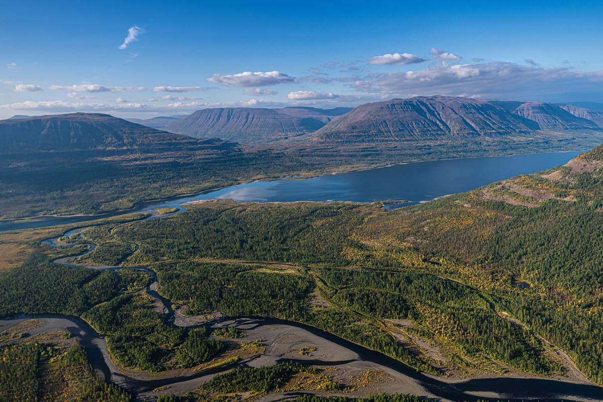
And, indeed, I was thinking maybe I’ll pass going over old ground – the Kam-wonders that are reachable by car within a day, but then I reconsidered…
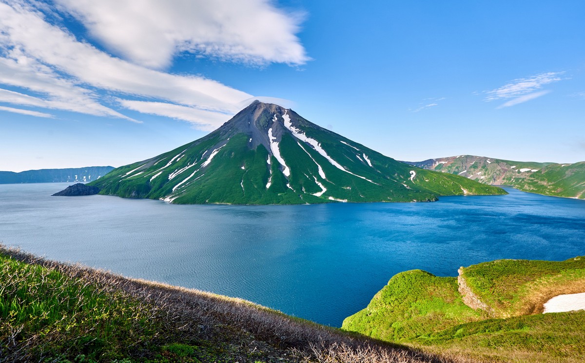
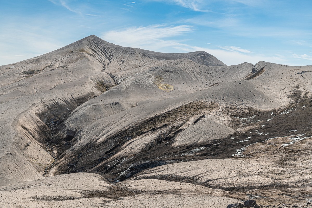
The main reason is… I occasionally read folks’ travel notes from their trips to southern Kamchatka, and they’re… just silly! Example: a group will report proudly how they made it to the top of the volcano Gorely. But getting to the peak completely misses the point: what needs doing is a trek along the top-rims of the craters – full circle, and the same goes for other volcanoes here. Then you get a whole day of the most amazing natural beauty all around you, while you steadily plod along. Racing to a peak, taking a few pics, then racing back down again – where’s the fun in that? What is the point? See – it’s like I say: just silly ). So, that’s my first reason for not passing over some previously-reported volcanisms: to make up for the sacrilege that’s out there on the internet!
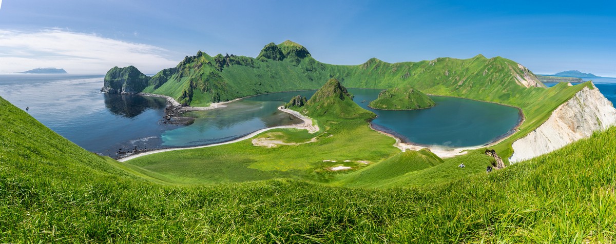
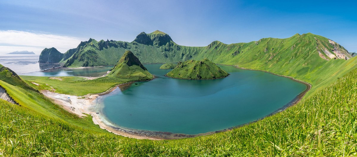
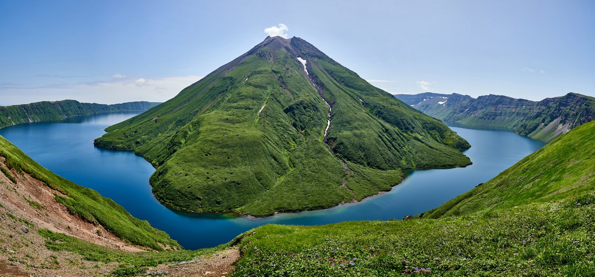
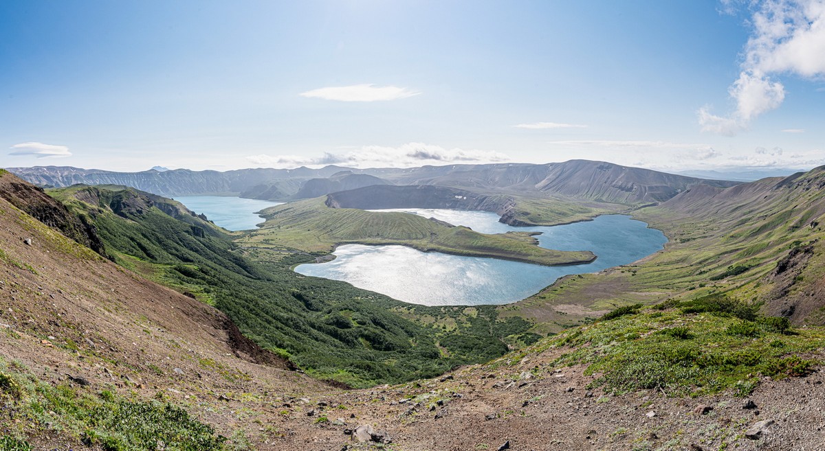
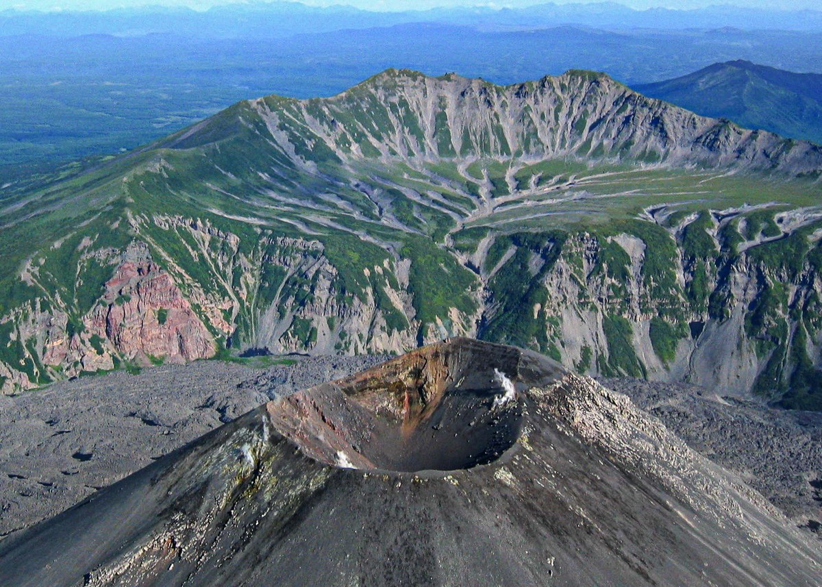
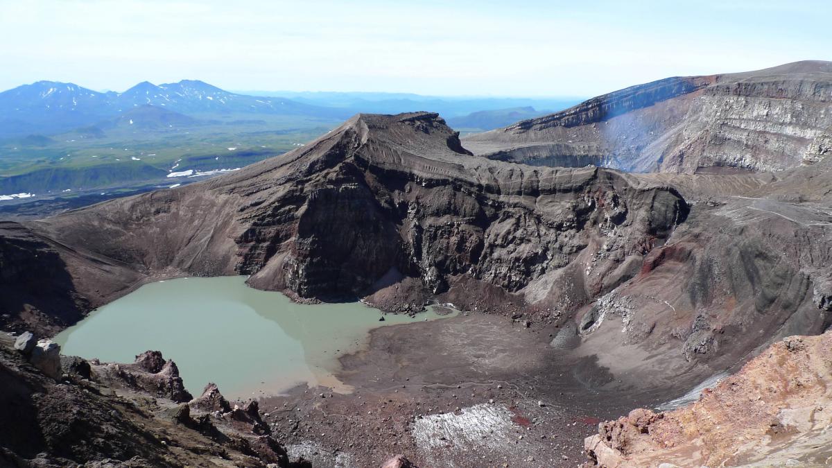
Accordingly, here, today, dear readers: Gorely review! In particular – the multicolored lakes thereof.
First – to the readers who haven’t (yet:) been to Kamchatka: this is a volcano that is categorically visit-mandatory! I know I rave about most any volcano on the peninsula, but this one really is A-list, VIP, elite, etc. Alas, neither Google Maps nor Russia’s Yandex Maps shows the full topology of this volcano, but that doesn’t make it any less awesome in the flesh. The main thing: the sheer size and… ambiguity of the structure of this volcano – plus the lakes in its two main craters.
Read on…