August 22, 2022
Wake Me Up, Before You Ebeko!
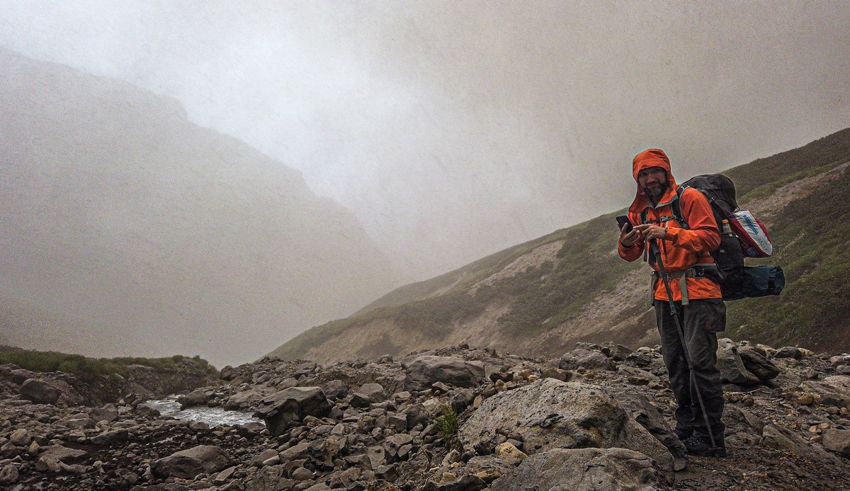
And then it was time to go… to Ebeko!…
Our expedition left the mainland and down to the northern Kurils. First up – the island of Paramushir and its active volcano Ebeko.
The name Ebeko comes from the native Ainu language for “kindling the flame”, and it appears to have been kindling and erupting and volcanizing ever since it first appeared, some 2400 years ago, for practically all the land here is of volcanic origin (with very few exceptions), which goes for most all the other Kurils too.
Ebeko is a magnificently monumental volcano. It’s massive, wide-branching, and mind-numbingly awesome to behold. Here’s its peak, on one of its quieter days ->
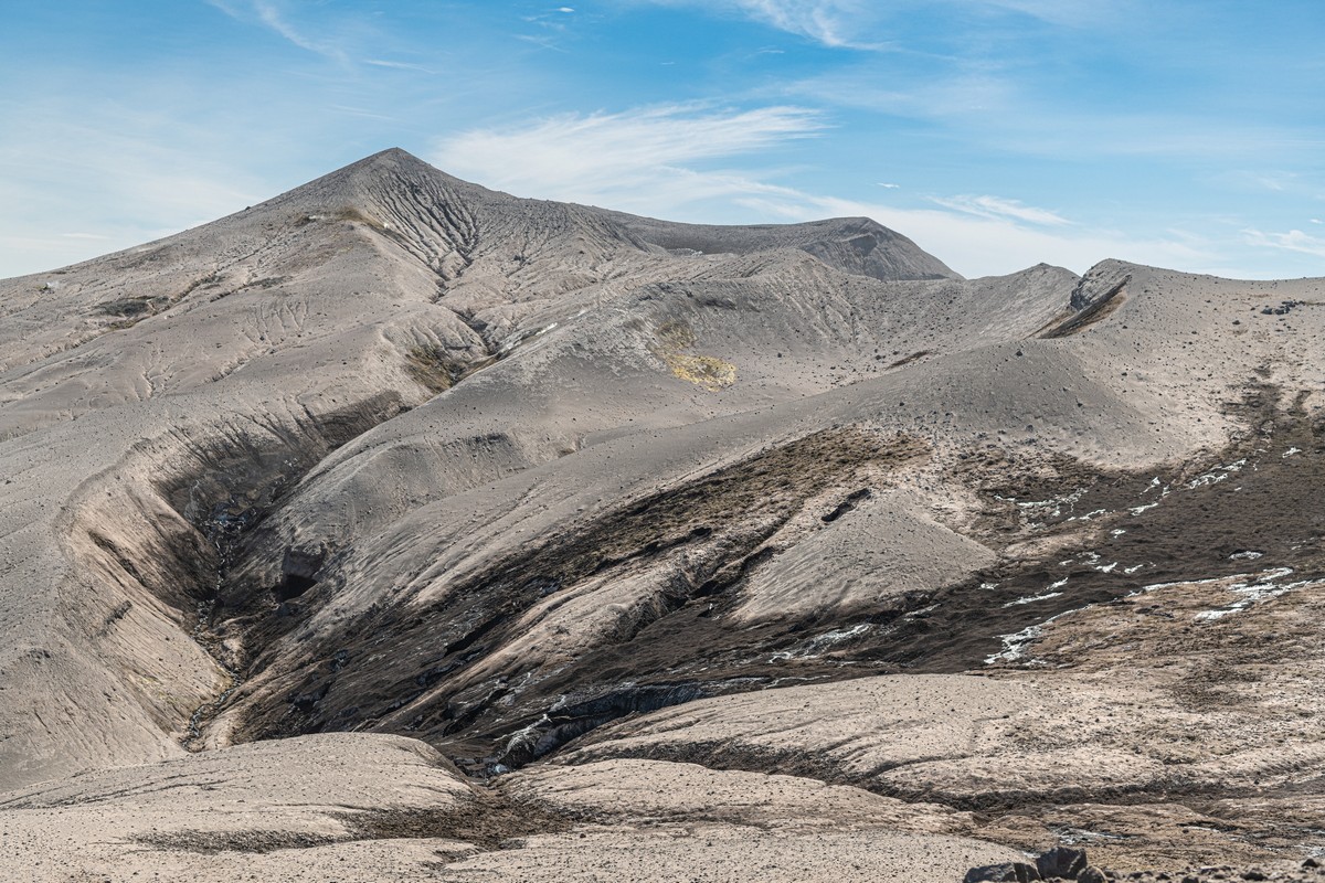
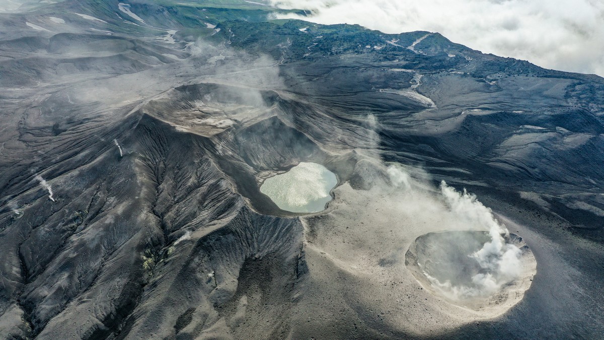
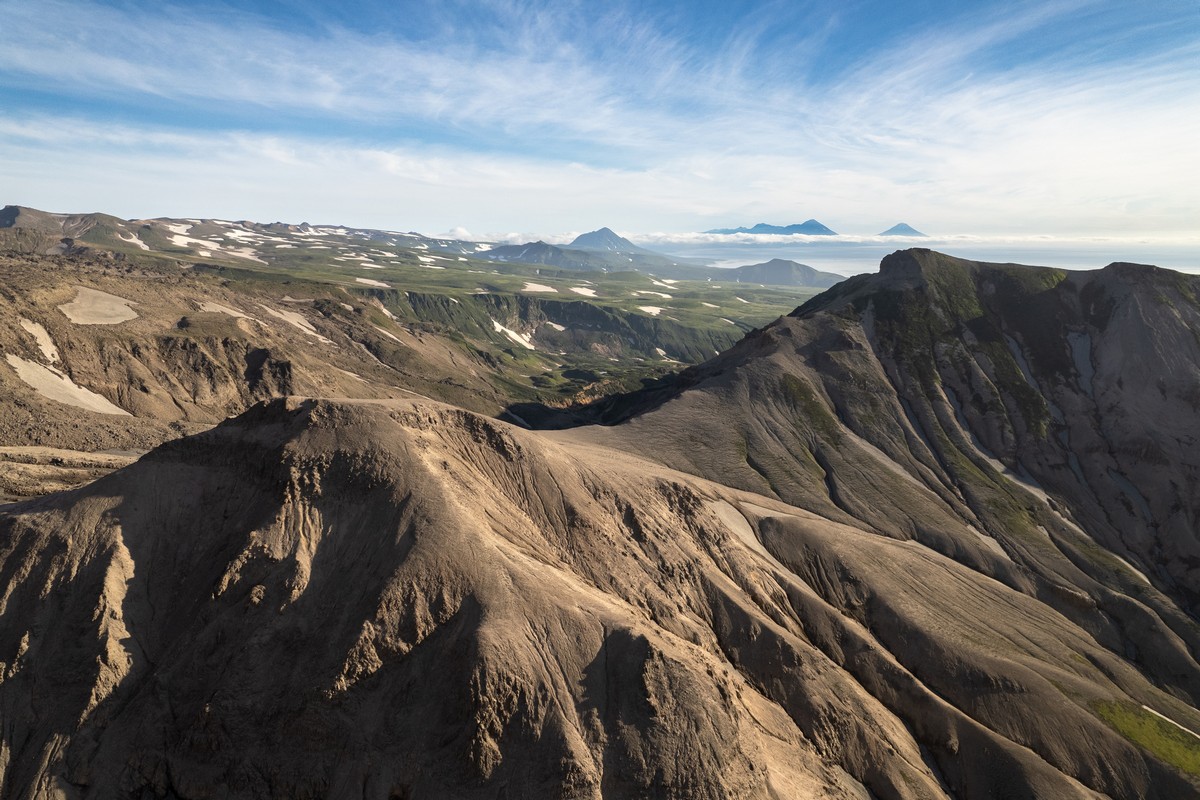
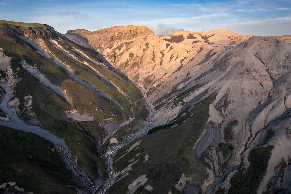
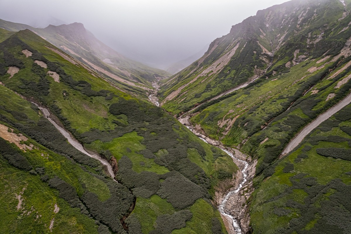
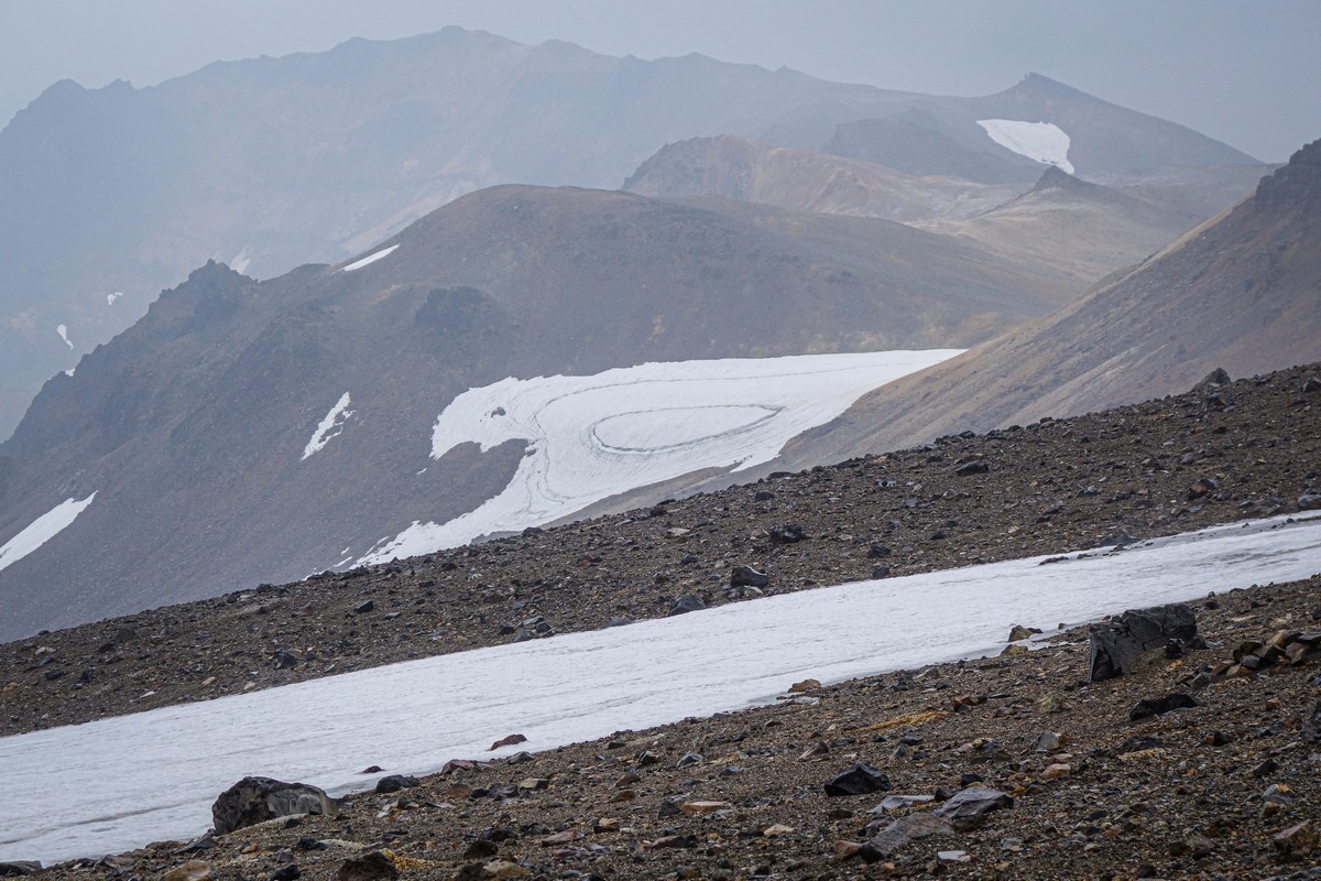
The landscapes of the volcano are bizarrely uneven and complex, but perhaps all the more spellbindingly beautiful because of it – not to mention all the more mega-meditative too. With its random volcanic emissions, nature here has created a work of art. And it needs to be looked at from all different angles, including from directly up above – from a drone ->
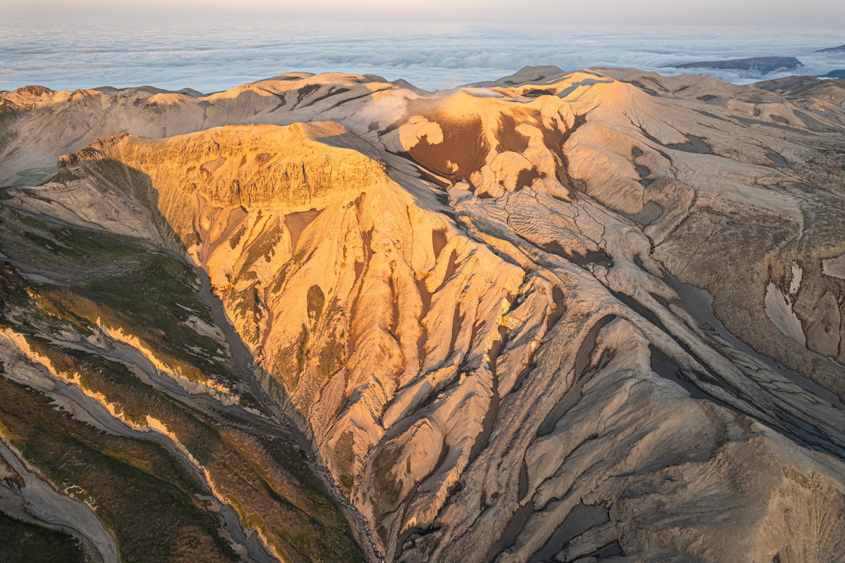
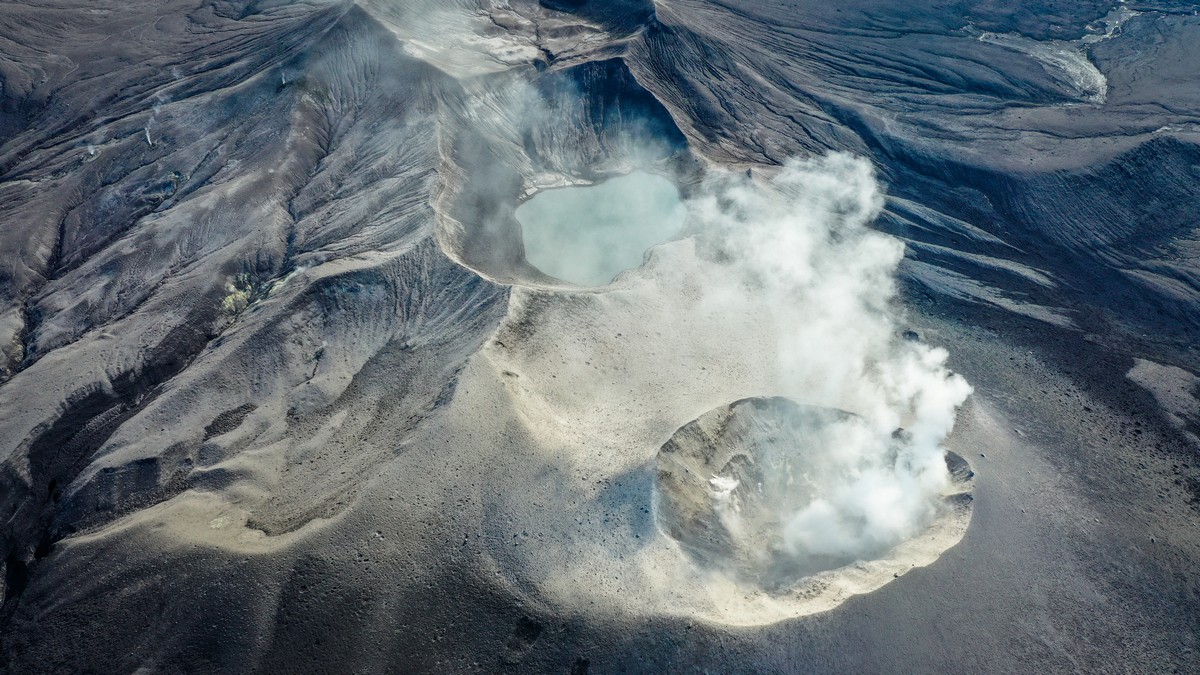
To compare, here are the drone views of Ebeko back in 2019 ->
Fantastical…
Btw, that there basin is a separate volcano. Ebeko is actually made up of two separate volcanoes, which grow up out of two entirely separate magma chambers!


The eastern side of Ebeko we’d seen before – twice – and in good weather:
Thus, we decided to go further this time. To break on through to the other side, as it were…
And, oh my grandiose – we did the right thing. Just check out this view (to the west) that opened up before us! ->
…and back to the east (toward the Ebeko massif) ->
Next – another outside-the-box plan…
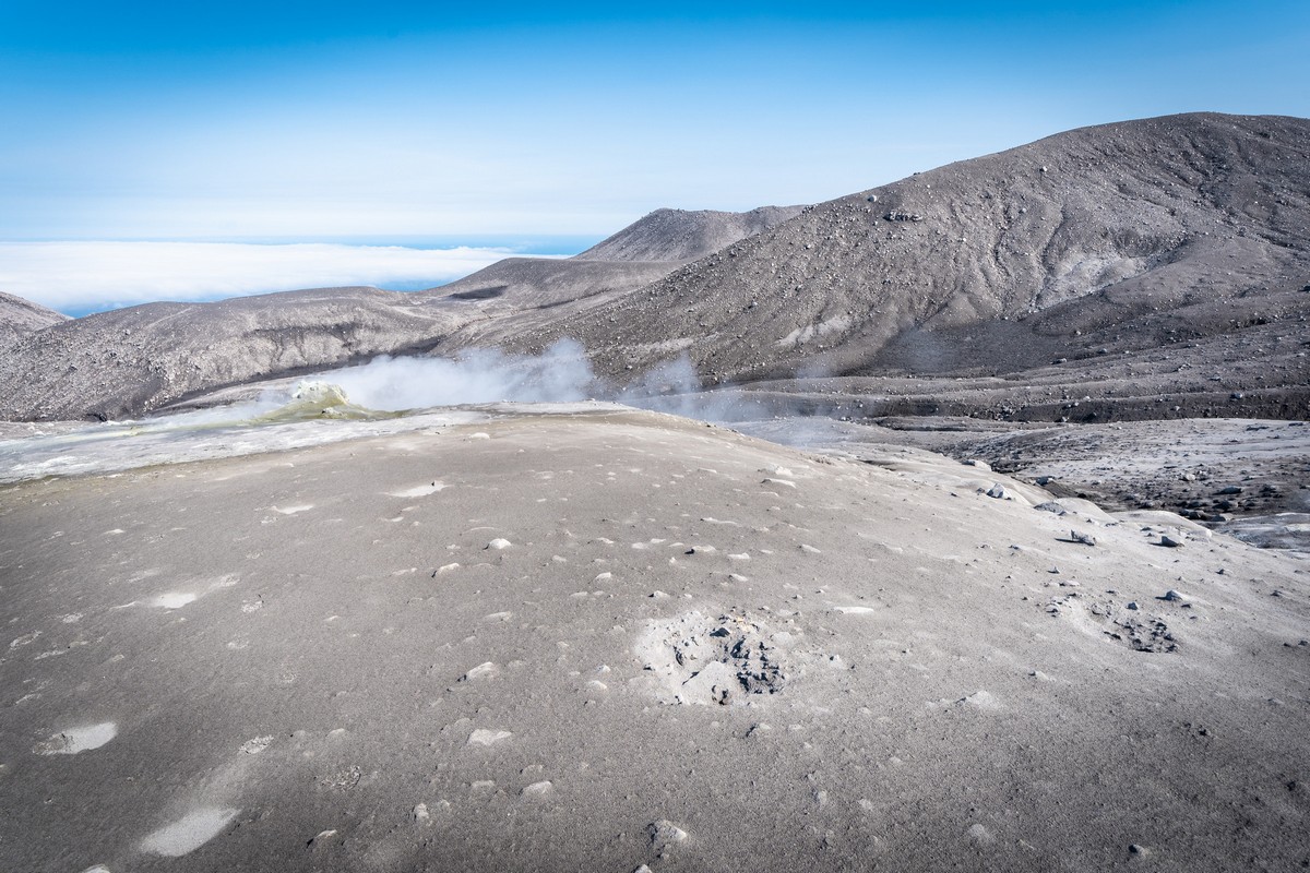
First – quick reminder: Ebeko has been erupting (in recent times) ~constantly since 2016. But not with explosions and red-hot lava flows, which is what you probably associate the most with a “volcanic eruption”. Ebeko “erupts” differently: it just puffs out colossal columns of ash and gas, and throws out volcanic rocks in all directions too (more on this later).
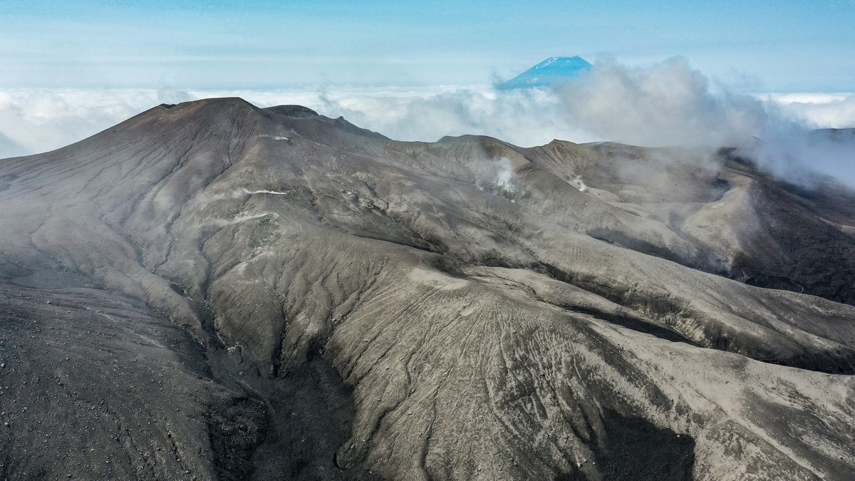
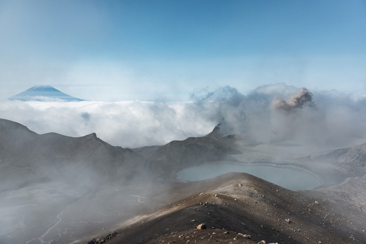
Now, somewhere around the end of 2021, I heard somewhere that Ebeko had stopped its smokey-eruptions. “Hurray!” I thought: it was time to get up it and walk around each of its three craters. Those three are visible in the below pic. To the left – the peak of the volcano; to its left – down its side – fumaroles; the lake in the middle has almost dried up; and bottom-right – the active crater – from which are spewed the main active volcanisms ->
These and the below pics: from 2019 (early August).
We soooo wanted to stroll around up here ->
The stroll (if without eruptions) promised to be comfortable and meditative:
…Just look at the views! ->


Alas (a word that will be used a lot in this series:), that time, in August 2019, it wasn’t to be. Ebeko erupted fairly violently – in our direction – and we had to evacuate pronto…
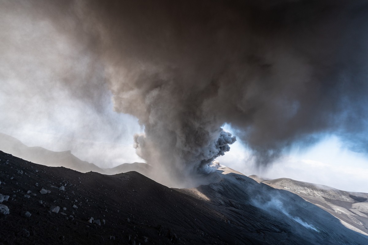
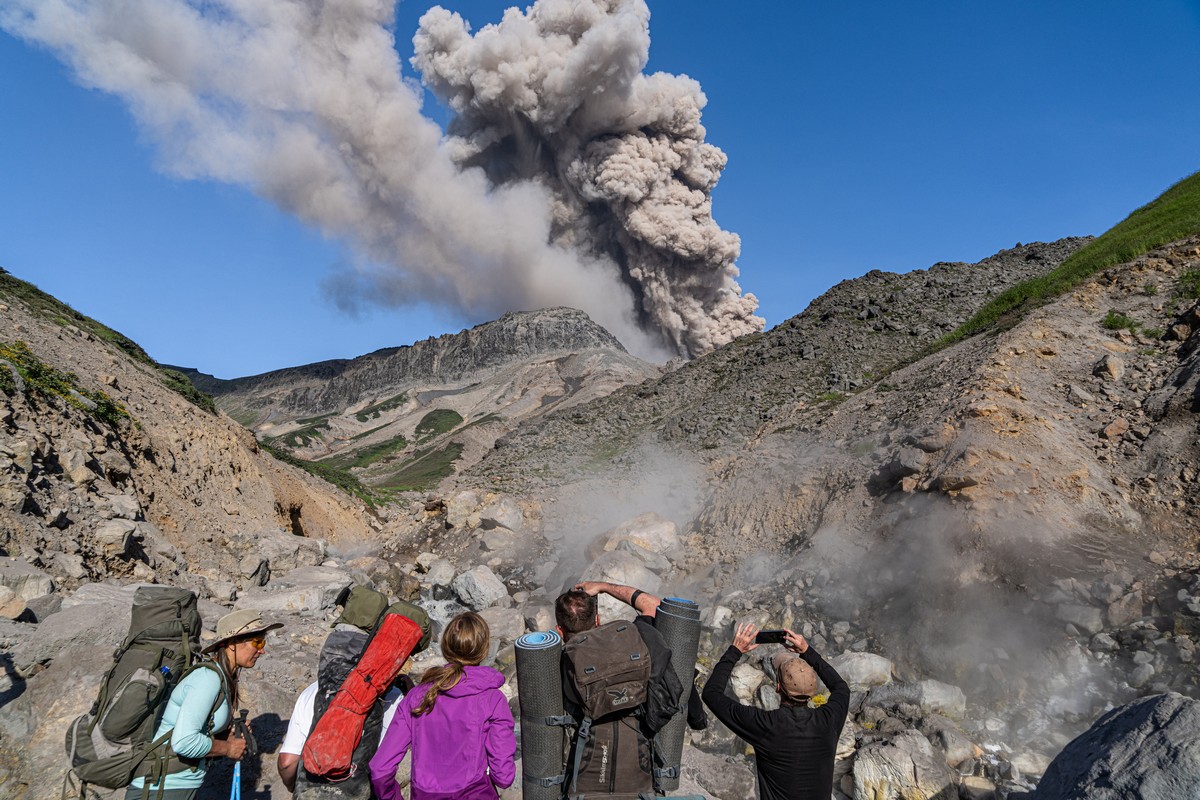
This year – alas! – Ebeko started erupting again (after a short break). Again it was too dangerous to contemplate strolls upon it. Best to keep our distance. I mean, the stench you can somehow get used to and cope with, and the volcanic ash can be filtered out with masks or buffs (though photo-video kit could get damaged), but it’s the red-hot boulders flying everywhere that are the real walk-idea-killer (if not just “killer” on its own).
// Btw: Judging by the photos, I reckon the boulders were thrown up to 500 or maybe even 700 meters from the crater. I’ll show you the photos of them after they’ve landed later on…
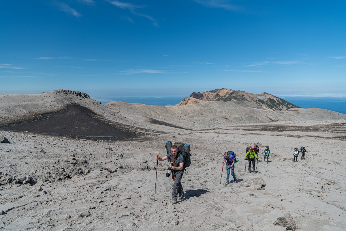
Still, we were able to get some walking in around Ebeko; we just had to keep our distance from the active crater…
Scaling up parts of Ebeko in good weather isn’t difficult: there are neither steep slopes nor loose stone coverings to navigate. It’s a steady walk all the way – some six kilometers to the top in a straight line, but around ten given the winding ~path, and it’s around a kilometer up along the vertical axis. But if you plan ahead well, half the way can be covered on quad bikes:


The landscapes all around are covered in the gray volcanic ash that’s been falling for six years already. Accordingly, their appearance is most unusual – and most fantastically pleasing to the eye:
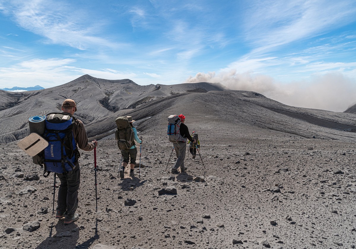
Ahead of us – the peak with its active crater. As mentioned, it periodically erupts, so we didn’t go any closer…
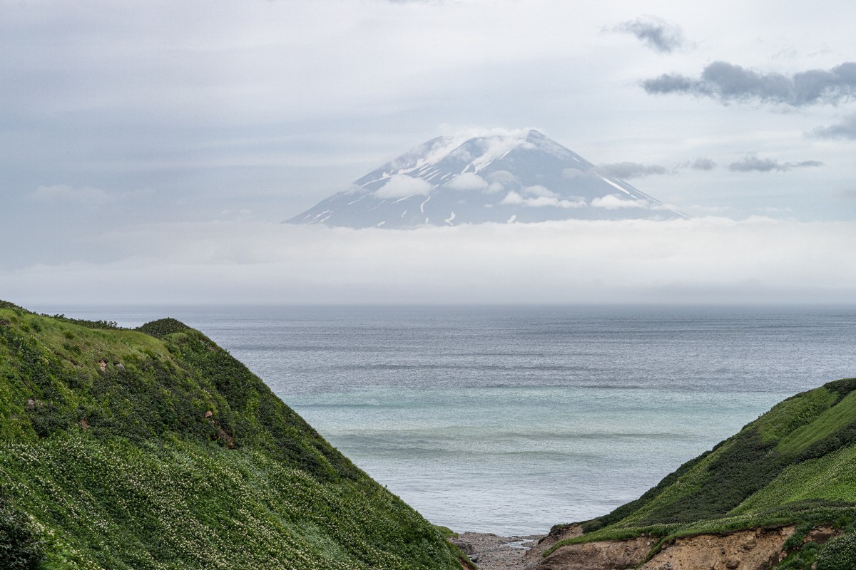
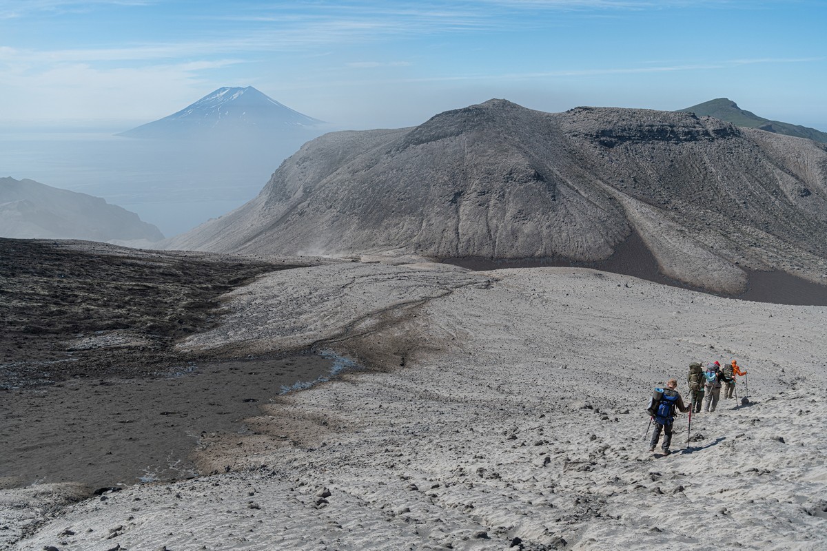
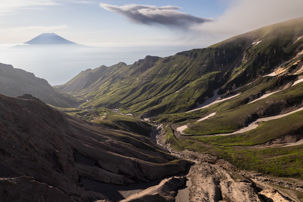
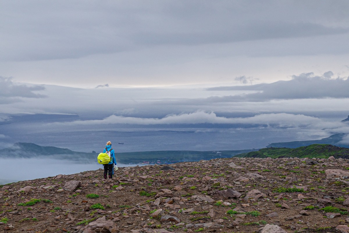
But we did get quite high up all the same, the views getting better the further we went. Over there – Alaid on Atlasov Island:
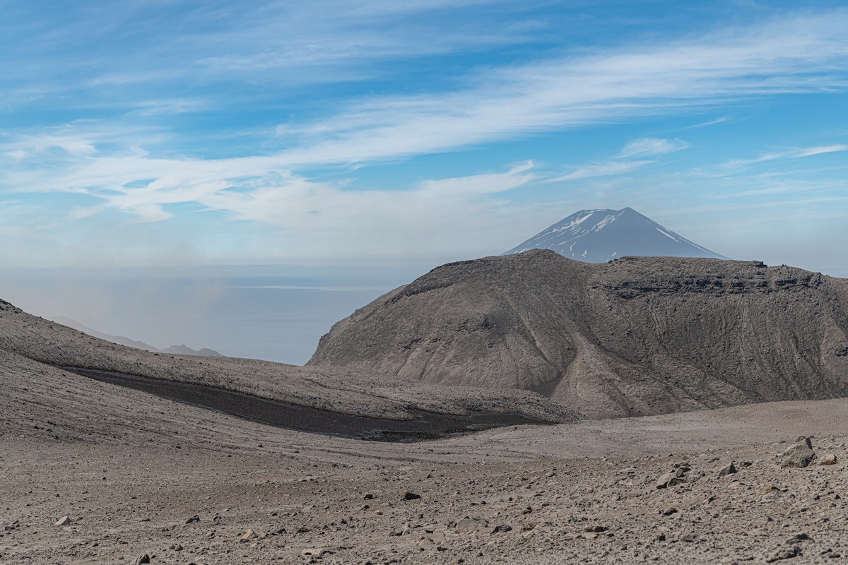
…And in the other directions ->


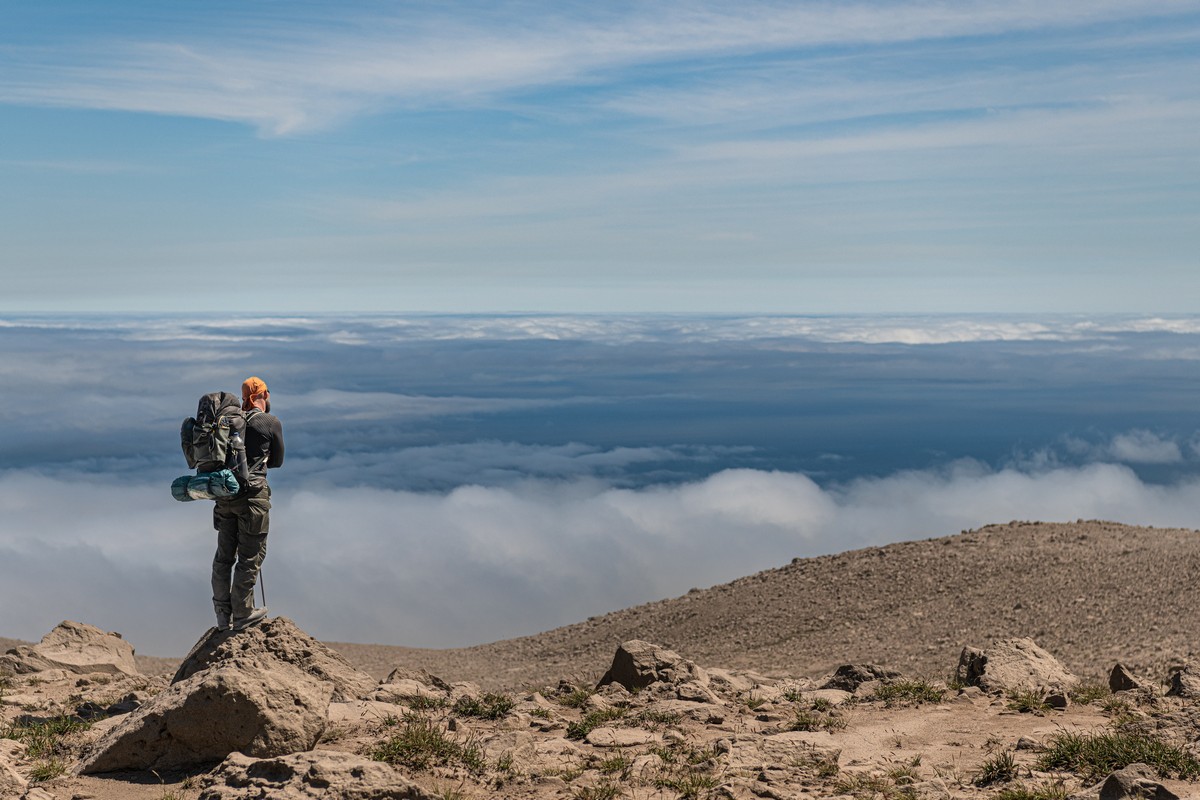
“But, why such big backpacks for a quick ascent up a volcano?” asks the more attentive reader. Well, it wasn’t so quick. We decided to go up one side, roam the safer upper reaches, then continue across the volcano and down the other side; i.e., Pacific Ocean to Sea of Okhotsk. In all, that’s quite a way, and quite a long time climbing-roaming-snapping – more than a day. We needed supplies in our backpacks for the refreshment stops (and there was the ton of photo-video equipment we’d brought too), but most importantly – tents for our overnight stay…
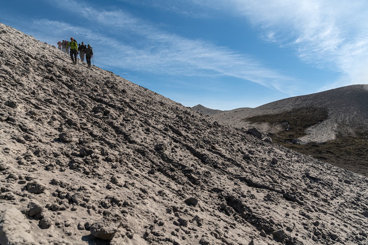
Back down we head… ->
Steep in places…
The views all around – cosmic. And, you see the white holes to the right in this pic? They’re the marks left from boulders that landed here from the active crater ->
We quickly get past those holes to a safer distance…
Plenty photos taken – including one of me! ->


To the right – the unpleasant “lava tongue” slope covered in loose rock, duly by-passed:
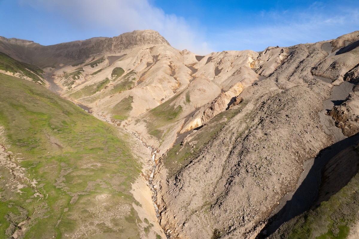
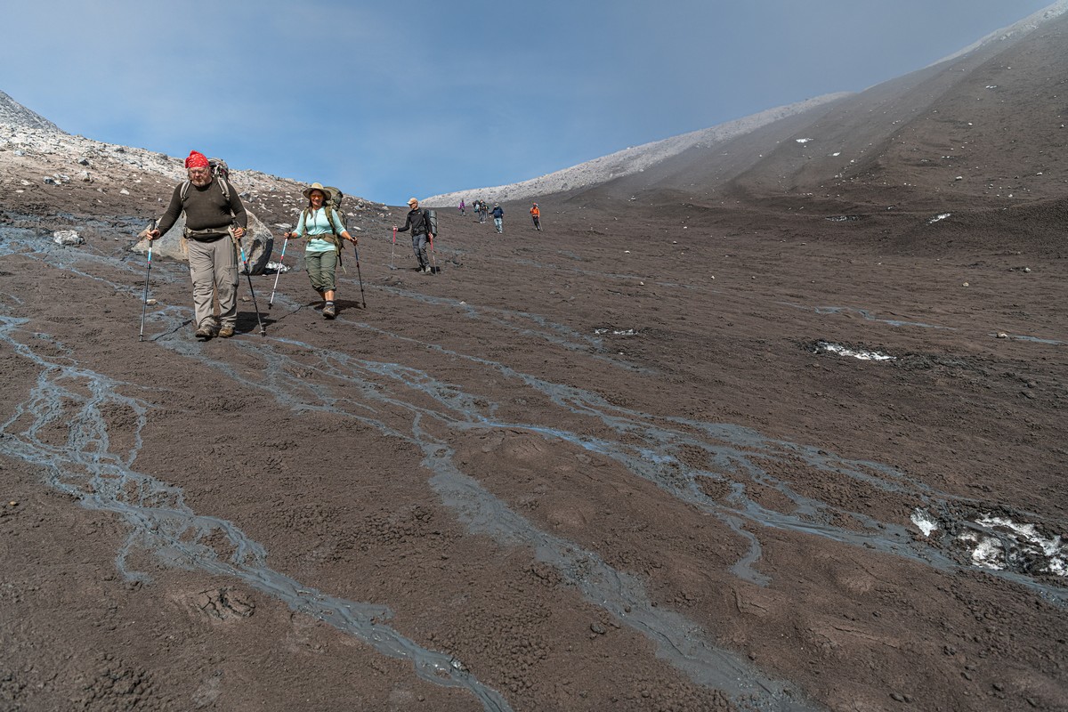
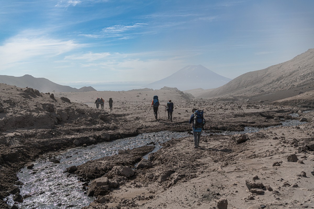
We headed down the Yurevka river valley the other side ->
Now – as promised, a few words about those red-hot flying boulders…
First – they’re not to be confused with volcanic bombs, which are made up of liquid/partially molten lava, because Ebeko doesn’t do the molten lava thing, remember? Instead, here, since 2016, ash and gas have been emitted, sometimes accompanied by rocks of various sizes. It’s as if the volcano came down with a cold and sneezes occasionally. And these are the craters left behind in the ground from such flying rocks:
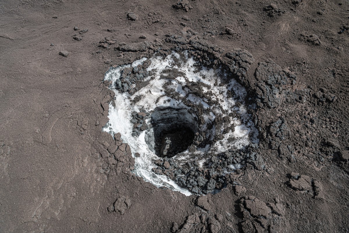
If the hot rocks land on the snow – they burrow out something like a well:
Some 500-700 meters from the active crater, you’re fairly safe from flying rocks; however, ash can reach up to several kilometers (!) from the source. So if Ebeko does one of its volcanic sneezes and you’re within the 7km radius – be sure to hide your photo-video kit, because minutes afer the sneeze you’ll have this to deal with! ->
While if the wind’s blowing in another direction, this is what you get:
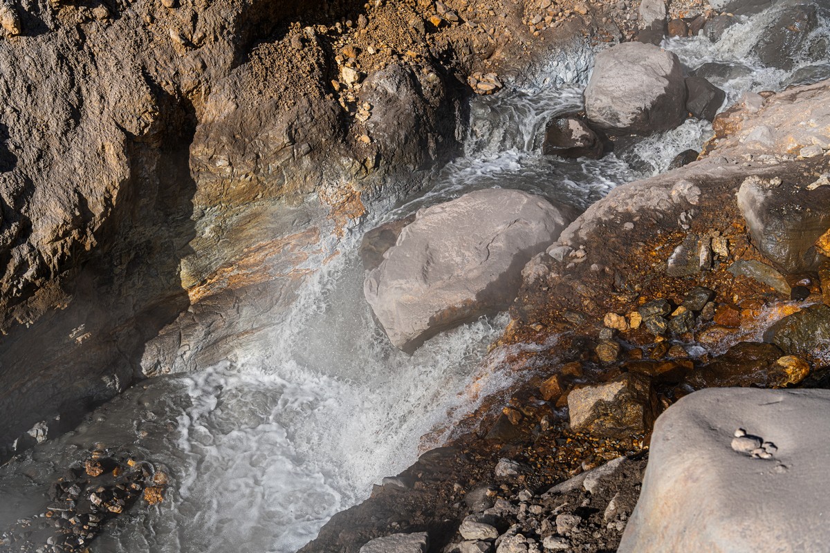
Onward down the valley; the water in the river – warm and possibly bath-able?! ->
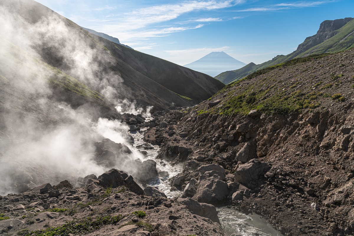
But we decide against a bathe; the water, though warm, is somewhat milky – no doubt testifying to the fact it contains plenty of volcanisms – probably most of the elements in the periodic table (for drinking water we used other streams with fresh water, of which there are plenty).
Time to set up camp! We got to the only grass to be found in these parts and pitched there. Even the grass had a covering of volcanic dust, mind – albeit a thin one.
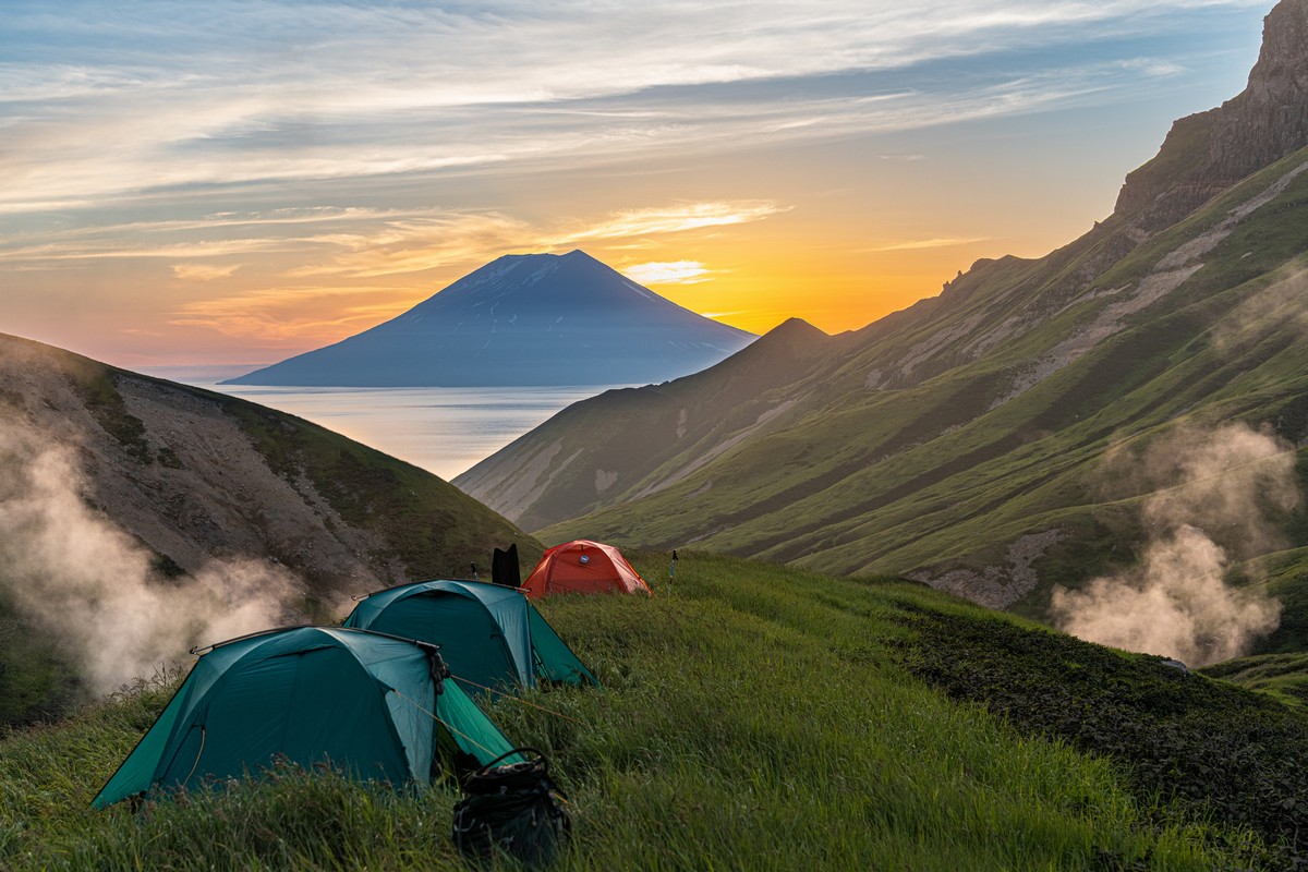
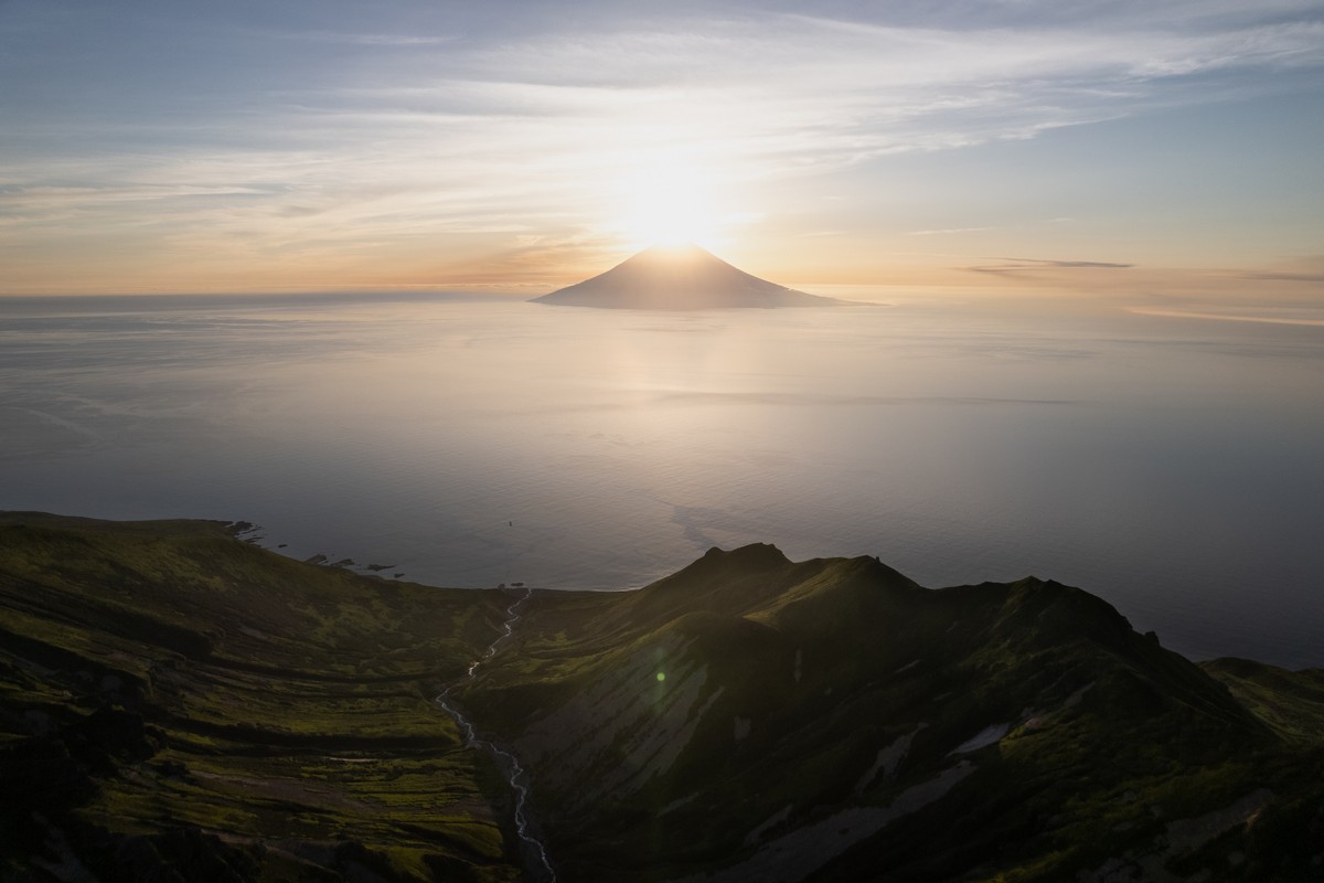
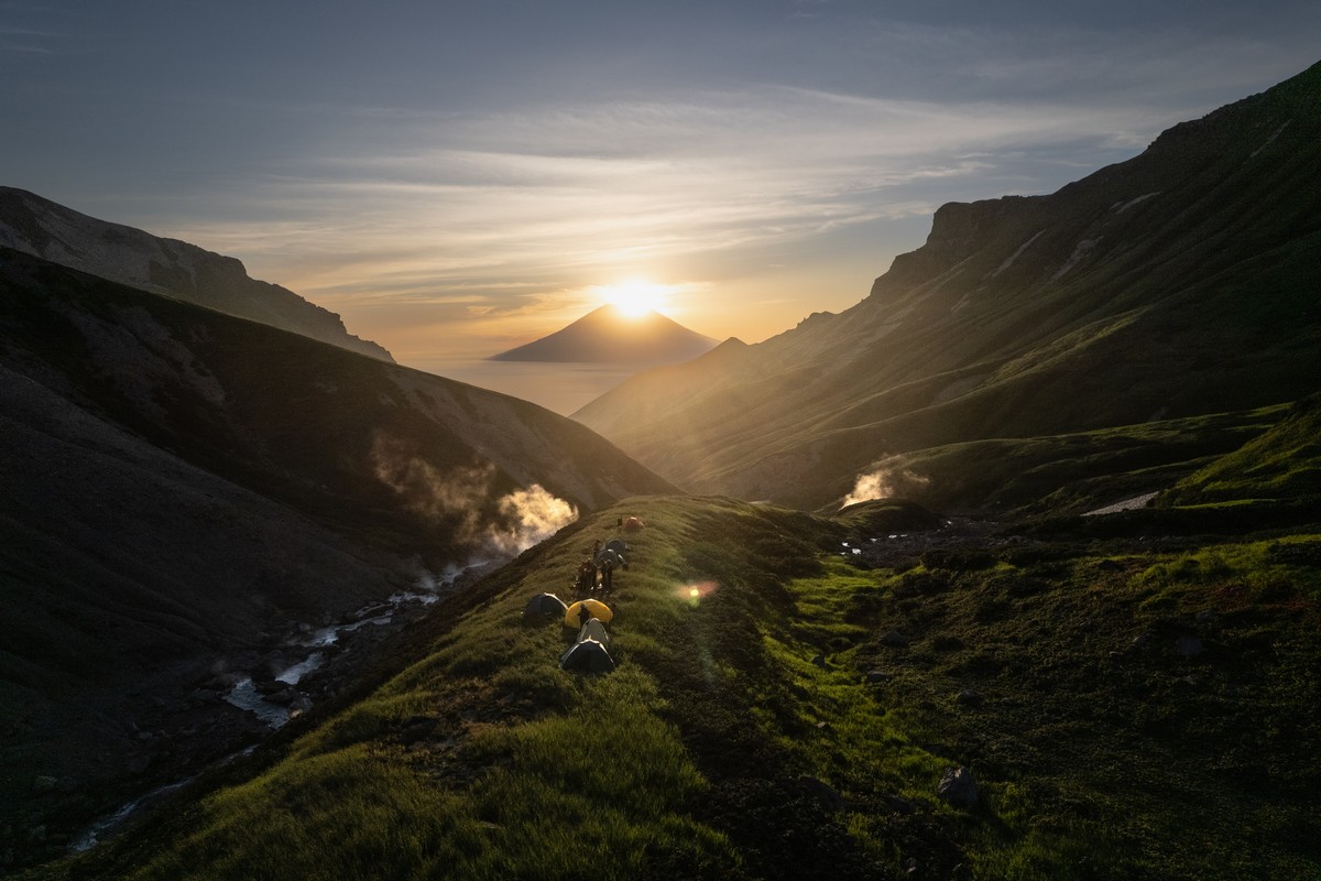
The sunset we viewed here – sensational! The sun seemed to sit itself down upon Alaid, then it slowly slid down its side to the Sea of Okhotsk. Sunsational!


A sunset beheld from Yurevka river – categorically recommended!
Throughout the night Ebeko kept on puffing away. But then the wind changed direction – toward us! Several times throughout the night we heard a kind of tapping on our tents – much like rain. But it was volcanic ash dropping onto them! What a unique if a little unnerving experience!
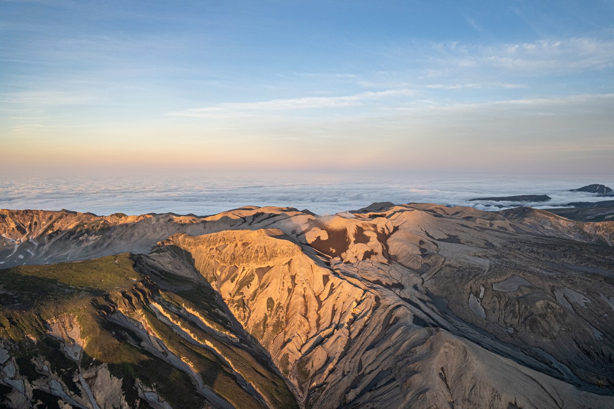
Morning! Up! Down (the valley)!… ->
Just four kilometers to walk today, but it would take half-a-day, since… ->
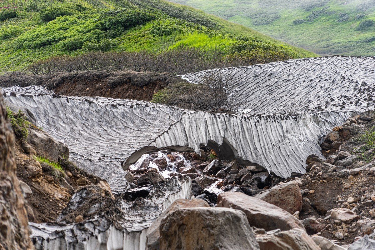
Snow – in the middle of July! ->
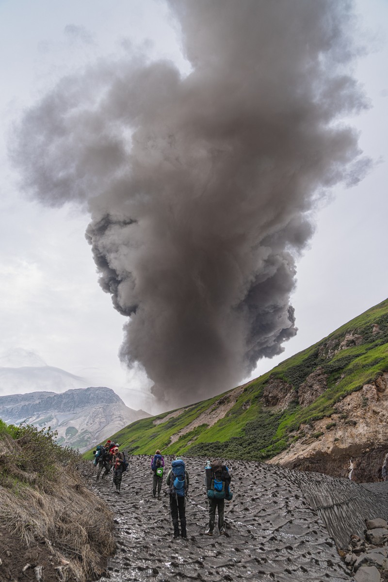
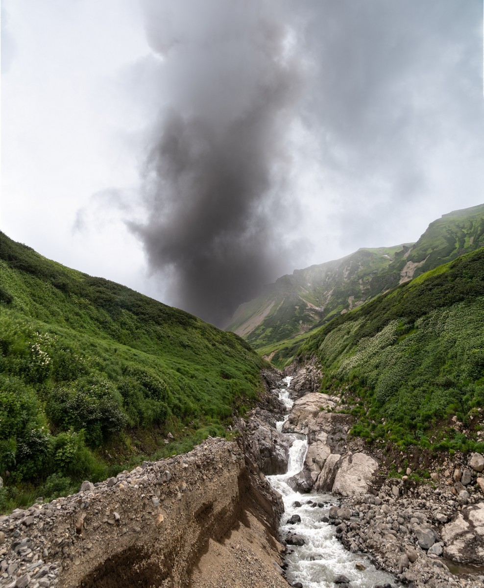
Then, suddenly – BANG! Then again – BOOM! Yikes – the wind’s in our direction. Get outta here!…
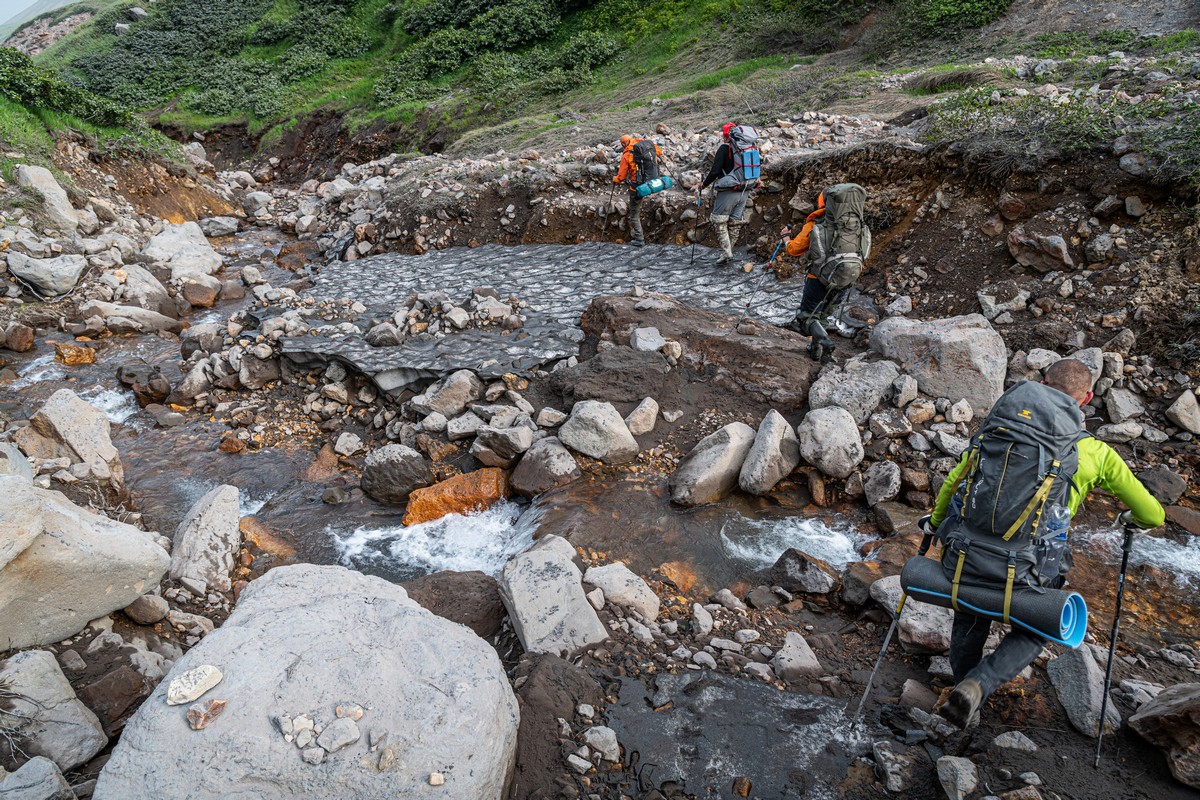
We had to cross the river plenty of times – actually, 17 times! Though the river’s shallow, it was rather fast-flowing. In a word: tricky ->
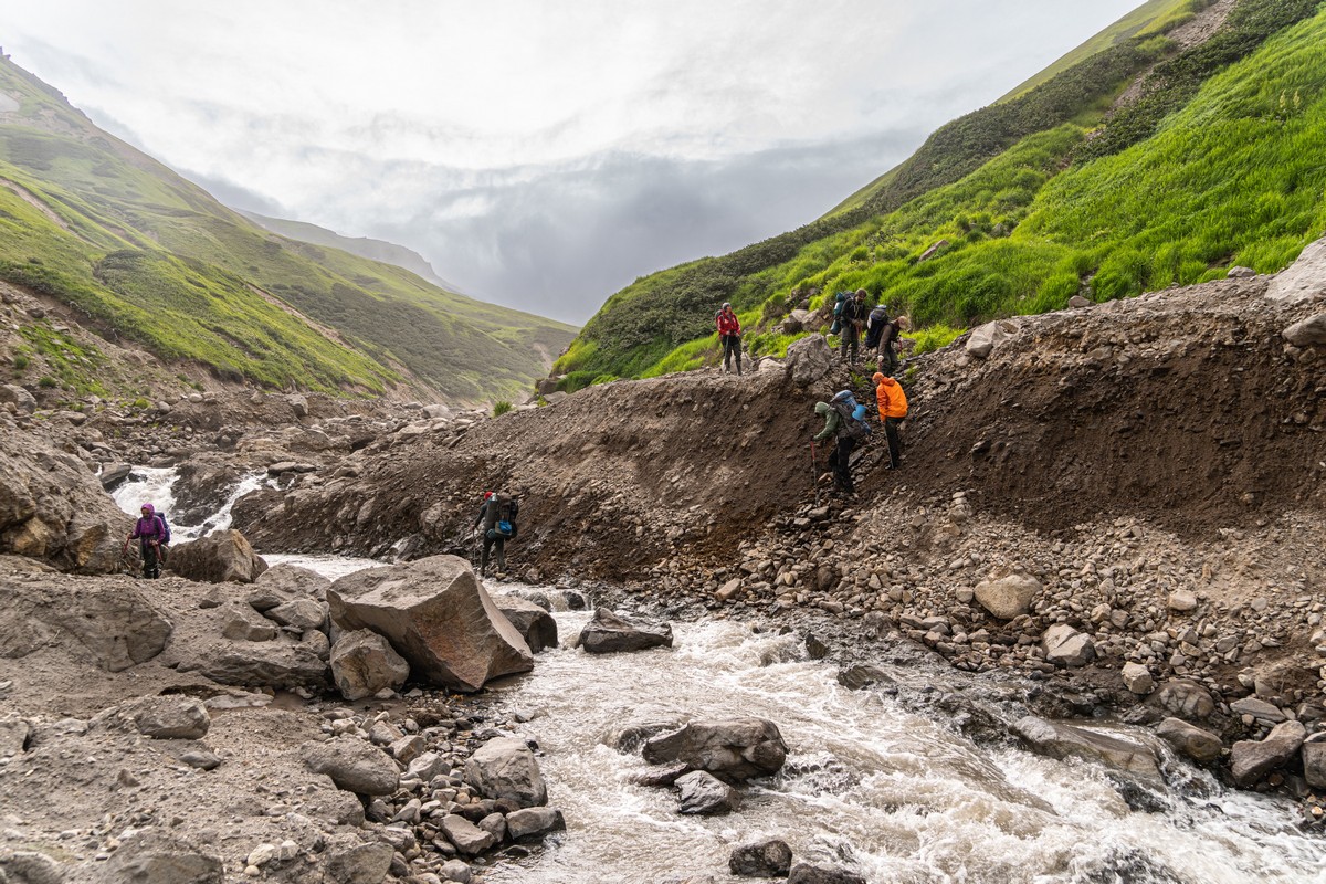
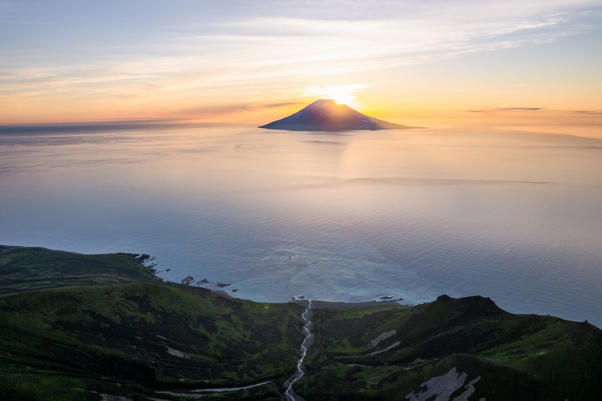
We were starting to tire of all the river-crossings, but the finish line was now at least in sight. Which could not be said for Alaid – invisible behind the clouds:
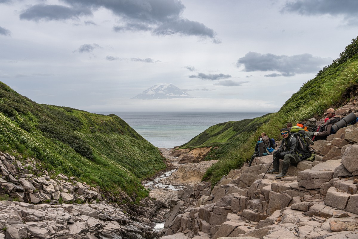
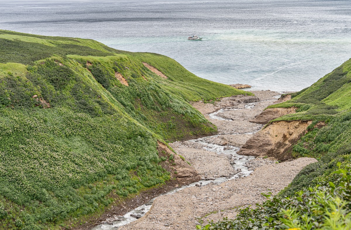
And over there’s our ship:
And then, again – BANG! Again in our direction. Our drones nearly didn’t make it in time:
Finish line!
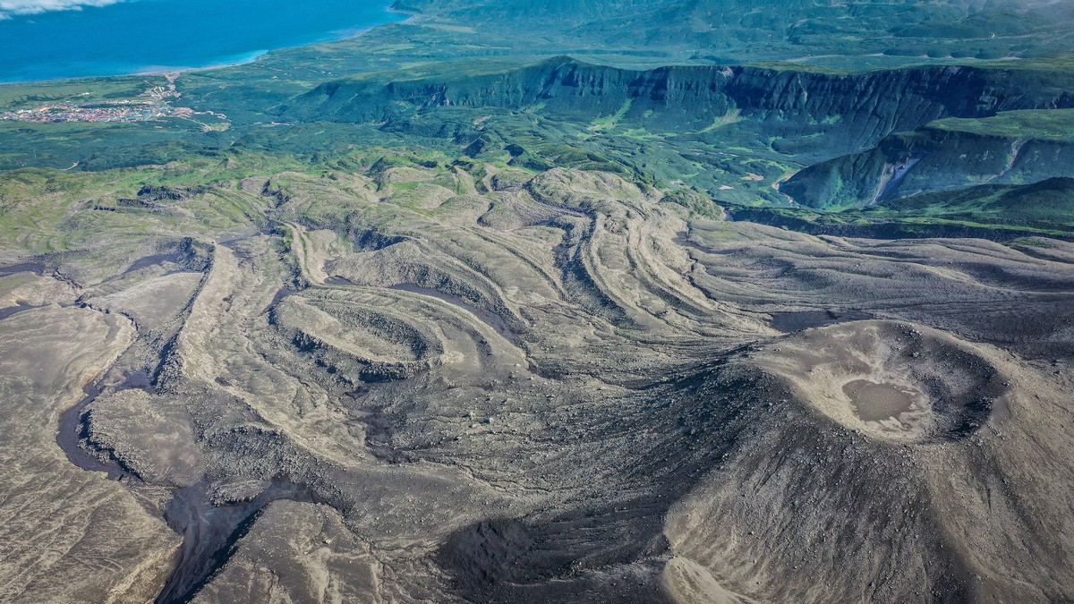
As mentioned, the water in the Yurevka – full of volcanistic chemicals and ash. Not to be drunk. But it makes great patterns when it hits the sea:


At first glance this phenomenon could be mistaken for an ecological catastrophe like an oil spill (albeit not a black one). Turns out it’s nature running its course – drawing pictures with its heavenly crayons! ->
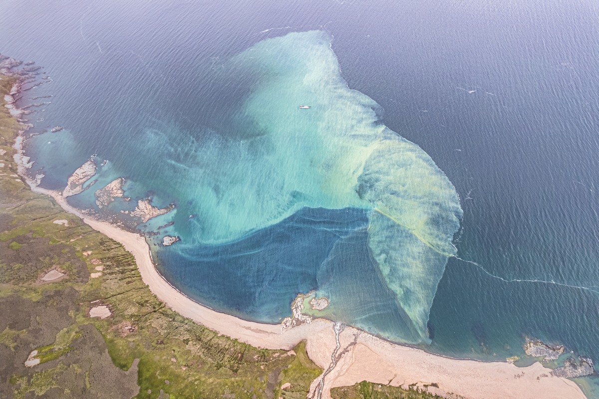
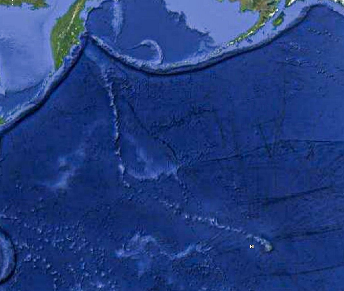
In fact, the above Godly pastel sketches are actually rather harmful for the ecology of the area – particularly the sea. However, the harm to ecology from things like them have been occurring now for… millions of years. For once, at least, Homo sapiens can’t be blamed ). These infinitely-long natural processes remind me of how the ancestors of the Hawaiian islands are unstoppably slowly moving toward Kamchatka – “surfing” the tectonic plates upon which they sit:
Btw – this is how things looked (a lot brighter) here back in 2019 (pics by Chris Burkard) ->


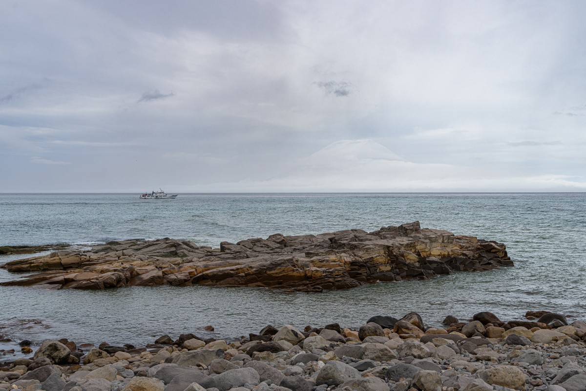
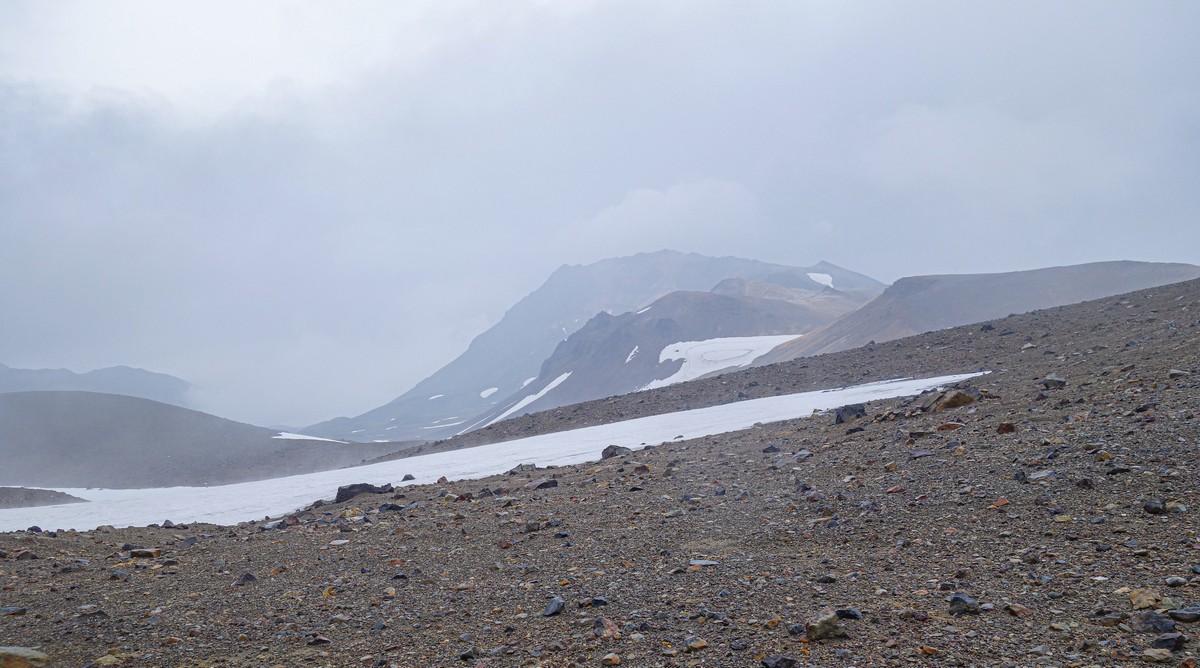
And that was that. A wonderful, transformational trek! Big thanks in particular to the Kuril weather for being so (rarely) kind to us – after all, it can get like this here! ->
And this phallic installation is no longer there. It’s been blown away! ->
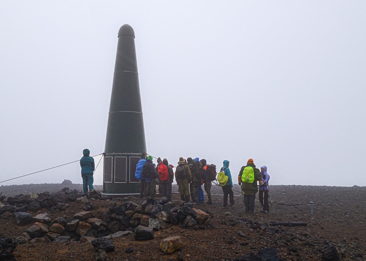
And the rocks are all the same color – gray.
And that’s all from Ebeko!
The rest of the photos from the Kurils-2022 expedition are here.

