December 22, 2021
How to experience the Kamchatkan volcanoes Gorely and Mutnovsky properly.
Wanting to continue my travelogue series ‘southward from the city’, I looked back at some of my older Kamchatka chronicles, and I found this neat little ‘southward from the city’ synopsis, from 2015:
“In my humble opinion, Kamchatka is the most fascinating and beautiful place on the planet. Voluptuous volcanoes with colossal craters with multicolored lakes, + unearthly surrounding landscapes, geysers and hot springs, + lazy wild brown bears roaming free, + red caviar applied on your sandwiches not with a knife or teaspoon but with a spade :).”
And, indeed, I was thinking maybe I’ll pass going over old ground – the Kam-wonders that are reachable by car within a day, but then I reconsidered…
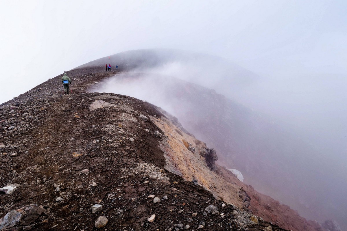
The main reason is… I occasionally read folks’ travel notes from their trips to southern Kamchatka, and they’re… just silly! Example: a group will report proudly how they made it to the top of the volcano Gorely. But getting to the peak completely misses the point: what needs doing is a trek along the top-rims of the craters – full circle, and the same goes for other volcanoes here. Then you get a whole day of the most amazing natural beauty all around you, while you steadily plod along. Racing to a peak, taking a few pics, then racing back down again – where’s the fun in that? What is the point? See – it’s like I say: just silly ). So, that’s my first reason for not passing over some previously-reported volcanisms: to make up for the sacrilege that’s out there on the internet!
Accordingly, here, today, dear readers: Gorely review! In particular – the multicolored lakes thereof.
First – to the readers who haven’t (yet:) been to Kamchatka: this is a volcano that is categorically visit-mandatory! I know I rave about most any volcano on the peninsula, but this one really is A-list, VIP, elite, etc. Alas, neither Google Maps nor Russia’s Yandex Maps shows the full topology of this volcano, but that doesn’t make it any less awesome in the flesh. The main thing: the sheer size and… ambiguity of the structure of this volcano – plus the lakes in its two main craters.
Citing Wikipedia, “Gorely … consists of five overlapping stratovolcanoes and is one of the most active in southern Kamchatka. It is a large, long-lived shield-type volcano that is currently in an eruptive phase. Prior eruptions occurred in 1980-81 and 1984–86. Several complexes compose the overall volcanic structure:
– ancient Pra-Gorely volcano, which measures 20–25 km in diameter;
– a 12km diameter caldera;
– thick stratum of ignimbrites totaling a volume of 100 km3;
– post-caldera eruption cinder cones;
– modern edifice – “Young Gorely” composed of three large superimposed cones and 11 associated craters forming a NW-SE trending intra-caldera ridgeline;
– a complex of 40 modern subsidiary cones on the slopes of “Young Gorely”.
In 2010, activity began to increase, suggesting the volcano was waking up. The Aviation Color Code has been raised to Yellow, and a new vent has been discovered on the inner South east wall of the crater.”
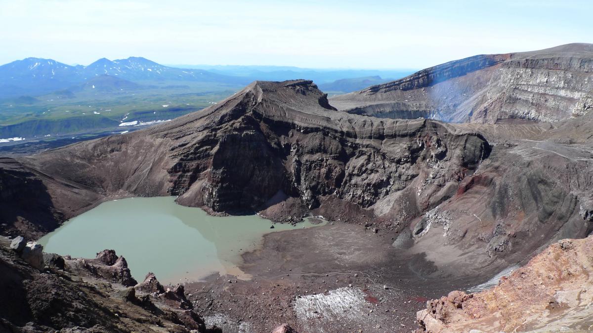
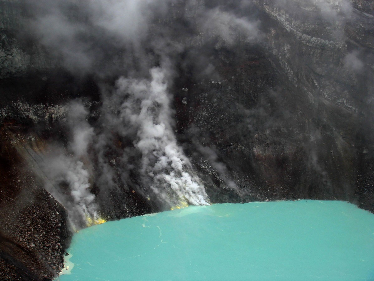
Alas, volcanic beauty is short-lived: two extraordinarily beautiful multicolored lakes appeared in the 1970s, but for the last decade or so they’ve been drying out as the bottom of the craters have been warming up. The above pic shows this – with hardly any water left; the pics via the link above show how things used to be.
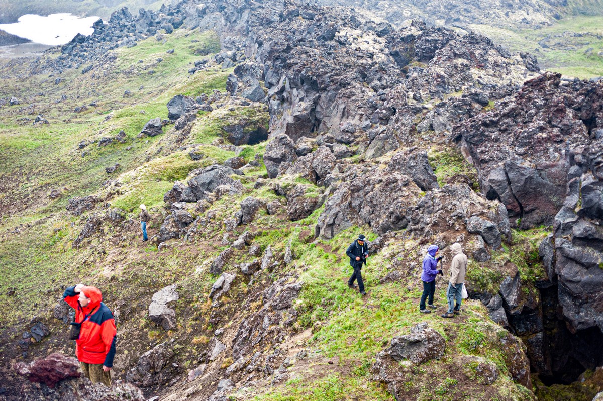
Still, voluminous lakes or no – the craters’ rims still need trekking (and don’t let any peak-climbers tell you otherwise:).
Btw: here’s Gorely on Yandex Maps. Could just as well be Malibu on a cloudy day – and that there tiny glimpse of turquoise is a movie-star’s swimming pool :) ->
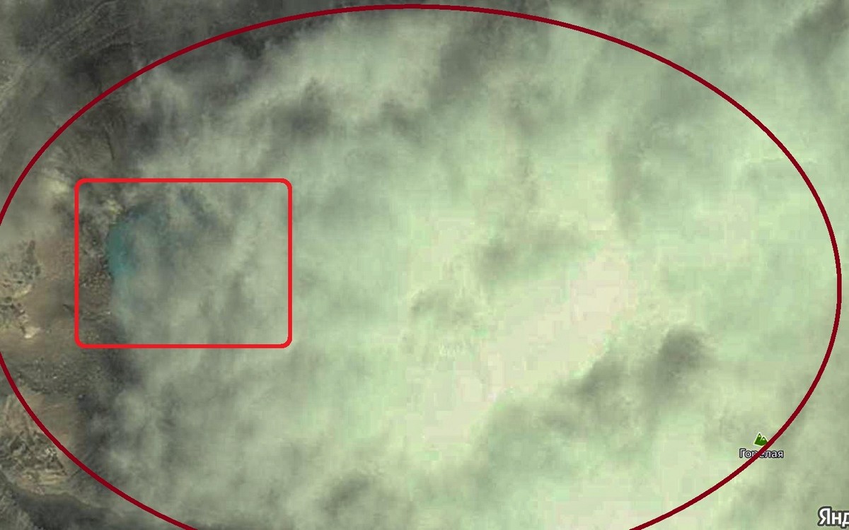
But it is, in fact Gorely. The oval shape marked in red is, approximately, the outline of the crater. In the rectangle – the above-mentioned pool in Brad Pitt’s back garden.
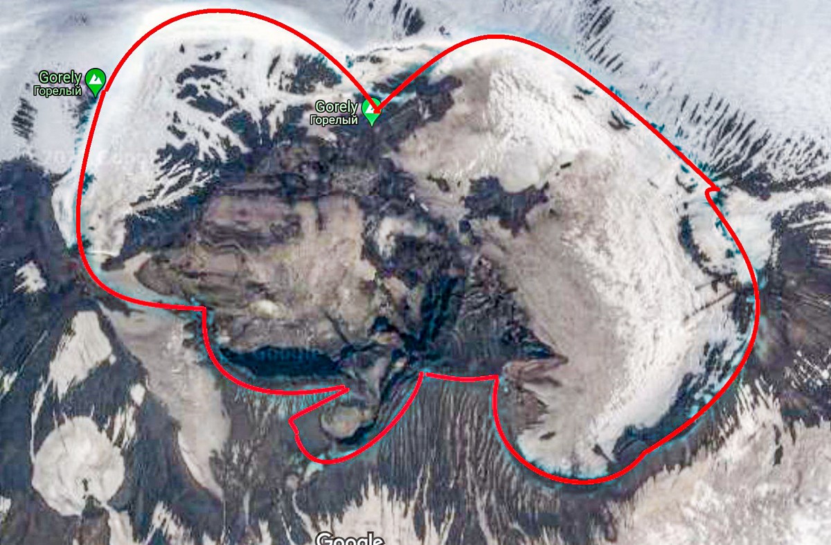
Here’s Google Maps’ attempt: a little more transparent, but the crater lakes aren’t visible at all! Still, a more accurate outline of the rim-walk is possible:
If you ever fancy visiting Kamchatka, but renting helicopters is a bit too dear, I recommend one of two options – either of which takes around two weeks. Option one: drive up toward the north and then get trekking on the route Tolbachik – Bezymianny; option two: Nalychevo + Gorely + Mutnovsky. There’s also some rafting down rivers needs to be done, which is real easy – and there’s a lot of fish in the rivers, but I digress…
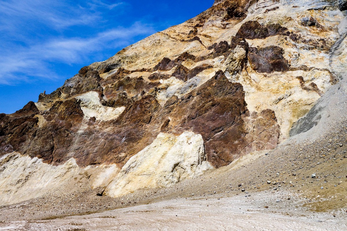
Mutnovsky is a crazily-colorful volcanic attraction that’s simply astounding.
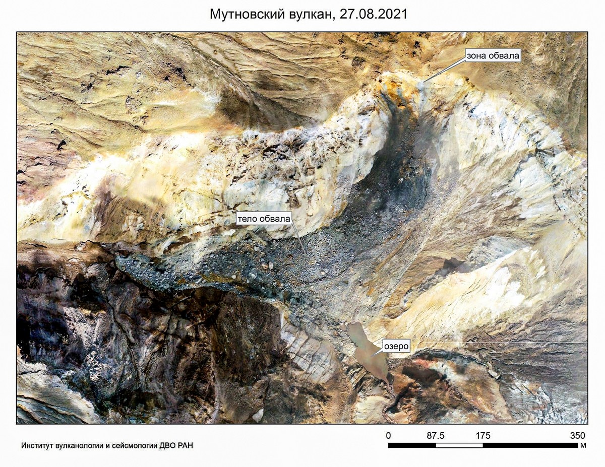
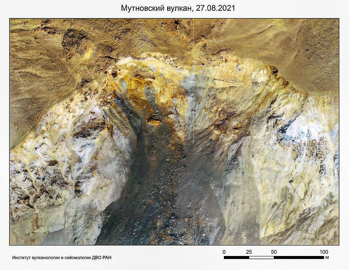
Been. A while ago. How things are there at present is unclear. In August of this year the only passable ravine suffered a mud flow much like that in the Valley of Geysers in 2007 (yes – it is a good job we didn’t choose Mutnovsky this year:). It seems that getting into Mutnovsky’s crater is temporarily either impossible or difficult. Which is a great shame, as it was (and will be) one of the most fantastic volcanic experiences of Kamchatka.
Below are some photos from the Institute of Volcanology and Seismology (Far-Eastern Department) of the Russian Academy of Sciences. First up, the mud flow, just mentioned, blocking entry to Mutnovsky:
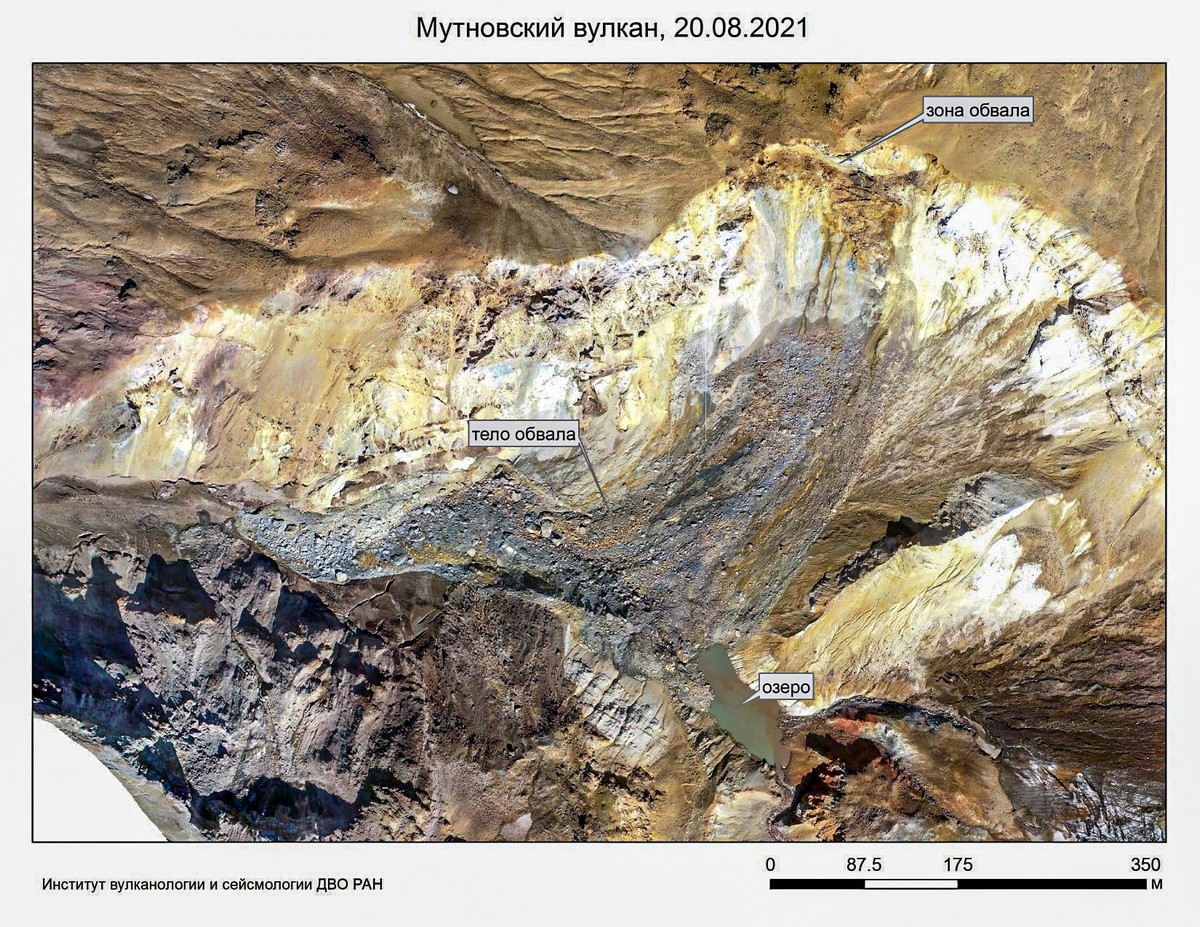
The above photo was taken after the first collapse; yes – alas – there was a second:
Yikes:
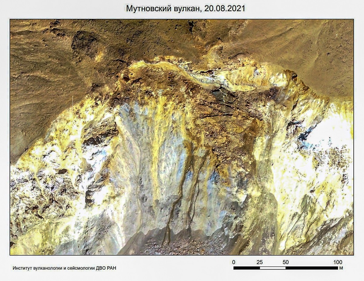
Then some more, for good bad measure:
The single saving grace: no one was in the crater at the time of the landslide. Which is pretty lucky considering it was August – peak holiday season.
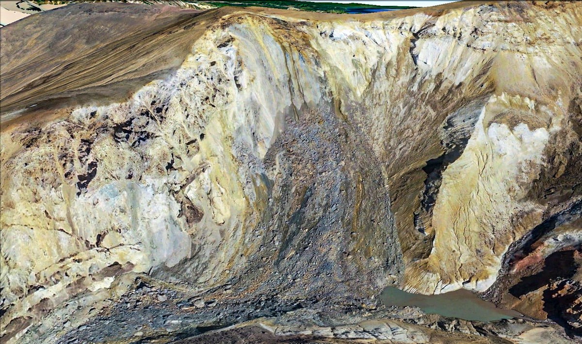
There was no one around to be hurt during later rockfalls either:
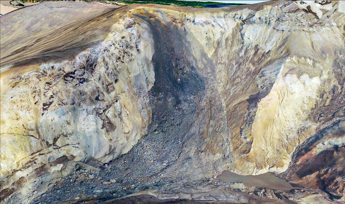
Here’s the collapse of the volcanic rock from another angle:
The stream was dammed up > another temporary lake:
If you can make them out – there are some paths down there in places overwhelmed by the detritus:
// Reminder: Mutnovsky is somewhere near the 53rd parallel north; as such it’s on the same circle of latitude as Amsterdam, Dublin and southern Canada. Sure, those places aren’t the warmest, but they’re positively temperate compared to the climate of Kamchatka – where glaciers feature even at low altitudes.
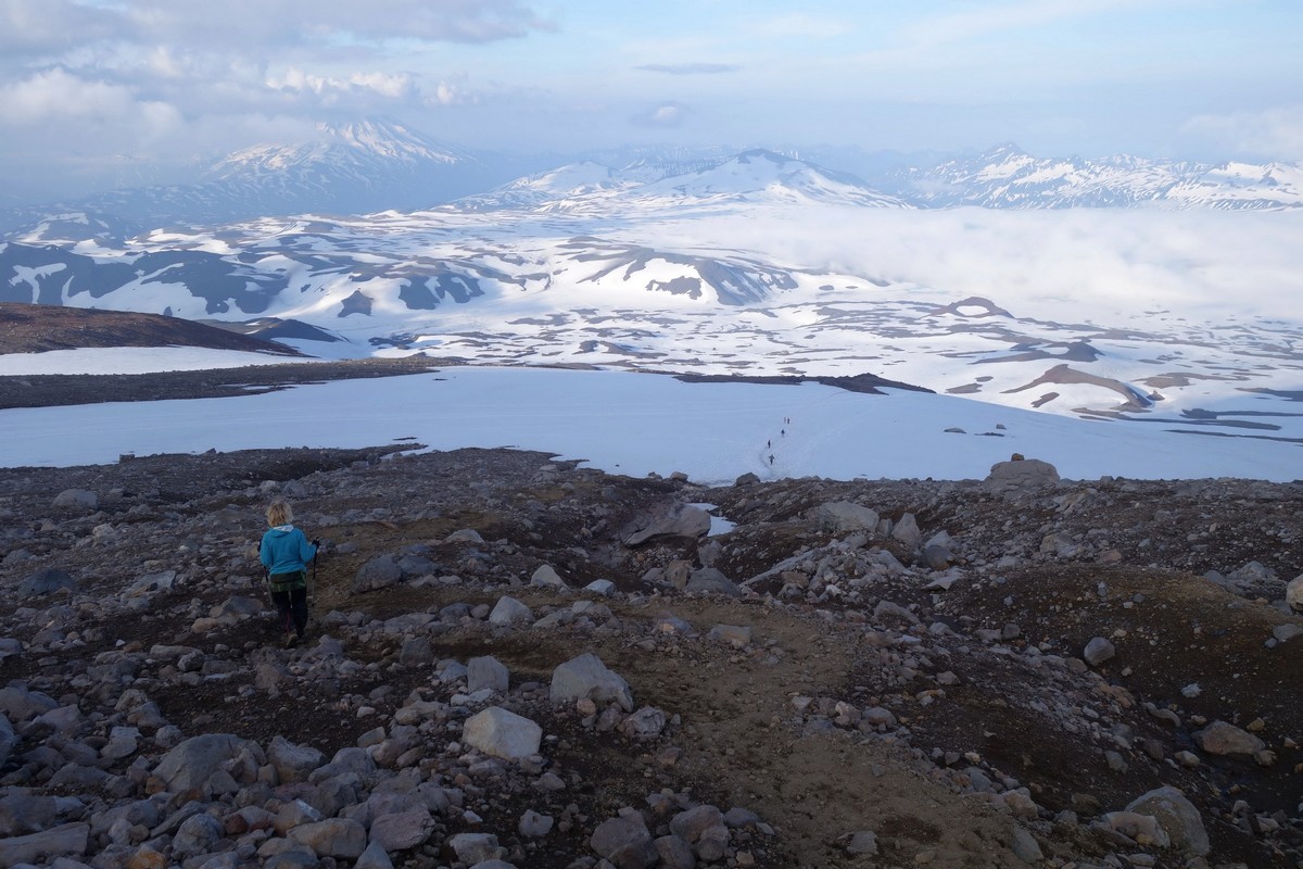
Now for some of my own photos of Gorely and Mutnosvky. Check out the lakes changing down the years in the months of July-August:


The lake starting to boil…
…Boiled dry!
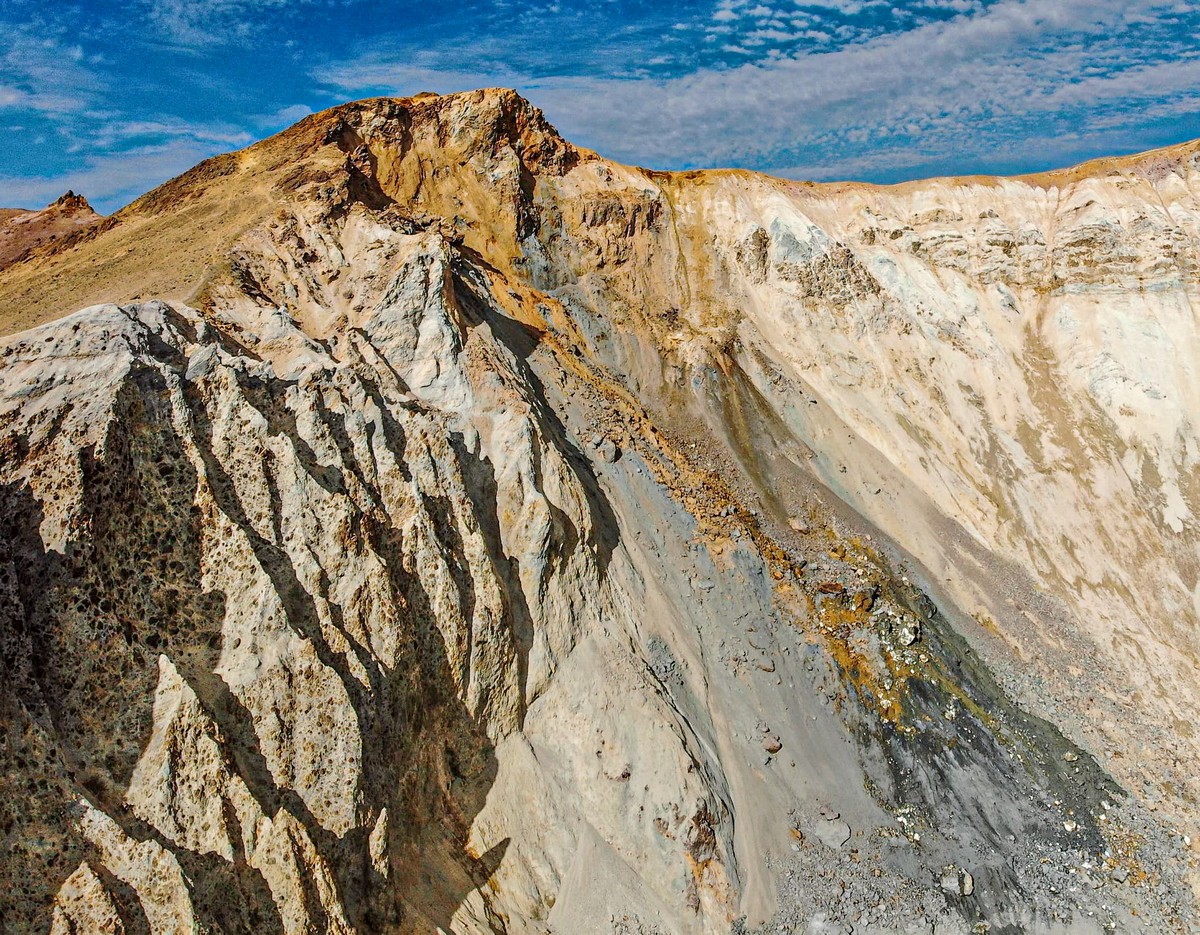
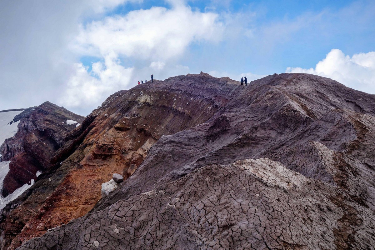
Crater-rim walking – best ever:
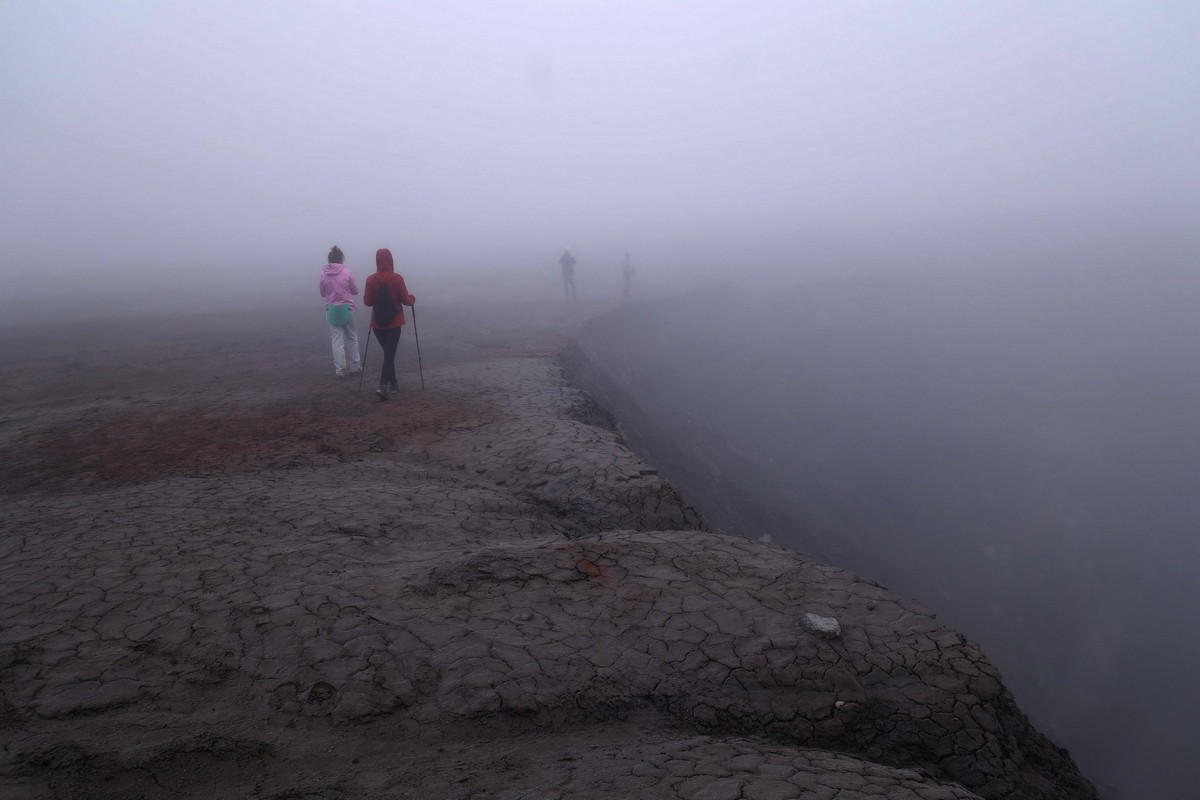
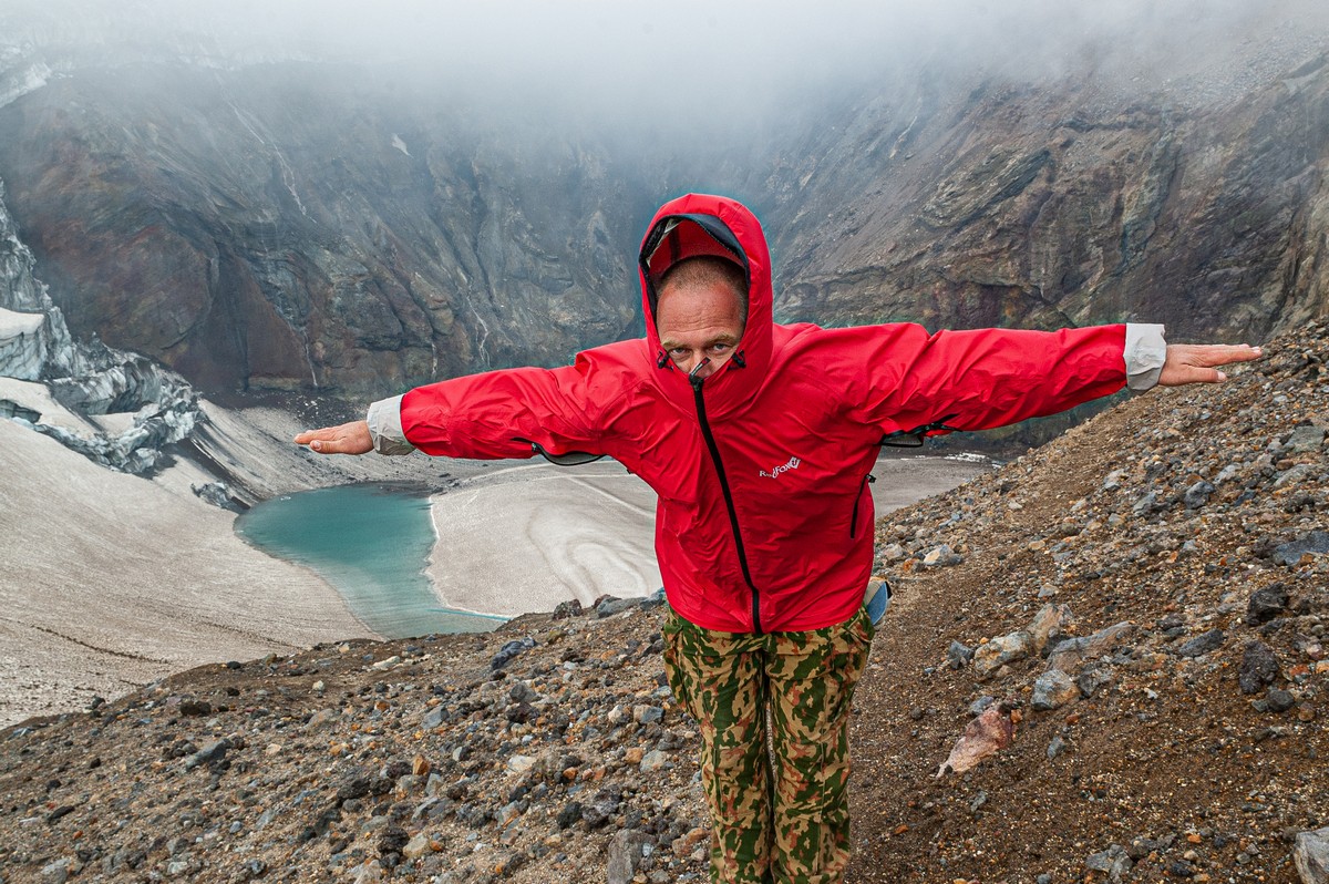
Of course, the weather unpredictable and extremely changeable:
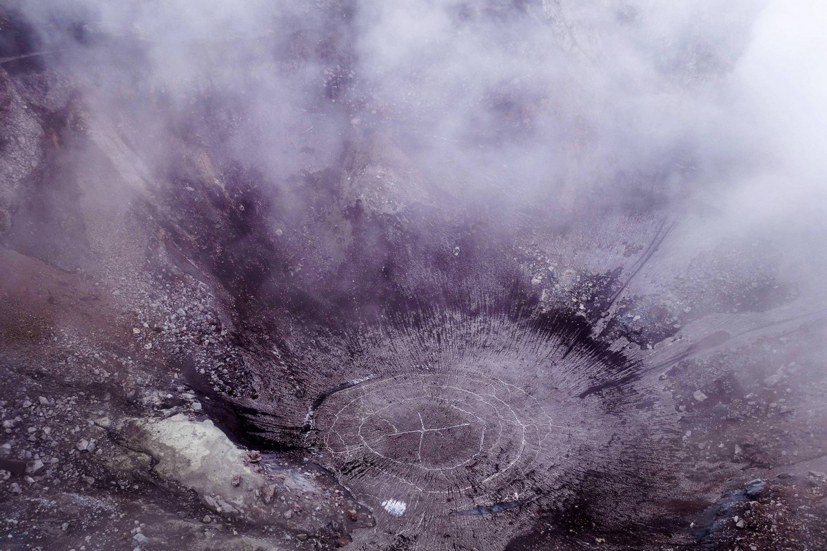
A steaming… crater slope! ->
And back down the outer slope ->
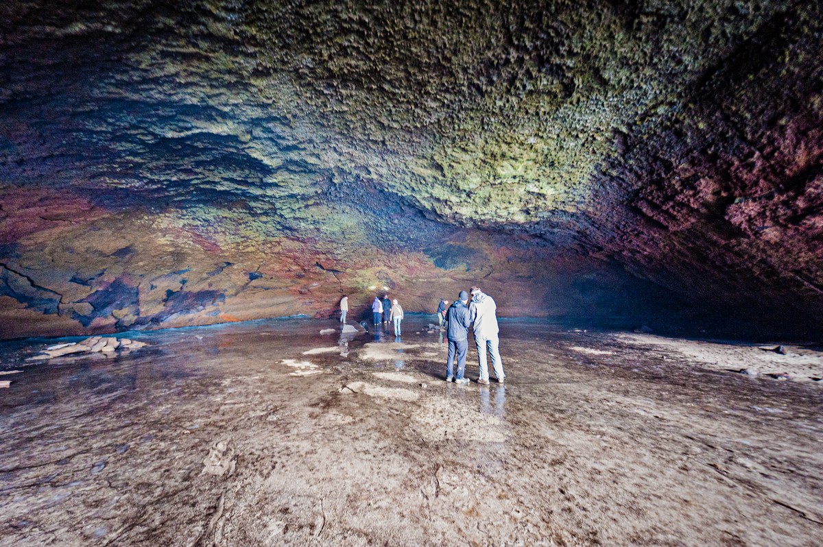
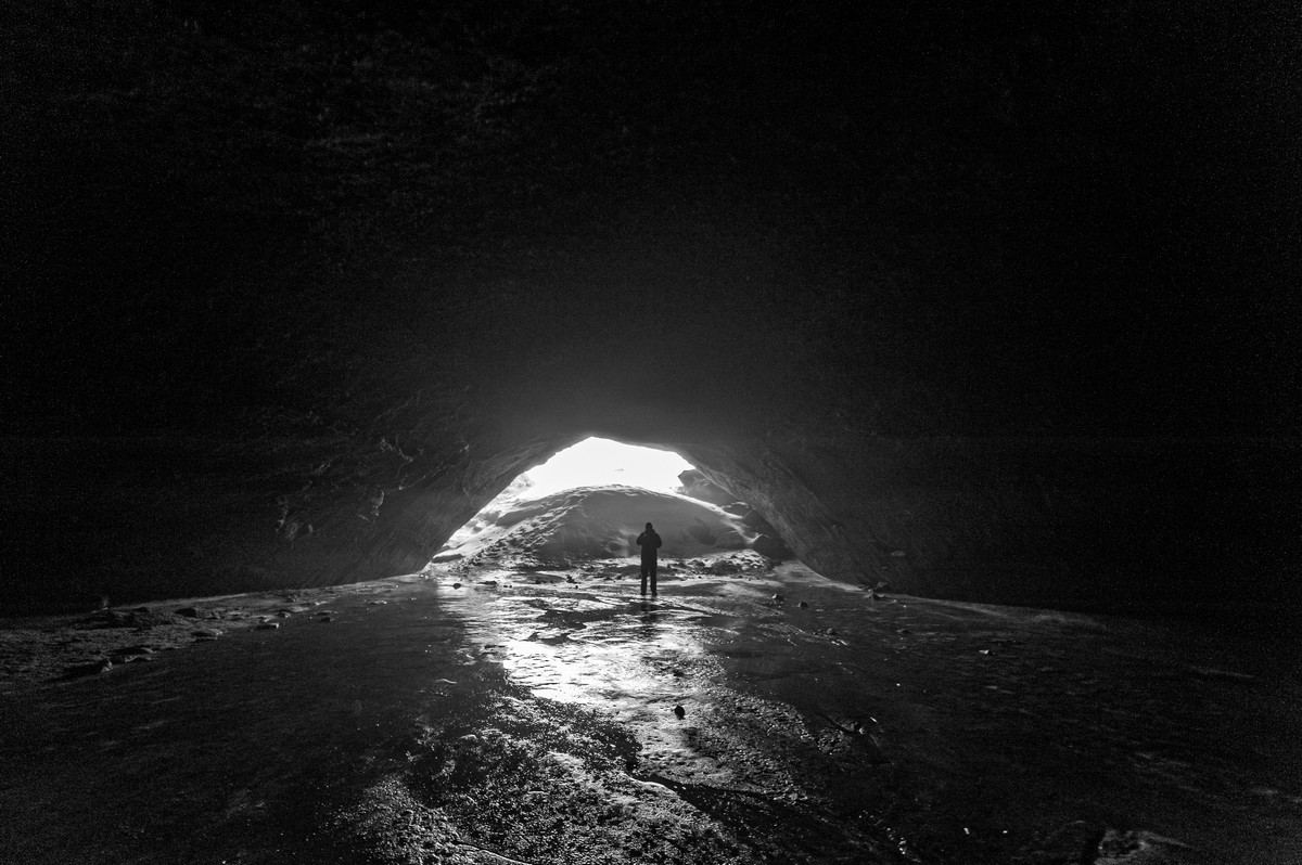
Near Gorely there are also some fantastic volcanic caves/tunnels. The enormity of one of them is staggering, while another is so narrow you need to hack at the walls to be able to squeeze through. And if you’ve a bit of a pot-belly [red face], you might even get stuck à la Winnie the Pooh ). I was last there in 2012.
Here’s the biggie – the biggest lava tunnel/cave I’ve ever seen:
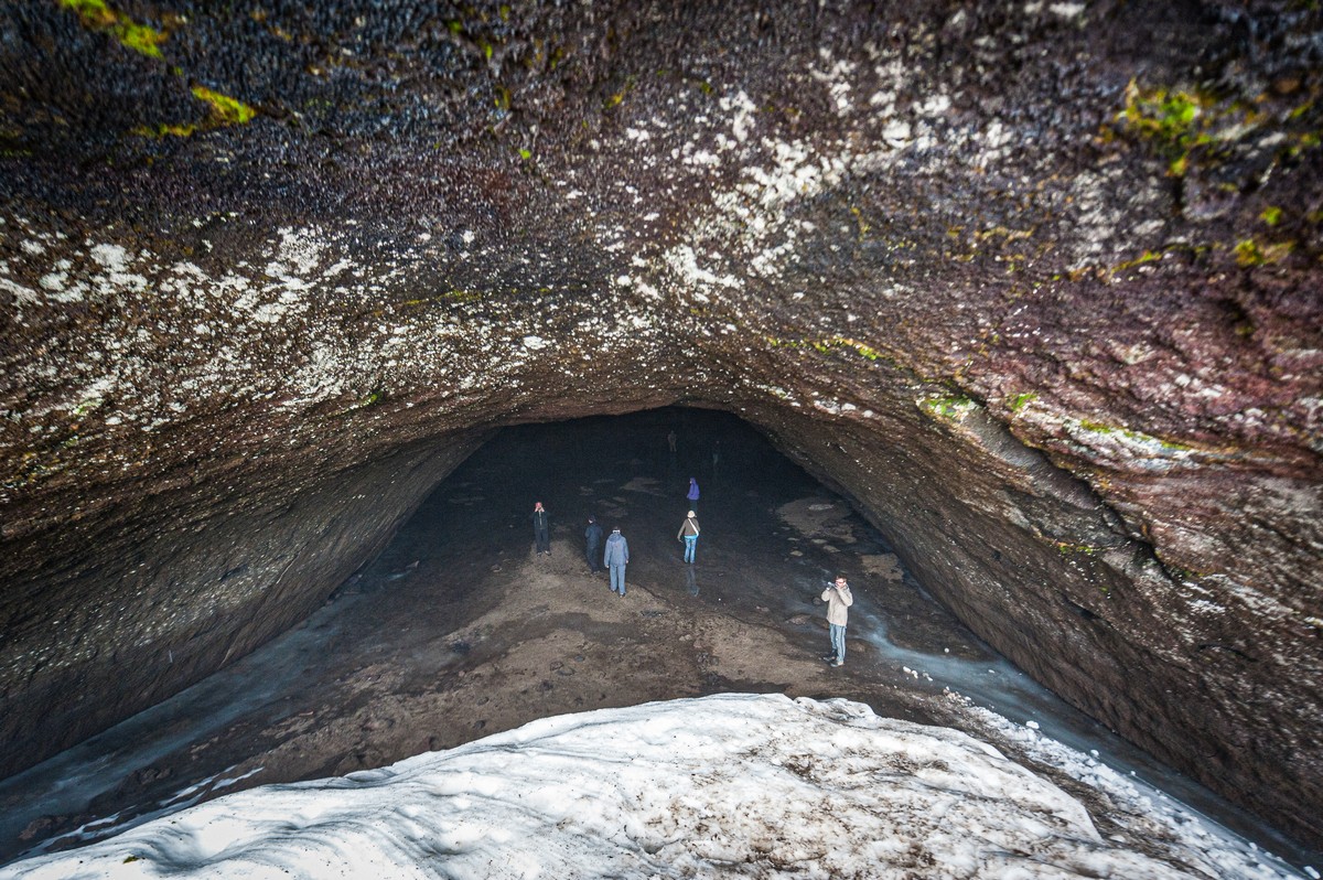
There’s little consensus as to its age, but it’s probably not thousands of years, not tens of thousands of years, and more like hundreds of thousands of years old…
The ice doesn’t melt – even in August:
The smaller tunnel takes some finding:
When you finally find it – inside: interesting and unusual – including tubes within tubes! ->


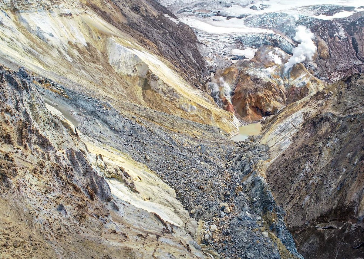
Now for some Mutnovsky – from different years:


Inside the crater: oh my glacier! ->


It gets windy up there…
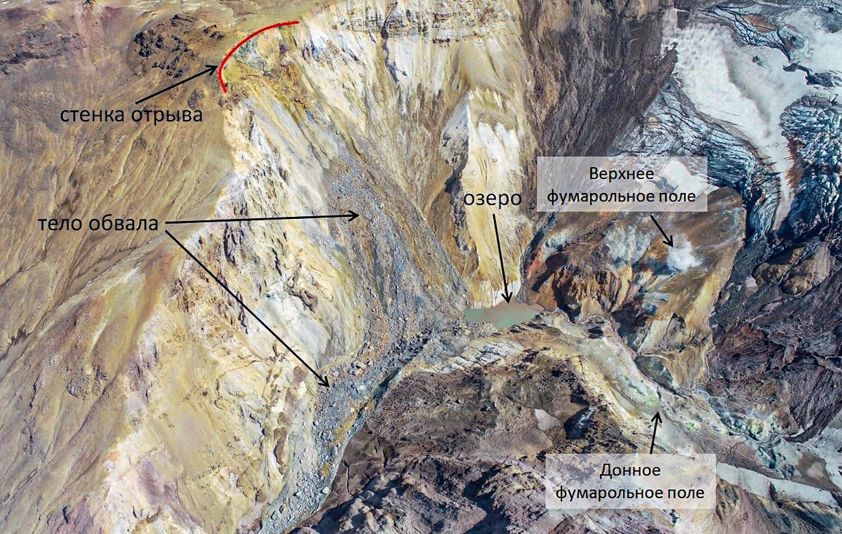
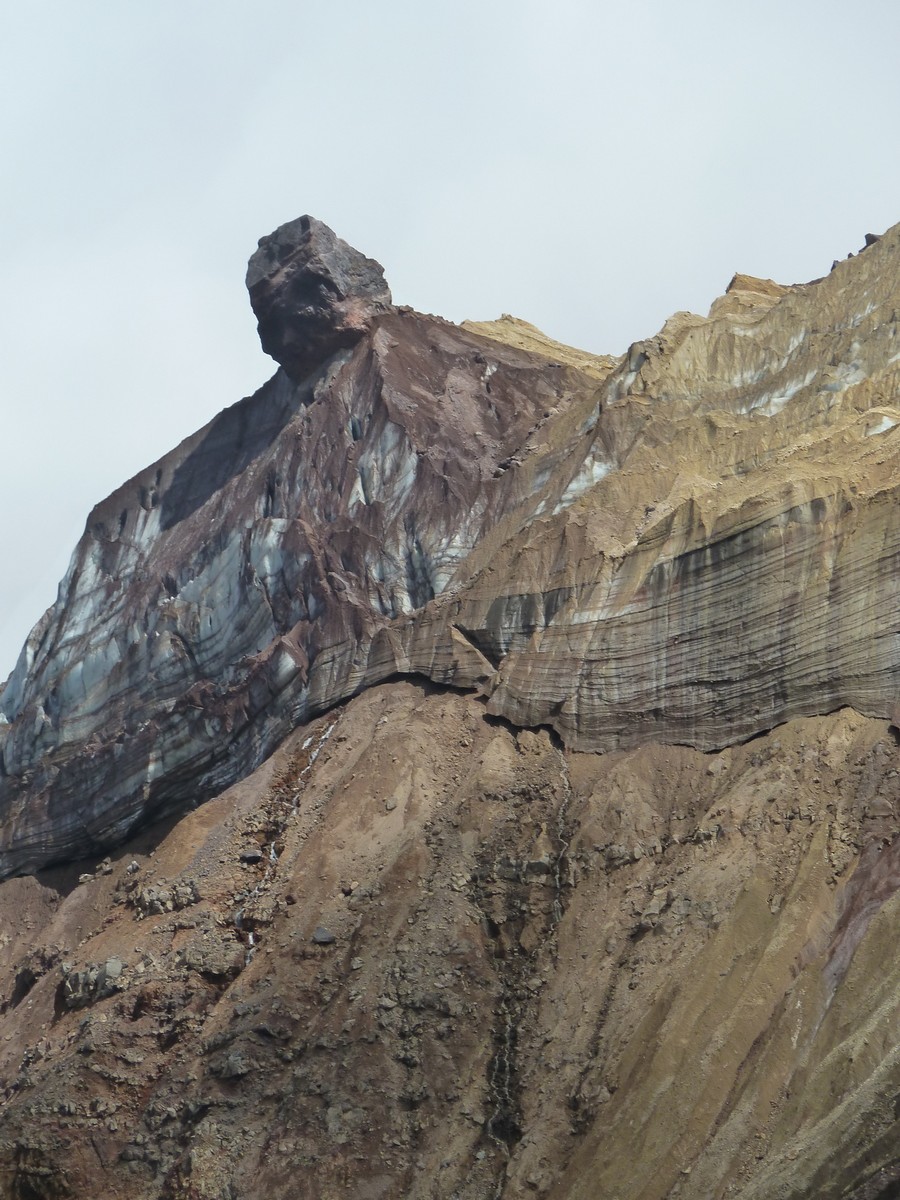
This rocky wall is the one that collapsed:
All this also joined in the landslide:


This rocky outcrop isn’t there anymore – also came tumbling down into the crater:
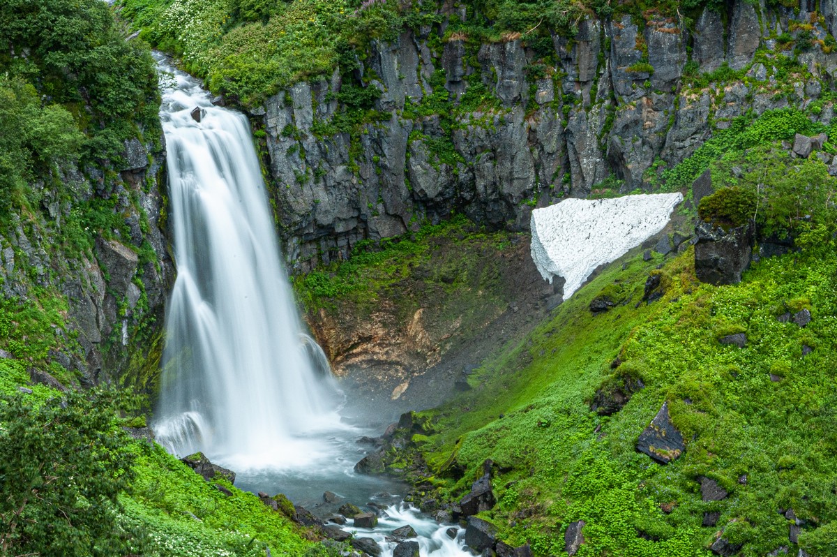
The Opasny (dangerous) Canyon and its waterfall:


Oh my gorgeous! ->


Another waterfall nearby. Indeed, there are plenty here:
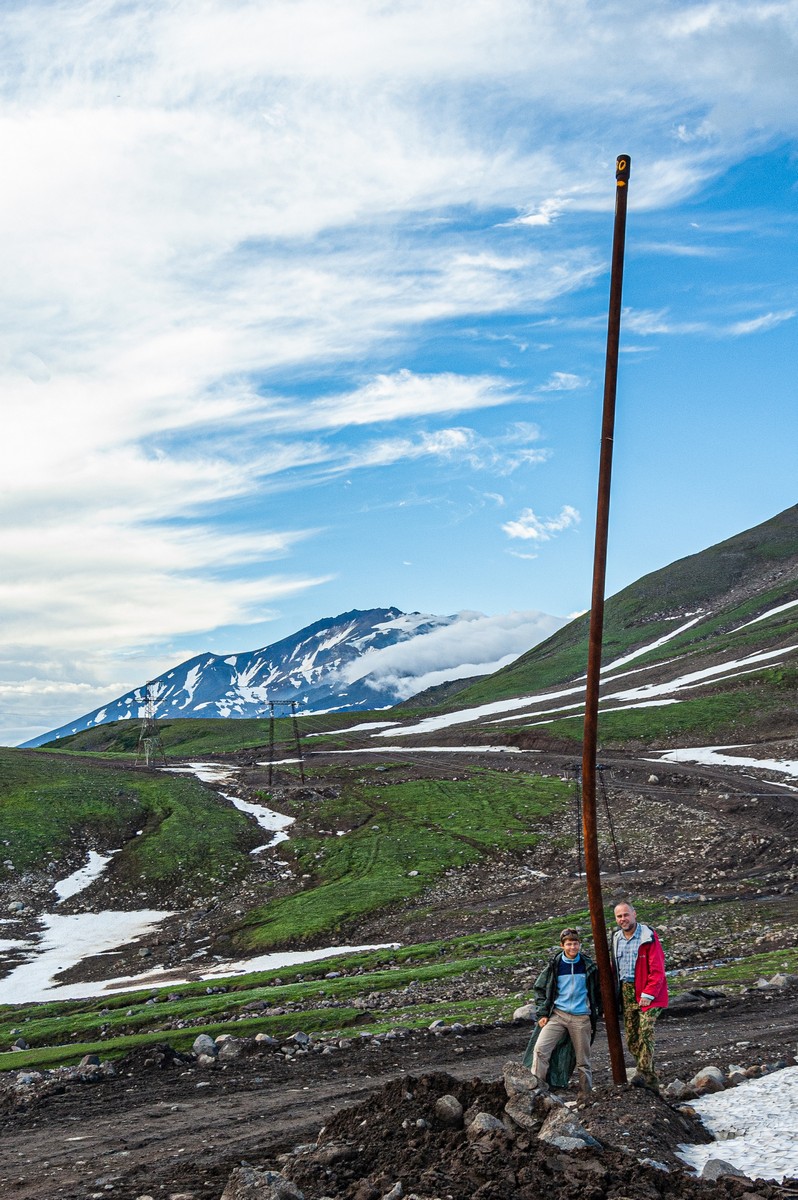
These poles are there to mark out the road in the winter under the snow. Just look how tall it is! That’s an old pole, btw – as that pic was taken in 2006. More modern poles have been installed since…
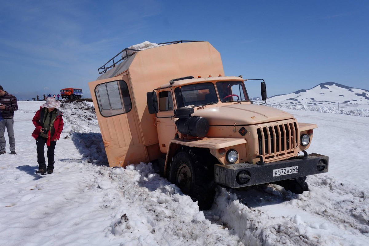
July 2015, and we got stuck in… snow!
And on that typically unusual Kamchatkan note, I bring my Gorely-Mutnovsky review to a close. Hope you liked it; and I hope you visit these volcanoes one day too!..
The rest of the photos from out Kamchatka-2021 expedition are here.

