This is getting silly. Our Kurils expedition this year was in summer. Soon – it’ll be winter! So I’d better get back to my tales from the Kurilian side and make some decent progress toward finishing them; otherwise it’ll be Christmas and I’m still on about our summer holidays.
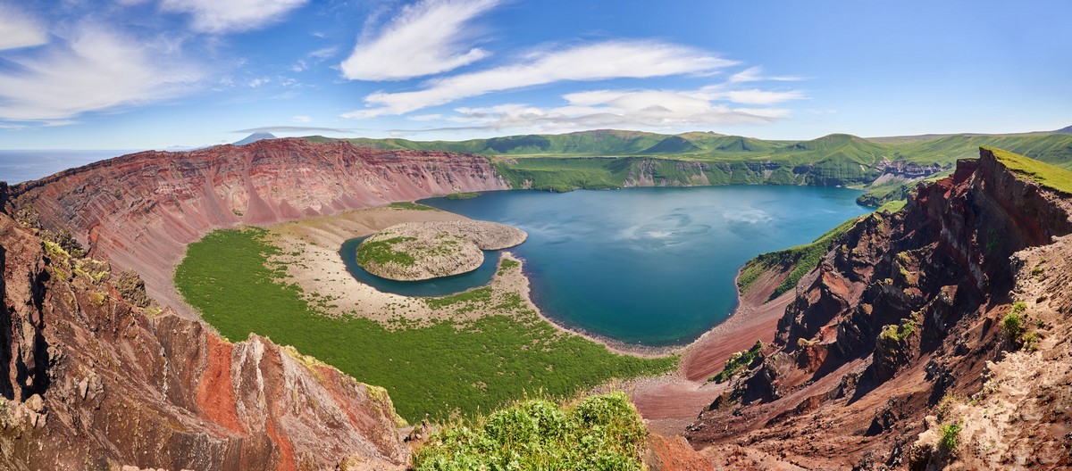
So, as every YouTuber loves to say, ‘without further ado’, let’s get back (far-)east. Specifically – ~40 kilometers to the southwest of Brouton Bay along the eastern coast of the Kuril island of Simushir, namely – at Zavaritsky Caldera.
Zavaritsky is yet another voluptuous volcano of the Kurils. Now, if Krenitsyn is the ‘King of the Volcanoes’, and Ushishir is the ‘Jewel in the King’s Crown’, where does that leave Zavaritsky? Zavaritsky is… the ‘Cherry on the Colorful Cake’, which the king, in his crown, loves to eat, when he gets the munchies. Ok, I have backed myself into a corner with the metaphors, so… let me extract myself from the compulsion to stick with royalty, its headgear and sweet-tooth, and simply state that Zavaritsky is… – a ‘Festival of Vivid Volcanic Color that Couldn’t Be Fuller!’
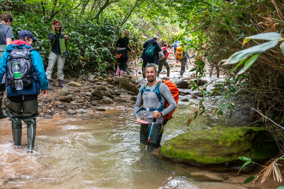
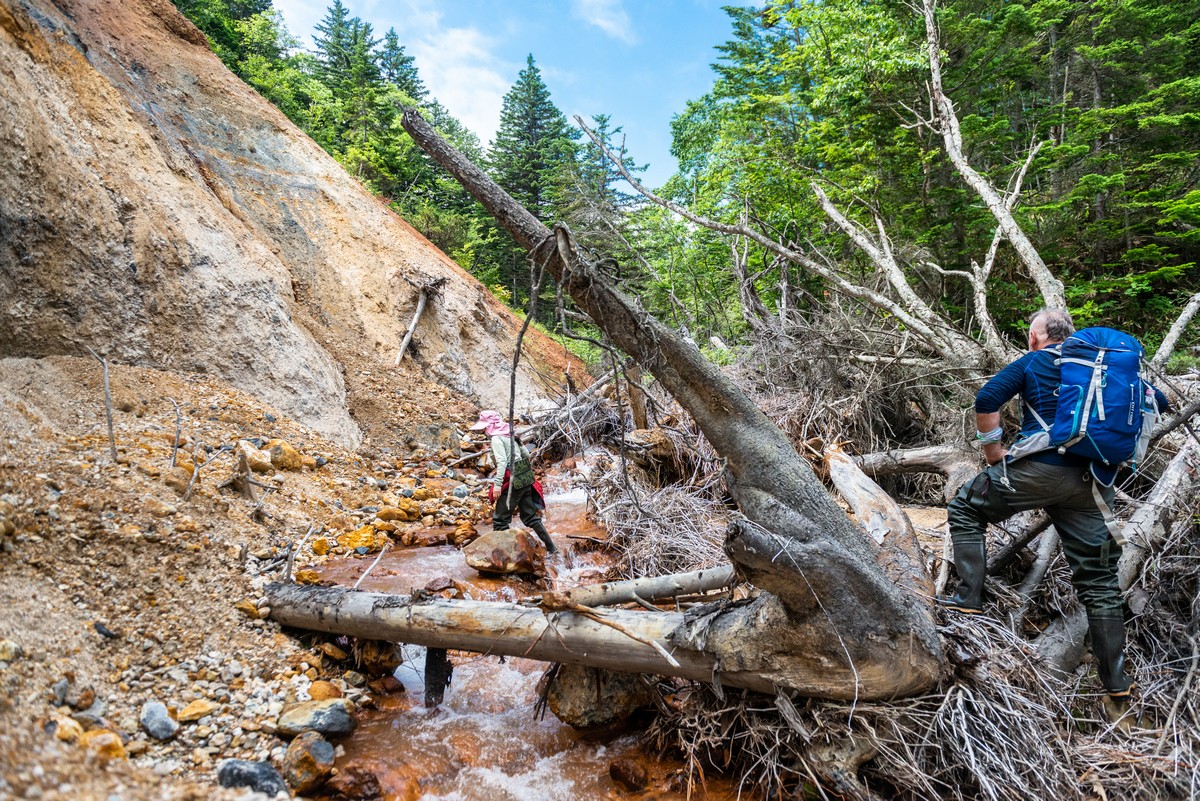
There’s another volcanism feature on Kunashir definitely worth a visit: the fumarole ‘fields’ of Mendeleyeva Volcano. Last time we strolled across one such field; this time we walked along the river toward the second. And a wonderful walk it was too. Though it was a ‘mere’ eight kilometers one way, another eight back, it still took our group of office dwellers the full day to cover it. Still, taking our time meant the meditative-enjoyment factor was fully guaranteed!
To get to the nearest fumarole field you take the forest path; to get to the furthest one you take… the river! The overgrowth either side of the river is just too thick for trekking. So it’s on with the Wellingtons and off you splash, enjoying the views all around as you do!…
Woah. Bright green volcanic discharge. I wasn’t sure whether to say ‘urrggh’, or ‘woweeeee’!
The bush with the pink leaves. Actually, one side of the leaves is the customary green color; the other – that there bright pink. Mutant foliage!
Along the banks of the river – the highway for the local inhabitants:
The deepest bit of the river:
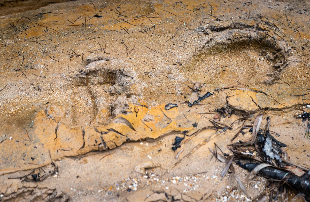
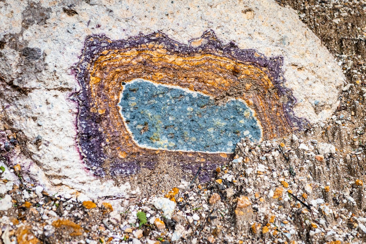
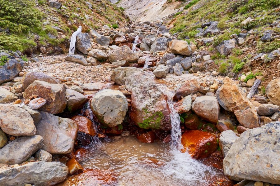
In places the constant water erosion reveals secrets of the periodic table in the stone:
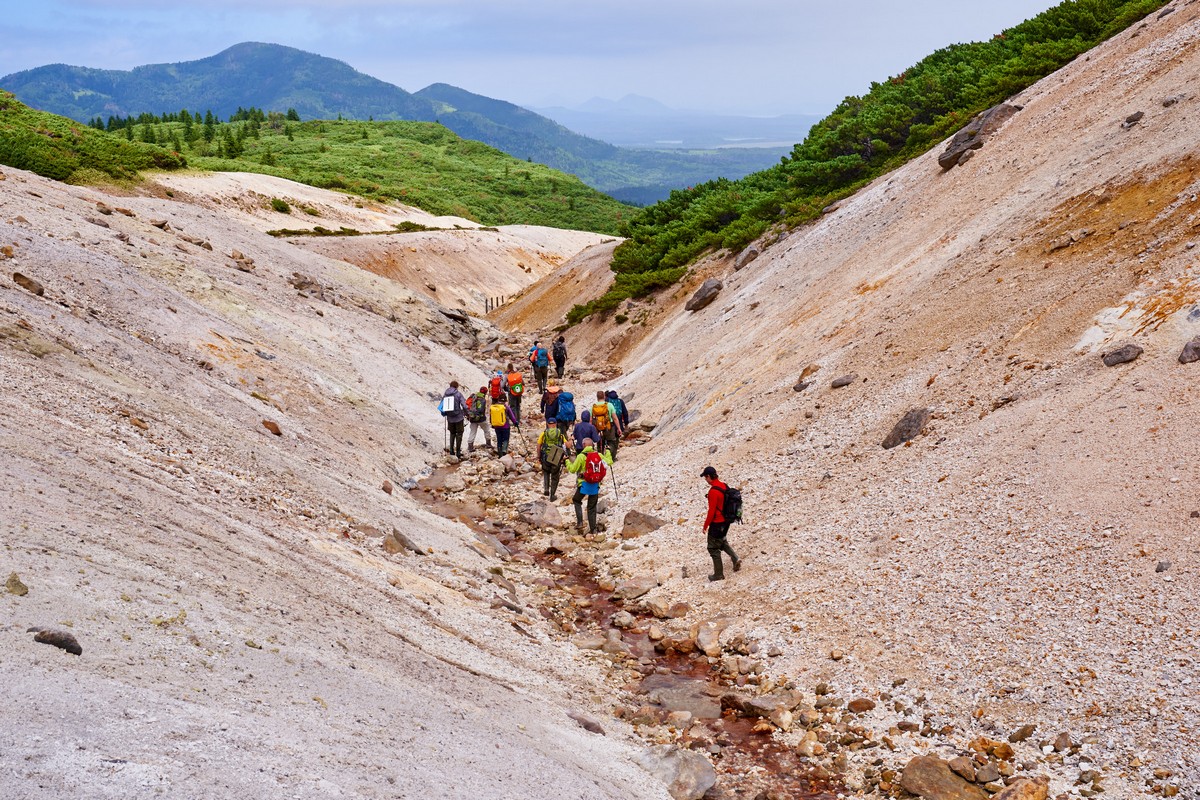
The further up we got, the more often did we have to switch on the ‘4×4’.
Suddenly – ruins of Japanese sulfur mining buildings:
After two or three hours, we finally make it to the top. Time for our habitual ritual when we’re atop mountains or… fumarole fields: sit, chill, meditate, zone out, or whatever else you want to call it…
The multicolored volcanico-fumarolio are a wonderful sight to behold, and none of the strong odors that normally accompany such sulfuric sights as these.
Pleasant surroundings, comfortable, calm. The only thing disturbing the peace and quiet – the buzz from the drone. But given the quality of the vids it takes – it is forgiven ).
Of all the many colors here, perhaps the most outstanding are the rich reds and awesome oranges. Clearly plenty of ferrous oxide round here…
Alas, time to head back…
…And not just to the Athens. It’s almost time for us to head back to civilization: our Kurils adventure is drawing to a close (.
Next up for us – in fact, our last Kuril Island of this year’s expedition – was Kunashir, which, luckily, happens to be covered in outstanding volcanisms. To the north there’s Tyatya; to the south of it there are Cape Stolbchaty and its crazy columns; and further south there are the multicolored fumarole fields of Mendeleyeva Volcano and the hot mud baths in the Golovina Caldera. Each instance of volcanism – spectacularly beautiful in its own right; but all together they make sure the island of Kunashir would – if it were in China – geyt a full KKKKK rating!
We were here five years ago, and I wrote plenty about this phenomenal island then and showed you a ton of pics. Here, I’ll just be complementing that earlier narrative and photography with some extra-special new impressions.
Alas Tyatya wasn’t ‘open for visitors’ when we were there – the weather was too bad and the huge waves didn’t permit us a safe landing. But we did get a rerun of Mendeleyeva’s fumaroles and the stone pillars of Stolbchaty.
If you had to describe Kunashir with just one word, what would it be? ‘Ура!’, of course (in Russian), which means ‘hurray’ in English. Accordingly – basalt graffiti thereof:
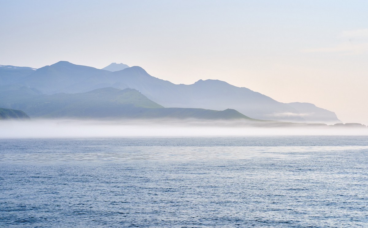
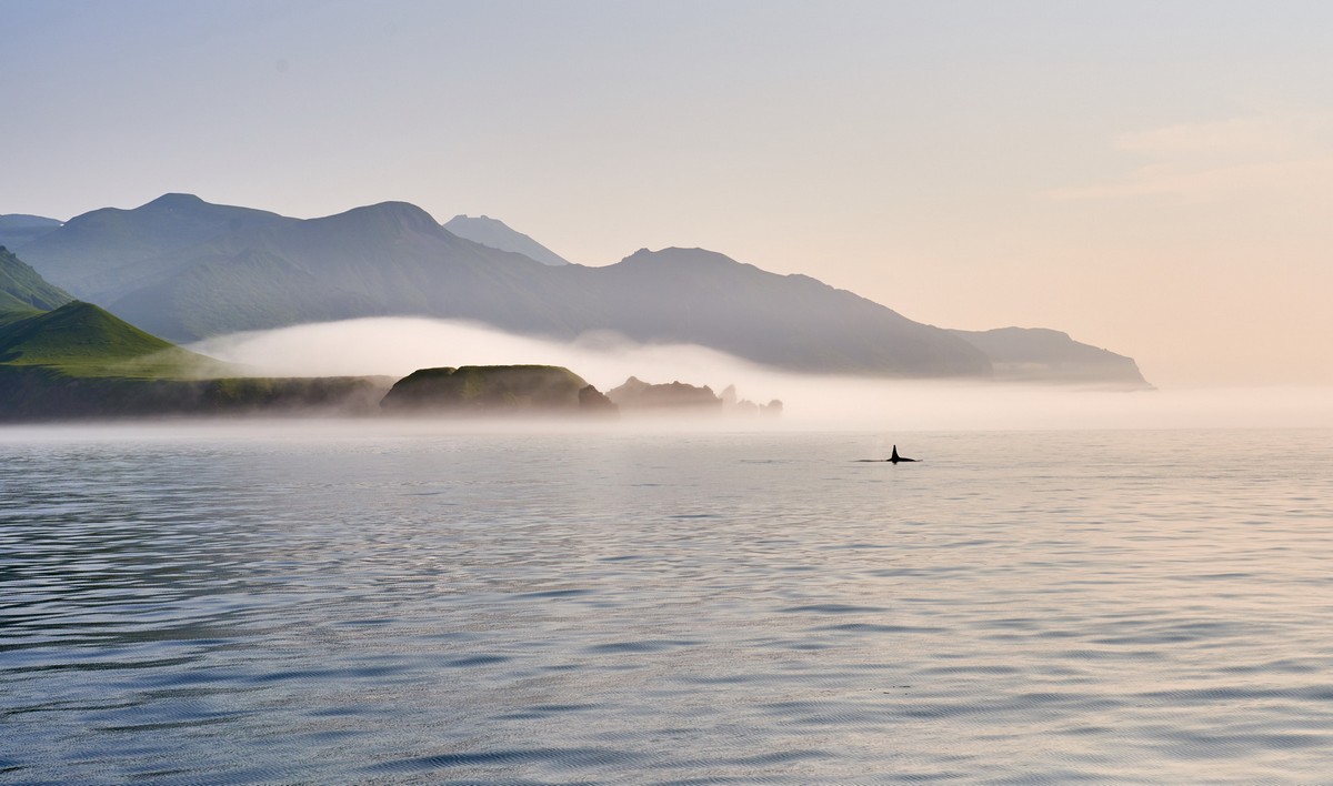
Onward we sail further and further south, with it getting warmer and warmer as we get nearer to the equator. We keep wondering if, sooner or later, the waters around these parts might become warm enough to take a pleasant dip in… a quick check – alas: not yet. So we continue on our merry way southward – toward our next Kuril: Urup, which comes from the Ainu word for salmon trout. Probably named that way as the island is long and thin like a salmon. But wait – so… does that mean the Ainu people drew maps? How else would they know the shape? Maybe by climbing up a neighboring volcano and seeing it that way?
Or could it be named after the salmon that perhaps inhabit the small island’s… streams (no rivers; no lakes)? Maybe there are salmon trout here. To the north, as far as Paramushir, all the islands are too small for salmon trout to reside on them. And to the south, perhaps, the climate’s too warm for a northerner-fish such as the salmon trout? But just here in between (also on neighboring Simushir), there well could be salmon (there was on Simushir – I saw them myself). Not that we found out – we passed Urup by. We’d landed there last time and there’s not a great deal to see onshore that can’t be seen from the sea (see the below pics), so we just missed it out this time…
Severe Kurilian landscapes…
Woah – killer whales! Maybe they’re after the salmon? What else would they be doing next to an island called Salmon?!
But why take pics from the Athens? Let’s get a drone up! So our American friends did just that…
Evening approaches; in rolls the fog; time for us to move on!…
Next up – Iturup; that rhymes! Surely this will mean something fish-related in Ainu? But of course: it means jellyfish! That’s funny; the island neither resembles a jellyfish, nor did I see a single jellyfish swimming about in the sea around the island. Stop. Perhaps those long capes the jut out quite far into the sea were deemed jellyfish’s tentacles?! But I digress…
One of those tentacles is in fact a volcano of considerable stature: Atsonupuri. We climbed to the top of it last time (what a nightmare it was: real tough conditions), and bathed in its hot springs. It was also here where we found the Answer to the Ultimate Question of Life, the Universe, and Everything; that is – 42 ). I won’t go over Iturup again here; just a few highlights…
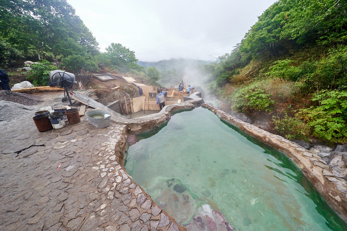
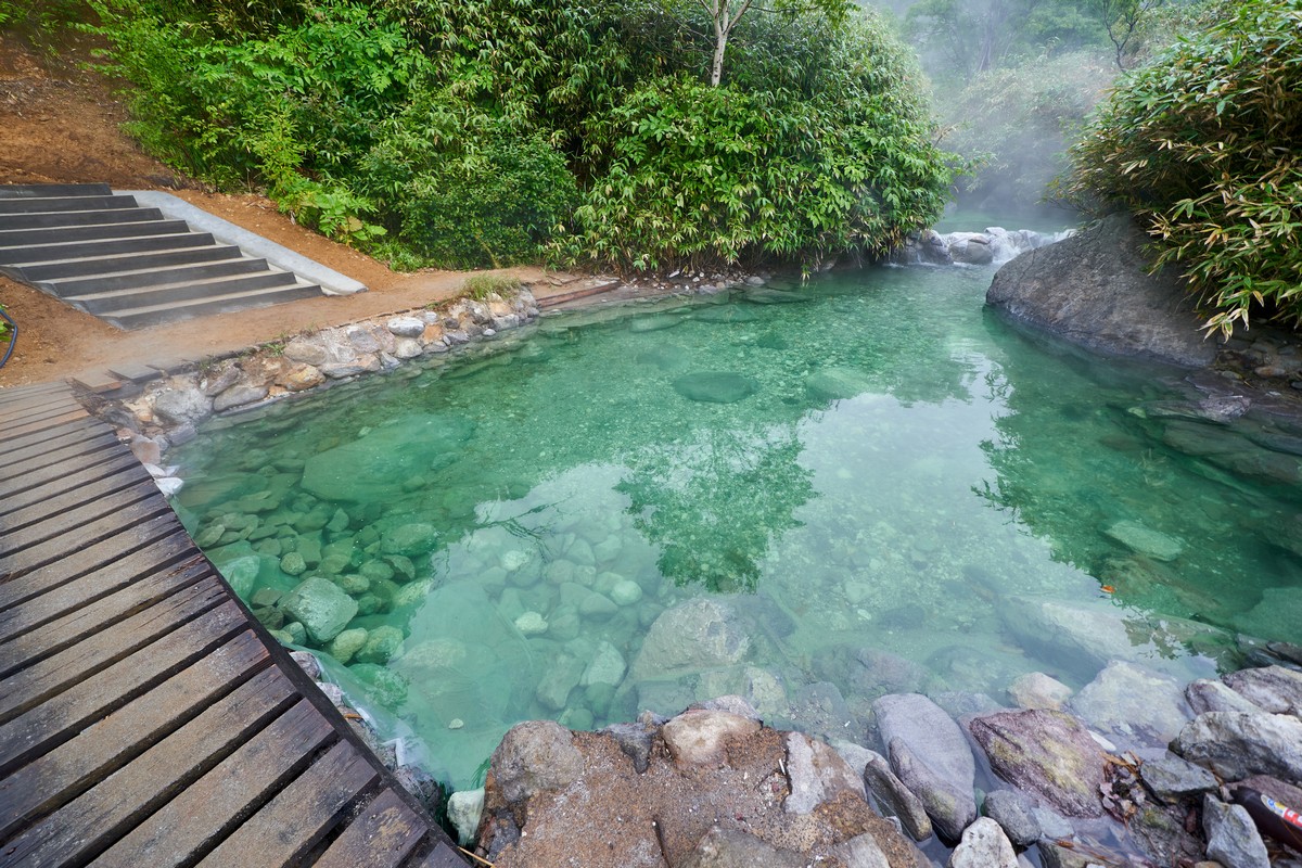
In the next pic: hot stream coming down from Baransky Volcano! In the steeper places: hot waterfalls!
Up here the water’s literally boiling! It cools down enough to be able to bath in it some 400 meters further down…
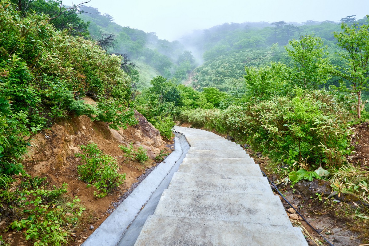
Woah – here’s something new since last time: neat concrete steps. Just what the doctor ordered (to go with the prescribed recuperative natural spring water:).
Down we go…
Oh no – repair work going on!
Not to worry: two of the upper pools had had their repairs completed:
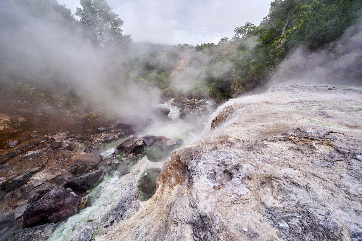
And anyway, the best bit of all – the full-on hot-spring waterfall – was further down, ahead of the repairs…
Aaaaaaah. What a place! 42 – no two ways about it. And it gets even better for you, dear readers…: drone footage! Could this possibly be the first ever drone footage of these waterfalls in the history of the Universe? Again: 42!!
Must get back here one day. Simply mandatory… That goes for all you readers as well!
The rest of the pics of our Kurils-2019 expedition are here.
Yesterday you’ll recall we were on Sumishir being bowled over by its Zavaritsky Caldera. Today, sailing southwest along the string of Kurils, we first took in the rather plain Broutona and its bay of the same name (named after the British naval officer and explorer William Broughton). And after that – two small islands together referred to as Chyornye Bratya – the Black Brothers, with one called Chirpoy, and the other – Brat Chirpoyev (Chirpoy’s brother!), here.
I’ve already mentioned a few times that we had a few American friends along for the rideadventure in the Far East, and that I’d be ‘getting to them’ later on. Well that later on has arrived!…
So who were these folks from the U. S. of A. (and a few other countries), who traveled with me and my regular expeditioners?
First up – Mr. Chris Burkard, the very famous and very successful photographer of all things extreme, distant, fantastic – often and preferably all three at the same time. He’d heard lots about the Kurils, and had long dreamed of exploring and snapping them. So one day, while researching the islands on the internet, he couldn’t help but come across my blog and e–photo-albums, since there probably is no other blogger/amateur photographer who’s written and snapped the islands more than moi. I mean – really, you can’t avoid Me & D.Z. and Co. on the net if you search for anything Kuril-related: if you simply put in the name of a Kuril volcano into Google Images – a ton of our holiday snaps come up toward the top of the list!
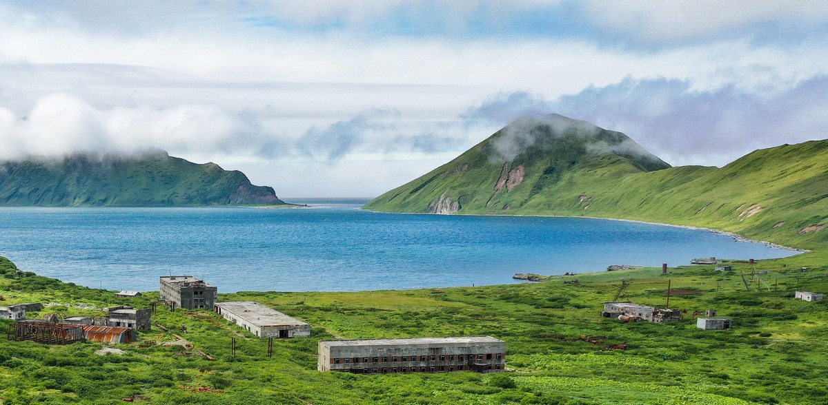
The naval base existed from the late-70s up until 1994. In its heyday around 3000 folks lived here. Now the place is deserted, has been looted, is overgrown and rusting. Up close: ugly. A way off, on a sunny day – mysteriously charming:
You didn’t think there’d be just one post on Ushishir, did you! )…
Of course not! Why limit probably the best volcano in the world to just one? No reason at all; accordingly, here we go – deeper. Literally! Into a cave here! For example – the one ringed red, here:
The next stop on our Kuril-2019 adventure was the unparalleled Ushishir! One of the most beautiful locations in the Kurils; one of the most beautiful locations in the world. And If I were ever to compile a ‘Ten Most Beautiful Volcanoes in the World’ list (hmm – now there’s an idea!), Ushishir of course would be on it, and could even be at the top of it.
Actually, yes. Striking while the iron’s hot – let me quickly write up that list! I’ve seen all the world’s mega-volcanoes, so why not?
Every single island of the Kuril archipelago is volcanic. Each island came about due to volcanism; and most islands have one, two, three or more volcanoes on their territory, some being among the most beautifully symmetric (e.g., ideal pyramids) in the world. Many of the volcanoes are active – with lava-spewing eruptions occurring regularly. One such active island-volcano is Raikoke – an island with a real checkered (green and black – as you’ll see:) history – literally.