The albatross is one of the most astonishing birds in the world. It can fly for thousands of miles from the shore, it can actually live up in the air for years without landing, epic poems are written about it, epic songs are sung about it, it’s considered an omen, and generally there’s an air of mystery around the species. I mean, like, how did they learn to fly just soooo far? How do they sleep up in the sky? How do they sniff out smells of potential prey from miles away?.
The first time I saw some albatrosses was while sailing on a research vessel through the Drake Passage en route to Antarctica, as you do. They seemed to appear out of nowhere, soared so low over the ocean it looked like they were touching it, circled round the ship (just curious?), and then disappeared never to be seen again; and never once did we see them flap their wings! Like, really: zero times! Indeed, they can glide for hours (or is it days, weeks or months?) upon airstreams caused by large ocean waves and wind – both of which they need both to survive; calm, windless conditions are lethal to the albatross. No wind means it simply can’t fly off – not from water, not from land.
In fact, the species has gone so far down the evolutionary road that’s led to its extraordinary gliding abilities that their wings are hardly flappable like other birds’ wings any more. Instead, they have special retainers into which the bones of the wings stick into, fixing the two-or-three-meter-wide wings in place to resemble a glider plane – with no muscles being used at all and zero energy expenditure.
How do they sleep if they’re up in the sky for years (the first six years of their lives they never touch land once!)? Apparently it’s still not known. It might be that the two halves of their brains take it in turns to sleep and be awake, much like whales and dolphins’ do.
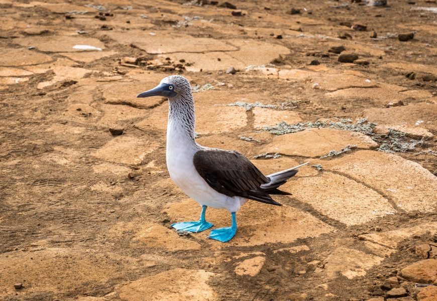
Great albatrosses are expert fishermen and fisherwomen. Much like the boobies, they’re super-fast divers, though they don’t go as far deep into the ocean as boobies. They can sniff out ‘food’ from miles away; they drink seawater (they have a special organ in their beaks (the little bumps with the holes thereon) that filters out the salt!!). They nest and breed only in one place – where they were born. That is, after several years and hundreds of thousands of kilometers of flying gliding they return right back to their birthplace.
Truly fantastic fowl.
Simply seeing an albatross would probably have been the main Ecuad-awe-someness of our second day on the Galápagos Islands. However, what made it even more incredible was that we saw the first ever flight of a young great albatross! But I’ll get to that in a bit…
Rewind! A new day – a new island. Next up: Española Island, which is the main breeding ground of the Galápagos Islands.
Read on…