Tag Archives: volcanism

Four tickets to Aogashima – part 2. Hachijo-jima.

A summary of part 1:

07:00. Flight from Tokyo (Haneda) to Hachijo-jima, then a tight connection – helicopter flight to Aogashima, a day there trekking and climbing about, and looking at and taking pictures of every nook and cranny. Beautiful!

The next morning I had a vague sense of déjà-vu: waking up at the impossible hour of 07:30, but this time ‘Boy Scout style’, accompanied by a lively announcer’s voice from speakers all over the hotel: peem paam poom puum ohayo gozaimasu (that’s ‘good morning ‘in Japanese). Followed by a lot more Japanese chatter, of which I only picked out ‘arigato’ and ‘kudasai’. Then rise and shine, get up from the straw mattresses, breakfast – and back to the helipad.

Just to recap: there’s only one helicopter flight a day – if the weather’s good. If it’s bad, no helicopter flight. The Hachijo-jima–Aogashima flight leaves at 09:15 and arrives at the destination around 09:40 (based on our observations). After landing, a regular helipad bustle: unloading/loading freight from/to the ‘mainland’, boarding new passengers – Aogashima natives and stray tourists – and flying back.

Thus, the return flight dropped us off on Hachijo-jima at some 11:30. Our flight to Haneda was at 17:20, so we had some six hours on our hands. How were we to spend that time? Rent a car and go to the onsen hot springs, of course! At least, that was what some of us thought. Wrong! I looked at the map, saw a track leading to the top of the local volcanic blister, and we all proceeded to climb this local Hachijo-Fuji (apparently, all sacred mountains in Japan are called ‘Fuji’) in accordance with this sudden plan.

hachijojima-island-japan-1Source

2. hachijojima-island-japan-2

Read on: Not a bad sight at all!…

Four tickets to Aogashima.

The other day as I was browsing the Internet I came across a story about a most unusual place in Japan. It’s hard to get to but really worth the effort as it’s both beautiful and interesting. It’s the island of Aogashima, several hundred kilometers south of Tokyo, on the border between the Philippine Sea and the Pacific ocean. ‘That’s worth a look,’ I thought. Next thing… we were there – spending last Saturday on the island. A very curious place; highly recommended!

Now, let’s see what kind of an island it is…

Aogashima is a volcanic still-life made up of an ancient caldera that collapsed inwards, and the rather fetching cone of a new volcano that started to grow within it a few hundred years ago.

Aerial photos report the following:

aogashima-island-japan-1Source

2.

aogashima-island-japan-2Source

The first thing I did was call KL Japan to find out the details of this bizarre island, ask who might be ready to risk traveling there with me, and make other travel arrangements, which turned out to be rather complicated.

Read on: Yes, reaching that island proved anything but easy…

Cool your boots, Japan.

Tired after a seemingly endless journey, the long-distance traveler normally resorts to some kind of body of water first in his/her attempt at winding down, chilling out a bit, and returning from zombie state to kinda normal state. Usually a shower, sometimes a bath – sometimes even a banya and its attendant cold pool!

But only in Japan can one hope to reap the mega-chillage effects of a ryokan, which mixes bathing with a fantastic culinary experience to have you back all recharged and fully energized in no time at all. Which is what happened to me recently at Izukogen Hanafubuki Ryokan on the Izu Peninsula (伊豆), not far from Mount Fuji, Japan. Cool our boots, man, we sure did.

In case anyone doesn’t know what a ryokan is, let me tell you that it is a traditional Japanese hotel, usually not too big, with straw mattresses on the floor, offering super-duper Japanese food plus sometimes hot springs to dip in.

If you’re not Japanese, however, you have to be careful. You’ll need to bone up on the Japanese culture first, as it’s easy to put the proverbial foot in it with some faux pas that will cause upset at best, an international scandal at worst :). Best of all is to visit a ryokan with Japanese friends or colleagues, then there’s no chance of unintended mix-ups/offense. Accompanied by locals, you’re safely under their wing, so can feel just like a Japanese: blissfully content to recuperate for a few days, feed the soul, and revitalize the spirit.

And it’s not just the food and waters that act as a tonic to the body and soul – there’s also all the cherry blossoms still a-blooming here, picturesque little cottages, cozy little paths and an overall abundance of fauna and flora. Most fine.

izu-japan-1

izu-japan-2

Why are we here?

Read on: Rainy day at volcano…

Enter your email address to subscribe to this blog
(Required)

Guatem-ooh-la-la volcanism.

Turns out the Ring of Fire affects Guatemala too. But then that country classic affects many, and always will :). But no, it’s the seismic-lithospheric-tectonic Ring of Fire that ensures Guatemala is fully sorted in the volcano department.

In all there are around 30 volcanoes in Guatemala – impressive for a country of its modest size. Taking a peek at trusty old Wikipedia, we see Guatemala covers approx. 100,000 square kilometers, so if we divide that by the number of volcanoes… ooh la la!: the volcanism force is strong with this one! It’s nothing on the Kurils of course (68 volcanoes in 10,500 square kilometers!), but the Kurils aren’t a whole country…

Antigua is surrounded by three volcanoes – Agua, Fuego and Acatenango – all of which were visible from our hotel:

Guatemala volcanos

Read on: Ahhh, so great being up a mountain!…

Guatemala – what a gala (of color). Part 1.

Which airline to choose to get from Madrid to Guatemala was a no-brainer: practically the only airline to fly direct is Iberia. It’s like, why would we fly with a connection – heaven forbid a North American one? :)

So off we popped, direct to Central America…

The first bit of land on the other side of the Atlantic was Haitian (I think), and then came Jamaica. Over the mainland we flew over Honduras, and next up was our country of destination – Guatemala.

Madrid - Guatemala

Madrid - Guatemala

Madrid - GuatemalaHonduras coming into view

Incidentally, Honduras – why’s it called Honduras? You can find out here. It appears there are two alternative versions. The first starts:

In Spanish, the word “honduras” means “deep waters” or “depths”. It is a peculiar name for a country, but there is also a peculiar story behind how our country got this name.

Madrid - GuatemalaYou have reached your destination

Not everyone (who lives outside Central America maybe) is able to point out Guatemala on a world map. Not everyone knows it’s in Central America even – many think it’s in South America. But no, Guatemala is the quintessential Central American country – the most central Central American country, in fact.

It sits neatly between Honduras, Salvador, Belize and Mexico. Firther to the south there’s also Nicaragua, Costa Rica, Panama, and then Columbia and Ecuador.

I flew over this nest of cuckoos curiosity a while back. Unfortunately that was at nighttime so I saw nothing at all of it. This time things were different:

Madrid - Guatemala

Madrid - GuatemalaVolcanism on the horizon. My cup of tea

Madrid - Guatemala

Madrid - Guatemala

Madrid - GuatemalaA Fuji competitor!

Madrid - Guatemala

Madrid - Guatemala

Turns out there are 33 volcanoes here, three of which, I’m told ‘represent a threat’. That makes sense: this part of the world’s seen plenty of volcanic activity in its time, some of it very sad. For example, in the sixteenth century Agua destroyed the first capital of the country; and in 1965 Pacaya blew its top violently and has been erupting constantly ever since.

And right now Fuego‘s causing all sorts of problems for the locals. And on the first night after we arrived there was even an earthquake! I missed it as I was in a jetlag-compensating deep sleep. Not sure if that was a good or bad thing.

We went for a walk up Pacaya while in Guatemala; not to the top – it’s smoking like a bar steward right now up there – but around the old crater near it. Impressive. So impressive in fact that it warrants a post of its own. I wasn’t expecting that there’d be a lot to report back on from here – I was proved wrong!

All the photos are here.

Back soon folks!…

The three Kurilsks of the Kurils – your guide.

The Kuril Islands are bleak – plain and simple. Extreme weather, poor communications with the continent, a 100% mark-up on all imported goods (and just about all goods are imported from mainland Russia), and a constant threat of natural disasters such as volcano eruptions, earthquakes and tsunami!

It takes a tough individual to survive here; an even tougher individual to love the place. However, there are things to love about it; you just need to know where to look…

The total land mass of all the Kurils is slightly less than that of Israel or Slovenia, or about half the size of Belgium. However, its population is only around 20,000, half of which lives in three towns: (i) Severo-Kurilsk (North-Kurilsk), (ii) Kurilsk, and (iii) Yuzhno-Kurilsk (South-Kurilsk). All very logical.

Surprisingly, the first two have the official status of town, yet their populations combined are smaller than that of the third, which is officially deemed an ‘urban type settlement’. (Logical?) There are also a few tiny hamlets plus seasonal fishing villages which come to life in the summer after hibernating through the winter.

So what’s it like living on the Kuril Islands?

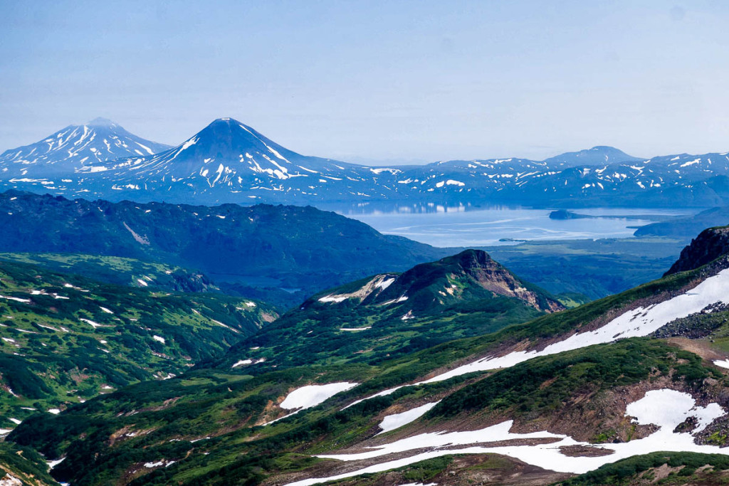
Kurils islands, Tyatya volcano

Read on: your complete guide to Kuril settlements…

Onekotan: None better than.

I’m not sure why, but for some reason volcanos are my fave natural phenomena.

I’ve clambered up scores around the globe, and seen even more from up above in helicopters – more again from the side. The views they all provide are just breathtaking. Santorini, Mount Fuji, Gorely (before the eruption), Mutnovka, Ksudach… I’ll have to tot them all up one day.

All volcanos are unique in their own special way, and each is beautiful in its own special way, so to compare and rank them is no simple task.

However, now I know which volcano tops my list of the best of the best.

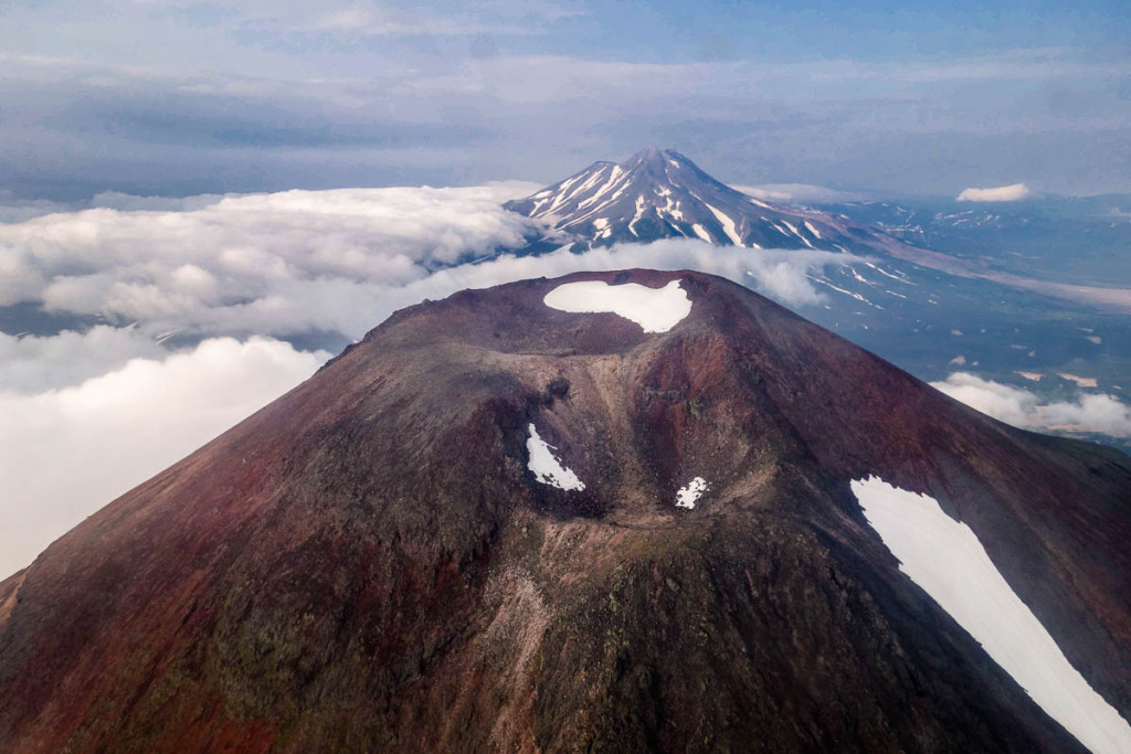
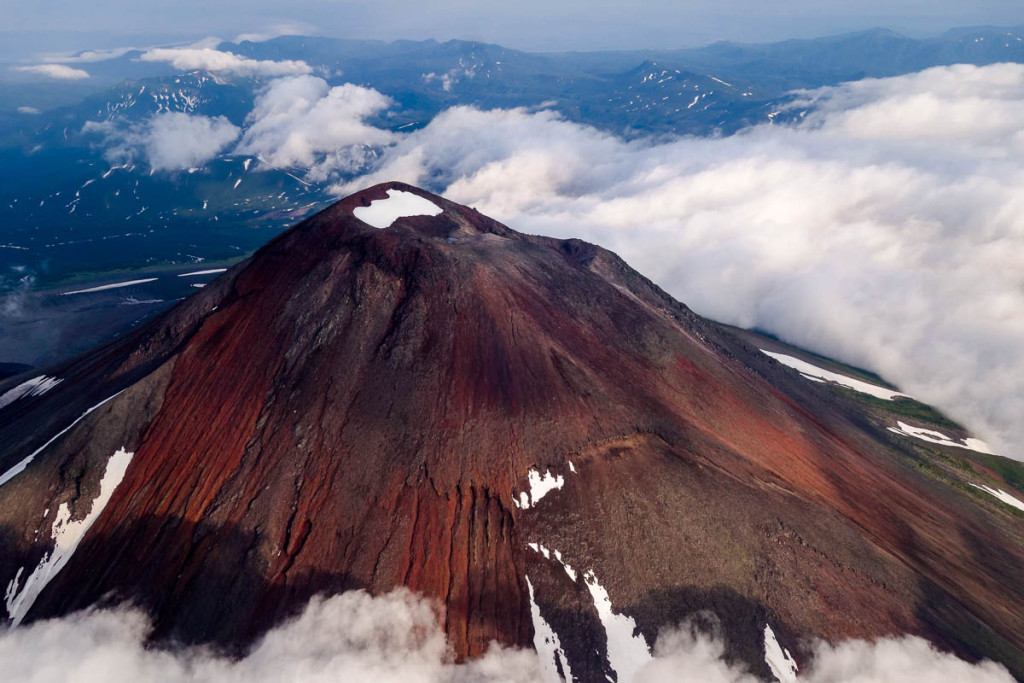
Easy: it’s the Krenitsyn volcano on the Kuril island of Onekotan. It’s also a rather exclusive volcano – just for the more discerning connoisseurs of volcanism; after all – it doesn’t even have its own Wiki page in English :).

The views it has in store are absolutely magical.

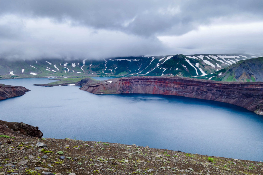
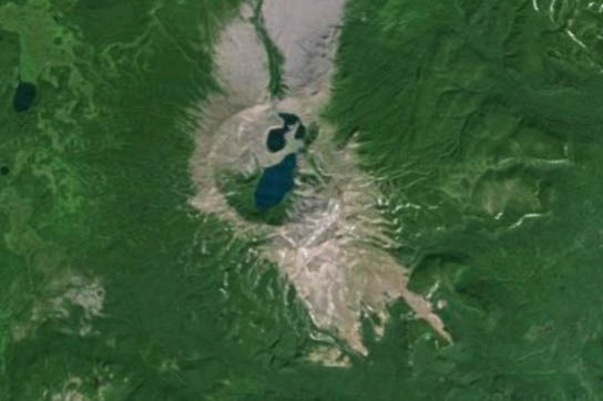
The almost perfectly round caldera is colossal – stretching seven (7) kilometers across. Inside the caldera there’s a correspondingly capacious lake, out of which peeps the cone of a new volcano (height 1324m). The volcano’s surrounded by the sea on all sides; the lake’s at a height of around 400 meters above sea level, and its depth is about 200 meters. That’s the basic run-down of this fantastical phenomenon of nature.

Kuril islands, Krenitsyn volcano

The most beautiful volcano in the world, according to @e_kaspersky – KrenitsynTweet

Read on: The view from up above is also impressive…

Gobsmacked on Kunashir.

Besides cha-cha, on Kunashir island there’s still plenty to check out…

…Ludicrous lava columns on the coast, the fantastic fumaroles of Mendeleyeva volcano, and the magnificent mud baths in Golovnina’s caldera, for example. Bathing in a 30°С muddy lake didn’t quite do it for me, but the volcanism of Mendeleyeva – especially the lava columns there – now that was something else. Quite simply gobsmackingly unforgettable.

Kuril islands

Read on: Basalt columns on Kunashir – breathtaking!…

Shikotan – the Kuril New Zealand.

If you’ve ever been to New Zealand, and then one day you were to wake up on Shikotan island (er, without knowing how you got there, or why were you asleep for so long, etc., etc.), you’d probably think you’ve been teleported to NZ. They’re just so similar!

Non-volcanic gently rolling grassy landscapes, nano-bamboo, picturesque and seemingly carefully positioned trees. All neatly trimmed, colored, and – you’d think – Photoshopped, and sparkling under the inevitable Kuril rain. If sheep and sun were added – it’d be the carbon copy of NZ – somewhere around the center of the North Island.

Kuril Islands - Shikotan

Read on: Only the hobbits’ cubbyholes are missing…