Of course, we’re all different. Some are tall, some average height, some a little shorter; some are brown-haired; some blond(e), while others are already gray. In some places there are more Asian faces, in others African, yet others – European. Some are extroverts (as I choose to be); at the opposite end of the spectrum are introverts, and the rest are somewhere in-between. Some are “XY”, and the other, lovely half is “XX”. So… makes sense that we all have completely different thoughts and feelings about… shopping. Not for the weekly groceries, but for clothes, presents, accessories, and other bits and bats…
For example, if I go into a store, I quickly choose the item I need, try it on in a flash (if it’s clothing), instantly fill the cart (if it’s something else), and in transit airports on the way home I just randomly stuff bags with all kinds of tasty goodies (for both home and the office) -> pay fast and get out of there!
For others, it works differently. They simply go nuts over every sort of item laid out or hung up in stores. All of it has to be examined, compared, tried on, etc., etc. – and that all takes time (plenty of it!).
However, the world can be a surprising place. And here in Seoul, I spent a whole hour (60 minutes!) wandering around a store, goggling at the display windows and everything else – something I literally never do. But let’s start right at the very beginning…
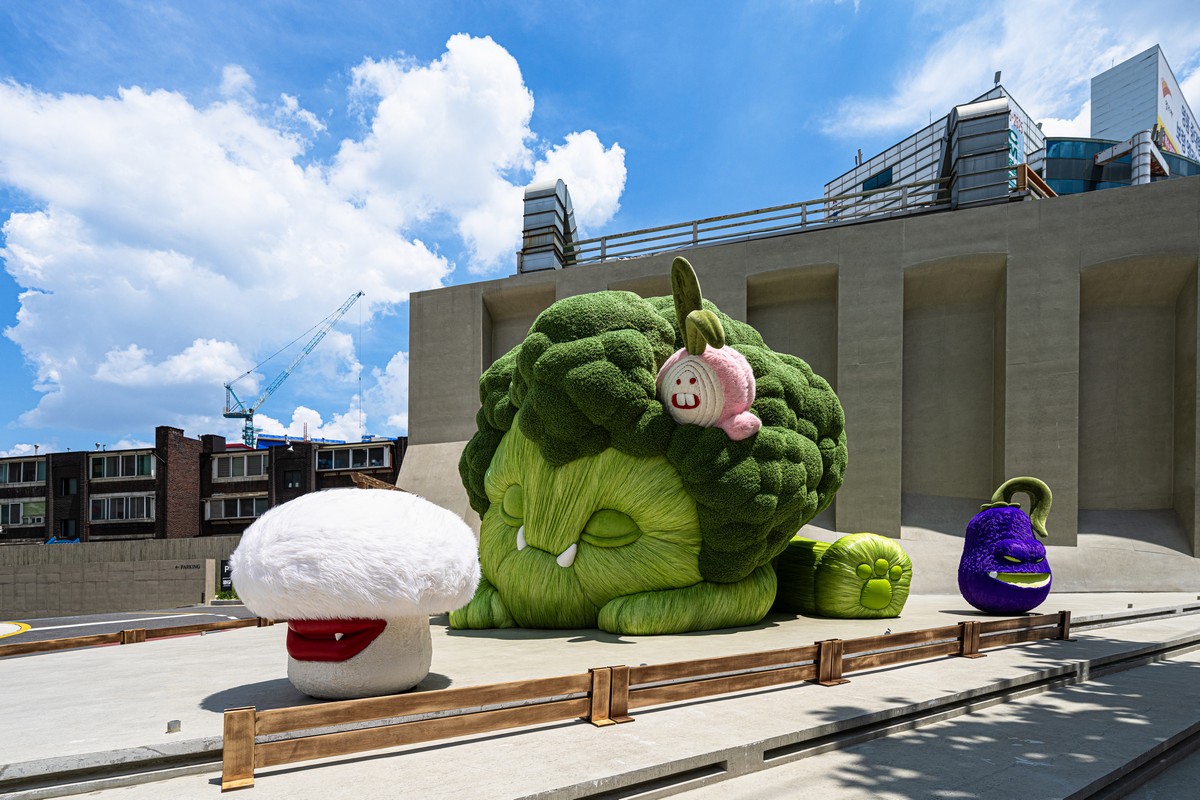
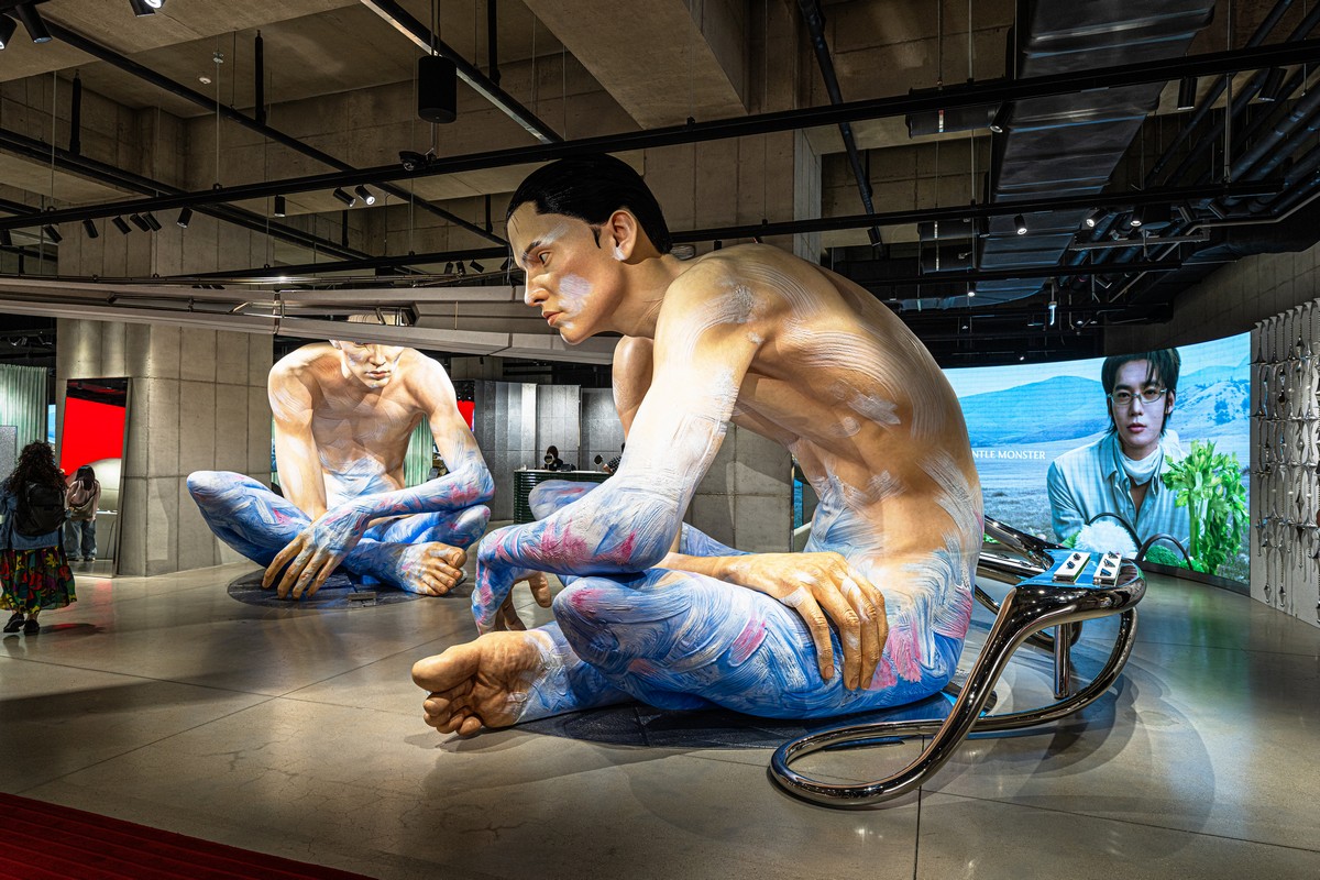
This wasn’t just a “store full of all kinds of very important little odds and ends”. It was, in fact, a full-blown art object – outside and in:
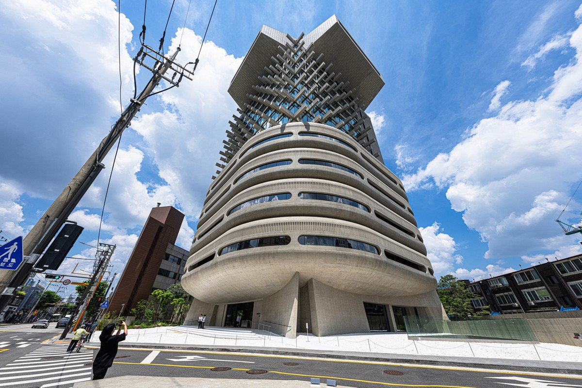
And it’s called Haus Nowhere:

What can I say? It’s a total mind-blower – not just a retail outlet. Practically the whole place was filled with really impressive art objects of completely different calibers and styles:
Read on…