Tag Archives: mym expedition

A trip to the Lena Pillars; the cold – nearly killed us!

This continuing Yakutsk topic is all very well, but it’d never be complete without… the Lena Pillars! Unique – check. Grandiose – check. Must-see – check! A long (~250km!) line of huge stone ‘fingers’ (~200 meters in height) sticking up out of the ground along the eastern bank of the river Lena ->

The Lena Pillars have been a firm fixture on my Top-100 List of Most Beautiful Must-See Places on the Planet since its inception, it goes withoug saying.

Read on…

A 17km winter ‘road’ – over the frozen river Lena.

When in Yakutsk, besides the museums and institutes, you need to get to have a drive over the frozen river Lena. The ‘road’ over the river links the city up to the Lena Highway, which in turn winds southward 1100km until it meets the Amur Highway, just above the border with China.

Why it is that the main road is on one side of the river, while Yakutsk is on the other is a bit of a historical mystery curiosity. A quick scan of the internet tells me that the city was founded in 1632, and the Cossacks’ first ostrog was built on the ‘correct’ bank of the river Lena. Then, 10 years later, for some reason it was transferred to the other bank – where it still stands today. It seems likely that the reason was strategic-defensive: back then there were frequent skirmishes with natives, and there’s not much better protection for a settlement than a wide (2km+!) body of water (such as the river Lena). But that still doesn’t quite explain why 300 years later the road was built on the other side. But I digress. Anyway, still today there’s no bridge crosses the Lena at Yakutsk, but in winter there’s the ‘winter road’ you can take over the river. There have been plans for construction of a bridge, but in these conditions – what with the permafrost (and, thus, perma-unstable) ground, the extreme cold, and the significant girth of the Lena – they’ve kept being put off.

But it seems folks have gotten used to it; they’ve had to! There are ferries in summer, in the winter there’s driving over the frozen Lena as I’ve mentioned already (twice!), but around about every spring – when the ice starts breaking up (so no driving thereupon), and also every fall – when it starts to ice over but it’s still not strong enough to support vehicles but too icy for the ferries to cope with, that’s it: no crossings possible at all! Apart from in a helicopter. But that’s hardly an accessible mode of transportation now is it?

The ‘winter road’ over the frozen Lena is really something, especially because it doesn’t take the shortest route across; it lasts a full 17 kilometers (following the route the ferries take in the summer, I think, shown here), and there are two lanes going in each direction on it! Just like a real highway, but it’s on a frozen river! ->

Read on…

Many a diamond, gold nugget, and mammoth tusk – in permafrosted Yakutsk.

Hi folks,

Today, excursions – of a Yakutskian kind!…

We had a day to fill in the city, and fill it we did, with plenty of assorted brief visits to wholly interesting and rather unique places of interest (one place was truly unique – the mammoth museum: so unique it’s probably the only one of its kind in the world).

First up, Yakutskian bling and glamor!…

The Treasury of Yakutia is, as the name suggests, a collection of the precious – precious stones, precious minerals, precious metals, and precious… mammoth tusks, all of which have been found and dug up on the territory of the republic. The exposition isn’t too big – just three or four rooms – but you can spend a good hour there, maybe more.

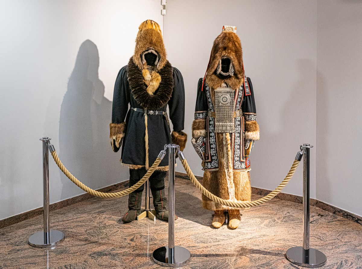
As you walk in, you’re met with striking examples of what the proper dress is for the sub-minus-50-degrees temperatures here:

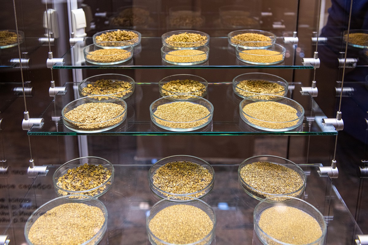
Gold – in the various forms it is found in in the wild (which, it turns out, are numerous) :

Read on…

Enter your email address to subscribe to this blog
(Required)

The city that’s completely white – morning, day and night.

The last stretch of the Kolyma Highway – from Khandyga to Yakutsk – on day seven of our Magadan-to-Moscow road trip was as beautiful as most other days – at least, most of it was: as we were approaching Yakutsk itself (at night) a suspiciously thick fog (suspicious because it looked more like smoke!) descended and brought visibility down to a few meters. And if you get caught behind an old diesel bus… visibility – almost zero!

And talking of diesel… Turns out it could be the reason for the pea-souper. Some of my fellow travelers told me how it could be unspent diesel oil: below minus-fifty, in old and fairly worn-out vehicle engines, diesel has trouble doing what it’s meant to – ignite fully. The result: see the below pics.

The whole city has a thick, icy (natural) fog complemented by a thick diesel fog. And you can’t see the end of the car hood for it! Amazingly, as mentioned, modern digital cameras do a much better job of seeing through such haze than does the naked human eye:

Read on…

No child, woman or man – in the abandoned mining town of Kadykchan.

En route from sunny Magadan to Yakutsk, about an hour-and-a-half after Susuman (as I mentioned in yesterday’s post) we passed the ghost town of Kadykchan.

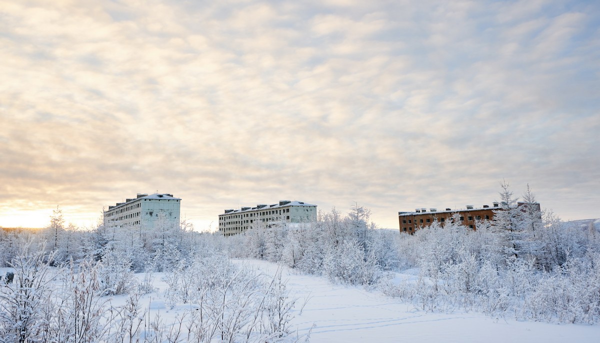
Kadykchan was once a monotown, with its mono single industry being coalmining. Founded during WWII, its population grew to over 5000 at its peak (in the mid-80s). It was already in decline after the fall of the Soviet Union (in 1991), but an explosion in 1996 sealed its fate once and for all: the coalmine was shut down and the inhabitants started leaving – helped by government subsidies to relocate. Extraordinarily, 10 years after the mine had closed (in 2007) there were still 200 folks living there!

But three years later – in 2010 – the population had fallen to zero (imagine the story (and emotions) of the very last inhabitant – walking out through the front door to his/her apartment for good and not needing to lock or even close it!). Today the place still ‘exists’, in that there are buildings and roads left and you can still look the place up on the map, but it’s an afterlife really – completely abandoned and deserted; there’s also now no electricity, no running water, no heating, no schools, no shops, no cinema (as there once was).

Read on…

Kolyma dreaming.

Though we weren’t to quick getting from one end of the Kolyma Highway (in Magadan) to the other (in Yakutsk) – a mere seven days! – we didn’t see all that much. Still, what we did see, I haven’t told you about or shown you yet. That changes here…

Eighty kilometers from Magadan there’s a village with the unusual name of Palatka, which means ‘tent’ in English. You might think the name comes from the early days of the settlement – in the early 1930s – when it was indeed merely a collection of tents put up before buildings were built during the construction of the highway. However, it seems that’s just a coincidence: the name actually appears to date back a lot earlier than the 20th century – from two ancient Evenk words, palja and atken, meaning ‘stony river’!

Read on…

Wham, bam, thank-you Magadan.

Magadan. Maybe you’ve heard of it; maybe not. If you have, but haven’t been, how do you imagine it?

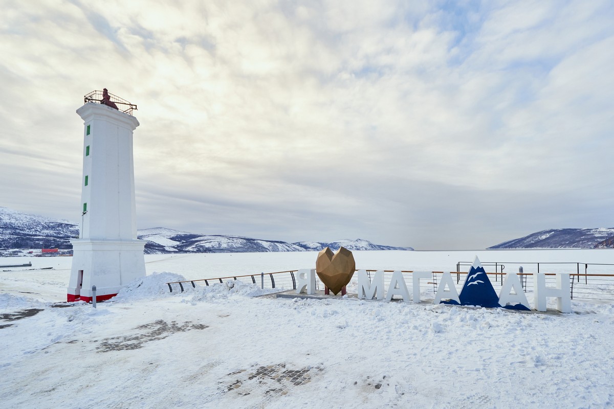
I think words like ‘remote’, ‘a long way away’, ‘cold’, ‘I know the name, but I’m still not sure quite where it is!’ might be chosen. My descriptive words were ‘middle of nowhere’, ‘freezing cold’ and ‘over there in the corner of a world map almost as far as Alaska’. But that was before I’d been. Now I’ve visited the city, here’s how things really are…

First, of course, you need to get there. From Moscow it’s seven hours on a plane – eight time zones away! Yes, Russia is enormous; but you knew that ).

Read on…

Eats, fuel, and places to stay – on the Kolyma Highway.

Before the next report on the next stretch of long, frozen road… a digression, albeit one central to the whole Magadan-to-Moscow-road-trip experience, or, to be more precise – to the first segment thereof – on the Kolyma Highway. And that digression is about the daily routine and practicalities of life-on-the-road and the mundanities it comprises: eating, sleeping, refueling, etc…

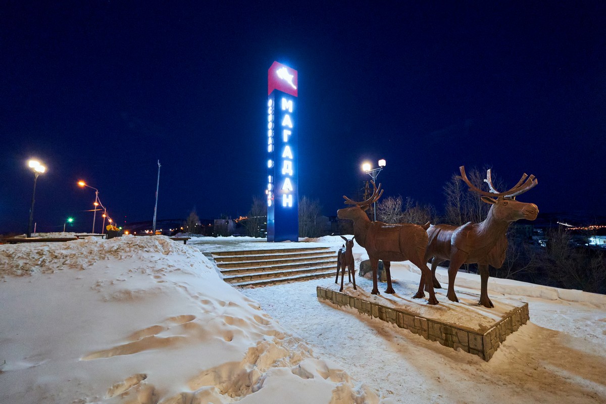
We start from the reindeer at the city limits of Magadan and will get to… well, let’s just see how far we get before the quantity of photos becomes excessive for a single post…

The Kolyma Highway is 2032 kilometers long, and ends (for us – started) in Magadan. In the city locals call it the ‘longest street in the world’, since it starts out as the city’s central street, Lenin Prospect, which ends (starts) at a roundabout with a TV tower in the middle of it.

Read on…

A visit to the icy household – of the Yakut Custodian of Cold.

On the way back to the Kolyma Highway after our overnight stay in Oymyakon, the next port of call on our Magadan-to-Moscow road trip was the village of Tomtor. Being just 40km from Oymyakon it was no warmer; however, at least the place we stayed at was more comfortable, plus there was… a banya (Russian sauna)!

Though tiny (1250 inhabitants at the last official count, but that was back in 2002) and as remote as it gets, the village is home to an airport, built for the Alaska-Siberian air road receiving Lend-Lease aircraft from the U.S. during World War II. Alas, it was abandoned long ago; also alas – we didn’t visit it (no time left).

What we did visit was the ‘Ice Residence of Chyskhaan – the Yakut Custodian of Cold’, a museum in an old mine shaft inside a mountain! However, we soon found out that inside the tunnel it was just -10°C – a full 40 degrees warmer than outside it!

Read on…

The one and only Oymyakon: the situation on the (frozen) ground.

Picking up again where we last left off – we finally made it to the a legendary Pole of Cold of the northern hemisphere – Oymyakon. I’d heard about it many times down the years as the world’s coldest settlement, and now – finally – I was to get myself there. Hurray! And now, after having been there, since I liked it so much – I want to go back already!…

Oymyakon. So, what gives. Remote? Check. Tiny? Check. Forgotten in the sands snows of time, run-down, and down-at-the-heel? No! The place is very much ‘alive’, with around 400–500 folks living there; the log cabins they live in are really rather decent; there’s centralized heating (as in – piped water arrives at each cabin already piping hot; not as in heated individually per cottage); there’s a stable supply of electricity; there’s satellite TV and there’s internet! Oh yes – and it’s very cold. The coldest ever officially recorded temperature was a little under -65°C. Incidentally – the hottest it’s ever been was almost +35°C! Woah: that’s a temperature range of more than 100 degrees centigrade!

I wrote above that Oymyakon is a Pole of Cold, not the Pole of Cold. I had to write that as there’s another contender for the coldest settlement in the northern hemisphere – the town of Verkhoyansk, which isn’t all that far away, relatively (what’s a thousand kilometers between rivals?:). Sure, we’d have liked to have checked out this challenger, but it is 800 kilometers from the highway, whereas Oymyakon is a mere 190 and the backroad to it is a real good one.

// Btw: about those 190 kilometers: I started to doubt their accuracy. From Tomtor to Oymyakon it’s 40km for sure, I remember that. But from the highway to Tomtor I’m certain our odometers read just 120; however, Yandex Maps gives 150km (meanwhile, Google Maps tells you not to take the (excellent) road we took, instead sending you in a huge circle round the other way – a journey of almost 800km!). So, what, the road was so hypnotic that the distance in kilometers was magically transformed into miles?!

Anyway, once in Oymyakon, it was time to start snapping. So my long-time, almost constant travel companions DZ and Petrovich and I did just that – started snapping. And the results aren’t bad at all ->

Oymyakon at night – our first pics upon arrival:

Read on…