February 14, 2019
A qilometer inside Quilotoa.
As I’m sure you’ll know, Ecuador has plenty of volcanism. Right down the middle of the country from top to bottom there’s a section of the mountain range that goes be the name of the Andes, along which are not less than ~three dozen volcanoes, many of which are situated in the ‘Alley of the Volcanoes’ – a valley with mountain ridges and volcanic cones on each side.
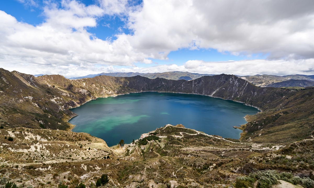
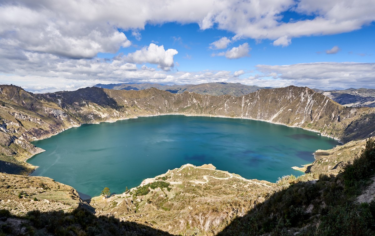
Not only is the quantity of volcanoes very impressive; the quality is too: attractive though unusual; monumental and hypnotic, with lush (and perfectly round) lakes in considerable craters, sheer cliffs, and assorted other OMG panoramic views. The first one we inspected like that was Quilotoa:
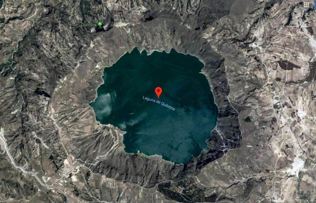
This is how it looks from a satellite:
The rim of the caldera is nearly 4000 meters above sea level (the internet states 3915m; local sources state 3930). To get down to the lake, which is around one kilometer below the rim on the vertical axis, you walk down a dusty path, which takes around 40 minutes accounting for multiple stops for snaps (which are many). So, down we walked:


To be honest, the walk isn’t the most pleasant. The steps can be high, while in other places there are no steps at all. Horses are always snorting, same horses ‘fertilize’ the path frequently, the wind gets the dust up, plus the path is at an altitude of around 4000 meters, so altitude sickness can be a problem if you’re not careful (we’d flown straight here from the low plains so had to slow the tempo right down). That said, the surrounding vistas almost made up for the lack of comfort. See for yourself:


We finally made it down to the lake, and found you can hire canoes!


In places there’s lots of green sludgy stuff, but not everywhere:


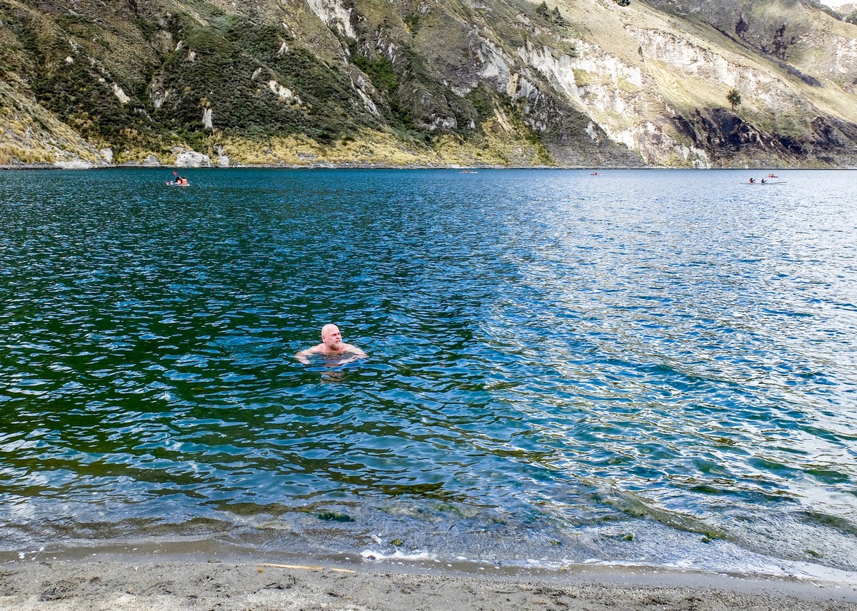
And when I see a large body of water, you know already what I’m wont to do…
(pic: olly_ru)
… I get in it! And as I did I realized this was a kinda post-scriptum closing of the 2018 swimming/bathing season!
Both the locals and other visiting tourists seemed a little surprised we were swimming around in the lake instead of kayaking atop it. But after a while, some of the other – younger – tourists decided ‘if you can’t beat them – join them’, and in they splashed too, shrieking as they did.
You could be forgiven for thinking the water in the lake would be naturally hot spring water; however, this was not the case. Instead the water was rather cold, but it was just what was needed after the long, sticky, dusty descent. It also turned out that this was hardly fresh potable mountain water as pure as the driven snow: I accidentally licked my lips at one point and understood immediately that quite possibly every single element of the periodic table was present therein. Best not drunk. Imagine if a chemical reaction took place after drinking some? )
Btw, I set myself a new record swimming here – the highest natural-lake spot of bathing for me ever! Previous records were: (i) at an altitude of around 3200 meters on Mount Aragats in Armenia in Lake Kari in 2016; and (ii) at 3300m in a lake in a glacier on Tian Shan in Kyrgyzstan in 2017. Here our bathing took place at 3500–3600m above sea level.


We came, we swam, we photographed, we chilled, we fed the many dogs roaming about here. It was time to clamber back up the side of the caldera…
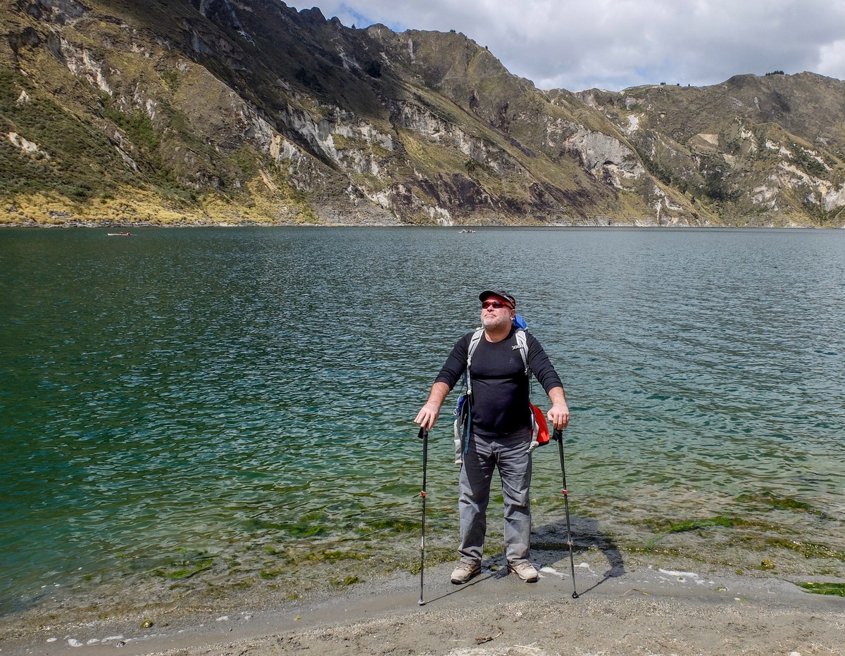
Now, normally a short walk up a hill wouldn’t pose a problem; however, at ~4000 meters above sea level? Problematic; at least for folks still acclimatizing, as we were. So some of our group paid the $10 (no local currency here; just greenbacks please!) to dig a pony back up to the top. Wise move!


I have to say I felt sorry for the poor ponies. All that walking uphill can’t have been easy, poor things. And, given my not inconsiderable weight… – no, I just couldn’t. I took it slowly (so as to avoid altitude sickness) on foot instead. Tough – yes, but a good aerobic exercise workout at the same time, so no complaints.
Then the sun came out to light up the chemical composition of the lake below. Impressive!
You can walk right round the lake along a signposted path, which will take you between five and seven hours depending on your tempo.
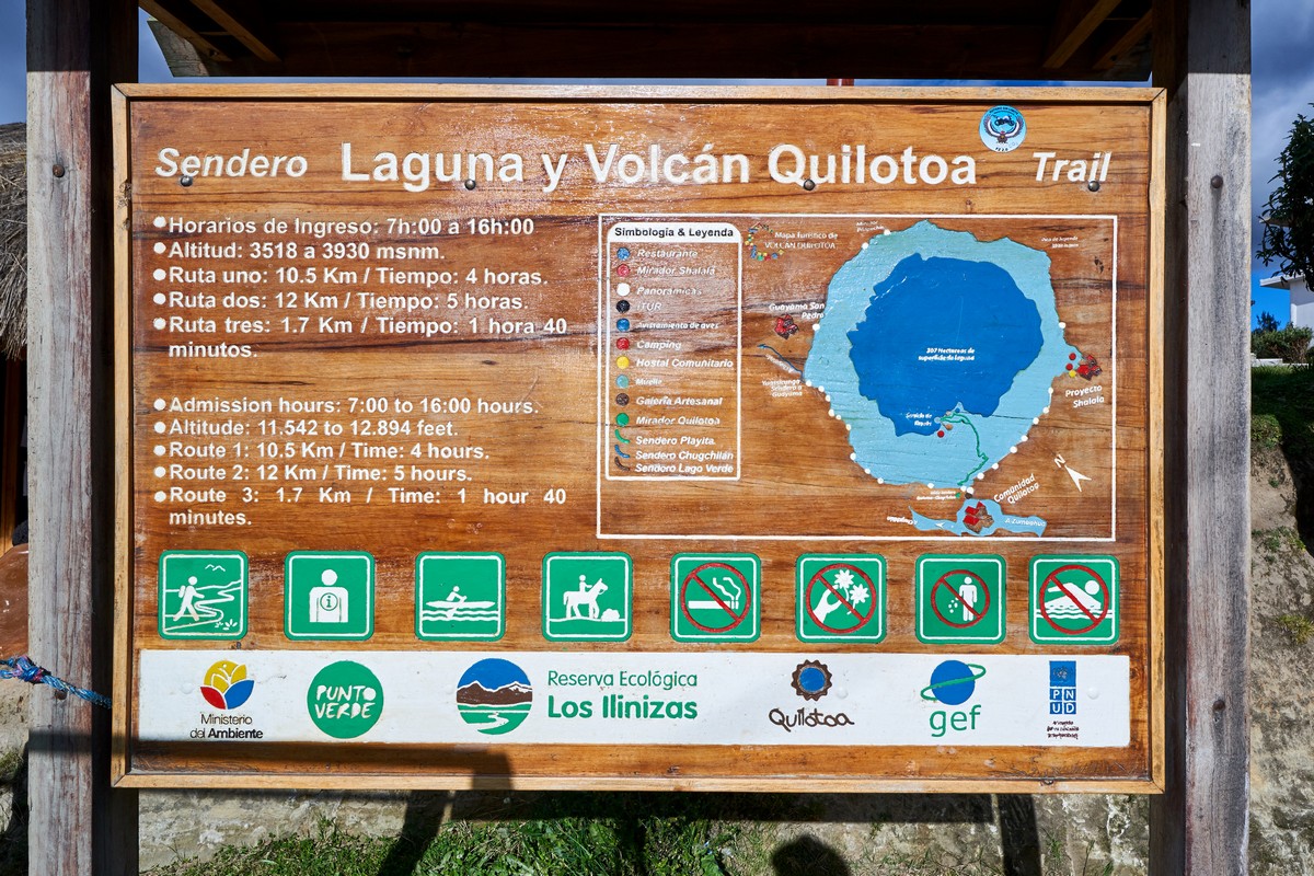
But wait. What’s that inexplicable symbol in the bottom right corner on that sign? Well, bit late telling us now isn’t it?! )
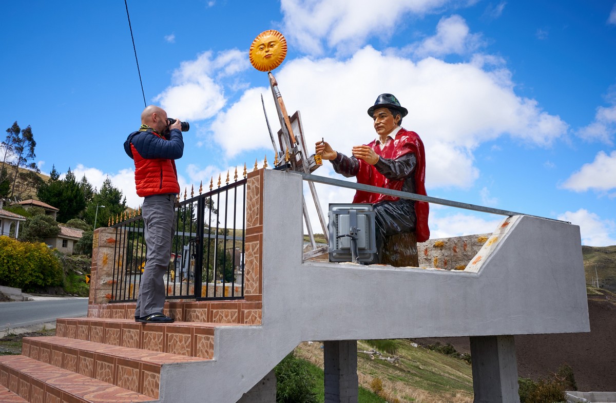
Btw, there’s nothing much else worthy of note around these parts. Probably the most remarkable thing we saw between the Quito and Quilotoa was this here… whatever it is:
It takes two to three hours to get to the volcano from the capital. So it’s probably best to get here, spend the night, and then have an early start the next morning to be able to take your time; maybe even two nights – the second one after doing the round-the-lake path perhaps…
All righty. That’s all for today folks. Back with more equatorial Ecuadorial tomorrow.
All the photos from Ecuador are here.

