June 15, 2017
The local volcano with global implications.
Boys and girls! Can you guess what my biggest concern is now after my return from New Zealand?
It’s that I’ve already done 8 posts and I haven’t even got to the halfway point of my trip! Given the catastrophic time constraints I’ve been under of late, there’s not even the slightest glimmer of a light at the end of the tunnel. Quite unexpectedly, though, I have half an hour of free time, so I can post some nice photos and a few more tales.
It’s been quite a few days since my NZ stories started, plenty of time for everyone to do some work, right? Come, come now children, be honest! :) If you’ve been leading an idle life, then… well, you know, karma and all that. Sorry, that’s getting a bit negative. Can’t be done with negativity. Let’s switch to complete and utter stunning visual positivity:
This was the most positive picture of all. After that things got a bit more scary.


Along the rim of the Pacific Ocean there is the so-called Ring of Fire where tectonic plates collide or, on the contrary, shift away from each other. This is why the Kamchatka volcanoes exist, this is why there are constantly earthquakes in Japan, California and Chile. Mount Fuji is located at a point where three plates converge. New Zealand is also a member of this club: it’s located right along the boundary of the Australian and the Pacific plates. Hence the regular earthquakes and all the volcanic landscapes. Plate tectonics is a very interesting subject, ideal for self-study.


On New Zealand’s North Island, this tectonism resulted in the Taupo Volcanic Zone, which is where Rotorua is, and which is where my fellow traveler A.B. and I took so many photos and wrote so many posts about geysers, hot springs and foul-smelling sulfur pits :)


Now it’s time to tell you about another truly remarkable place – the Waimangu Valley and Tarawera volcano. It’s highly recommended to go to the top of the volcano, especially as you can take a jeep nearly all the way to the top:


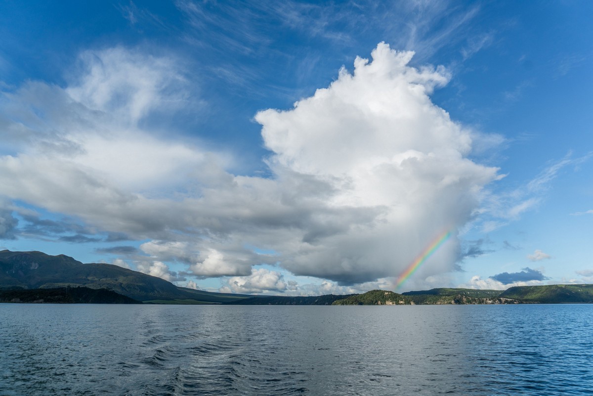
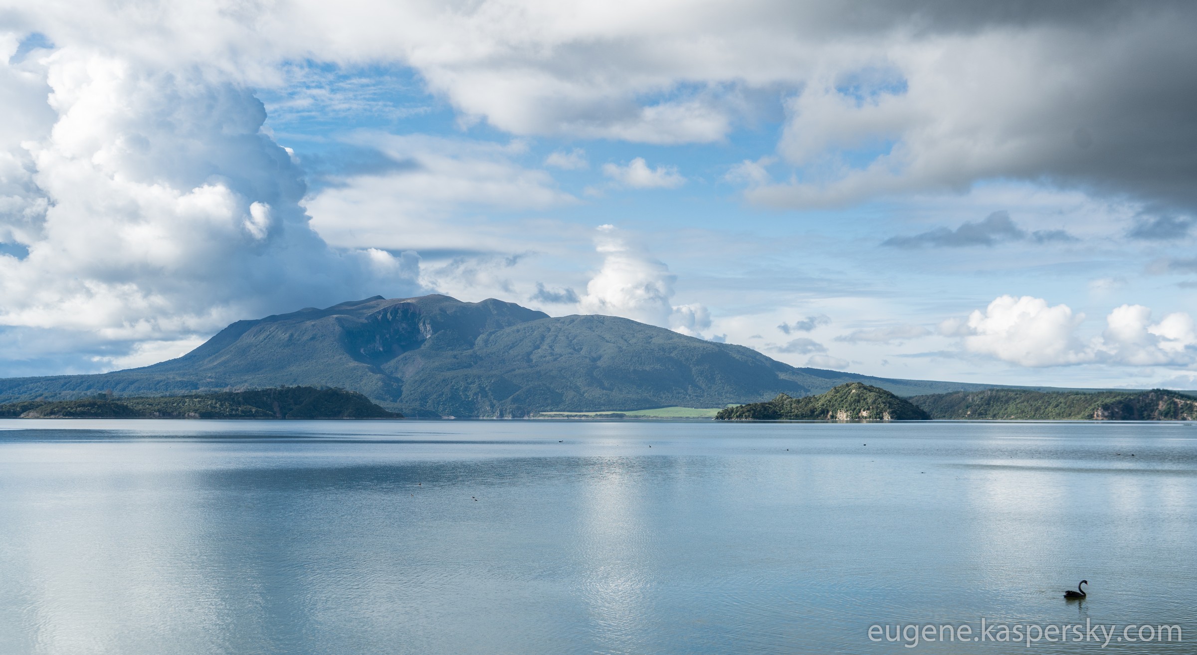
The valley is beautiful, especially the lake. And then, completely out of the blue … black Australian swans – lots of them!


Here’s a trick question. How many swans can you find in this photo?
Tip: the photo is clickable.
This lake reminded me once again of the pond at the Novolipetsk steel plant. Also, while I’m at it, let me mention The Black Swan by Nassim Taleb – this is an absolute must-read.
Now, let me get down to the main business.
This remarkable place is widely known for the 1886 eruption – back then, it exploded big time, destroyed several villages in the vicinity, dried out a local lake and left behind a long trench and a chain of craters. Wikipedia says this volcanic fault is 17 km long. In these images I see 15 km, which is by no means small. The width of this volcanic feature is probably ~500m at the widest spot. A close look reveals more than 20 craters at the top of the volcano, in the valley and around the lakeside. Plus goodness knows how many at the bottom of the lake.
Needless to say, the eruption 130 years ago was not the only one. There are publications on the Internet about a catastrophic 1315 eruption that apparently led to a short-term cooling down of the global climate and brought about the Great Famine of 1315-17. So, this ‘provincial’ NZ volcano has global implications…
However, there are no visible traces of the disaster that occurred 700 years ago. All the small hills and craters are from the 1886 event.
So, an evening stroll along the Waimangu valley. What could be better after a hard day in the office?
This is a gorgeous place, but a long way to travel from Europe, Russia or the Americas. The scenic landscapes definitely deserve far more visitors than there are. It’s amazingly beautiful, so extraordinary that it sends a shiver down your spine. But very few visitors. China and Japan are (more or less) nearby, but that doesn’t help the situation much.
So, a visitor here has the chance to have a solitary walk down the Waimangu valley, like this:

This is the first crater. The water is warm (or it looks as though it is), but not toxic. There are ducks swimming in it. All the best to them and their numerous breeds – not too many predators around these parts.

It gets warmer here. This is only a few hundred meters from the cold crater lake. This place is much hotter.

In this crater lake, the water is acidic and 55˚С, if I remember correctly. The locals boast that this volcanic area is the largest source of thermal waters globally. Well, I can officially challenge that view – I even did a little research on this theme.
Now, if my legs carry me onwards along the path, then the next stop is a geyser at an elevation of 400 meters. But more on that in my next blogpost.

