April 28, 2025
Altiplano – lagoons, unique rock formations, and flamingo!
Part 0: Introducing Altiplano: first an appetizer-intro
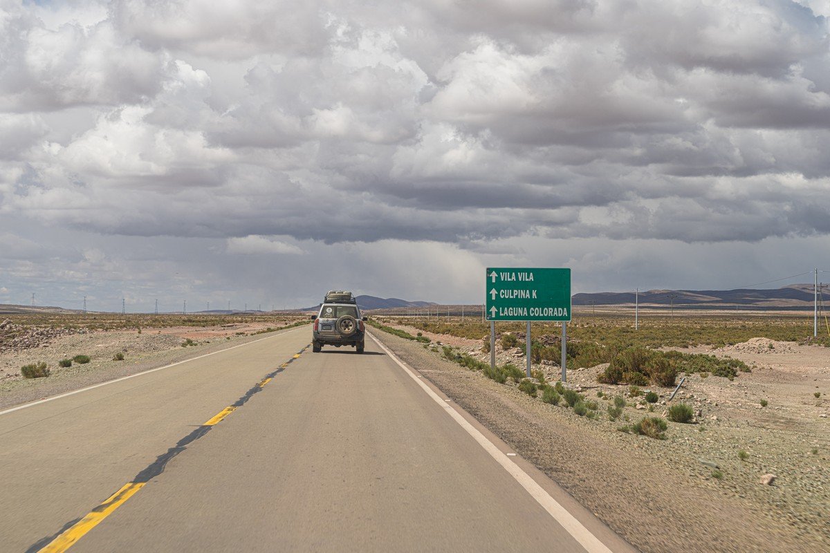
Next up, southwest of the Uyuni Salt Flat – the Altiplano Plateau and the Bolivian section of the high-altitude Atacama Desert. We had only two days to explore these imposing landscapes, and to cram in the maximum amount of uncrammable experiences we had to switch to our now-familiar “tourism till you drop” mode. Even still, that turned out to be way too little time for such a vast territory – especially considering the slow pace on roads that barely qualified as such. To explore everything thoroughly and walk at a leisurely pace, you should really reserve at least three days. For there’s plenty to see: highland plains dotted with multi-colored volcanic cones, salt and freshwater lagoons with pink flamingos, bizarrely-shaped rock formations, hot springs and bubbling geothermal fields. A truly worthy destination! Let’s go!…
Our route went like this (the original’s here) ->
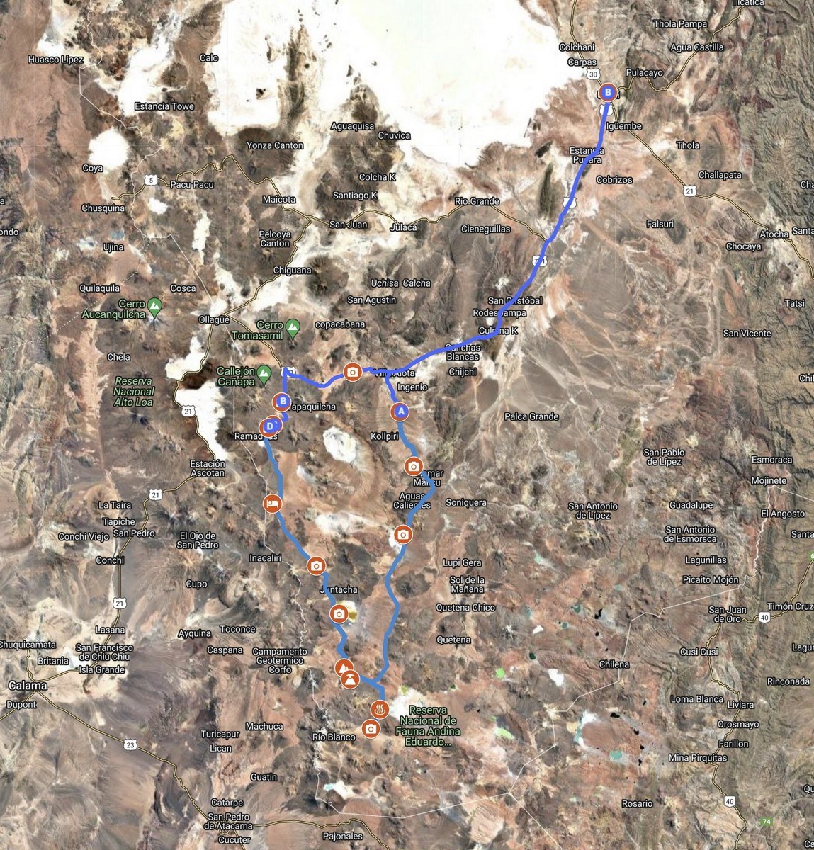
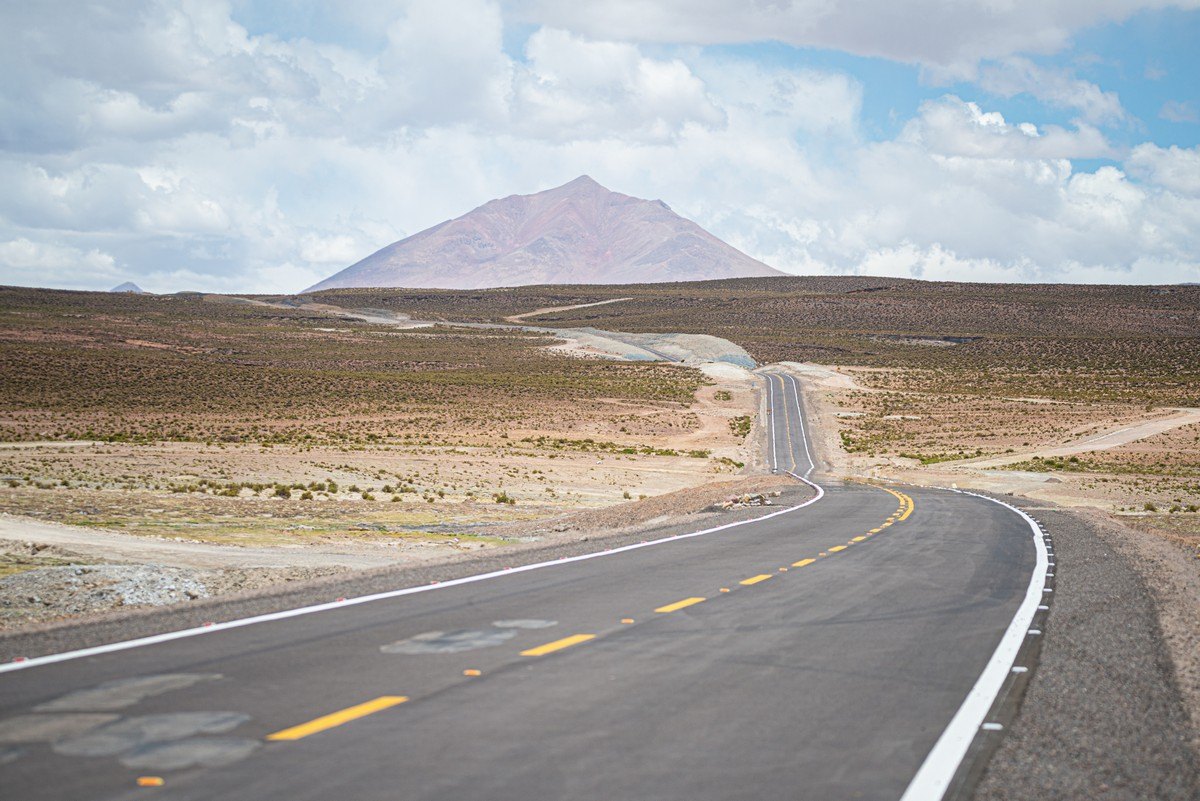
The road was of good quality only at the very beginning (and the very end) of our circular route:
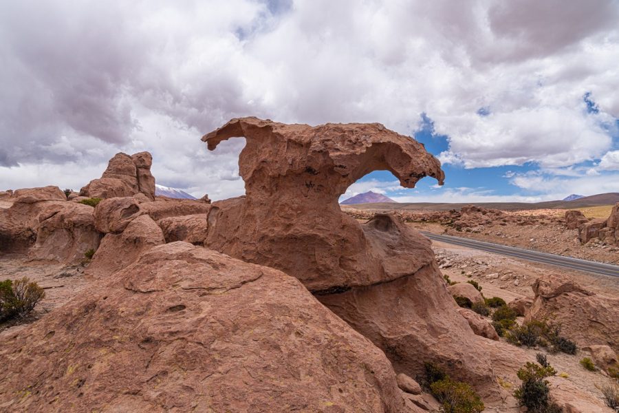
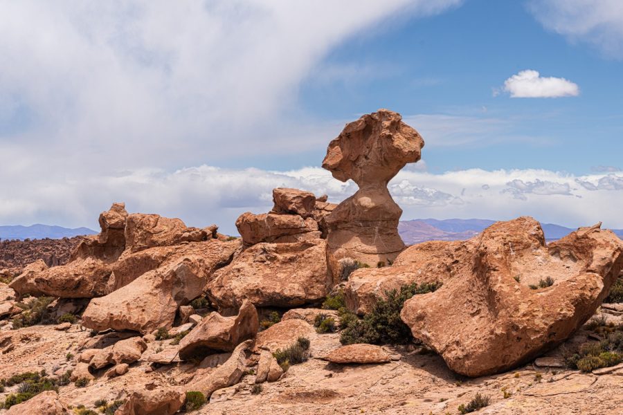
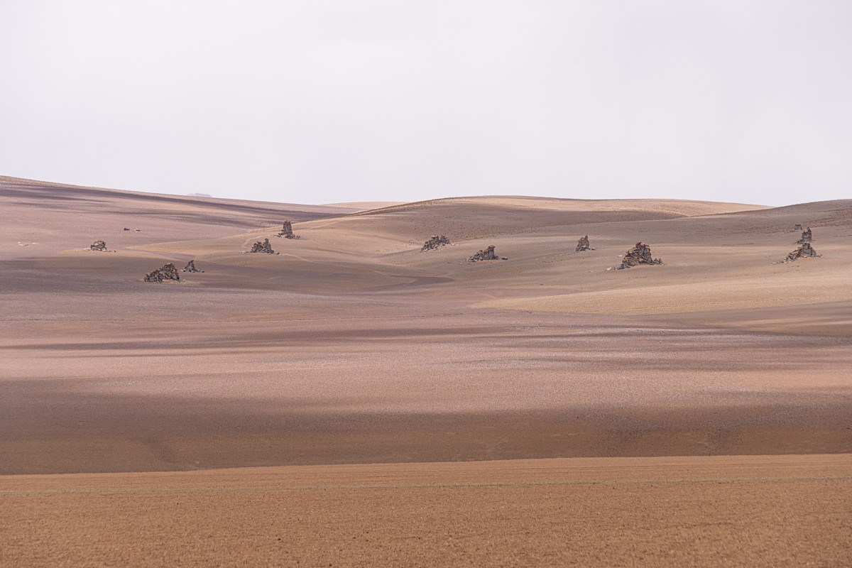
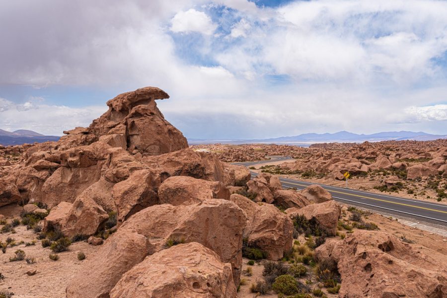
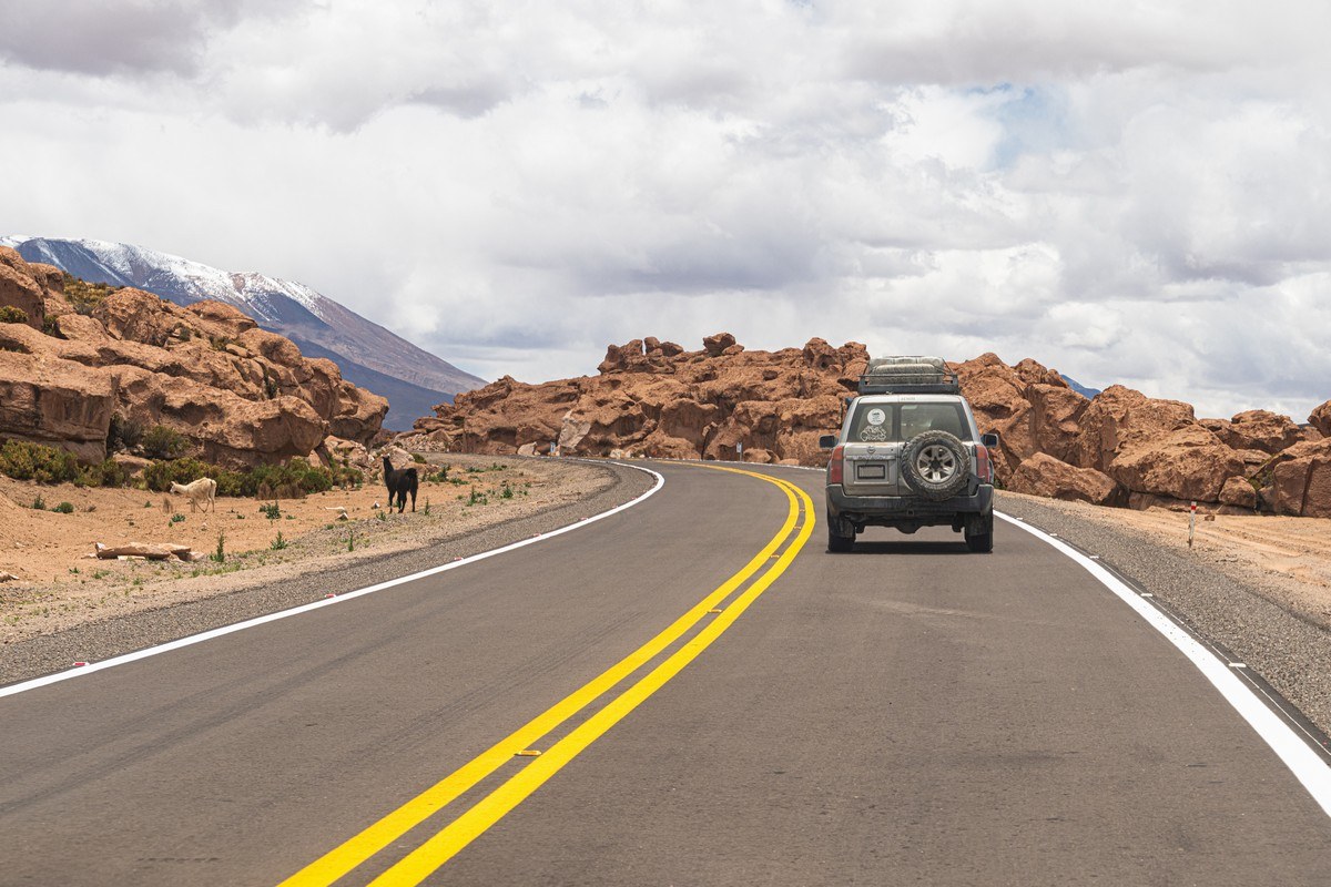
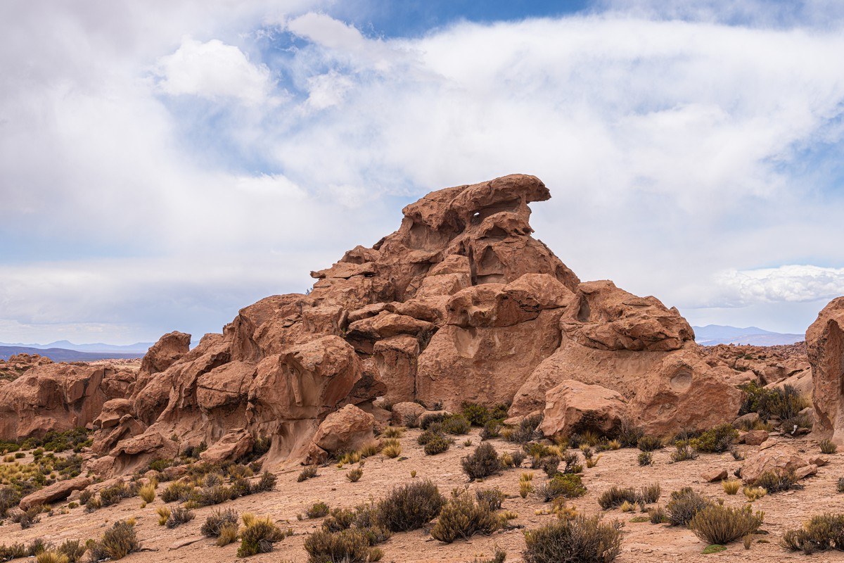
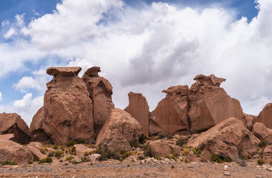
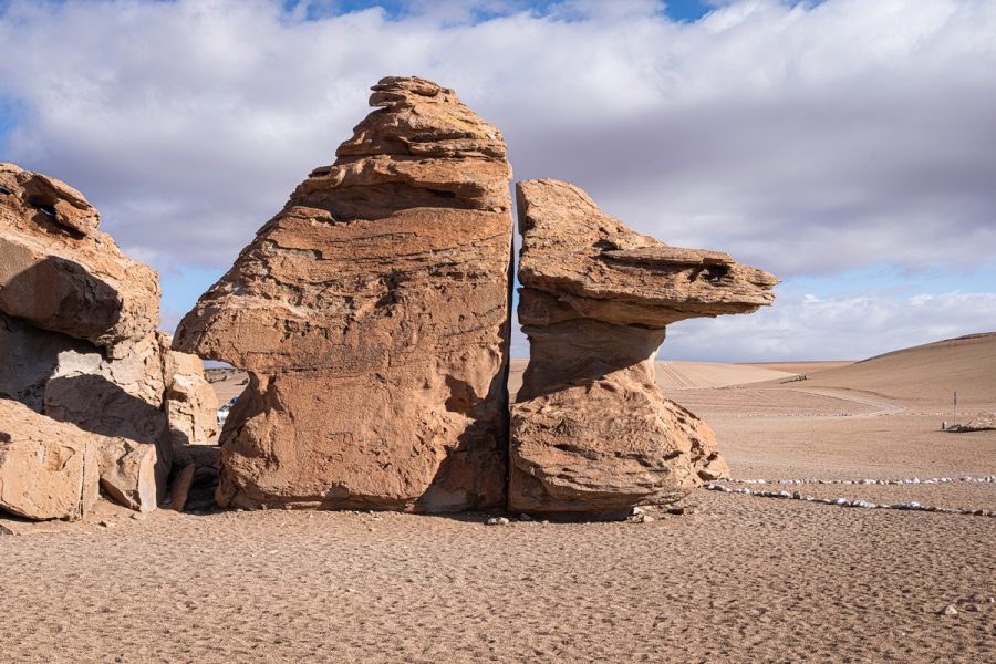
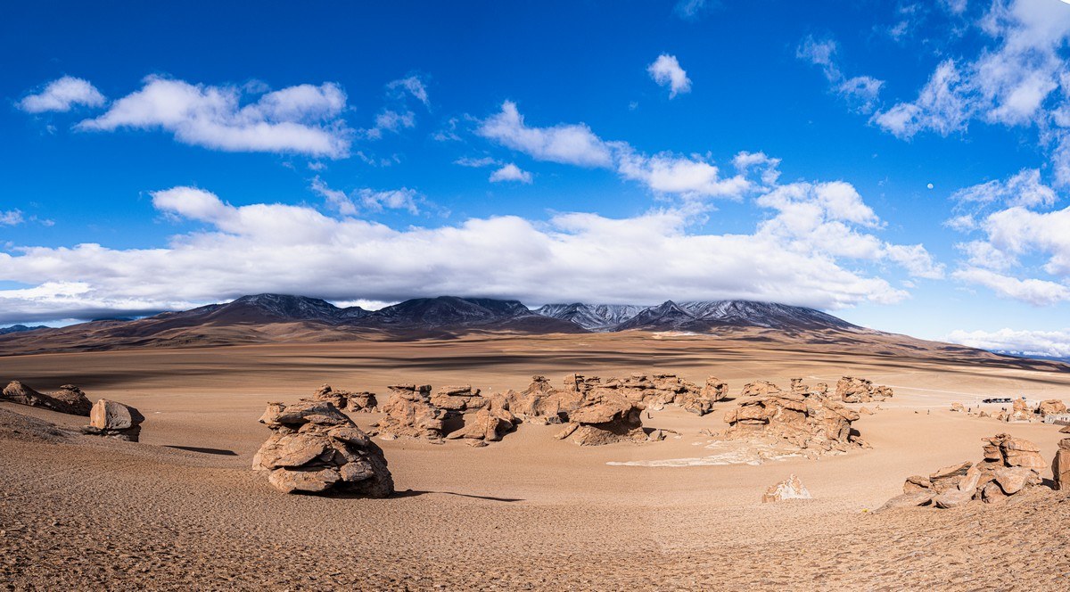
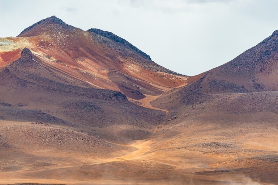
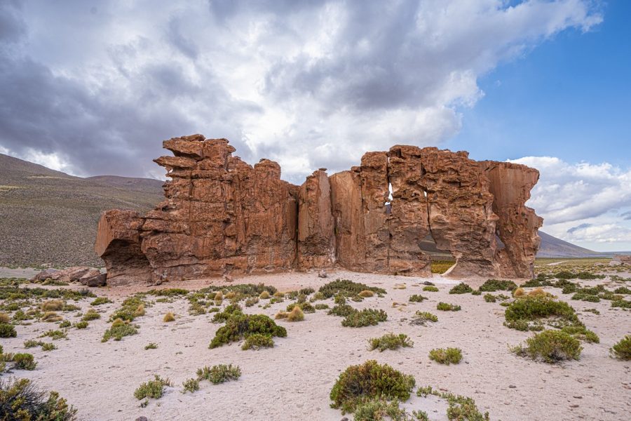
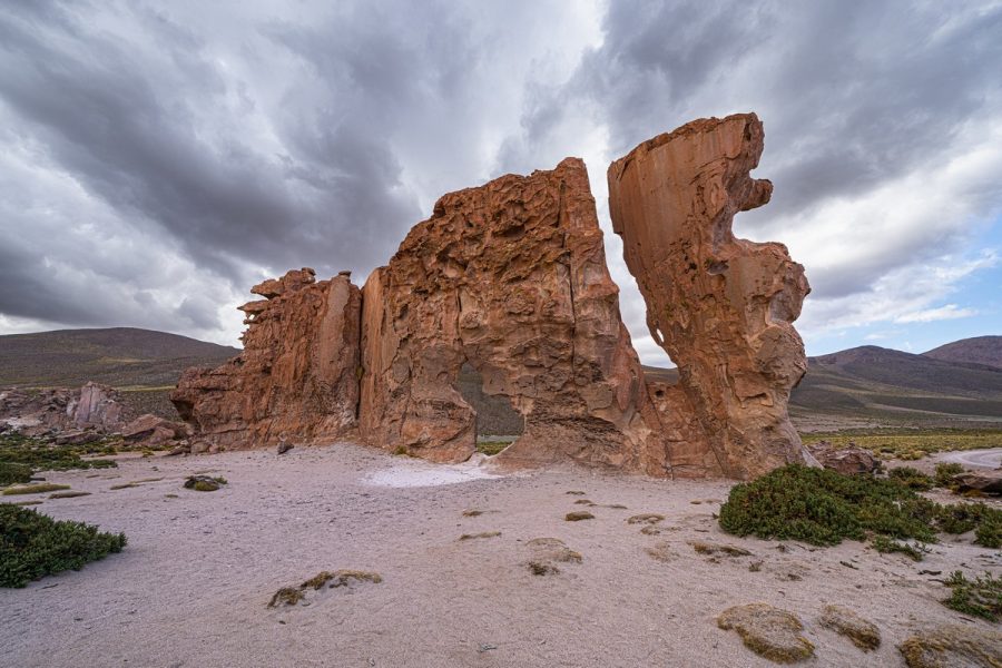
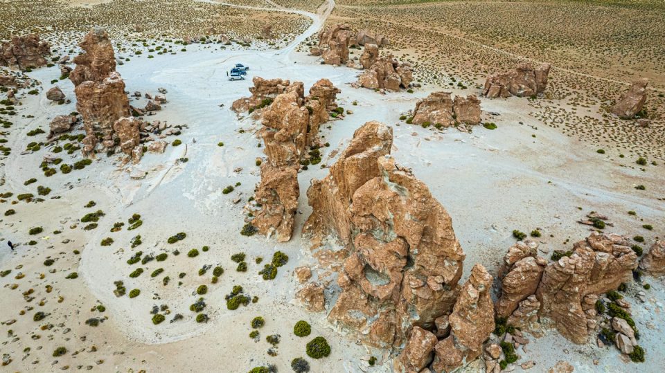
And that’s where the first strange rock formations began – in the parque del desierto de piedra.
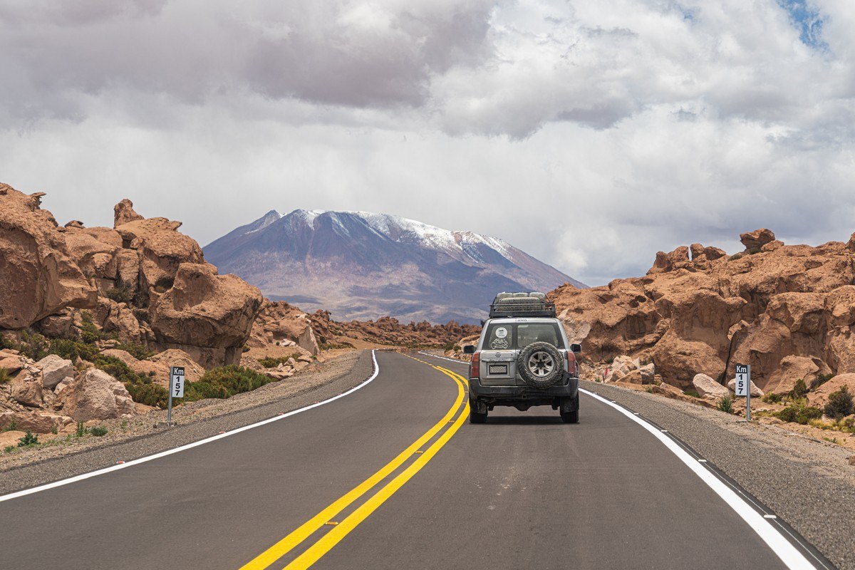
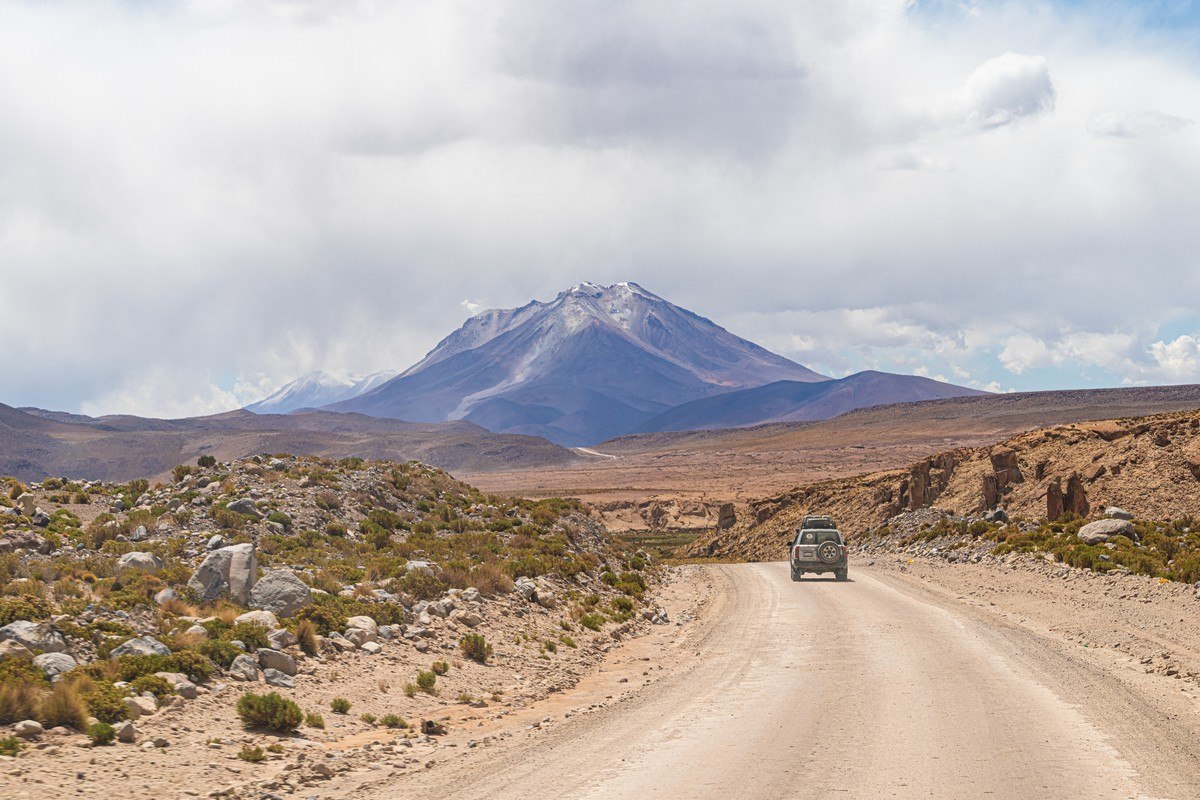
The asphalt ends about 170km from the city. Beyond that, there’s a decent gravel road, but another 50km in, after we turn off, the roads become mere dirt tracks carved by tourist vehicles. // By the way: over there a lone fumarole’s actively smoking away at the summit of that volcano ->
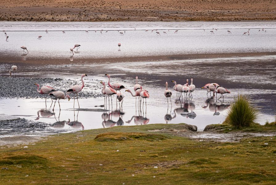
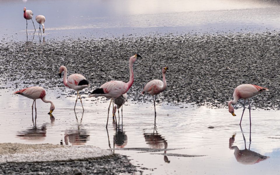
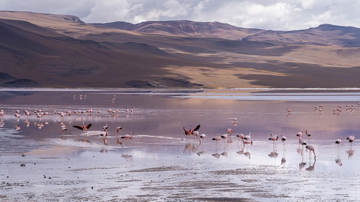
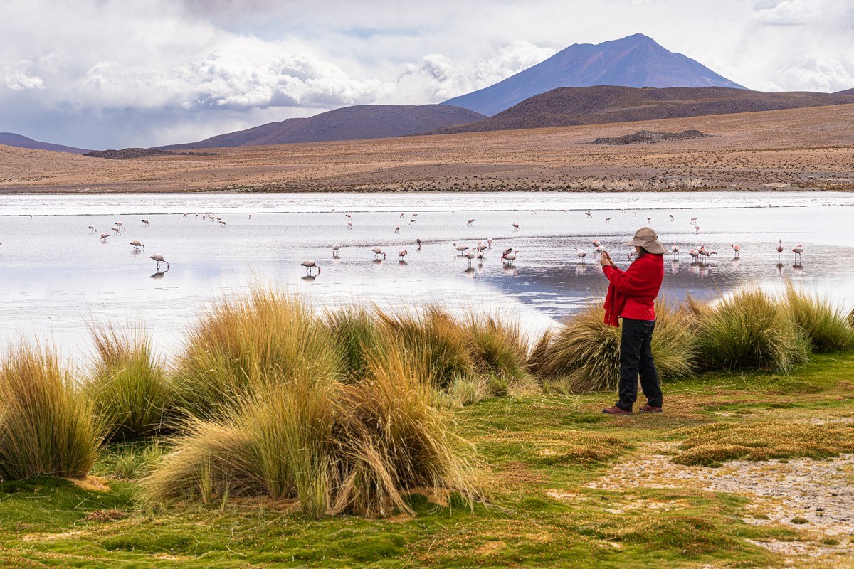
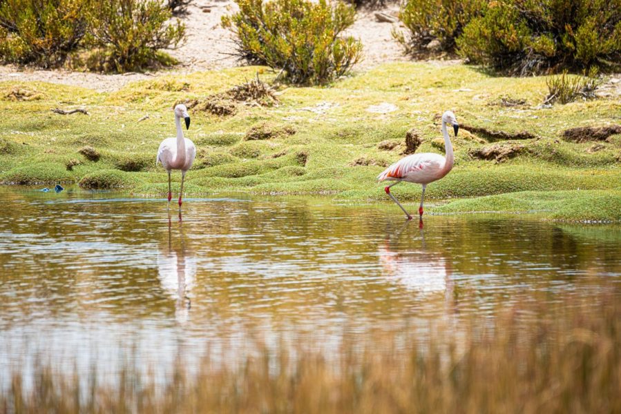
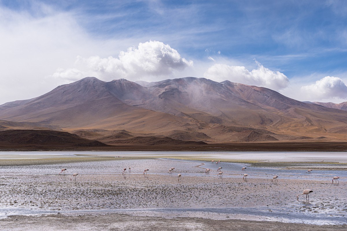
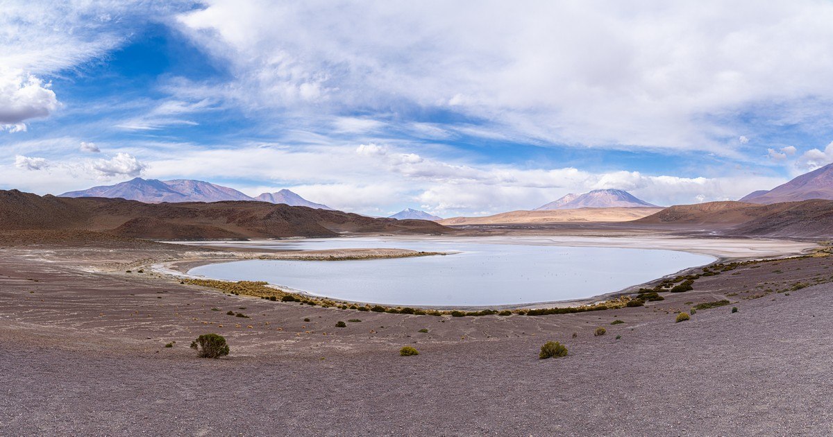
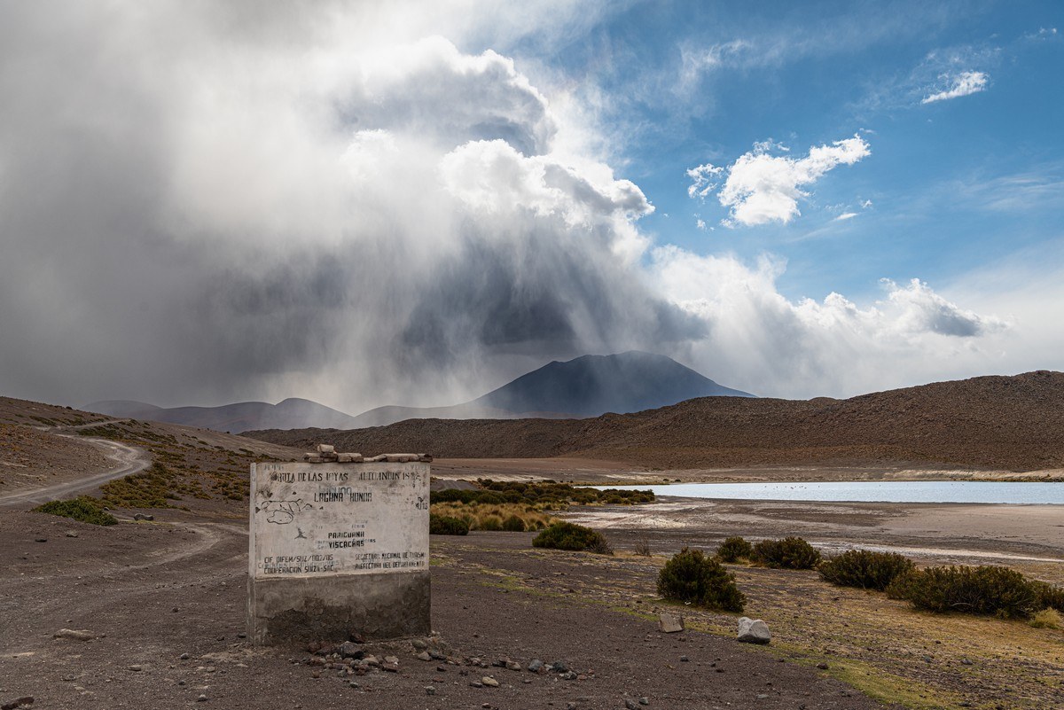
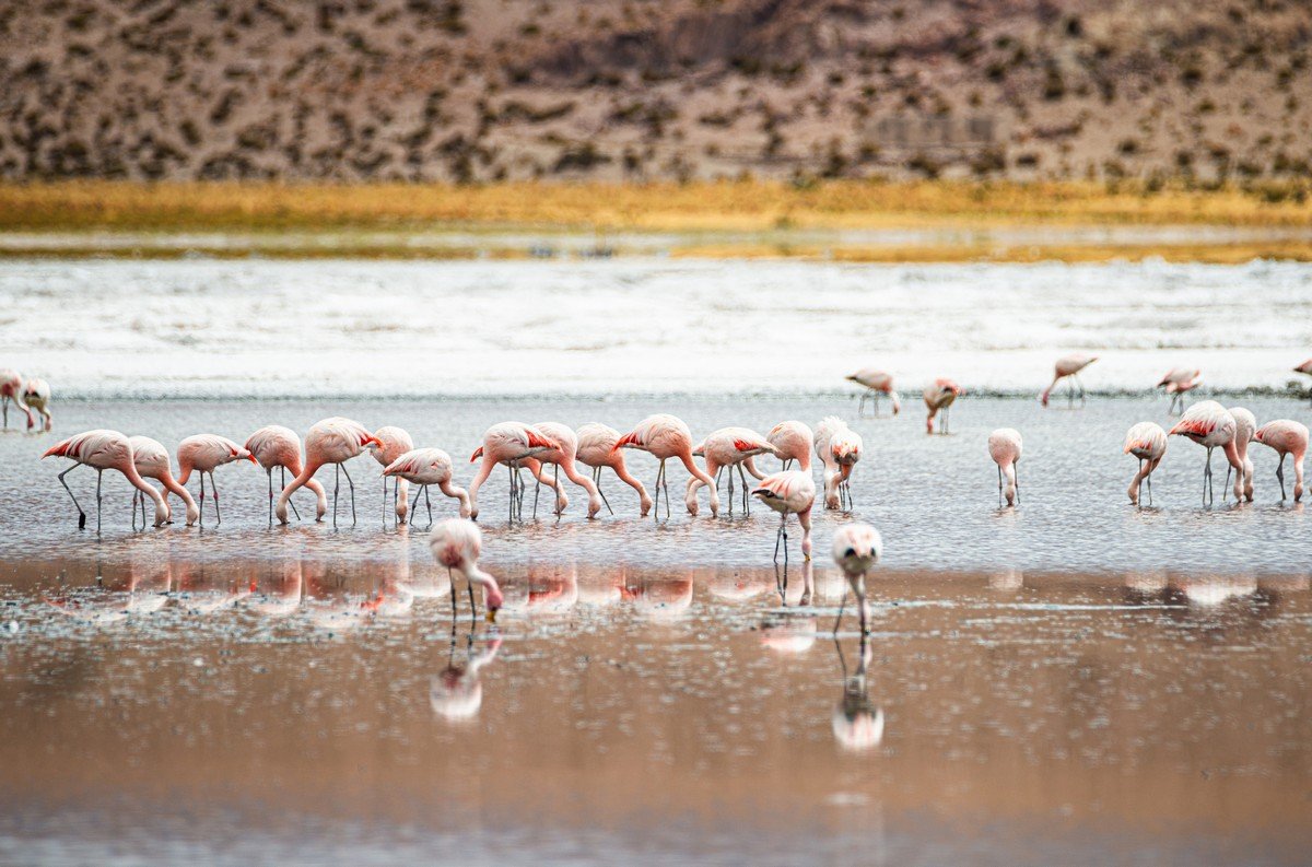
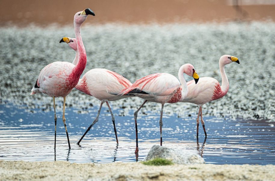
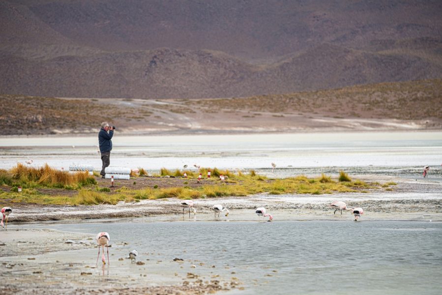
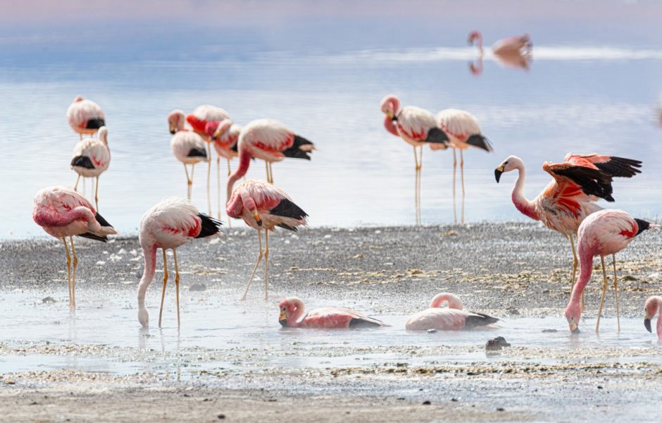
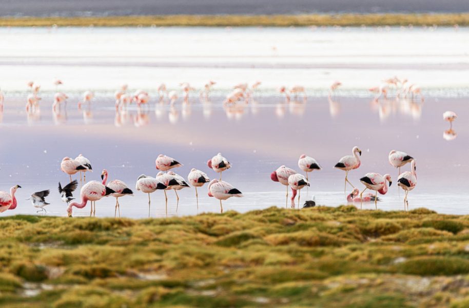
We stopped by three lagoons (which are a mix of freshwater and salty lakes) – Cañapa, Hedionda, and Honda. Pink flamingos inhabit these lagoons, though not in vast numbers; still a beautiful sight:
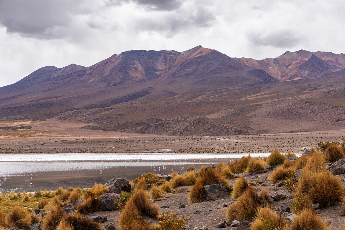
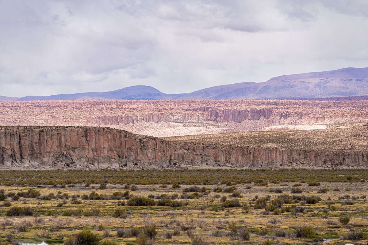
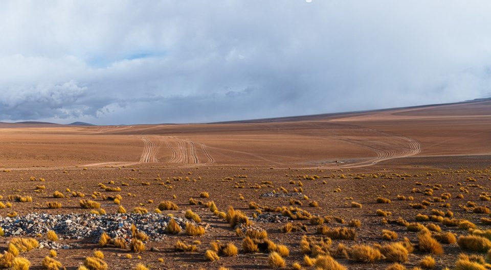
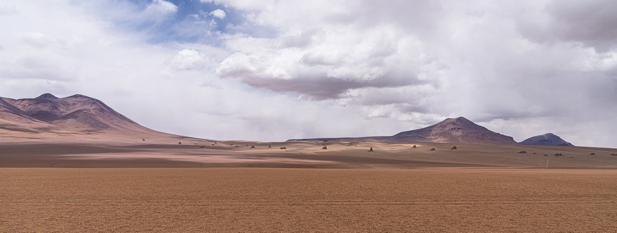
The views are simply stunning:
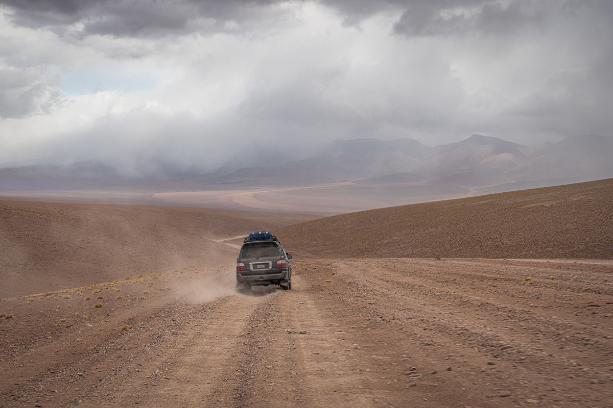
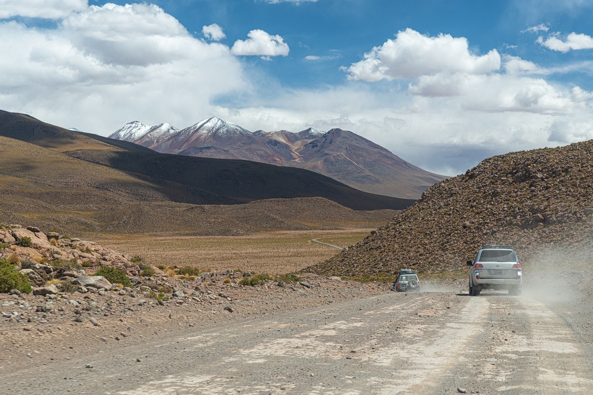
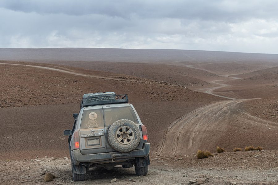
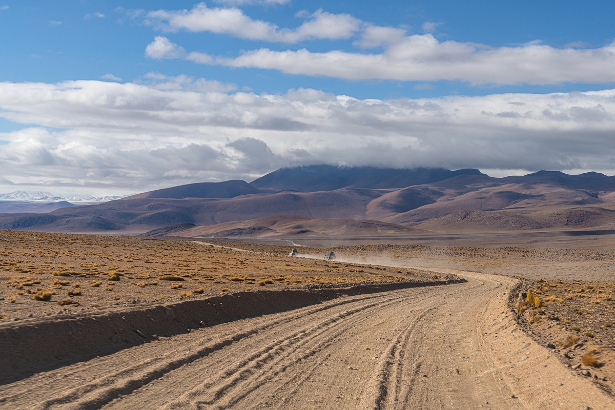
The further we went, the rougher the road became:
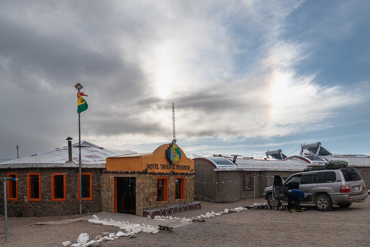
We stayed overnight stay at the Tayka del Desierto hotel – situated at an altitude of around… 4600 meters! ->
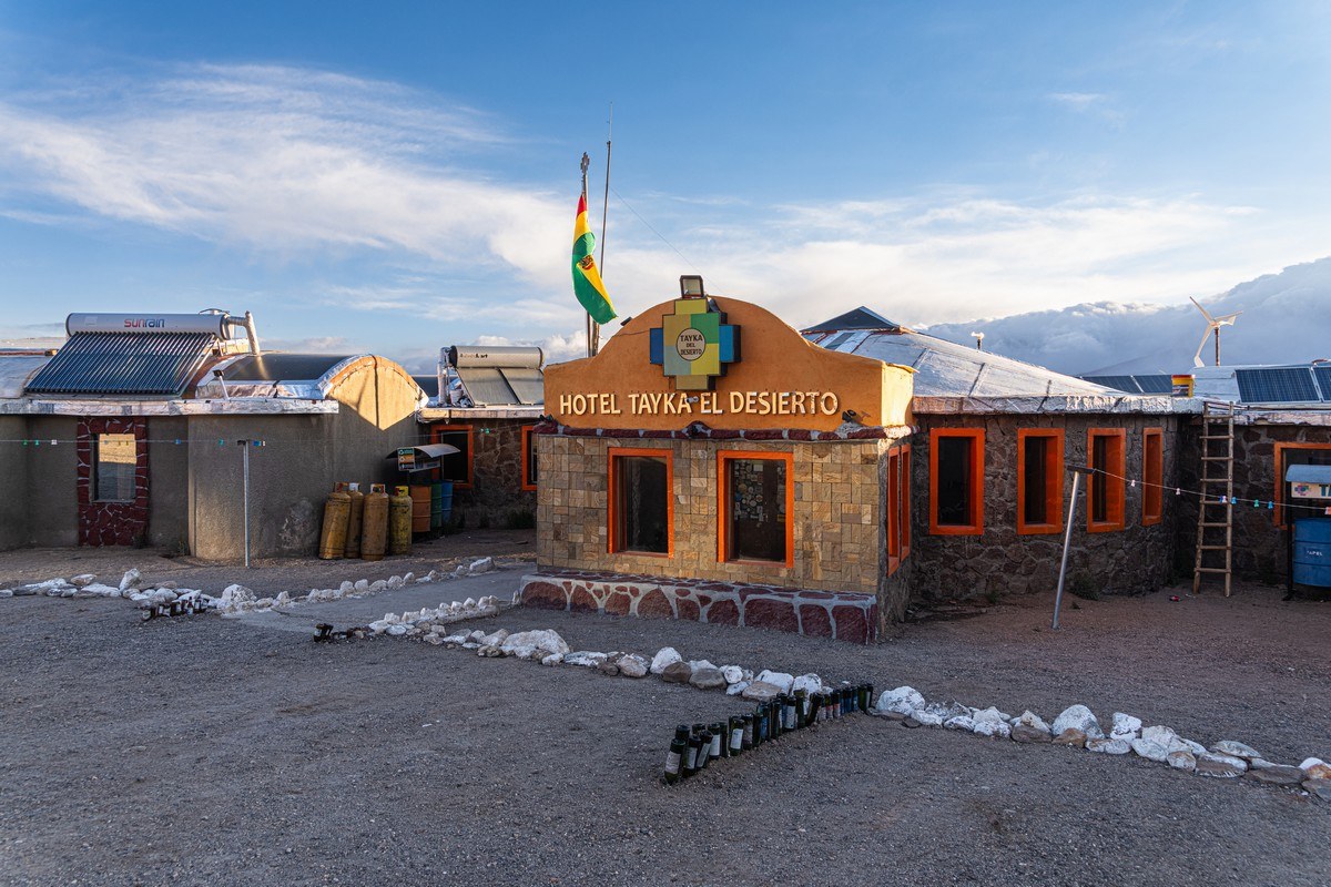
// The internet falsely claims this is the highest-altitude hotel in the world. That’s simply not true. We’ve stayed at even higher places – like in the Nepalese village of Gorakshep, which sits at about 5160m!
The next morning – back on the road:
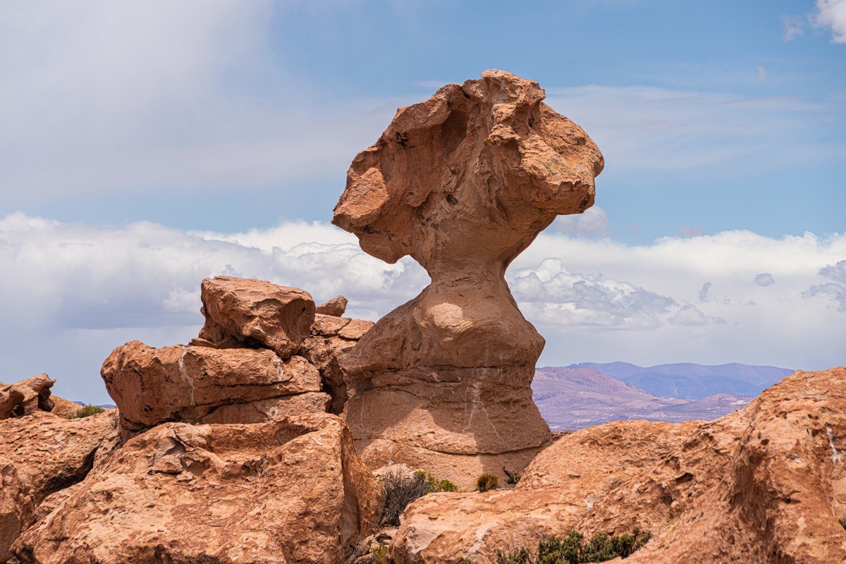
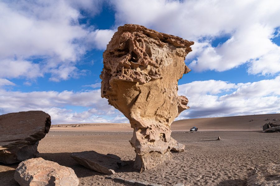
Rock “flowers”. I don’t know what this place is called, but on Google Maps, it’s labeled Rock Tree:

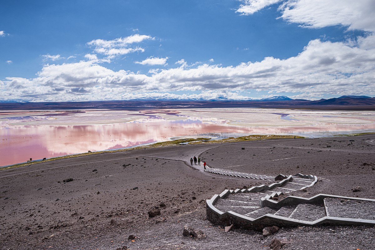
Laguna Colorada is aptly titled: it really is multi-colored!
And more Andean flamingos:
We continue climbing – now approaching 5000 meters, and in to fresh snow:
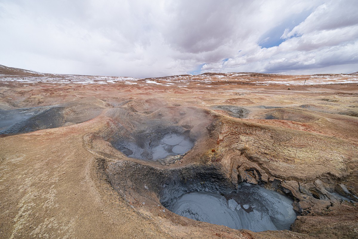
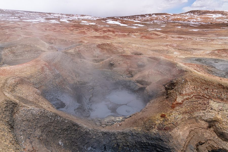
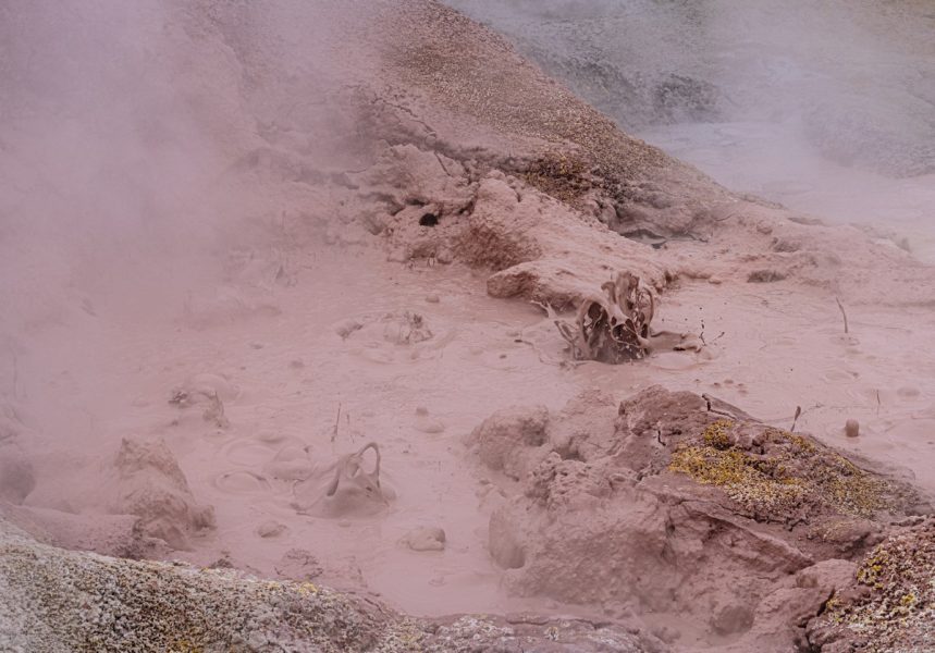
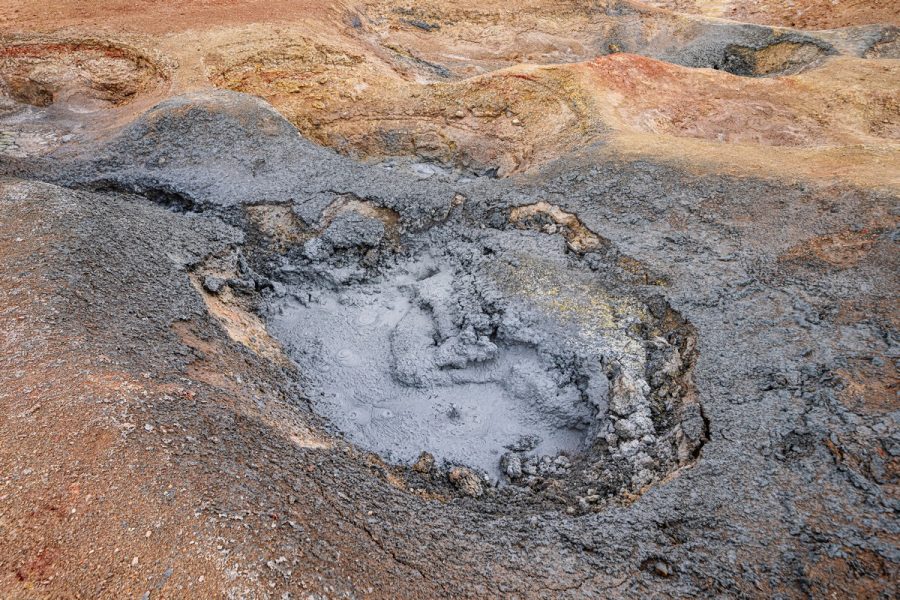
Bubbling mud pools – this place is called Sol de Mañana ->
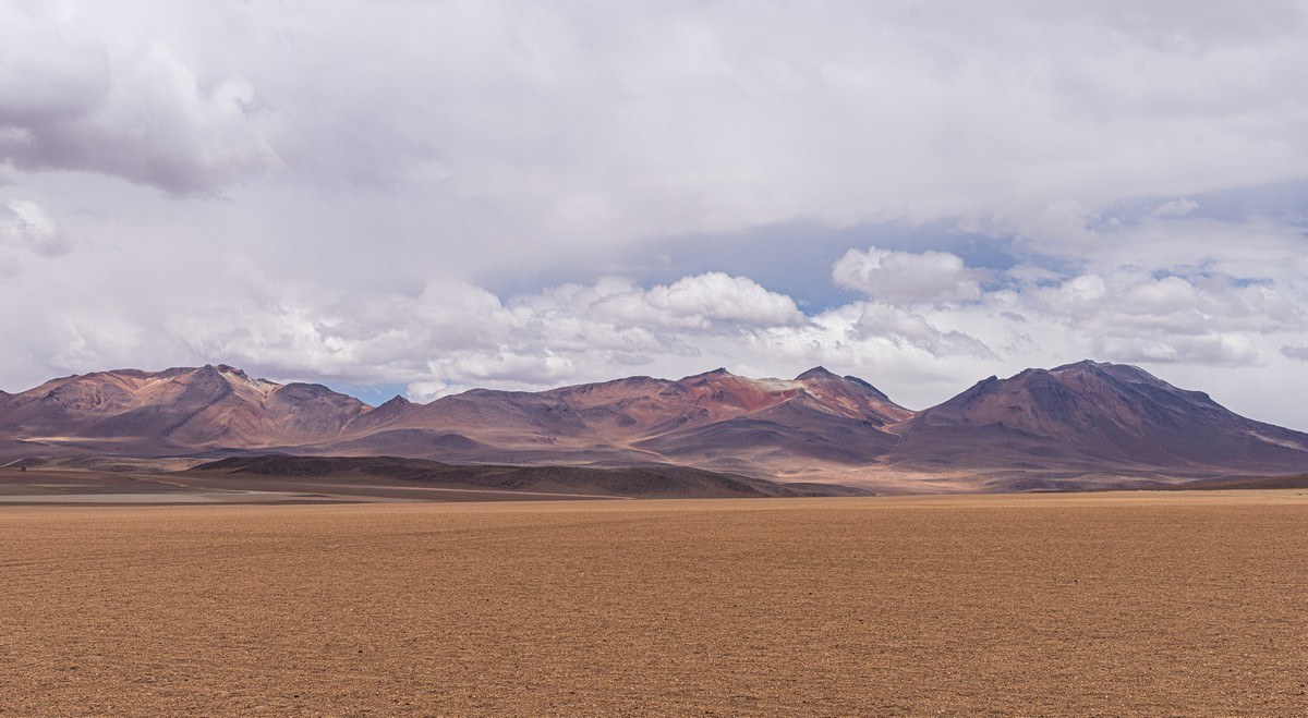
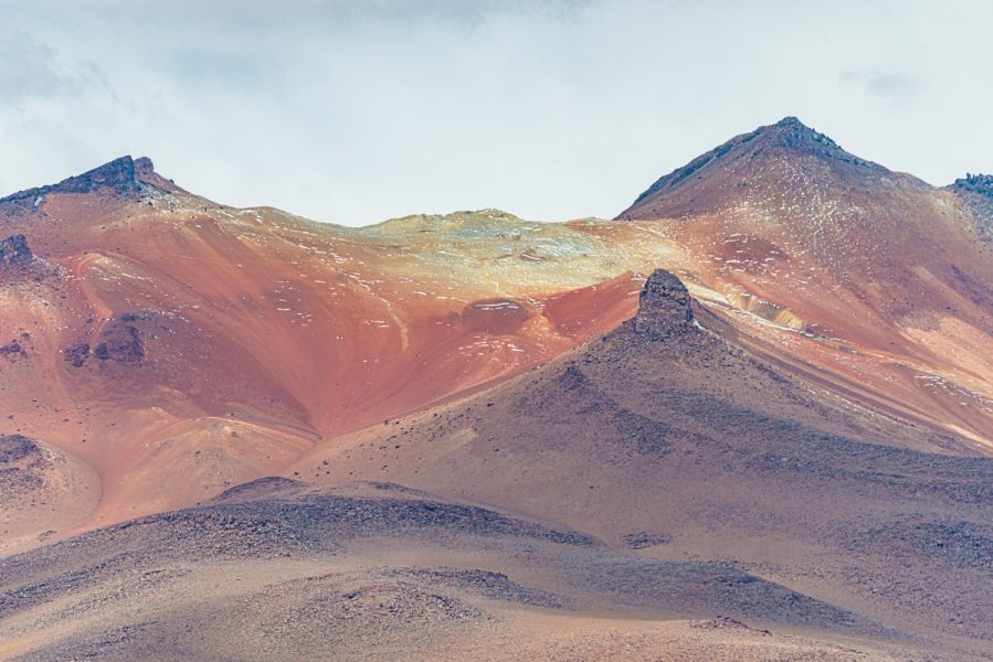
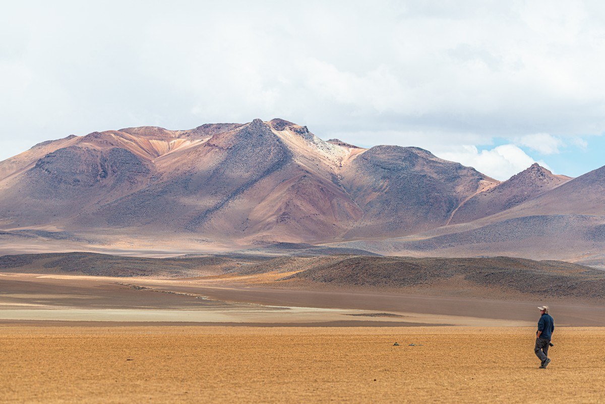
Salvador Dalí Desert was clearly named for its colors and surreal landscapes:
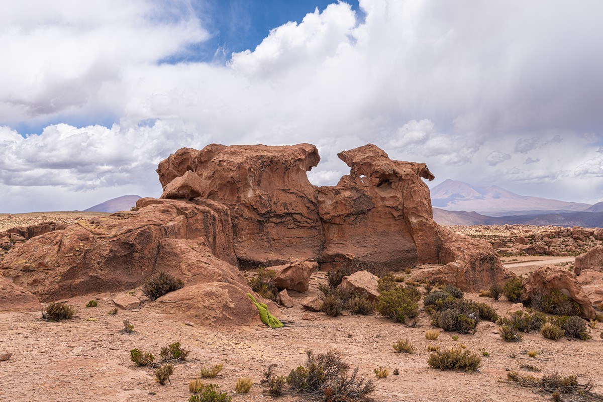
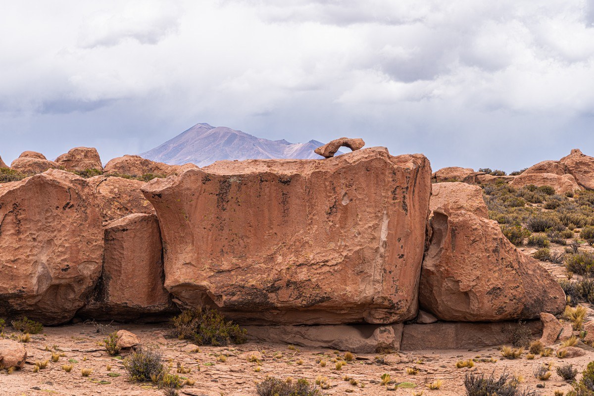
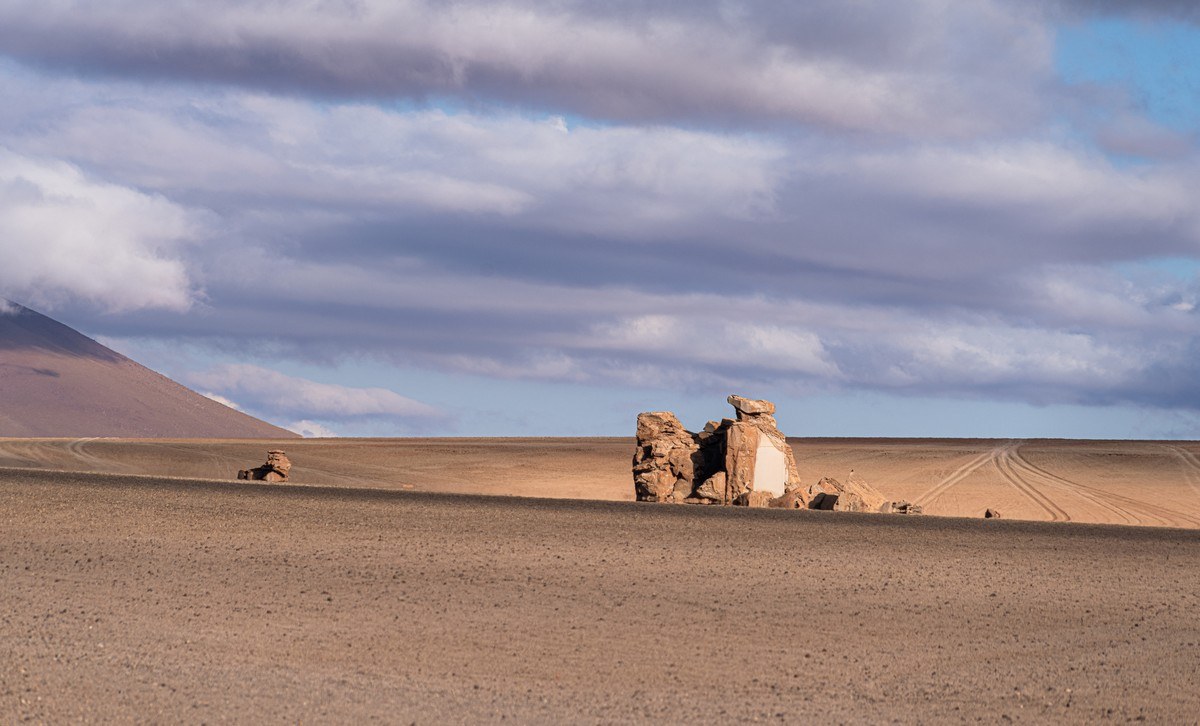
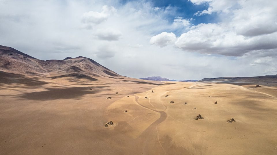
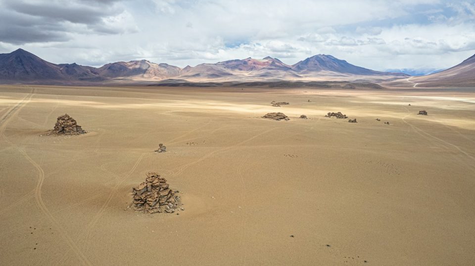
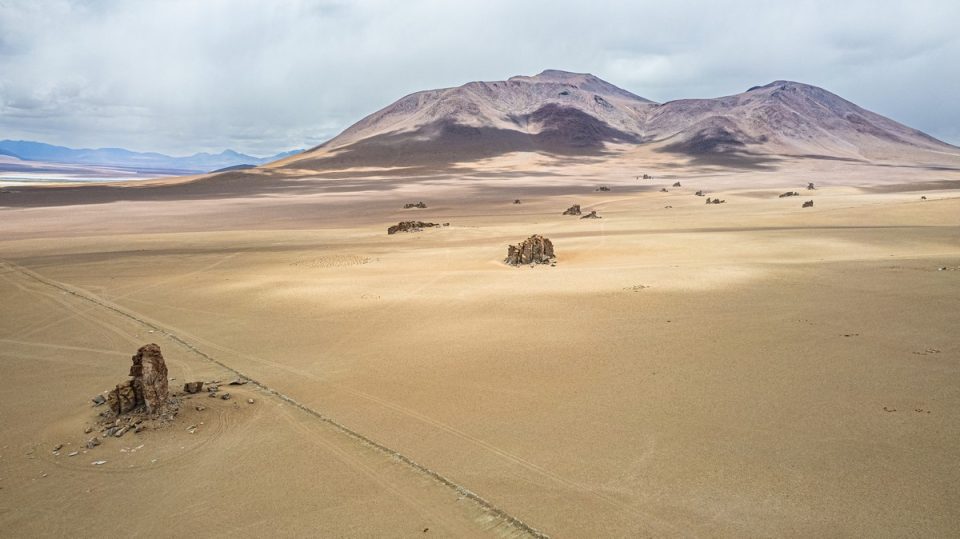
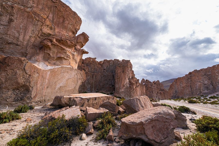
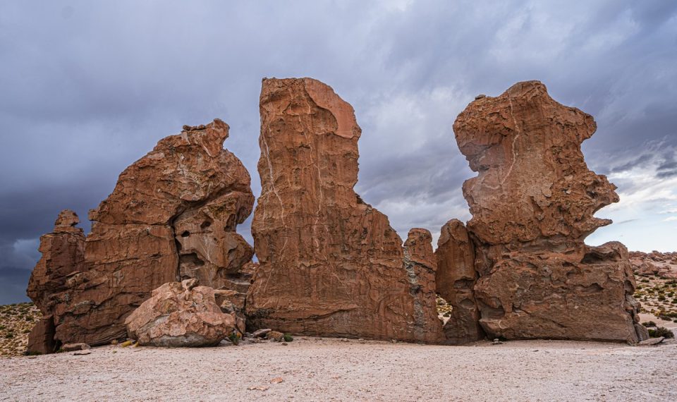
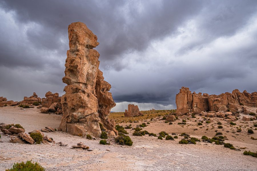
Very strange rocks chaotically scattered in the middle of nowhere. Why here? Why so few?!…:
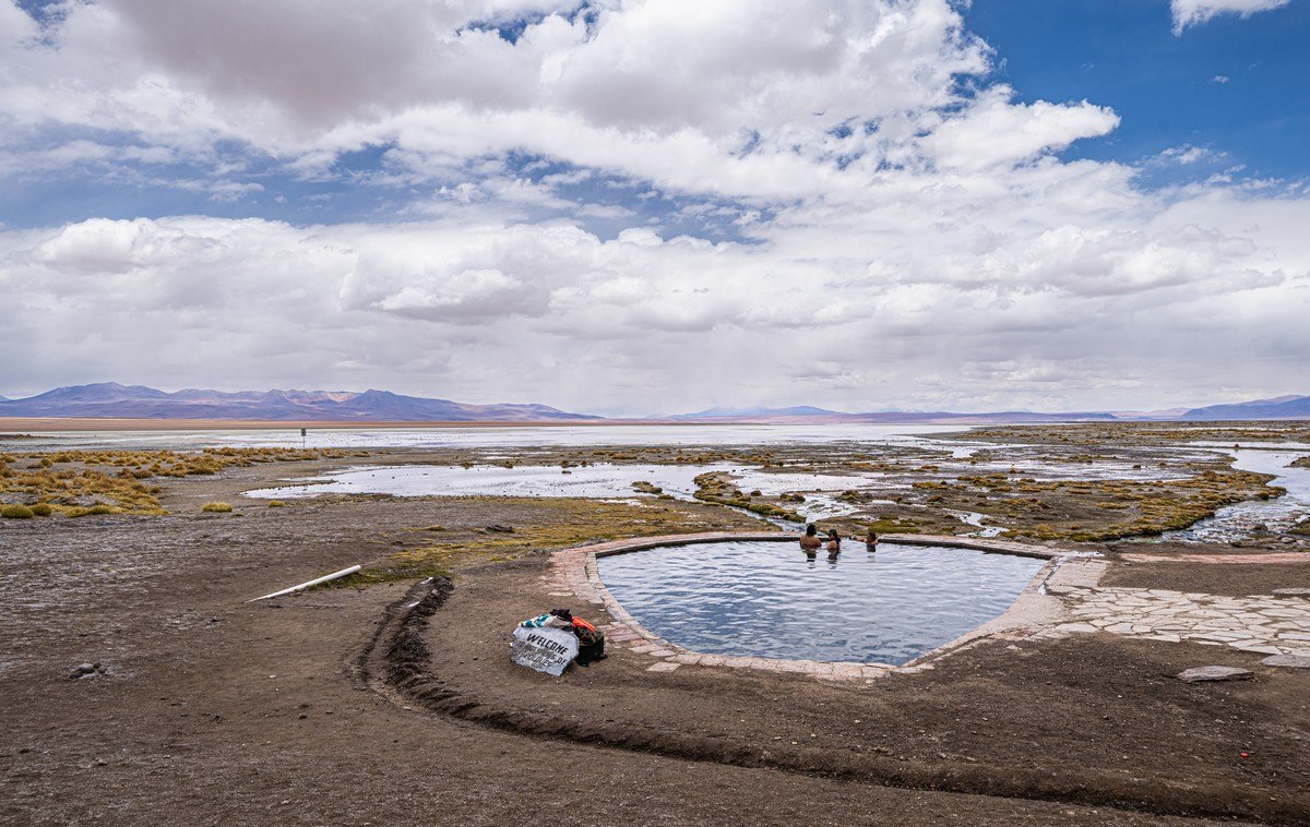
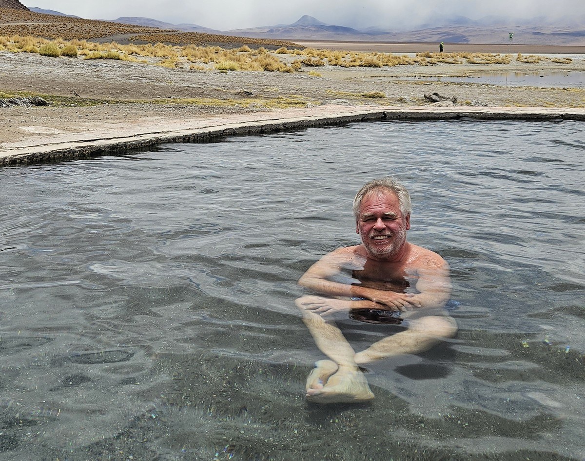
The Termas de Polques hot springs ->
We passed another salt lake (Laguna Capina) without stopping for a walk:

The Italia Perdida rock formations. It would’ve been nice to have stopped and explored them for an hour or so, but time was running out…
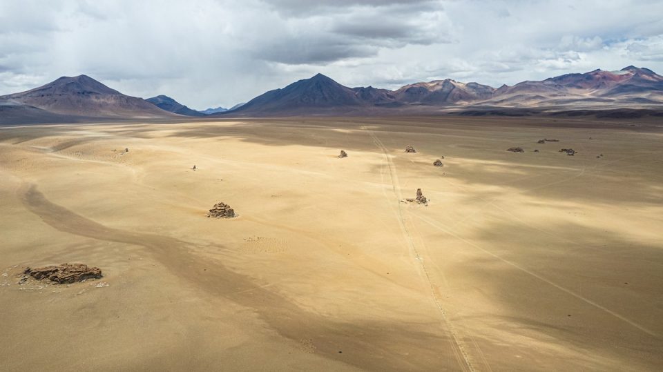
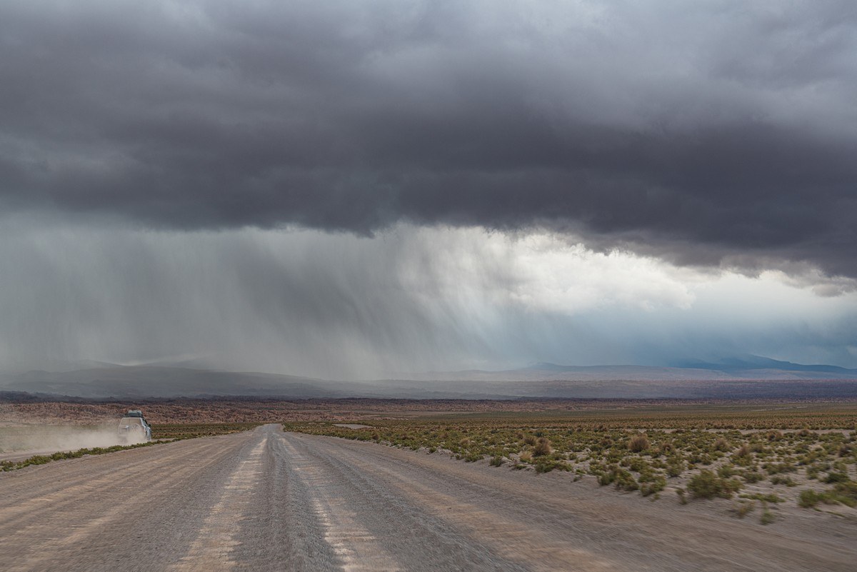
More rock formations of all kinds – Bosque De Piedras. We really rushed through here, with the approaching rain egging us on ever faster…
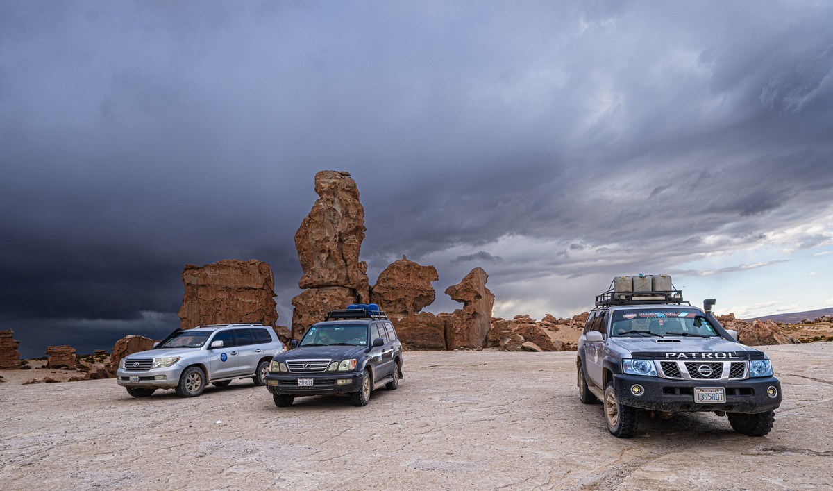
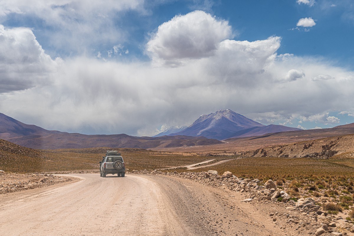
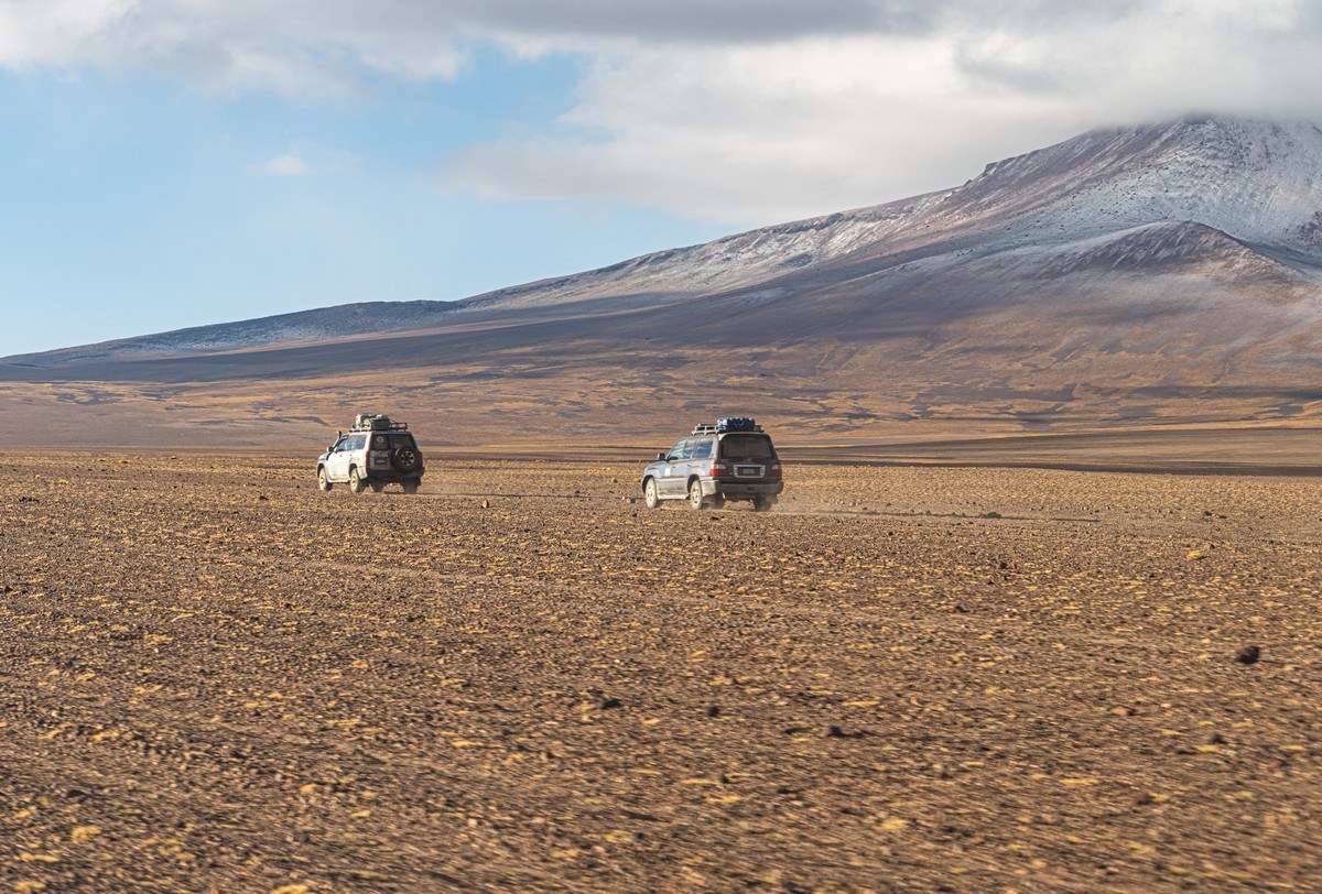
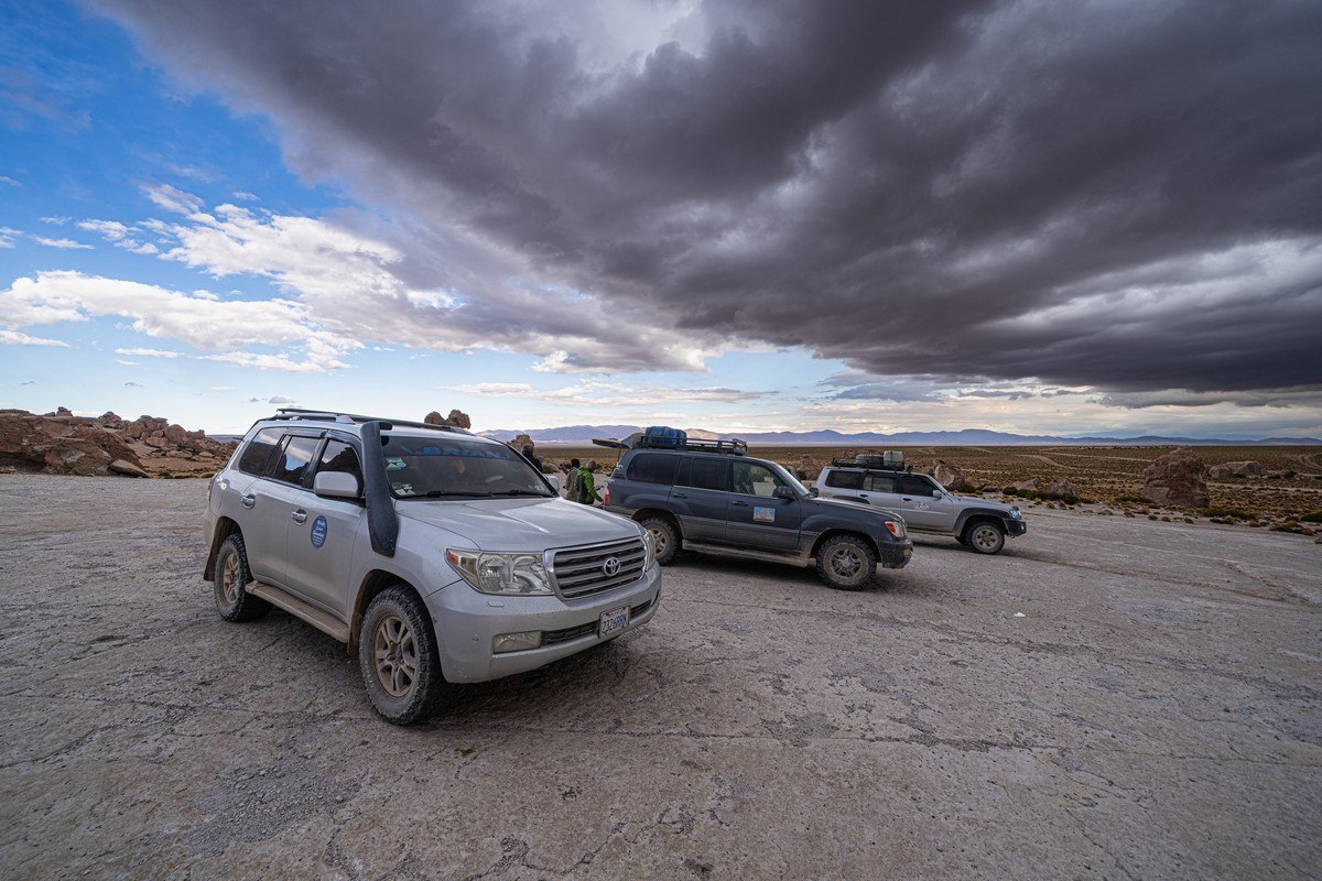
Btw, we were still in the same SUVs from earlier – which had been washed thoroughly after the Uyuni Salt Flat to remove the caked-on salt:
Part 1: Altiplano’s rock formations – exceeding expectations…
As the above intro may already have shown, we had an ambitious plan for the Altiplano Plateau (though we didn’t quite realize that setting off). We had two very intense days and about 700km of roads of varying quality ahead – though we didn’t know that yet either. We were told about the hot springs and told to bring swimwear. As for the rest – like making sure to charge all possible batteries – we figured that out on our own. All right; off we go!…
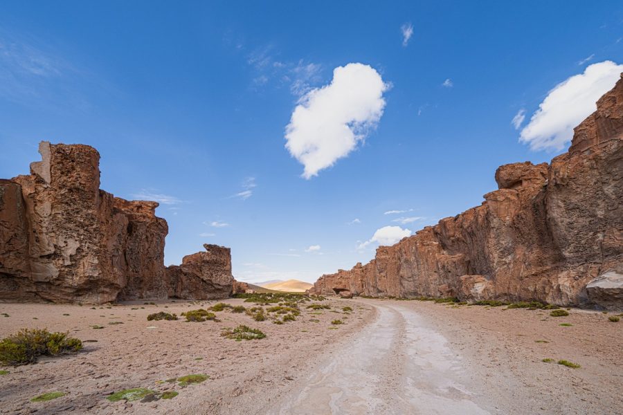
Our first stop: Parque del Desierto de Piedra, and it was here we encountered our first peculiar rock formations:
But I’m getting ahead of myself. Rewind to that morning – and it was a positive start, for it was the first time we didn’t have to set off at some ungodly hour like 6, 5, or even 4am. Instead, at around 9am, we loaded up into our off-road vehicles and eagerly set off for new adventures. The road was quite decent and, interestingly, the further we got from the city, the better the quality of the road became. At first, it was a smooth, well-compacted dirt road:
Then an old but still smooth asphalt road appeared:
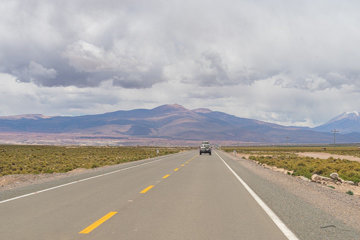
The farther we went, the newer and fresher the asphalt became. Clearly, the budget didn’t allow for paving the entire road at once. Ah, and there were the first volcanoes appearing on the horizon:
Eventually, it turned into a brand-new, freshly laid road, and that’s when the unusual rock formations began appearing:
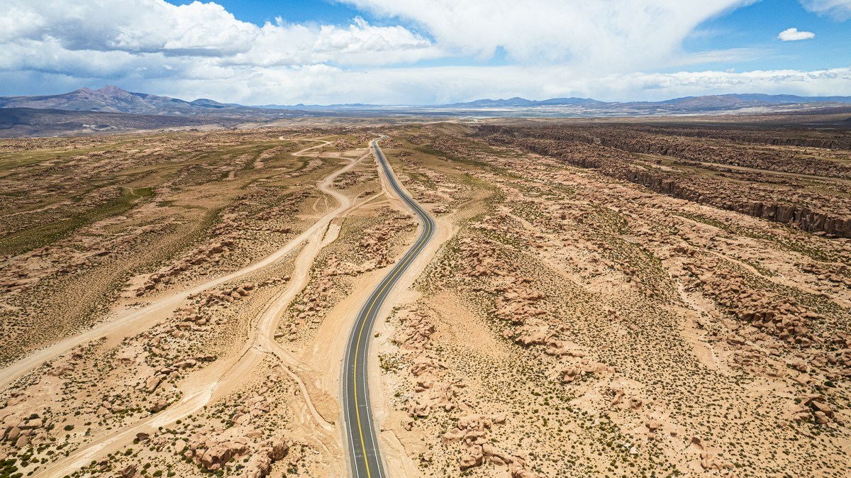
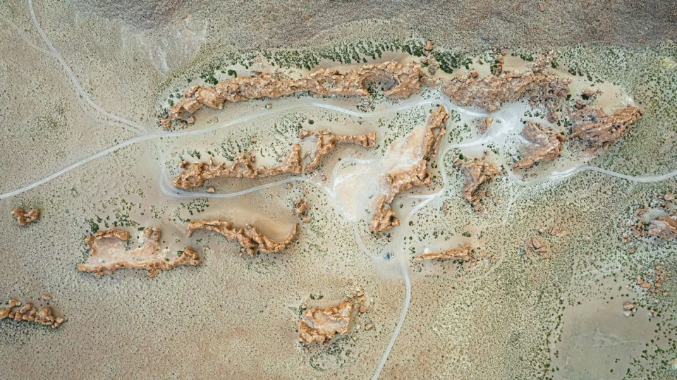
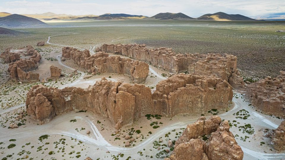
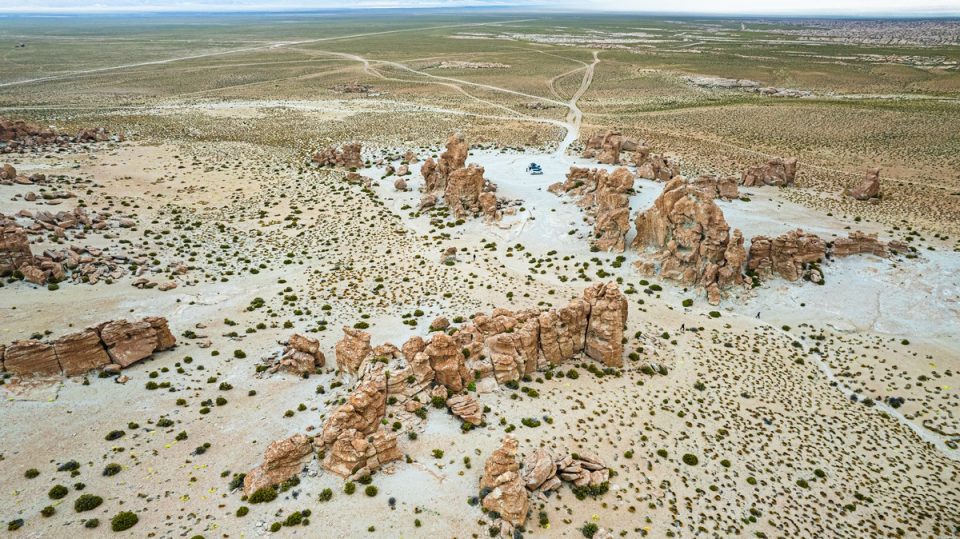
Here’s the road from the drone. Incidentally, you can see endless (natural) stone walls stretching along the right side of the photo – this is where the local natural wonders begin:
Erosion has sculpted these fantastic rock structures:
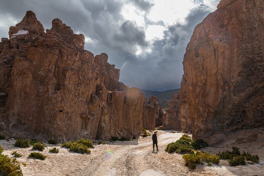
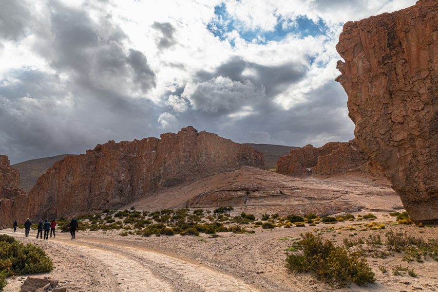
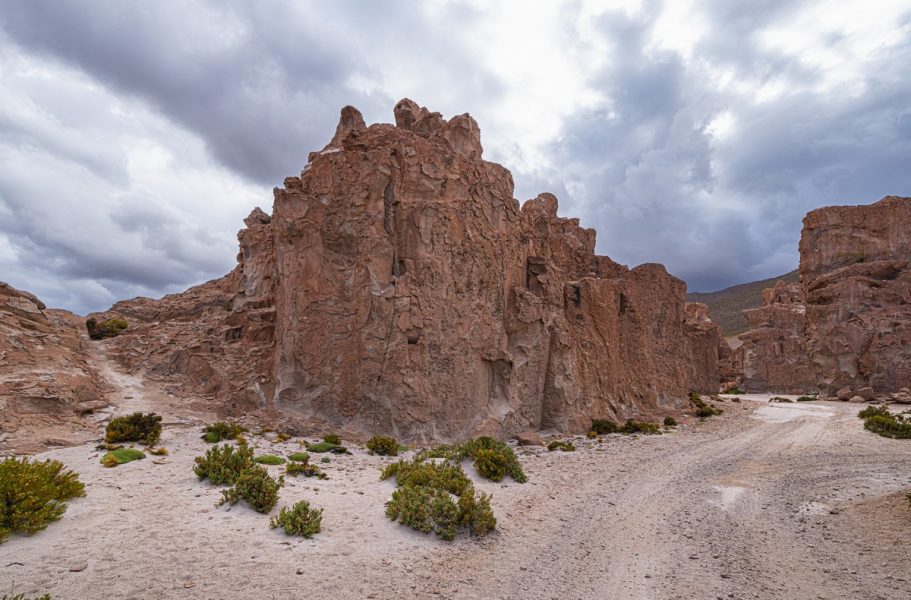
160km into the journey (mostly on smooth asphalt) – just 2.5 hours later (including a quick stop in the town of San Cristóbal) – we arrived. You need at least half-an-hour to explore around here quickly, but an hour or an-hour-and-a-half would be better – to walk further away and take in all the scenery. But in that case it’s best to leave earlier in the morning; otherwise you’ll be late for dinner :).
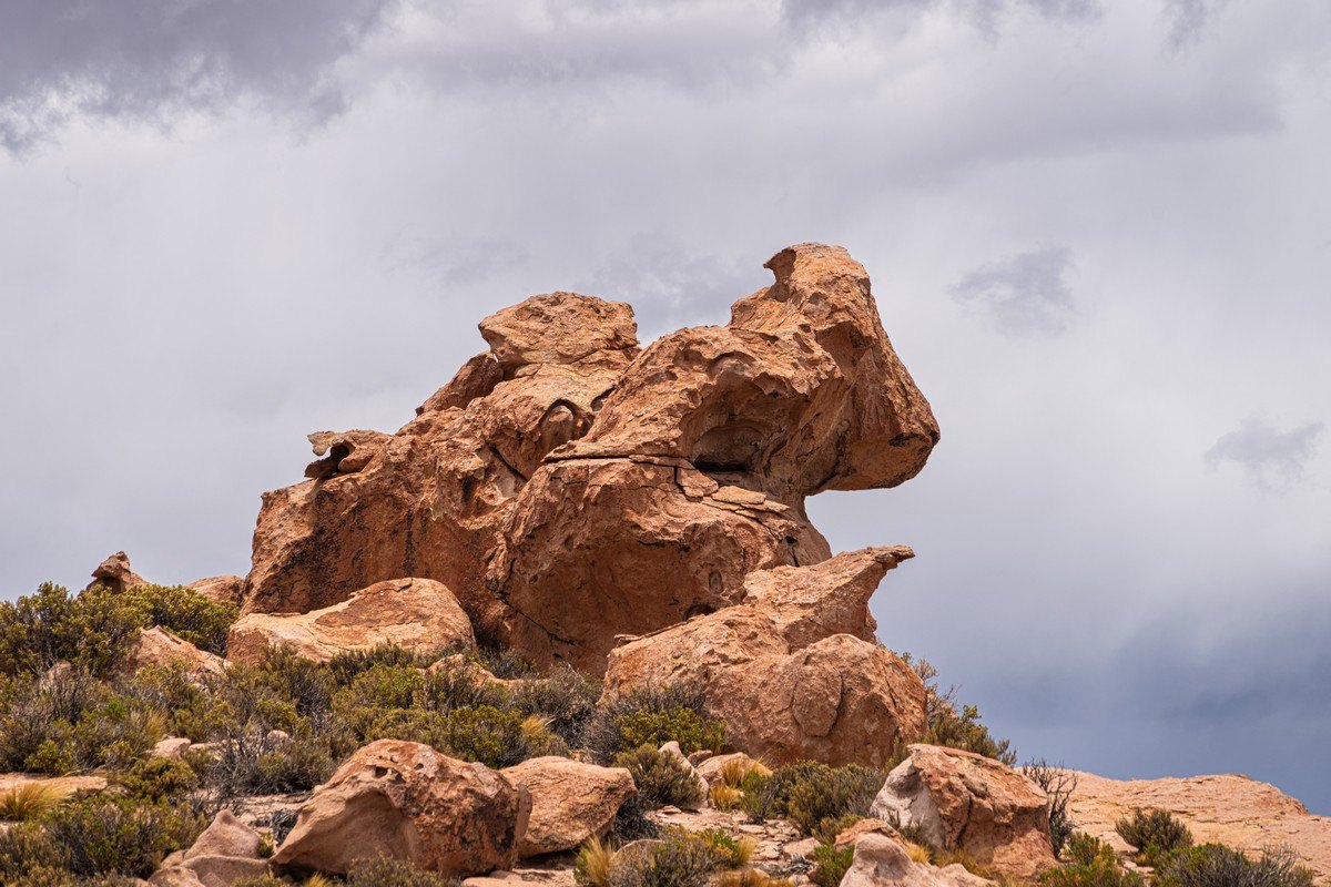
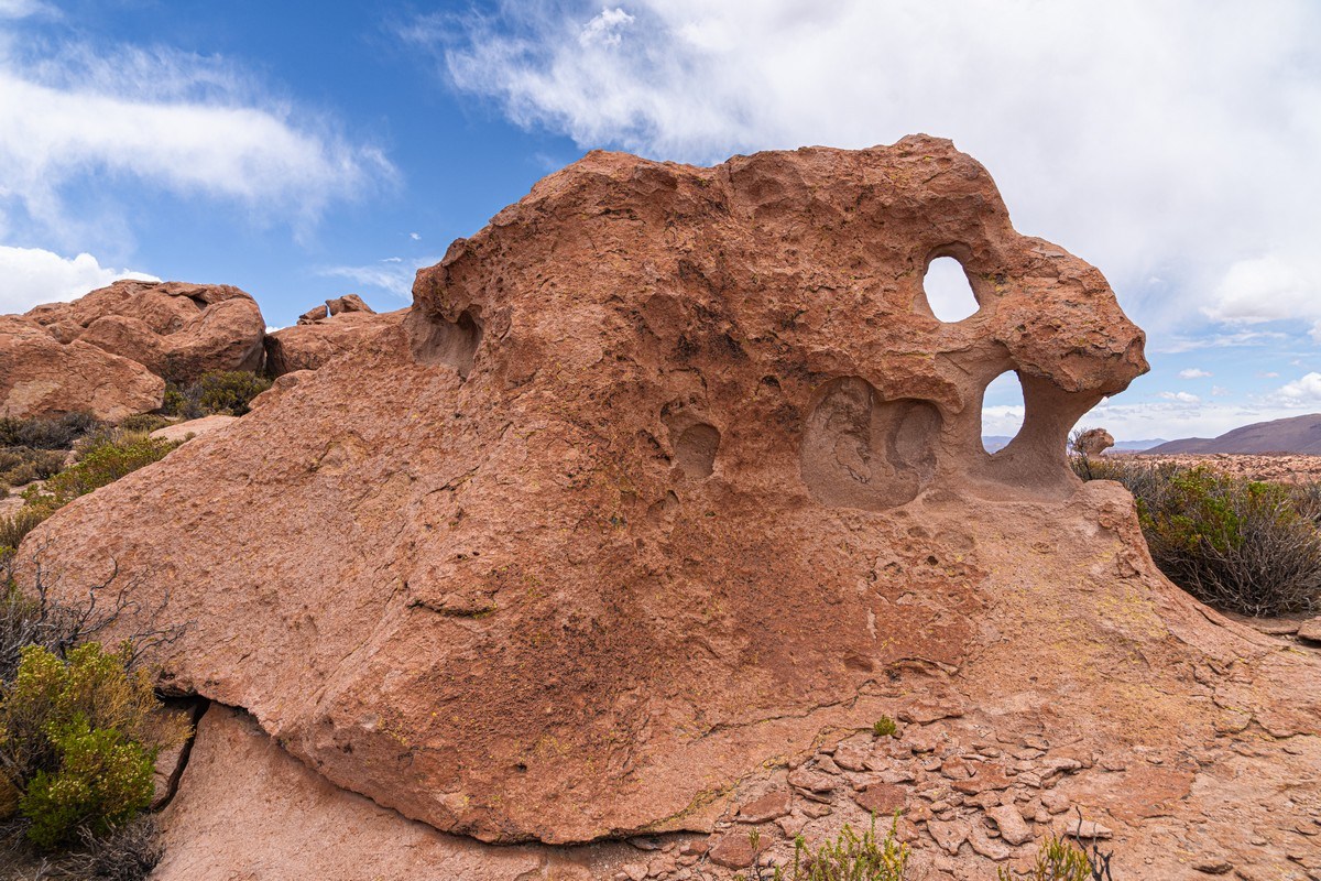
The rock formations here are incredibly diverse. It’s evident they were once battered by ocean waves – yet we’re now at an altitude of just under 4000 meters!
For some reason, our guide was adamant these rocks aere of volcanic origin – supposedly remnants of ancient lava flows; however, it’s clear that these are typical sedimentary rocks. Yes, there are volcanoes in the area, but they formed much later than these rocks, which were later shaped into their current forms:
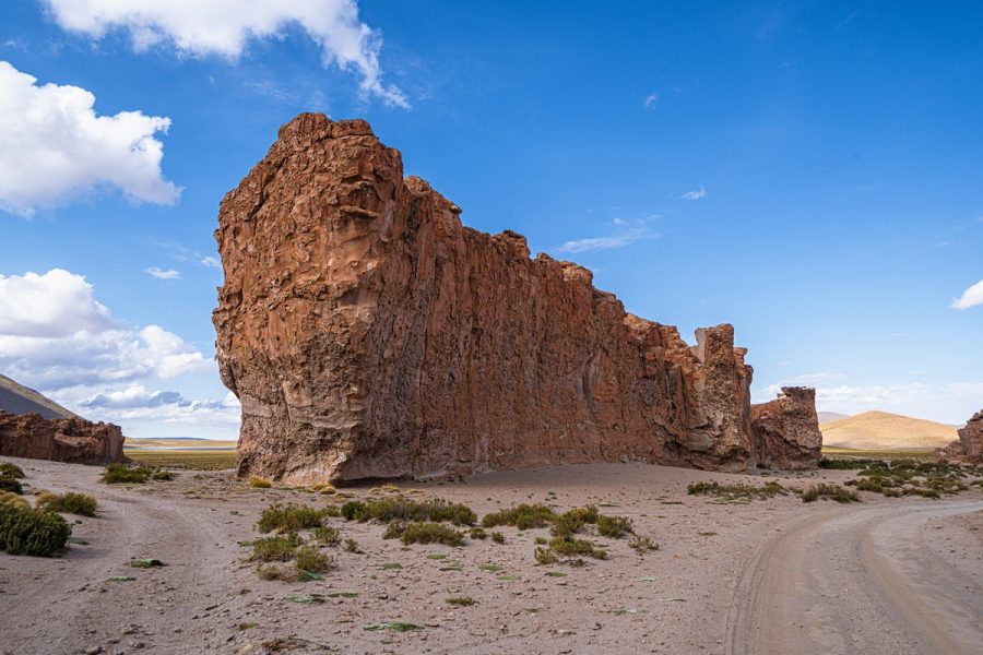
Natural magic – or magical nature ). How does this even happen?!…
…And this (the small rock placed there on that massive one)?! ->
Or did a Homo sapiens place it there? I seriously doubt it; sometimes natural erosion creates the most bizarre formations on its own. This one looks like a panther mid-leap! ->
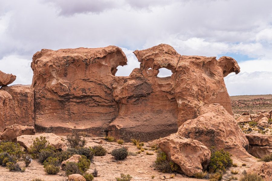
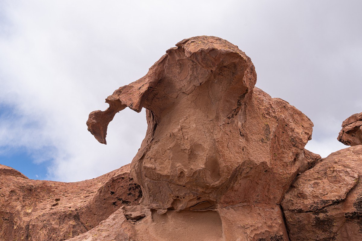
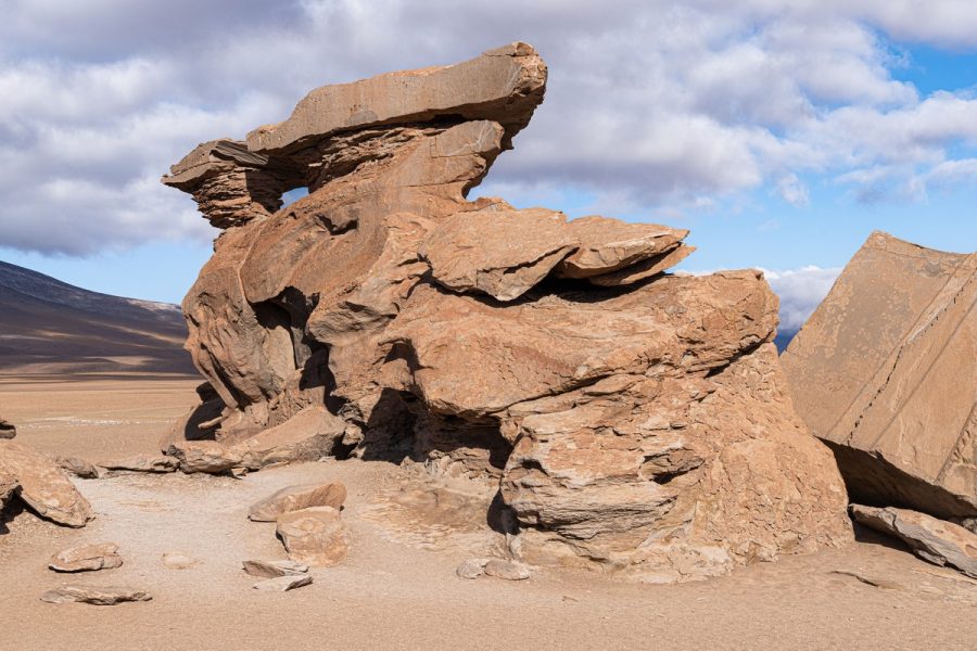
Some formations look like faces of strange creatures staring off into the distance:
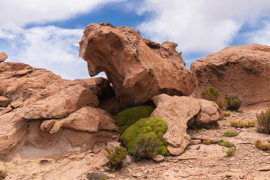
Rock rose (reminding me of the rock mushrooms in Yehliu Geopark in Taiwan)! ->
And up close…
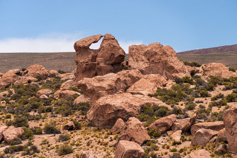
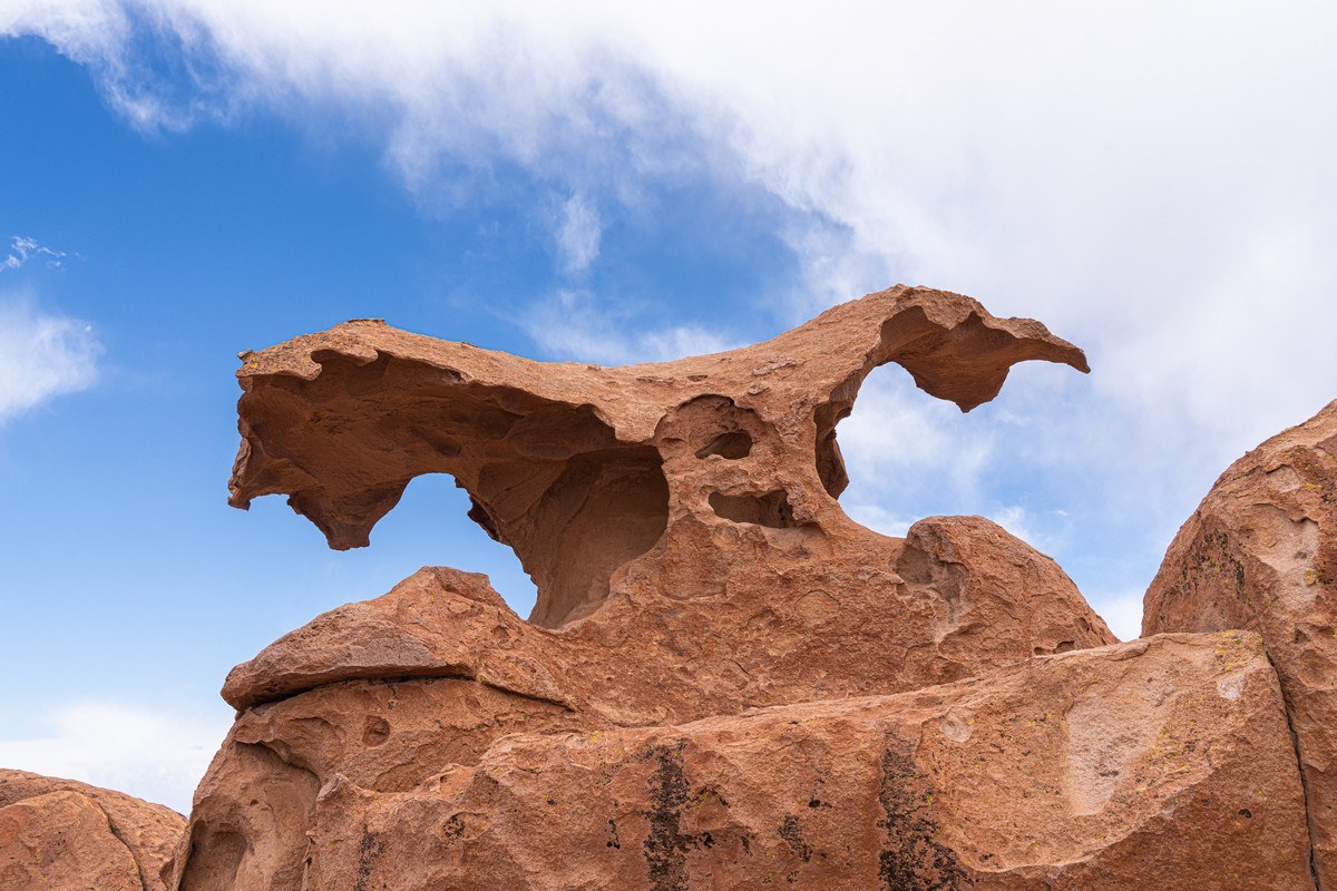
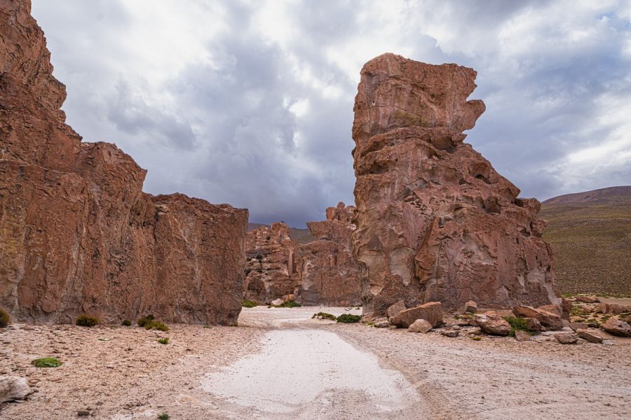
And other stunning rock formations:
Screaming rock ghost?! ->
Could this be a Mangalore from The Fifth Element?
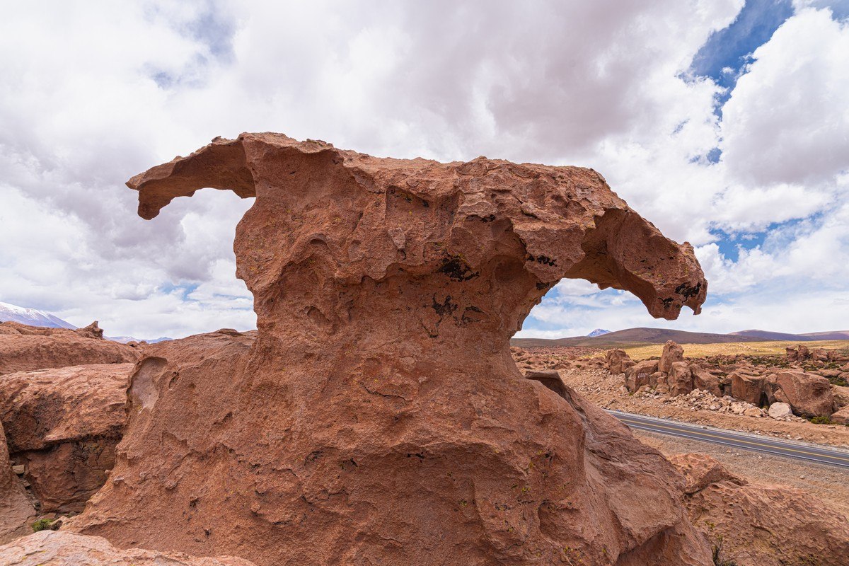
No, not quite – from the side it looks completely different (rock eagle?!) ->
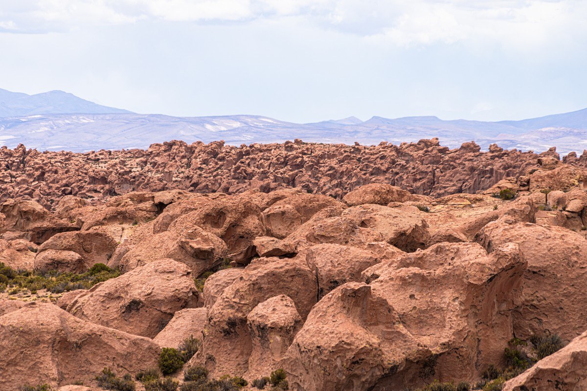
What’s fascinating is that these rock formations stretch across the landscape for miles and miles. Exploring them all would be impossible. It all reminded me of the Giant’s Playground in Namibia…
But it was time to move on!…
Part 2: Deeper into Altiplano – past multicolored salt-lakes and flamingo!
Next up – Andean flamingoes!…
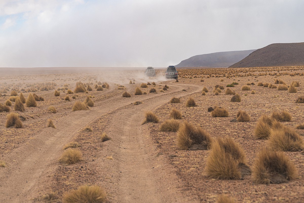
But before them, alas – the road started to become rougher:
The first small lakes/lagoons are right next to the main road leading to Chile. But they’re more like marshy pools than lakes…
Birds floating on the water, flamingos wading through the shallows:
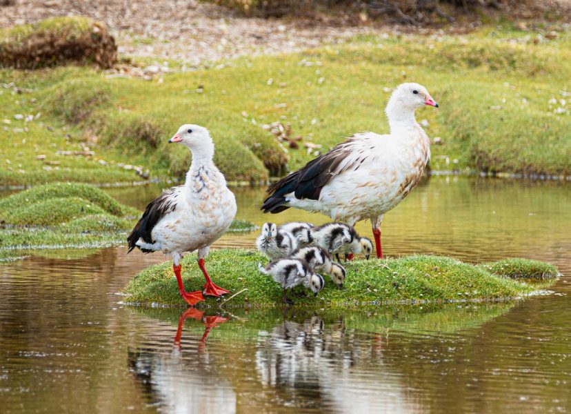
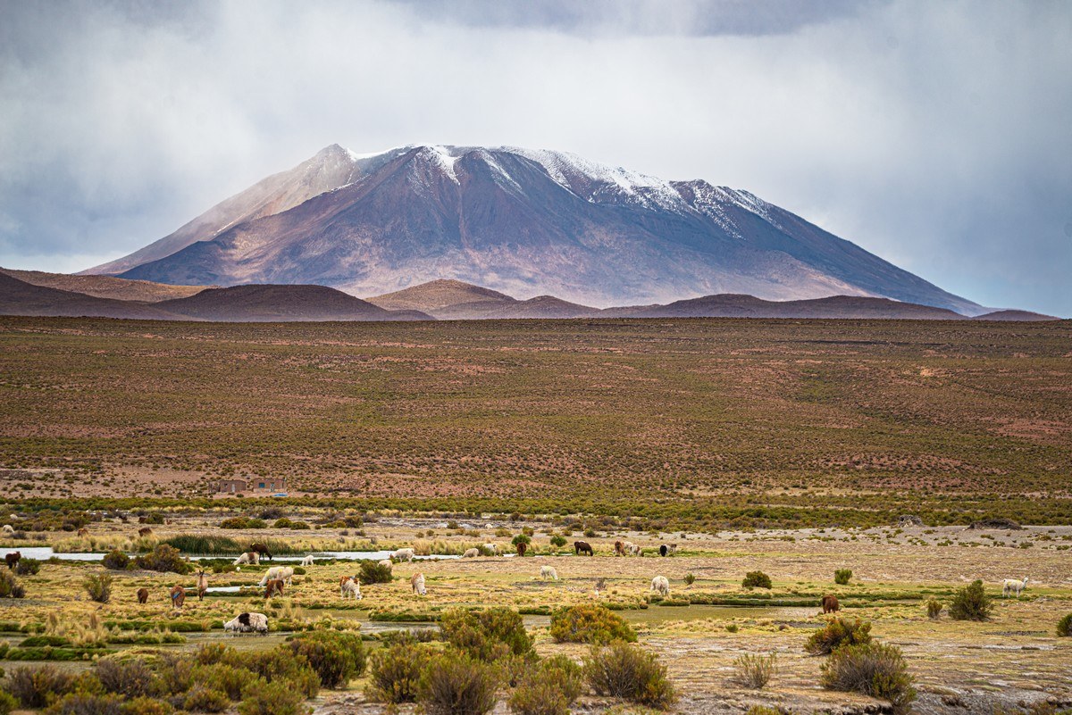
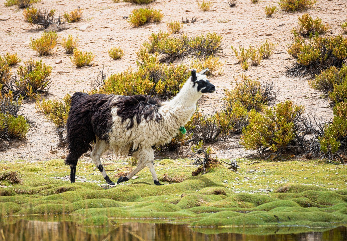
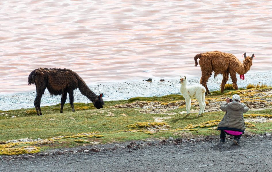
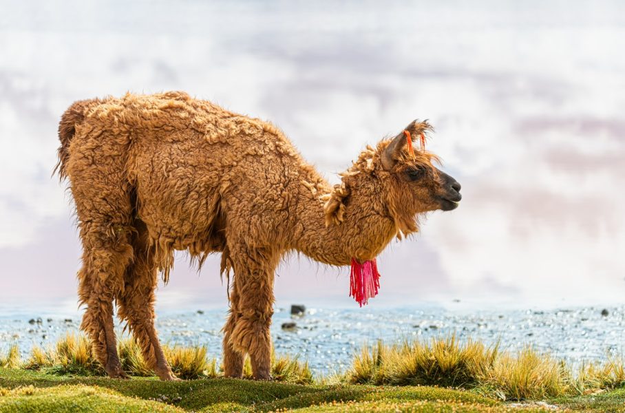
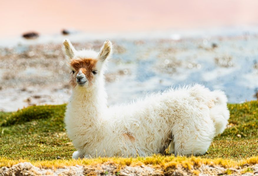
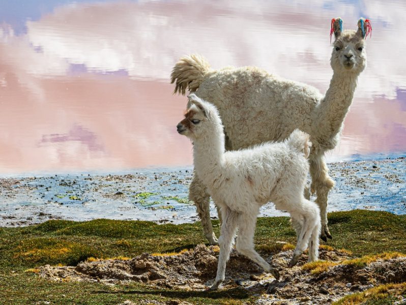
Not only wild birds, but also domesticated animals were spotted along the way:
As we drove further, we climbed higher, and the landscapes became even more rugged:
Several more lagoons lay ahead, requiring a left turn off the main road – the road conditions deteriorating significantly:
But the views got even better! ->
The first lake we stopped at was Laguna Cañapa. For some reason, I only managed to take one photo of it:
We continued driving from one lake to the next, and the road became increasingly… interesting:
The views kept getting more breathtaking! This is Laguna Hedionda ->
Flamingoes; volcanoes:
A beautiful sight!
If you look closely you can see salt deposits: areas tinged slightly yellow; very picturesque – especially in the flesh:
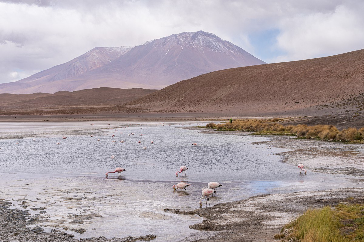
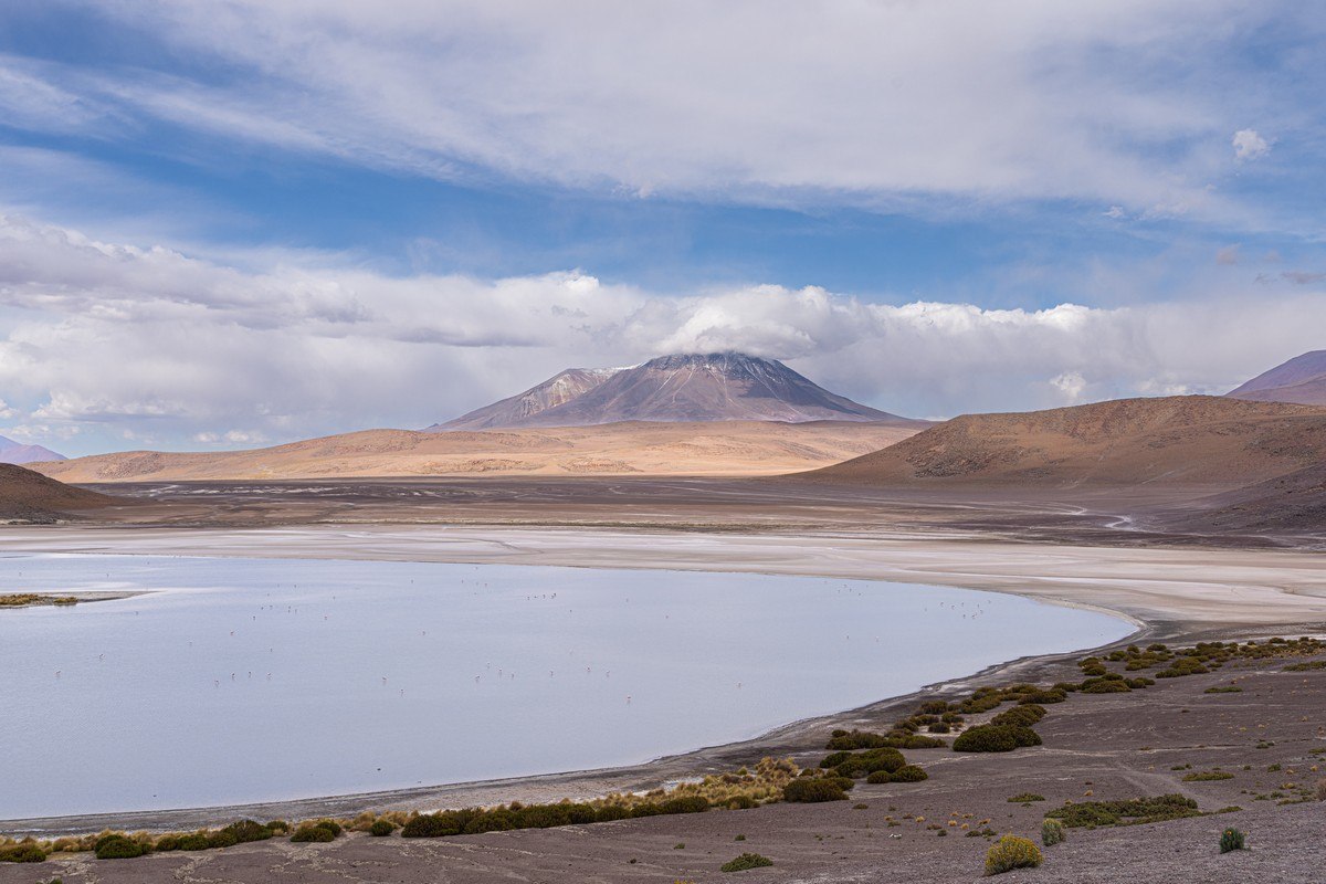
The last lake for today – Honda. Yes, just like the Japanese car brand. Curiously, there’s no word “honda” in Spanish. Was it named after the auto-manufacturer? Was the car brand named after this lake? No idea, but the views were spectacular ) ->
Closer:
But the weather was turning, and since the day was drawing to a close, it was time to head toward our overnight stop…
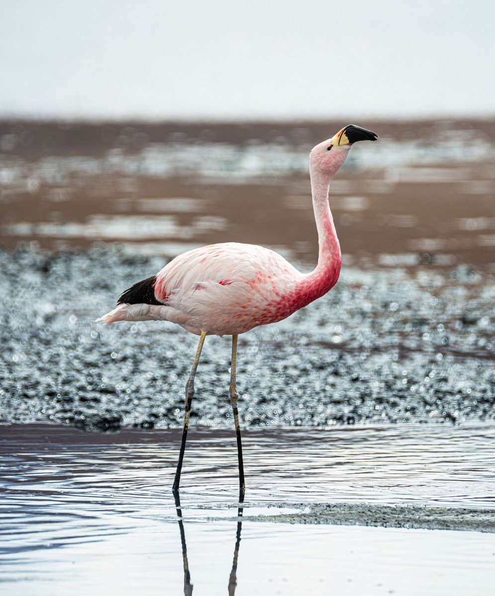
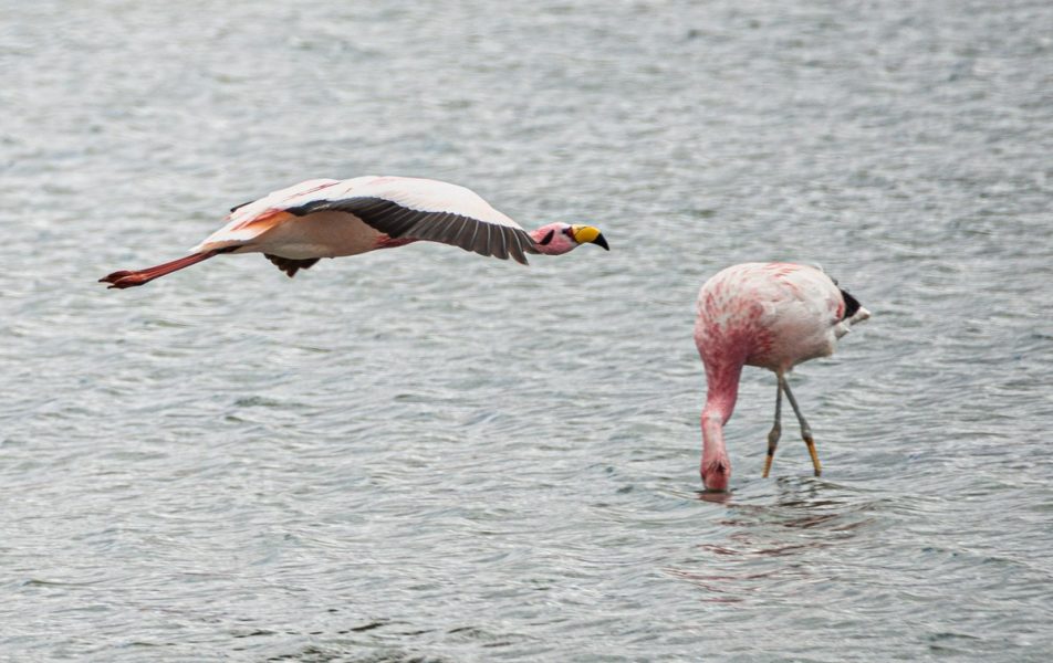
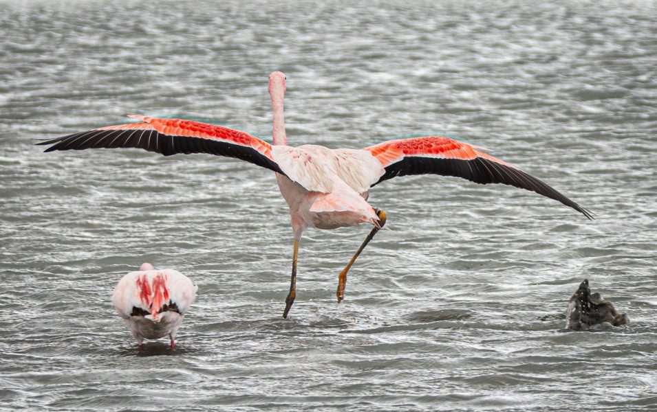
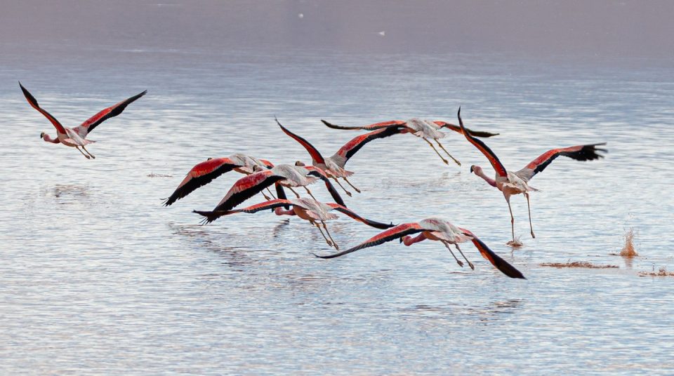
Before moving on to the toughest part of the day’s drive – here’s a fantastic flamingo shot taken by photo-maestro DZ ->
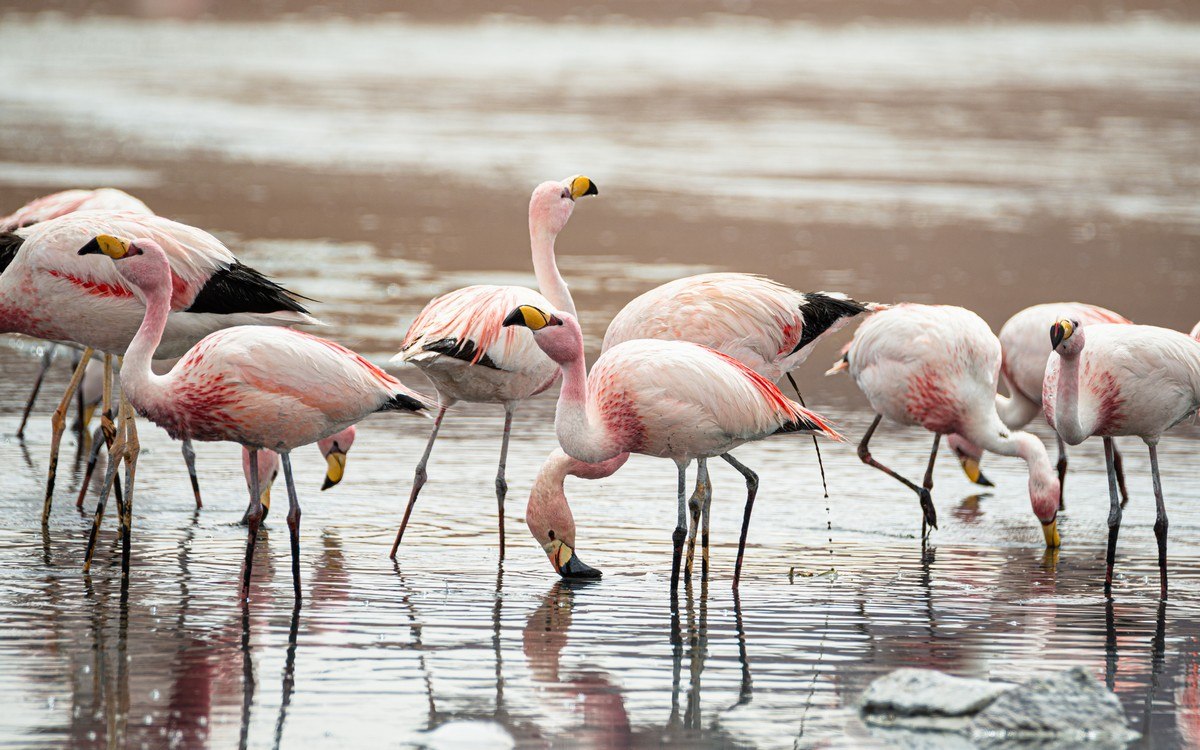
A proud flamingo! ->
Aah – that’s the life: all they do is eat and sleep!
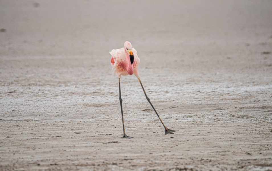
Flamingoes viewed from all angles ) ->
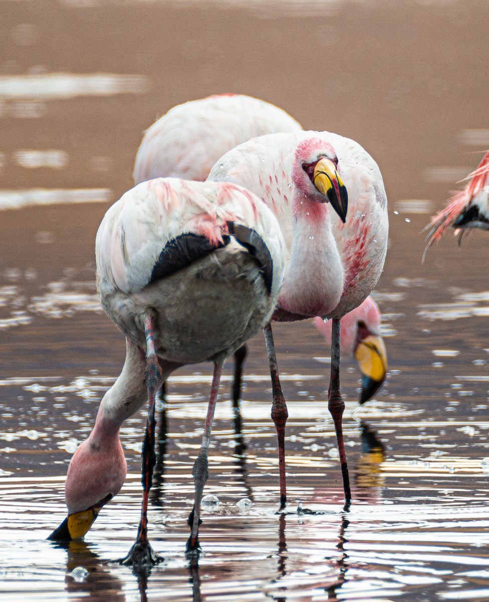
Oh, what beauties!
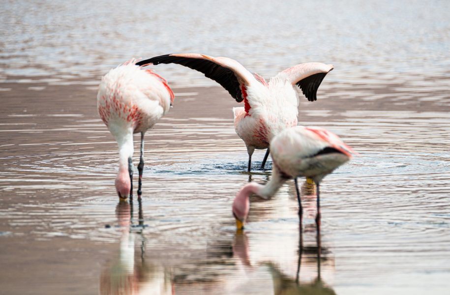
Someone seems a little confused:
The wider they spread their wings, the more majestic they look!
Flamingoes: done. Now onward to our overnight stop…
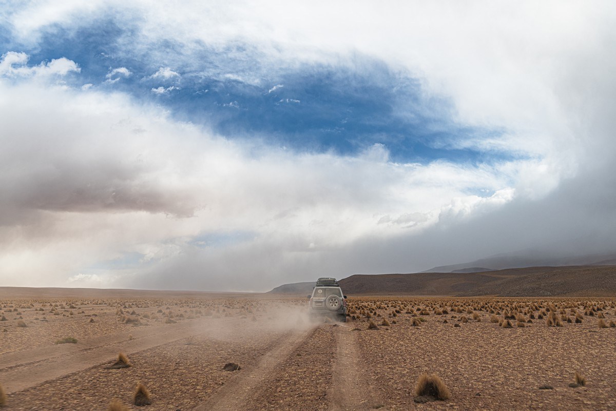
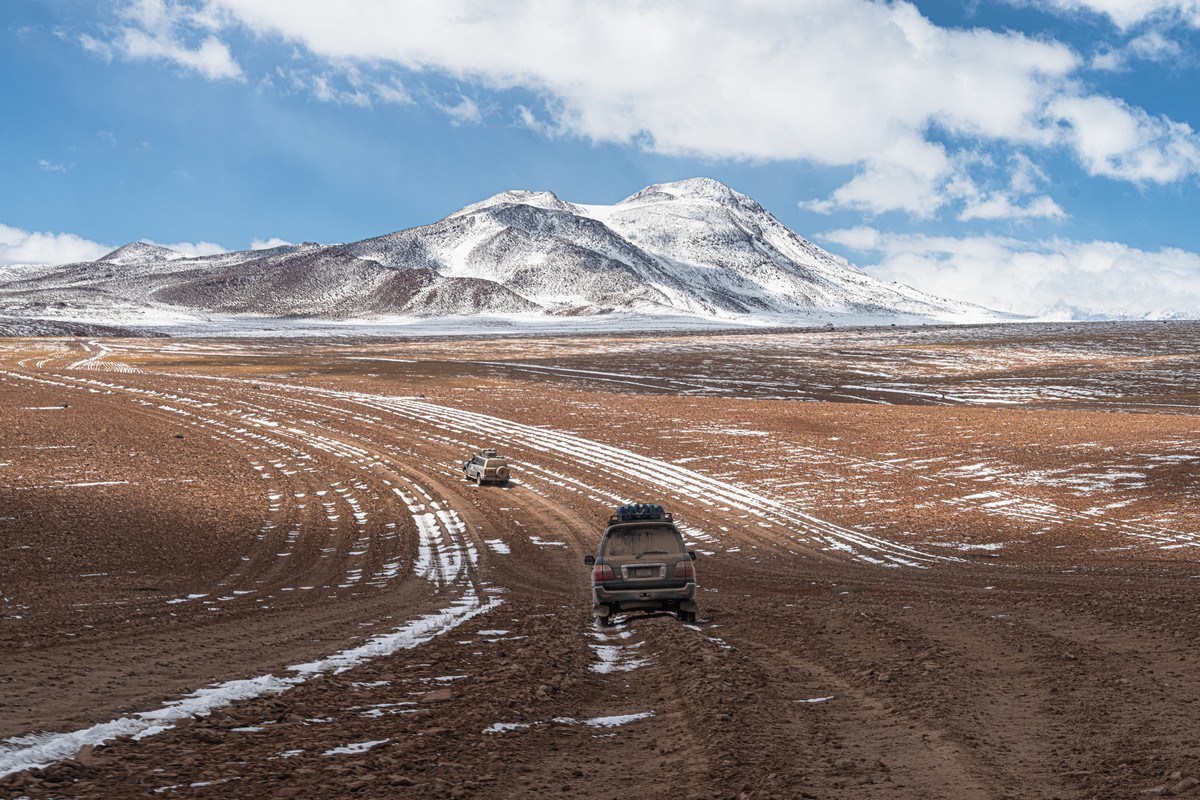
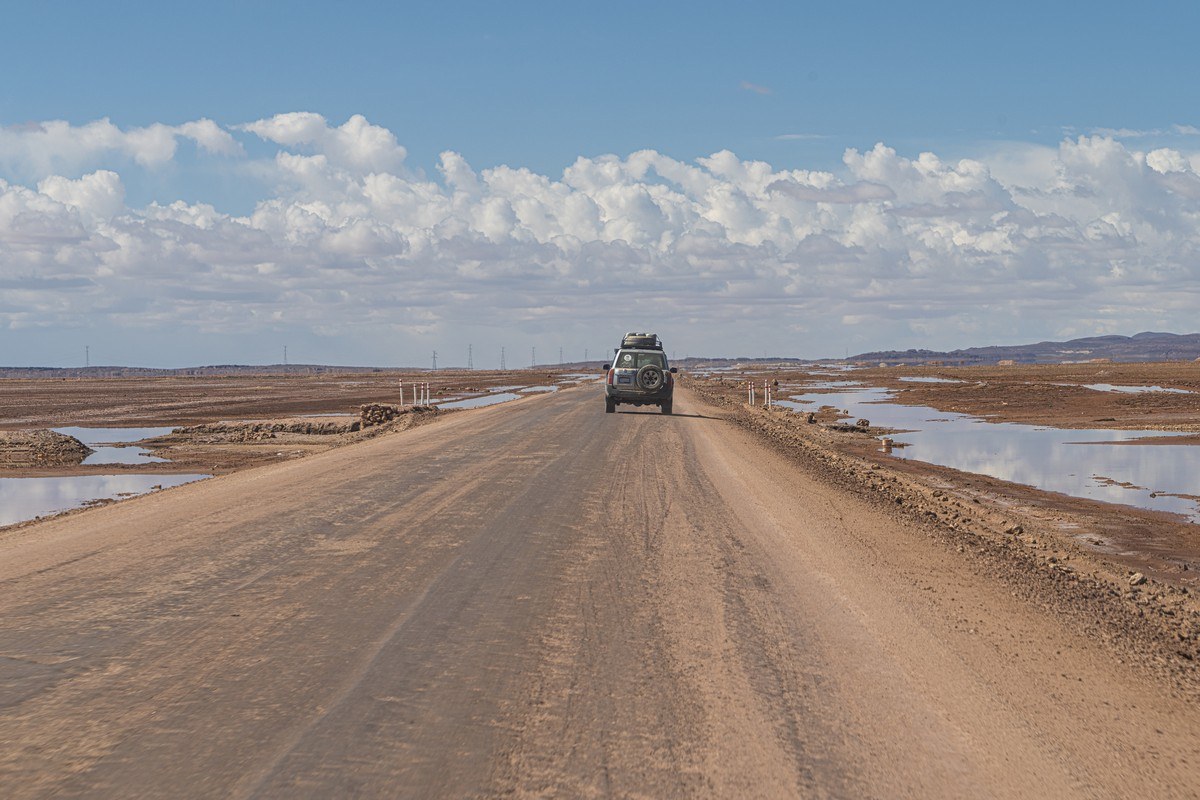
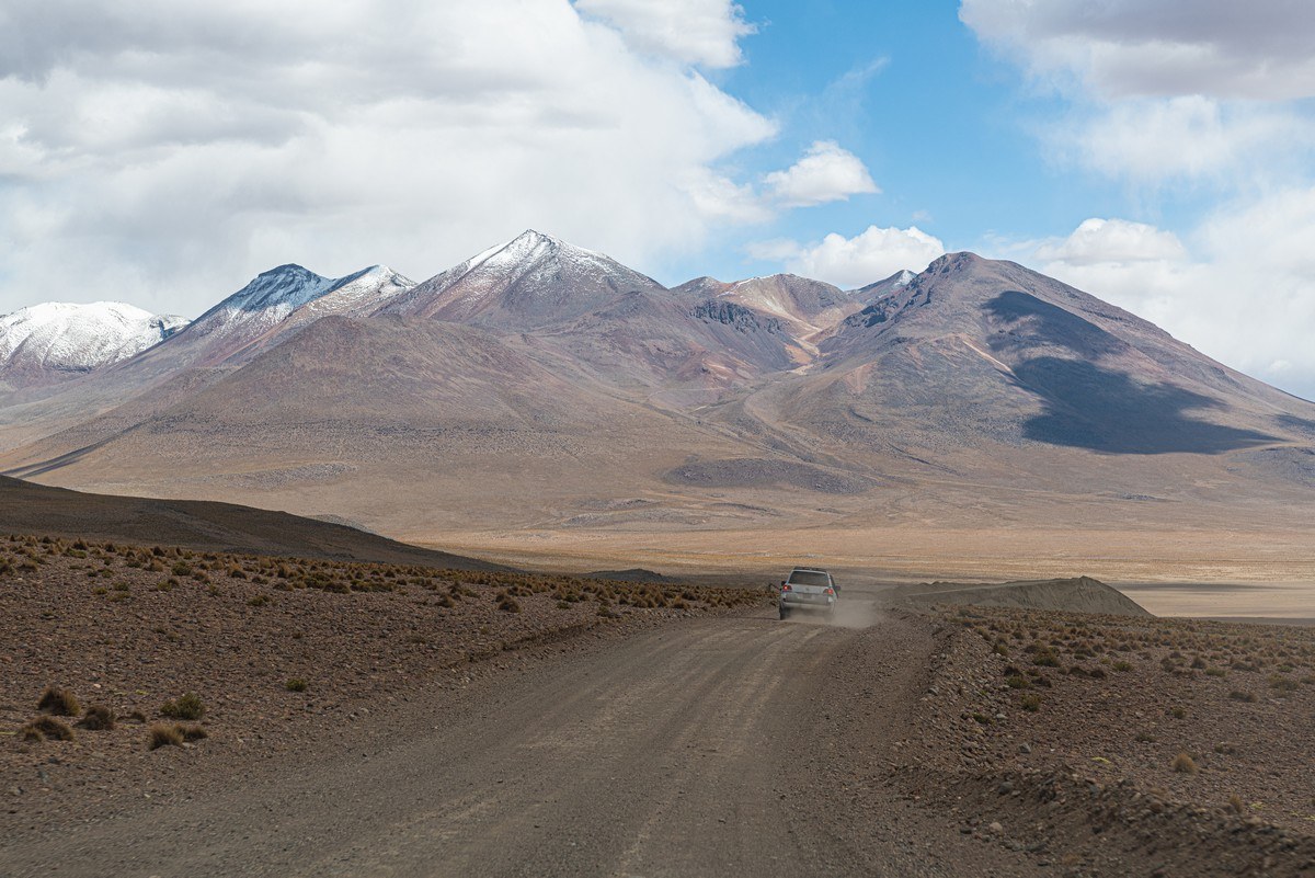
No road – only a vague direction to be headed in:
Rocky ravines:
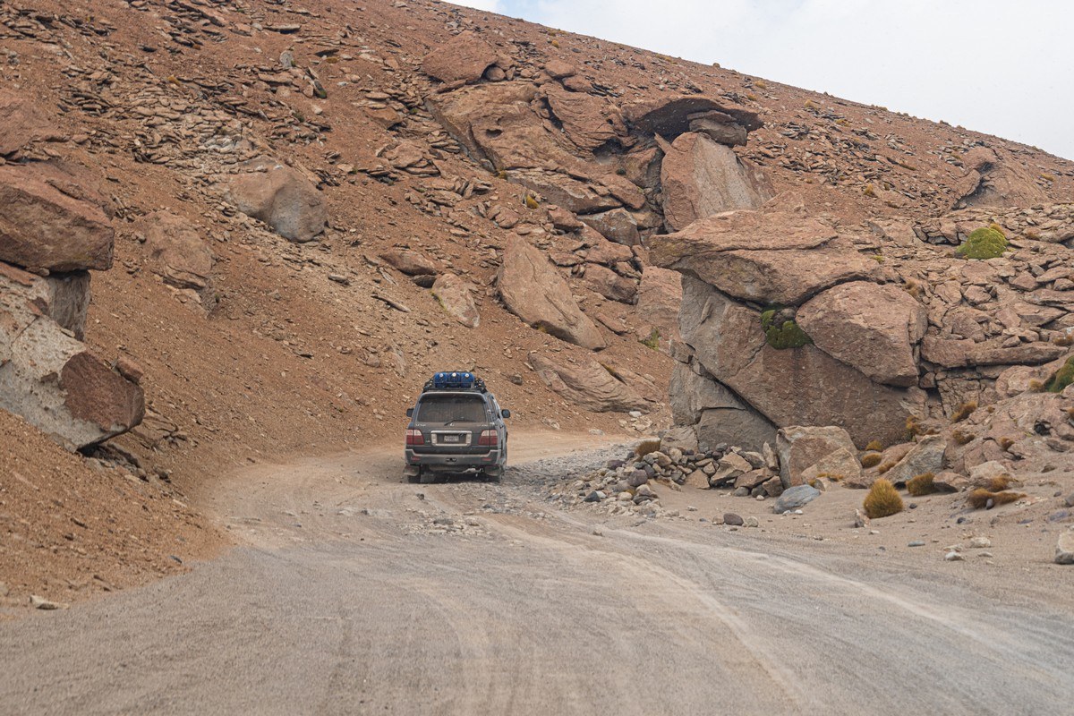
Driving here was far from comfortable, but what could we do? If you’re a passenger, it’s pure suffering – but if you’re the driver, it’s an adventure! Unfortunately, we only got to experience the suffering part…
The landscapes started changing…
…As did the weather: it started… snowing! ->
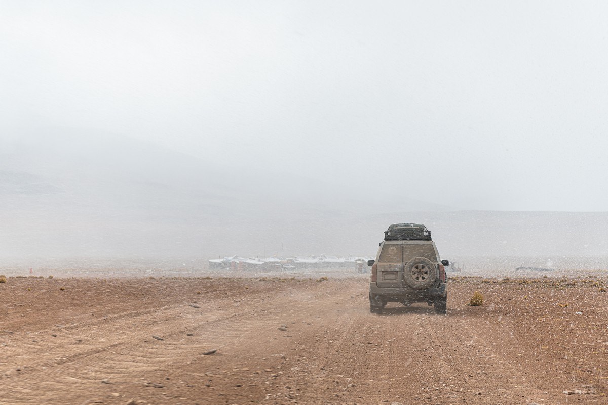
We finally arrive at the Tayka el Desierto hotel (more on it in a future post):
Part 3: Who knew a desert could be this unique: surreally contemplative, and full of mystique?!
Next morning, we were back to the typical getting up at the crack of dawn – around 6am. Come 6.40 we were already all packed and in our off-road vehicles and heading off for yet another exciting day. But before setting off, while the rest of us were still waking up, having breakfast, and getting ready, DZ was out capturing the sunrise…
He took two near-identical photos. I couldn’t decide which was better, so here they both are. And they’re of the direction we were heading in ->
Let’s go!…
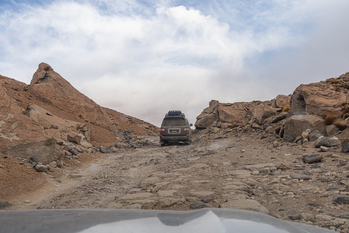
Again – nothing here you can really call a road. Each driver chooses their own path, which makes for great photo opportunities for fellow travelers:
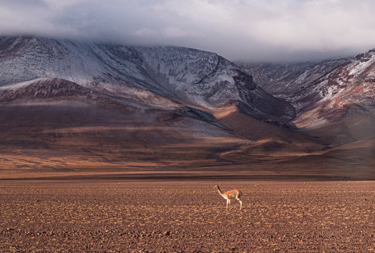
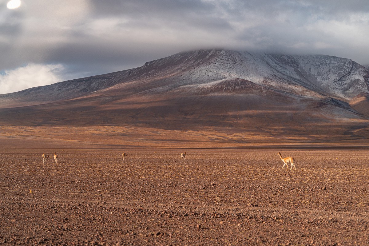
Wild vicuñas grazing. What do they even eat in this desert? Hard to say…
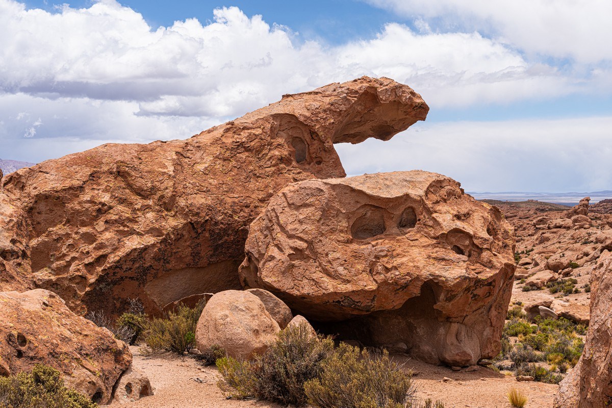
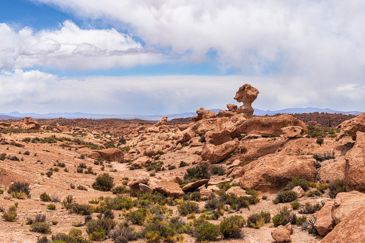
Every now and then bizarre rock formations appeared:
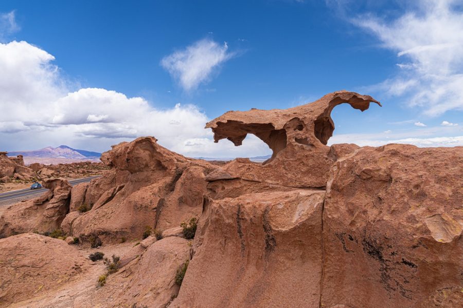
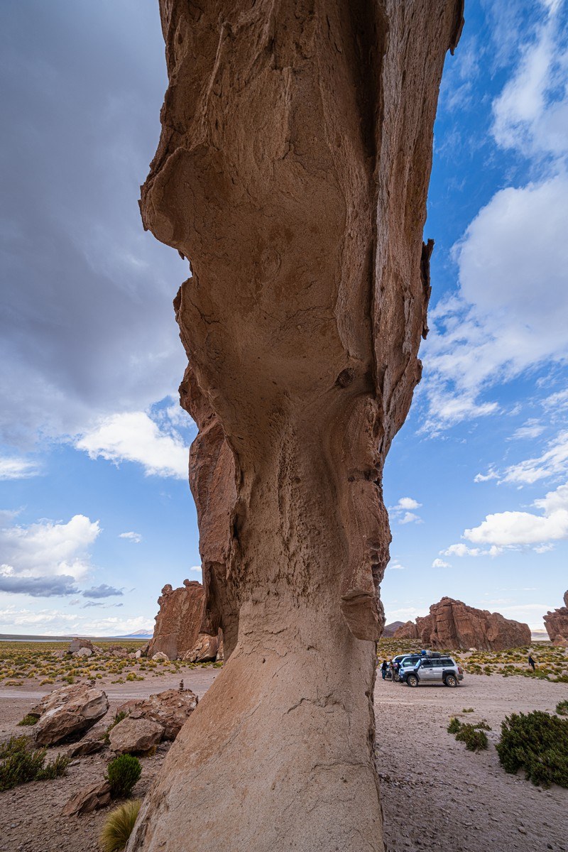
After about 30km, we reached our first point of interest. I don’t know its official name, but on Google Maps it’s marked as Rock Tree:
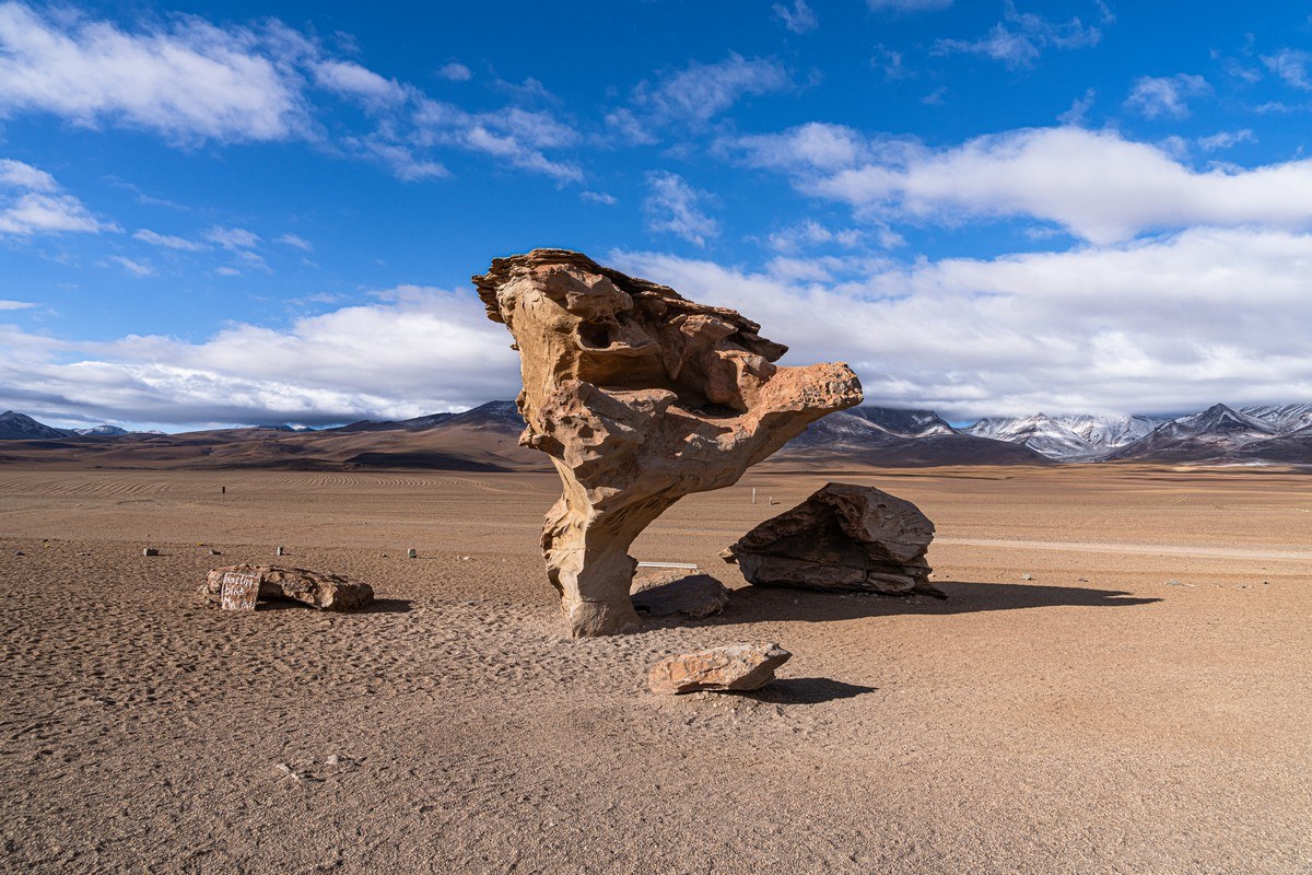
To fully appreciate the Rock Tree, it’s best to walk around and view it from different angles. From other perspectives, though, it doesn’t look quite as impressive:
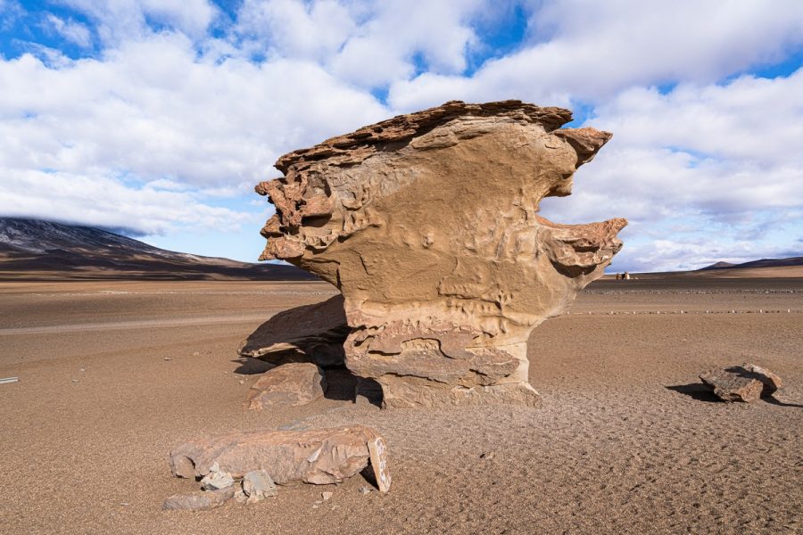
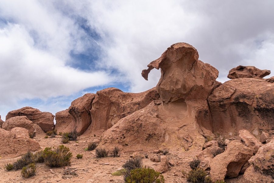
Most tourists just take a quick picture and move on, but I wanted to explore the surroundings – for there were plenty of other fascinating rock formations here:
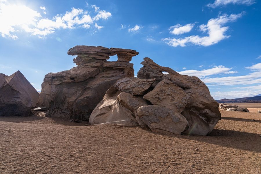
Some stones were decidedly mushroom-like…
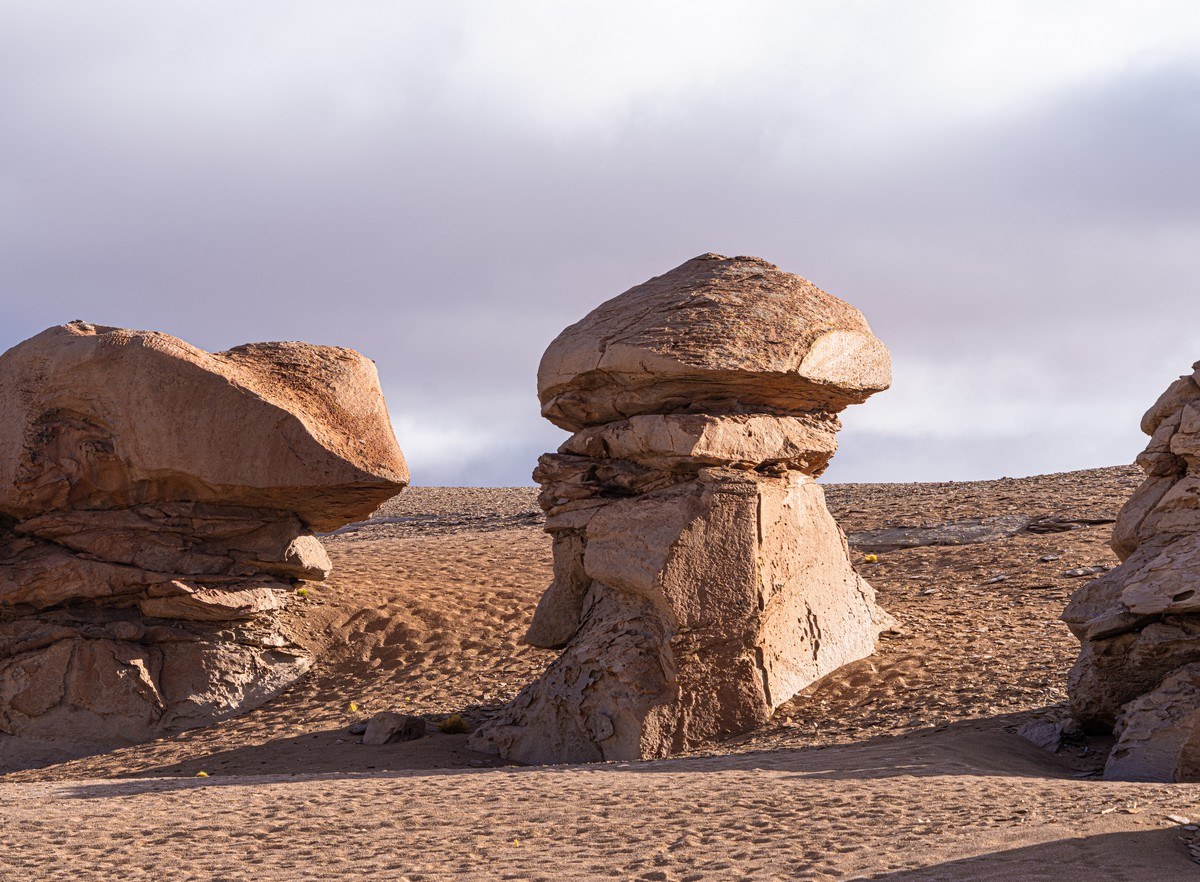
…Others stuck out of the sand like blades:
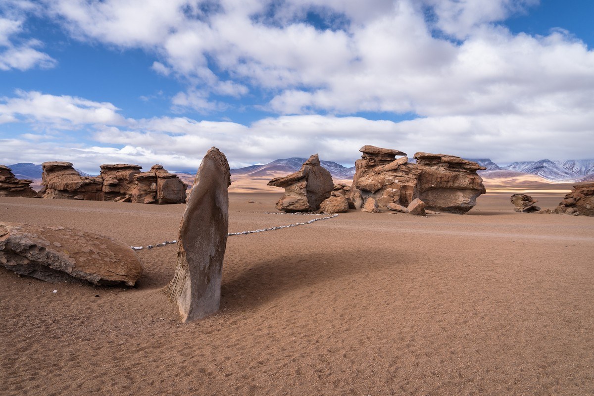
Here’s the whole of this rock garden:
Fifteen to twenty minutes was enough to walk around and see everything, then we were on our way – on a ~proper road again:
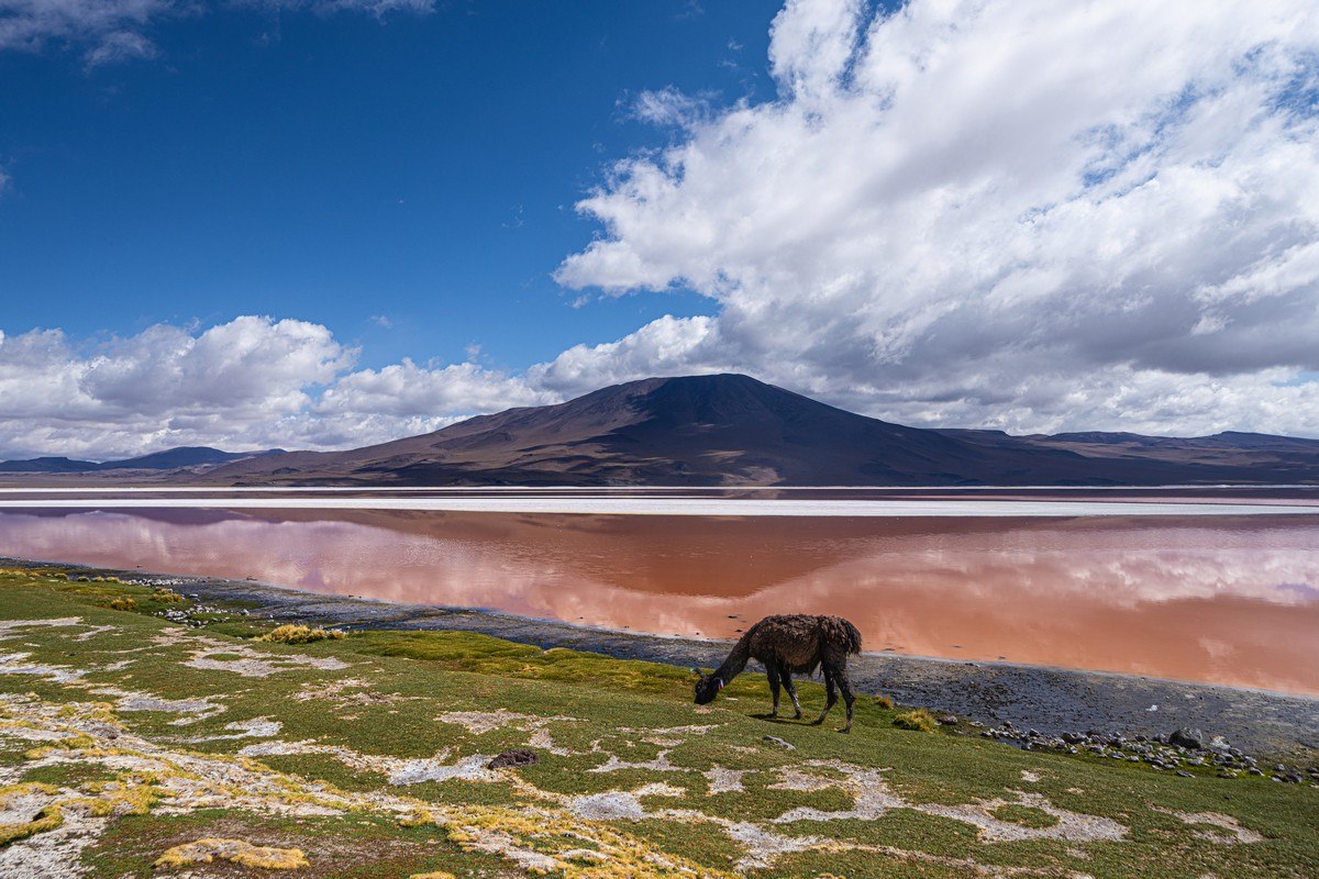
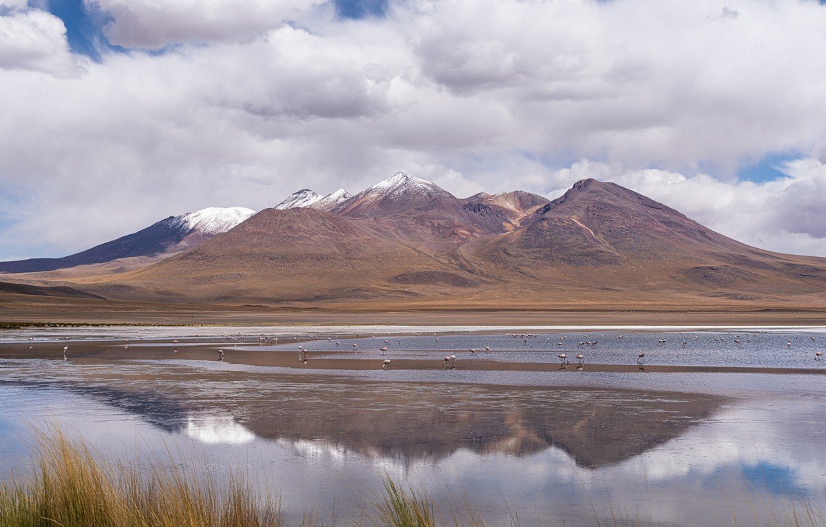
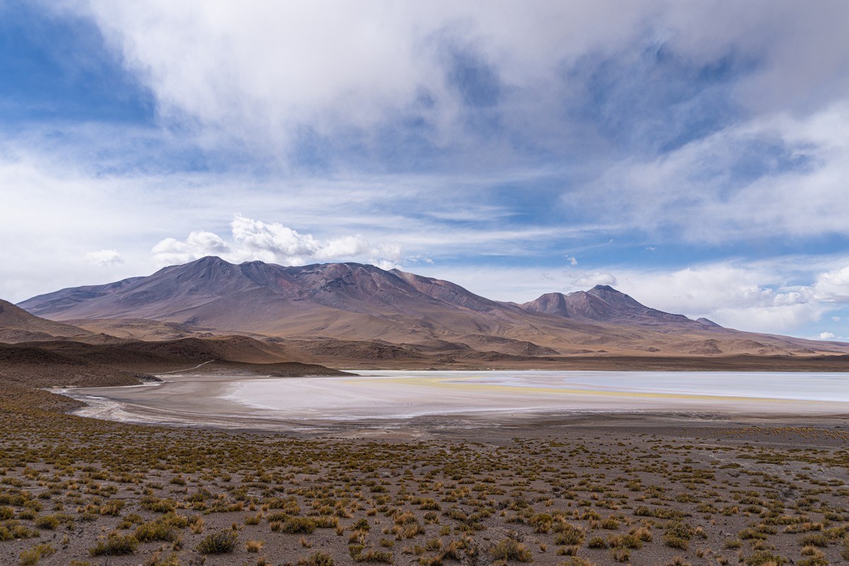
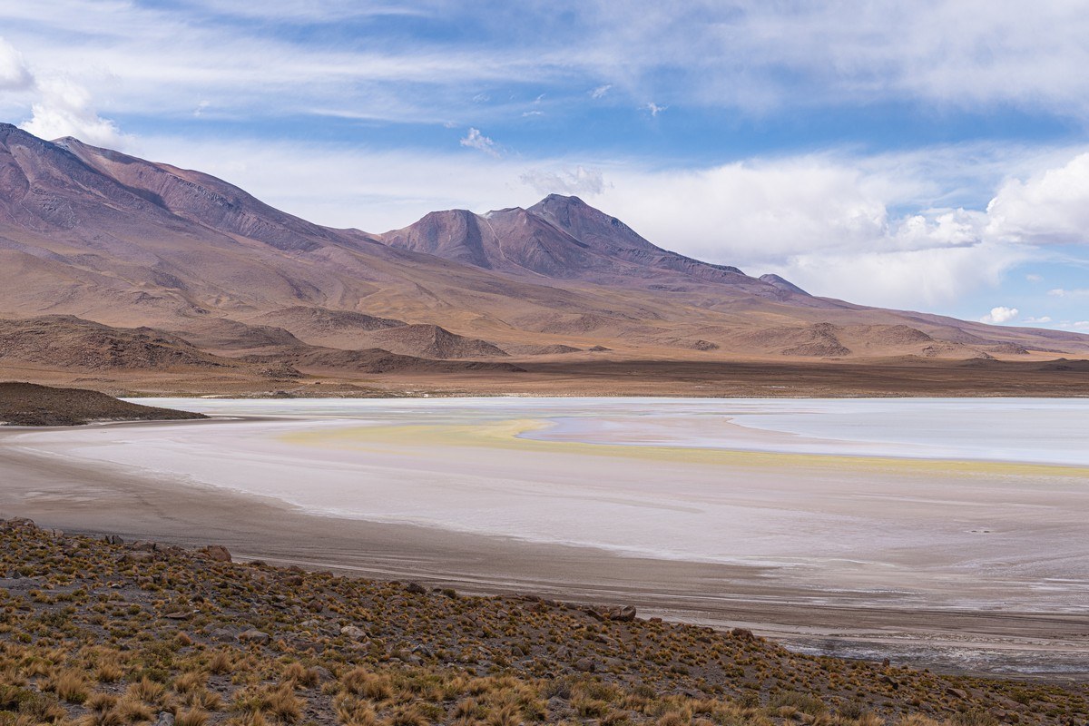
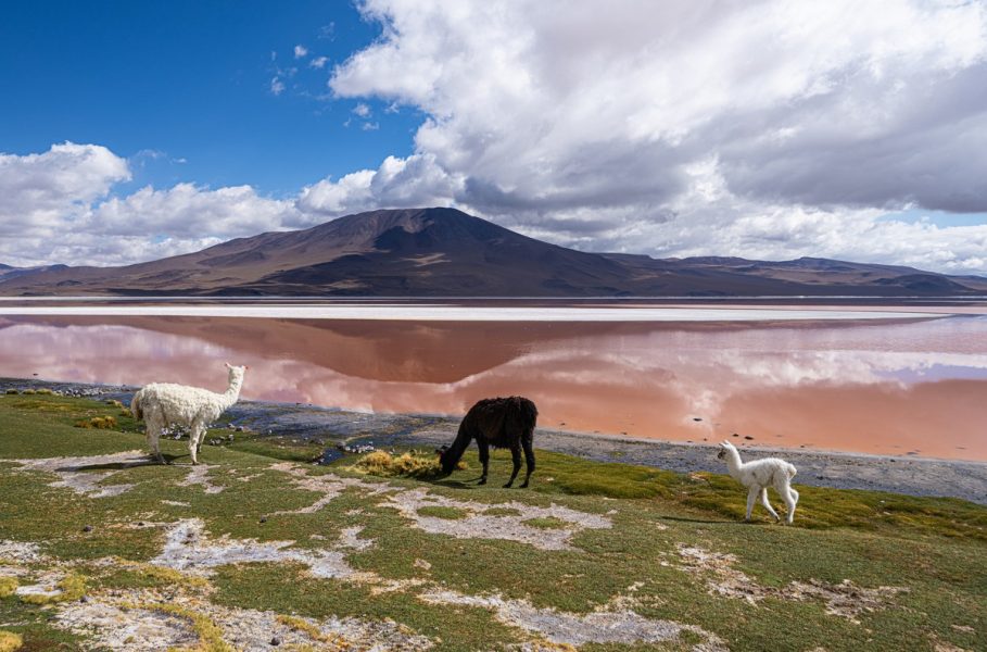
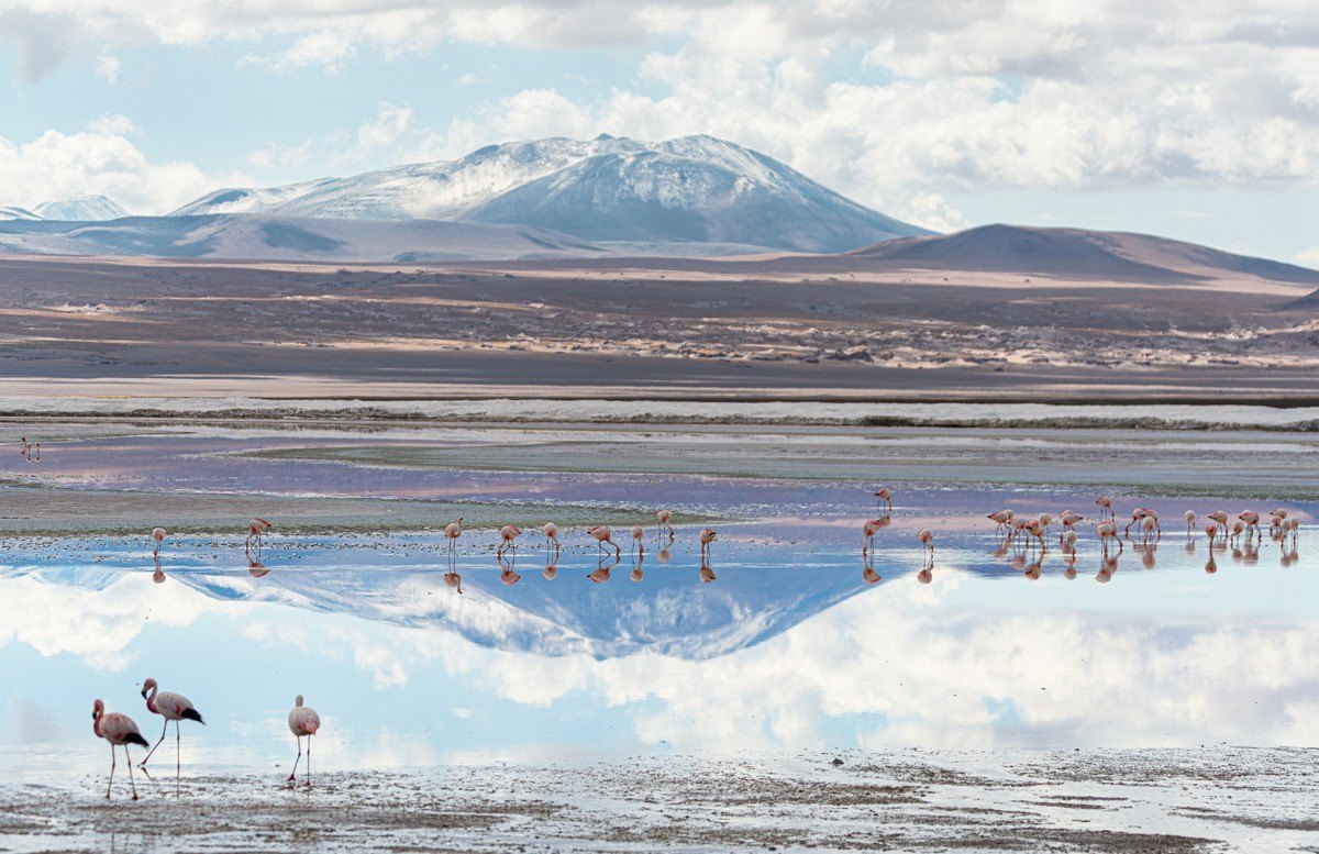
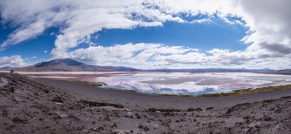
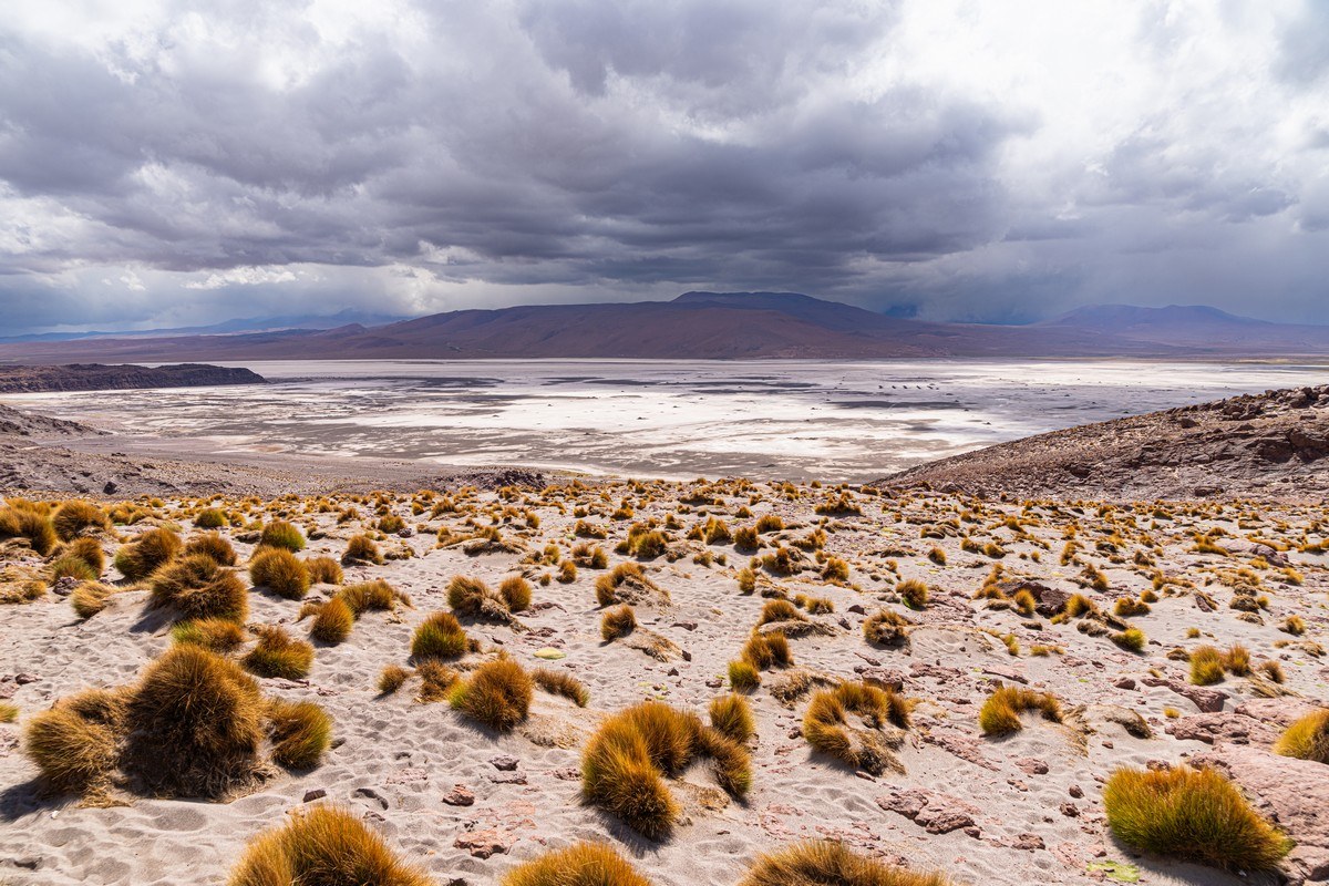
After 20km we arrived at Laguna Colorada (here). The name fits – this lake is indeed multi-colored:
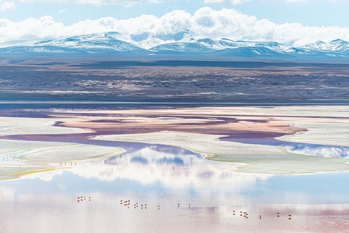
You could easily spend 40 minutes to an hour here, just soaking in the magnificent views. We didn’t get to find out why the water takes on this color – perhaps it’s due to minerals, or maybe some kind of algae gives it its hue.
// Such colored lakes are a rare phenomenon, but not unheard of. For example, in October of last year, we saw something similar in China (Emerald Lake), and in 2020 in Namibia – where certain algae were said to be responsible for the coloration.
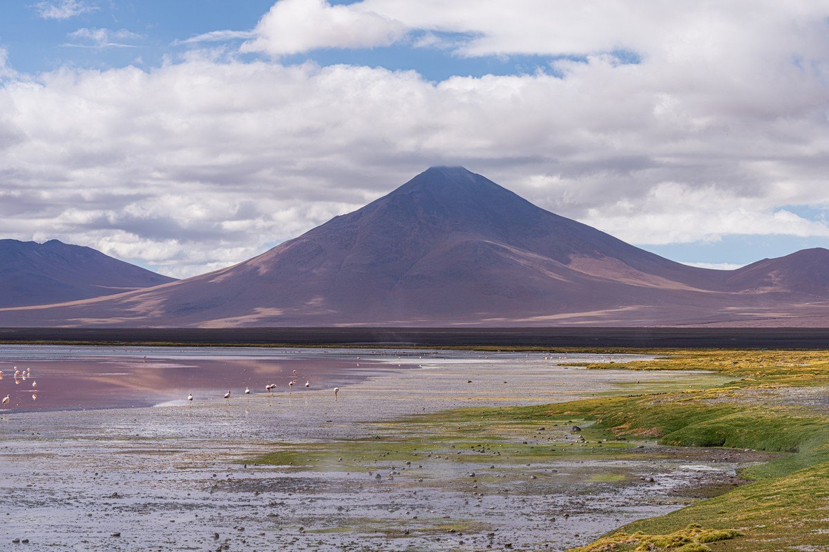
The ground and rocks here are clearly volcanic in origin. No surprise – considering the volcanoes all around.
Upon spotting some adorable animals, everyone naturally lined up to snap them all:
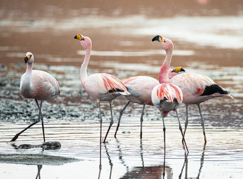
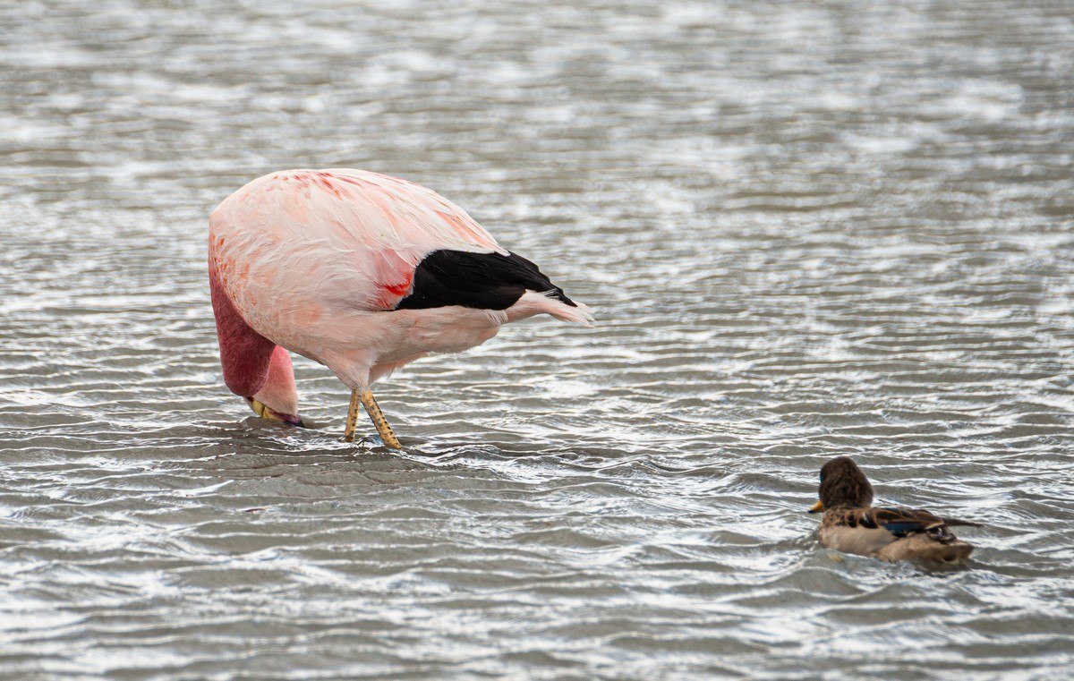
And of course – flamingos!
So majestic!
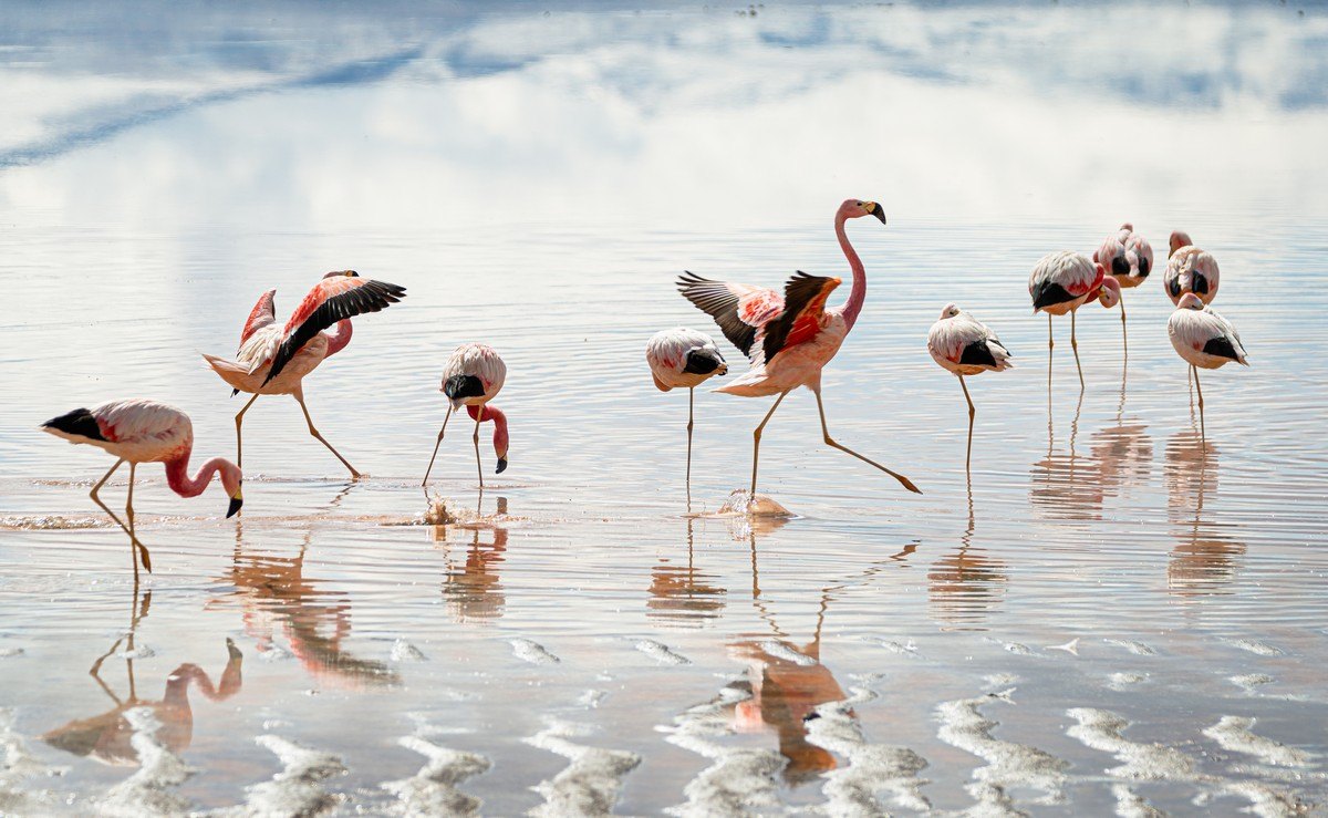
Absolutely breathtaking!
That was Laguna Colorada.
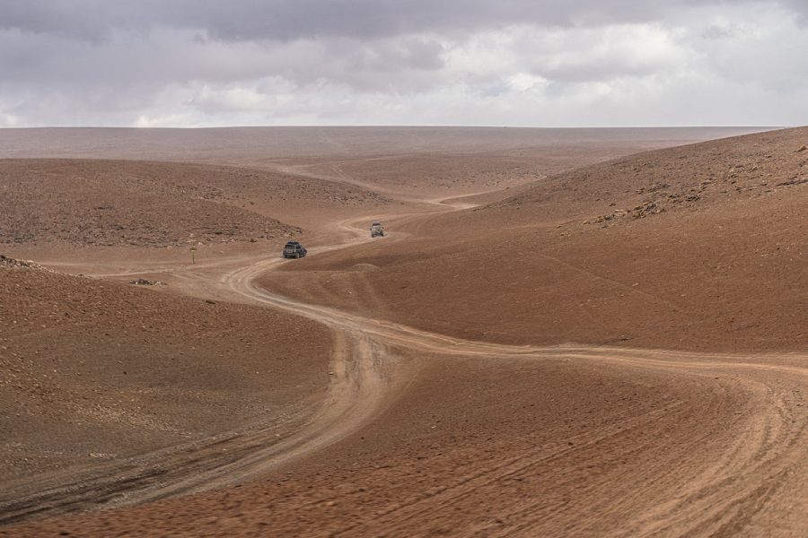
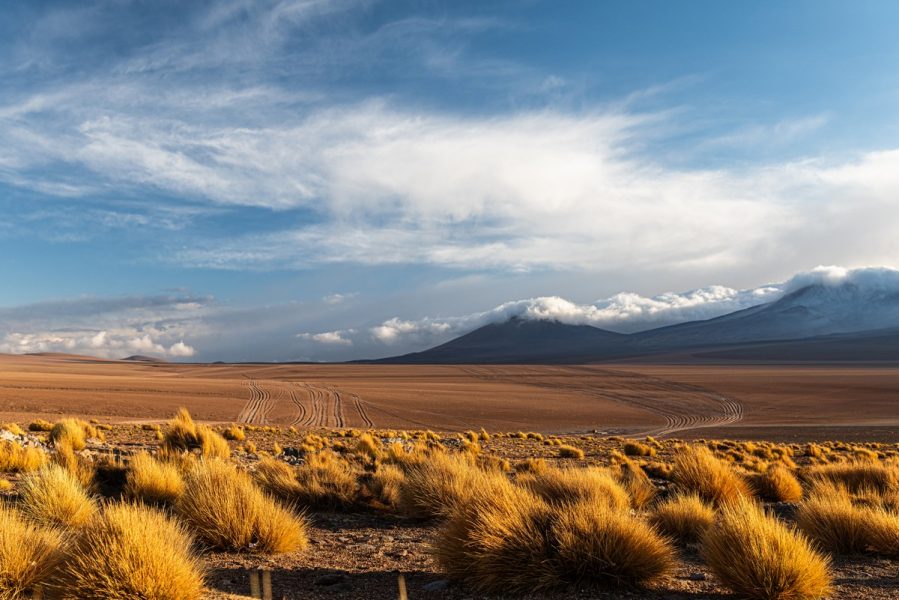
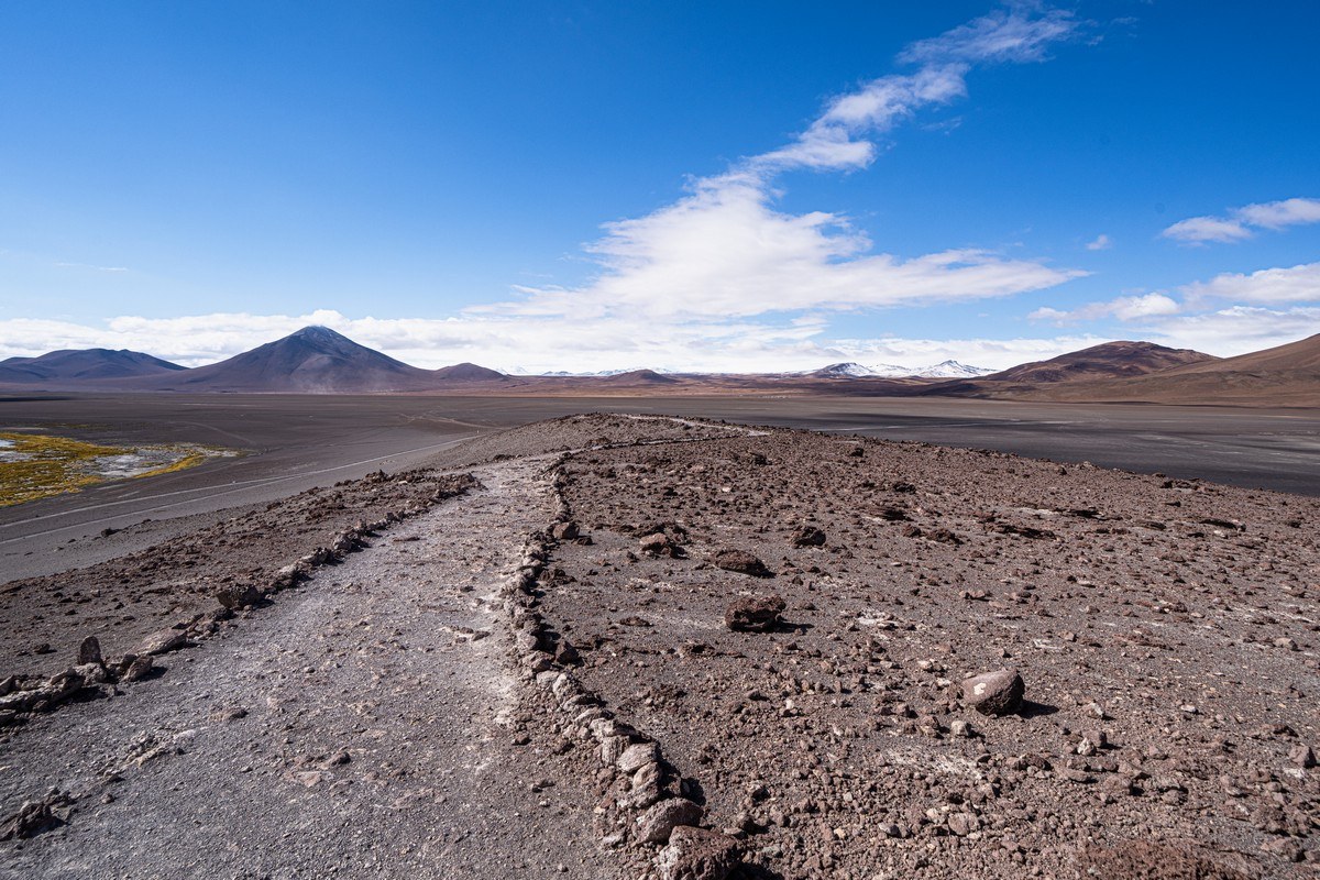
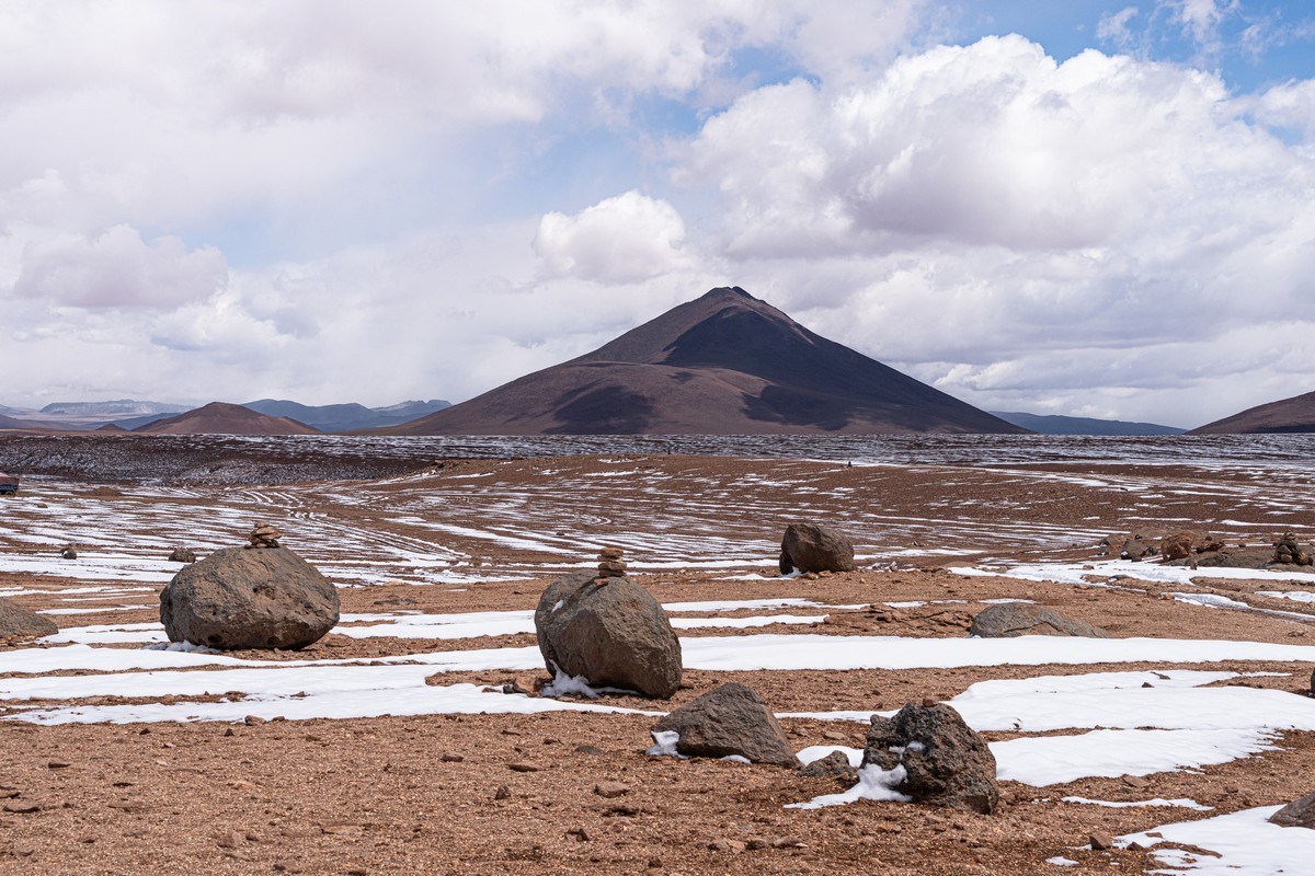
Our next stop was about 30km away – mostly off-road. That’s just how it is here: sometimes there’s a clear track, other times you’re just following parallel tire marks likely left by other tourist 4x4s:

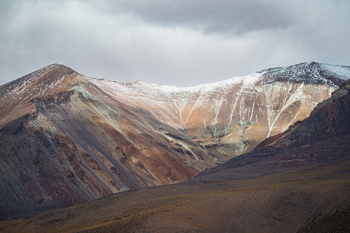
The highest point of our entire Altiplano journey: almost 5000 meters above sea-level! If I remember correctly, the exact altitude was 4950 meters. The views weren’t exactly masterpieces, but still impressive:
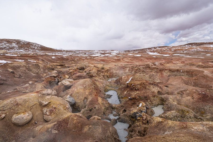
And here’s our next port of call: the bubbling mud pools of Sol de Mañana:
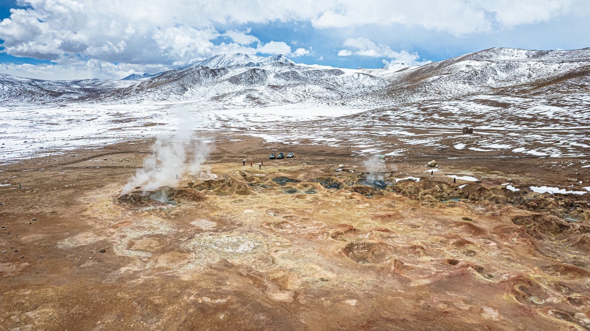
For those of us used to similar geothermal sites (like those in Kamchatka), this one wasn’t too amazing – but still pretty cool:
So it was a quick view of the volcanic activity (including much steaming), a quick whiff of the sulfur, and then it was time to move on. Our next stop was 32km off – the Salvador Dalí Desert (Desierto Salvador Dalí), here. No prizes for why it was named so ) ->
Surrealistic formations – over there:
They’re about 2.5km from the road, but for some reason tour vehicles don’t drive over there. So the only way to get a close-up view is either by flying a drone or using a good telephoto lens. Up close the formations looked even more bizarre:
Nature can get… weird – wouldn’t you say? In a good sense, of course ) ->
We decided to walk a little closer to these rock structures:
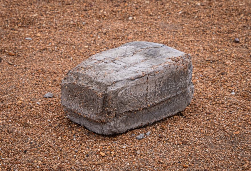
As we walked, we suddenly stumbled upon… a concrete brick! Just sitting there, in the absolute wilderness. How?! Why? There were no tire tracks anywhere nearby, not even within hundreds of meters…
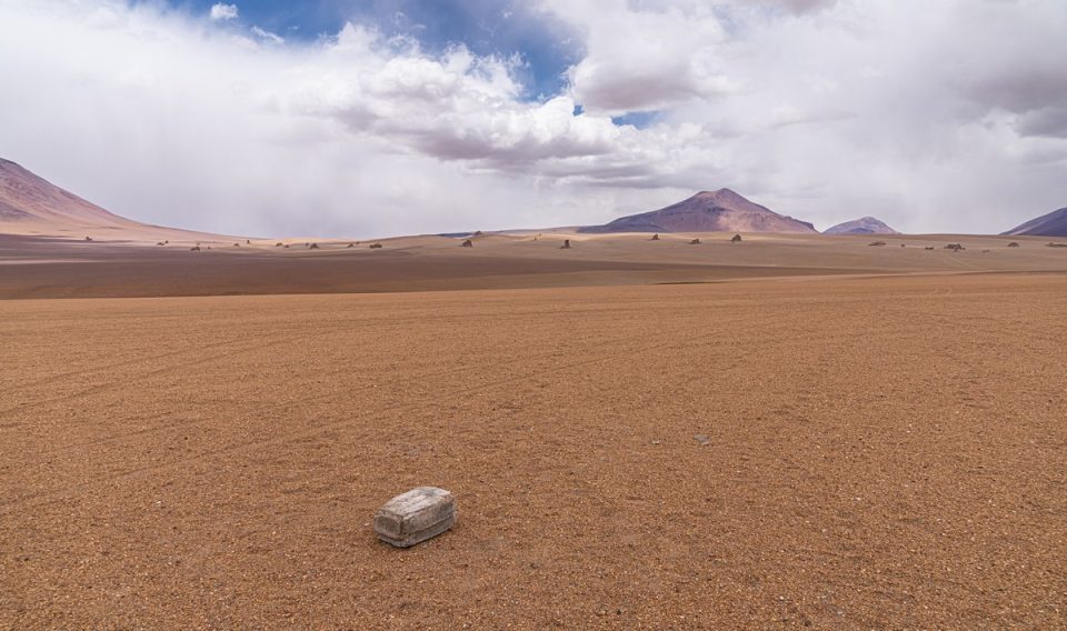
“Ok; whatever,” we thought, and headed back to our vehicles.
Next, we turned back along our route for around 10km to take a dip in the hot springs of Termas de Polques (and have lunch at the same time)…
There’s not much to describe or show here – just hot springs (though not that hot).
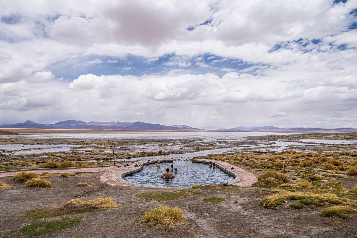
Soaking in warm waters midway through a long day – perfect!
Part 4: Middle-of-nowhere unique rock formations: alas, the last of the incredible sensations
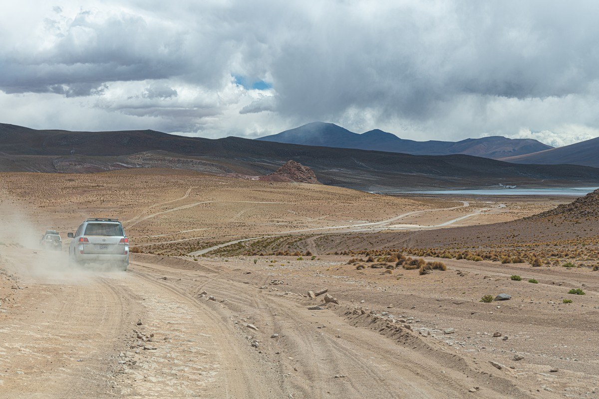
An hour or so later, duly revived and refreshed, it was back on the road for the long drive ahead: about 100km on barely existent roads. The maximum speed here was 30km/h, so we crawled along for about three-and-a-half hours. But at least the scenery along the way made up for it:
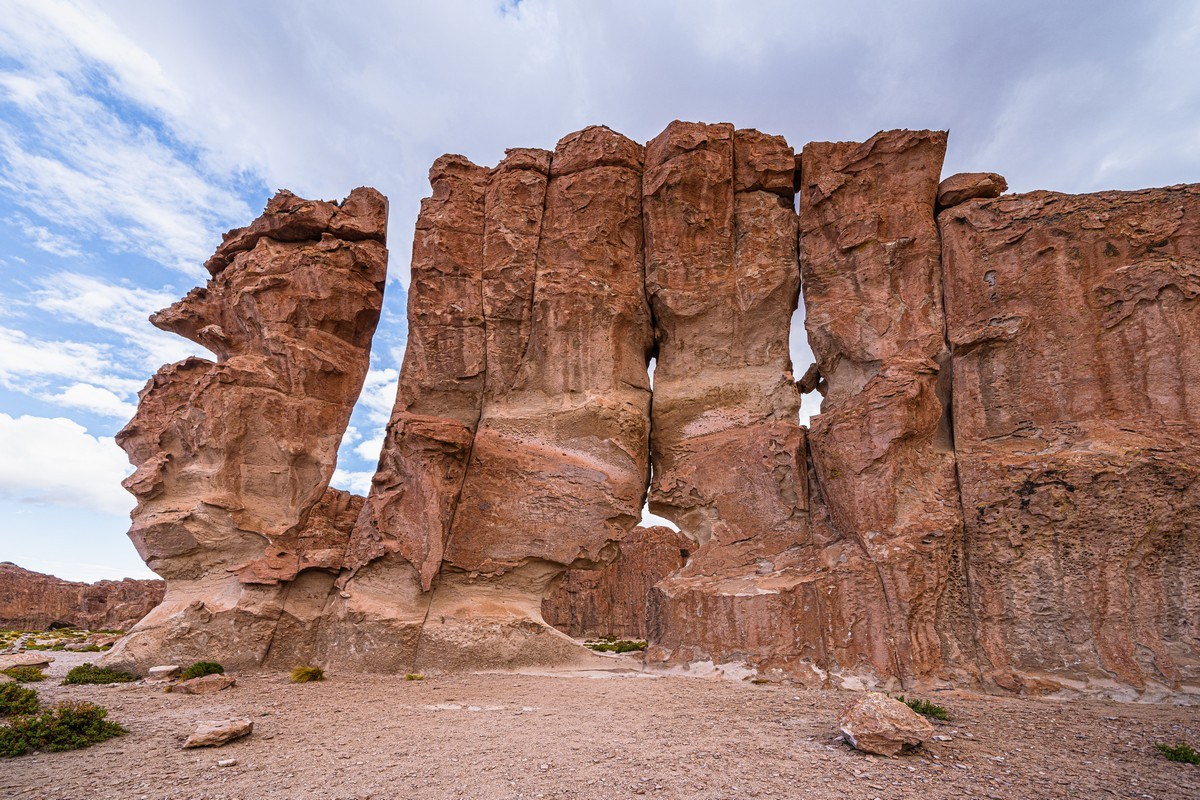
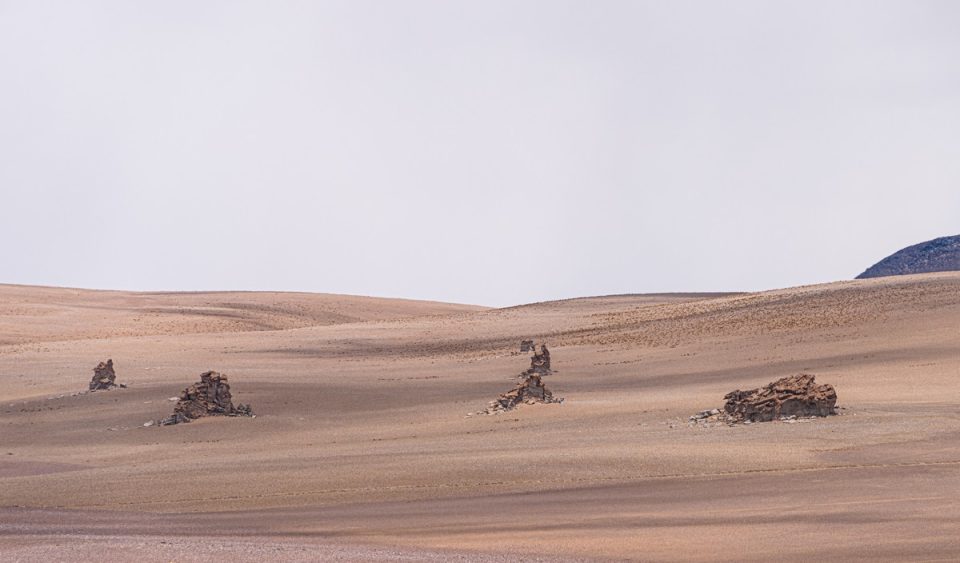
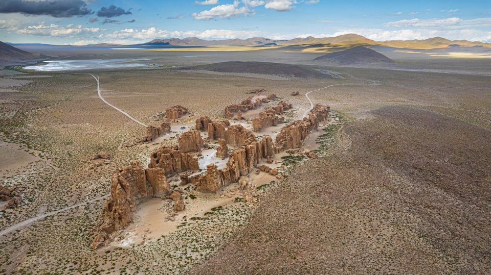
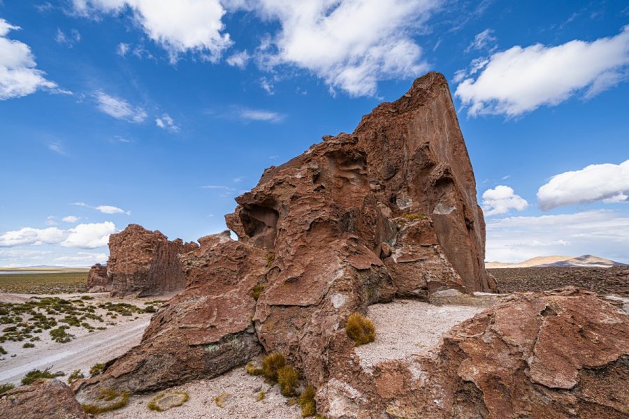
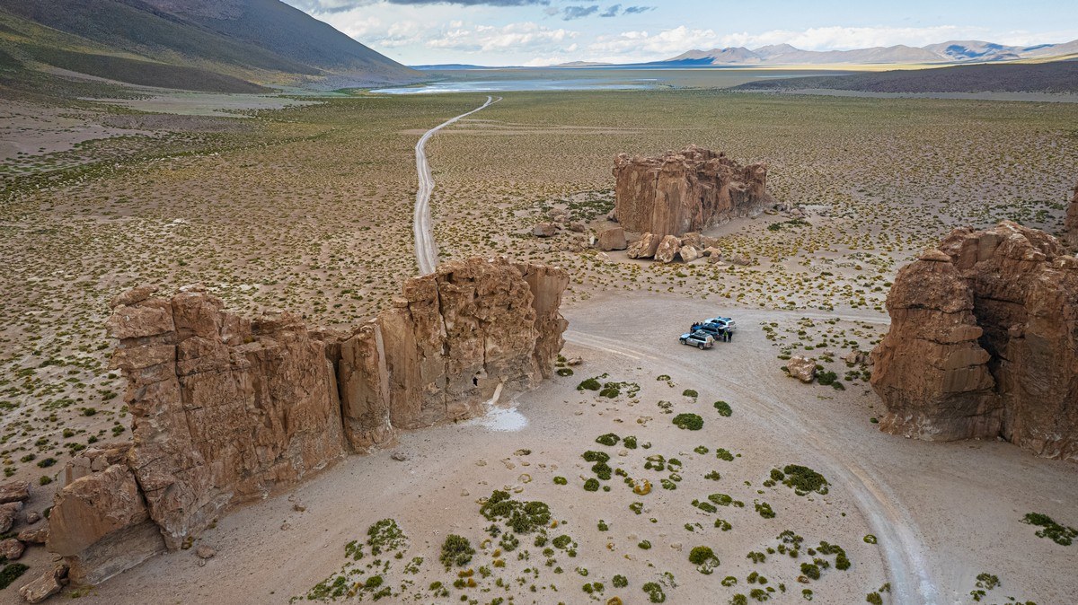
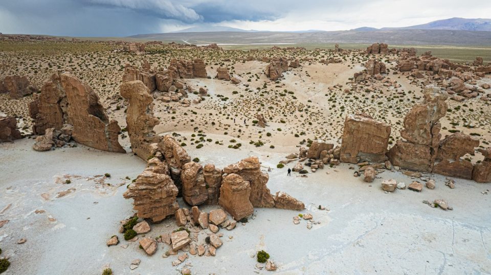
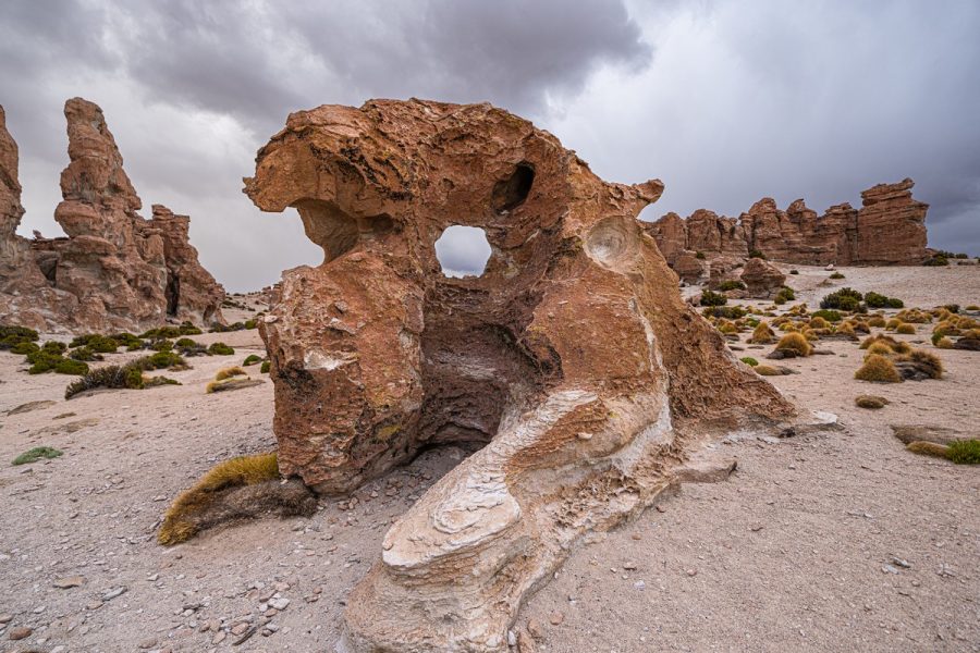
Our next stop was a place called Italia Perdida – a small collection of striking rock formations, here. And this is what it looks like:
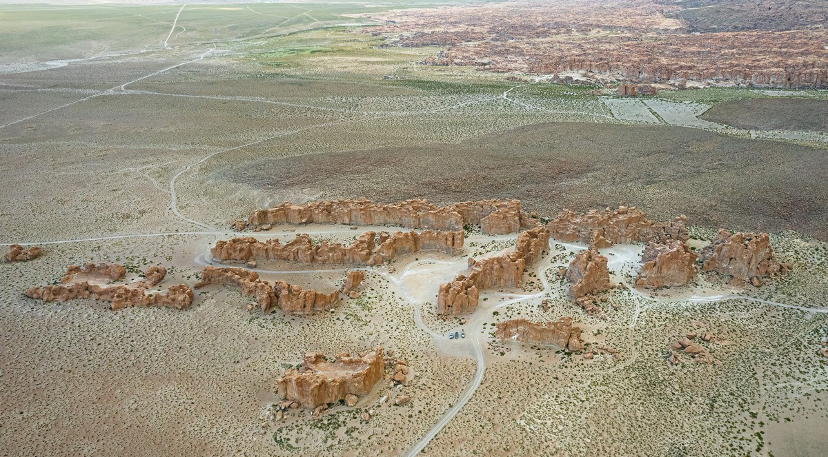
A fascinating location! A maze of rock formations:
Walking among these rocks felt like wandering down a street lined with apartment blocks:
Spectacular views!
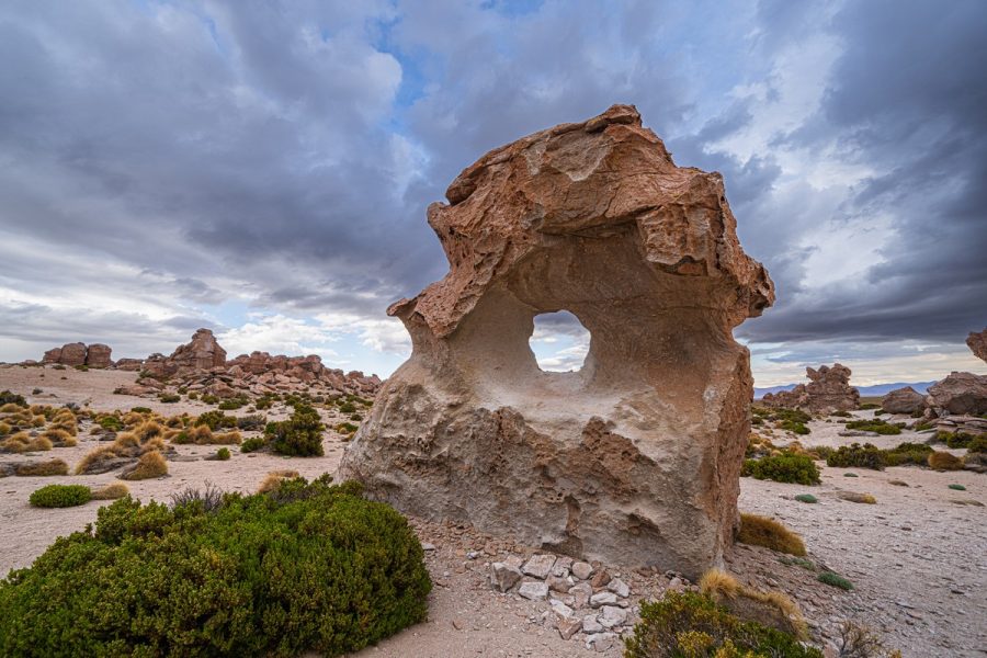
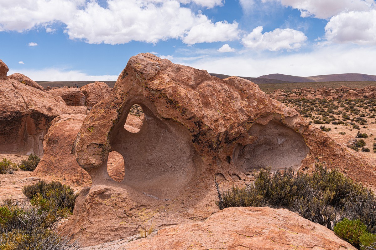
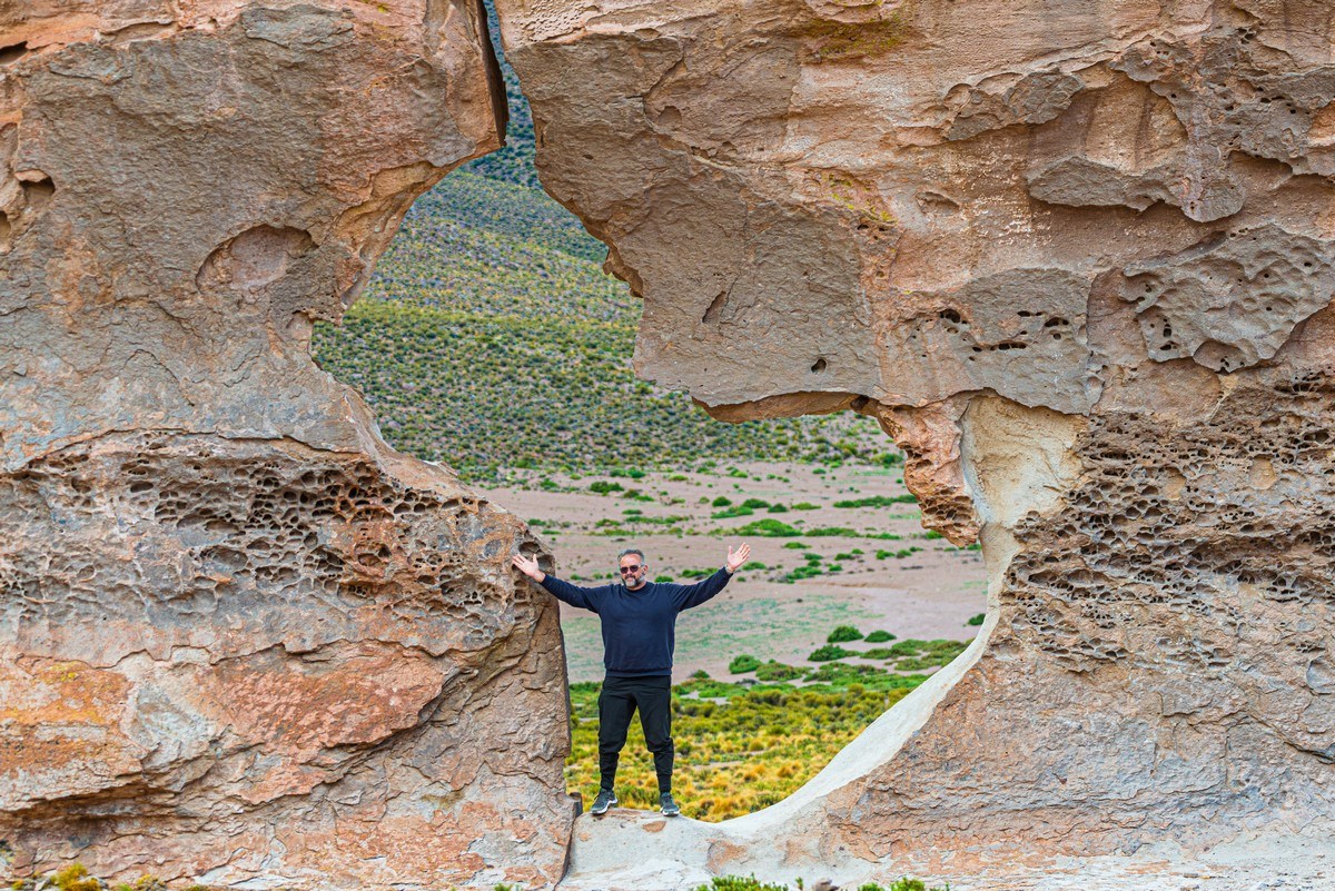
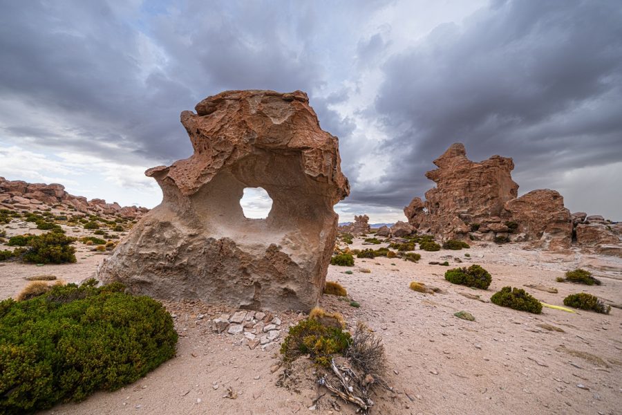
Hole! ->
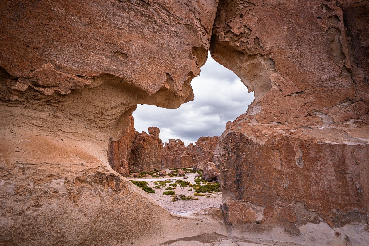
In the hole! ->
It was hard to grasp the size of these formations, so for scale we placed our Brazilian fellow traveler, KM, in said hole:
After a brief exploration – back on the road!…
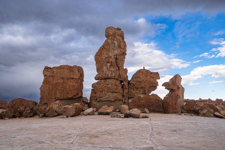
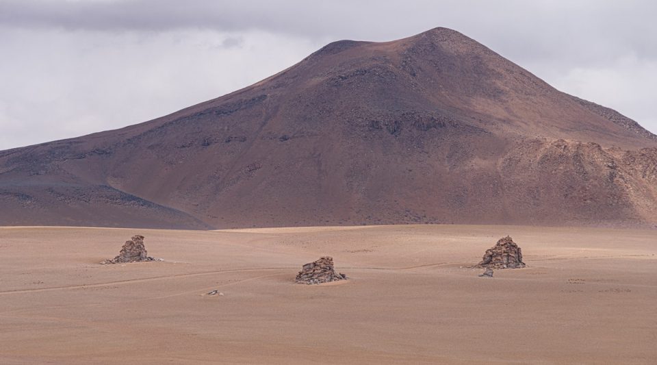
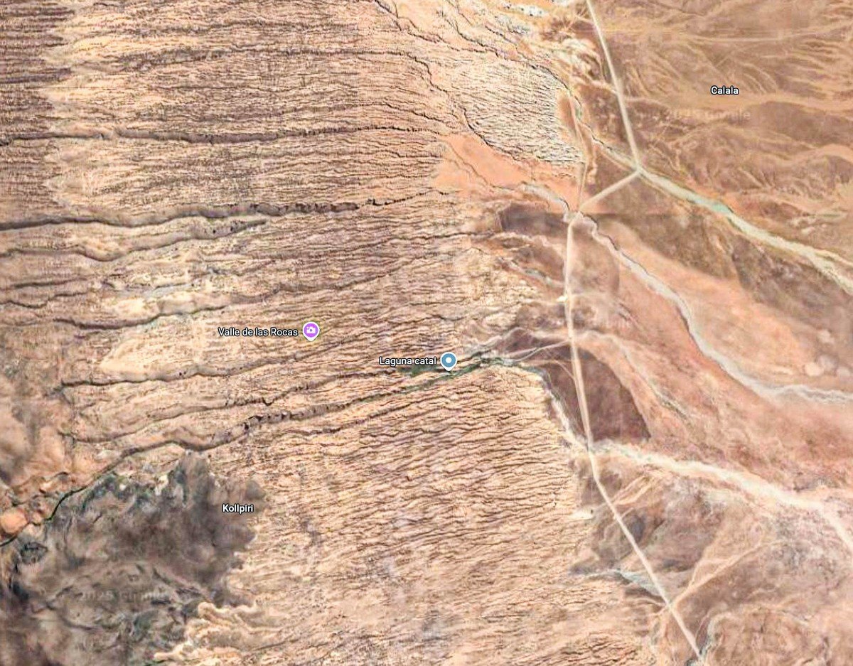
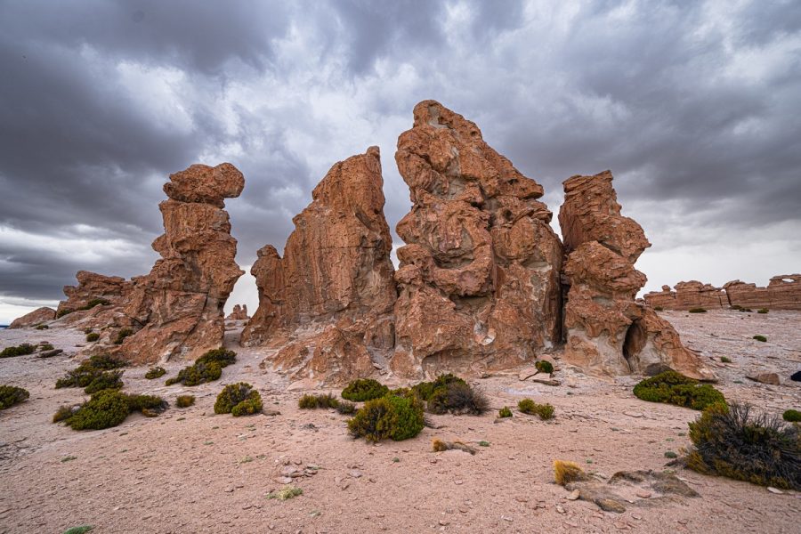
The final stop this day was at the Bosque De Piedras (Stone Forest), just 25km away, or about a half-an-hour drive on the relatively decent roads, here. And here it is:

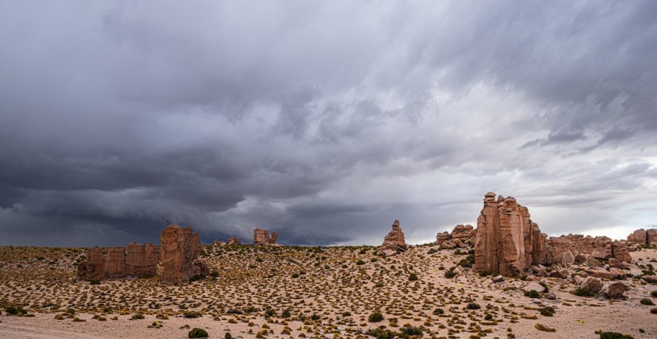
If you take a close look at the map, you’ll see that to the left of the road there’s an endless expanse of rock formations. As we were heading north it seemed like these rocky landscapes stretched on forever ->
Which goes to say that it appears that two days to fully explore these areas is nowhere near enough! At a minimum, you need three days – maybe even four. We were only shown the most significant spots, which left us wanting more…
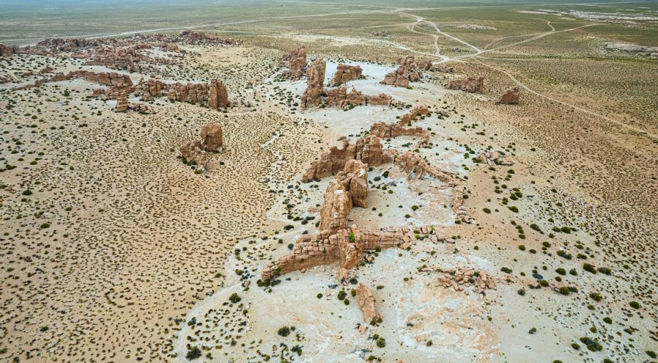
The rock formations here were striking, though not as abundant as in some other areas. 20 to 30 minutes was more than enough to look around:
Whoa! A rock with an almost perfectly round hole right in the center – nature really is incredible! ->
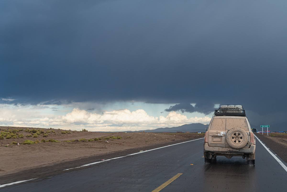
But our vehicles, legs, arms and heads were tired, so we all just wanted to get the day over with…
165km later we were back in Uyuni, where a hot dinner, shower, and soft bed awaited us all…
In all: two incredibly packed travel days, a dozen amazing locations, and around 270 + 430km covered. Not bad!
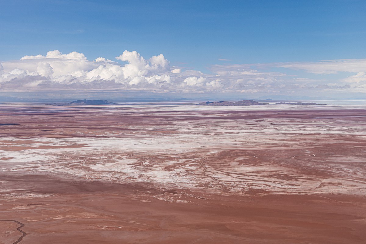
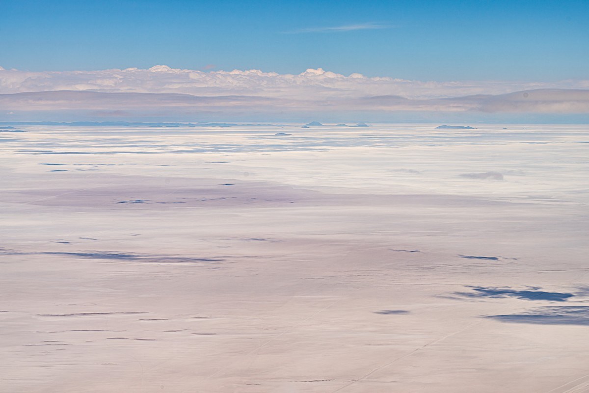
Next morning we were back to air travel and heading back to La Paz. Once again, surreal landscapes out the window:
Maybe I should print this photo and hang it on my wall in a fancy frame? ->
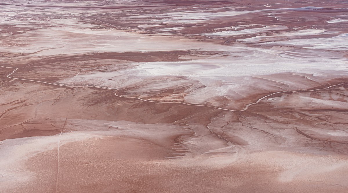
The Uyuni Salt Flat again (pro tip: sit on the left side of the plane for the best view!):
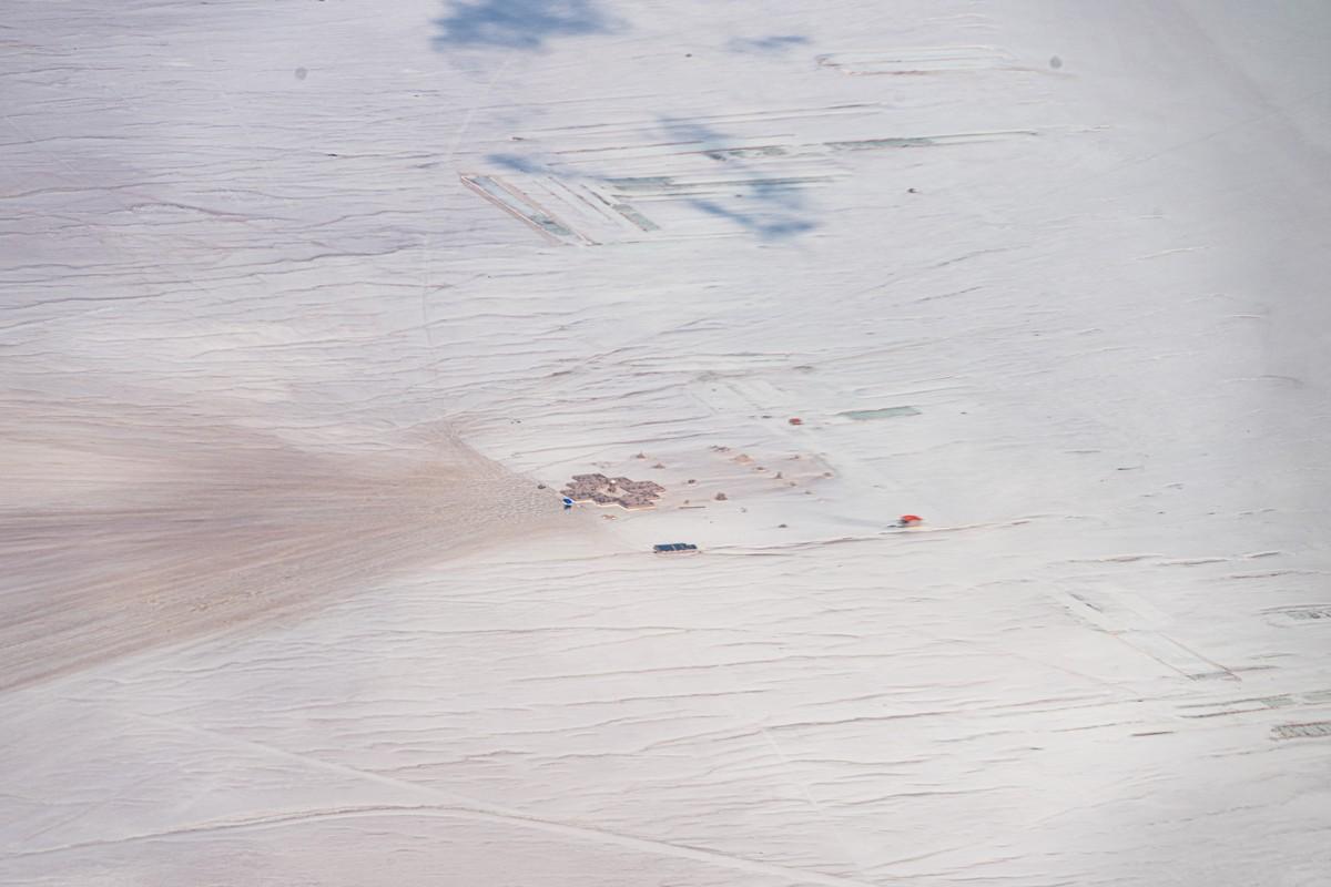
And there it is again – the hotel built from salt blocks:
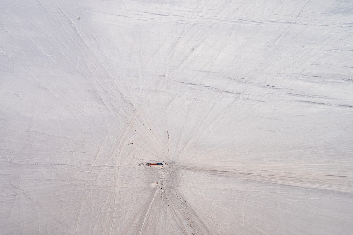
And the maze next to it:
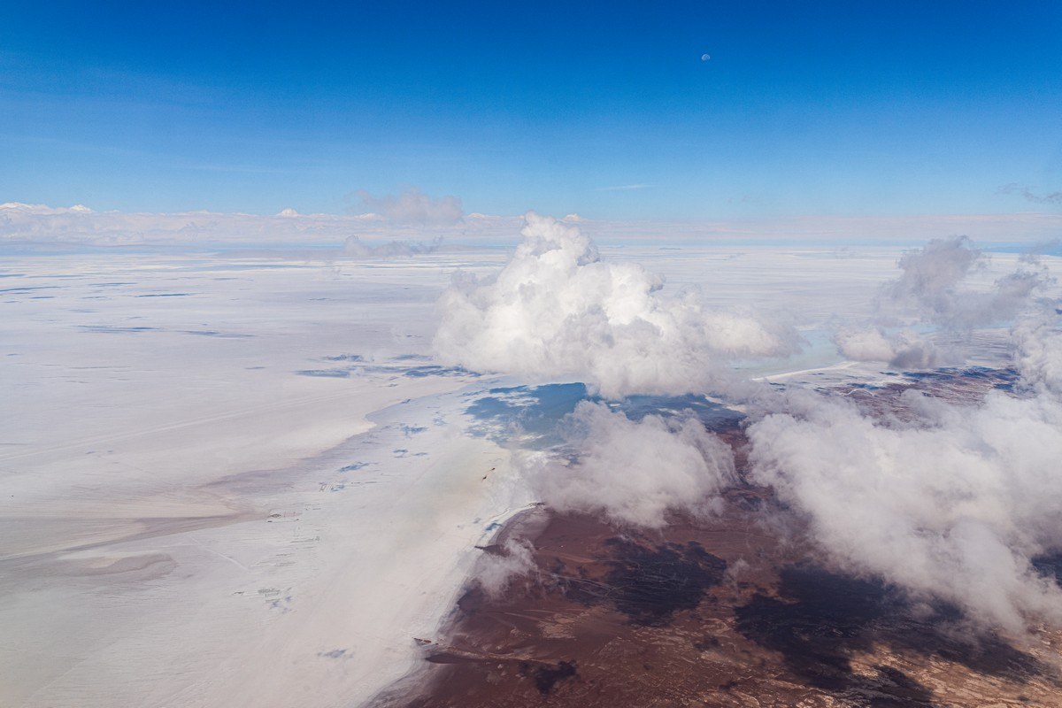
And that’s all for Uyuni – but I already want to go back. By the way, center/top-right in the next pic – you can see the moon. And I’m not sure I’ve ever seen it so small ->
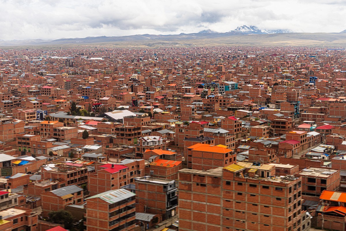
Coming in to land – again the endless brick jungles of El Alto through the window:
Up next – exploring La Paz, which turned out to be quite an experience!…
The best photos from our LatAm-2025 trip are here.

