February 6, 2020
Namibian pink feathers, pink lakes, and mysterious geology.
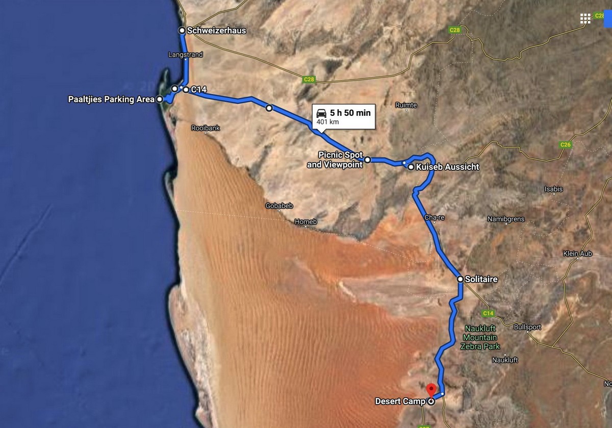
Skeleton Coast – done. Time to crack on further along our Namibian route. Next up – the country’s famous dunes, which are best seen at Sossusvlei. From Swakopmund (where we stayed the previous night) it’s around 400km. Sounds a lot, but when I tell you that those 400km were perhaps the most interesting and intense of any road I’ve been on – ever – well… the more distance the merrier!
For on this journey we experienced: flamingoes and pelicans, a mysterious mountain with endless views all around, a deep gorge, never-ending roads as straight as die, our crossing the Tropic of Capricorn, and our car getting stuck in the sand! Accordingly, plenty of words coming up describing this extraordinary journey, and plenty more photos too. // And it turns out I took 200 photos on this day – that’s one for every two kilometers!
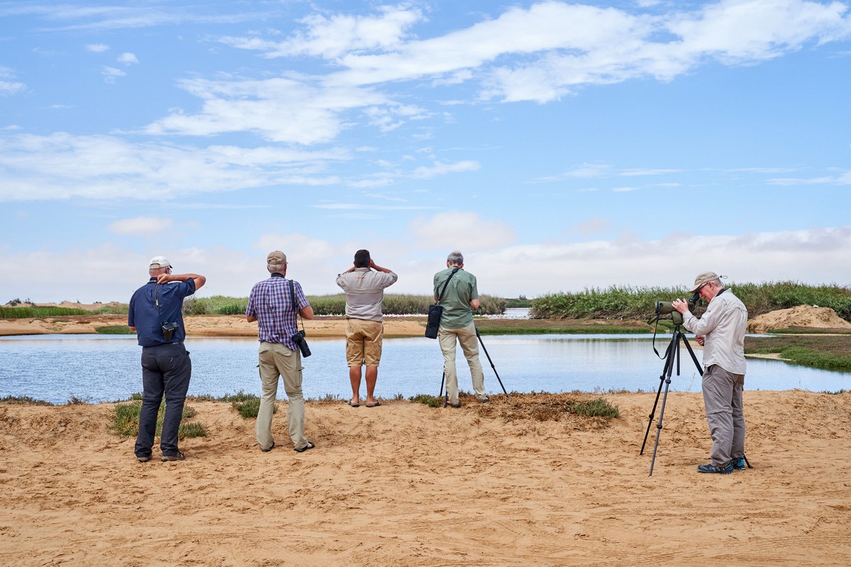
Our first stop, just ~40km from Swakopmund, was Pelican Bay, near Walvis Bay, here. Now, normally, I’m no big fan of birds (apologies to those who are, ornithologists and the like), but here was some kind of birdie paradise – even I found it not short of fascinating.
And these weren’t just any old pelicans. They’re some kind of extra-rare breed. Here they are:
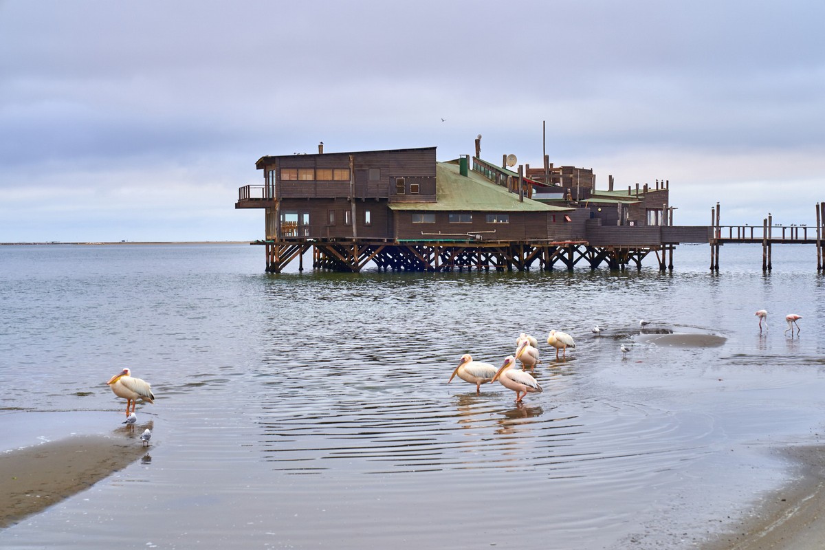
During low tide, they play around on the sandbanks:
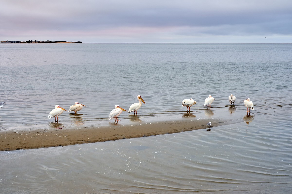
They don’t let you get near; but they don’t walk off too far either.

You need a telephoto lens to get interesting pics. Such beauties!


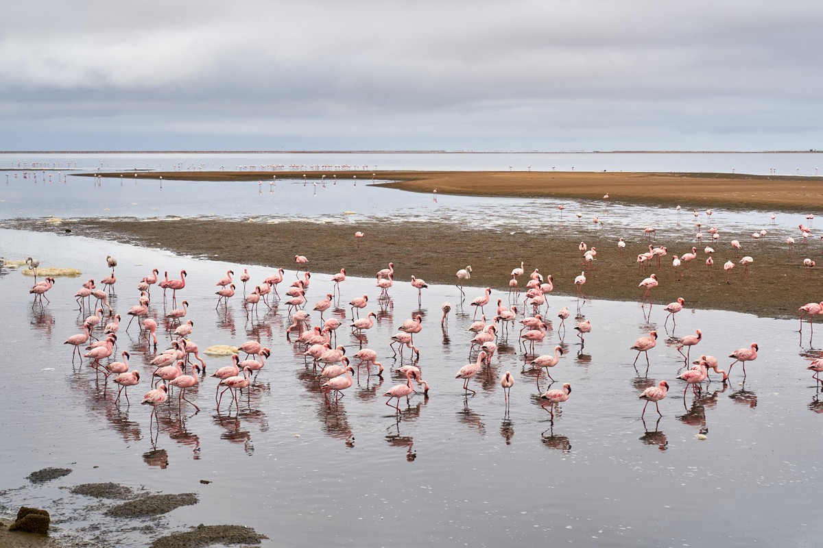
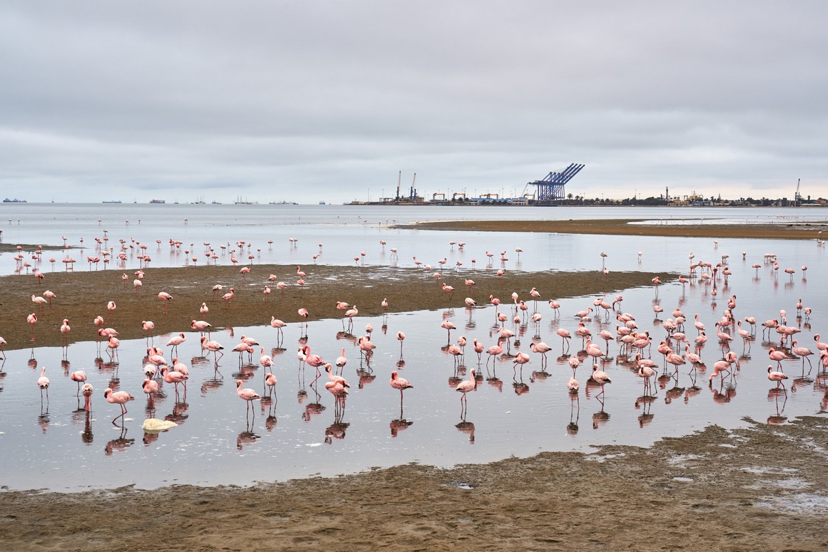
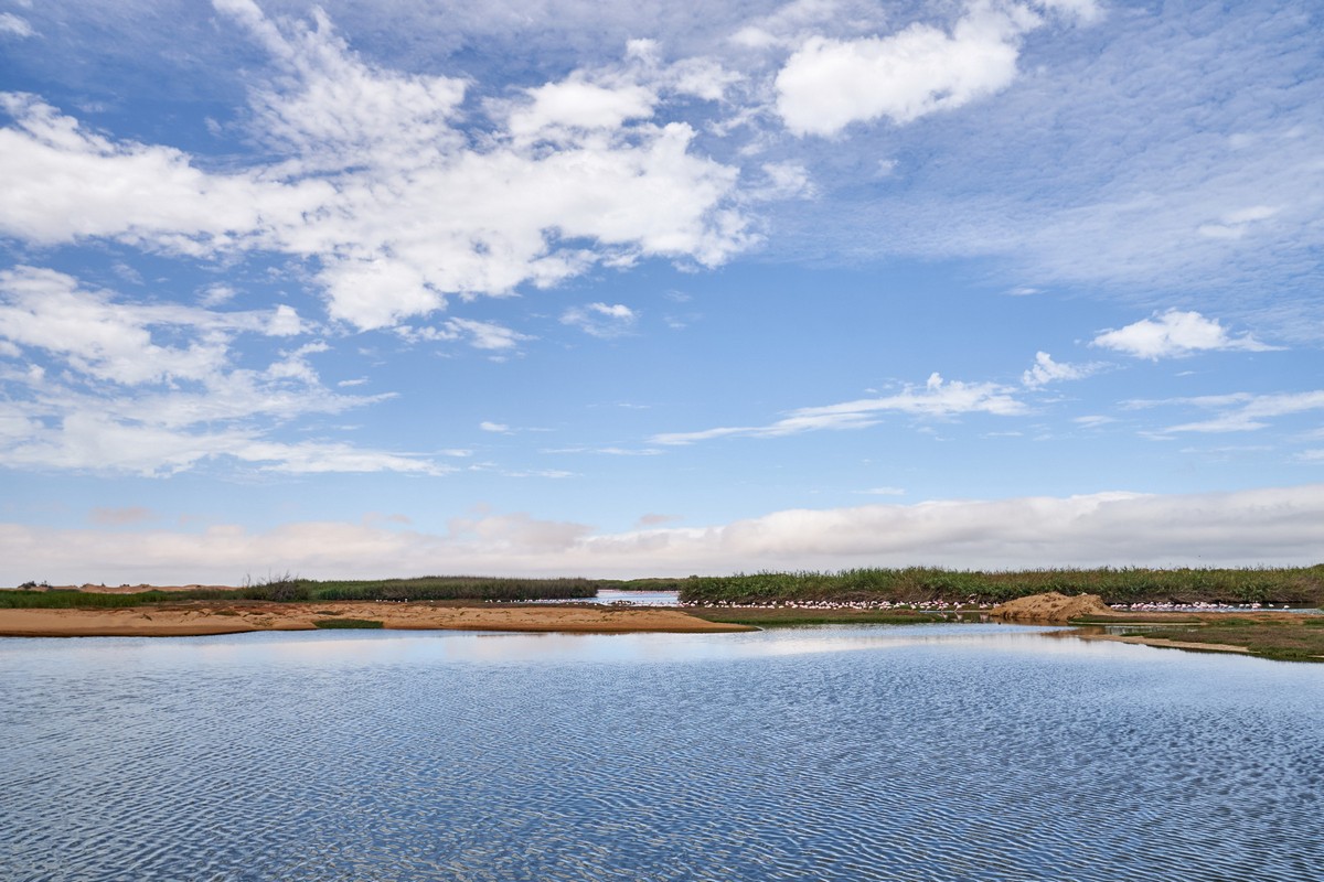
Two kilometers away – another ornithological place: Flamingo Lagoon. Also wonderful – in fact better than Pelican Bay.
Flamingoes and industry:
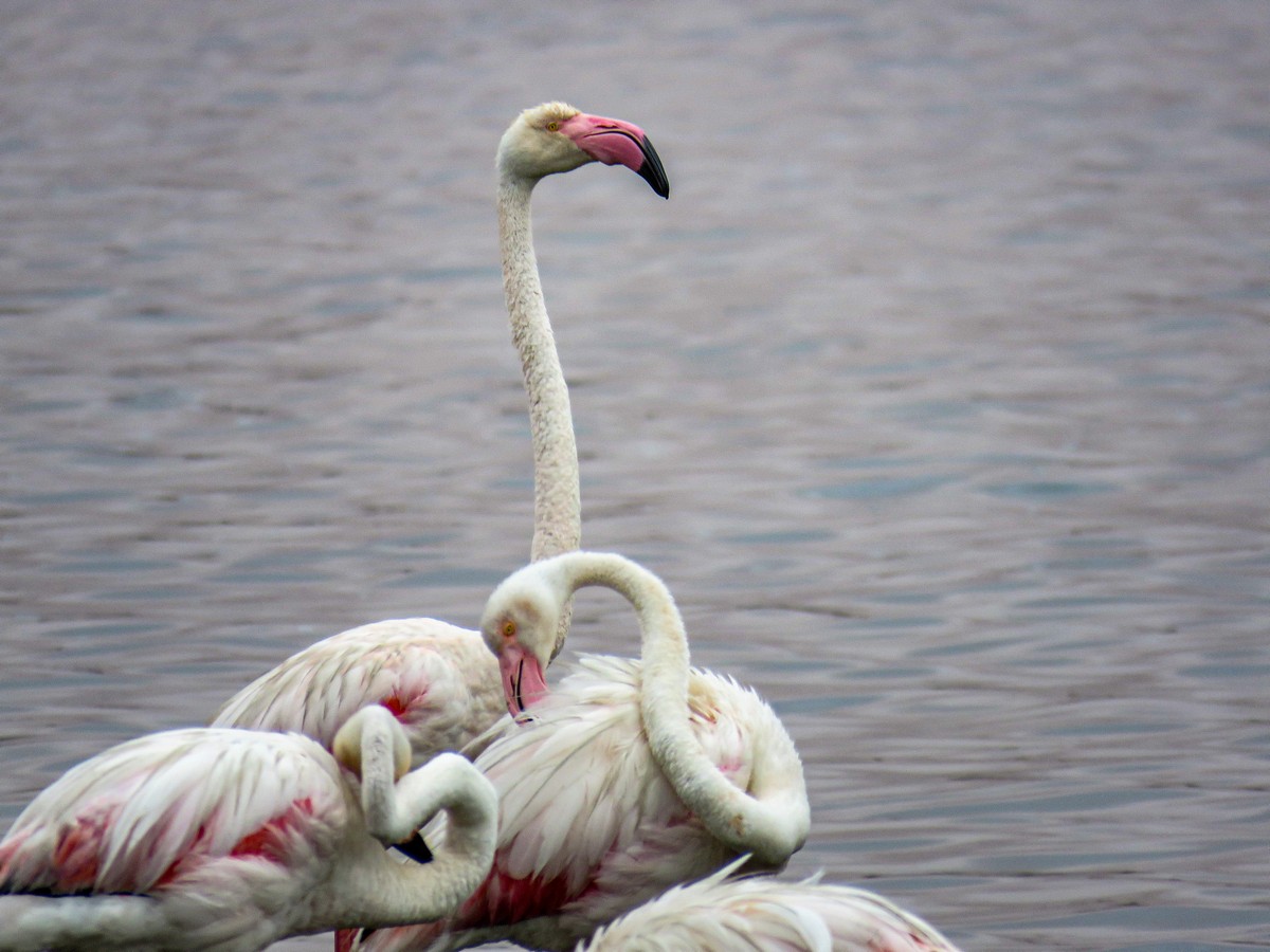
Proud beaks!
Btw: you see the red shading on the clouds? It’s not some optical illusion. But I’ll get onto that in a bit…


There are two types of flamingo here: smaller white-and-pale-pink, and larger bright pink with red feathers:


You could spend a long time here admiring and taking pics of the flamingoes. Staying in some kind of cabin on the shore here would have been grand. But we had to get going…
When the red flamingoes fly off, we could see that under their wings they have bright red patches. Like so:


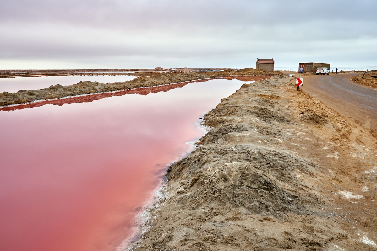
We head out. A few kilometers later – a salt plant:
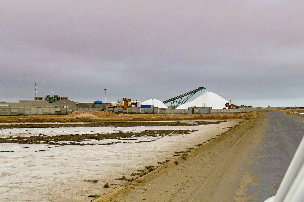
Next to it – salt lakes: pink ones, just like the flamingoes!


Remember the pink clouds? It’s the pink water lighting them up!


I wondered why the lakes are pink. Was it some kind of mineral in the water? Was it… prawns?! Was it something to do with the flamingoes (surely not a coincidence?)? Actually, the pink comes from a microorganism that flourishes in the salty water that emits carotene. That’s why the water is carrot-colored!
(I told you it couldn’t be a coincidence!) Turns out the flamingoes are pink also because of carotene. They eat prawns, and the carotene inside them builds up in their feathers. The more prawns they eat – the brighter they get!


But it was time we headed out…


We drove down to the seashore. There: endlessness everywhere. Plus one… toilet, in the middle of it all!
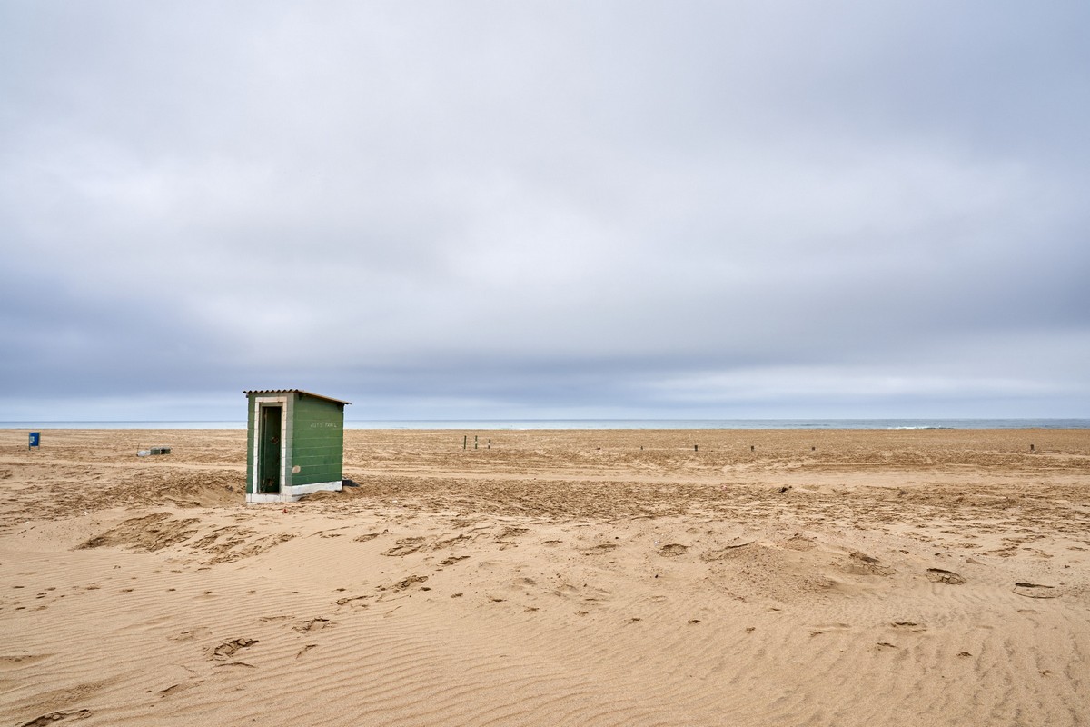
The toilet, after spoiling our pics, actually did come in handy, for we were to stay near it for longer than we thought: we got stuck in the sand!
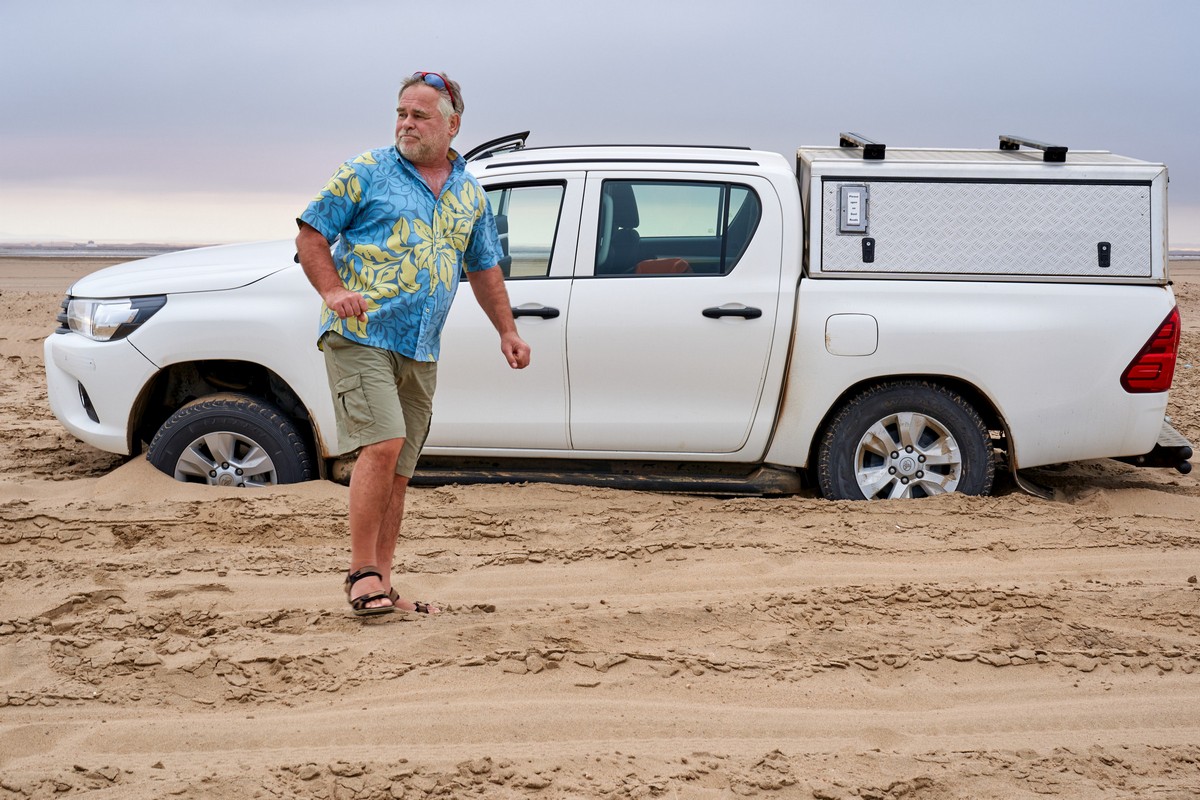
Eventually some kind Dutchmen with experience of such hazards yanked us out. Dank je!
As you can see, it’s not a good idea to come here alone. And it’s also worth bring a spade and some rope – just in case ).


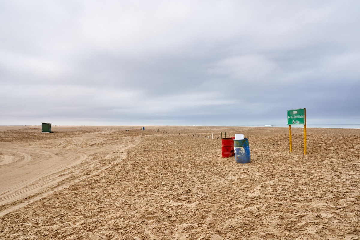
…Sounds tasty.
But no – Sandwich Bay was over there. Maybe next time…
Next up, the generically-named ‘Bird Sanctuary’. It probably has a name, but I don’t remember it…
Several lakes – apparently with seawater in them – and sandy dunes all around. Very nice.
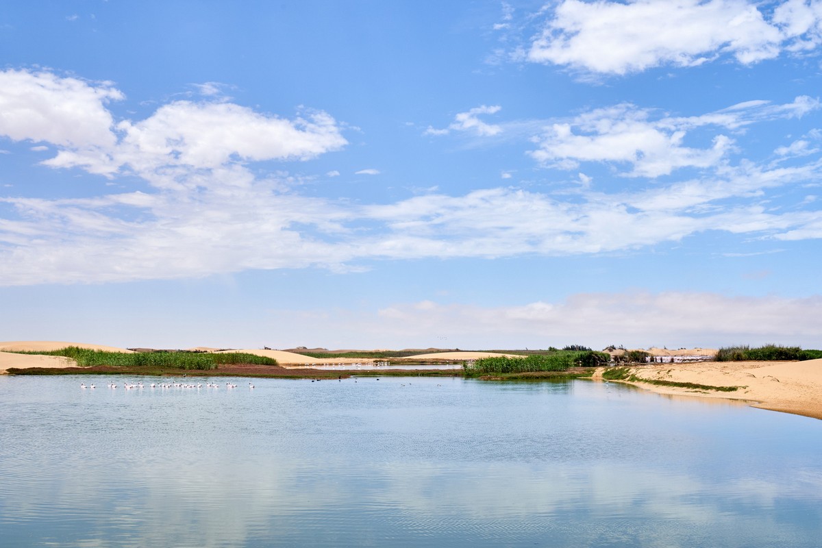
…And flamingoes, of course.
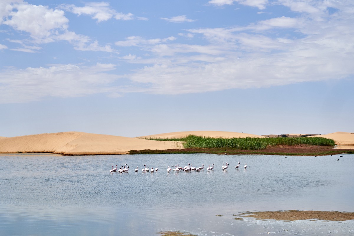
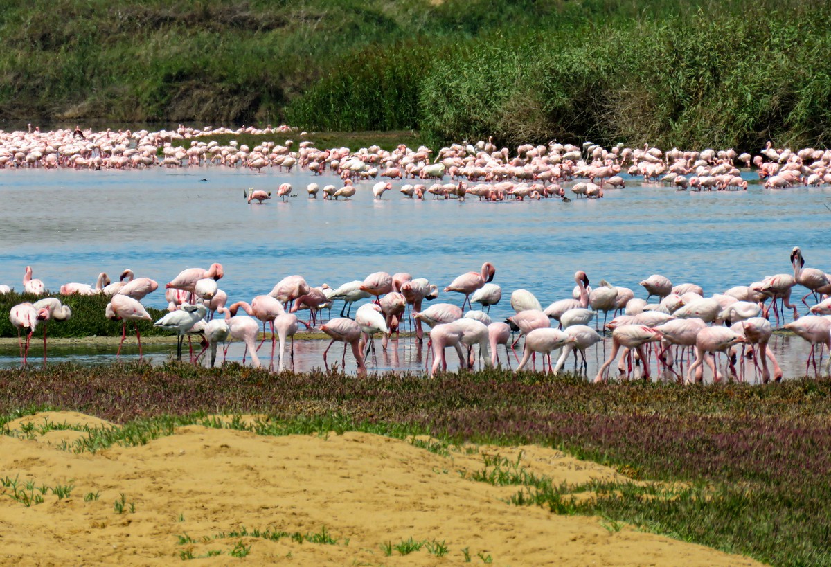
A lot of flamingoes.


Just silly numbers of flamingoes…
And these ones scare easily; not like at the lagoon. Upon hearing an approaching vehicle they all move over to the furthest lake. So keep quiet, approach silently; then they’ll come back and feed nearby.
And that was that. Our portion of birdwatching came to an end. Time to head inland…
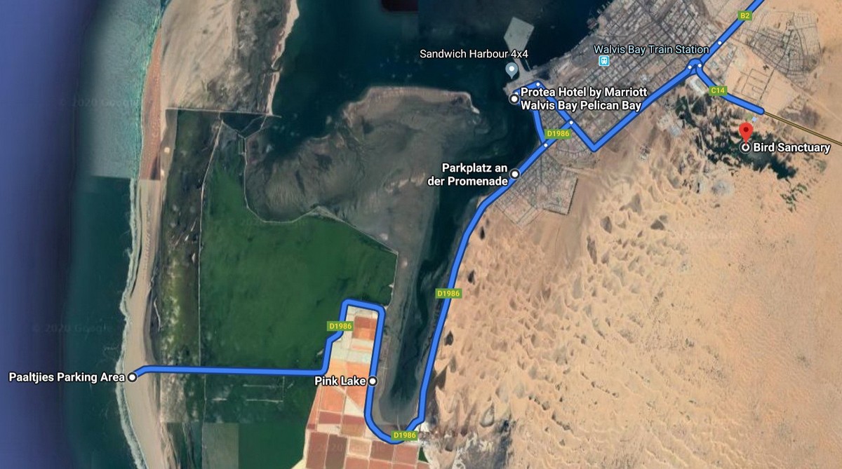
Today’s route – here. Also here:
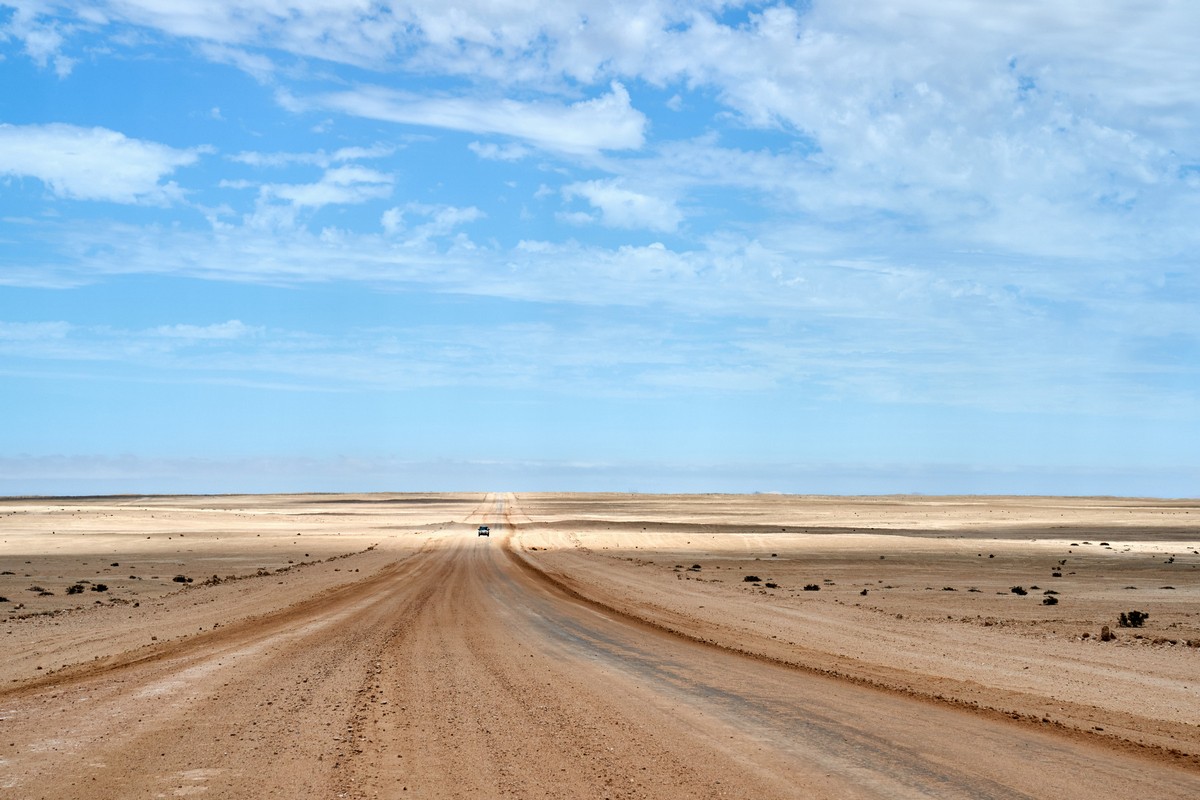
Then it was goodbye flamingoes, and hello open road – a very straight and smooth road at that (probably salted too), heading practically directly due east deeper into Africa. The going was fast; the views all around were, apparently, fantastic – but I was driving. Not that it mattered: just the view of the road to nowhere up ahead was plenty sufficient for me:
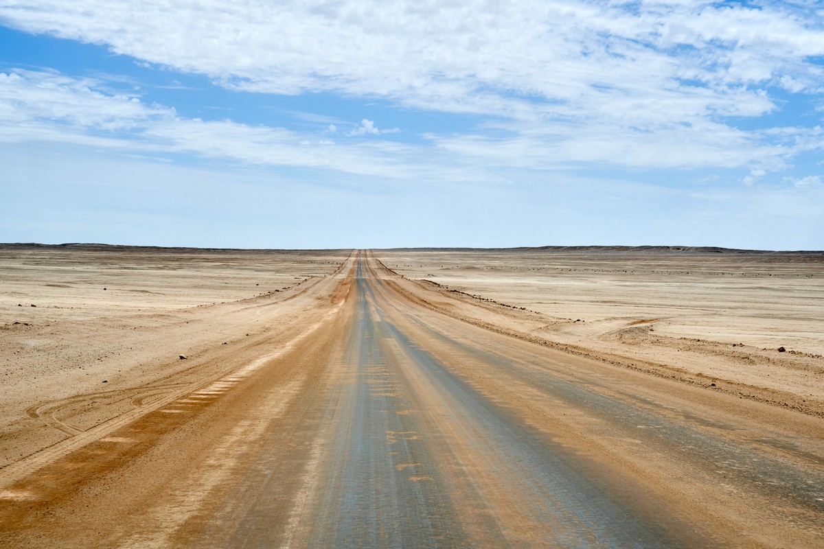
Out here in the Namibian desert it doesn’t feel like it’s you doing the traveling. It feels like the world is doing the traveling – passing by a stationary you! Quite an incredible feeling. Like becoming a child again and playing with a magical toy. You don’t believe me? Then you need to get to Namibia to try it for yourself!
After some time, once again, the road gets sandier. And sandier. And sandier…
But what’s a bit of sand? No problem when the road under it is a proper Autobahn. Indeed, we had everything just right: good roads, good vehicles, good passengers, good amazing views.
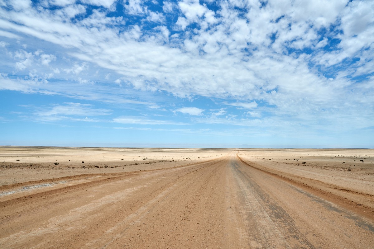
And the roads are as straight as… Namibia’s western border – with Botswana!
Woah: car coming the other way. The first of the day, after 40 kilometers! Sure beats Moscow’s traffic jams!
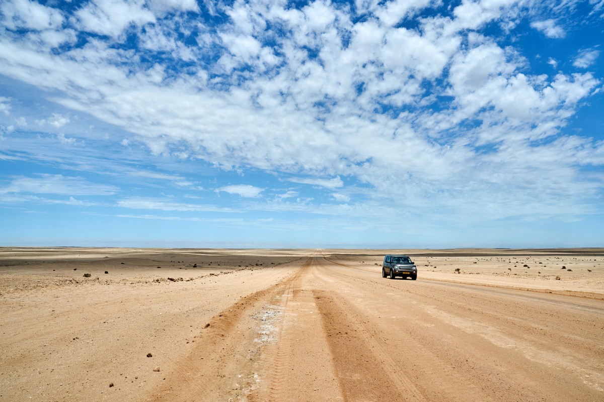
But why only snap the passing ‘traffic’? Let me take a car-selfie…
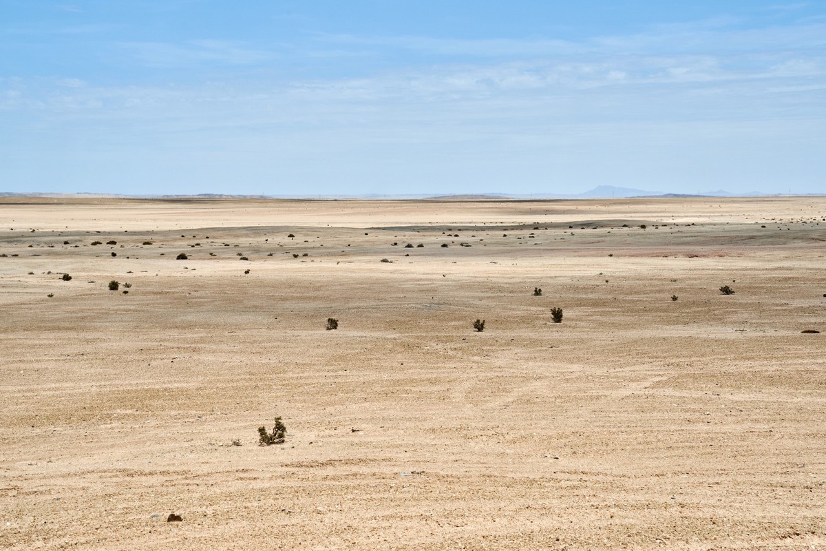
All around – vast desolation. Like Siberia. But without the snow ).
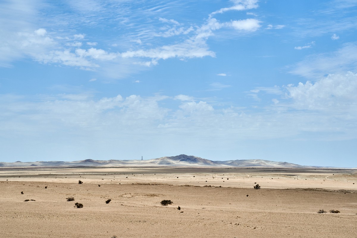
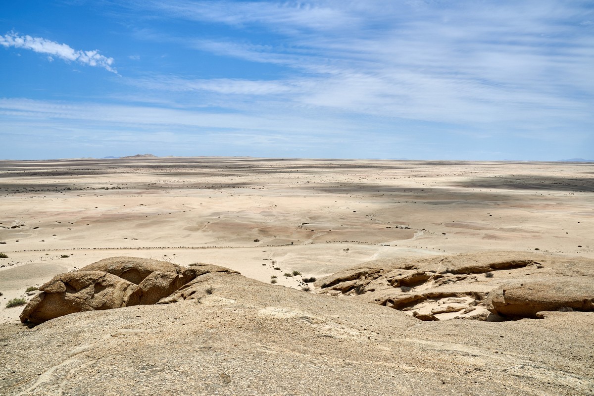
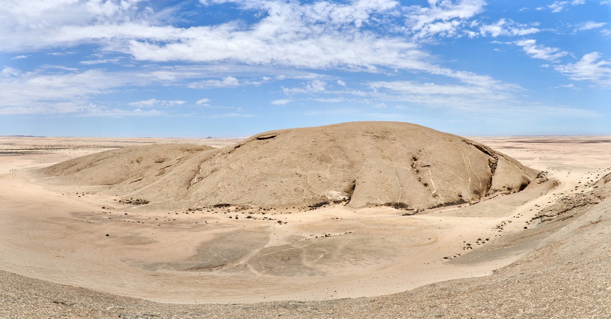
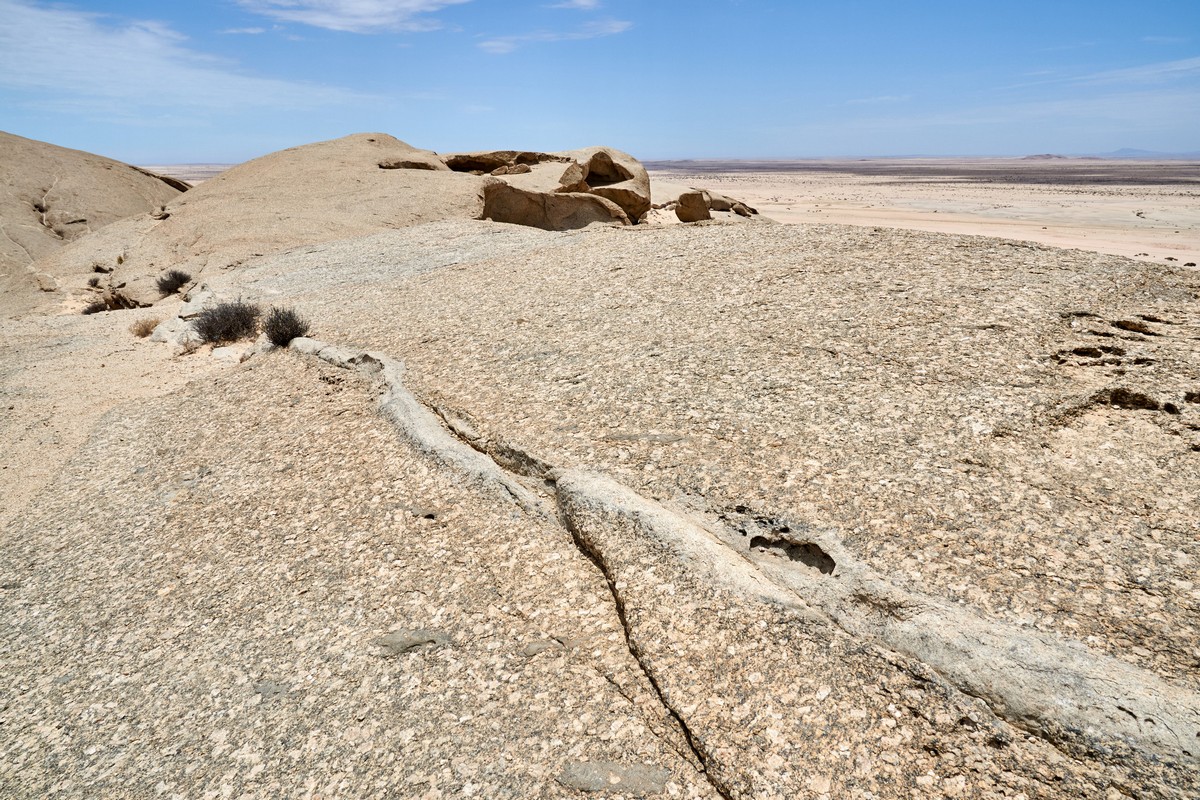
On and on. The monotony not grating – only delighting. I sometimes wanted to break into song, or do somersaults, but I resisted the temptation. Then, after 50km, we came across this here wholly curious rock formation.
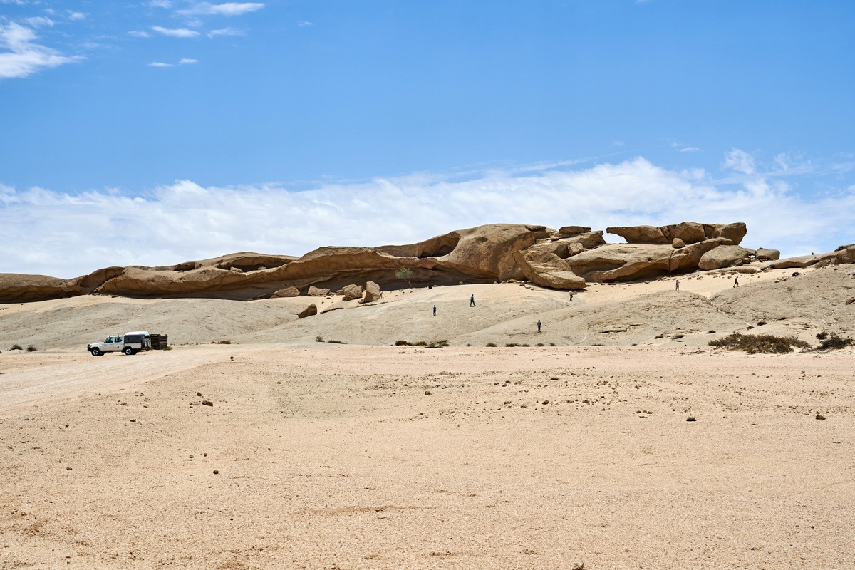
“Over there, folks!” shouted N.I, who had taken it upon herself from the outset to be the cyber-navigator. She gave me good warning this time, but there were a few times when she was, understandably, too busy staring at the scenery to keep up with her map-reading duties! But like I say: this time – perfect timing (or could it have been that these rock formations were so huge that, well, it would have been impossible to miss them?:).
We turn. We park. We alight. We head up to rocks…
Which turn out, actually, to be one huge rock, with bits that have fallen off. What a mysterious rock. Otherworldly almost. How did it get here? Why here, in the middle of the desert? Why just this one spot?…
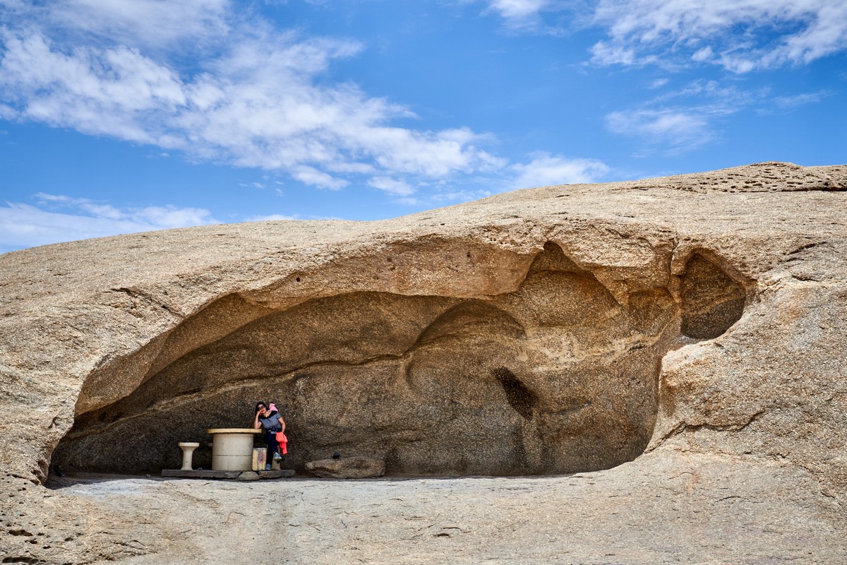
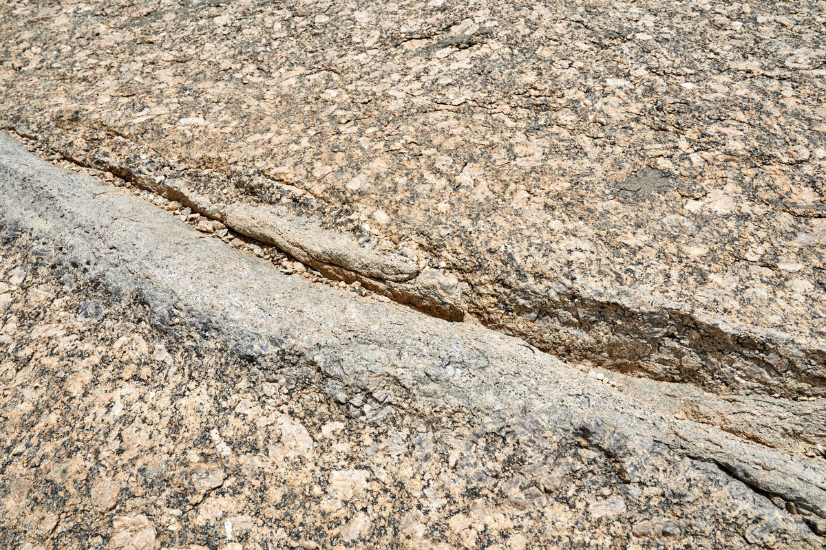
Erosion has clearly been at play for a billion years or so ->


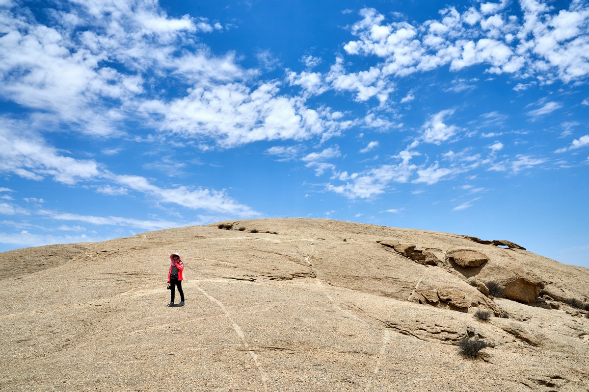
The panoramas from up top – awesome.
Teapot handle! ->


Another stone hill opposite. Also granite…
Clearly water was the main factor in the erosion here. Hard to imagine water here today…
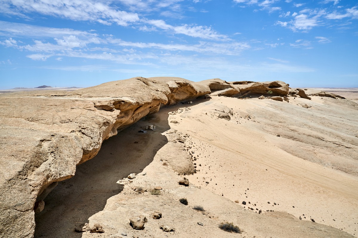
The wind, too, surely played a role:


Magical stones. Look for yourself. Regular granite:
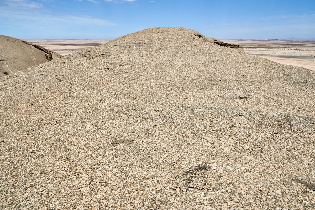
But if you look closer…
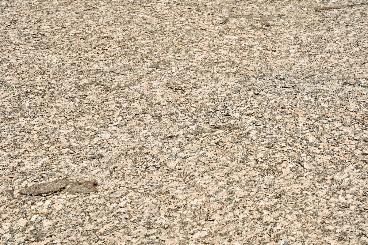
…Clearly marble!
How? Wish I were a geologist sometimes. But I’m not. But maybe some of you, dear readers, are? If so – please could you let me know what went on here? How can there be a layer of marble in the granite?


After a brief walk on the mysterious rock, we got back to the cars and were on our way again…
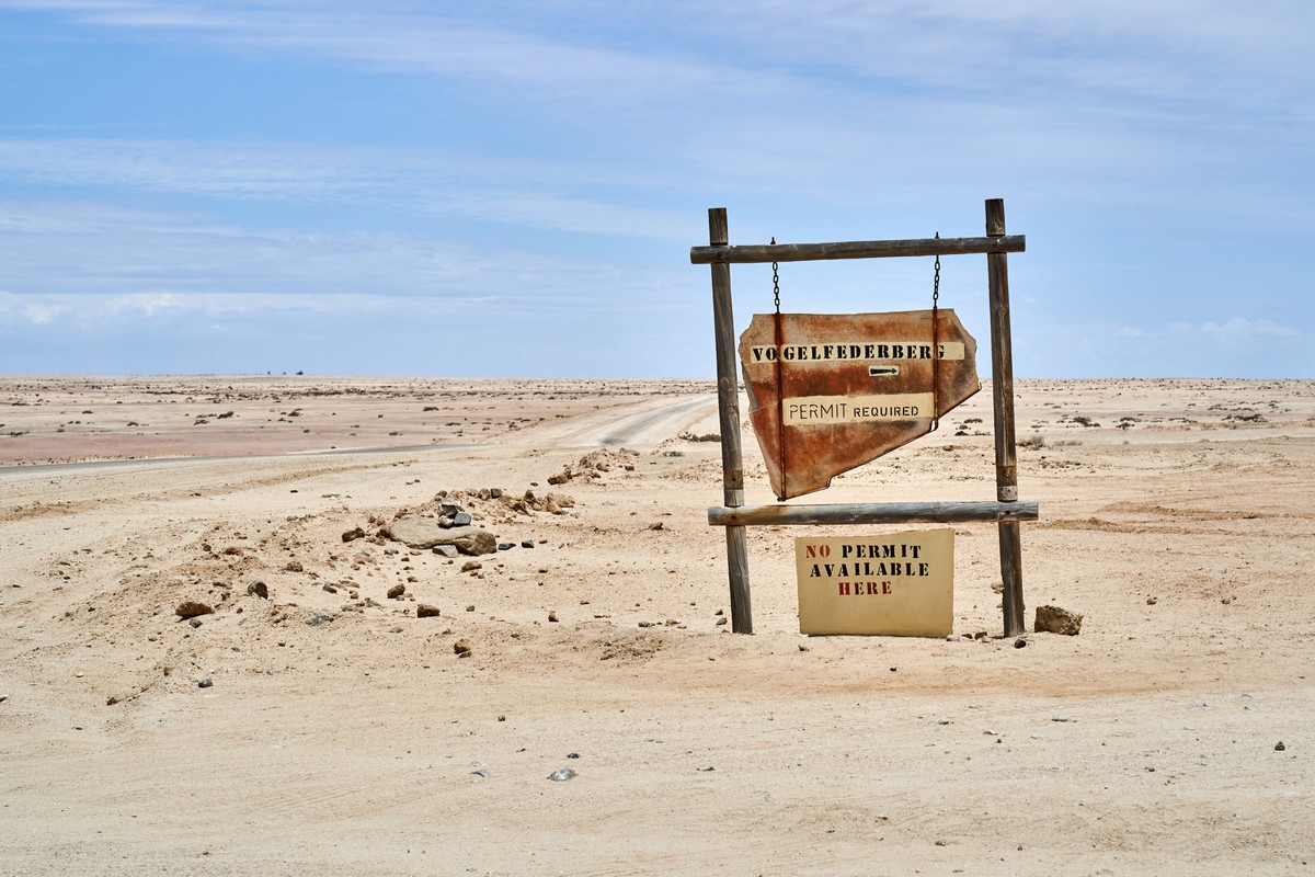
Silly signs:
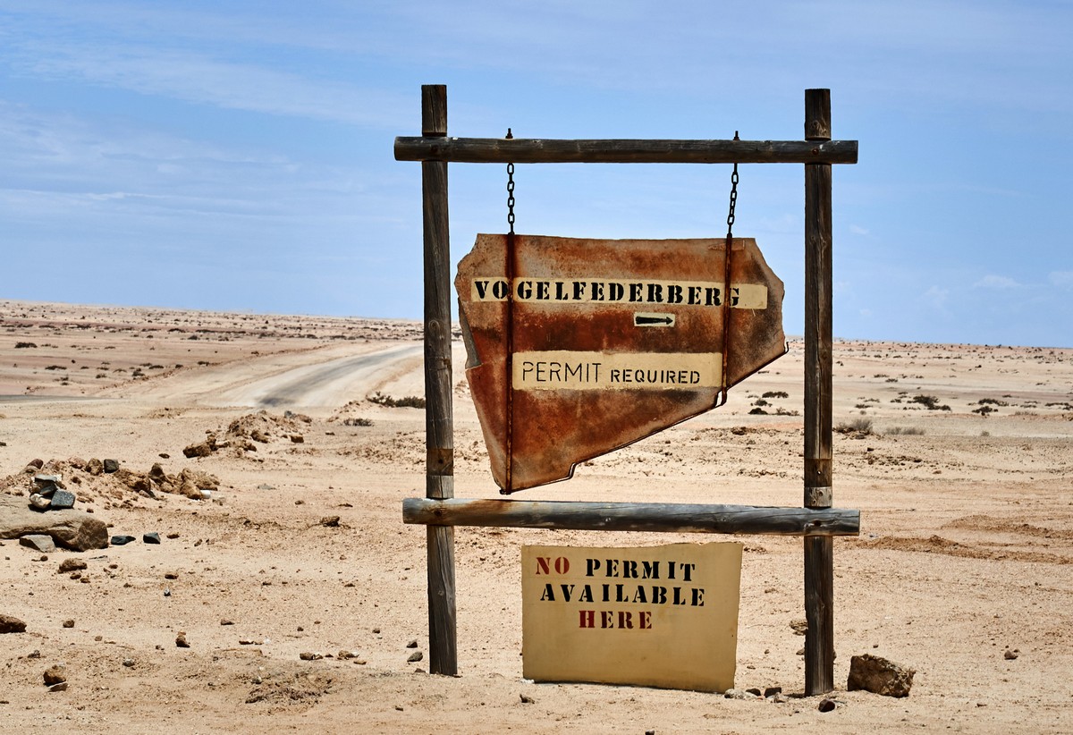
Oh – btw: the mysterious rock formation is called Vogelfederberg, which in German means the ‘bird-feather mountain’.
Onward we drive, with the roads gradually becoming worse, and with 250 kilometers still to go. Eek. But more on those 250km in the next post…
Meanwhile, all the pics from Namibia are here.

