Tag Archives: must see

Trekking to Machu Picchu on the Inca Trail.

Day zero: preview.

And so, after several days of acclimatization (in the middle of our LatAm-2025 trip), the day had finally come to begin our trek up the Inca Trail to Machu Picchu. I’d dreamed of walking this ancient path since 2011 when I first visited the place…

The Inca Trail (note the singular, but it’s actually made up of three overlapping trails) was just one of a great many like it that formed a dense path network covering the entire territory of the Inca Empire. The distance from the northernmost to the southernmost path is estimated at 6000 km (!!!). The internet suggests that a total of 30,000–40,000km of such trails have been discovered, while local guides – like ours, Vicente – have their own perspective: they claim that recent excavations have uncovered even more routes, bringing the total length of the Incan transportation network to 78,000km (for comparison, the total length of all railroad tracks in Russia (by far the largest country in the world) is 120,000+ km)!

Most of the trails were paved. Here’s what they look like today:

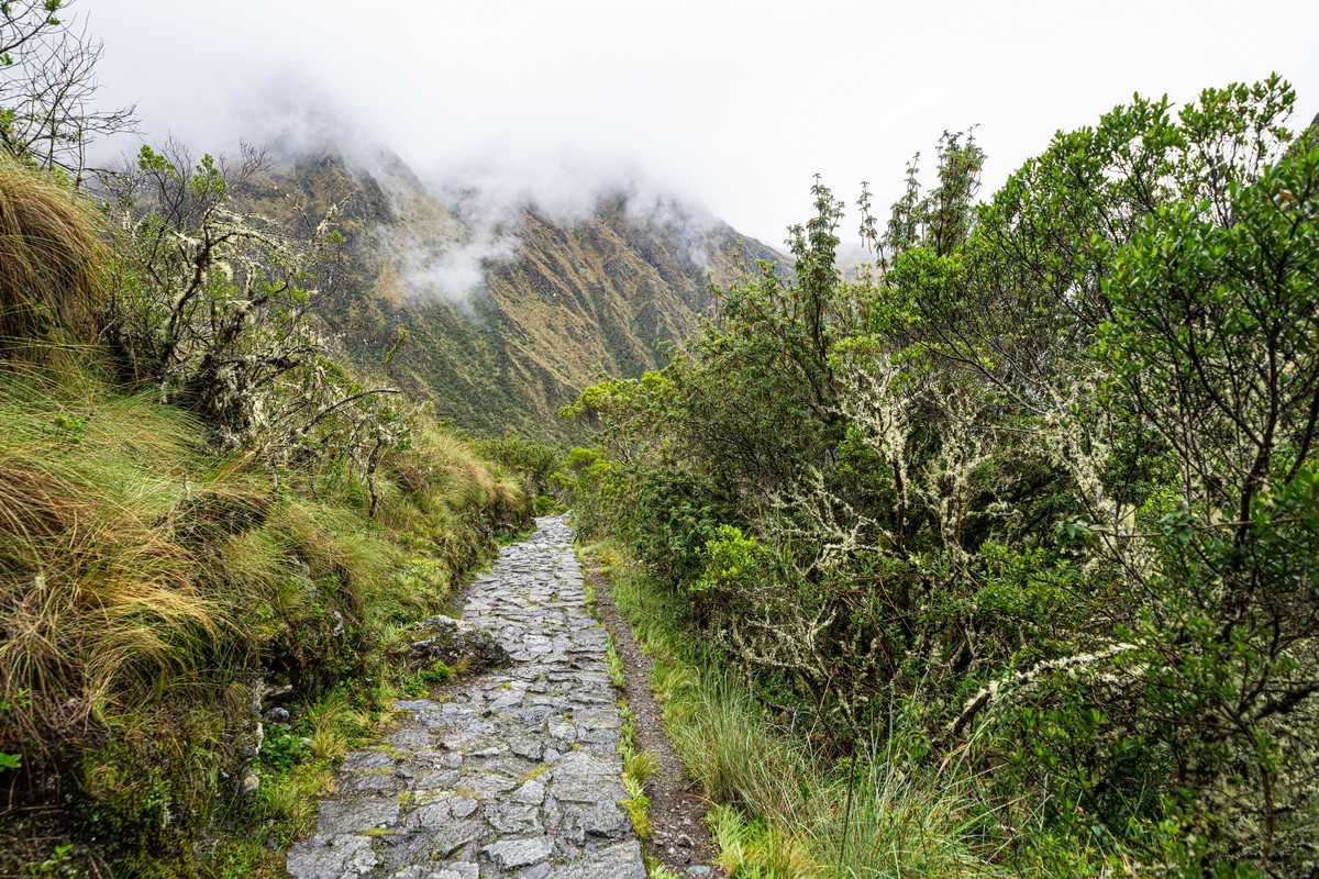
Some roads were actively used even after the empire’s fall. Later, they were used by vehicles, which led to the near-complete destruction of the stonework in lowland areas. However, in the mountains, although some damage has occurred (with restoration efforts on tourist trails), Vicente told us that around 70% of the stonework is original. Literally built for eternity!

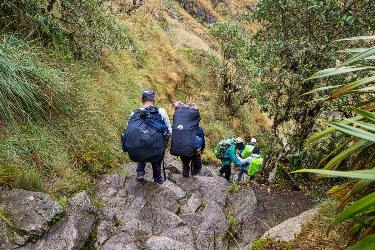
These paths were primarily pedestrian. The Incas never invented the wheel (just like the rest of the indigenous American civilizations), and local llamas and alpacas were not suited for such terrains. The maximum load a llama can carry is 15kg, and it can walk no more than 10km per day on flat ground with such a weight on its back. Therefore, everything here was carried by the Incans themselves. The steps along these paths can be quite steep in places. Watch your step!…

Read on…

The Nazca Lines – finally!

Peru. So, what’s generally known about this South American country by the average general-knowledge pub-quiz buff? I’d say: the mysteriously extinct Inca civilization/empire, the ancient cities of Cusco and Machu Picchu, the high-altitude Lake Titicaca, and, of course, the mysterious Nazca Lines (also known as the geoglyphs of the Nazca Plateau).

As to the latter, seeing these drawings in the flesh has been a childhood dream of mine ever since I enthusiastically studied the geography of this world through books filled with maps, pictures, and photos of different regions of the planet. Naturally, when planning my trip to Peru, visiting the plateau – flying over it in some kind of aircraft – was one of my top priorities. And now, decades half-a-century (!) later, I’ve finally made it happen! The lines, geometric figures, and depictions of funny-looking folks and animals on the Nazca Plateau – checked off the list!…

Read on…

Dawn in Zhangye.

Our fall trip around northern-central China was literally coming full circle on the big rock-desert loop from Xining to Xining. Our final must-see tourist spots were near the city of Zhangye, with the first one being the Zhangye Danxia Geopark

So what is this place? Well, it’s just over 500km² (if the internet is to be believed) of multi-colored mountains and hills. And the colors here are absolutely mind-blowing:

No Photoshop used! This is exactly how things looks at sunrise and sunset! The daytime view is still stunning but a bit more washed out. The best shots are at the beginning and end of a day:

Read on…

Enter your email address to subscribe to this blog
(Required)

The Taklamakan Desert: the Dunhuang Dunes and the 500 Buddhist Caves of Mogao.

Dunhuang. The name doesn’t ring a bell for most people – but it should! Not to worry, for we’re going to fix that right here, right now – as it’s next on the travel itinerary of our China-2024 trip…

So, Dunhuang. It’s a small city built around an oasis and surrounded by the rocky landscapes of the Taklamakan Desert (here). Once a major hub on the Silk Road, it’s a truly ancient place (being founded possibly as far back as 2000BC!). But let’s not get too deep into its history: we’re not historians – just meditative tourists here to take in the exceptional views (and share them with you photographically too:)…

There’s definitely plenty to see here. First and foremost: one of the world’s largest deserts, the Taklamakan, which the city’s situated next to and which features some impressive dunes:

Where the desert meets civilization, you get some really unusual, contrasting sights:

Read on…

Chaka Salt Lake: plenty photos to take!

After what we could call our lake-tourism warm-up (Qinghai Lake) the day before, it was time for the first significant stop on our big-loop route around inner China – Chaka Salt Lake.

It’s not the largest salt lake in the world, with an area of “only” about 100km² – which is around a hundred times smaller than, for example, Bolivia’s Salar de Uyuni (~10,000km²). However, it has its own unique charm: the Chinese have turned this “simple salt lake” into a major tourist attraction (fancy that?!), where you can easily spend an entire day (in the right season). The secret is simple: various installations have been set up across a significant portion of the lake that are practically begging to be photographed and shared on Instagram TikTok. These installations are a huge hit especially with girls – who bring bright (most often red) outfits specially for the occasion:

The photo installations here are plentiful and incredibly diverse:

Read on…

Huanglong travertine cascades: limestone beauty – in spades.

Not far from Jiuzhaigou National Park (100 km by road) there’s another unique beautiful natural object – the Huanglong Scenic and Historic Interest Area. It features a cascade of travertine (limestone) baths, pools, lakes and waterfalls of various forms and colors. The cascade is around 3km in length in a straight line, or ~5km if you take the tourist paths beside it. The spectacle is fantastic:

Read on…

The Valley of Geysers: a post-scriptum review.

You’ve had my report on our six-day Uzon trek, but I hardly told you anything about where we ended up on the last day of the trek – the Valley of Geysers. Now, with a bit more time on my hands, I can collect up my thoughts and impressions thereupon, and share them with you at a gentler, more meditative tempo…

First – a few photos. Bubbling, hissing, spurting, steaming, pouring – all present and correct, sir:

Read on…

In deepest Siberia: the world’s largest thermokarst “tadpole”.

Not far (20 minutes on snowmobiles) from the 70-kilometer road between Verkhoyansk and Batagay, there’s a unique natural phenomenon that goes by the name of the Batagaika crater ->

Apparently it formed as a result of a combination of global warming and certain actions of Soviet Homo sapiens – those certain actions being cutting down the trees in the surrounding area, plus the making of ruts by heavy all-terrain vehicles (used during the deforestation). This eventually led to the permafrost thawing, becoming a ravine, and then spreading out, giving us today this here bizarre massive tadpole-shaped depressed formation on the Siberian plains:

Read on…

The Maasai Mara National Reserve. It gets scary; can you hold you nerve?!

The main course on our Kenyan safari was Maasai Mara, the country’s vast game reserve, which we caught at just the right time: during the wild animals’ mass migration. Huge herds of wildebeest, zebras and assorted other, smaller hooved beasts. But the main attraction is the wildebeest, and their particular migration is known as the great migration – up from Serengeti in neighboring Tanzania ->

A zillion zebras too:

Read on…