April 9, 2026
Two attempts at the infamous abandoned “Road of Bones” in Siberia.
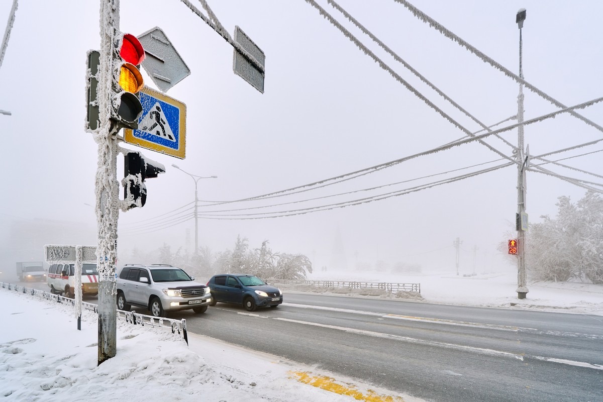
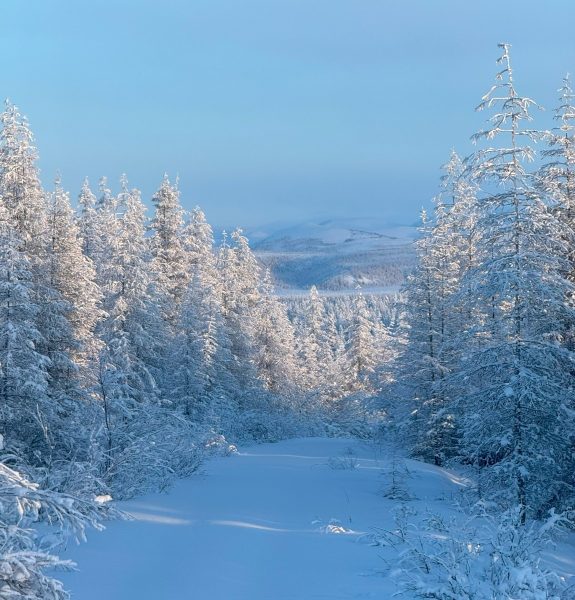
When the temperature drops below -50°C, the world turns into something else. It doesn’t just freeze; it visually transforms. Everything gets wrapped up head to toe in hoarfrost and grows a thick layer of fluffy white crystals. It’s kind of like the inside of a freezer, only way more intense. Trees, road signs, poles and the wires on the poles are all coated in white hoarfrost:
This year that kind of a deep-deepest freeze in the Russian Far East only took place in December and January, while February turned out to be unseasonably warm. In fact, I’d say it was hot for February in Yakutia. If the thermometer shows -20°C at that time of year – yes, that’s hot! The thermometer only crept lower than -40°C a couple of times early in the morning, but it’d almost immediately warm up to -30°C or even higher. It got to the point where, for most of the trip, I wasn’t even wearing thermal ski pants – just jeans. I had some thermal leggings on underneath the jeans – but that was it. And I only wore my fur-lined boots once (when we spent the night in our cars on the ice of the Kolyma River to enjoy the northern lights and a total lunar eclipse).
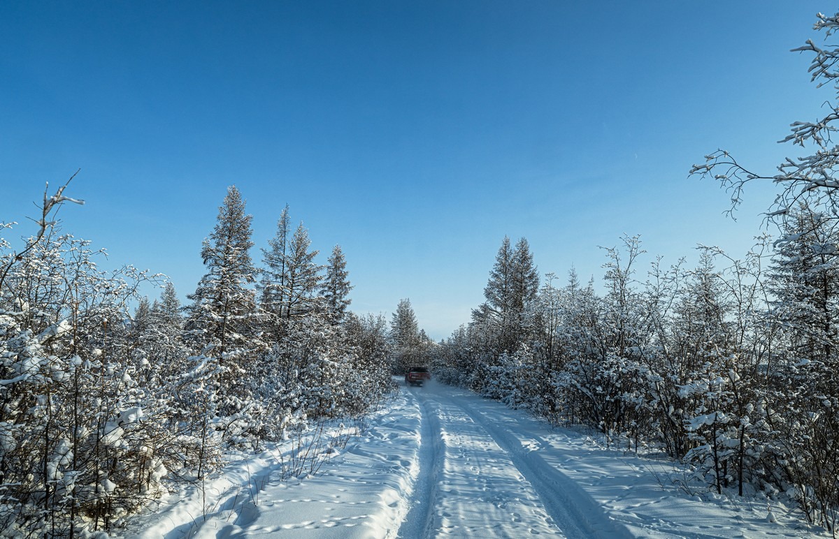
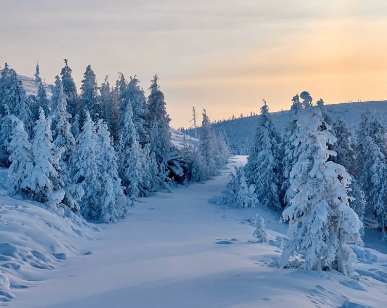
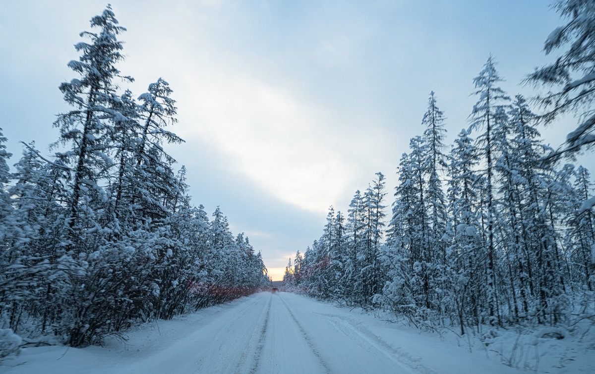
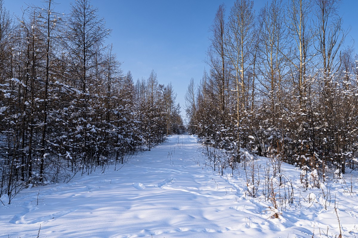
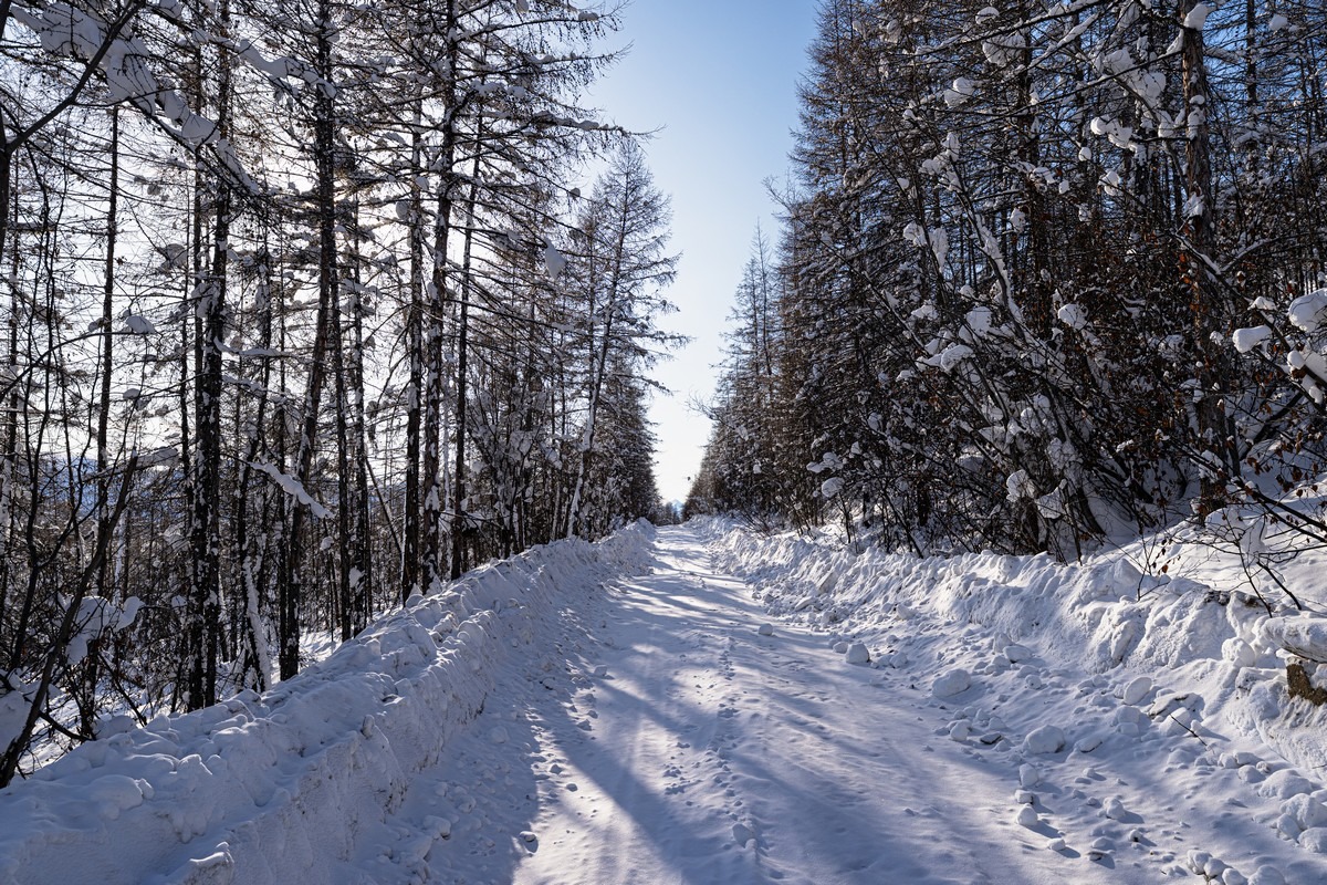
At such higher-than-usual temperatures, all the white beauty melts away quickly, and the world turns gray and boring again. But at least a few times we got lucky and drove right into “proper” bleached scenery:
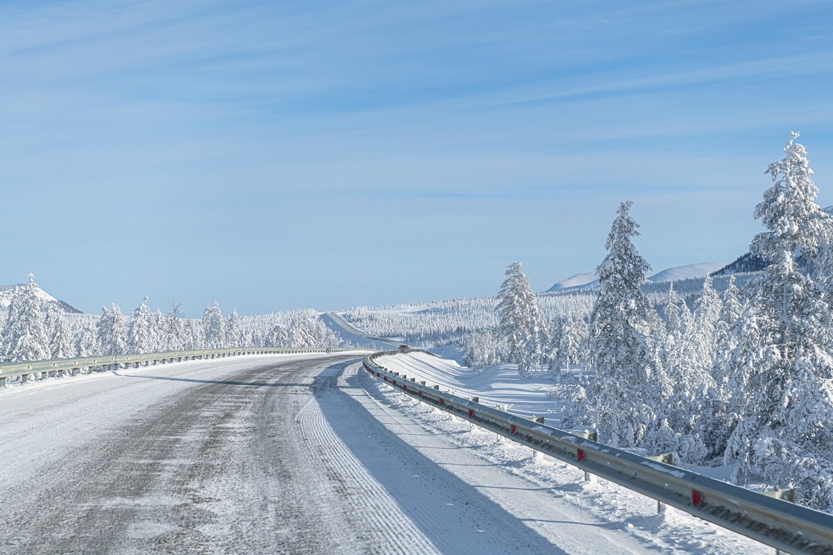
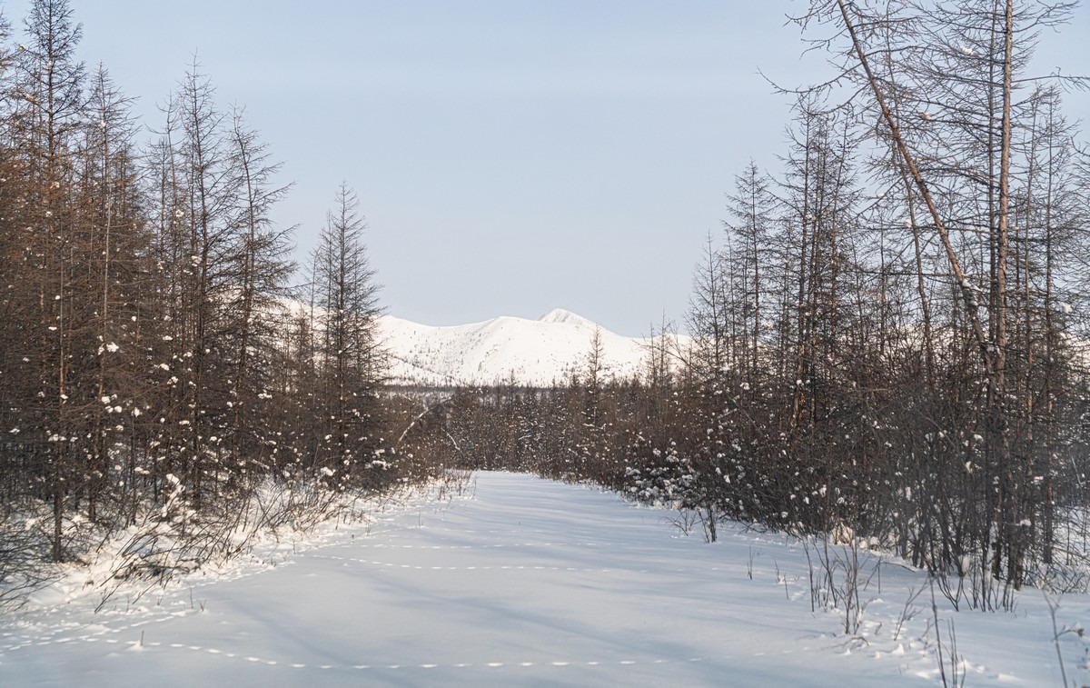
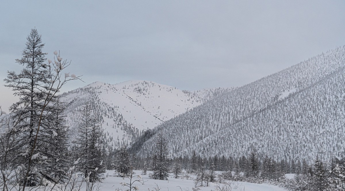
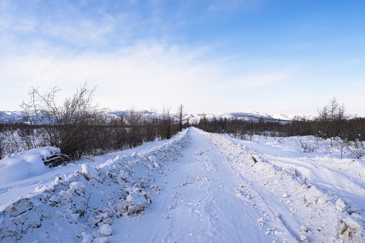
The Olchansky Pass was… fairly white – despite the record temperatures:
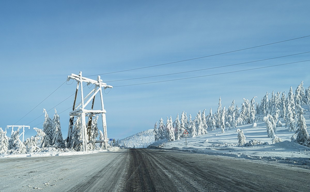
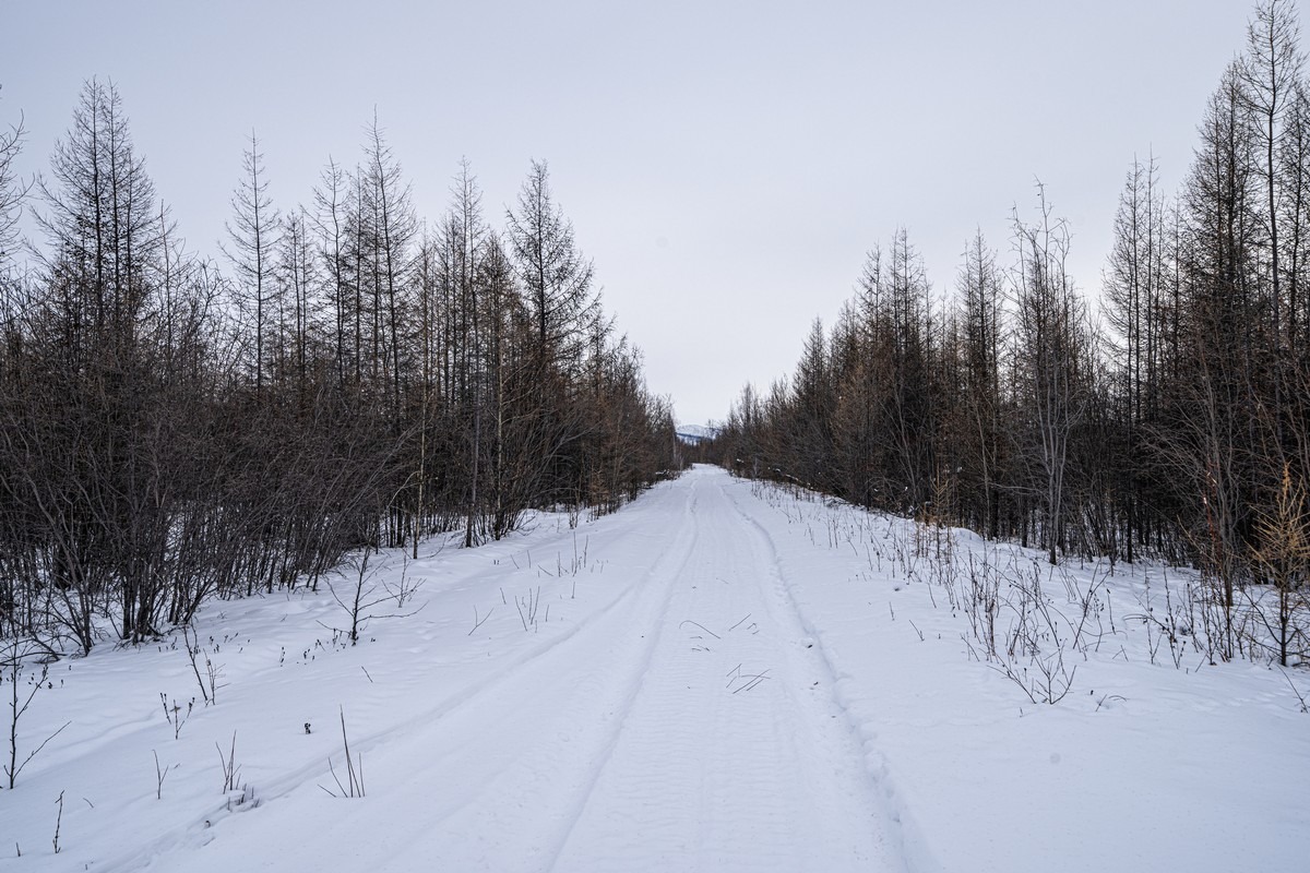
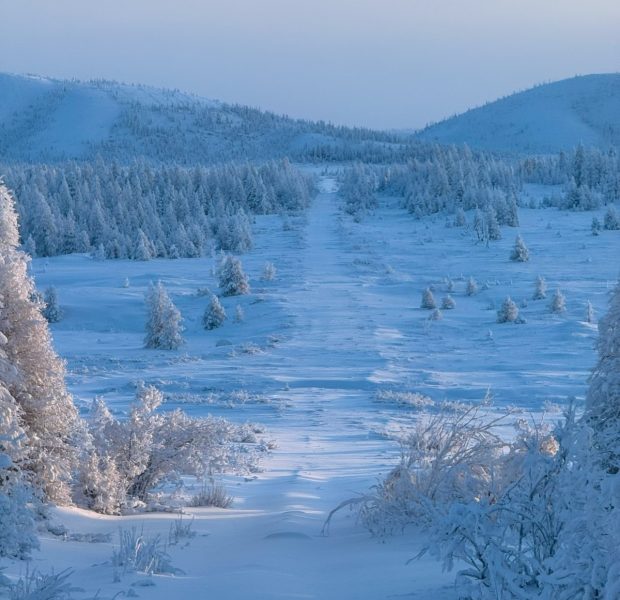
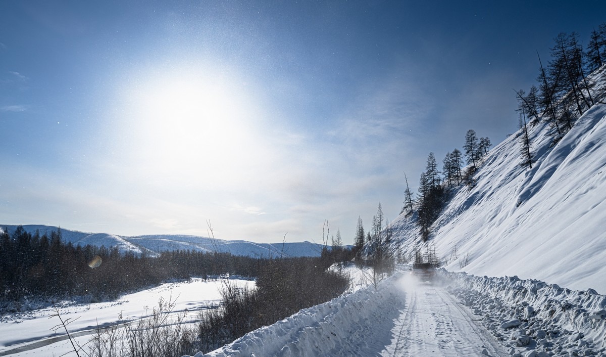
It was still a bit duller this season. Normally there’s a lot more white:
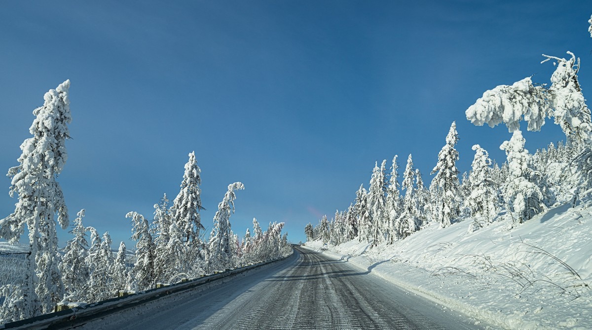
February in Yakutia is supposed to look like this: white and gorgeous, stretching for hundreds of kilometers (photo from 2021). Pure delight!
So, yes – this season was a bit of a let-down. On the upside – at least in terms of aesthetics – anomalous amounts of snow fell, which practically never happens here. Most of Yakutia has a continental climate, usually with blue skies and almost no precipitation. Apparently that’s been the case for at least a thousand years. During the last ice age, when all of northern Europe was buried under a massive layer of ice, mammoths roamed in huge herds across northern Yakutia. Why wasn’t there ice there? Because there was almost no precipitation – so there was nothing for the ice to form from.
Like I say – very snowy this year ->
…For comparison, here’s the same place in a normal year (2024) ->
Where are these pics from? This is the Old Kolyma Road – which for years has been abandoned and un-serviced (most importantly – never cleared of snow). And now, finally – it’s time for the full story about our attempts to drive along its full length…
Why did we even think of driving along an abandoned road in deepest Siberia? Simply because it’s an important part of our history. It’s not the jolliest part, but it’s still a part. And it needs to be known about and remembered…
In short, the country was in ruins in the early 1920s. The economy had practically been wiped out by the Bolsheviks and the civil war. According to some estimates, Russia’s GDP fell threefold compared to the pre-WWI period (historians like to compare it to the “fat” year of 1913). Threefold! That’s a total disaster. For comparison, Russia’s economy fell by 30% in the “wild 90s”, and that was a nightmare. But in the 1920s, the economy crashed… 300%! Poverty, destroyed factories, homeless children on city streets, and lots more besides.
So, all of that had to be rebuilt somehow. Industrialization, electrification, etc. But there was no technology or engineers. Where would you get them? From abroad – how else? But with what money? There was none. So they sold whatever people were willing to buy – anything valuable. That’s when Russian museum vaults were opened, and paintings, sculptures, and historical treasures headed to the West. At the same time, as part of this same drive, new factories, power plants, and roads appeared, and by 1930 the country’s GDP had reached pre-WWI levels. But that wasn’t enough; manufacturing had to grow even more. And this is where the gold from these distant lands came in handy. There was plenty of gold in Kolyma. So intense development began, and the city of Magadan was founded in 1929. Roads were built to the north and west, along with Gulag camps and other infrastructure — all for the sake of gold, which paid for technology, machinery, vehicles, and foreign engineers. And as far as I can recall, most of the engineers were American, since postwar Europe was also struggling.
In other words, the Kolyma Road is an important part of our history. It was one of the main arteries through which oxygen flowed into the veins of industrialization (like my phrasing there?!). Later, during World War II, the gold mined along the road went to the war effort. And that’s why we wanted to drive along the entire length of its old section.
Construction of the road began in 1931. At its northernmost point, in the village of Ust-Nera, work was completed in 1953. This was done in conditions of impossible cold in winter and intense heat in summer – as well as permafrost and vast, completely uninhabited spaces.
// I should note that I’m not a historian, so I might be wrong in places, and I might not mention some important details simply because I don’t know about them.
What else? Gulag labor was used in building the road. And the internet likes to state that prisoners who died or were killed there sometimes (often?) weren’t properly buried but instead laid in the roadbed. That’s why the route’s sometimes called the Road of Bones.
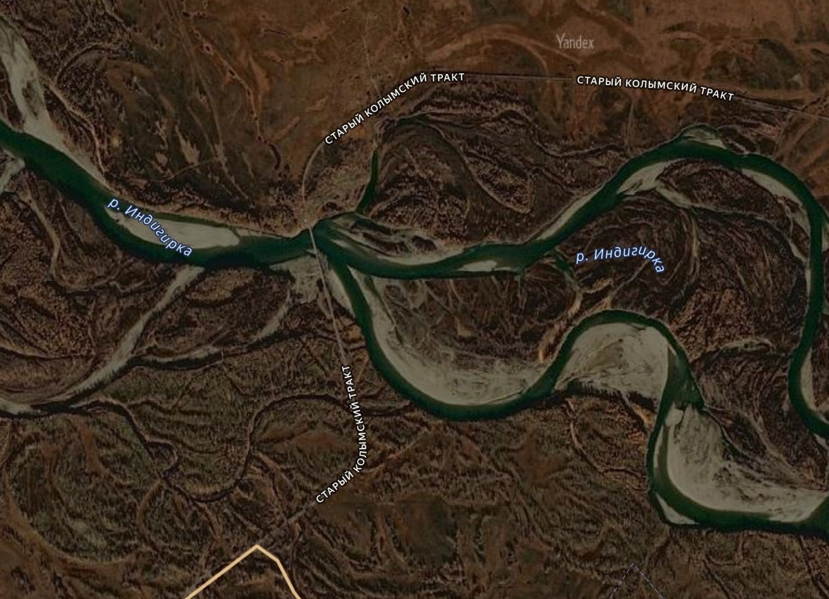
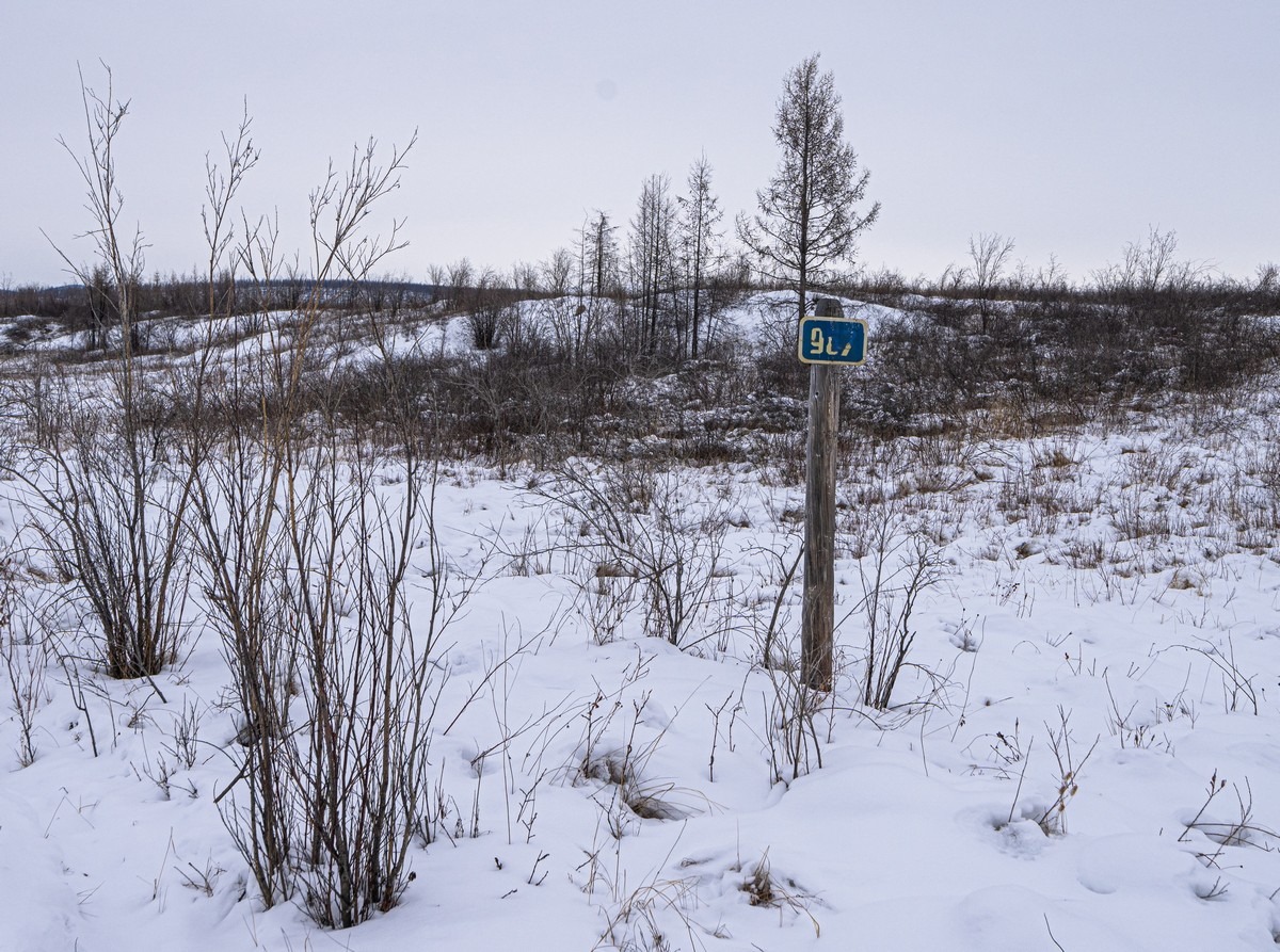
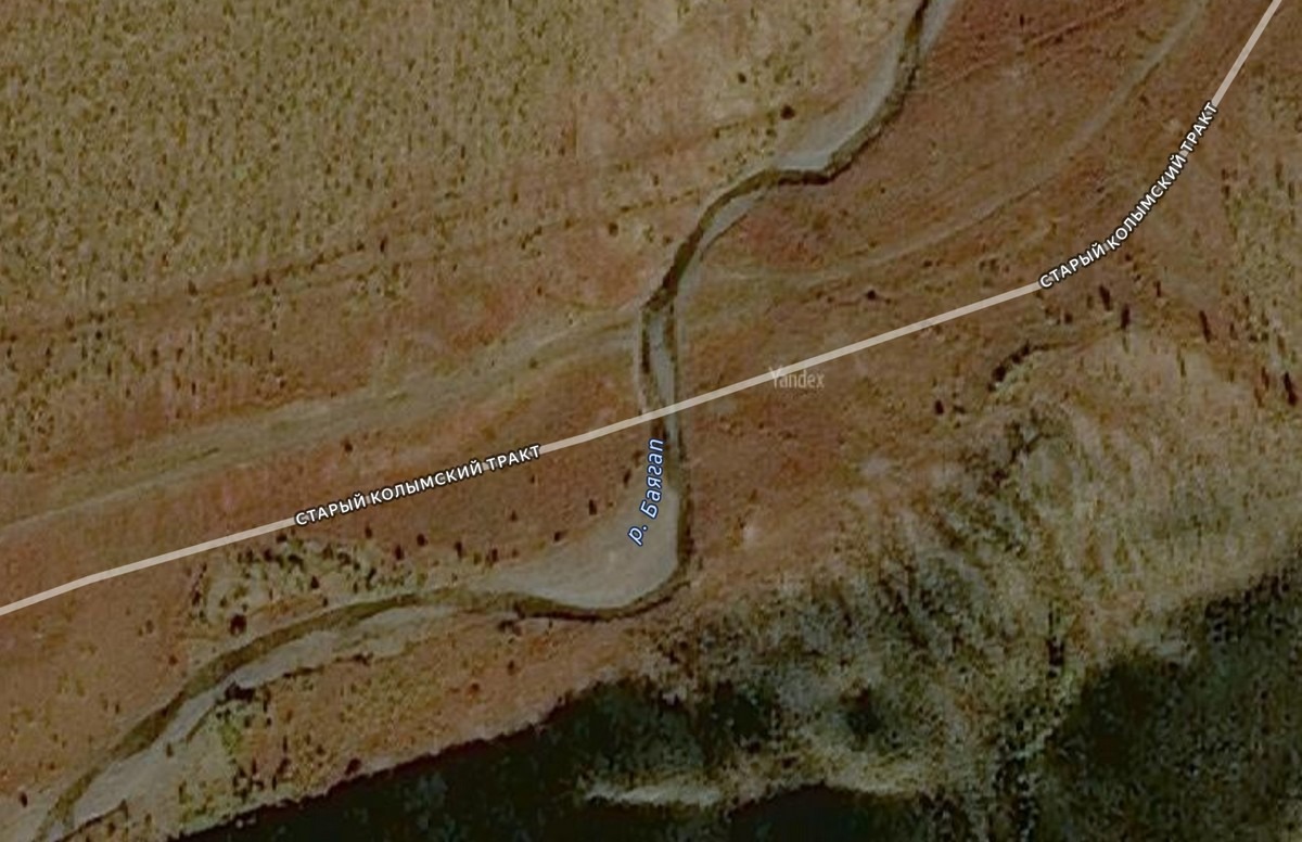
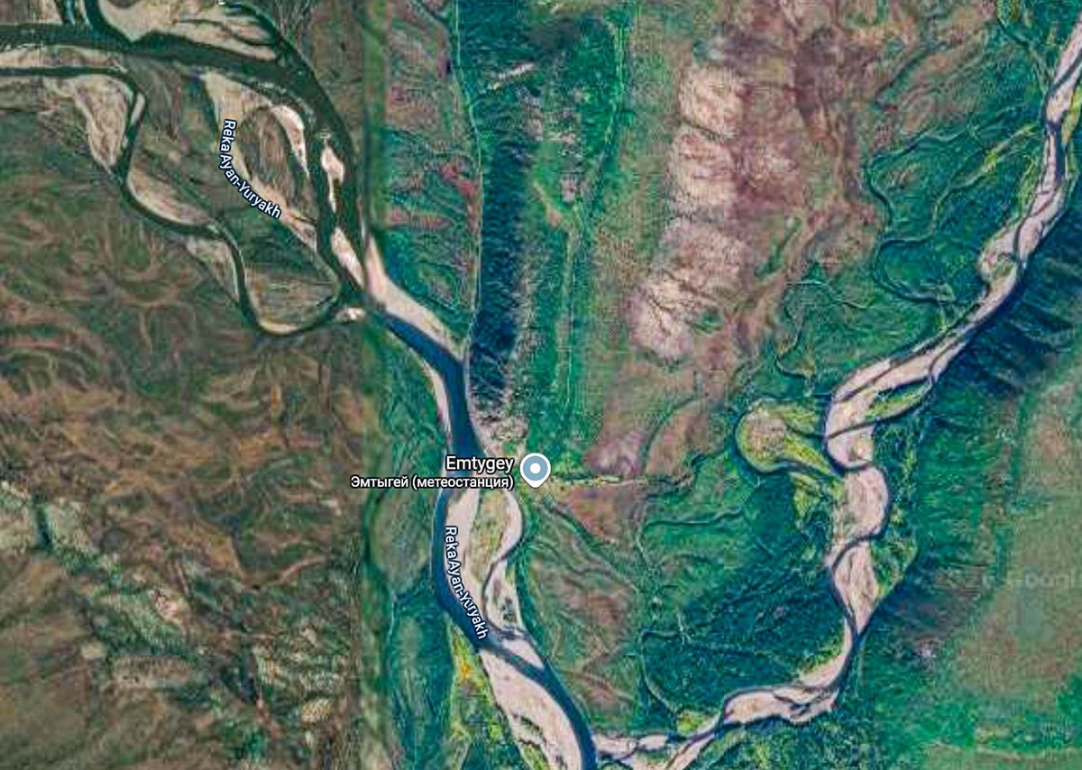
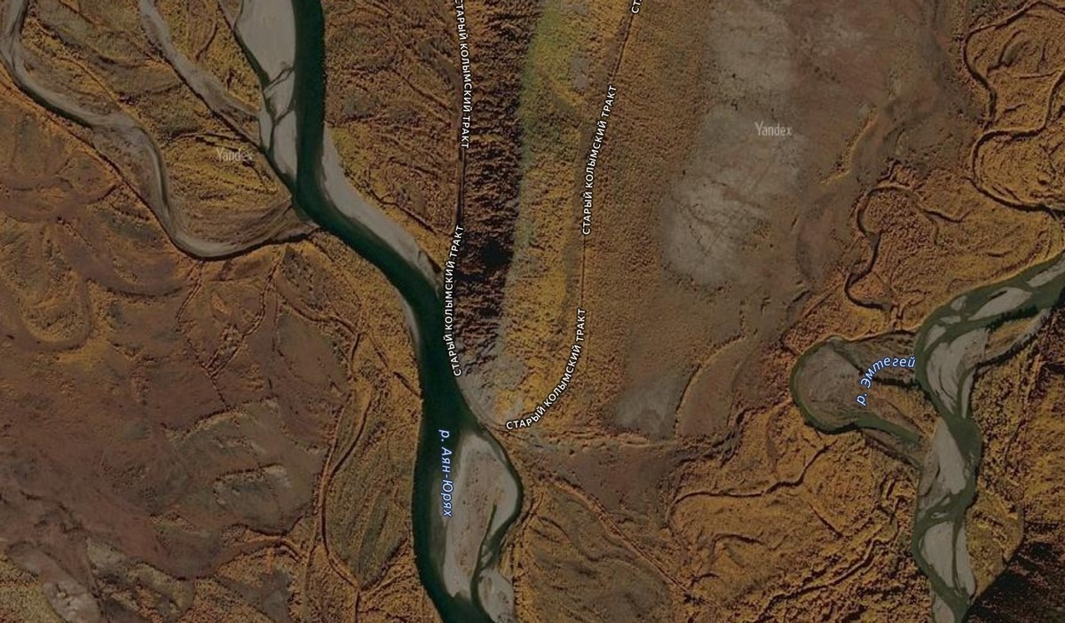
So where exactly is this section of the Old Kolyma Road? It’s located just west of the middle of the section, near the village of Tomtor, as shown on Yandex Maps. If you zoom in, Yandex even shows the old, abandoned road:
Yandex returned the road to its maps after wiping it in 2021. Here’s why it was wiped:
Two young idiots in jeans and sneakers drove a passenger car onto the abandoned Old Kolyma Road in -50°C temperatures. Naturally, they got stuck. One froze to death; the other survived, but he got frostbite and is now severely disabled. They blamed the sat-nav for everything — a classic case of shifting blame from the guilty to the innocent. As a result, Yandex deleted the impassable section. Curiously, Google did just the opposite — it erased the passable part and left the impassable section! More curiosity: Yandex put the impassable section back into the sat-nav but still routes around it! On Google Maps it’s still the same as before – it doesn’t recognize the drivable part.
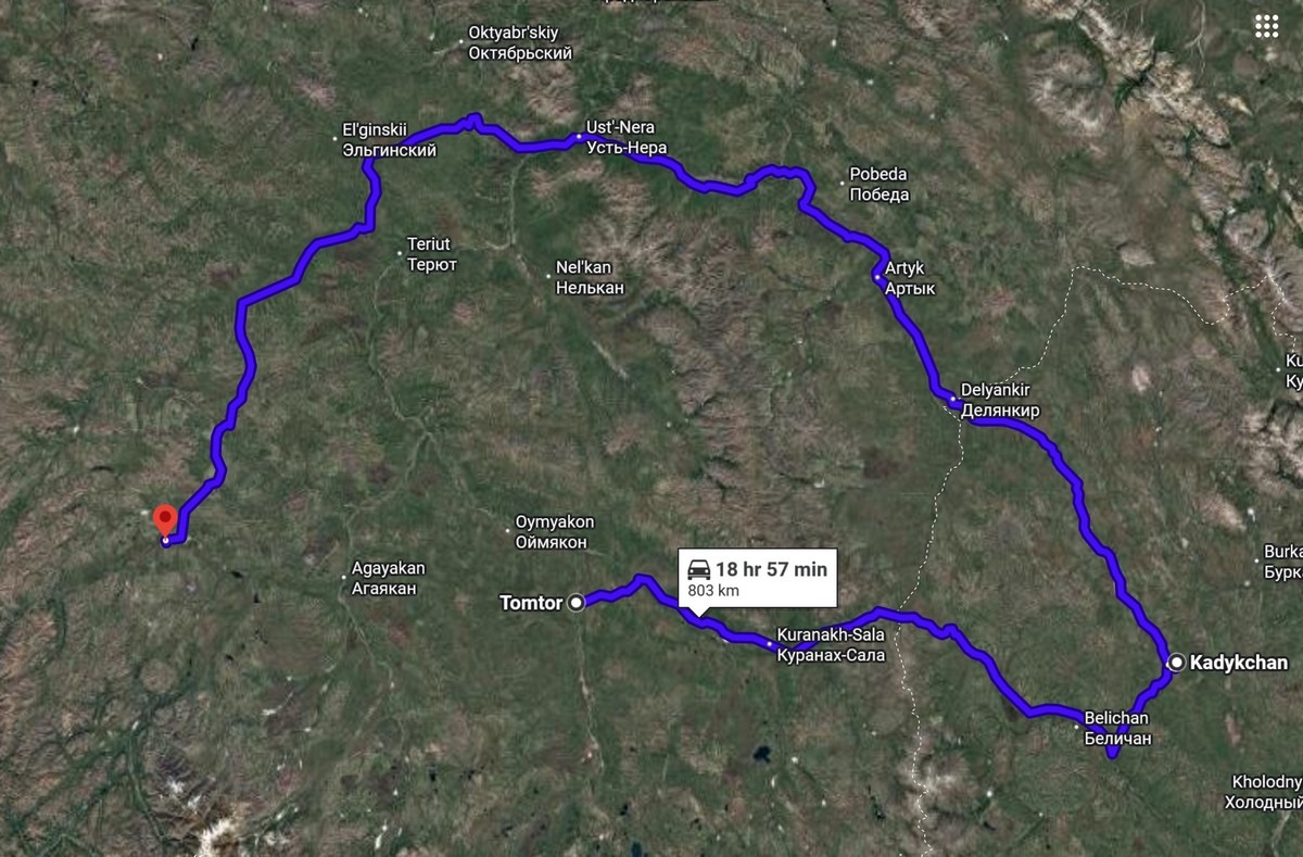
Is it actually possible to still drive along the abandoned stretch of this road? They say that, before 2024, folks would drive over the bridge across the Indigirka (when it was still standing) in summer to reach the opposite bank. They continued on specially prepared off-road vehicles or motorbikes to reach the eastern part of the permanently operating Kolyma Highway (where the abandoned settlement of Kadykchan is marked on the map). For some locals, this represented a side-hustle: in summer they’d escort travelers in a truck, hauling extra fuel and helping them ford the now bridge-less rivers.
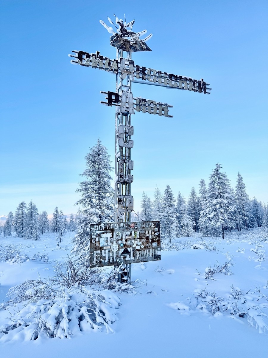
So what about in winter? Apparently, before Alexander Yelikov’s daring trip in December 2024, no one had done it. Btw: here’s proof that he did it: a photo he took of the monument at the border between Yakutia and the Magadan Region:
Here are a few more of his pics:
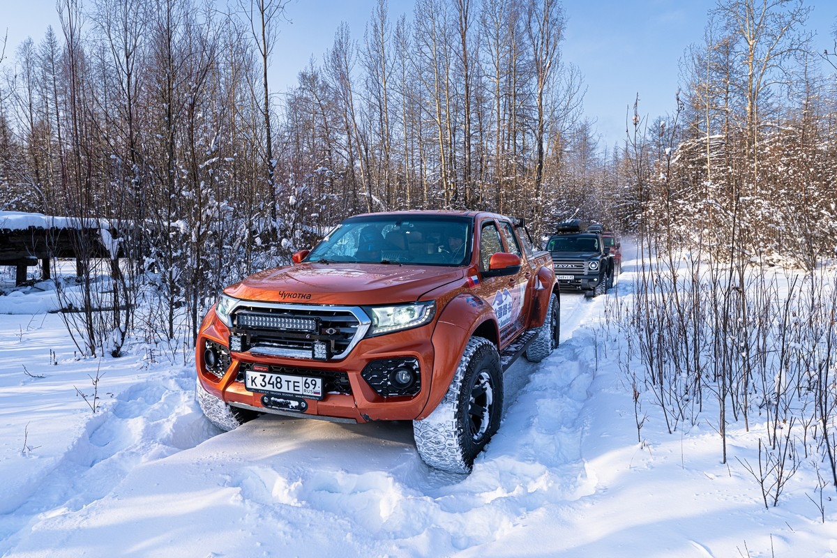
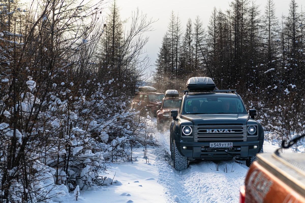
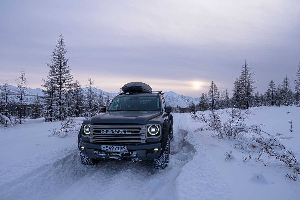
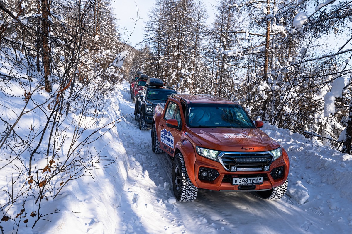
Alexander completed this route in an all-weather, go-anywhere monster like this one, so we decided to try and be the first to complete it in regular passenger vehicles.
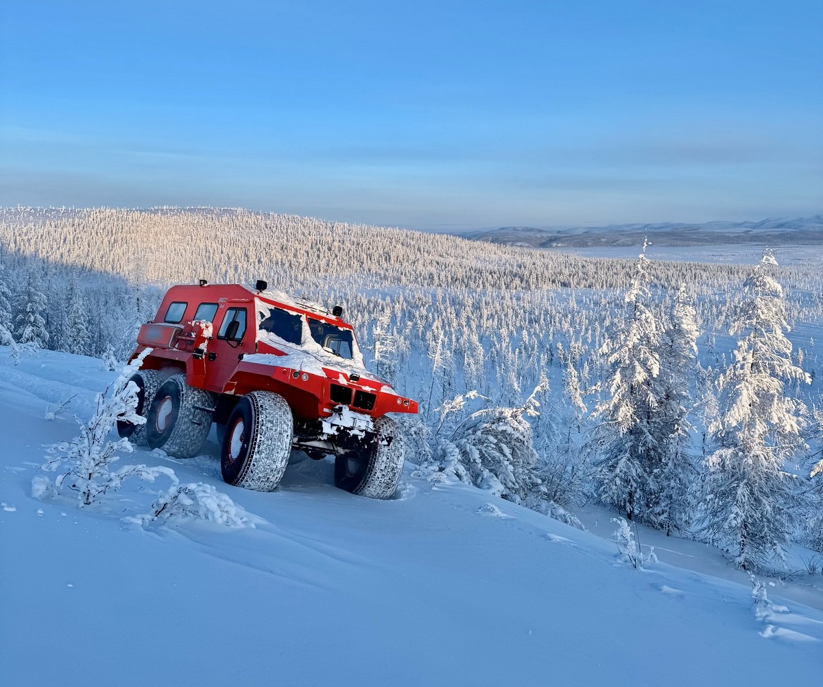
After driving the Old Kolyma Road from start to finish in a Trekol, Alexander concluded that, with his Arctic-hardened pickup truck and three off-road vehicles prepared by the engineering firm Arctic Trucks Russia, as well as six shovels, tow straps, and winches on each car, we could also accomplish the feat. However, as I mentioned earlier, no one expected this much snow this winter. But one thing at a time…
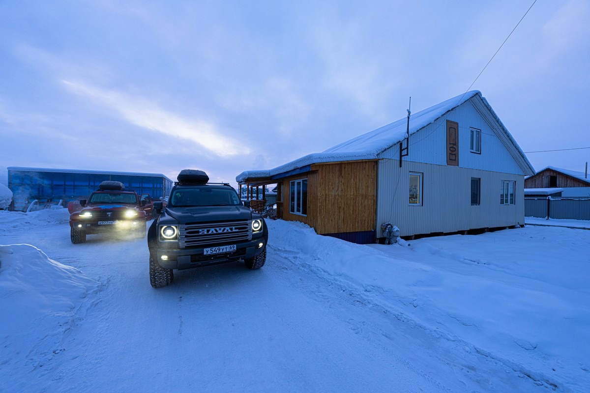
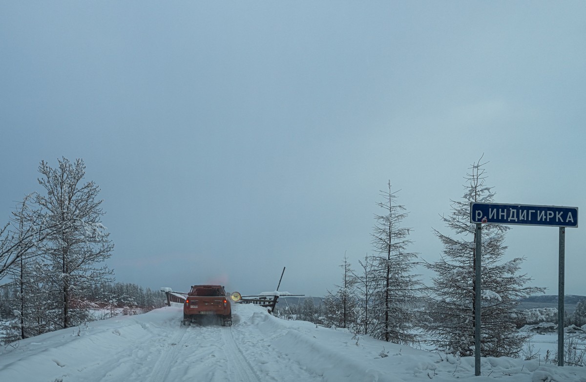
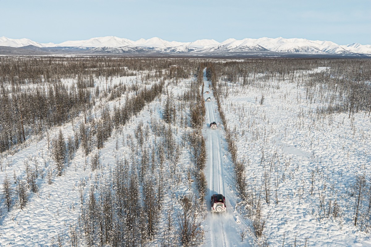
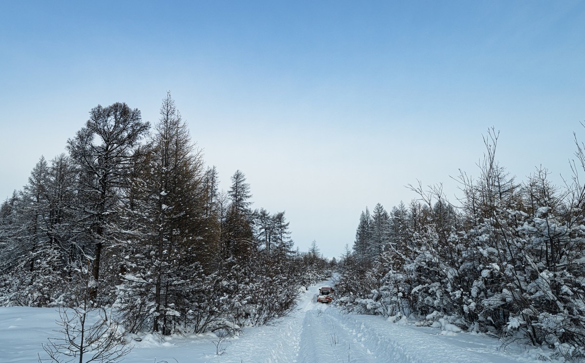
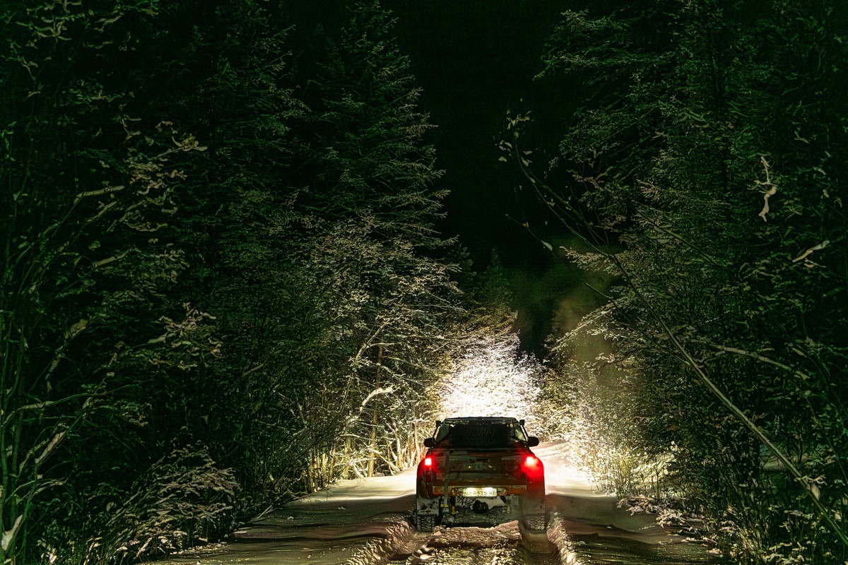
Not too early one morning – but before it was fully light – we said goodbye to the hospitable Ivan, in whose guesthouse in Tomtor we’d just stayed the night at (for the fourth time), and set out on our heroic mission…
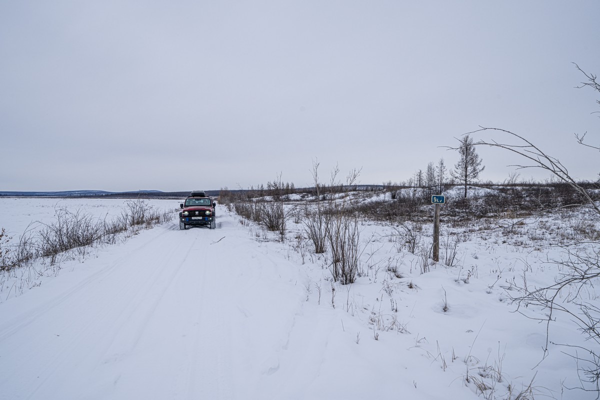
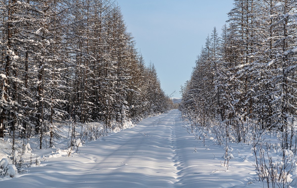
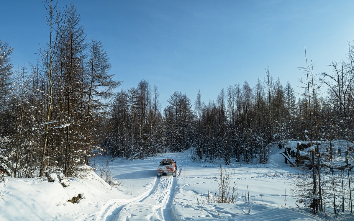
The first 20+ kilometers are along a regular gravel road:
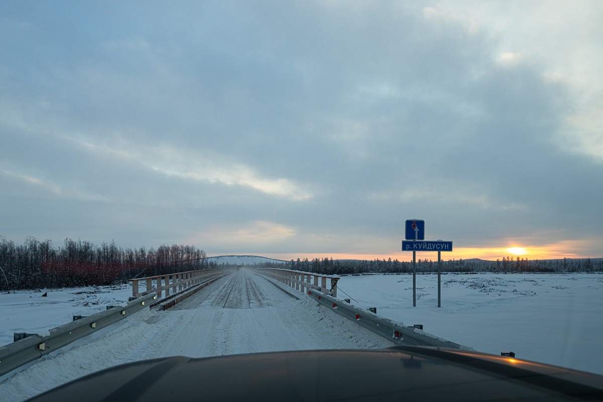
Sunrise! ->
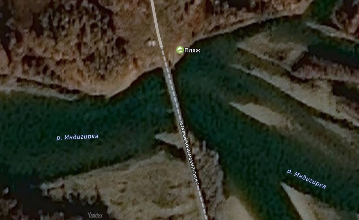
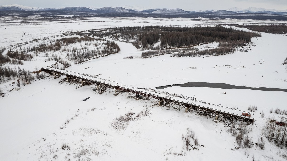
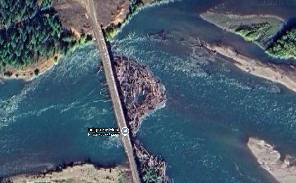
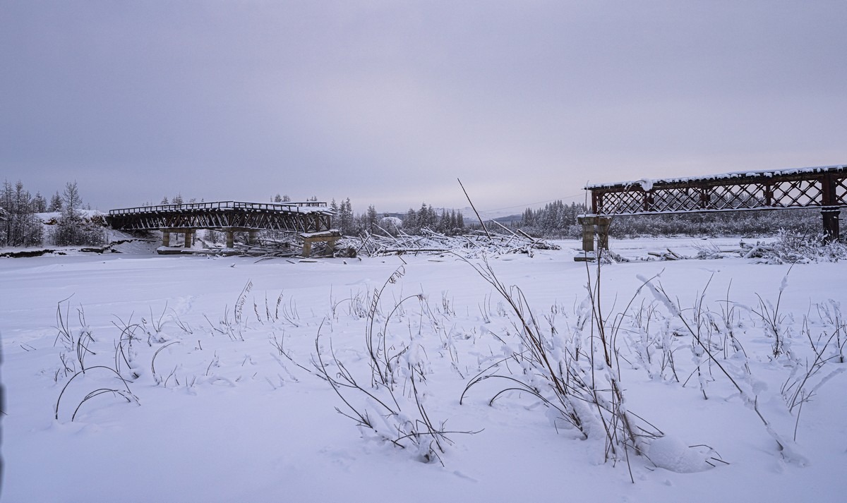
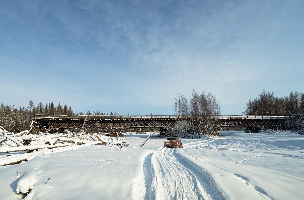
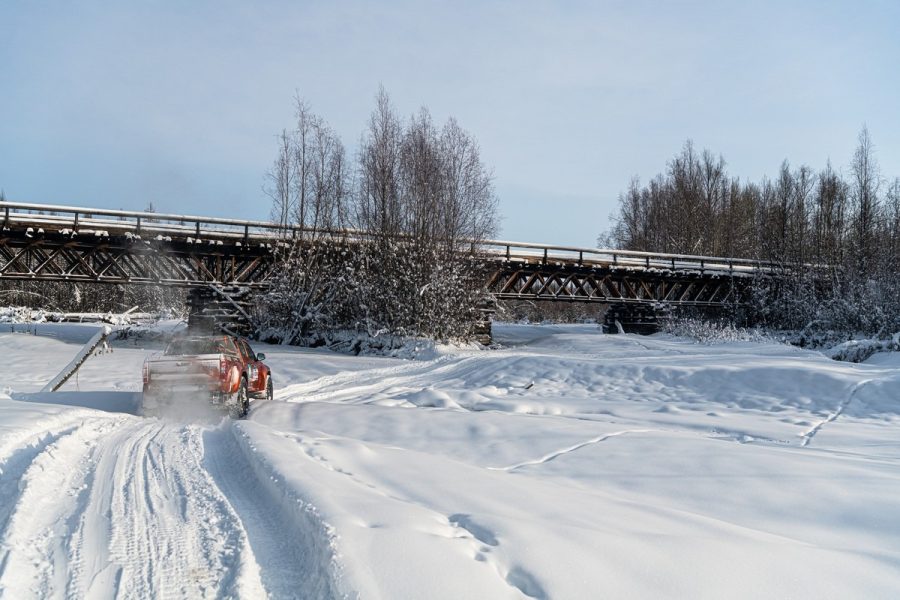
Here’s the above-mentioned (former) bridge across the Indigirka River:
We drove over it in March 2024. And it was unforgettable. It’s still shown as functioning on Yandex Maps. EH?! Ooh – and on the other bank, there’s a… beach marked. Well, well. Someone’s got a fun sense of humor )
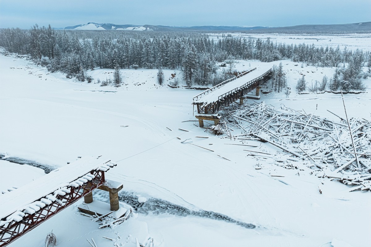
Here’s what the bridge (and “beach”) looks like now:
And here’s what things looked like at the beginning of 2024:
I’ll say it again: unforgettable impressions ->
Later that same year, in 2024, the spring flood washed away the middle section of the bridge, and that was that. We were probably among the last to drive across the bridge. Why did the bridge collapse? One theory is that too much floating debris piled up against it, and the old structure couldn’t take it anymore.
Back to this year – and what were we to do? Drive over the ice of course. However, even in the wintertime in Yakutia, river ice is treacherous. It thins from below due to the slightly warmer springs, so there can be unfrozen water even during extreme frosts. So first our commander and leader pulled out an ice chisel that he’d brought for situations like this and went out to check the ice:
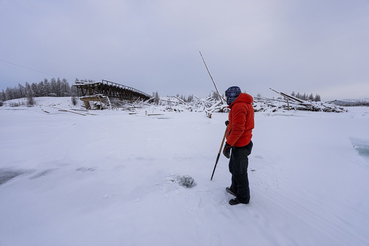
And it was the right call. Unfortunately, there was no way across for us near the bridge. The ice was thin and the river was too deep to cross. We tried from the other side, but it was the same situation.
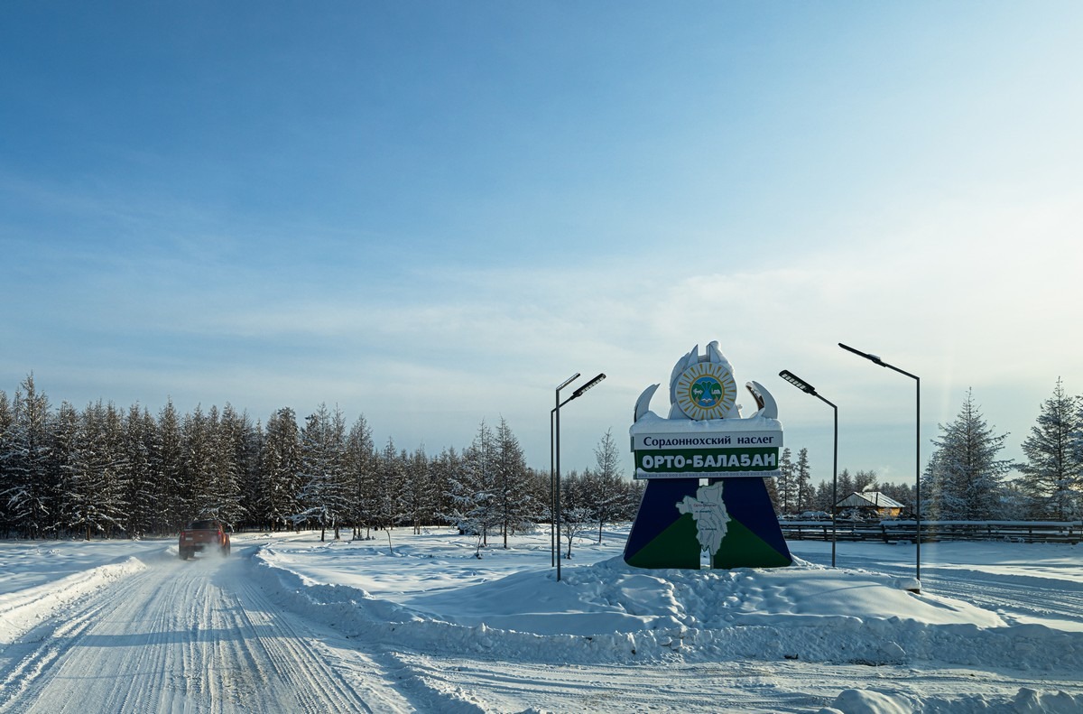
So, now what to do? It was time to switch to plan B (and I’m sure there were plans C, D, and E, too), and head to the alternative crossing. It’s 30km from the bridge by the village of Orto-Balagan…
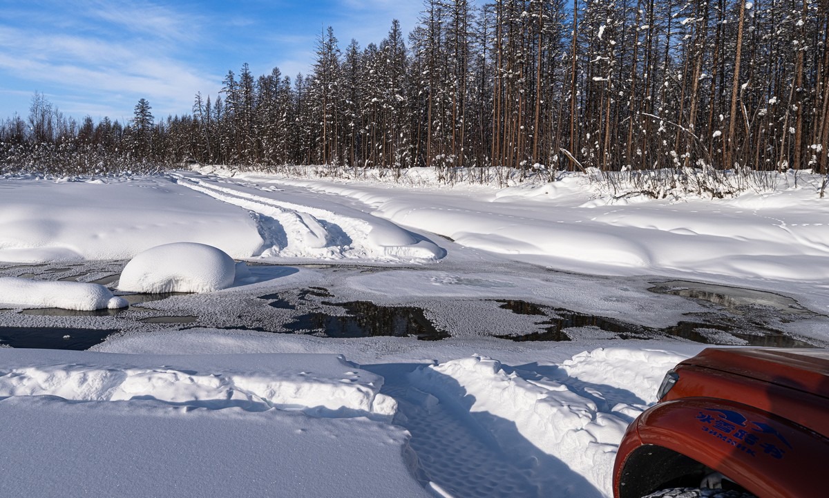
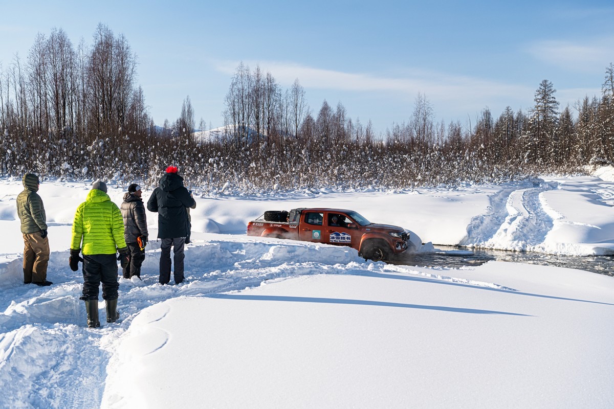
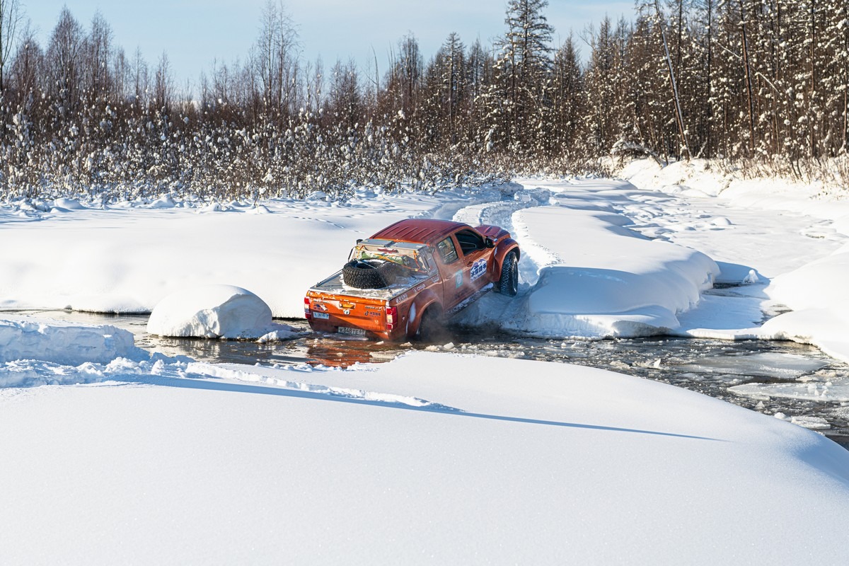
Even there we discovered that finding a reliable crossing would be tricky given the unexpectedly “hot” weather conditions. The Indigirka splits into branches here, and there are lots of islands. We really wanted to travel along the shallows, and it kinda worked ->
In some places, there’s water and no ice; in others, it’s unclear where the ice is safest. Alexander is a master at handling situations like this. So he took out his trusty ice pick and poked through the ice to find a safe route:
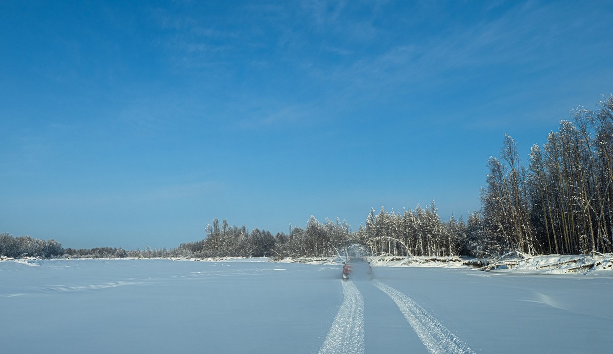
We were driving over freshly fallen snow – and it felt so good! ->
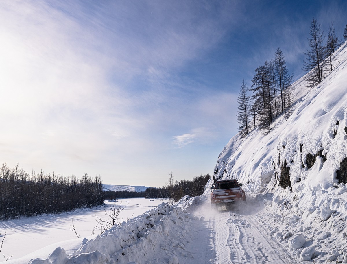
We handle the channels and their occasionally steep banks with only minor stress – all good:
We cracked the ice in one place, but the water was shallow there so we pulled through:
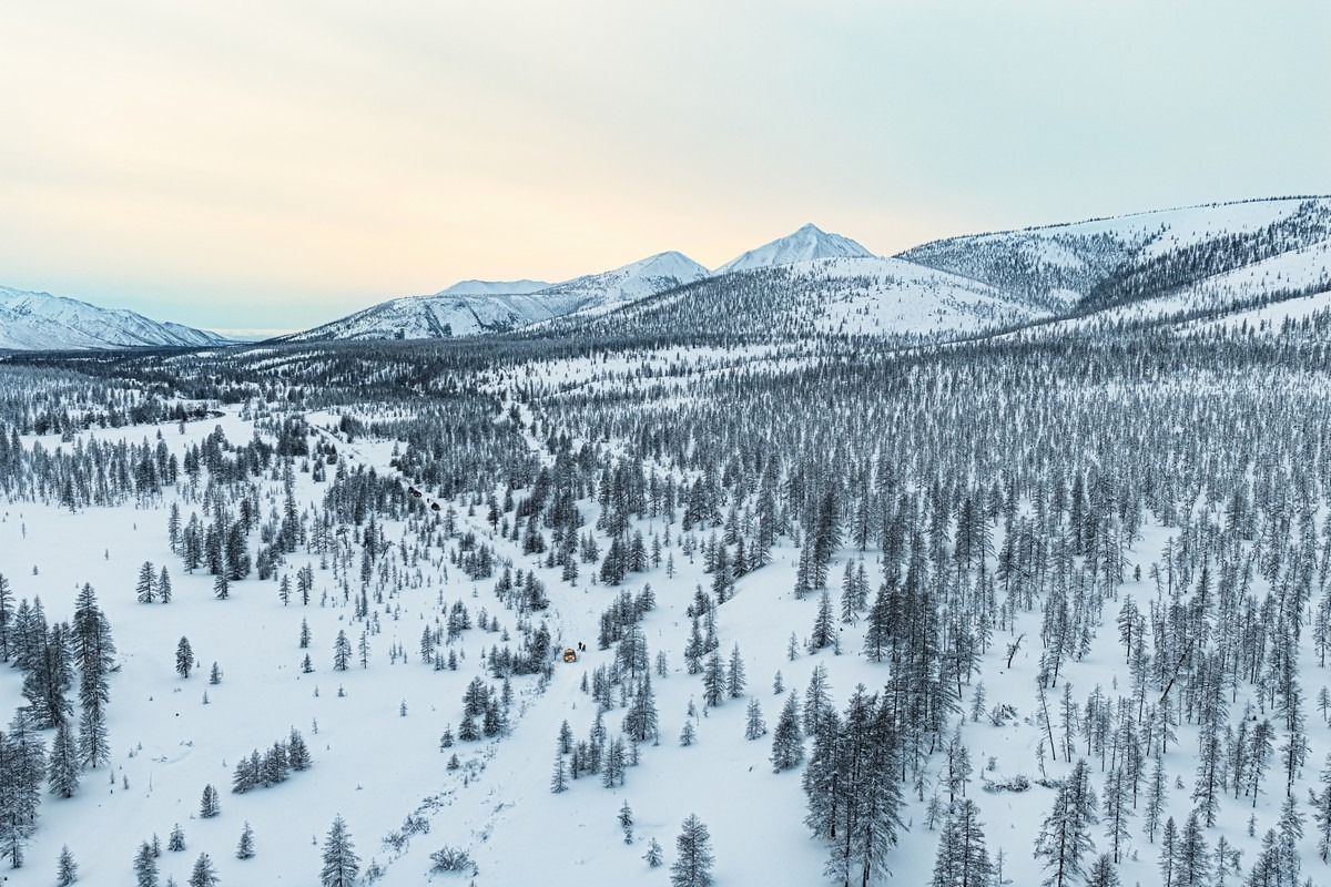
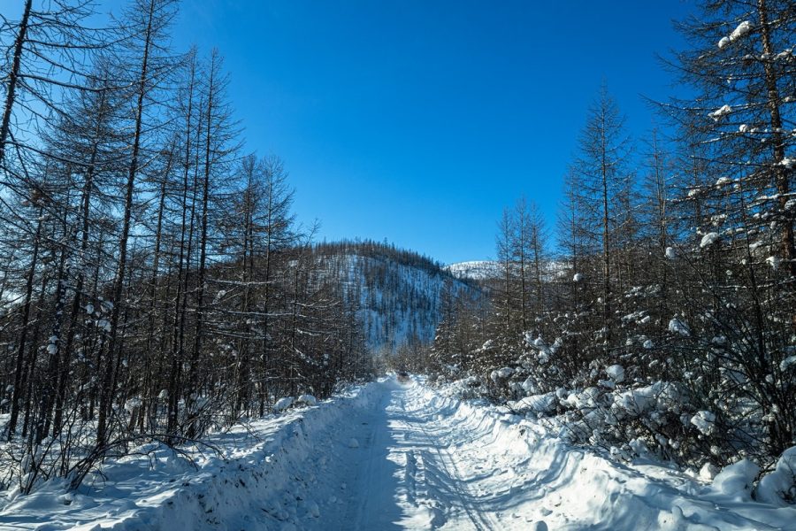
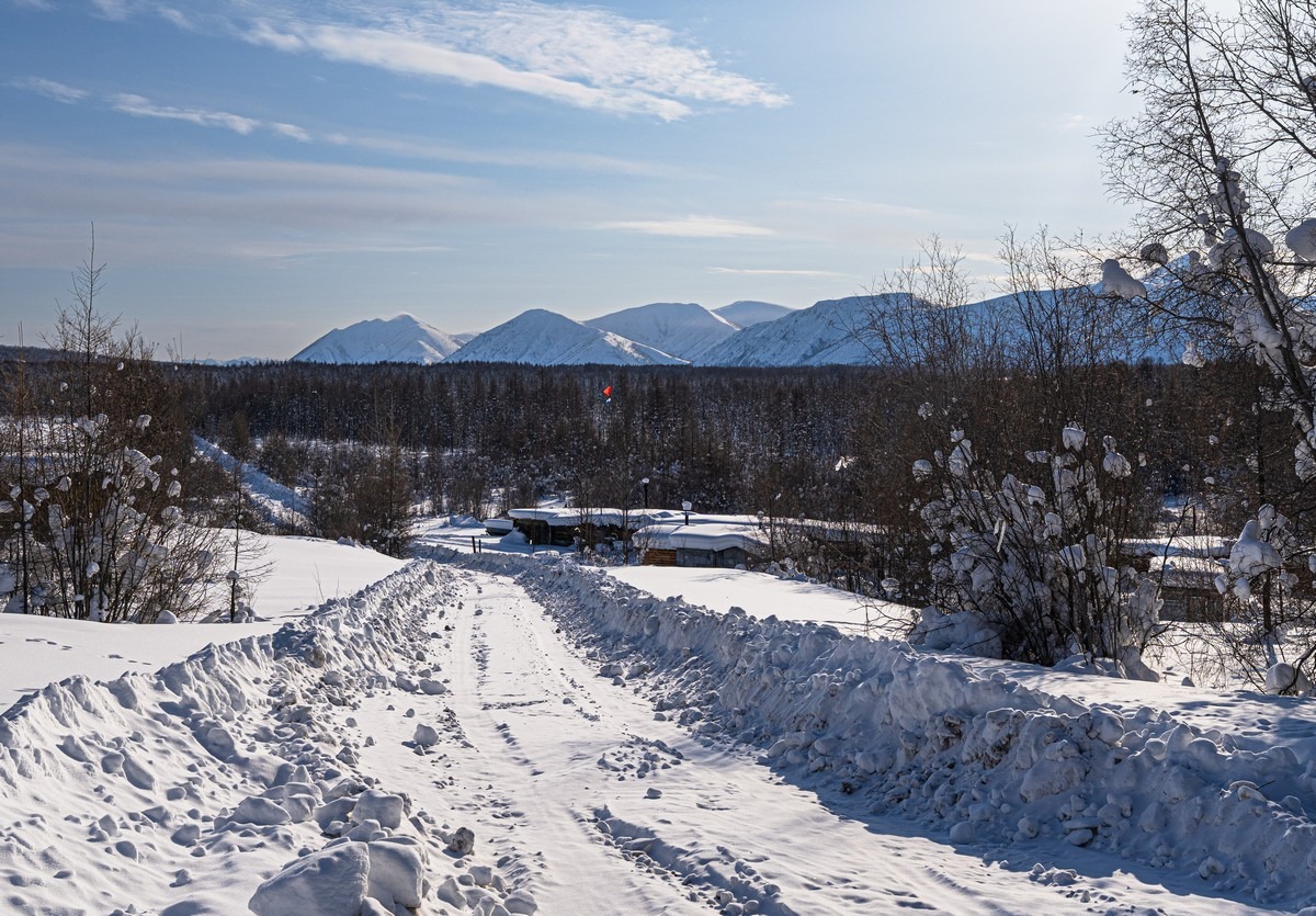
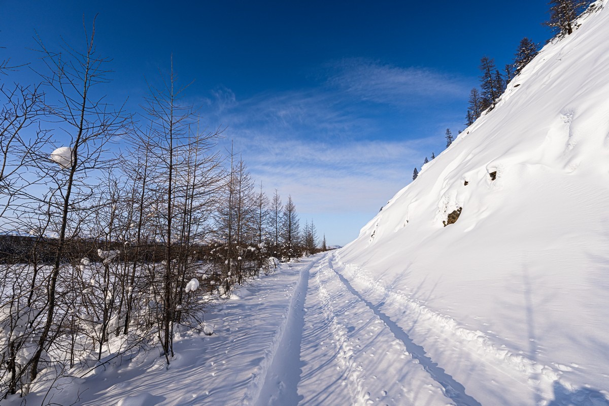
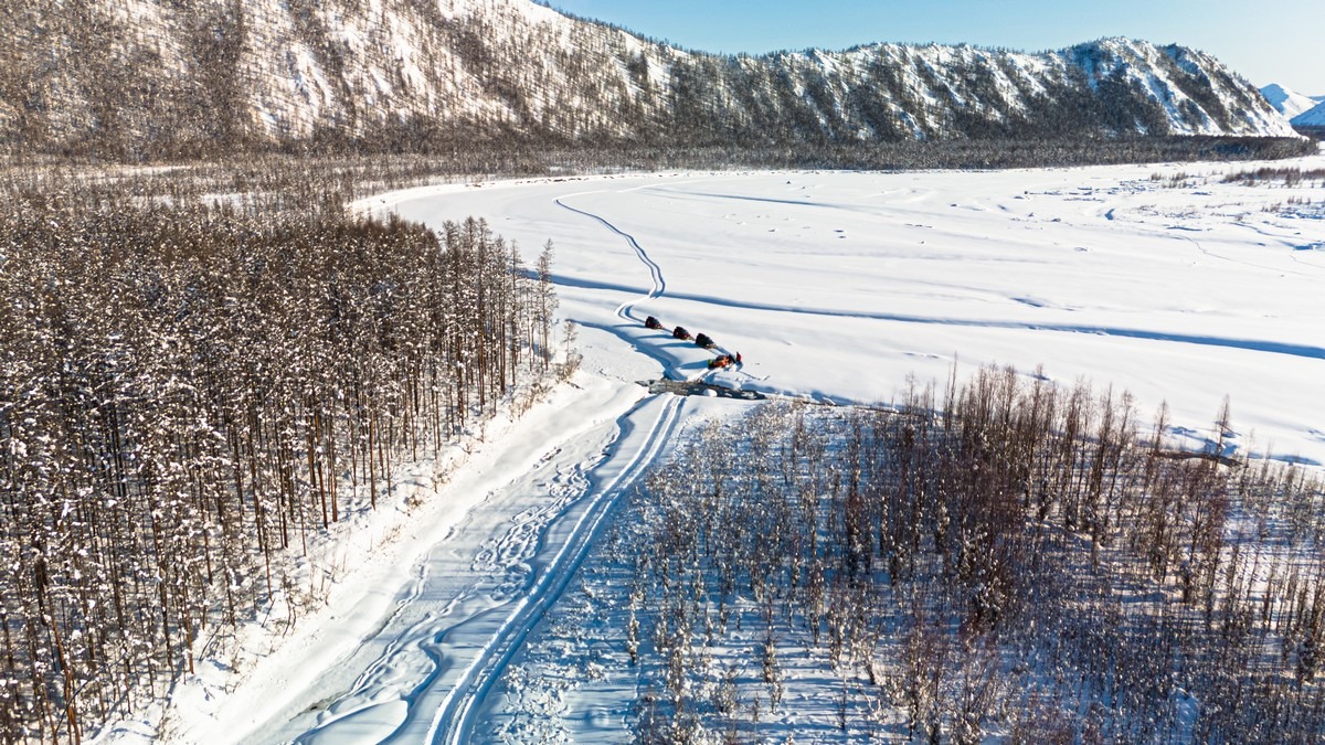
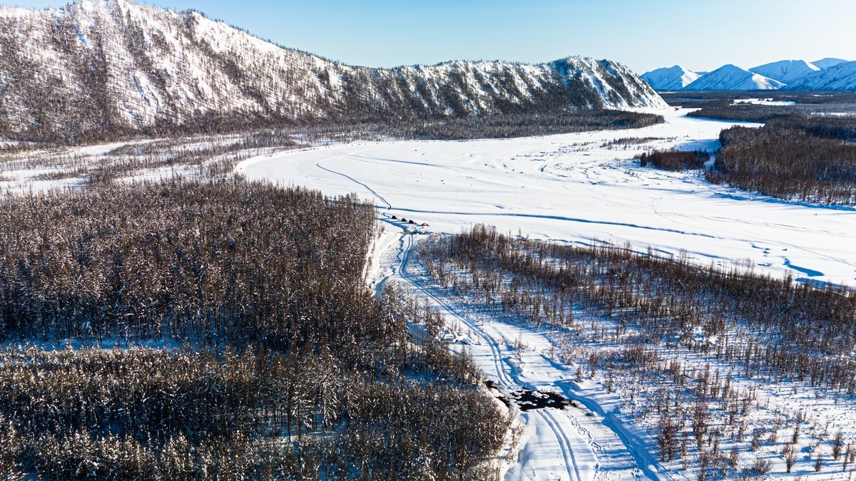
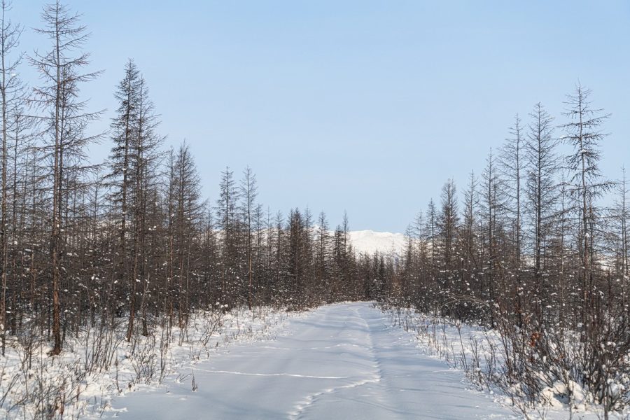
After fording the river – snowy forest tundra:
The Old Kolyma Road runs round the base of that hill:
And we were back on Old Kolyma:

The road runs along the right bank of the Indigirka there, and the scenery is pretty much the same everywhere (photos from the 2024 archives) ->
What’s interesting are the artifacts from the old days. The distance markers left over from back then will be a hundred years old soon:
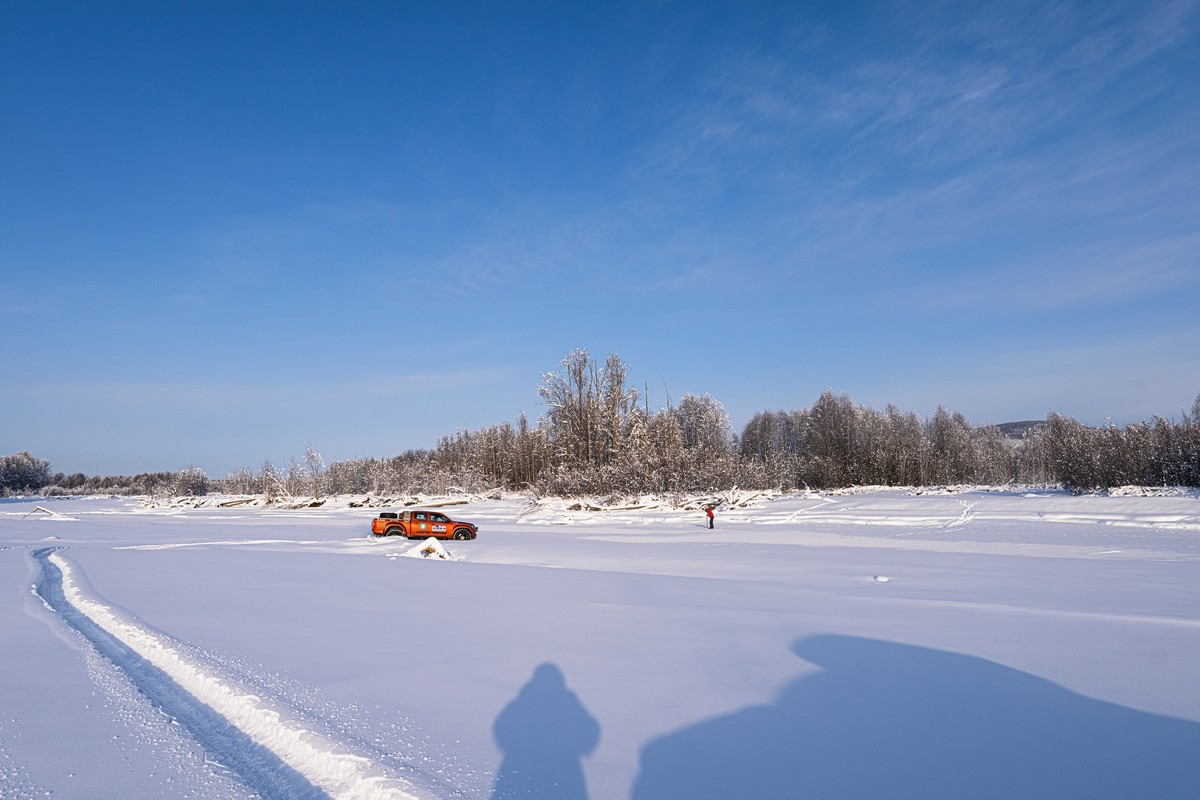
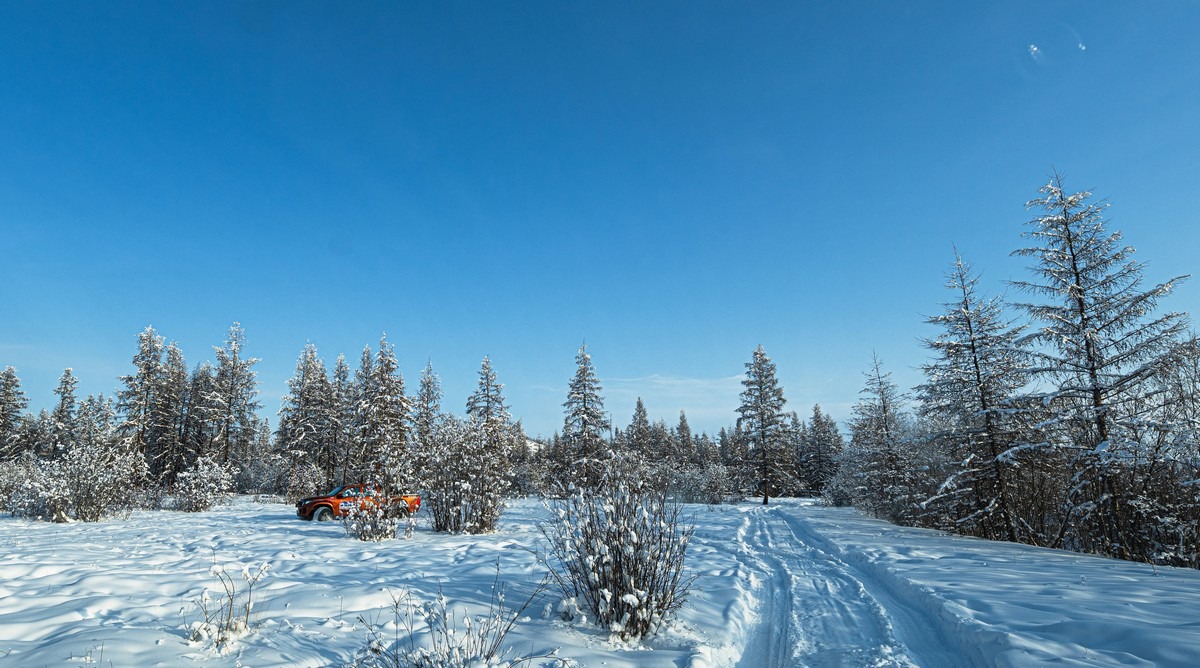
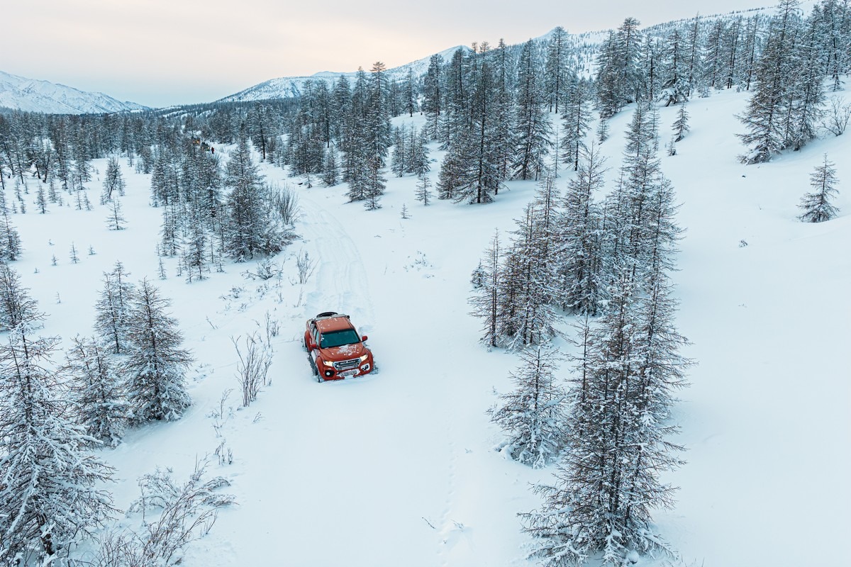
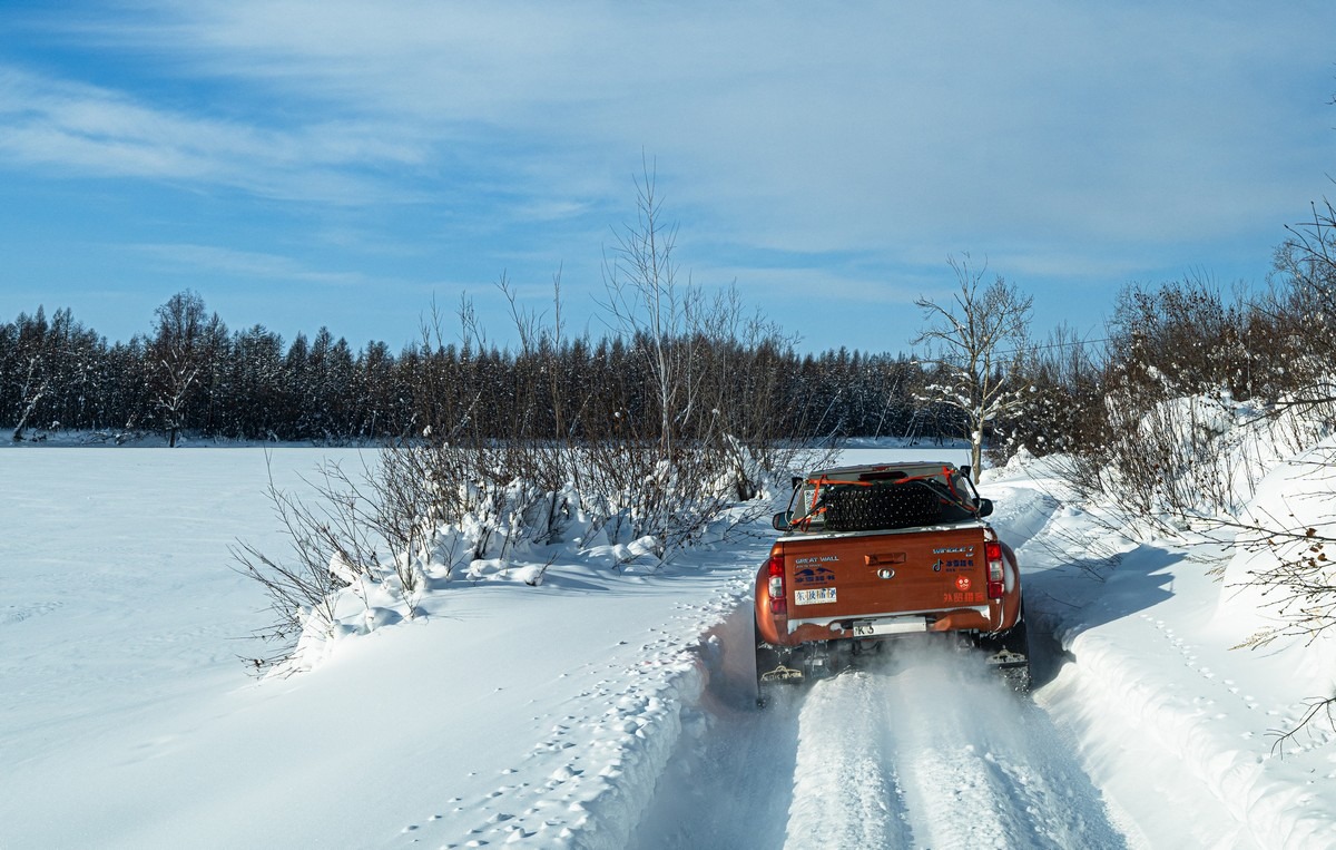
And here we are. Everyone looking good and pumped, and here’s my jeep:
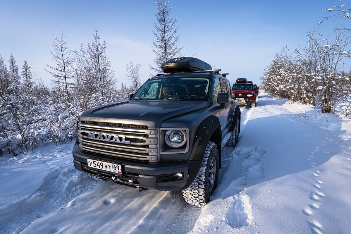
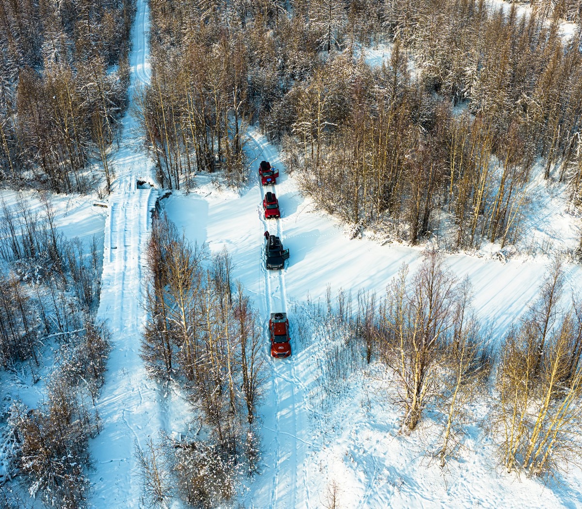
According to the plan, ahead of us were over 200 kilometers of abandoned, snow-covered road. But the cars are prepped, the fuel is in the cans and extra tanks, the food and drink are stashed away, the satellite phones are charged, and we’re bristling with anticipation. Let’s go!…
At first, everything was fun…
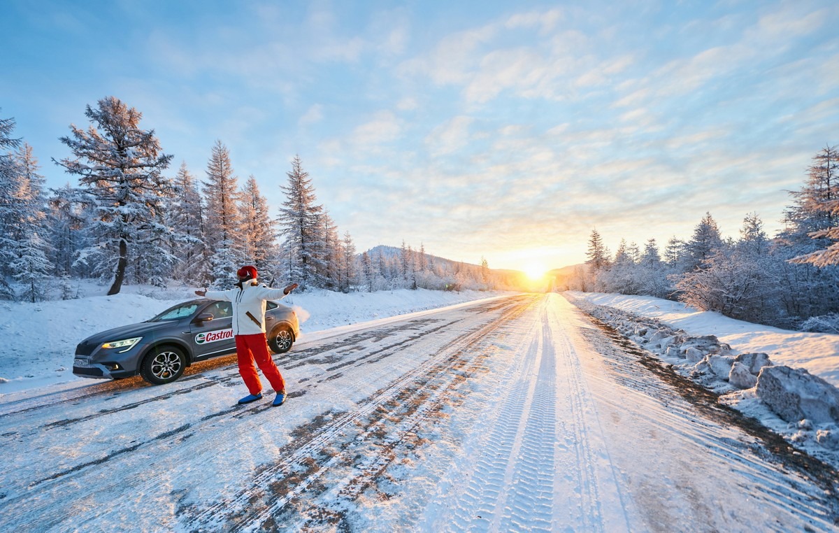
The mood was so chill (no pun intended) that I even put on my Hawaiian shirt – just to show how hot it was on Kolyma! ->
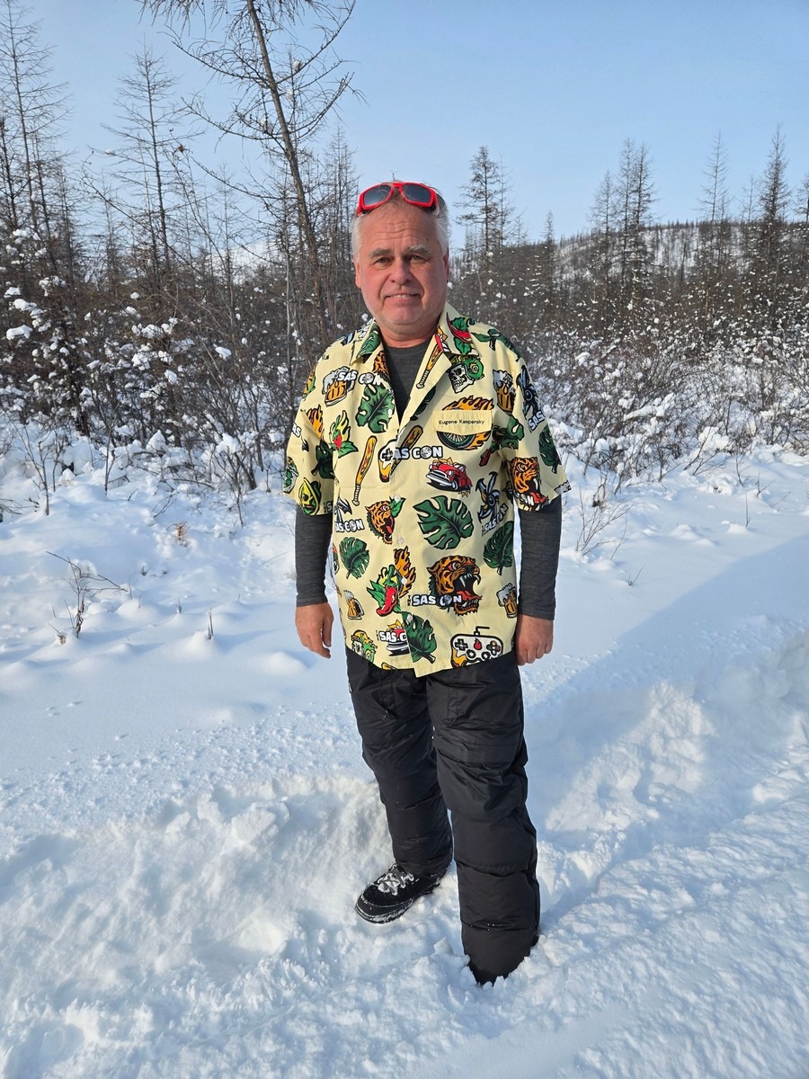
Yep, at-30°C and with not even the slightest breeze: positively sweltering!
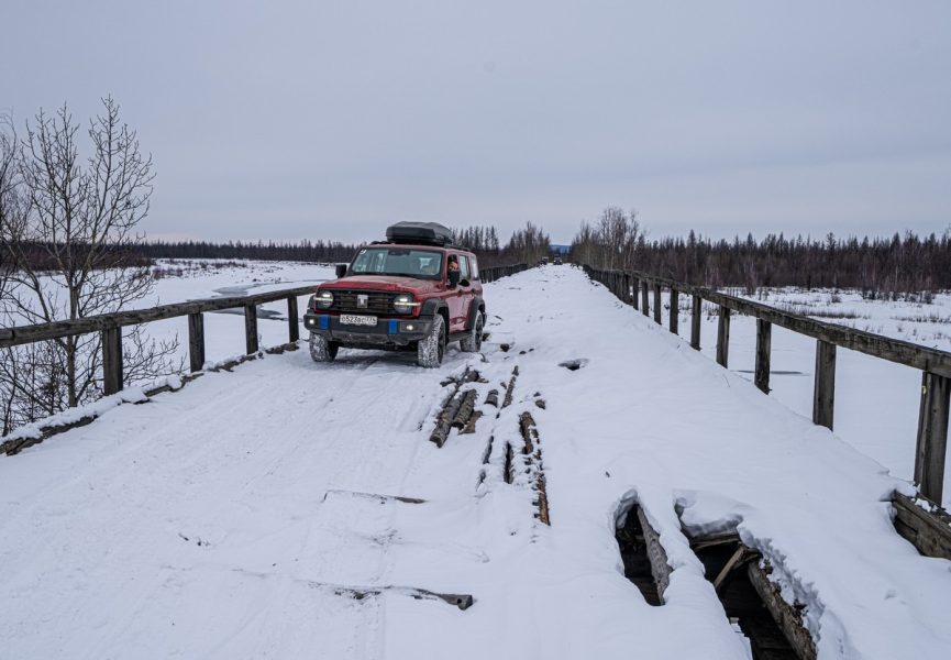
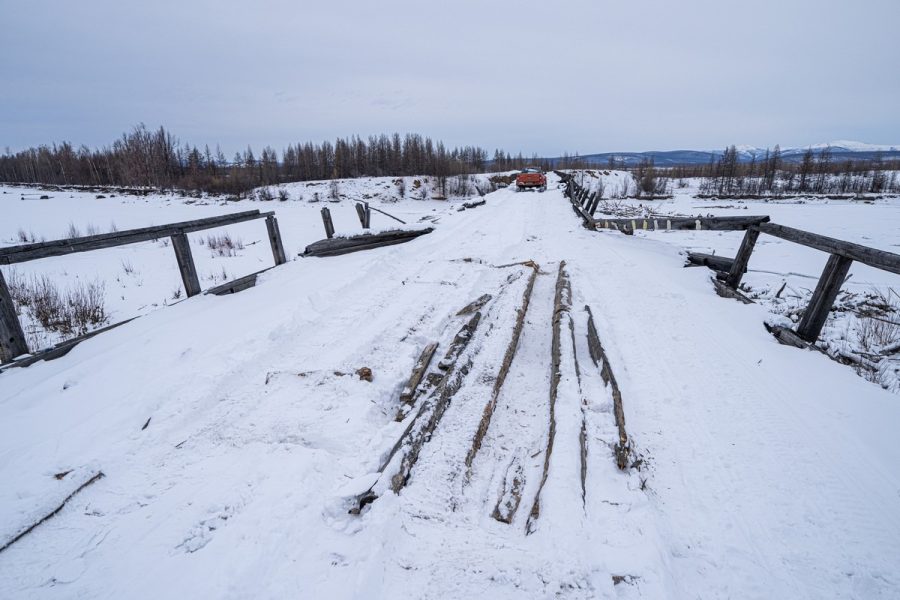
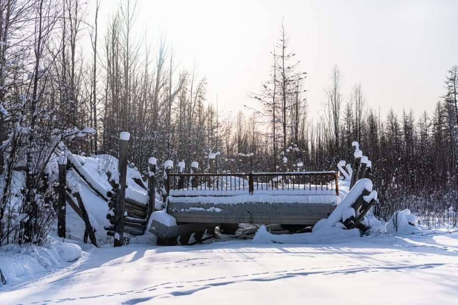
The Kolyma was now running along one of the Indigirka’s tributaries instead of the river itself. And soon we came to another old, worn-out bridge where they’d apparently taken one span down on purpose so that no one would try to kill themselves on it. In winter, though, you can just go around the bridge on the ice:
We bypass other long-collapsed bridges, too…
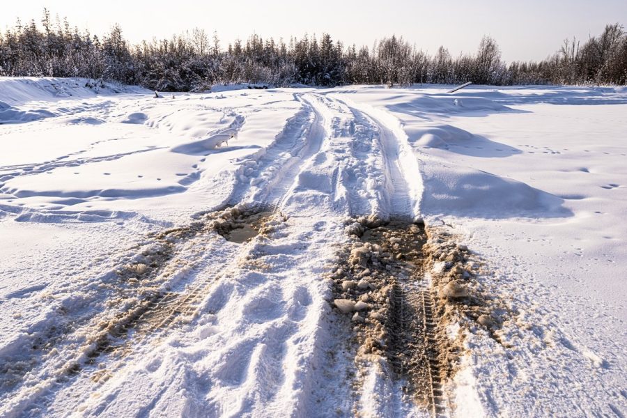
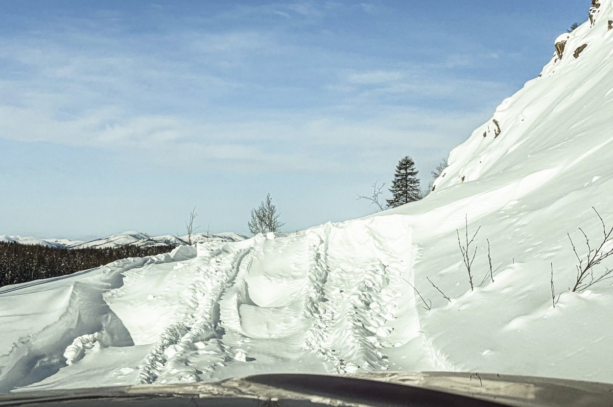
The farther we go – the more and more snow we notice. Bonkers amounts…
By the way, though “impassable”, there are still some vehicle tracks visible under the snow; like here, for example:
You can’t see them clearly, but they weren’t made by a snowmobile; they were made by something with wheels. Our leader and commander, Alexander, determined that the tracks were made in the fall when the first snow fell. And that makes sense — the locals don’t go hunting or gather firewood on skis. So, those marks must be from motor vehicles. But then they disappear…
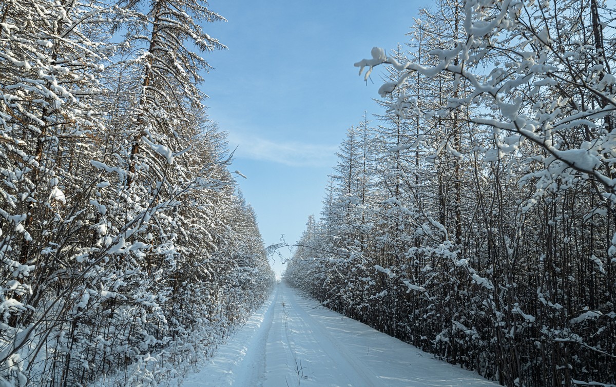
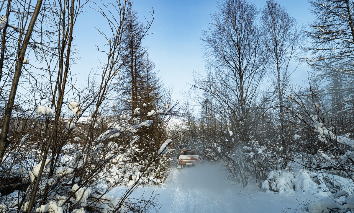
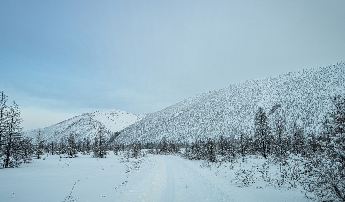
Meanwhile, we heroically keep grinding forward across this endless, fabulously eerie, and insanely beautiful white world…
The bridges over the small rivers have long since stopped working, so we go around them on the ice:
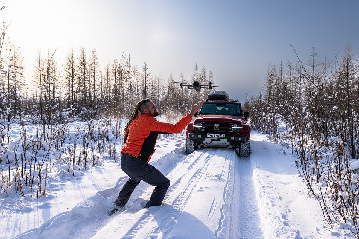
We shot some drone footage, too. I’ll show it to you in a bit…
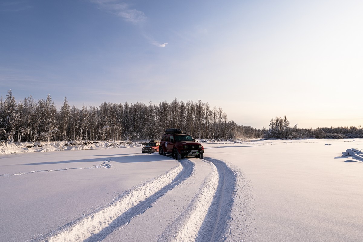
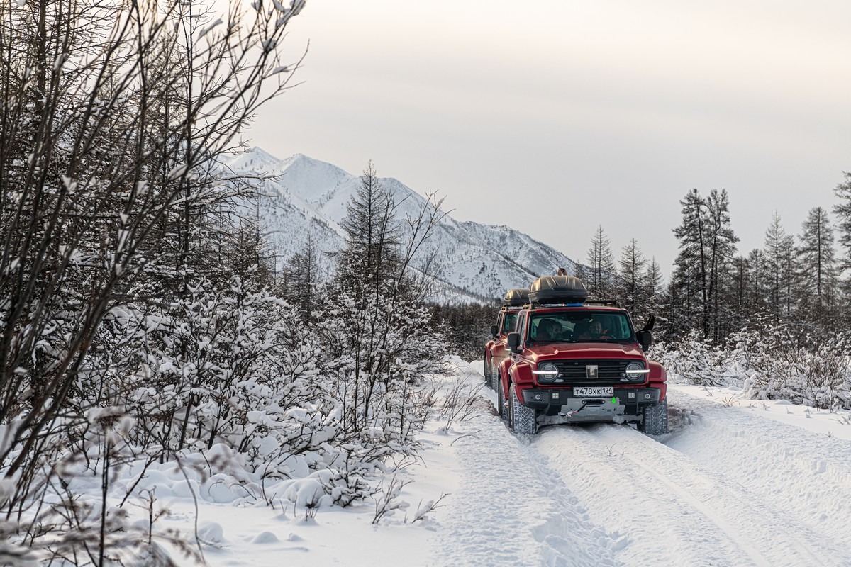
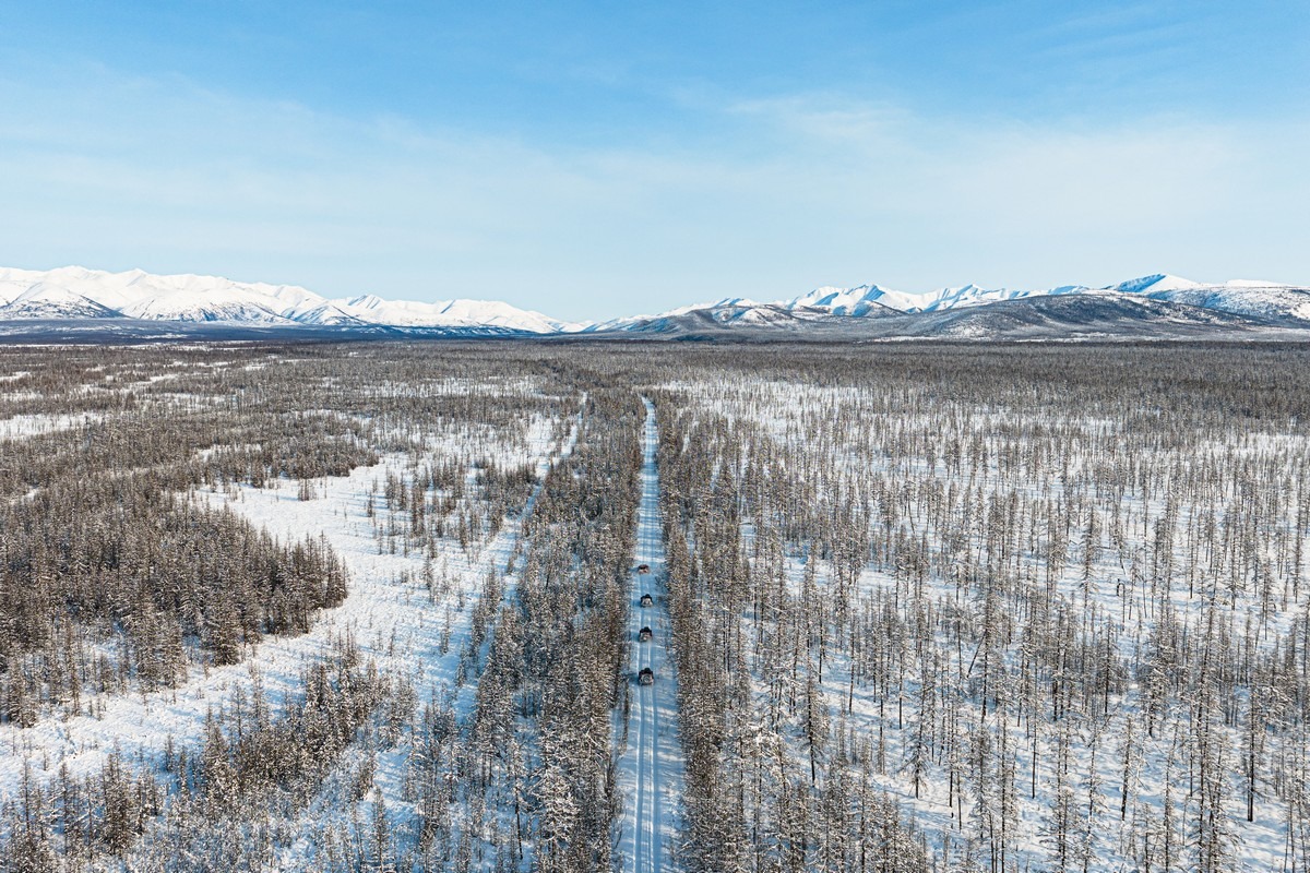
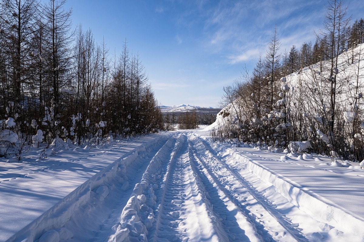
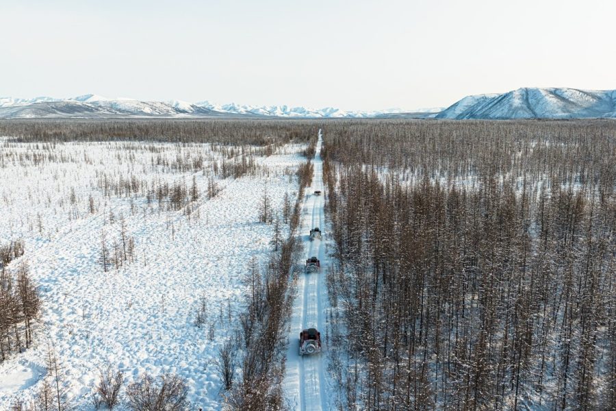
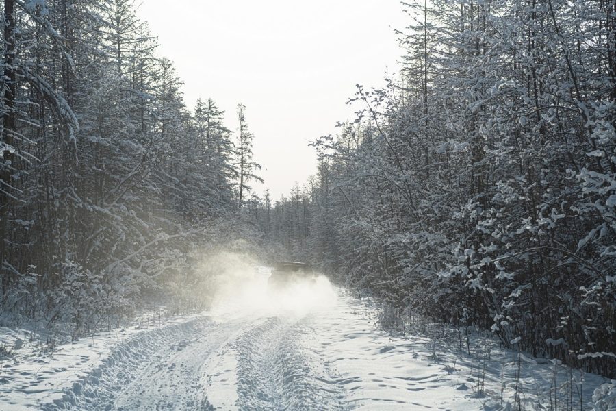
Everything was fine. The road was visible for many kilometers ahead, and we were driving in a neat convoy – how else can we drive with only one lane?…
Cruising along with snow dust flying to the sides. The road ahead looked magical:
But in some places, the drifts were getting silly deep. No matter, we just kept on going…
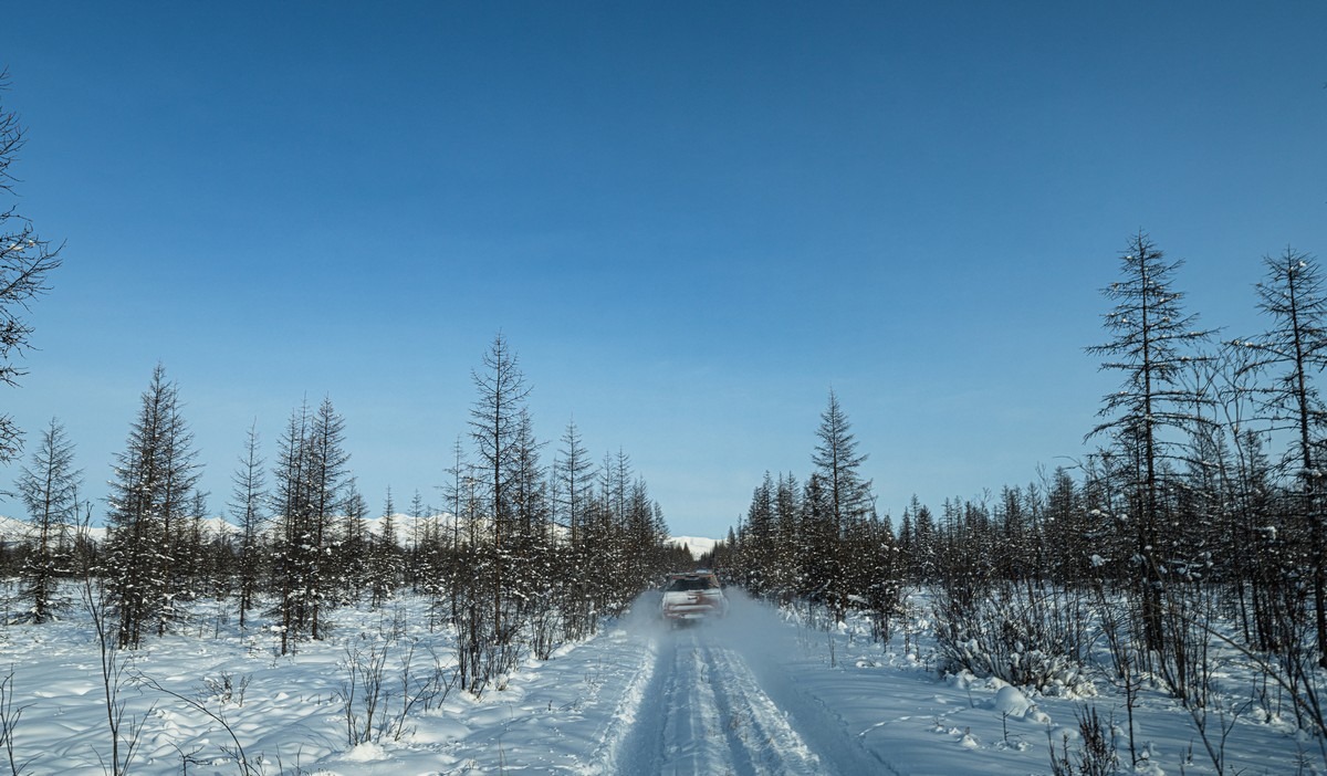
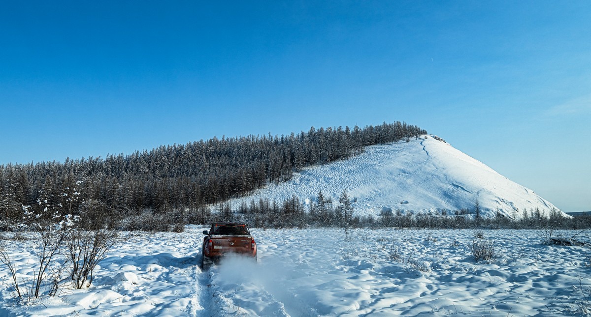
The closer we got to the mountain pass – the deeper the snow on the road became. We were already having difficulty keeping moving.
All around us – pure beauty. A white, frozen world:
But ahead of us was more impenetrable snow, and the closer we got to the pass, the tougher things got:
Initially, near the Indigirka, the snow was ankle-deep, then knee-deep, and finally even higher. We never expected to find this much snow in Yakutia!
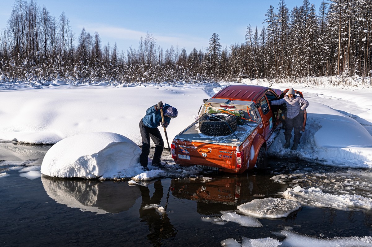
But we persevered and made our way through the snow. We had plenty of shovels to dig ourselves out. There were also enough of us to push….
Evening was approaching…
Onward!
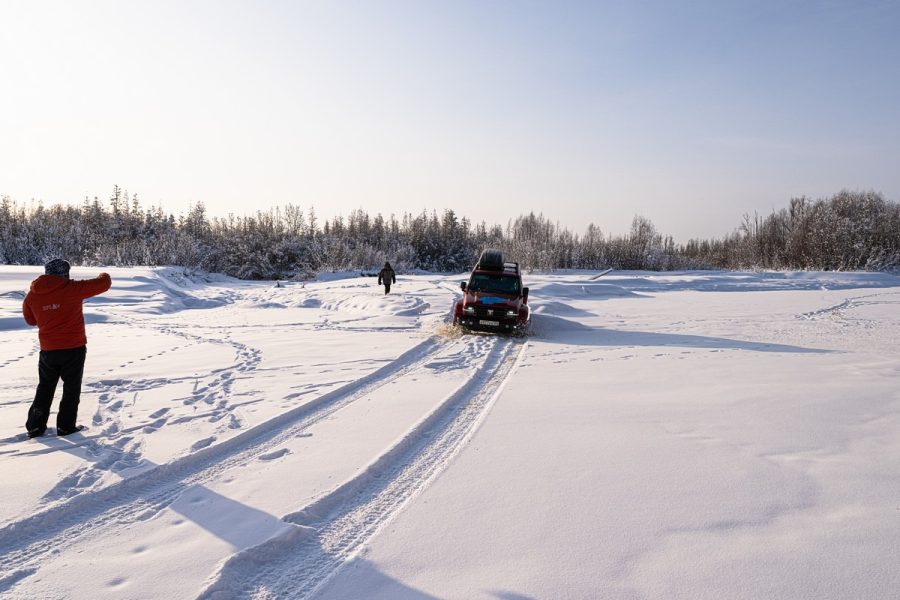
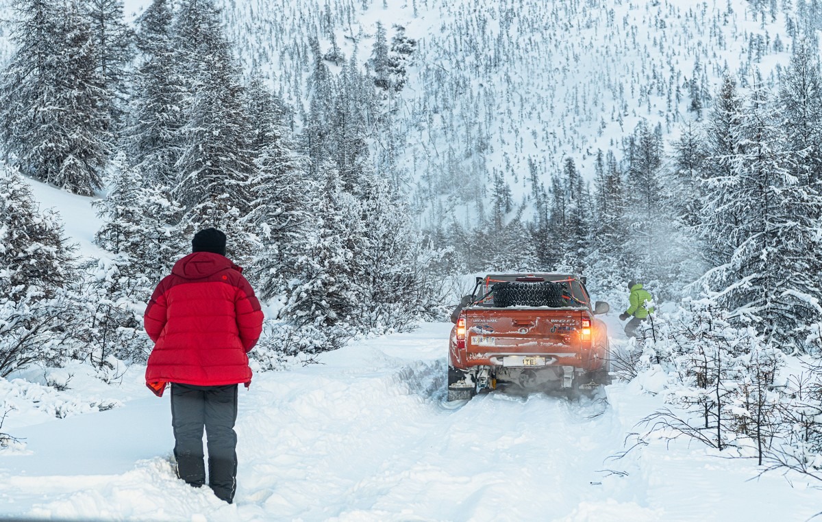
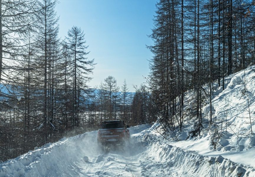
The drifts kept getting deeper and deeper. Alexander tirelessly charged into the snow at speed in his beefy pickup – moving forward 10-20 meters at a time (sometimes less):
We followed in his tracks – literally: the ones he’d just made ->
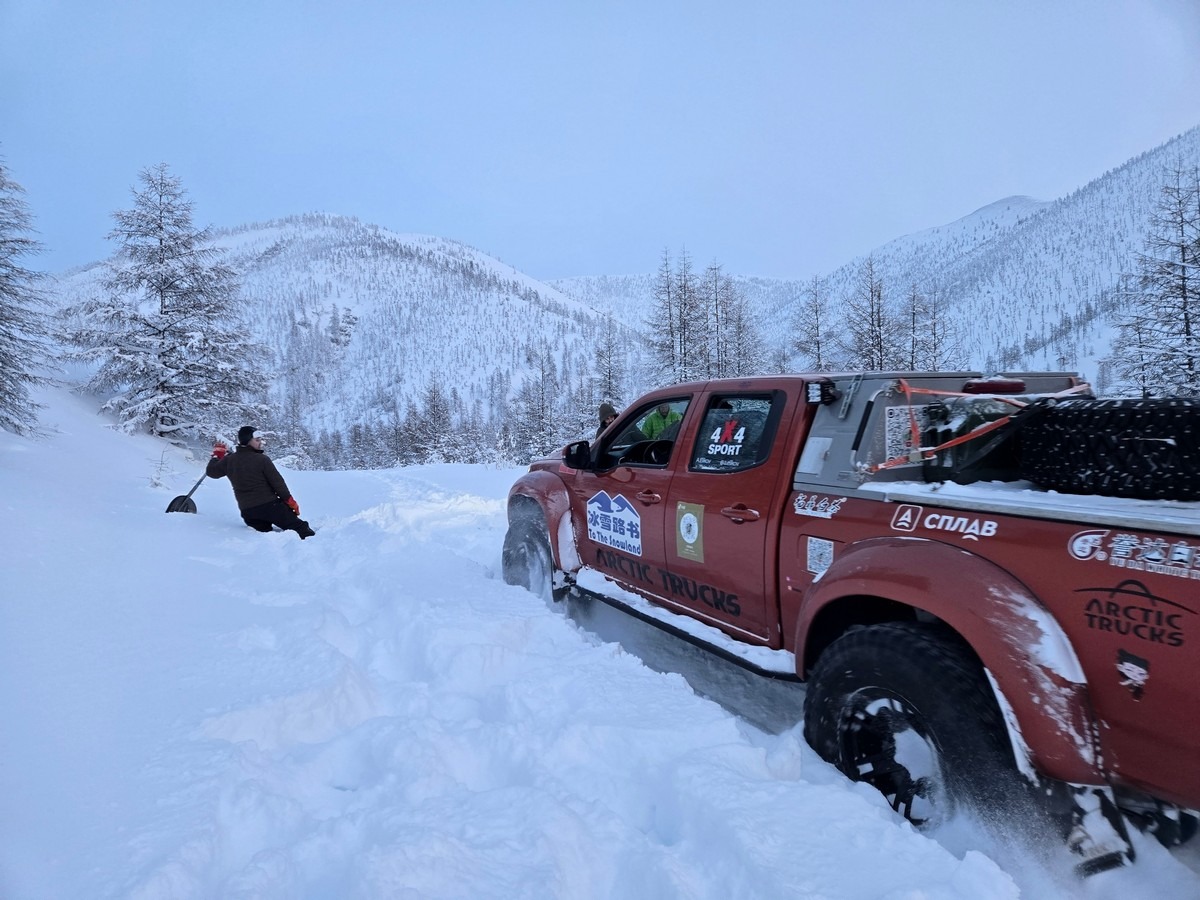
But even the pickup started getting stuck; that’s when the spades came out ->
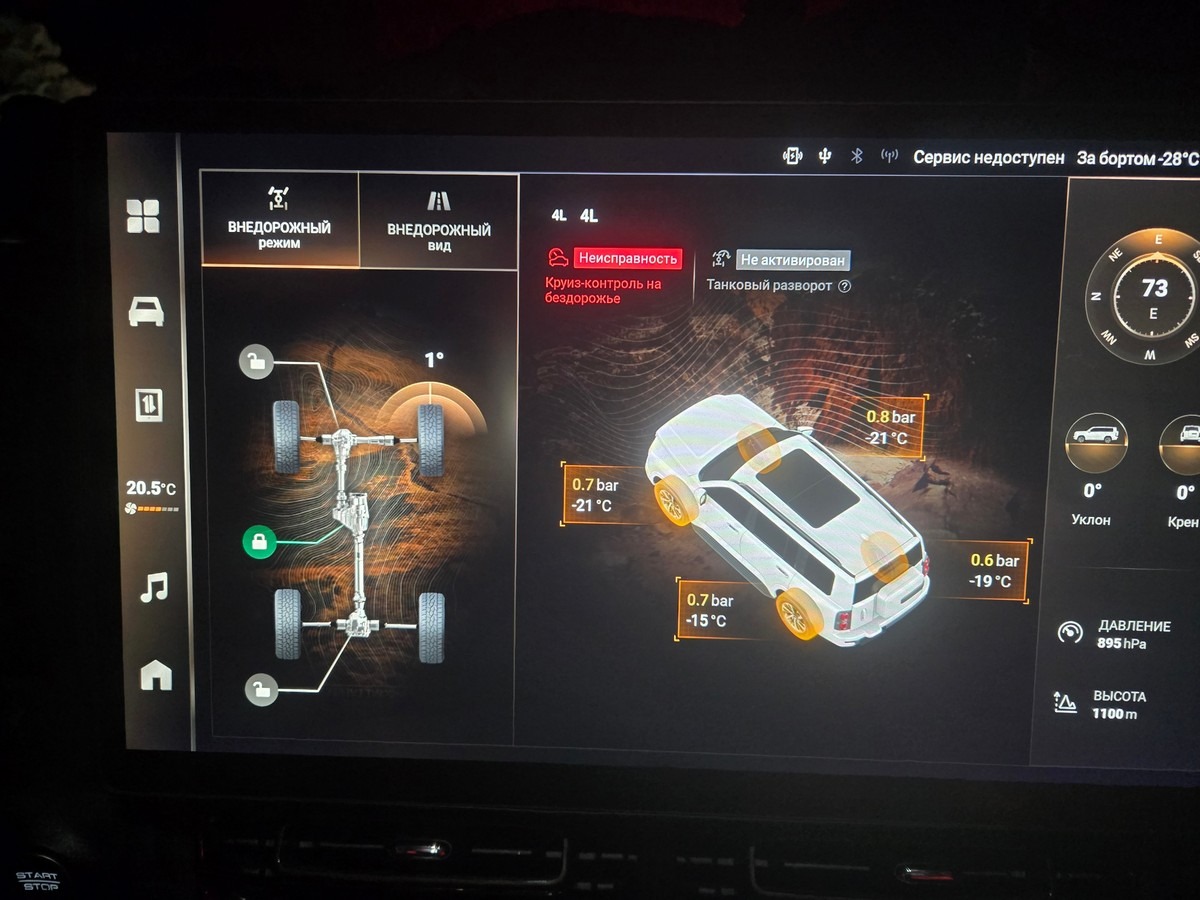
We also gradually lowered the tire pressure – first to 1.4, then to 0.8, and finally to 0.6 bar:
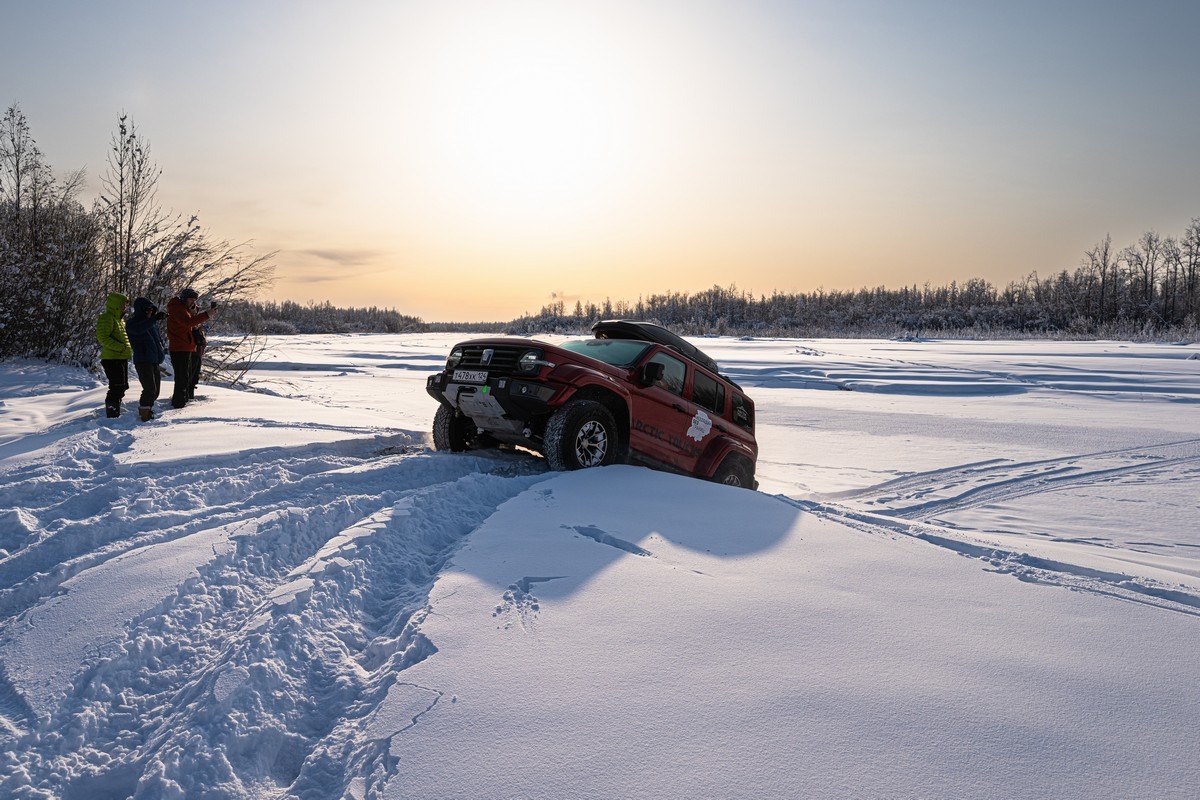
Despite our persistence, even the all-terrain pickup got hopelessly bogged down:
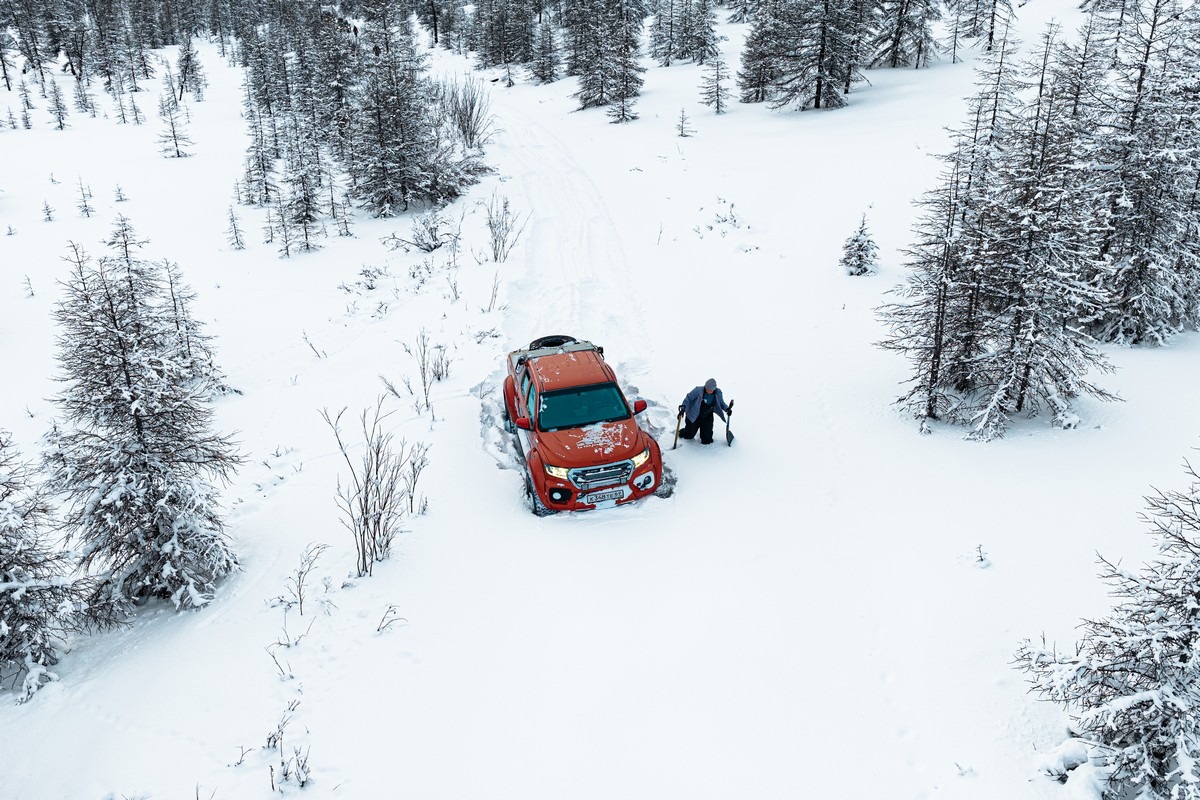
We dug it out and pulled it free, but eventually decided to turn back: if the pickup was getting stuck, the Haval and Tank would be completely screwed.
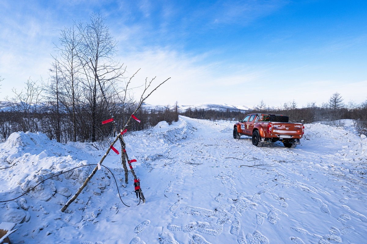
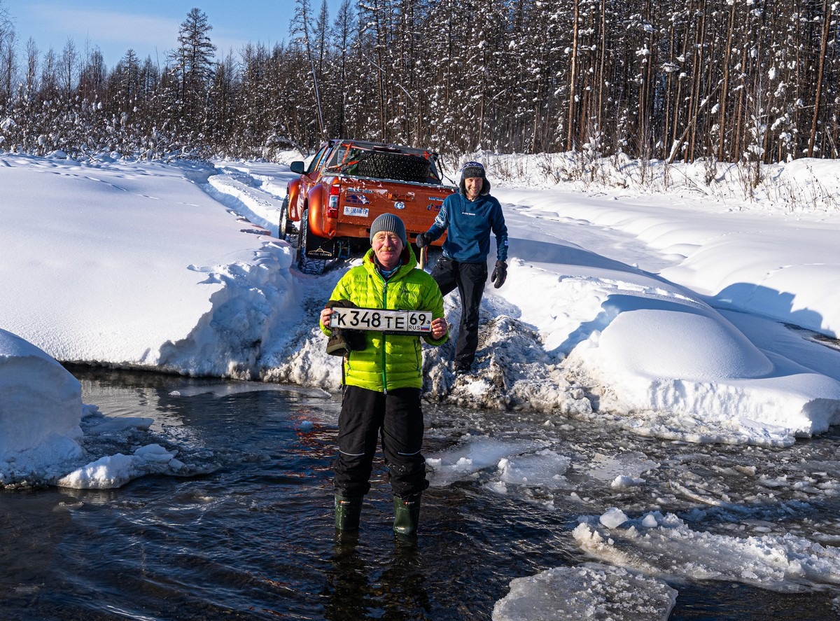
Ultimately, we made it as far as where the road crosses the Bayagap River. That’s precisely where our leader got stuck:
We turned around and headed back to Tomtor.
It was unfortunate and a bit frustrating, but we’ll make it through next time – if there isn’t that much snow, that is.
And that was that. We’d covered over 60 kilometers of the Old Kolyma Road (the abandoned section), which is more than a quarter of the total distance (including the “shortcut” we made through the village of Orto-Balagan). We fell short of the pass by 6-10km, and were only 9km from the Magadan Region border. The outbound run took 14 hours (including time spent looking for a way across the Indigirka), and we spent around six hours battling through the last six-and-a-half kilometers. We sang songs in honor of our perseverance and the craziness of the whole venture. On the way back, we drove for another five hours deep into the night. In total we drove around 240km in 19 hours. Phew! A very long day.
One thing I want to stress is that this kind of thing requires both serious preparation and experienced, skilled leadership. You need to prepare the vehicles, stock up on supplies for both yourselves and the cars, find an old-hand leader, and ensure you’ve satellite communications (with a backup). And, of course, the team must be ready for such a fun (albeit by far not your ordinary) adventure – both physically and mentally (bascially, they need to be as mad-hat as you!).
But wait. We weren’t done yet. We wanted another pop at Old Kolyma…
Sure – we didn’t pull it off from the west, but hey – every road has two ends. What if it’d work out from the other end? So, a few days later, we took a recce trip from the eastern end of the road in the Magadan Region. From that end the road had been partially cleared to give access to some gold mining sites. And when we saw a home-made “sign” warning against driving any farther – that was that: we had to drive farther!…
So, after the recce – off we go!…
This section of the road was obviously cleared, but nobody had been here in a good while…
It started getting real narrow:
…And hairier:
Still, we’d brought the shovels – just in case. It’ll be fine…
Curiously, Google Maps shows a weather station here:
But it looks like it’s only inhabited in the summer:
The convoy:
We weren’t the only ones driving in this neck of the woods: Trekol all-terrain vehicles had been here not long ago:
So we just followed their tracks:
Alas, we ran into an avalanche chute:
We hit reverse and followed the alternative route the Trekol had taken along the river:
Suddenly…
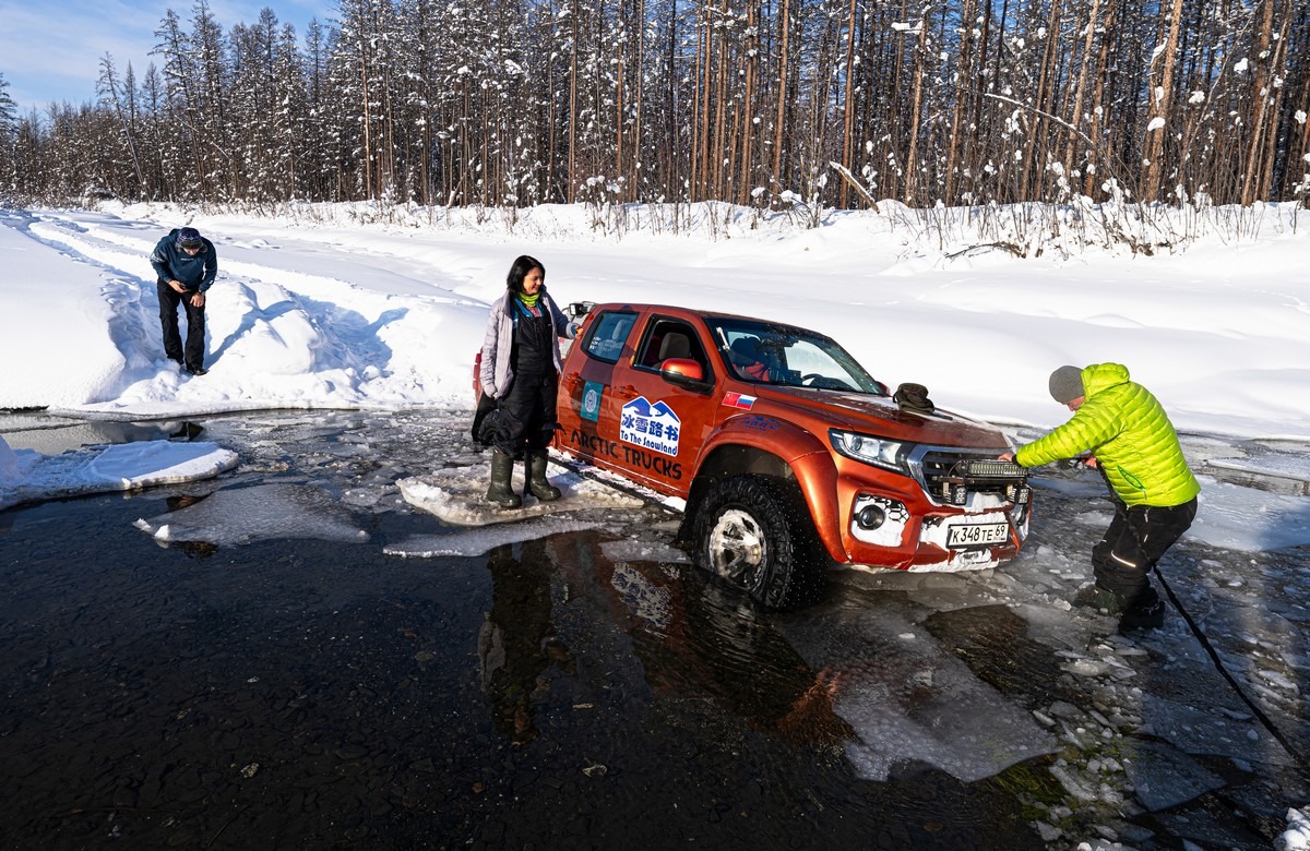
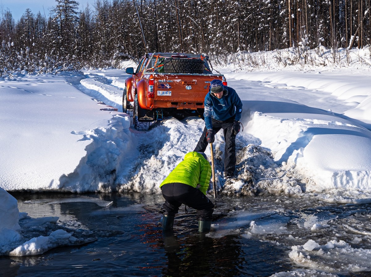
Then things got a bit funny – and a scary. It was a proper deep freeze outside. I don’t remember exactly, but it was probably around -20°C or lower. But the springs were gushing water and melting through the ice. This is what we ran into: an unfrozen channel:
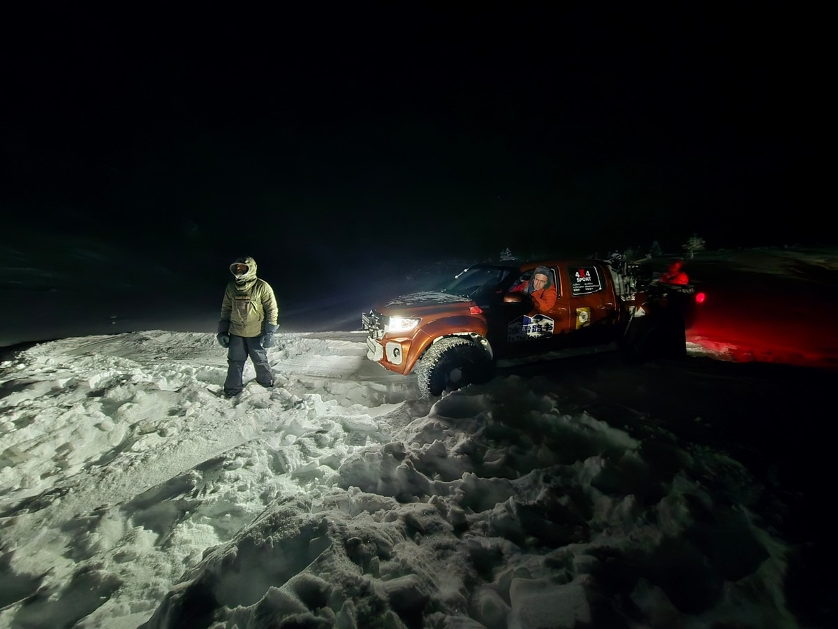
Our leader, of course, charged straight ahead:
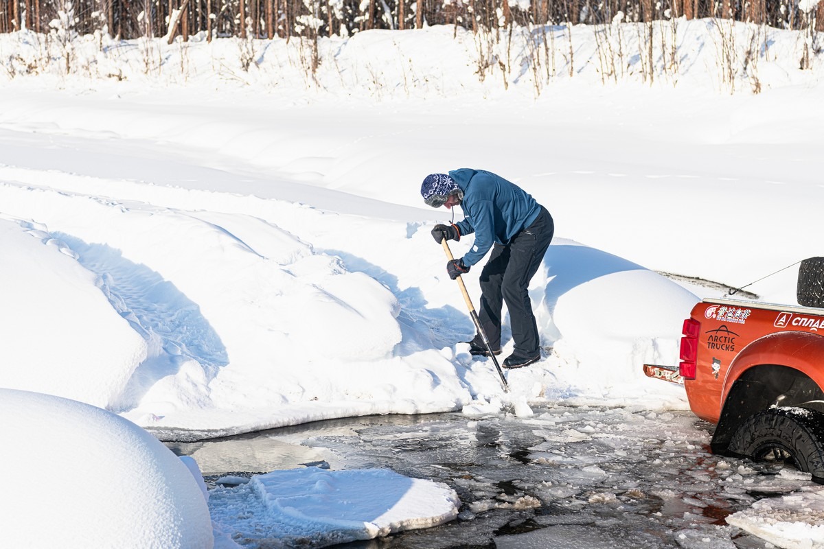
He tried to make it passable for us little guys:
He broke the ice on this channel with his own vehicle:
But as a result, got himself seriously stuck.
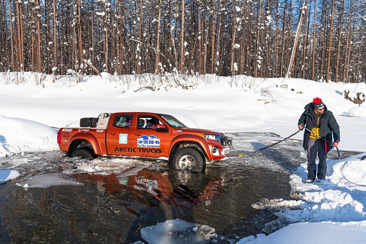
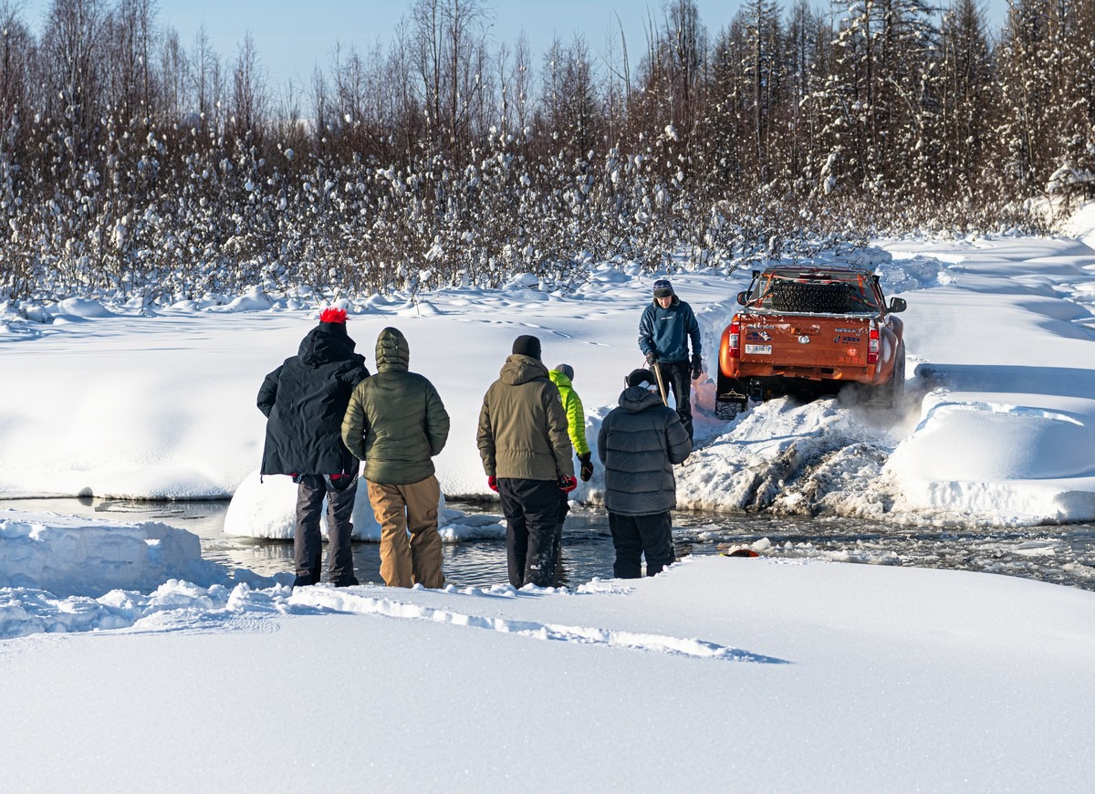
The rescue operation began:
But the winch didn’t work, so we pulled him out with a tow rope:
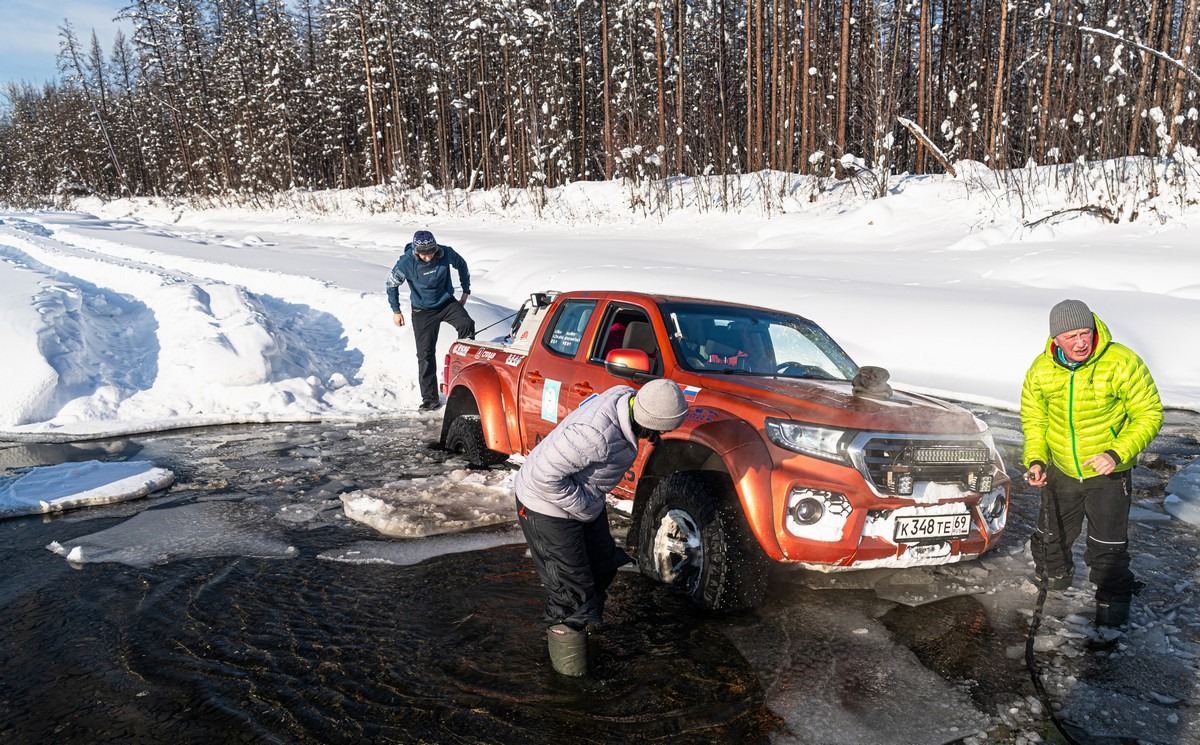
Quite the spectacle! Once we pulled him out, he turned around and tried to get to the other bank again.
In the process, he pranged his rear end and lost his license plate. Hooray! Regular travel companion, VM, fished the plate out of the water:
That’s just what winter reality looks like out here…
We launched a drone and discovered several more channels with open water ahead. So it was there where we turned around and drove back. Too dangerous.
Again – we didn’t make the full impassable stretch of Old Kolyma, but it still was an adventure!
Let me repeat: “Don’t try this at home”. If something goes wrong, breaks, or you get stuck somehow else: there’s a very real risk of… death!
We took all the necessary precautions, so were fine. Nevertheless, the full length of the closed Old Kolyma still needs doing. So, as Arnie would say, “I’ll be back!”…
Here are the best hi-res photos from our Irkutsk-Yakutsk-Magadan-Yakutsk 2026 road-trip.

