March 20, 2025
Trekking to Machu Picchu on the Inca Trail.
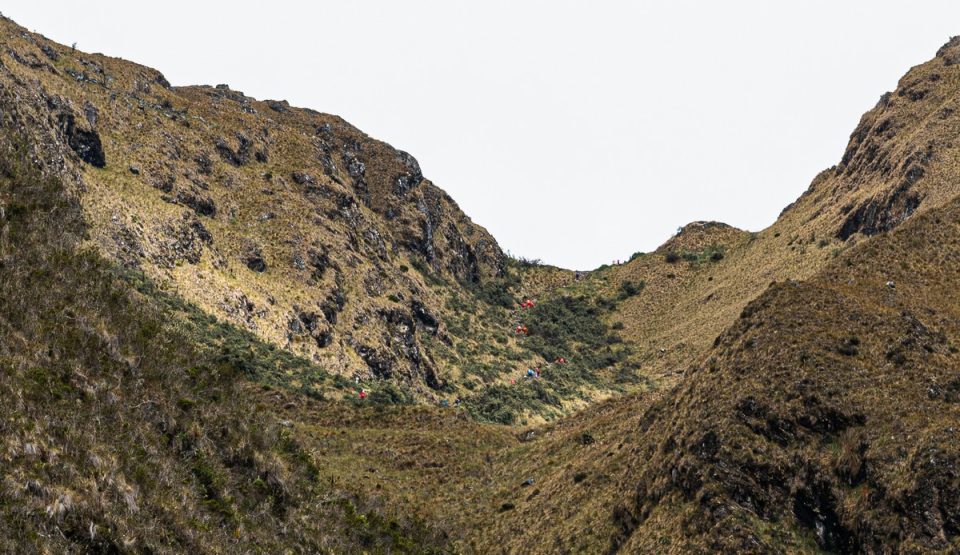
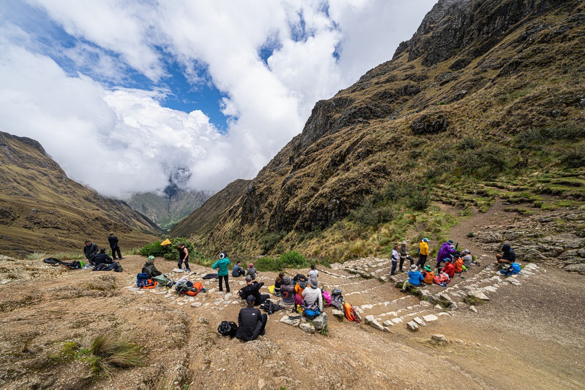
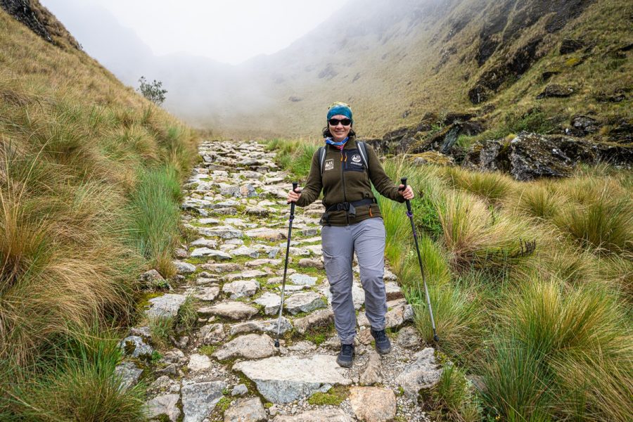
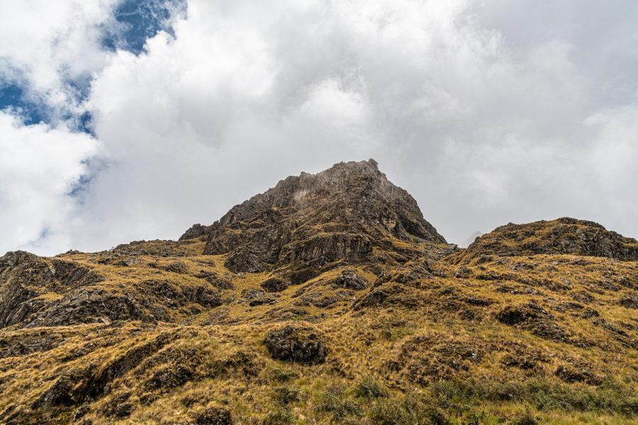
Day zero: preview.
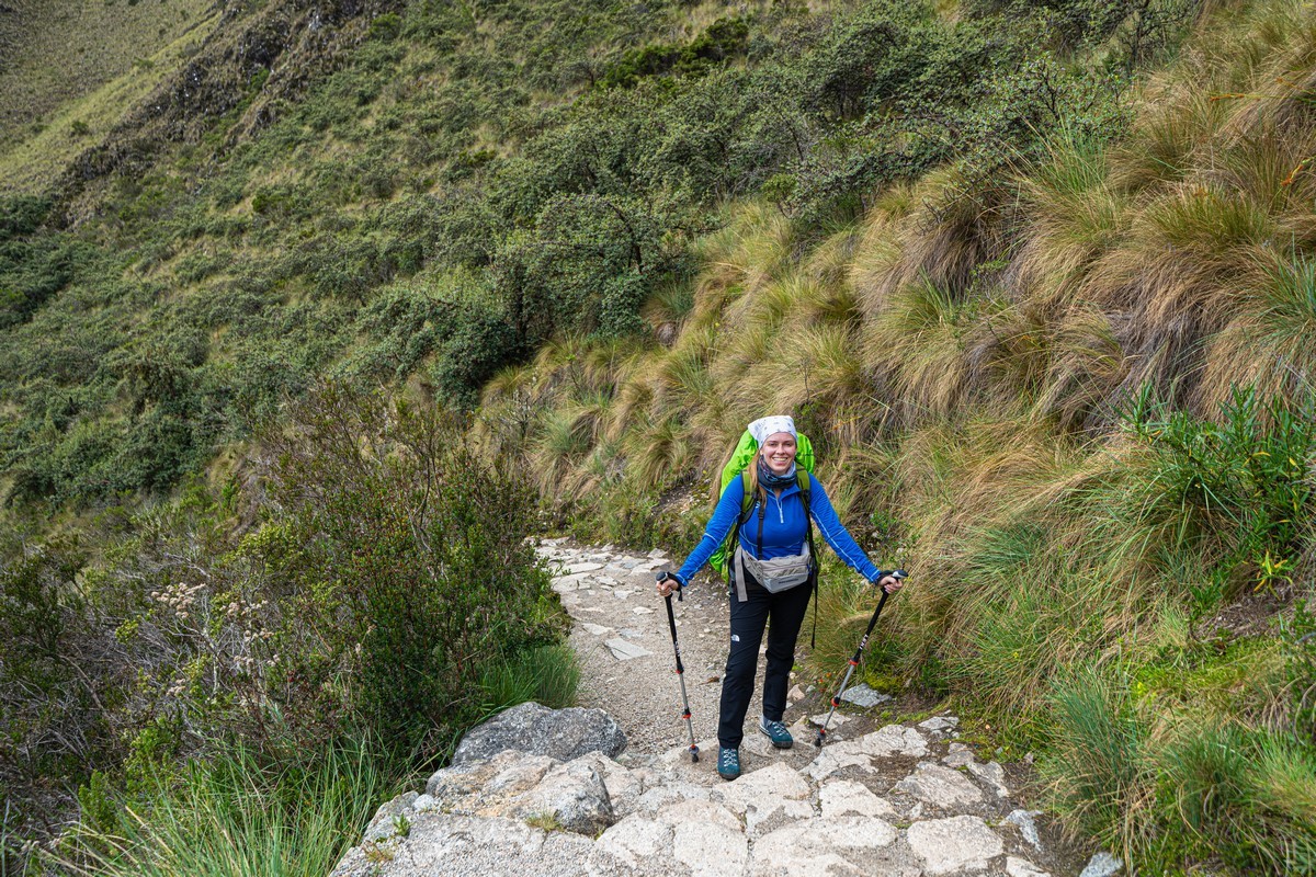
And so, after several days of acclimatization (in the middle of our LatAm-2025 trip), the day had finally come to begin our trek up the Inca Trail to Machu Picchu. I’d dreamed of walking this ancient path since 2011 when I first visited the place…
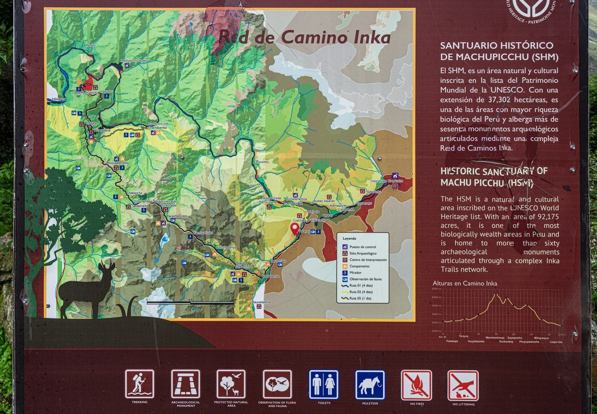
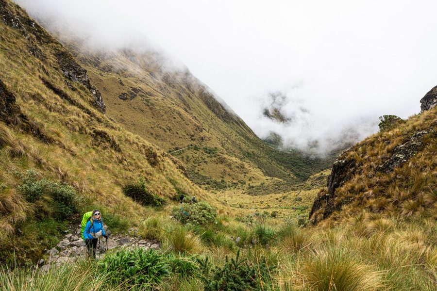
The Inca Trail (note the singular, but it’s actually made up of three overlapping trails) was just one of a great many like it that formed a dense path network covering the entire territory of the Inca Empire. The distance from the northernmost to the southernmost path is estimated at 6000 km (!!!). The internet suggests that a total of 30,000–40,000km of such trails have been discovered, while local guides – like ours, Vicente – have their own perspective: they claim that recent excavations have uncovered even more routes, bringing the total length of the Incan transportation network to 78,000km (for comparison, the total length of all railroad tracks in Russia (by far the largest country in the world) is 120,000+ km)!
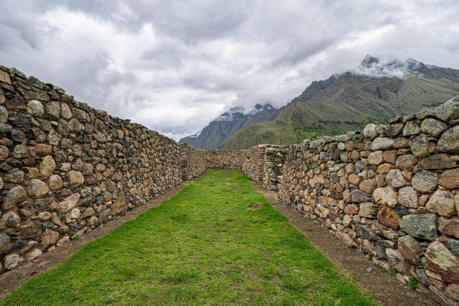
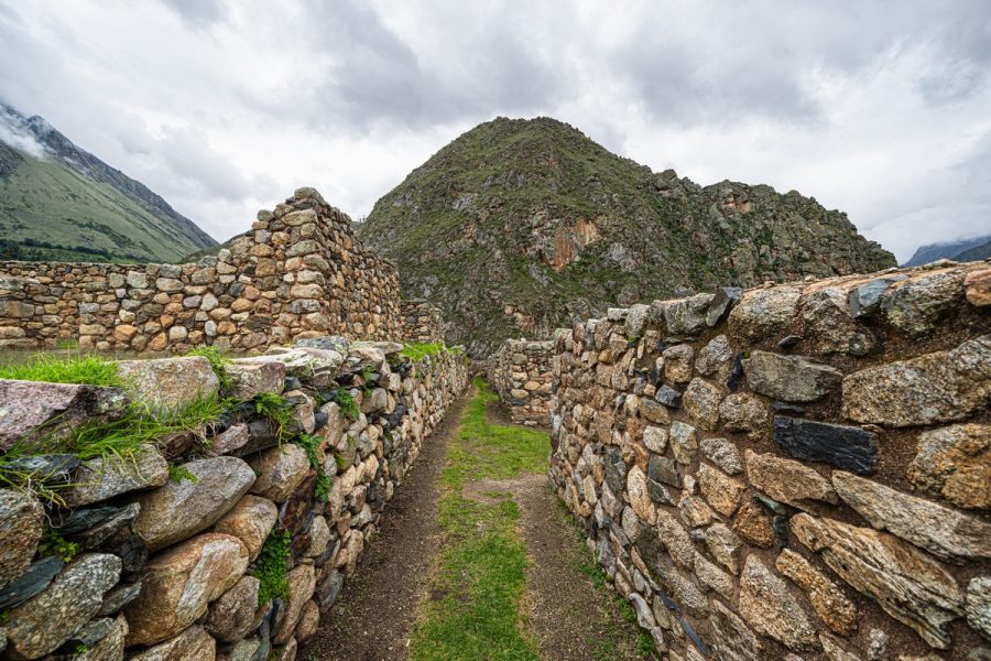
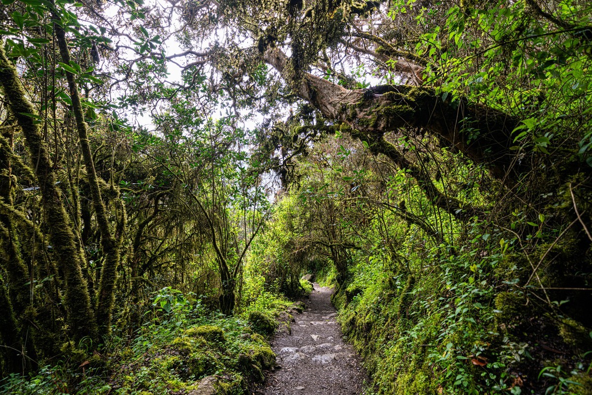
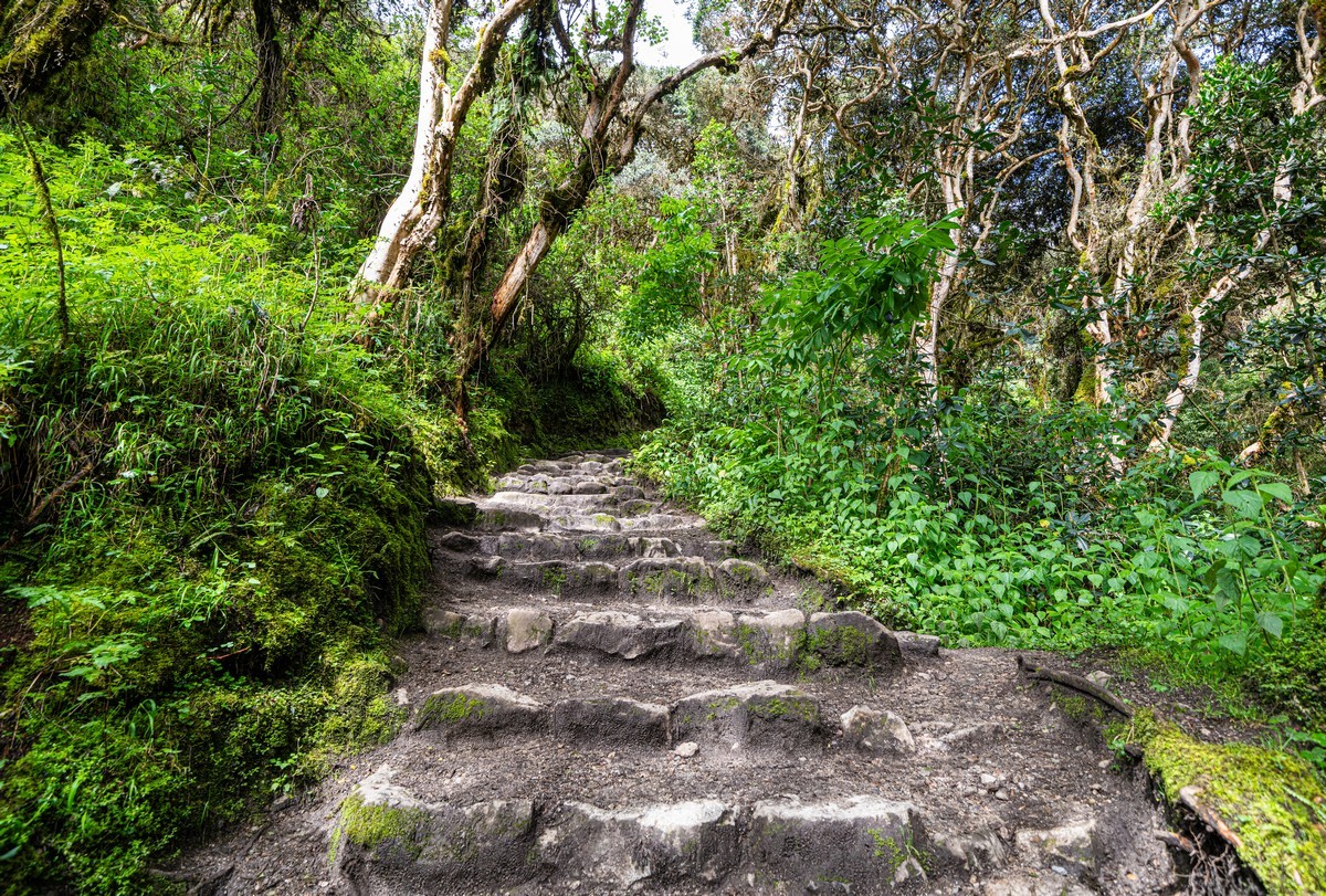
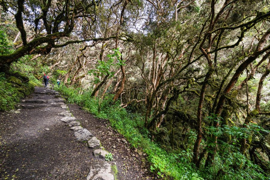
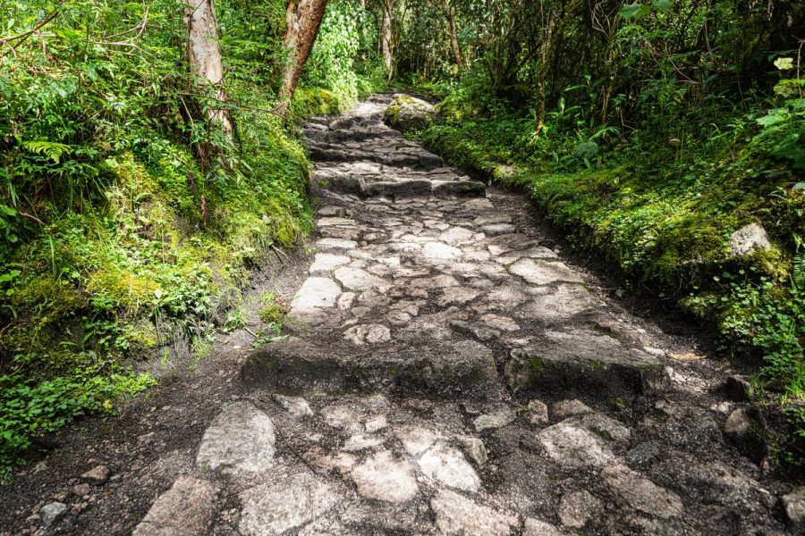
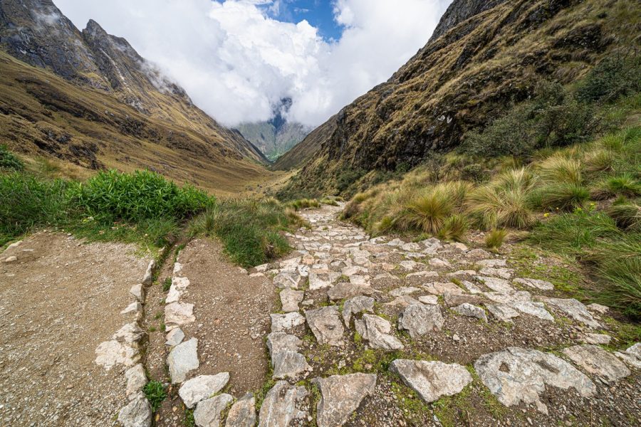
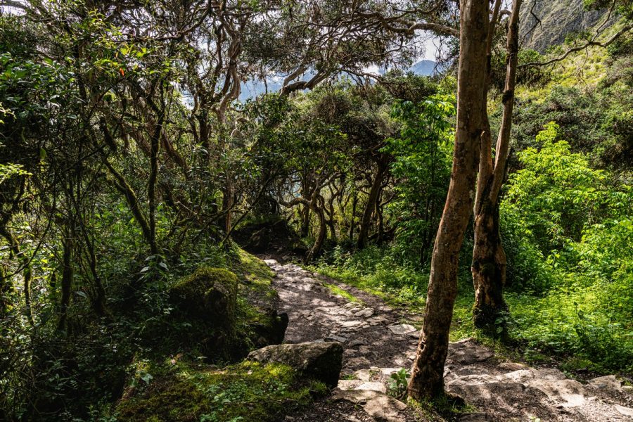
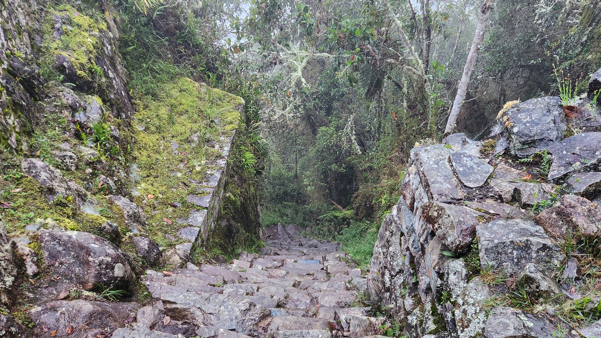
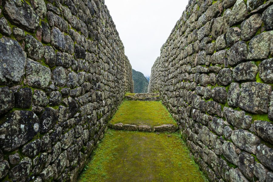
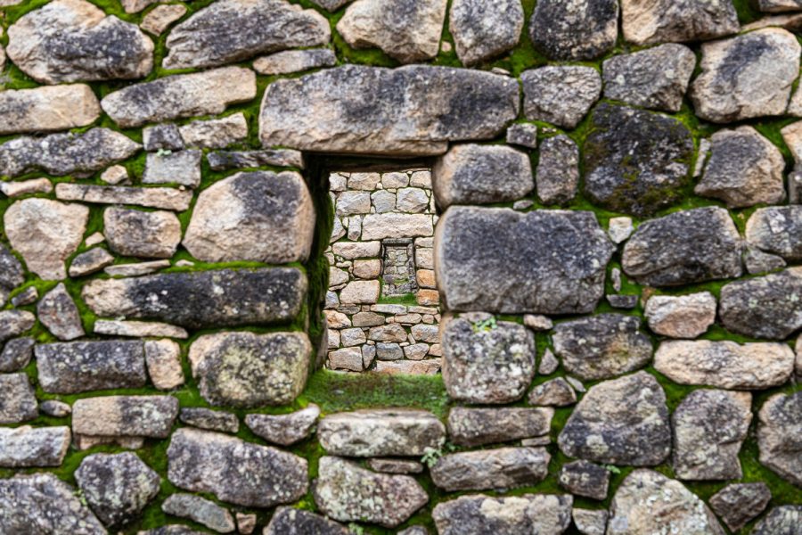
Most of the trails were paved. Here’s what they look like today:
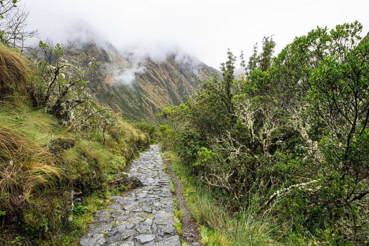
Some roads were actively used even after the empire’s fall. Later, they were used by vehicles, which led to the near-complete destruction of the stonework in lowland areas. However, in the mountains, although some damage has occurred (with restoration efforts on tourist trails), Vicente told us that around 70% of the stonework is original. Literally built for eternity!
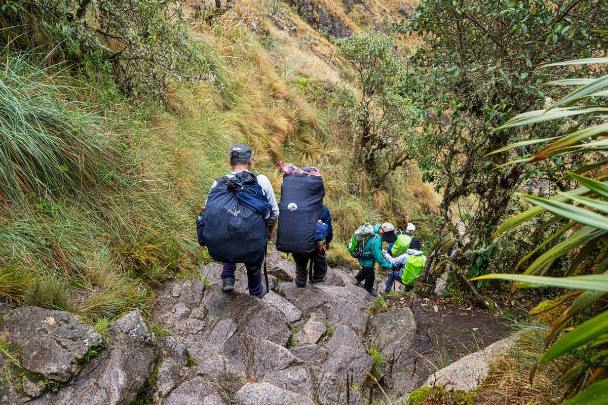
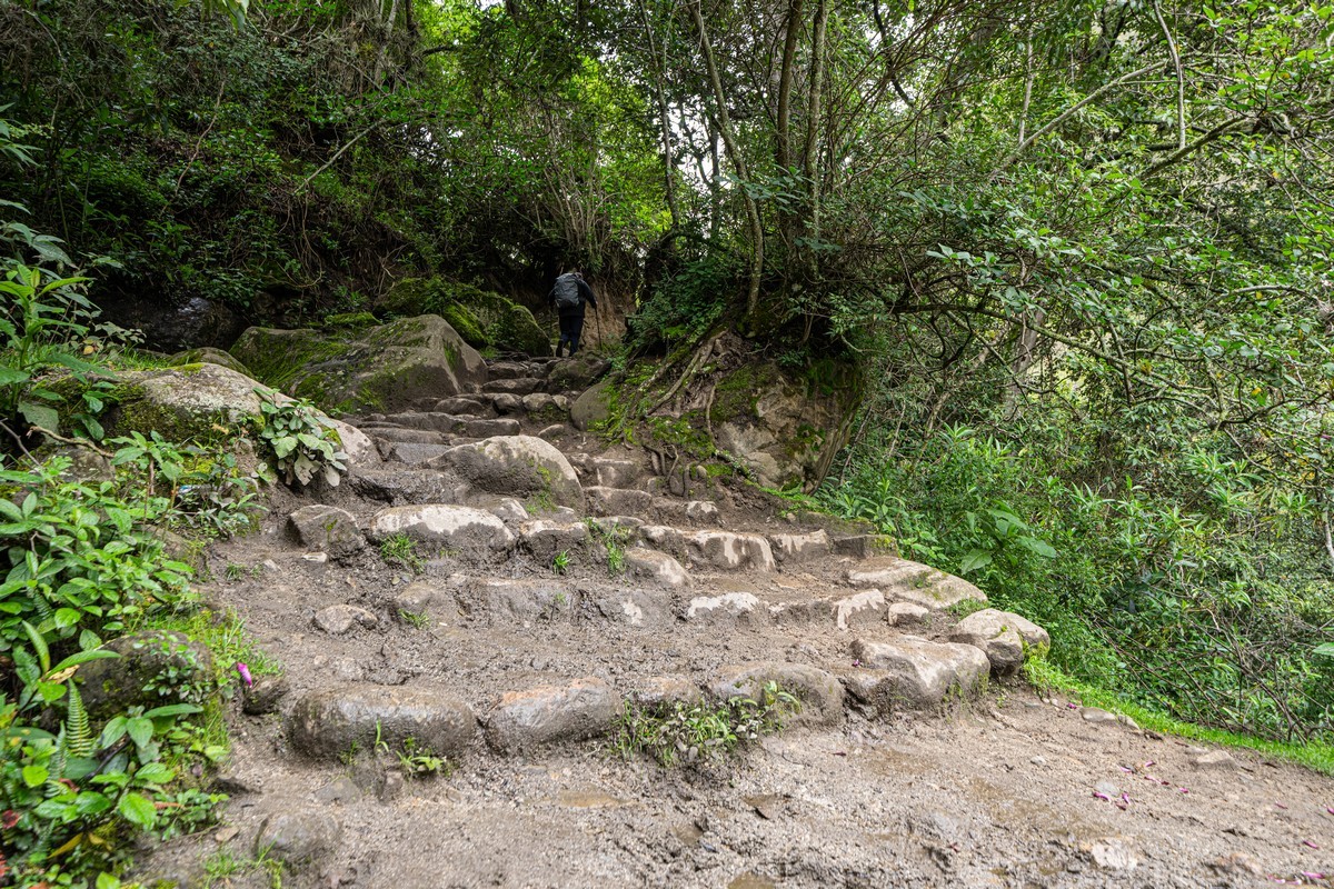
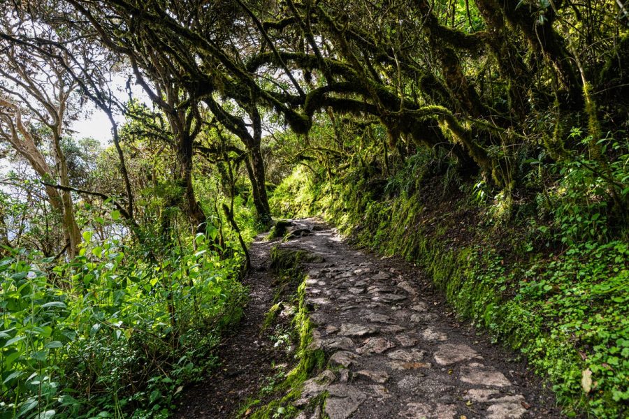
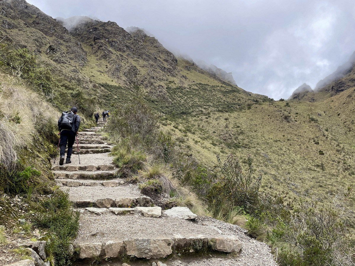
These paths were primarily pedestrian. The Incas never invented the wheel (just like the rest of the indigenous American civilizations), and local llamas and alpacas were not suited for such terrains. The maximum load a llama can carry is 15kg, and it can walk no more than 10km per day on flat ground with such a weight on its back. Therefore, everything here was carried by the Incans themselves. The steps along these paths can be quite steep in places. Watch your step!…
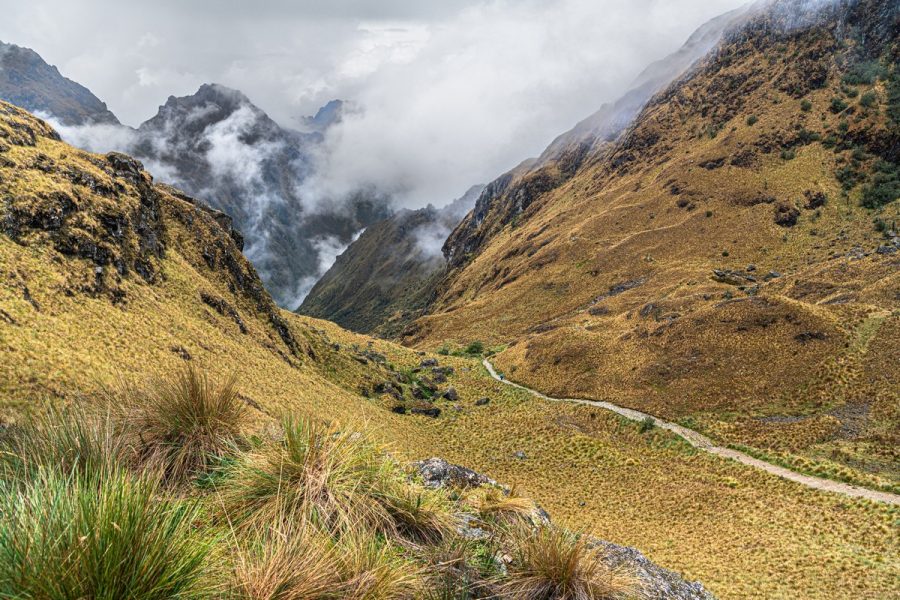
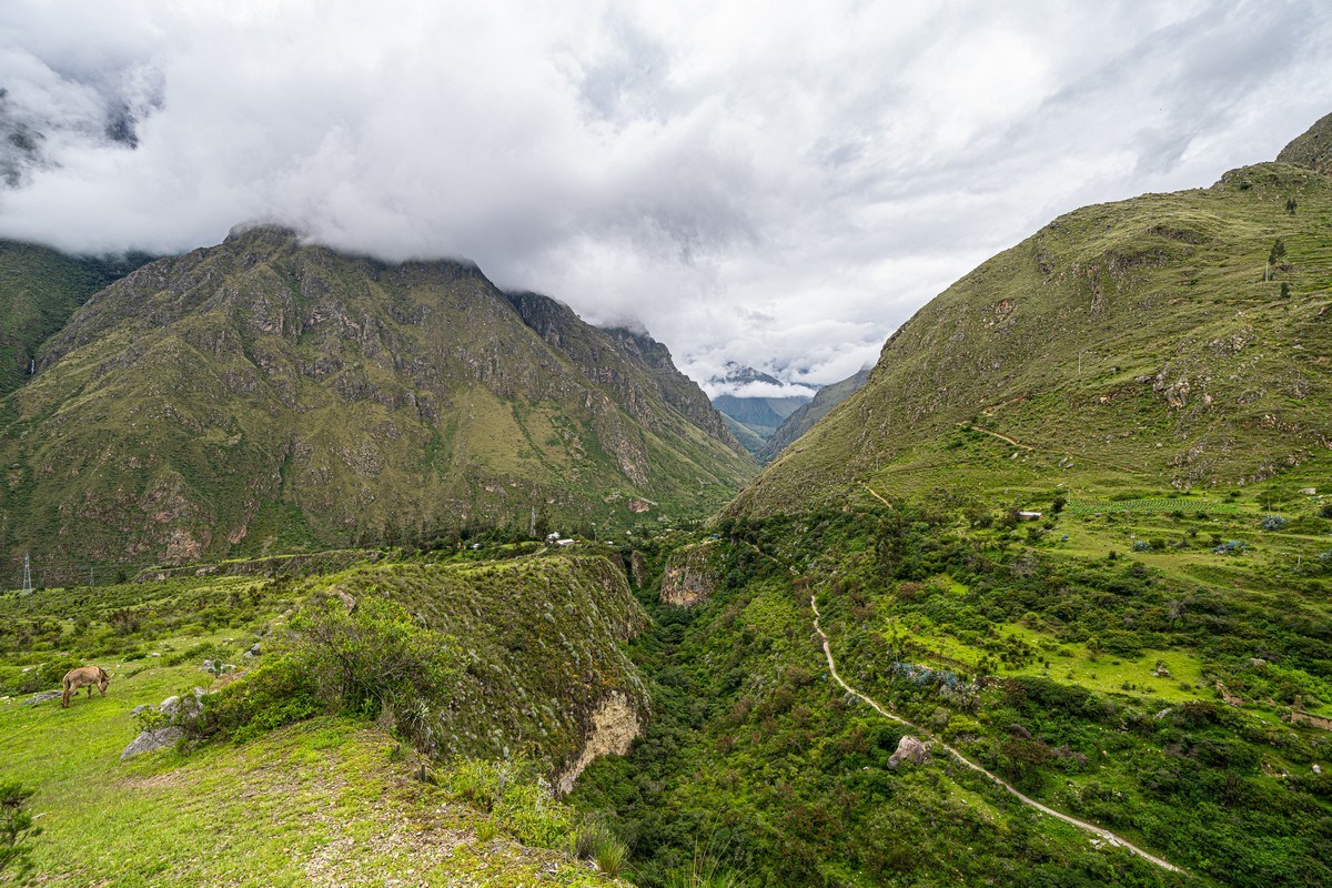
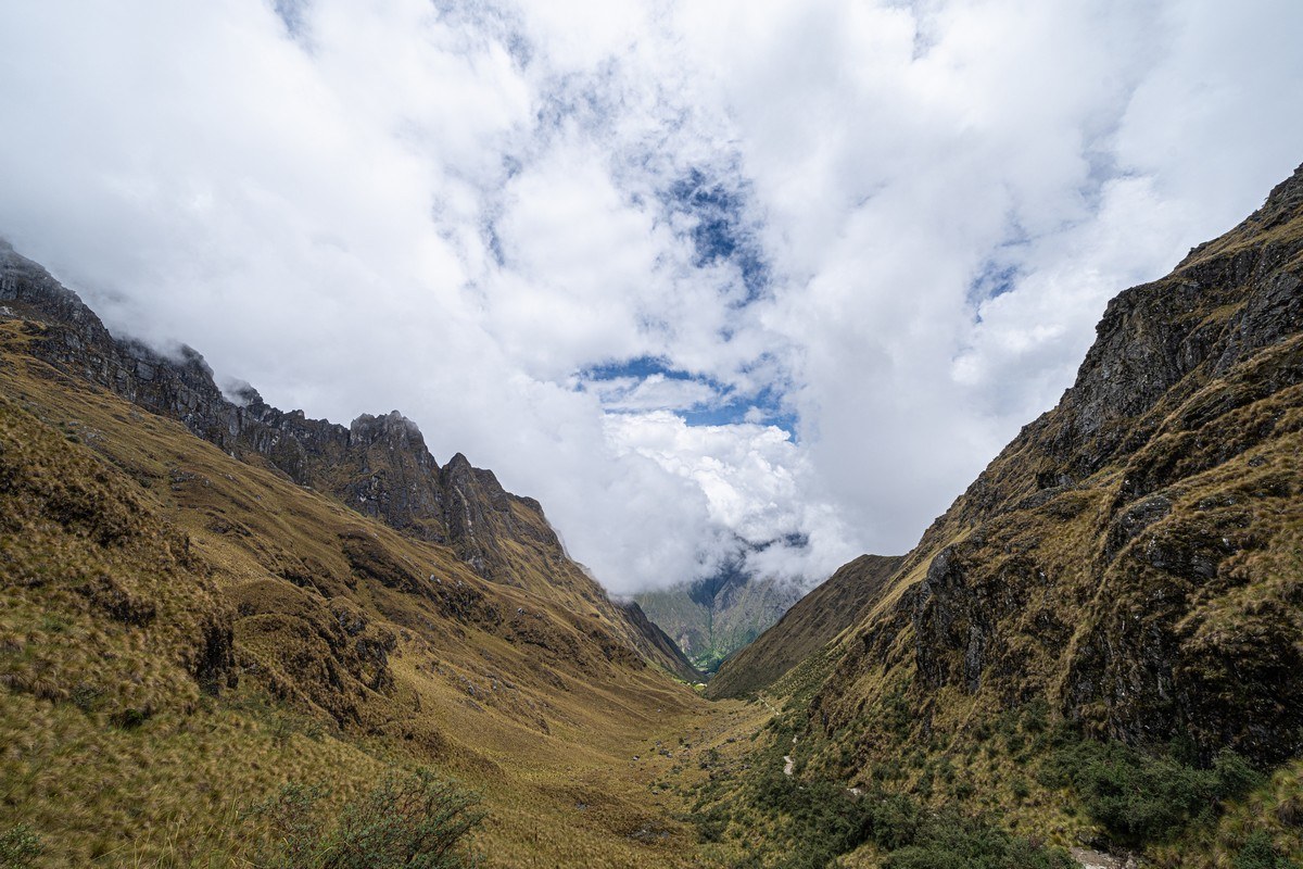
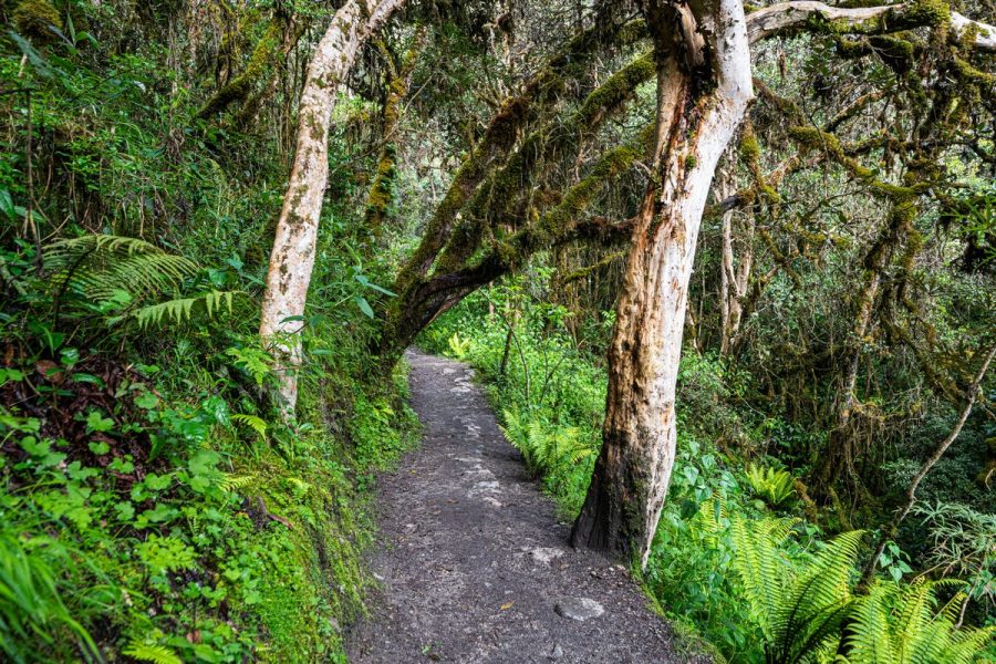
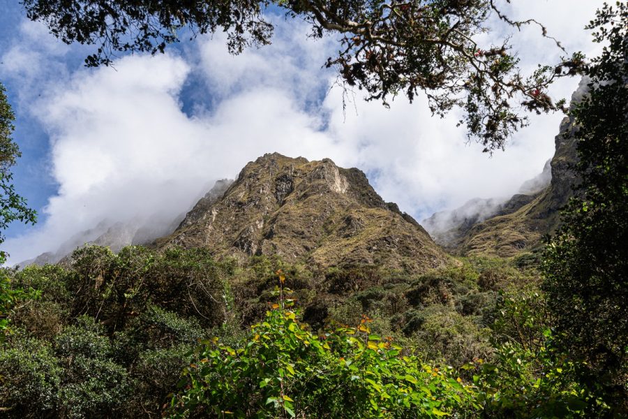
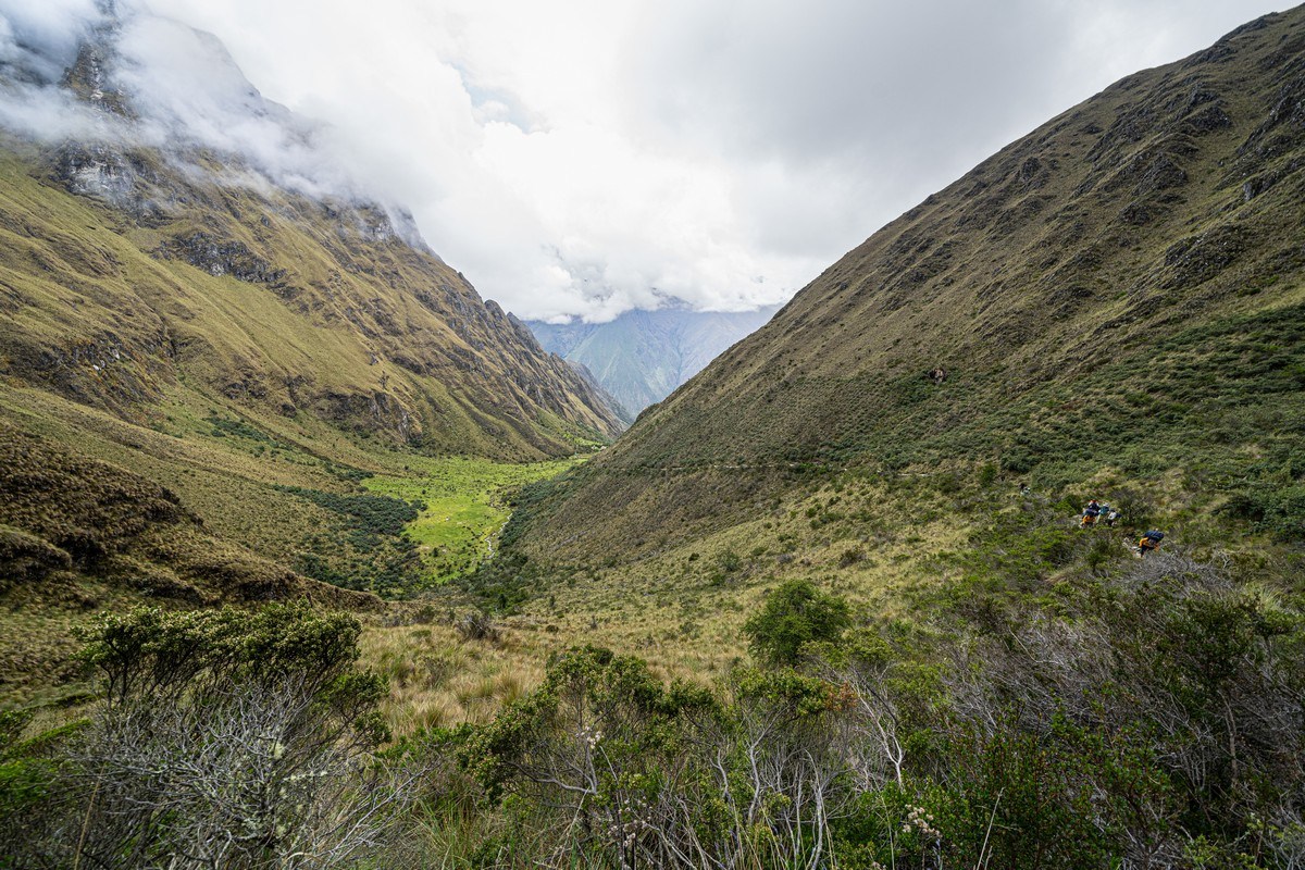
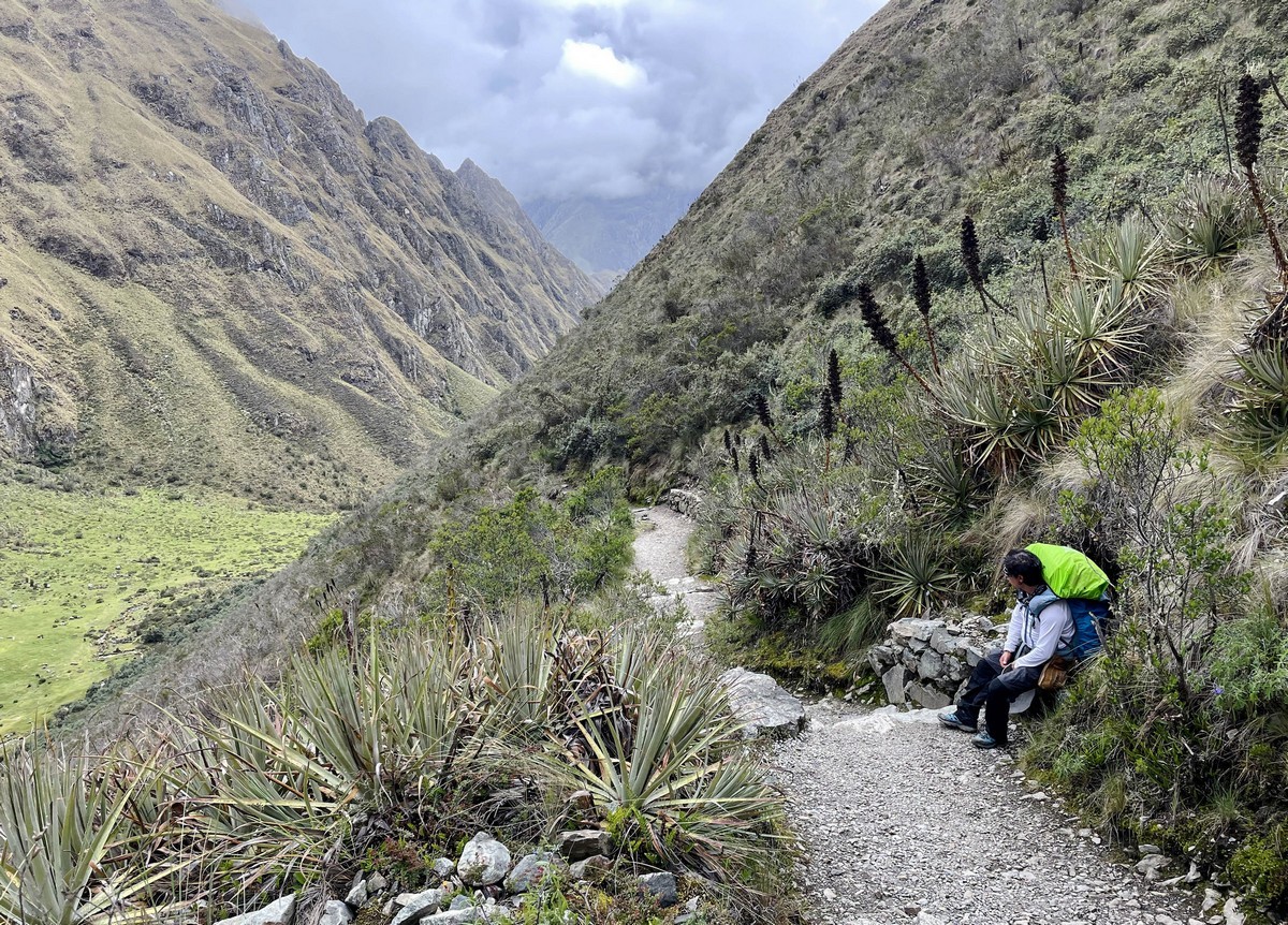
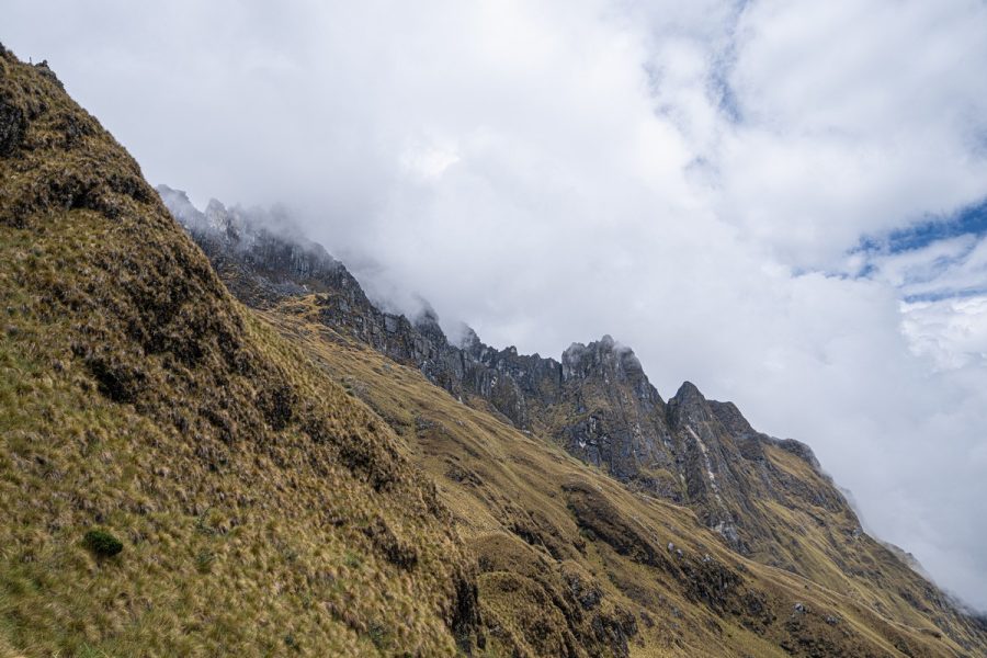
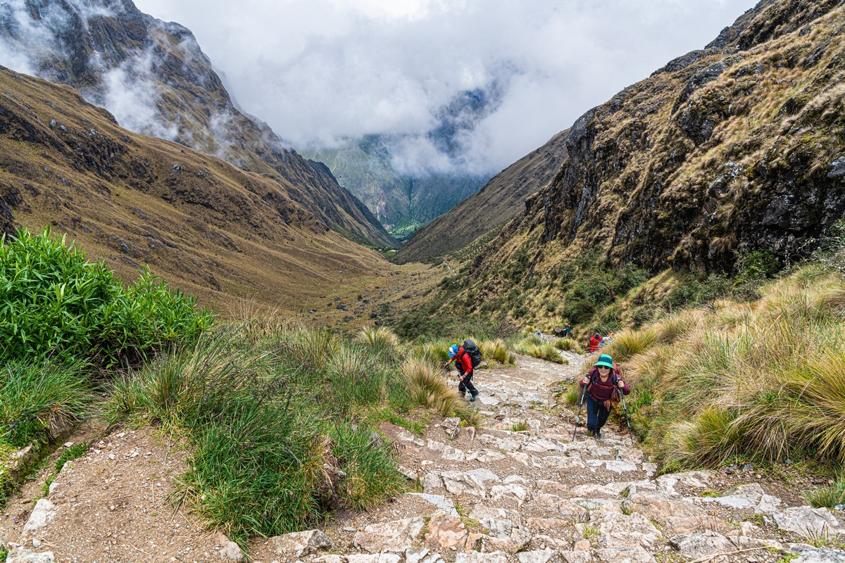
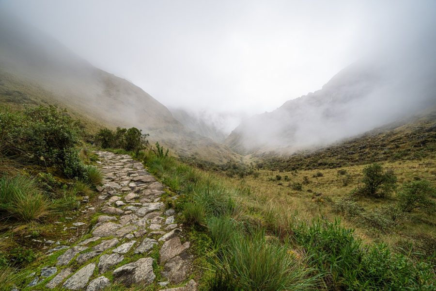
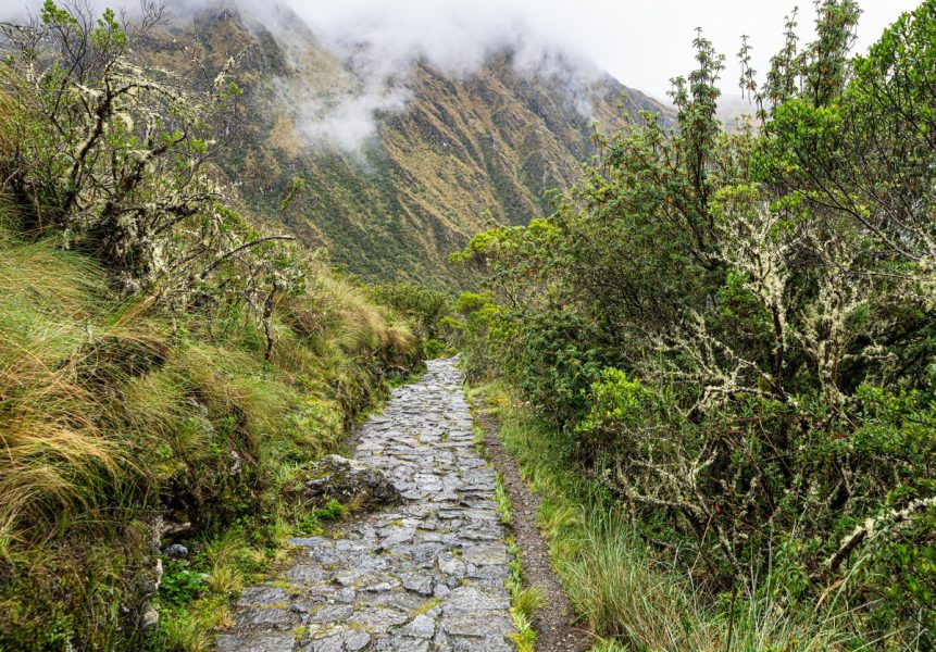
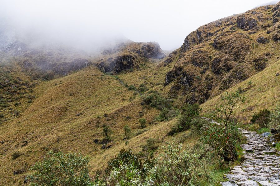
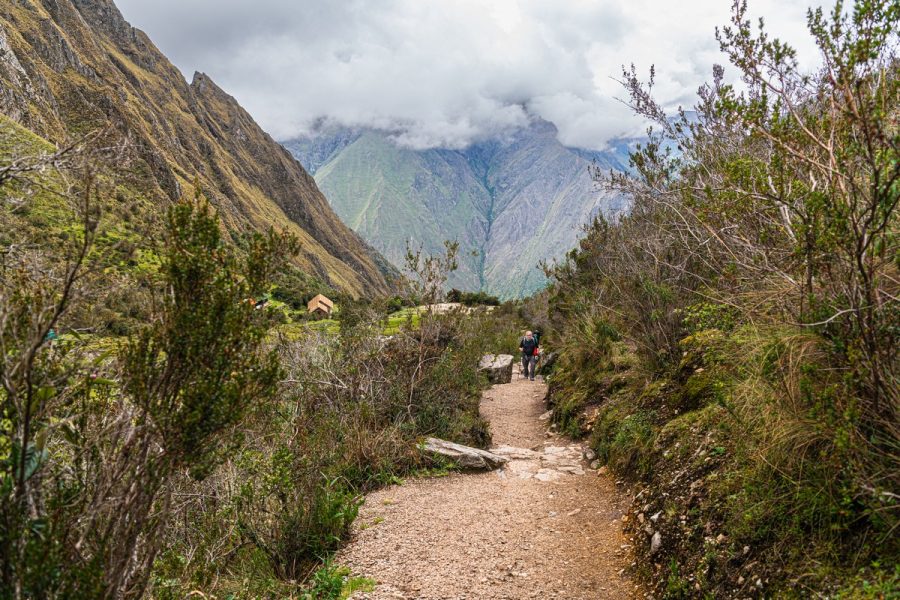
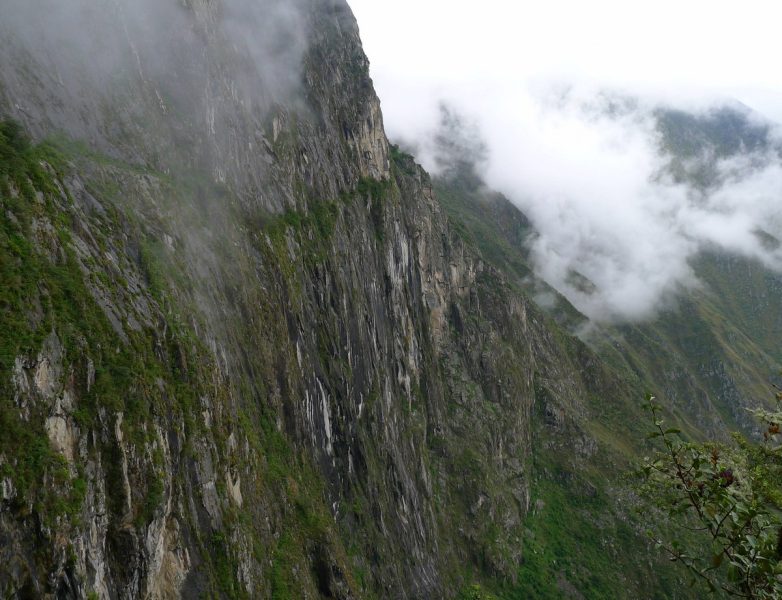
The paths stretch endlessly – passing through fields, forests, valleys, mountains, and mountain passes. It’s a fascinating journey, offering incredible views (when the weather’s good – rain season rarely permits this) ->
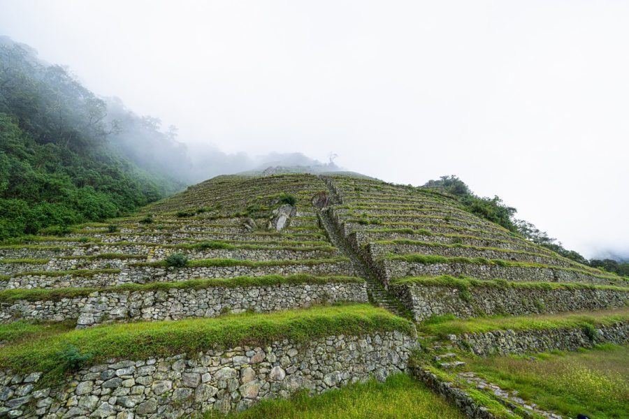
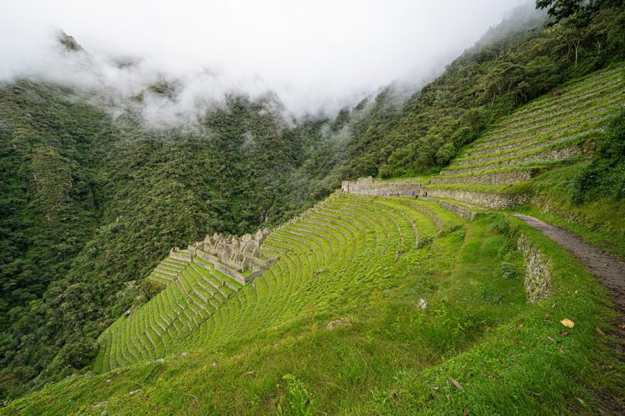
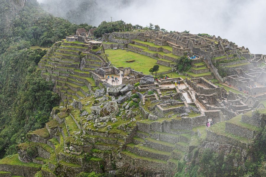
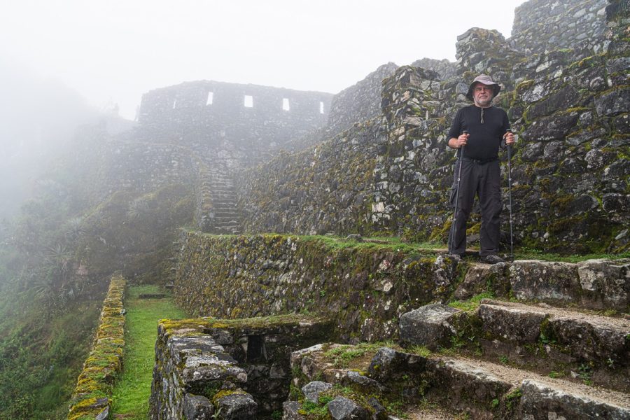
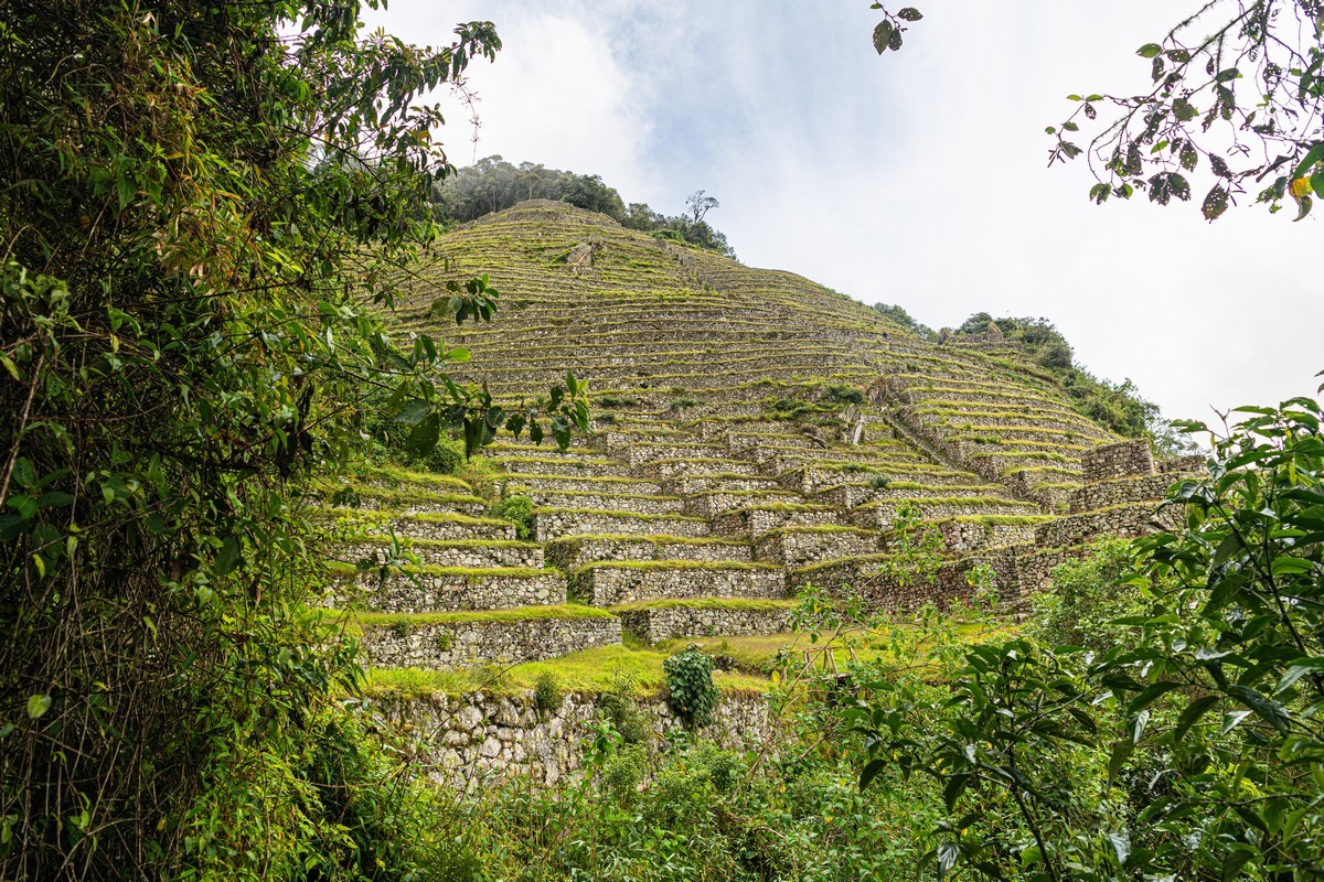
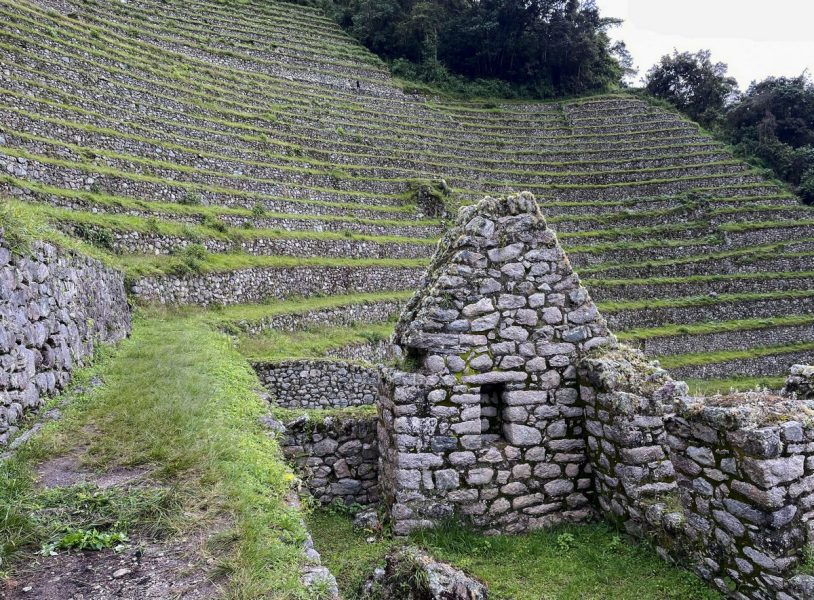
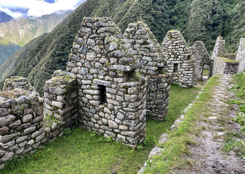
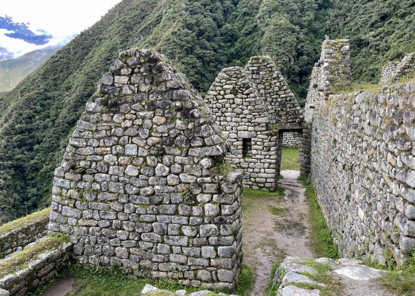
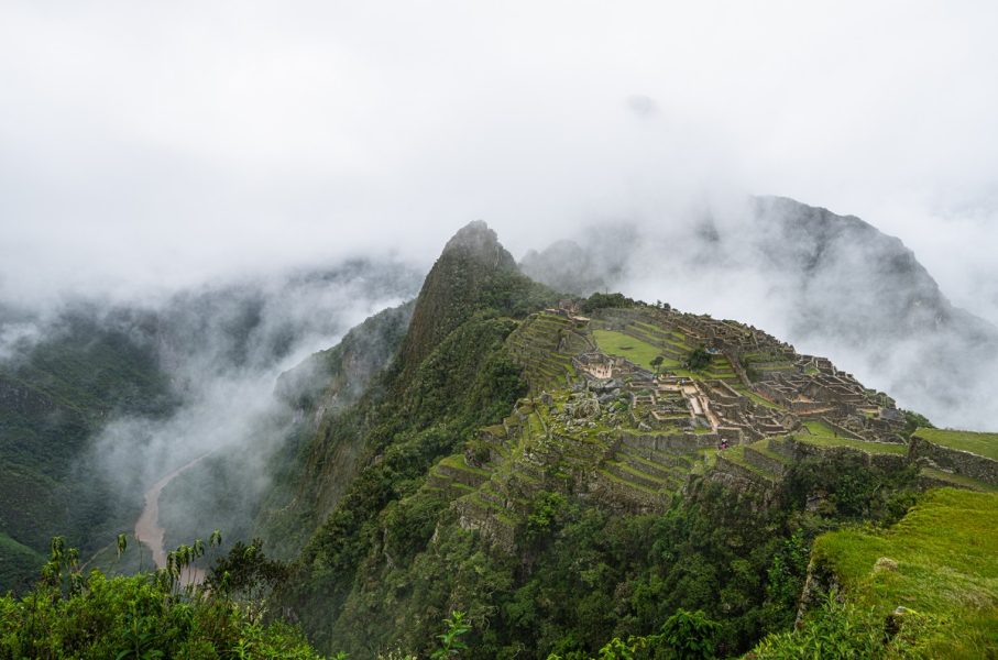
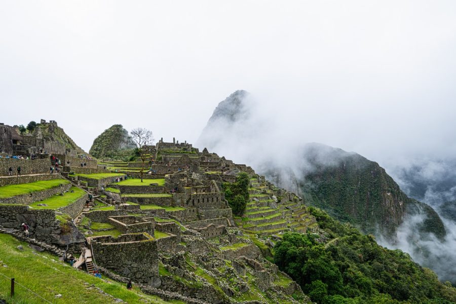
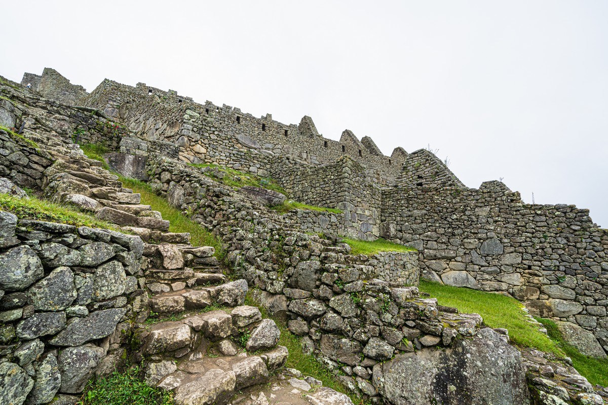
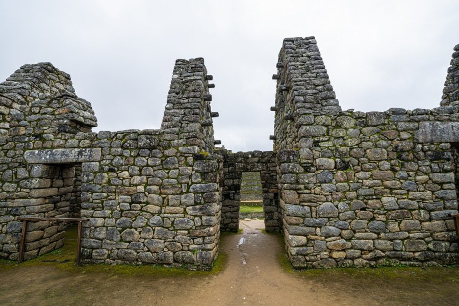
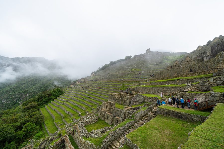
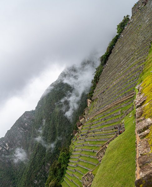
Along the trail there are also many ruins of ancient cities, fortresses, and the famous Incan terraces. And at the end of the four-day trek, the cherry on top – the legendary city of Machu Picchu:
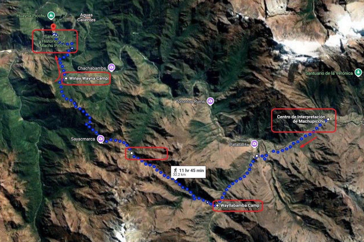
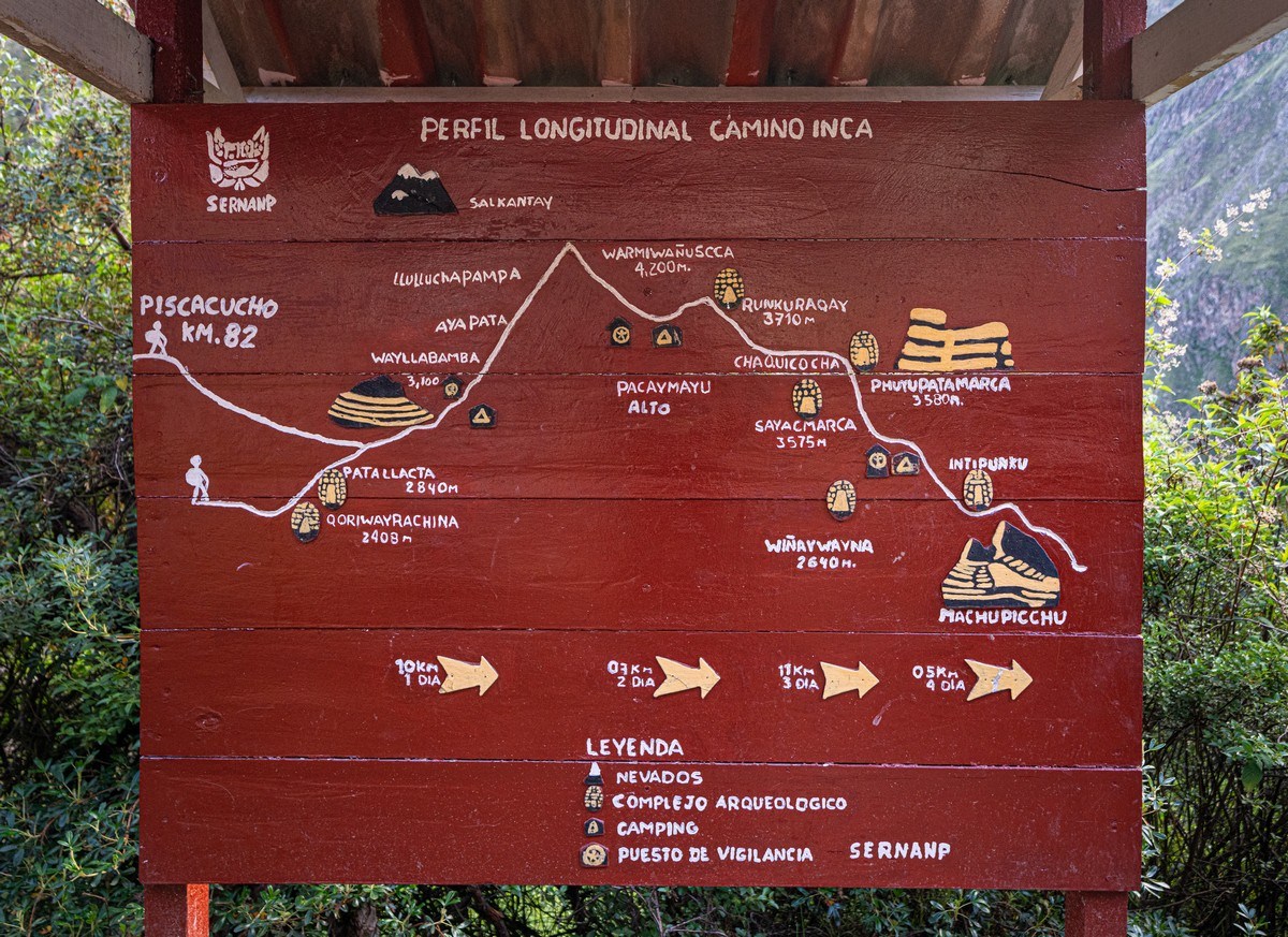
There are several routes for tourists, including exclusive ones for the most enthusiastic hikers who enjoy scrambling up Incan steps through jungle terrain. The standard route available to most tourists is relatively short – around 33km (if we’re to trust the maps). However, considering the elevation gain (a total of ~2000 meters – the trek starts and ends at ~2800–2400m, with a maximum altitude of 4200m), plus the inevitable frequent stops for scenic views and exploring ruins, the route’s taken very steadily:
- Day 1: 10km
- Day 2: 7km (but with a 1200m altitude gain)
- Day 3: 11km
- Day 4: 5km
Here’s the entire trekking route on the map:
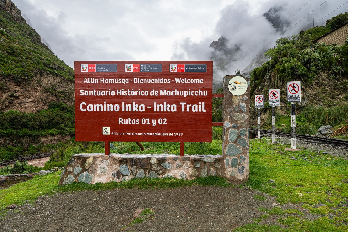
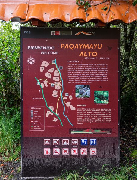
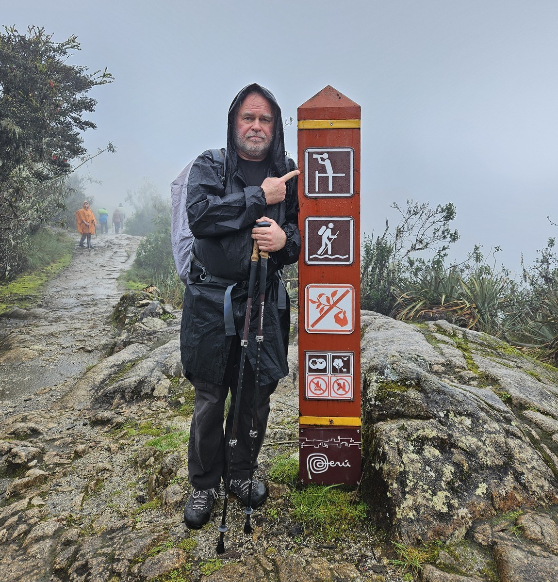
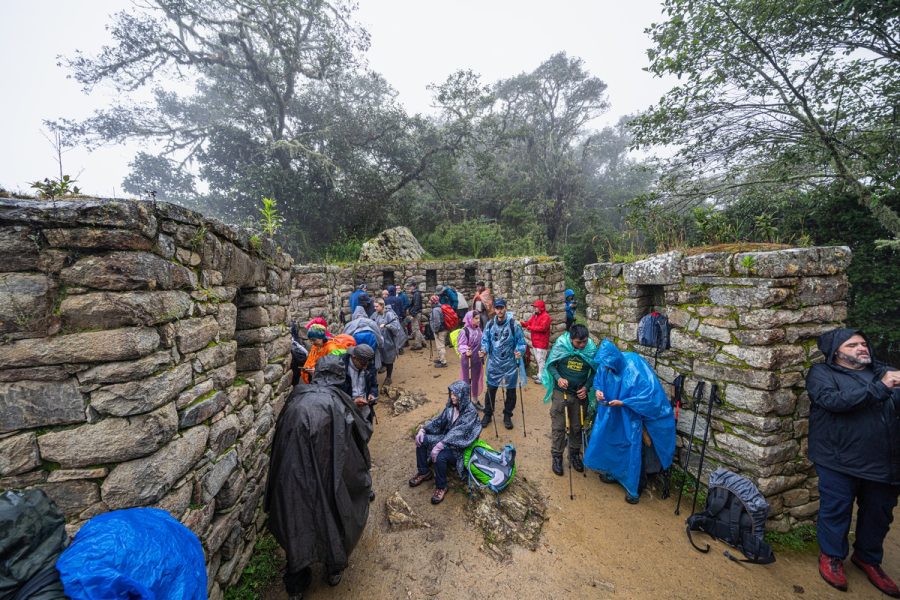
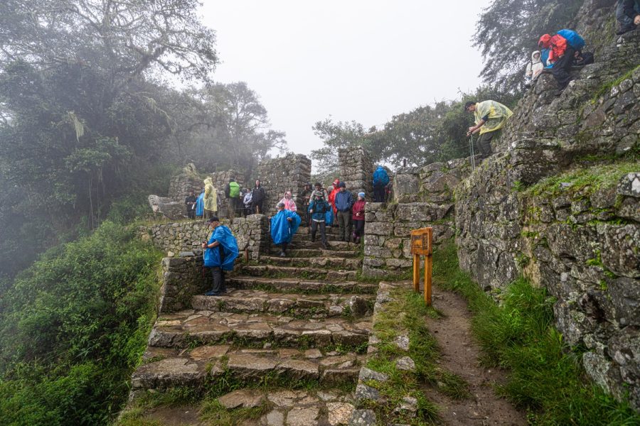
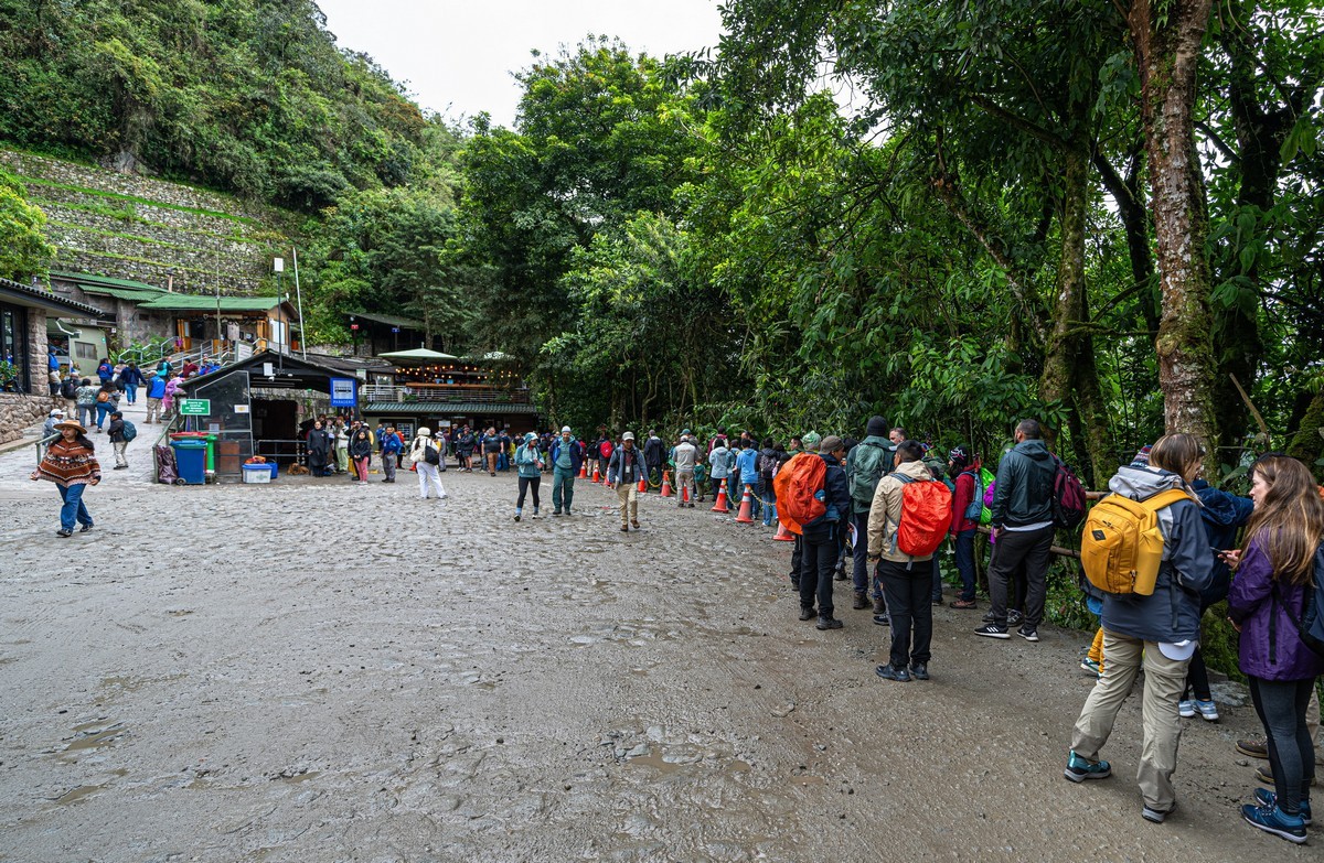
Btw, you can’t just show up and start hiking the Inca Trail – you need permits (only 500 people per day are allowed – including porters), and must be accompanied by a certified guide. If everything is in order, you register at the tourist center before setting off:
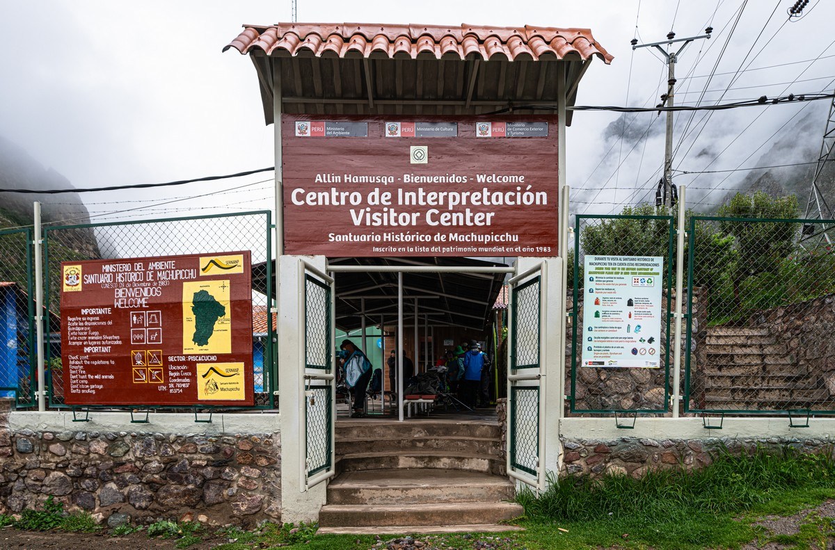
Everything needs to be booked in advance, for the campsites have only a limited number of spaces for tents (you can’t just pitch one where you want). Also, you need to buy some special rubber tips for your trekking poles – to avoid scratching the ancient Incan stones.
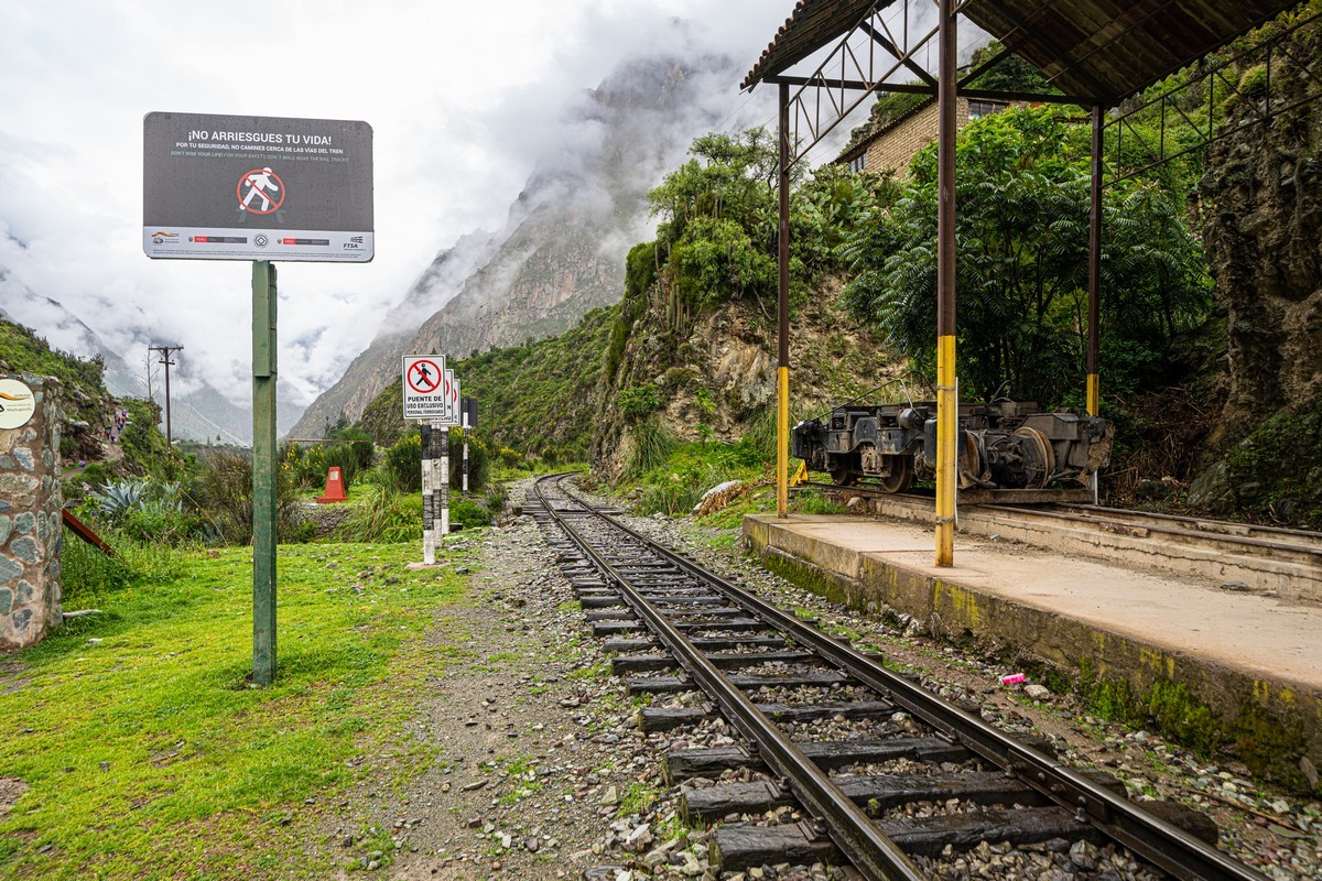
After completing these formalities, we head toward the trail. Nearby, there’s also a railroad that we’ll take on our way back – it’s the only land-based transportation to and from Machu Picchu (you can also go by helicopter – but that’s missing all the fun).
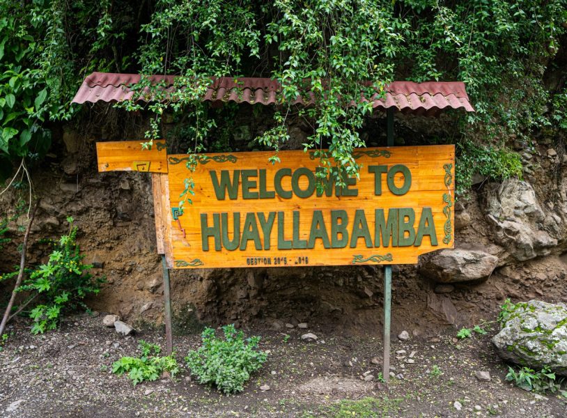
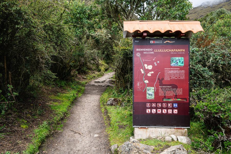
The Bienvenidos sign that’s often used for group and individual photo sessions:
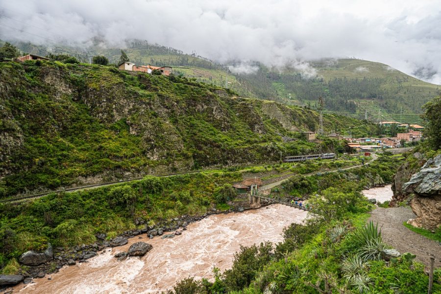
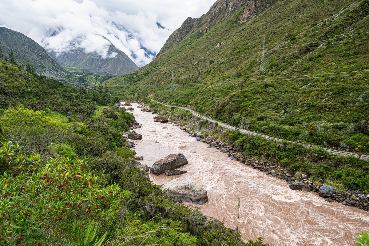
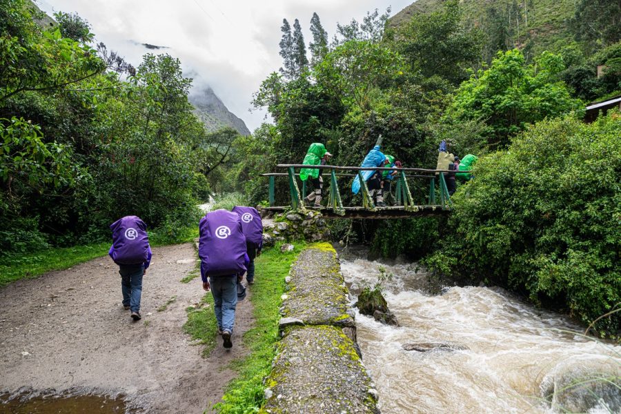
Next, we cross this little bridge over the Urubamba River, and we’re officially on the Inca Trail!…
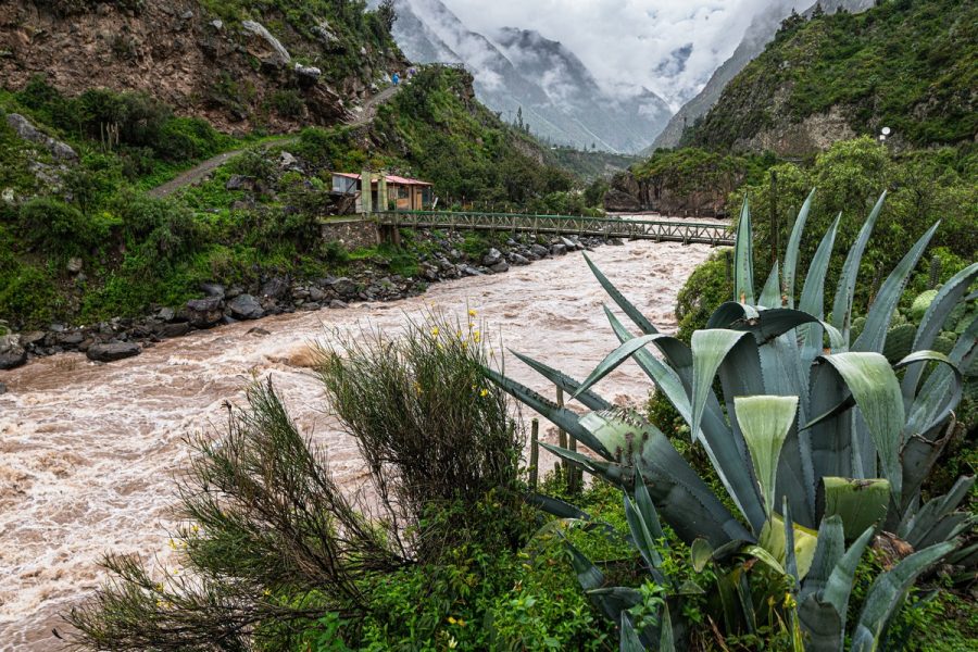
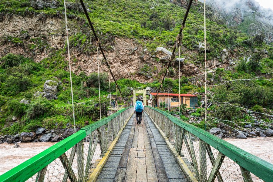
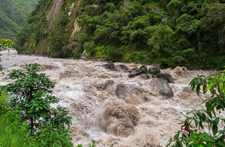
During wet season the river’s quite wild. Seeing such a sight, the adventure-seeker in me starts waking up and fancies a spot of white-water-rapids rafting, but then my rational mind quickly puts him back to sleep…
Al right, then. Here we go!…
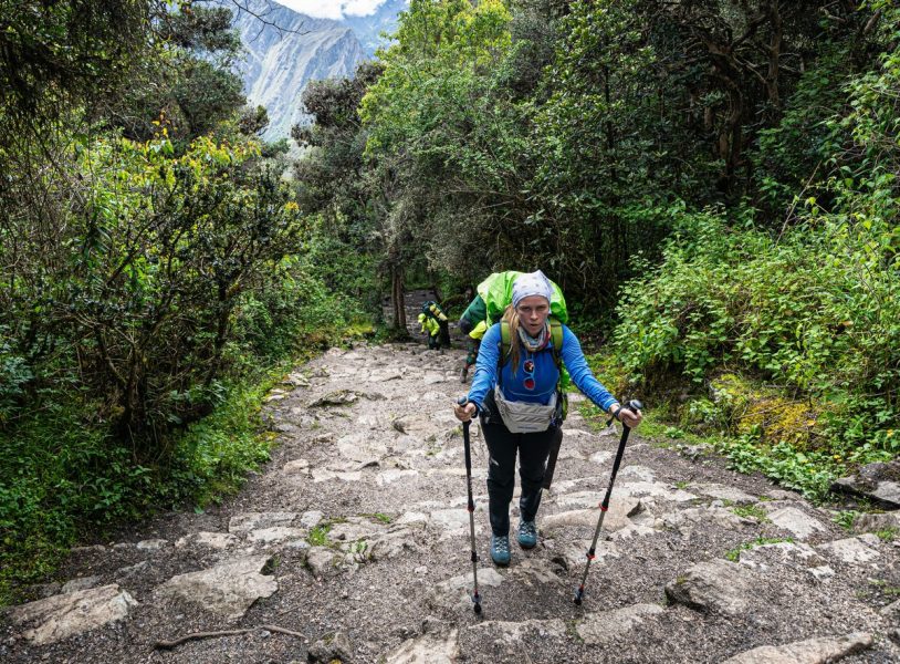
Day one – warm-up: Piscacucho to Wayllabamba
Cusco and its surroundings had been explored and our acclimatization was complete. Now the time had come to test the effectiveness of that acclimatization. After all, the trek ahead wasn’t an easy one – especially for an office worker accustomed to sea-level oxygen levels…
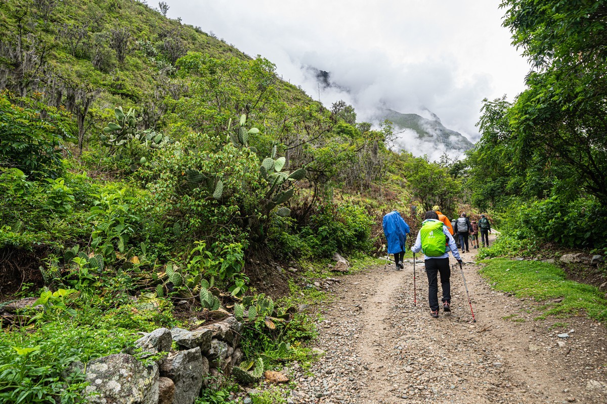
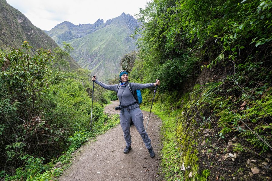
The first day of trekking on the Inca Trail looked mostly like this – a simple dirt path used by tourists and occasionally by locals on motorcycles. The sky was gray and low – but that, alas, was to be expected: November to March is the rainy season here. And in February the rain gets so intense that the tourist route gets closed…
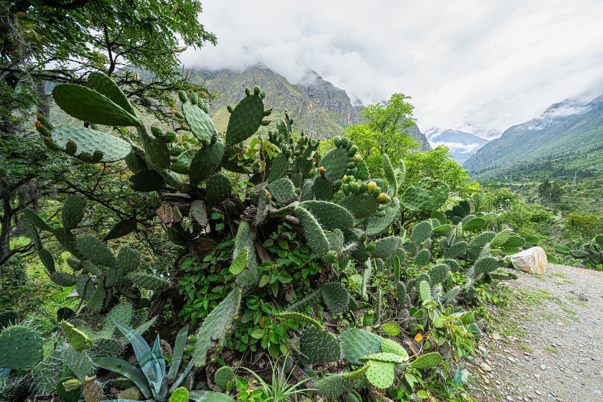
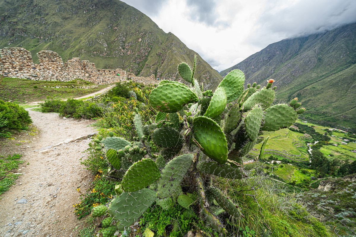
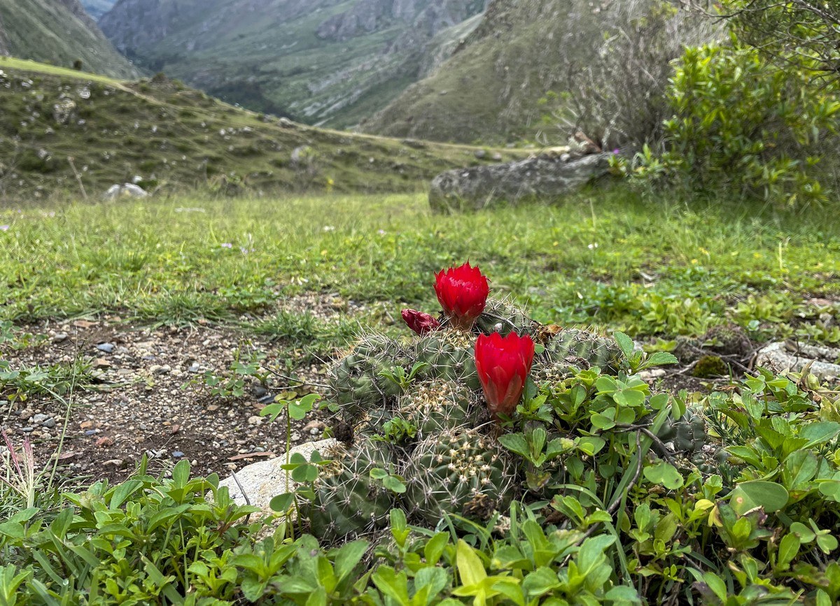
Cacti along the trail were a pleasant sight – fat, well-fed, and in full bloom:
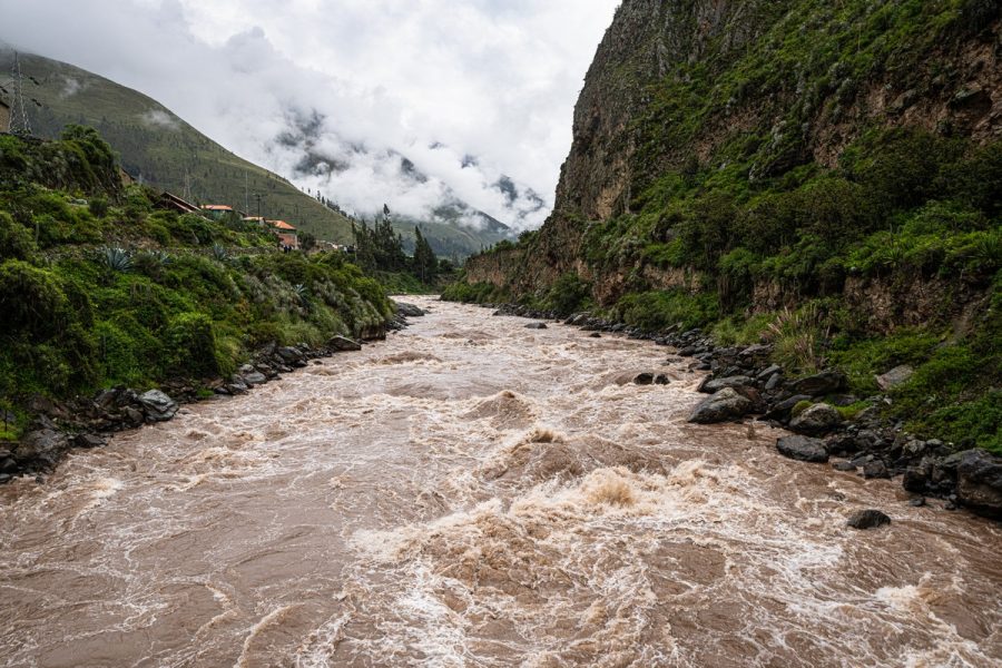
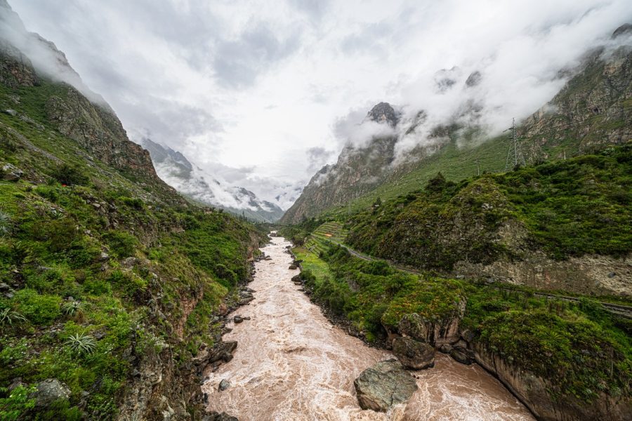
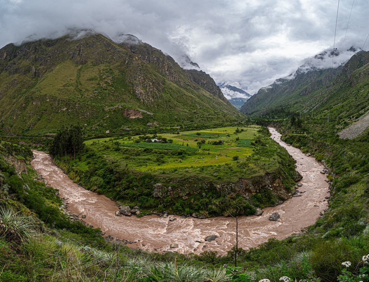
To our right, the Urubamba River flows toward Machu Picchu; on the other bank – a railroad track with occasional trains speeding by:
A hairpin bend in the river once again nudged awake my inner rafting enthusiast – making me wonder how one would navigate this turn with all its rocks and currents :) ->
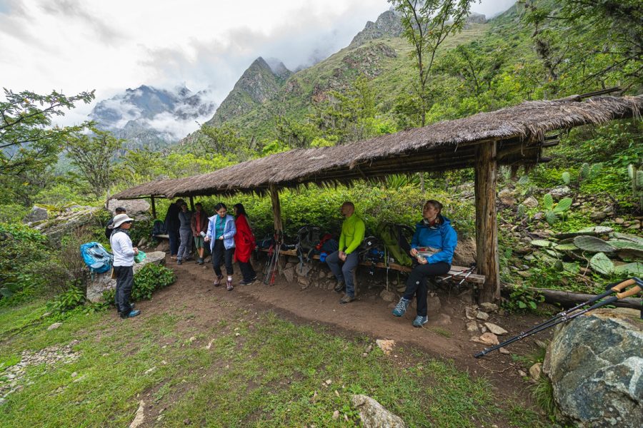
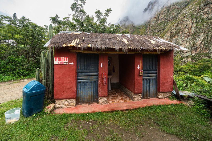
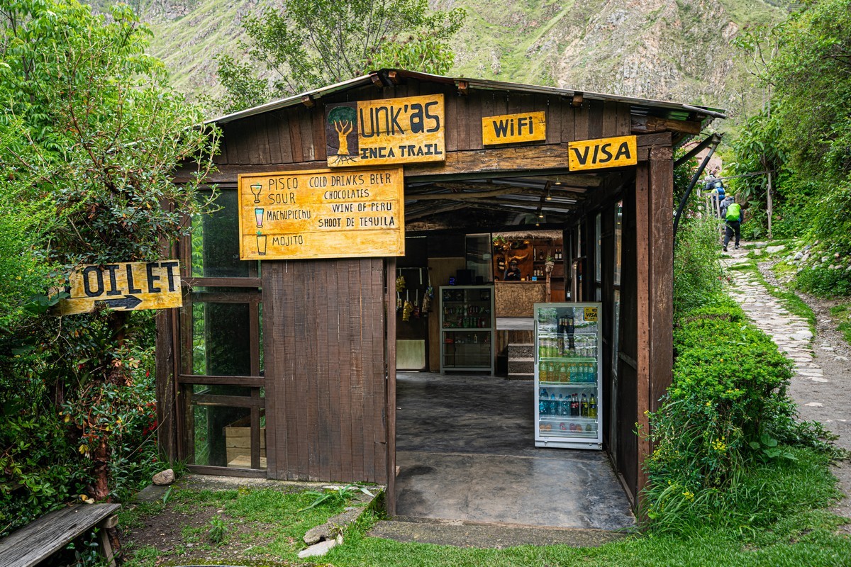
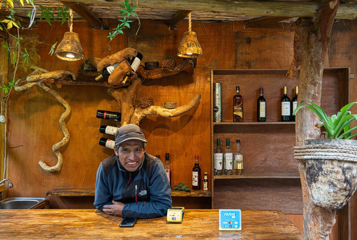
Rest-stops are conveniently placed at regular intervals along the trail. And even small shops! Public conveniences are paid – costing one sol (about 30 cents). Clearly this infrastructure is built for high tourist traffic:
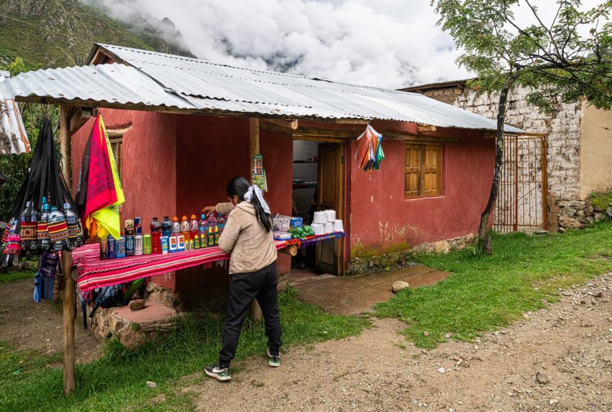
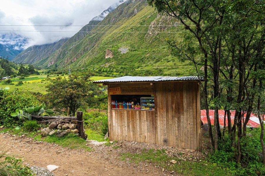
Ice cream! ->
The surrounding views are stunning – though it’s a shame there’s no blue sky. January’s not the best season. But at least it’s not too hot!
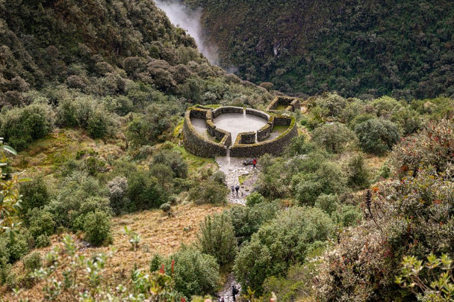
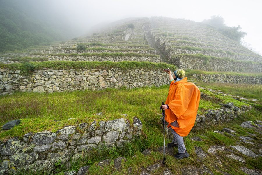
The trail continues, and soon the first Incan ruins appear along the route – Huillca Raccay, aka Willka Raqay. Our guide, Vicente, explained how this was once a military fortress and a food storage site – which makes sense since a strategic road like this needed both food supplies and protection:
More cacti:
Do you remember OR’s fondness of cacti? Well here she is again capturing yet another masterpiece ->
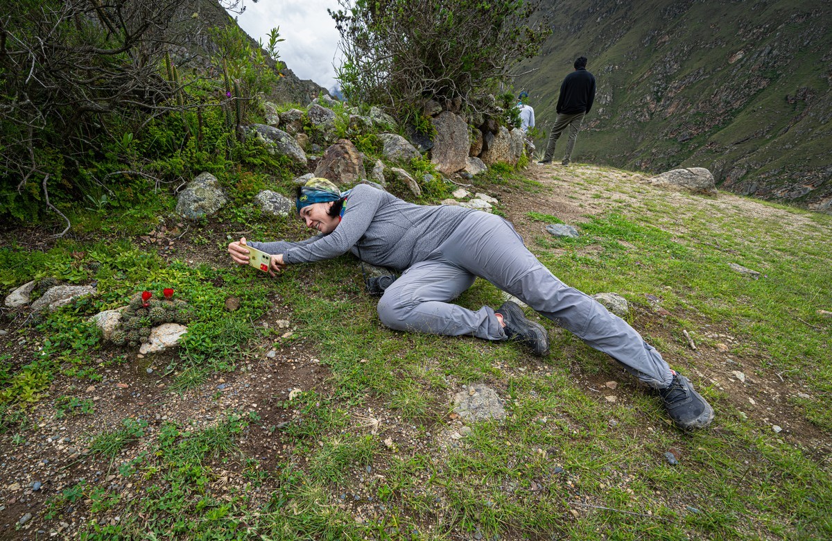
And she nailed it! ->
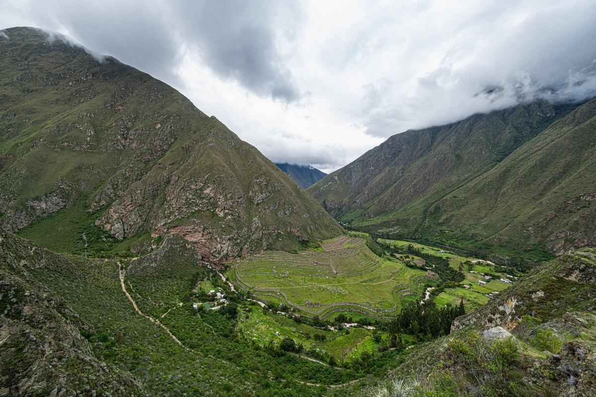
Down by the river, we spot larger ruins – Llaqtapata, aka Patallacta, aka Q’ente Marka. But we didn’t stop there; we needed to reach camp before dark.
On a rock face, we spot an extensive colony of tillandsia (also known as air plants) – a favorite food of the Andean bear:
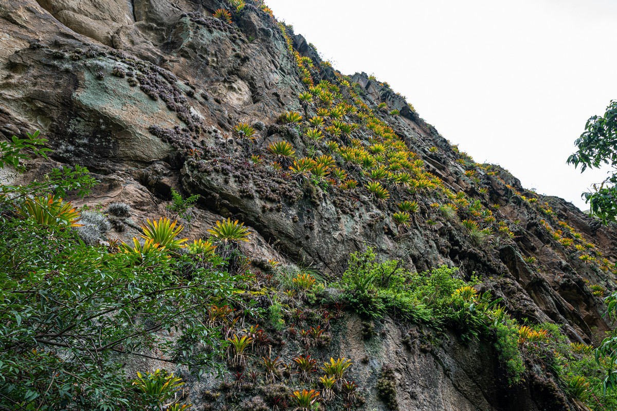
During covid, when no tourists were around, a few bears returned to these areas. But once things got busy again they retreated back into the mountains. By the way, we once saw one such bear in the mountains of Ecuador.
Meanwhile, it was lunchtime! But how we were fed – that deserves its own separate story (later on)…
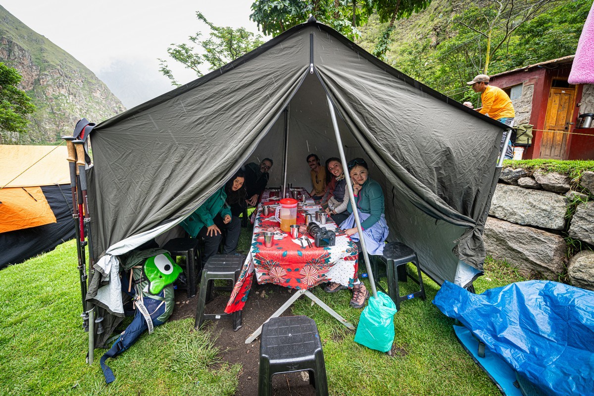
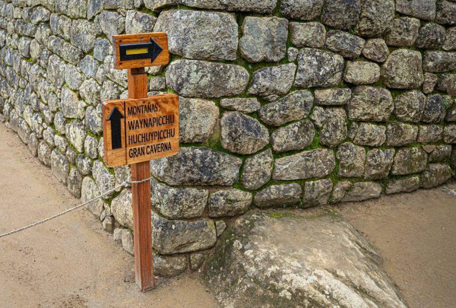
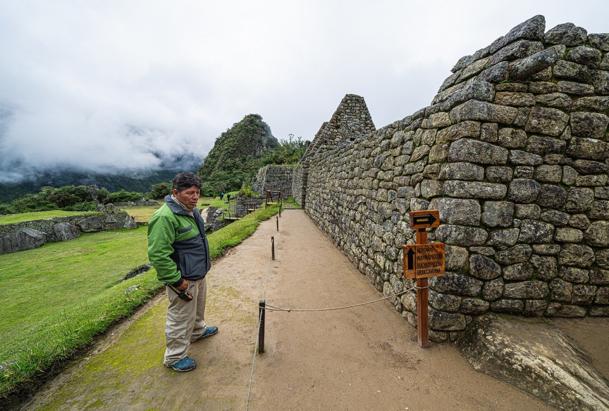
In the meantime, light rain began to fall. At first it was just a few drops and didn’t last long. After lunch, having waited out the brief drizzle, we moved on – but not before checking the route map. The trail signs are well-placed along the path, showing up at almost every rest stop. By here we’d already completed two-thirds of the day’s planned distance:
But the remaining path won’t walk itself, so we continue. And here are the stone steps – a sign of the imminent ascent:
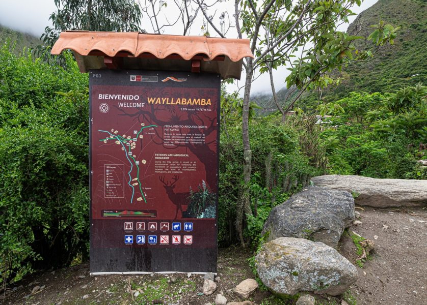
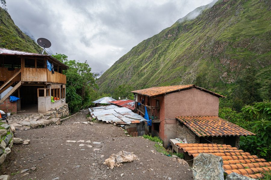
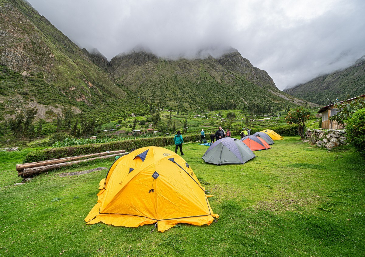
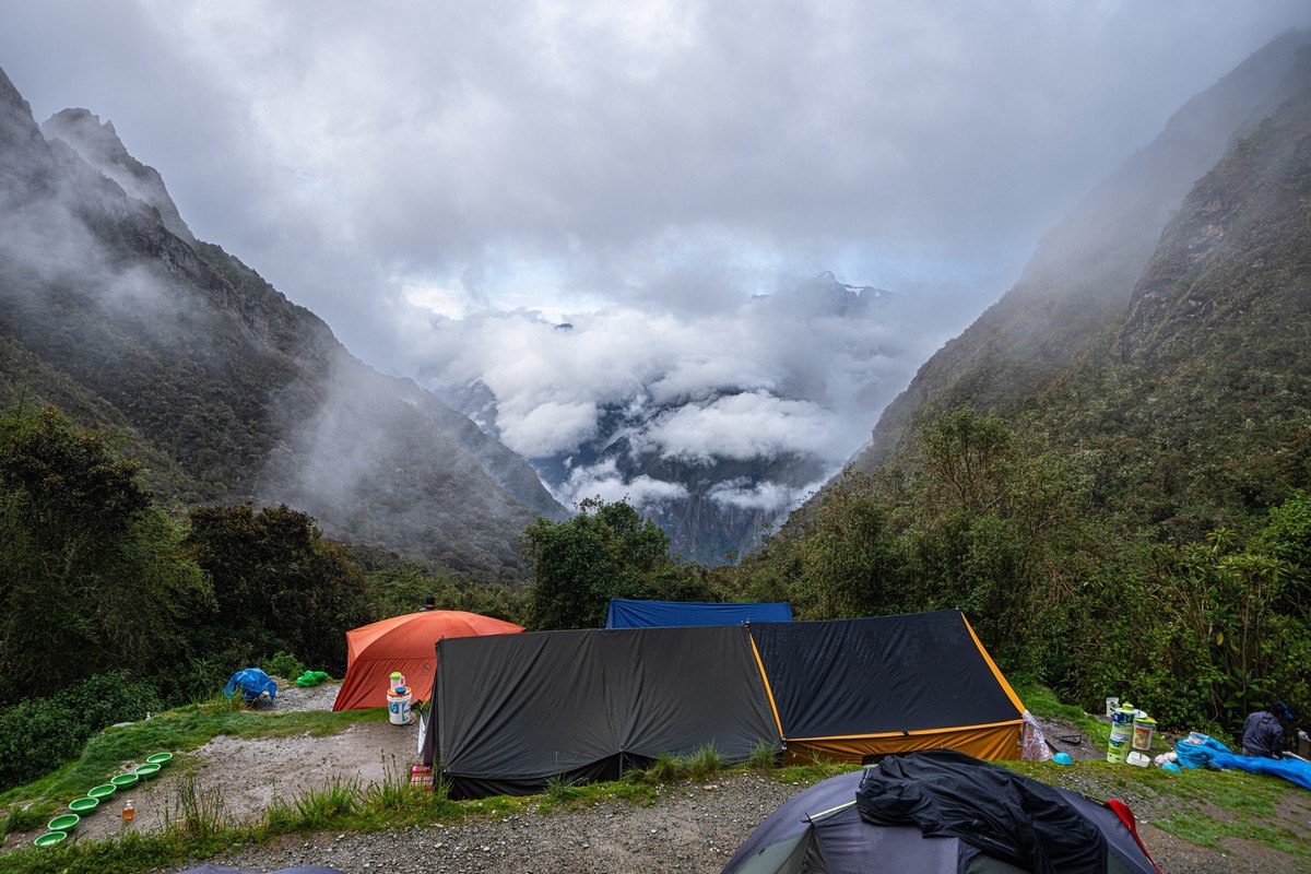
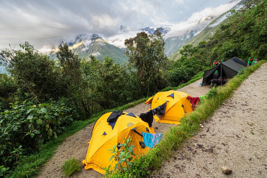
However, on the first day, there weren’t many steps at all. The path followed the rivers (first the Urubamba, then the Kusichaka), with only a gradual climb. Finally, we reached our camping spot – in the village of Wayllabamba. Comfort, as expected, was limited:
However…
Wow! Surprise: bar! But (and here’s another surprise!) honestly, at nearly 3000 meters above sea-level and after a full day of trekking, I had zero desire for alcohol!…
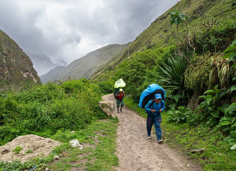
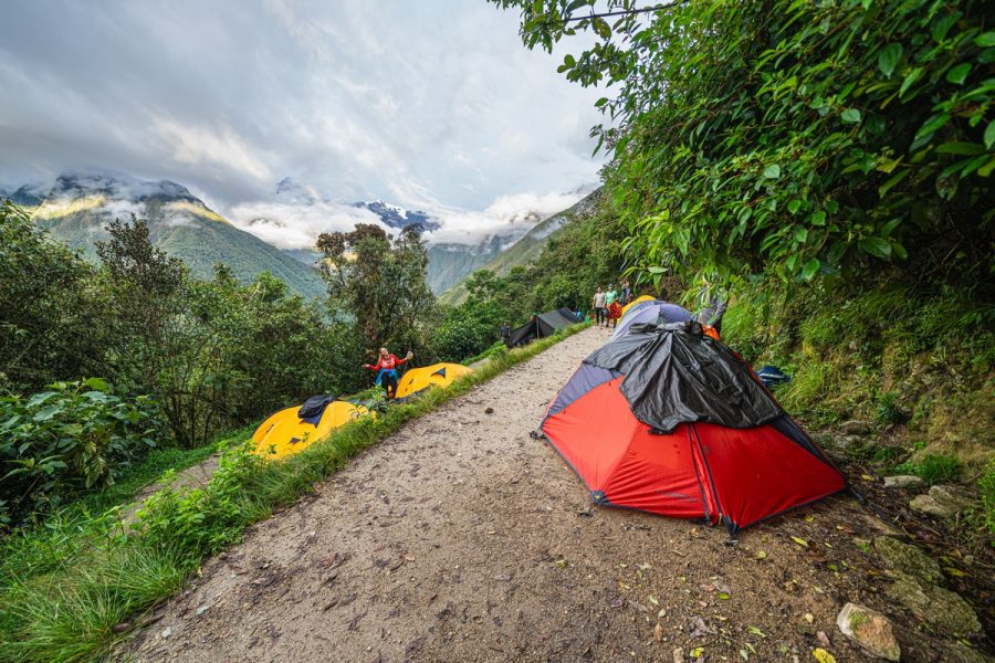
Just around the corner was our camp: the porters had carried and set everything up for us. By the way, they were also the ones who took the tents down in the morning…
…Which raises a question: why aren’t there permanent tourist lodges or other comfortable accommodation along the route? Here’s the answer: once upon a time there was an attempt to set up such infrastructure, but the porters… revolted! They’re all local farmers, but they earn more carrying loads for tourists than they do working the land. In the end the authorities gave in, and now bourgeois visitors just have to accept it.
Speaking of which – here are our porters:
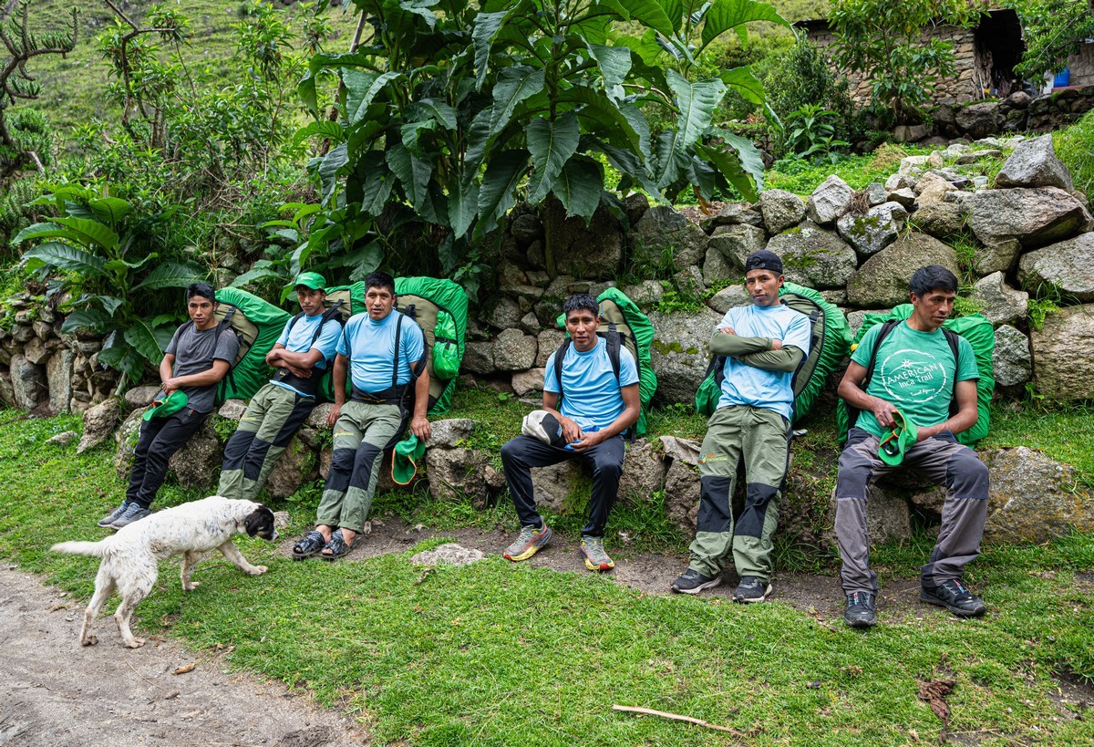
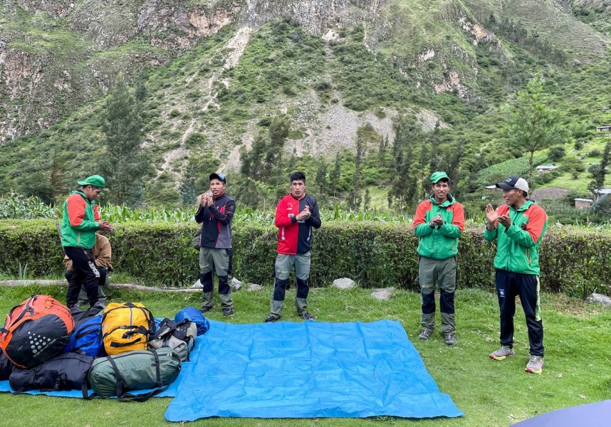
In total, our group was made up of around 15 porters (carrying not only our tents, tables, chairs, and food, but much more besides), plus a chef with an assistant, plus two guides. This is standard practice for trekking groups. However, we heard that some groups made up of just two people come with as many as… 20 porters, for some tourists demand beds, their own hot showers, and other luxuries. At this campsite, there were at least decent rest rooms and a hot shower for 10 soles (~$3), but further along the trail, comfort would be greatly reduced; accordingly, the porters had to carry everything. Not that they mind: it’s a paid job!
Day two: onward – up to the mountain pass.
Day two of our trek along the ancient Inca trails to Machu Picchu was the hardest. We only had to walk about 8km – but with a 1200-meter elevation gain.
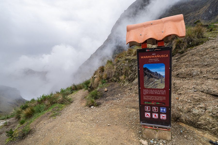
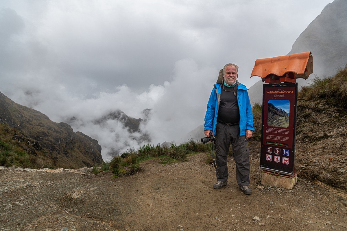
For experienced mountaineers or anyone else in great physical condition, this would have been a piece of cake. But for untrained “office plankton” like us, it felt like an act of personal heroism. Still – as if to make up for that, the path was breathtakingly beautiful! The mountain pass we were about to climb is called Warmi Wañusqa in the Quechua language, which translates as… Dead Woman’s Pass. Oof! The origin of the name apparently came from the wild imagination of the local people, who saw the shape of a dead woman (how that’s different to the shape of a live woman, I’m not sure:) in the mountains east of the pass. But we couldn’t see anything like that!
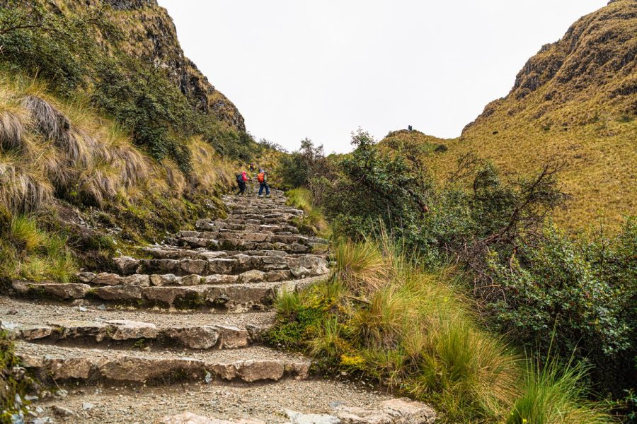
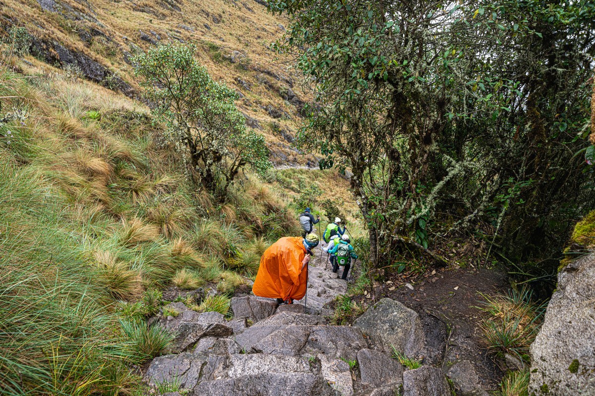
We were more interested in… the steps! There’d be a great many of them over the next few days: a never-ending stream of them up and up and up and out of sight – filling us with a sense of both futility and existential despair…
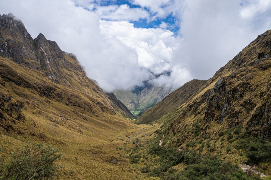
Skipping ahead a bit – this is the view from the pass back at the first part of the trail:
And after reaching the pass, we’d have to descend endlessly down this stone path:
We’d been warned in advance this wouldn’t be easy! We had to wake up at 4:30am, breakfast at 5, and start the climb as early as possible to make the most of the daylight hours. See that peak slightly left of center? That’s where we needed to go. After reaching the pass – the mentioned long and painful descent down the other side. Well, the trail won’t trek itself – let’s go!…
OR started out brimming with enthusiasm. To her, 1200 meters up the vertical was a walk in the park. That’s why she’s smiling :). Vicente was also feeling great, but then he’s a local and used to high altitude:
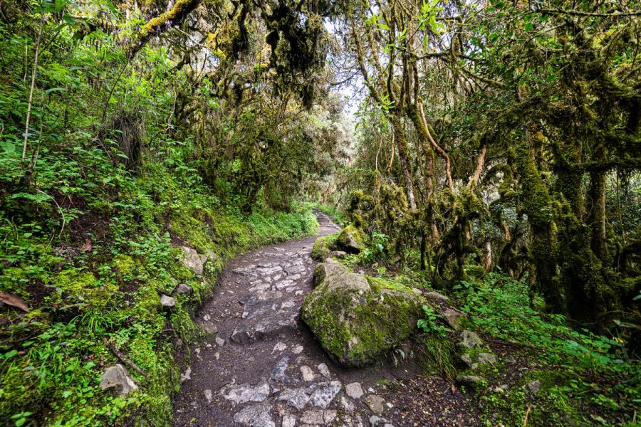
The initial climb wasn’t too steep – the trail started gently; while the surrounding landscapes were inspiring. But as the trail entered a moss-covered jungle, the path got steeper and steeper – and that’s when the stonework appeared. Now, I doubt the Incas paved every path with stone, but they definitely built stone ones where necessary. Either way – the amount of work they put into their construction is astonishing…
Then, it’s head down and just step, step, step – up, up, up. Steps, more steps, yet more steps, endless steps… Occasionally – mercifully – a flat section! Yeah, this was tough…
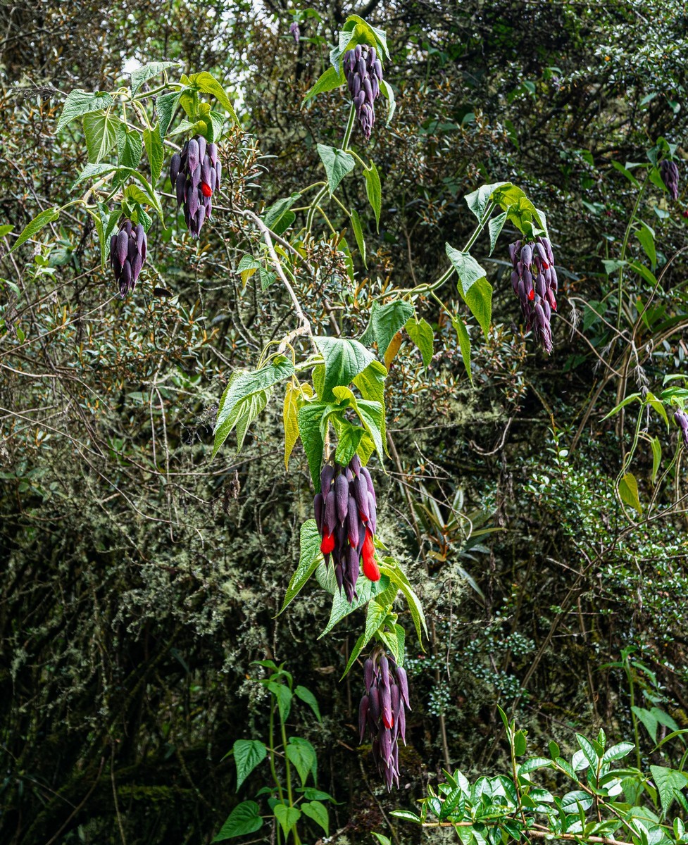
To distract us from the hardship, Vicente would point out flowers. This one, for example, is a Bolivian fuchsia – a favorite snack of hummingbirds:
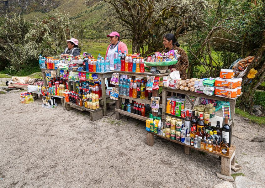
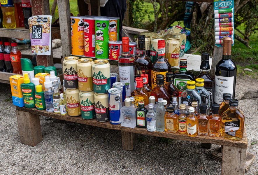
After four hours of steady climbing (a solid fitness session!), we’d gained 800 meters in altitude, which was two-thirds of the way to the pass. Before the final push, we took a well-earned rest at a spot named Llulluchapampa. Whoa, what kind of service is this?! The assortment was wild! You could easily stay here for a couple of days. Beer, Jägermeister, corn liquor, Red Bull, Pringles, nuts… lip balm – what more could you ask for?! No – we had to get away from these temptations as quickly as possible!…
We just needed to climb 400 more meters – all the way up there, following those there red backpacks:
“Just” a third of the climb left to go – with a “mere” 400 meters up the vertical. Sounds easy, right? But that’s basically a 100-story building! And on top of that, the altitude was approaching 4000 meters – where the oxygen level drops, air pressure decreases, and the hiking tempo slows plenty…
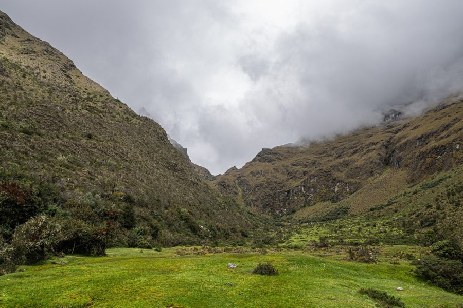
Half-way through this final third of the ascent, we took another quick break. Looking back, we could see the valley we’d hiked up from:
Don’t trust the smile! She’s only just keeping it together (the pic of her ~10 pix back (above) is more accurate:) ->
Don’t trust this picture either! It’s just our guide, waiting for the slower hikers:
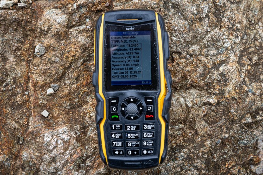
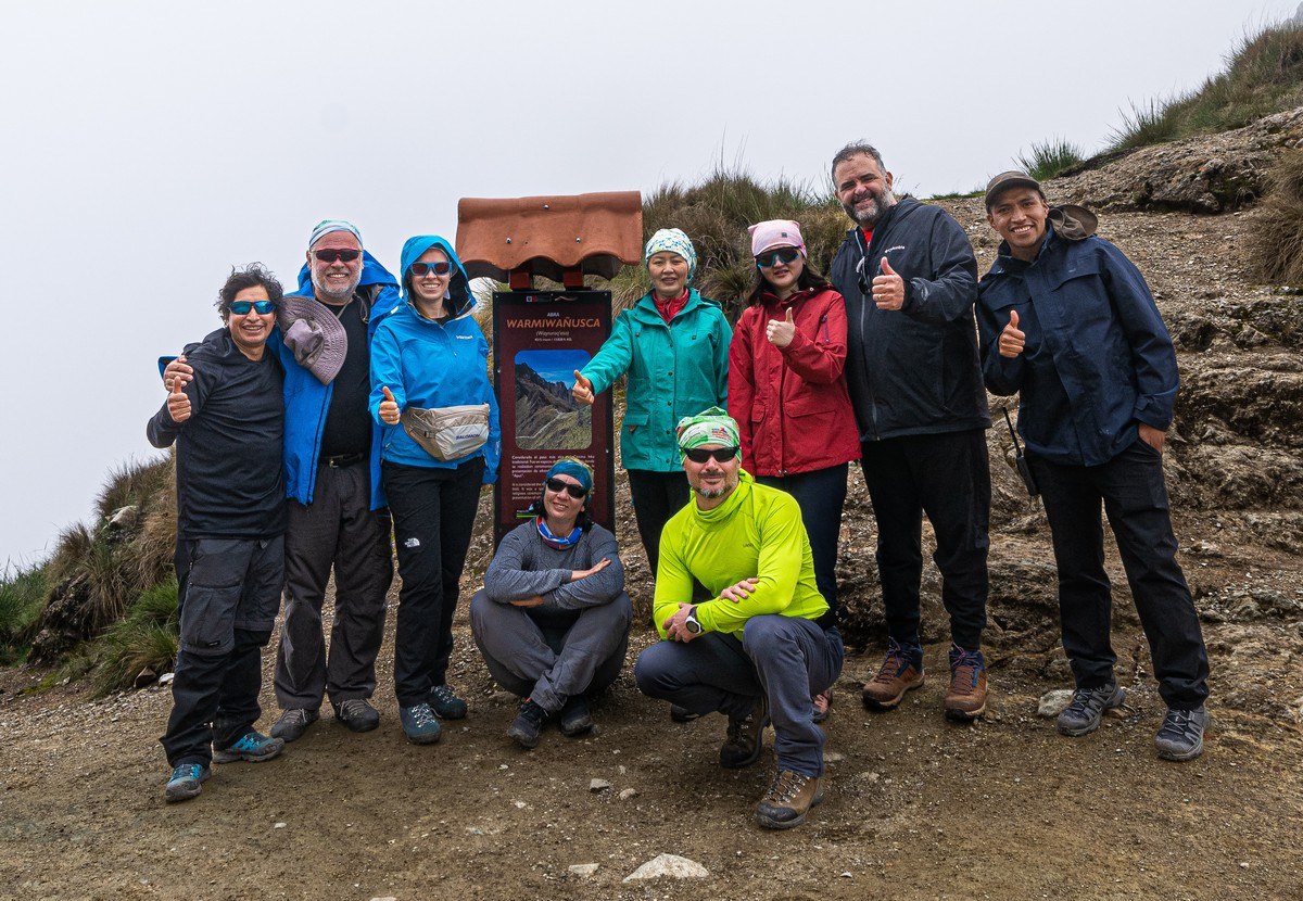
We finally we reach the mountain pass! Elevation: 4200+ meters. Not quite Everest, but still a respectable height – especially considering we were only on our third day at high altitudes and had been actively trekking the entire time ->
A group of cheerful elderly Korean tourists was hiking the same trail. The oldest of them was 80 years old, and she too conquered the pass: respect! ->
I wonder if we’ll be able to trek so high and intensely when we’re 80? Surely yes, given that we climb mountains or volcanoes practically every year…
At the pass, we all took a good long break – to catch our breath and take in the views…
A group photo to commemorate the achievement:
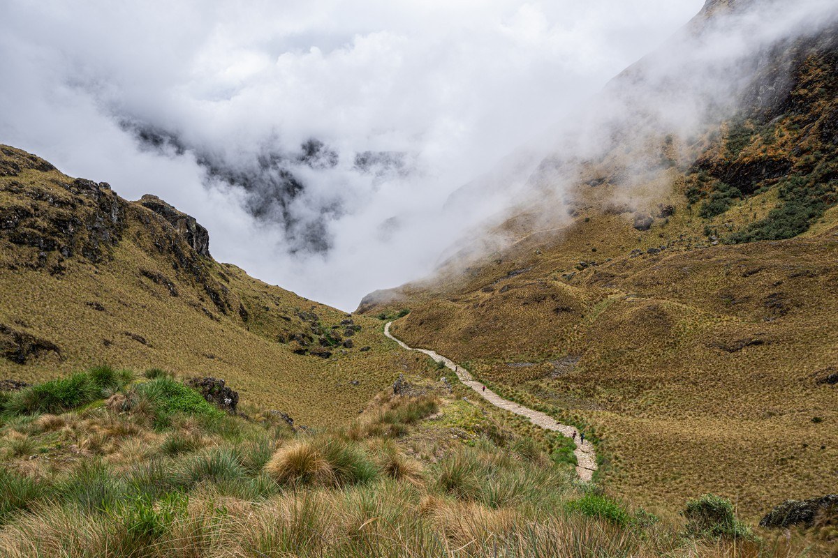
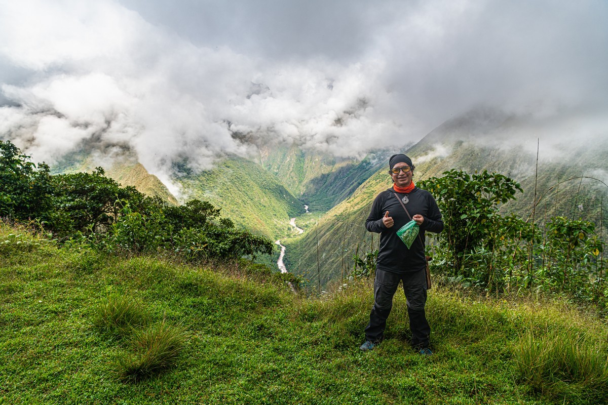
But we needed to start heading back down. A strong wind had picked up – signaling a coming weather change. Down there’s where we were headed ->
We started our descent – right into terrible weather conditions. But OR still looked happy – not sure why/how (had she seen and snapped another cactus?!). Then the rain started. First, just a drizzle. Then a persistent light rain. And then it became clear – this downpour wasn’t stopping anytime soon. So we kept on schlepping down the rain-soaked Inca paths. Fortunately, the stone paths weren’t slippery at all – which was of course good. But that didn’t make up for the fact that trekking these trails during rainy season is never a great idea.
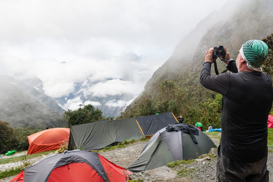
Despite the rain, and quite a bit of grumbling – but just as much banter – we finally reached our next campsite. It was wet, cold, and the WC was of the “one-star” variety – and requiring a 5–7-minute walk just to get to it! But we’d been in worse situations before! I wasn’t too bothered, but for some of my fellow office workers, this was a shocking introduction to this kind of wilderness-camping.
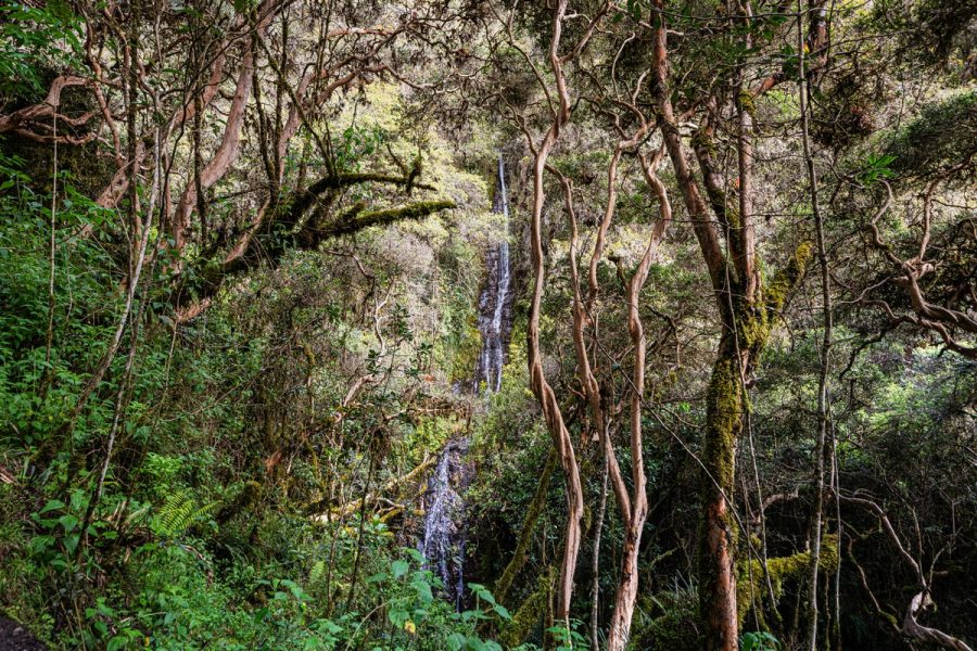
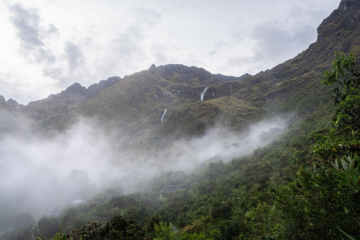
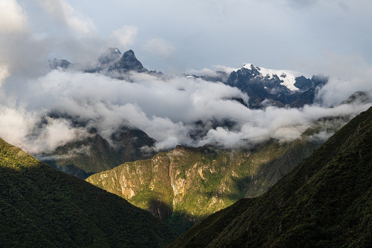
By the way, on clear days, this place is supposed to have stunning views! ->
…Unfortunately, not today – this is the rainy season, after all. However, the waterfalls were raging beautifully down the mountainsides:
To wrap this day up – an alternative perspective on the day’s events, courtesy of DZ ->

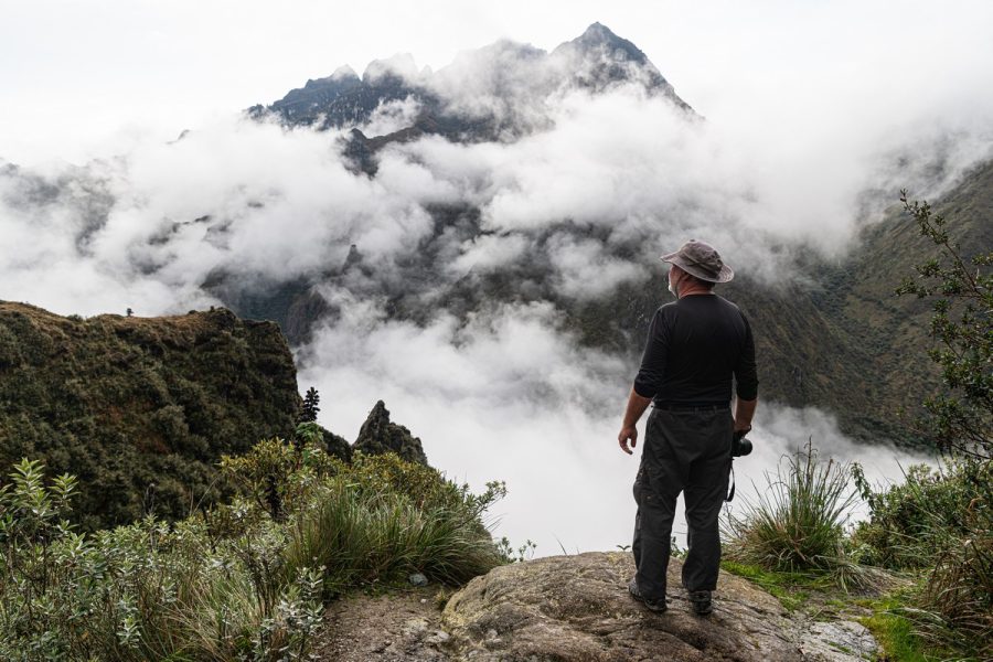
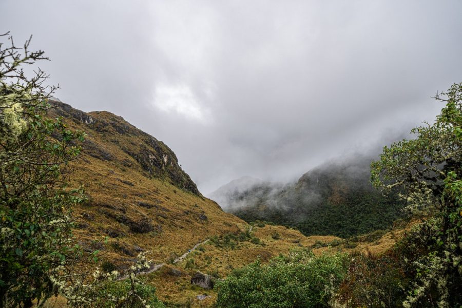
Day three: not much to see – besides fog.
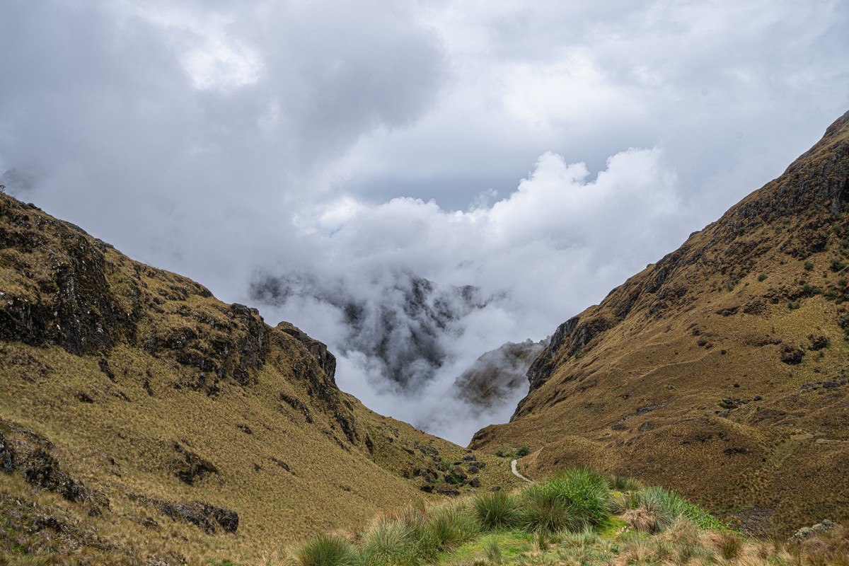
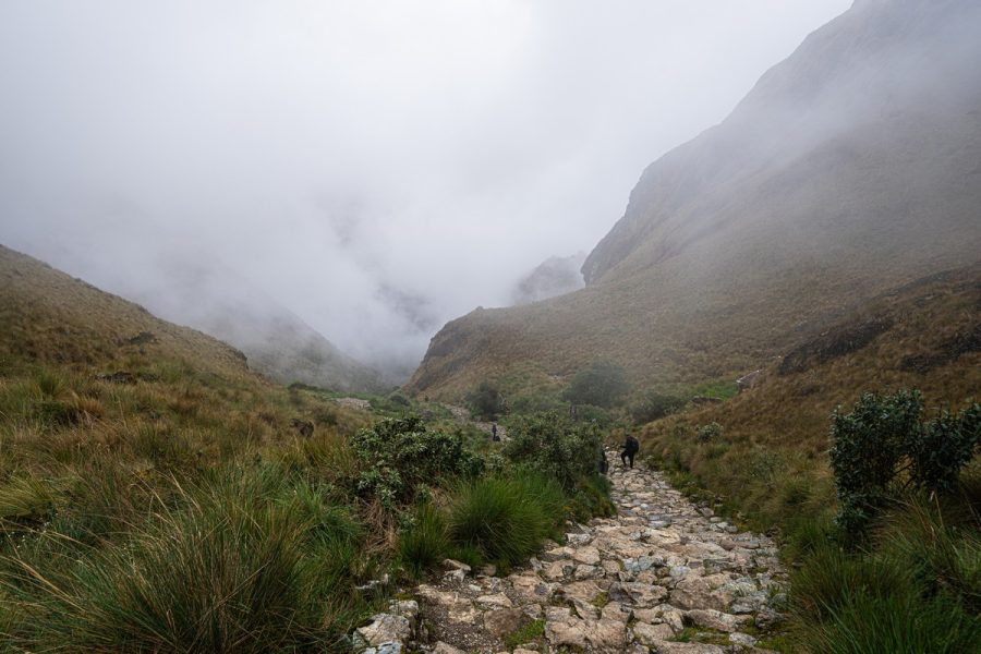
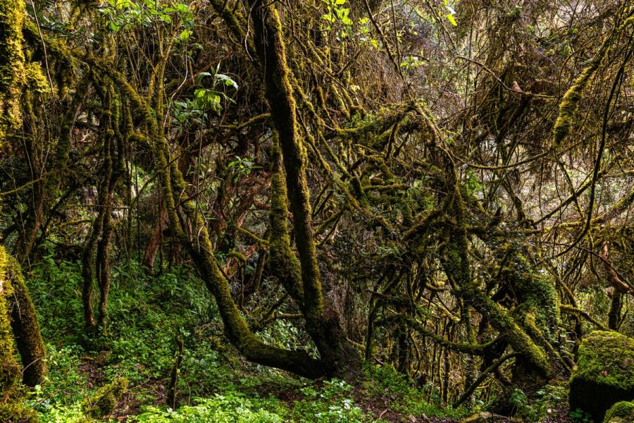
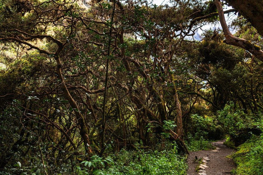
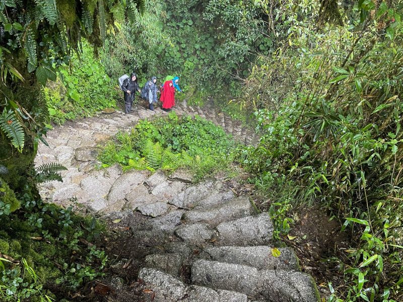
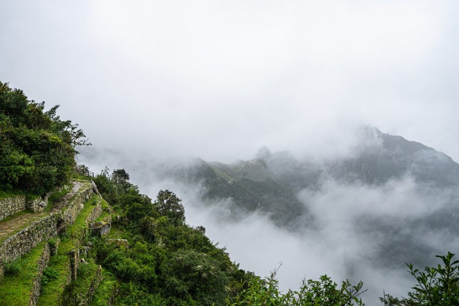
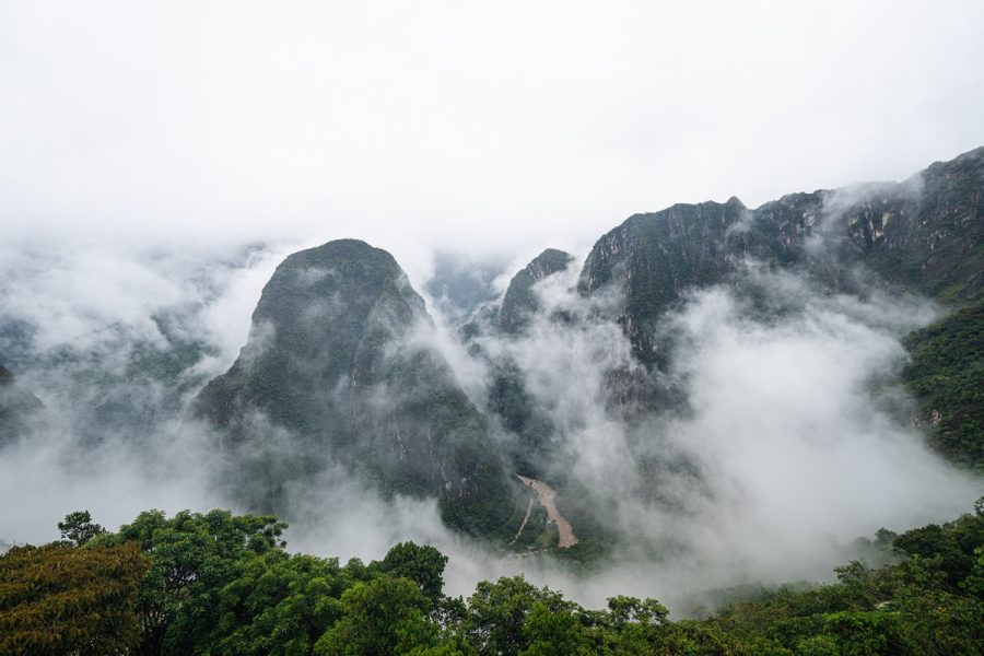
The third day of our Inca Trail trek began with some good news: the upcoming stretch wasn’t too difficult – just a 300-meter climb, followed by a gradual descent, then a flat section, and then down, down, down. This wasn’t necessarily easier than climbing, but it was sure faster. That was the end of the good news. We’d hoped that the previous night’s rain would clear the sky for this day. No such luck. The sky simply ignored our prayers. At first, the morning showed some signs of hope But soon the Inca Trail was engulfed in ever-thickening fog and gloomy weather:
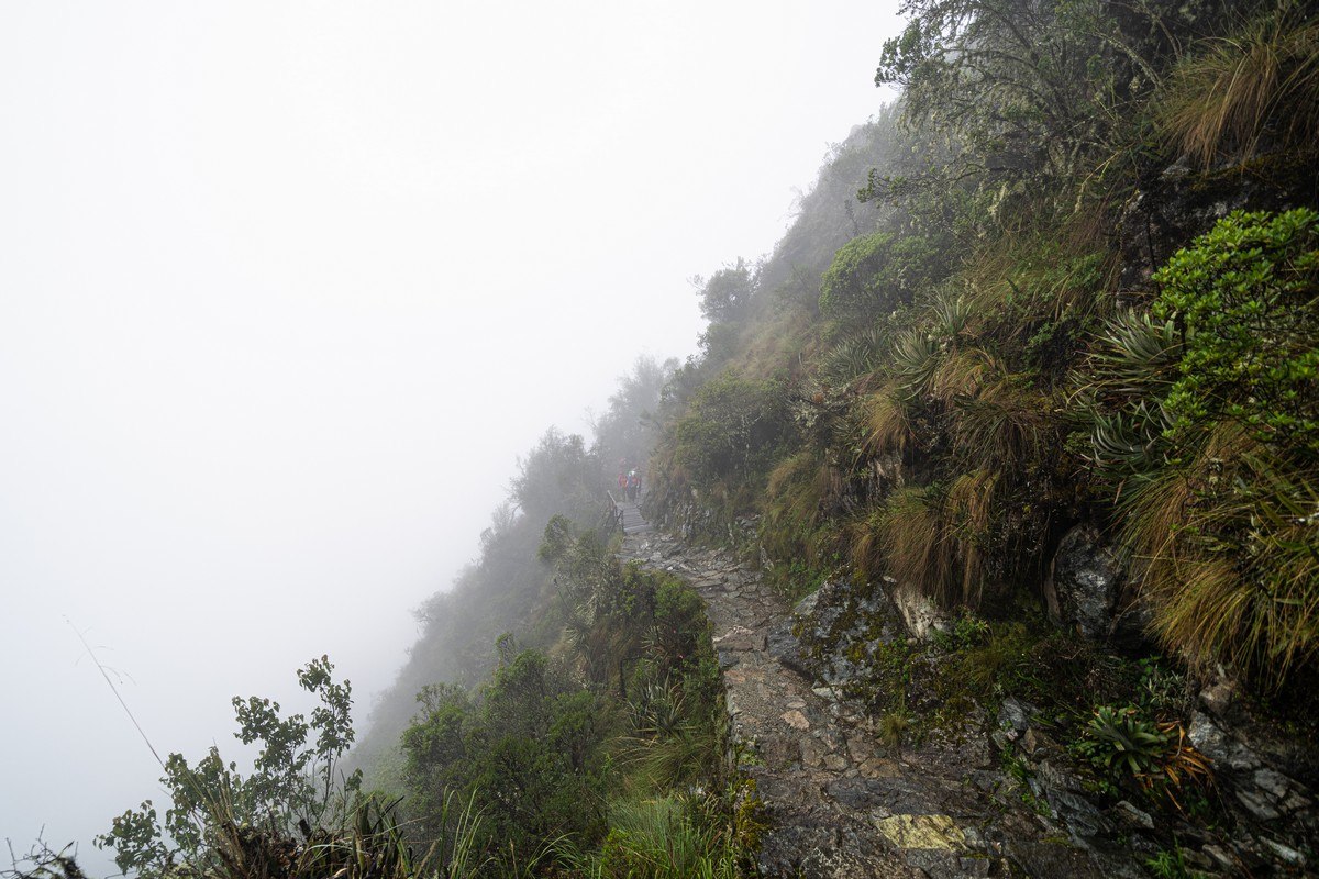
Dreaming of drier, brighter conditions, we pressed on downward. But this section required maximum caution! The Inca Empire didn’t exactly prioritize safety – or maybe they just trained their couriers better:
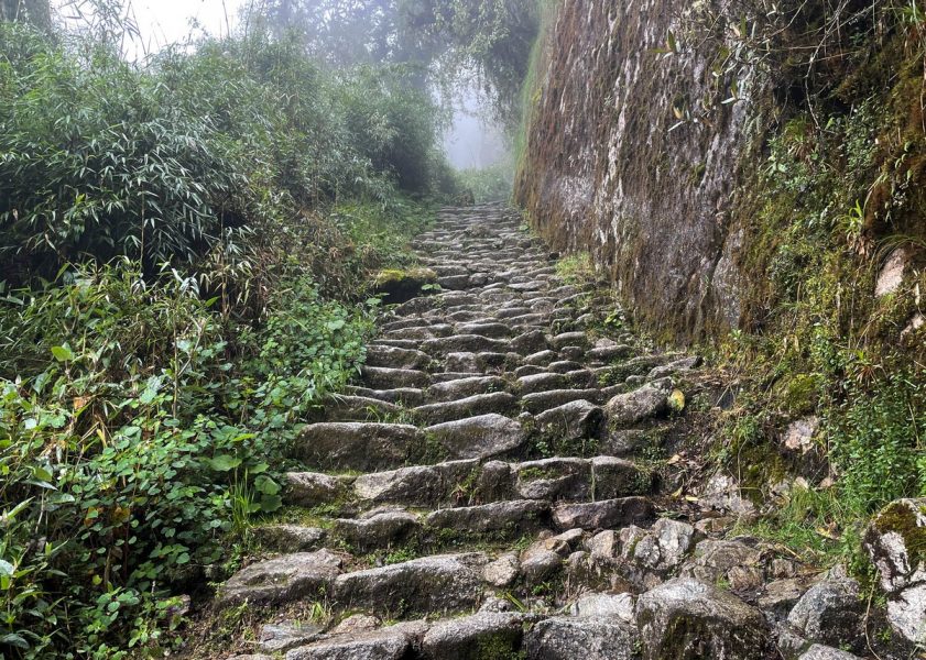
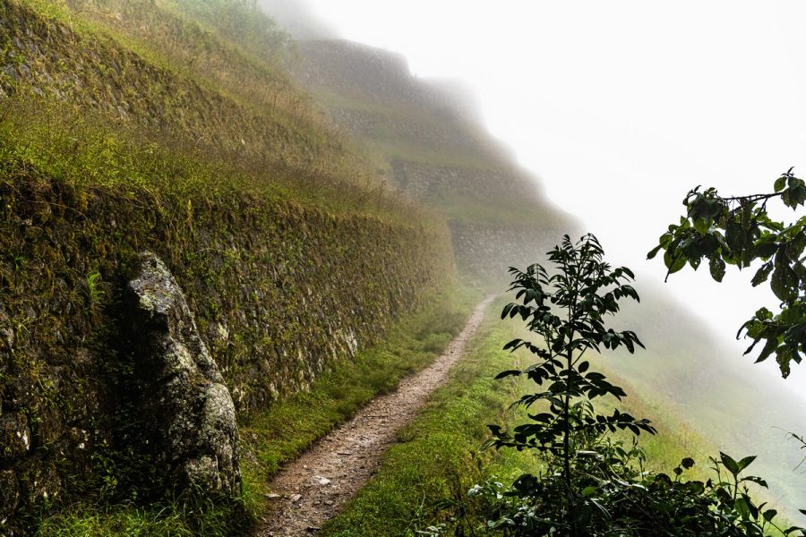
Then, suddenly, we were completely swallowed up by dense cloud. Sightseeing of the wonderful mountainous landscapes was over. We could only take photos of the trail itself:
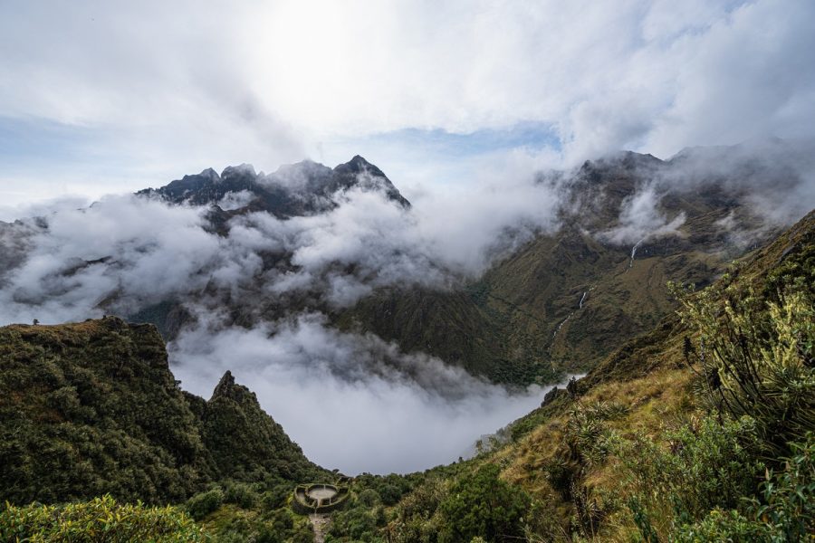
I’m convinced this is one of the most beautiful hiking routes in the world – but only in the dry season. For us, however, we were experiencing the absolute peak of the rainy season. But those… clouds have silver linings: it means we’ll just have to come back!
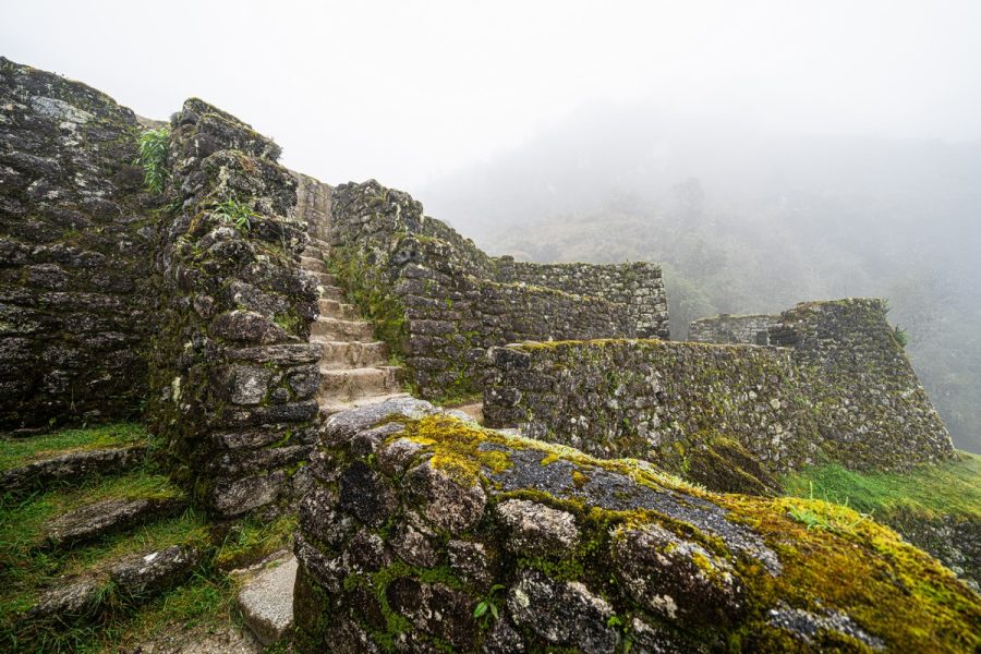
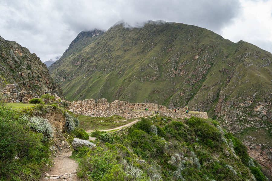
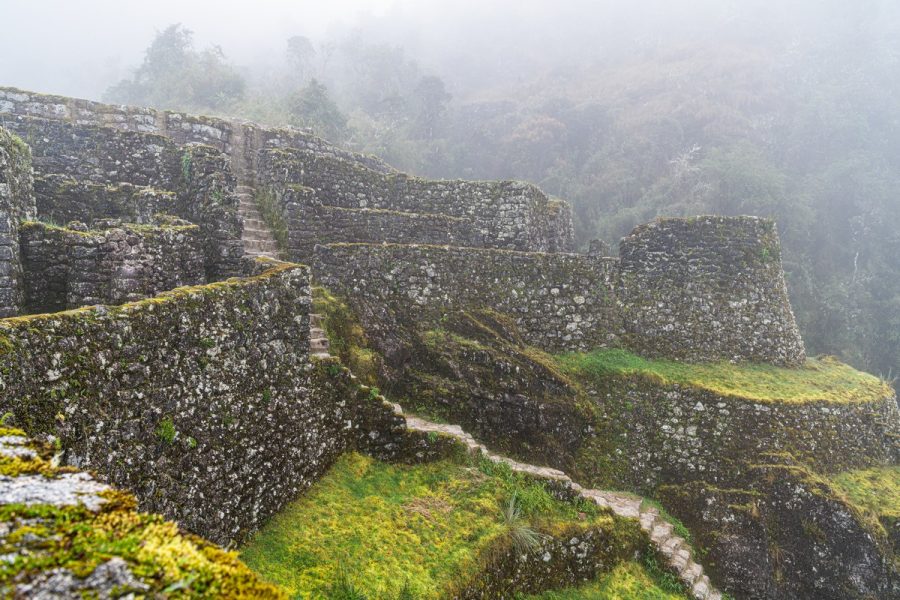
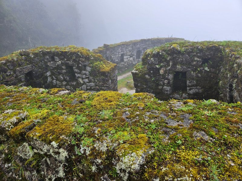
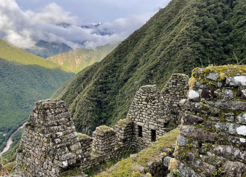
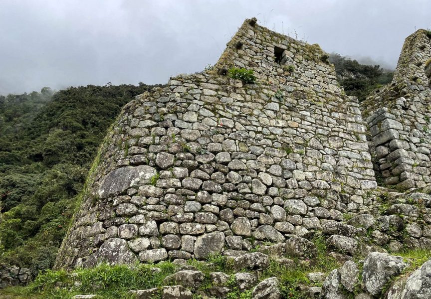
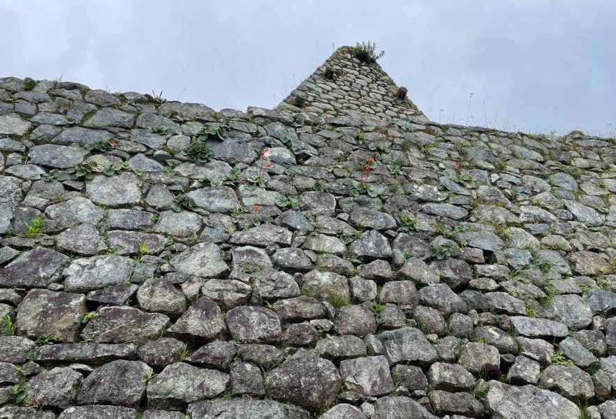
Meanwhile, here in thick fog during monsoon season in early 2025, we reach the ruins of another Incan fortress, Sayacmarca. Doing the Inca Trail to Machu Picchu isn’t just about the trekking – it’s also about slowing down to explore ruins. Unfortunately on this day the ruins were the only thing visible. No panoramic views, no landscapes – just ancient stone structures lost in the mist. I didn’t even bother bringing my camera to these ruins.
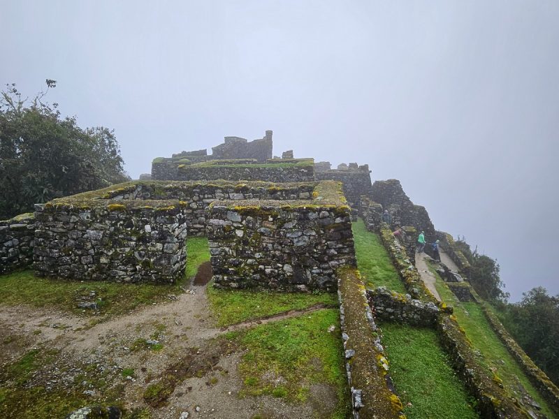
So, whatever you do, only visit this place during the dry season! In clear weather, I’m sure it offers incredible views. But for us – only fog and ruins.
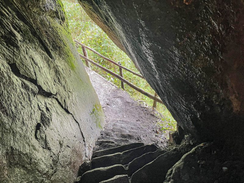
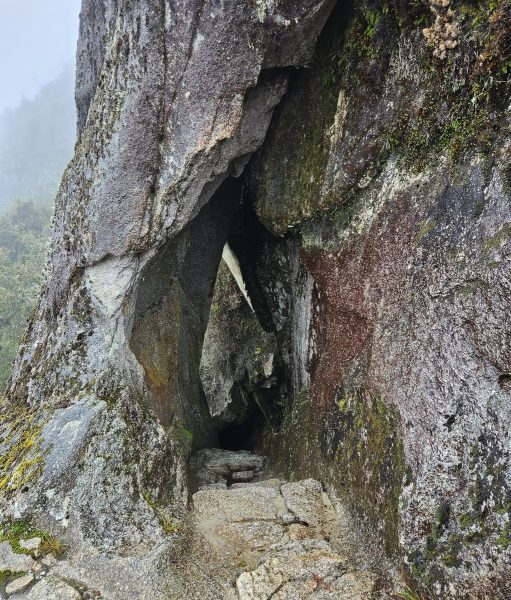
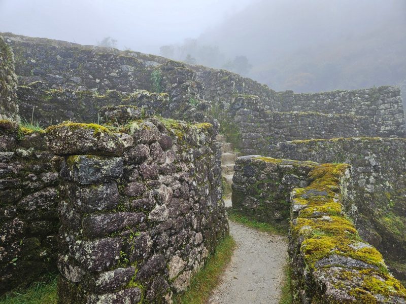
Onward – downward, the going rather precarious as the stones underfoot weren’t always flat. At times, the path became narrow and carved into the cliffs. And sometimes, the trail dove through tunnels and rock passages:
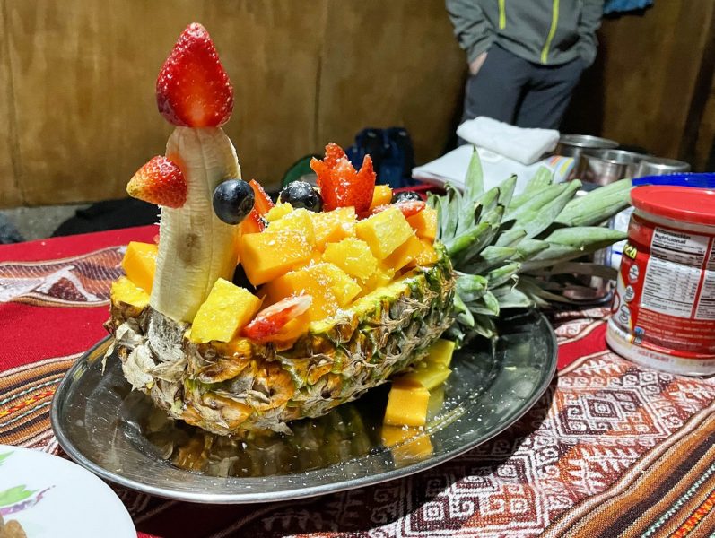
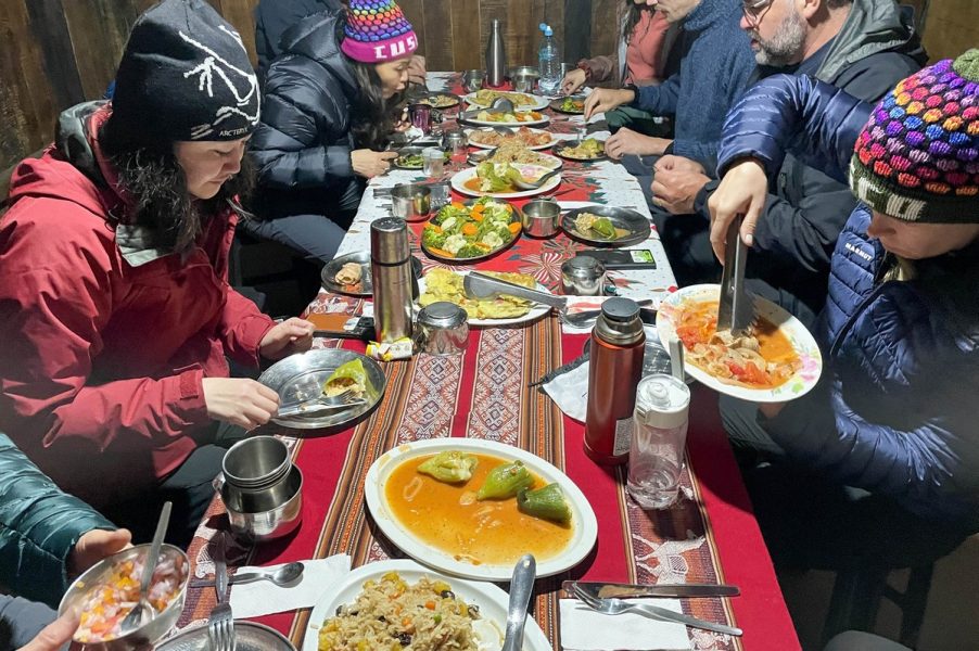
Next up – lunch. At specific points along the trail, porters from various trekking companies gathered together in designated areas, set up tents, prepared meals, and served their tourists an exceptionally delicious meal:
Once all the trekkers, even the slowest ones, had arrived, the cooks began bringing out an unbelievable amount of food. I don’t think we ever managed to eat even a third of it! Not only was it delicious (at least for my undemanding taste buds) – it was also beautifully presented. Of course, these photos weren’t taken on a single day – but at various meals throughout the trek, but this was the kind of presentation we got. And the menu was always changing. Absolutely top-notch!

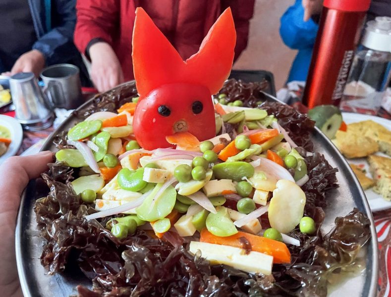
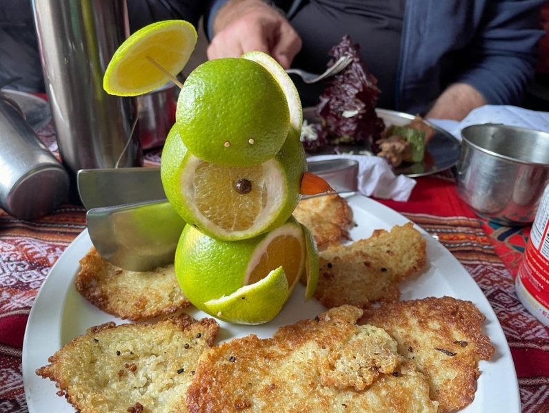
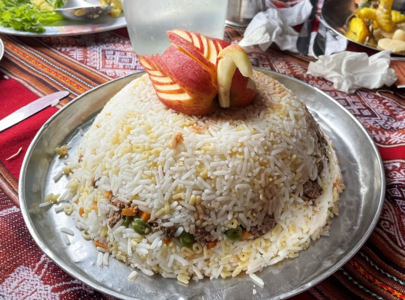
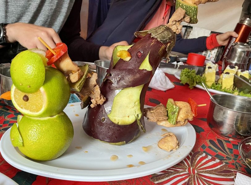


The porters carried all this food throughout the trek! And the chef? He proudly possessed some kind of special certificate. Bon appétit!
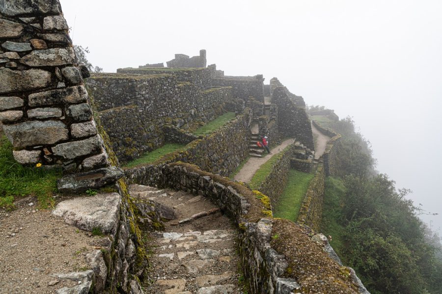
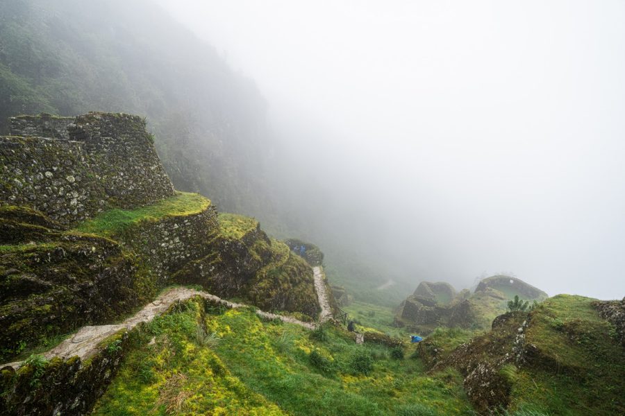
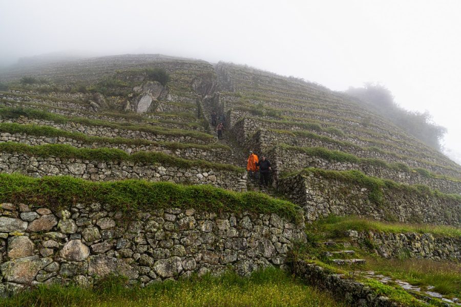
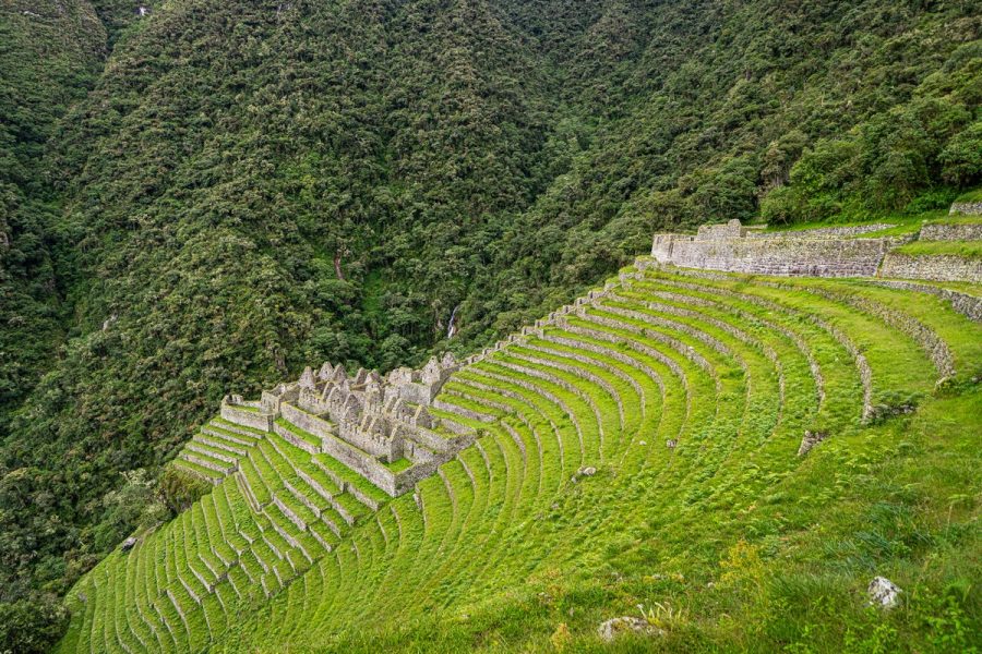
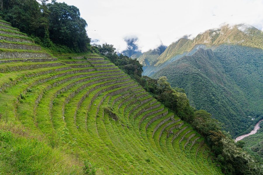
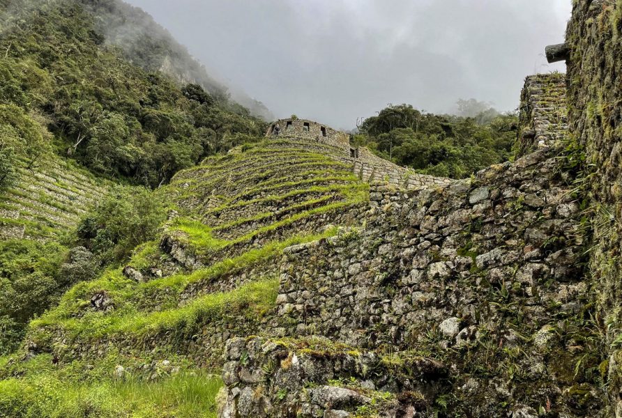
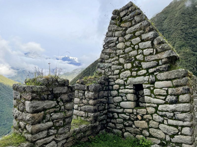
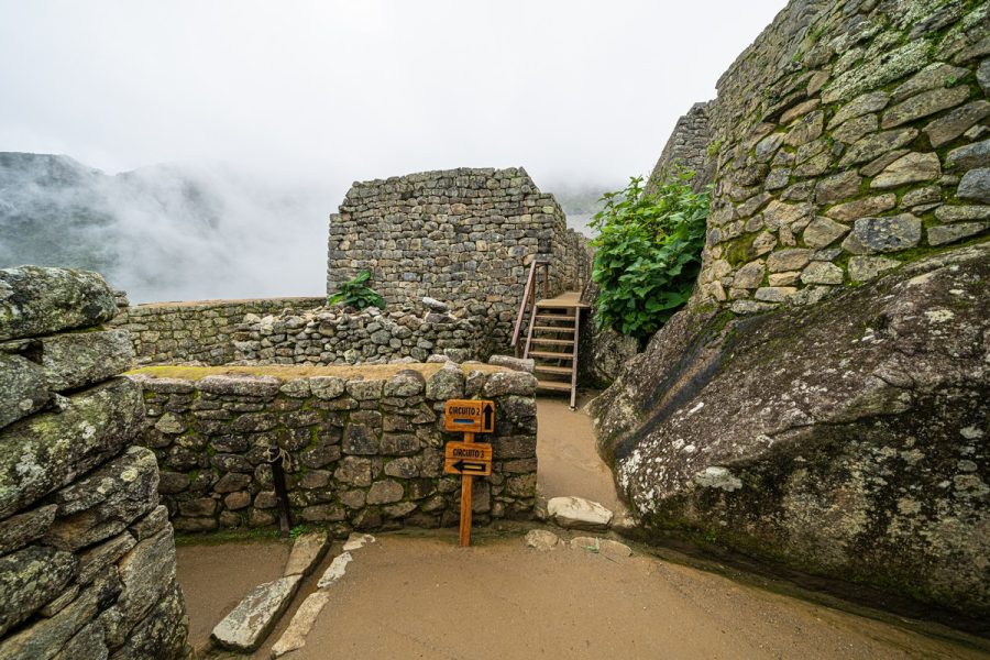
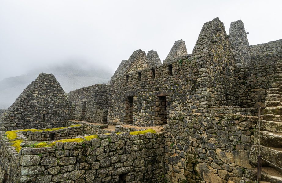
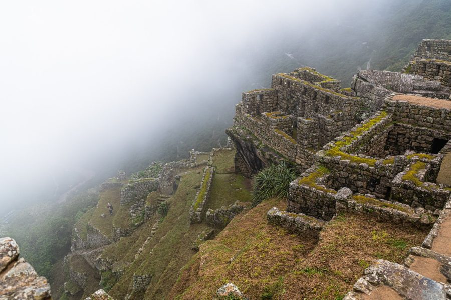
But now it was time to get moving again – heading toward Machu Picchu, losing altitude, and putting our knees to the test on the endless Inca steps. Since we’d already gained quite a bit of altitude, we now had to descend just as much. But I’ve already shown plenty of steps pics, so let’s skip straight to the next major tourist attraction: the fortress of Phuyupatamarca. As expected, alas, it too was shrouded in fog. On a clear day it probably looks incredible.
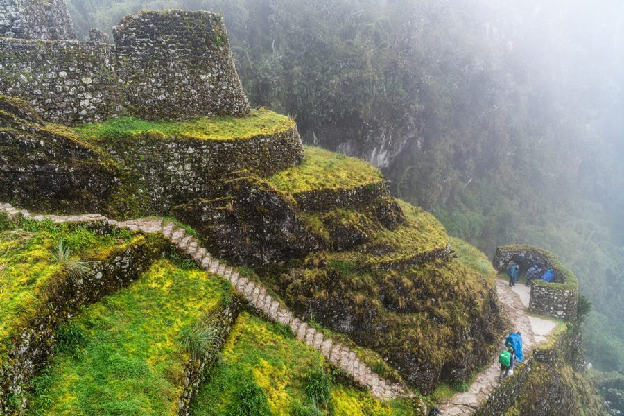
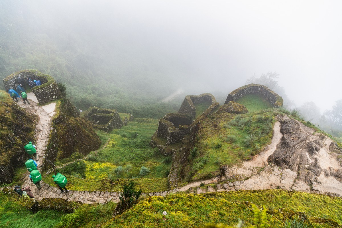
And over there is the long line of porters heading downward ->
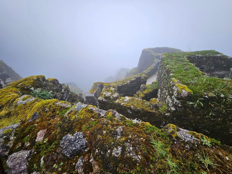
The closer we got to Machu Picchu – the worse the visibility got. Taking photos became nearly impossible – it was hard to even tell what we were looking at. How are you supposed to take a good photo in these conditions? Yes, we knew it was rainy season, but we’d had no idea the rain would be this constant. Our next historical site, Intipata, was explored in conditions like this:
“Anti-Rain” – yes: the ideal garment ->
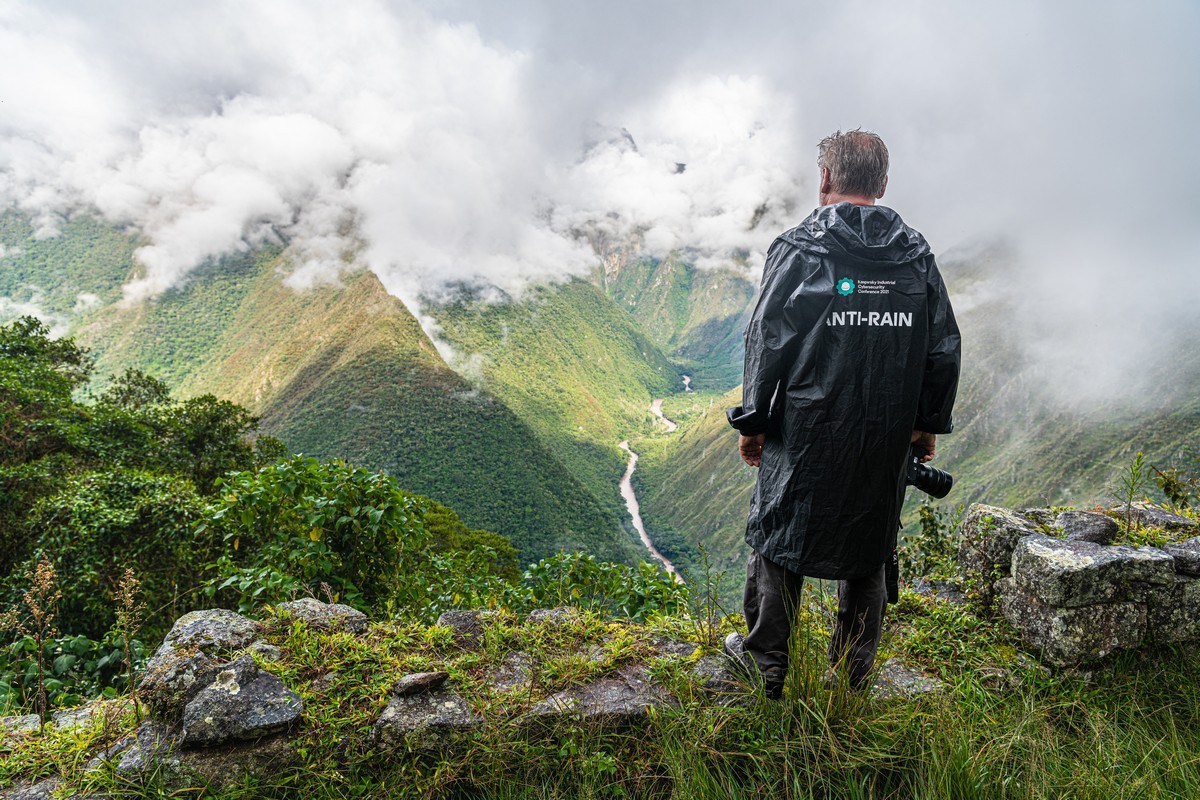
Bizarrely, as soon as I’d put my waterproof “poncho” on, the skies cleared somewhat!…
Next we needed to head down toward our next campsite for the night.
Vicente was still in a great mood:
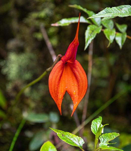
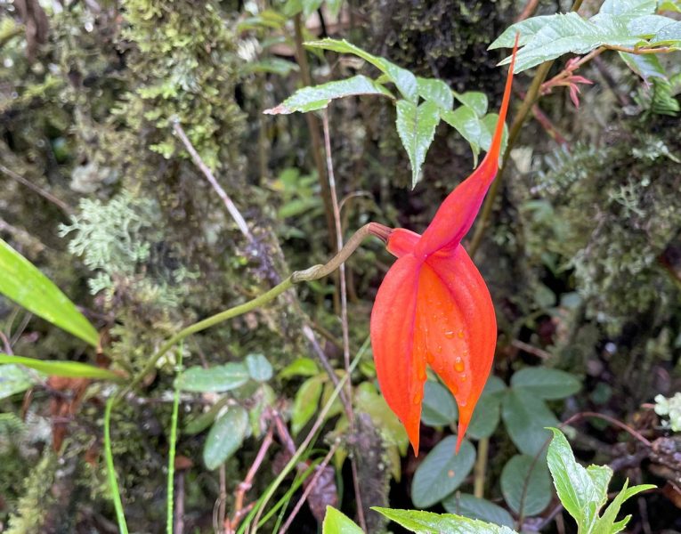
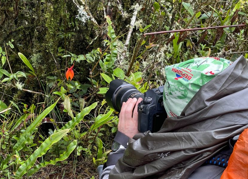
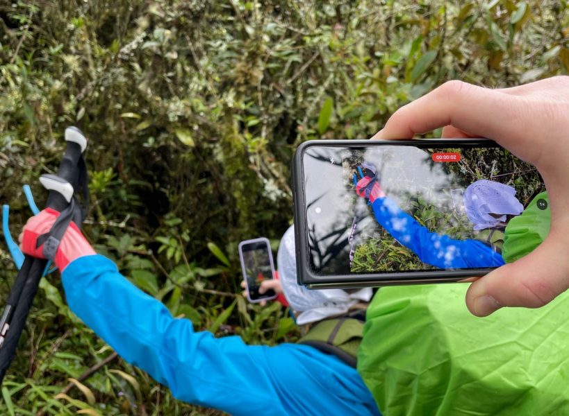
Just before reaching camp, Vicente got all excited: he’d spotted a Masdevallia orchid, a rare endemic flower that only blooms once every two years for a very short time. A truly beautiful flower! Naturally, everyone lined up to take a photo of it. And then, of course, photos of folks taking photos of it! ->
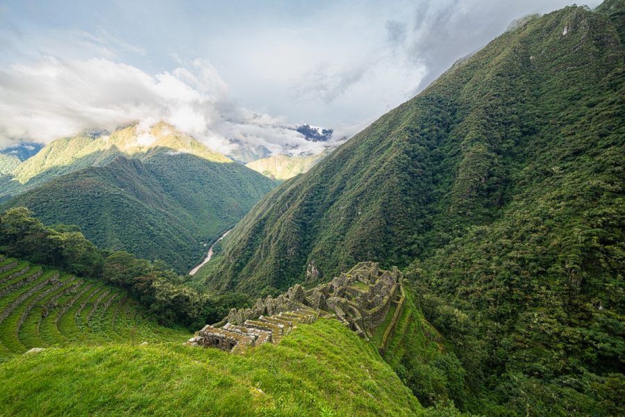
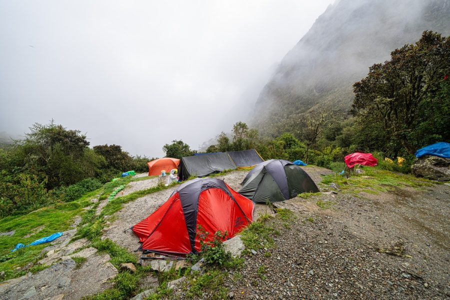
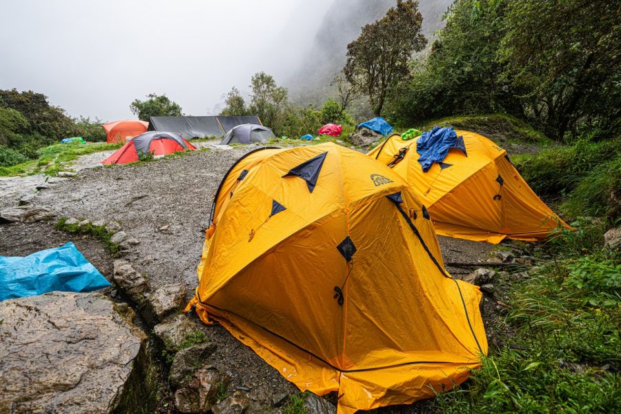
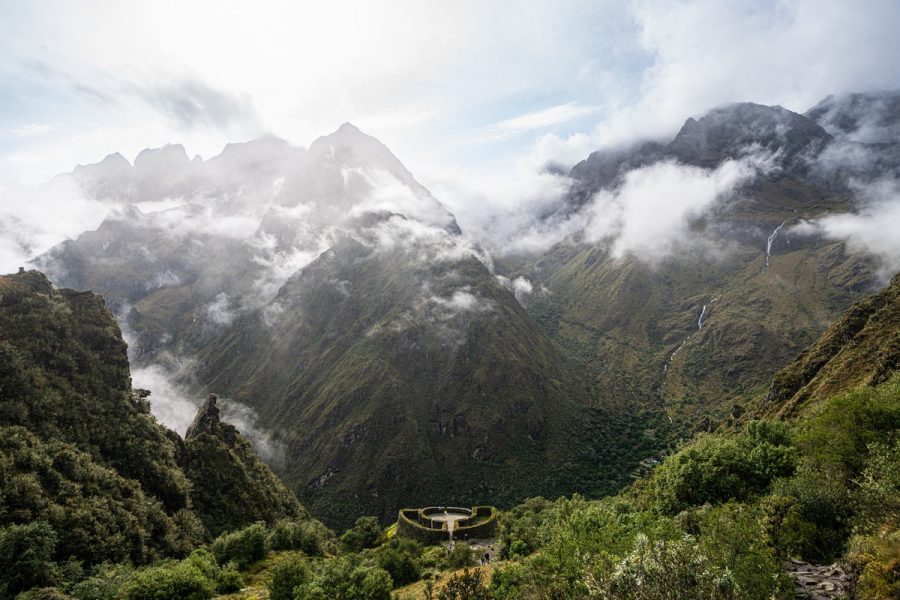
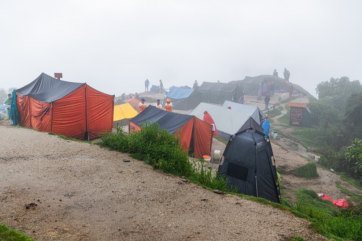
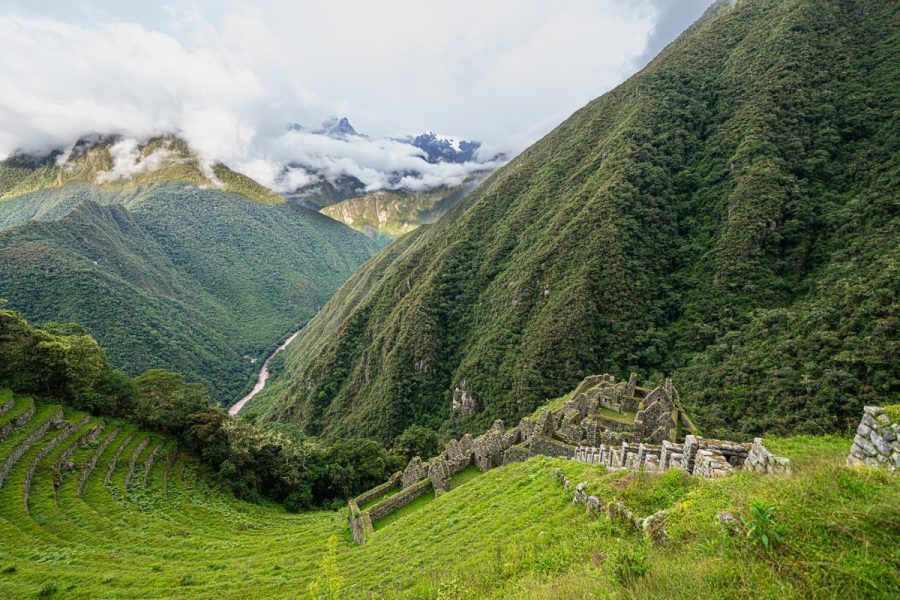
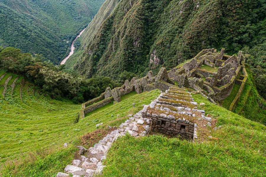
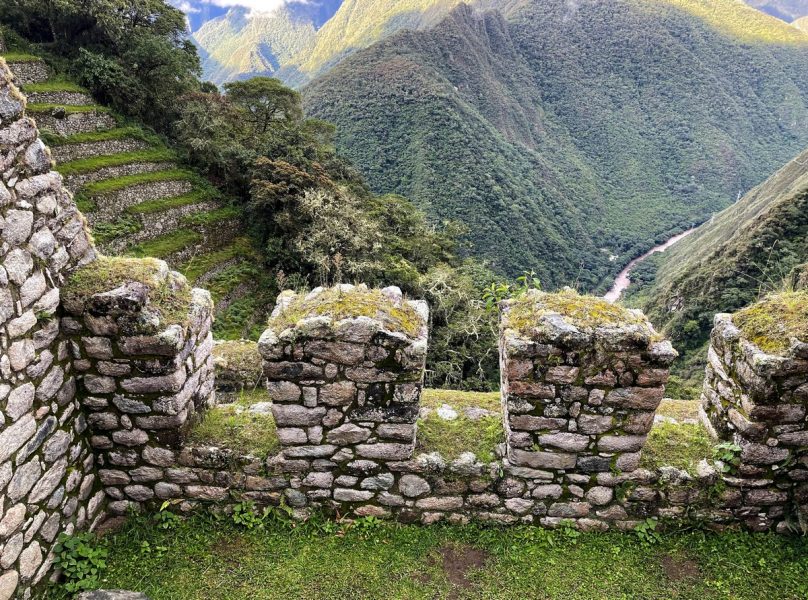
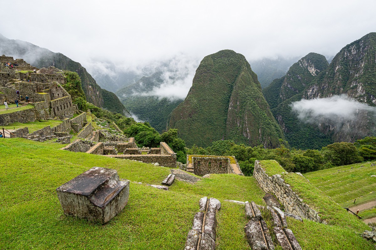
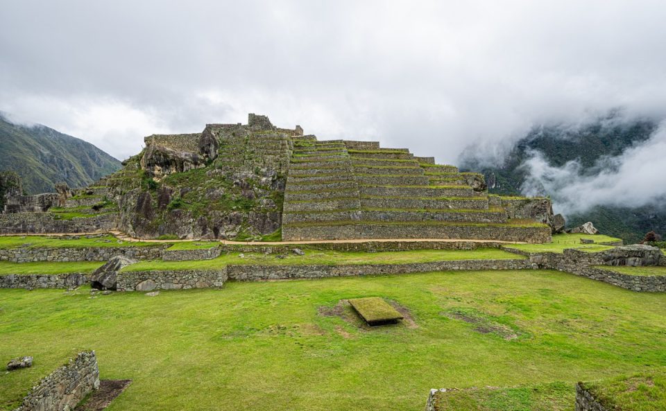
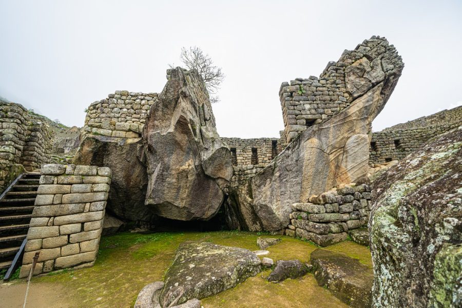
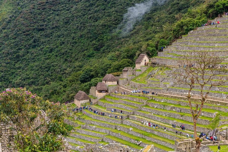
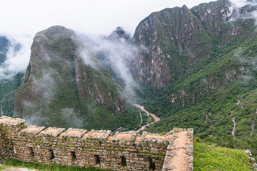
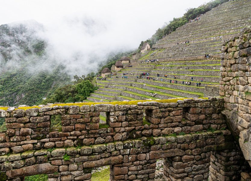
After dropping 500 meters in altitude, we arrived at our next campsite in the ancient Incan city of Wiñay Wayna. Absolutely breathtaking views:
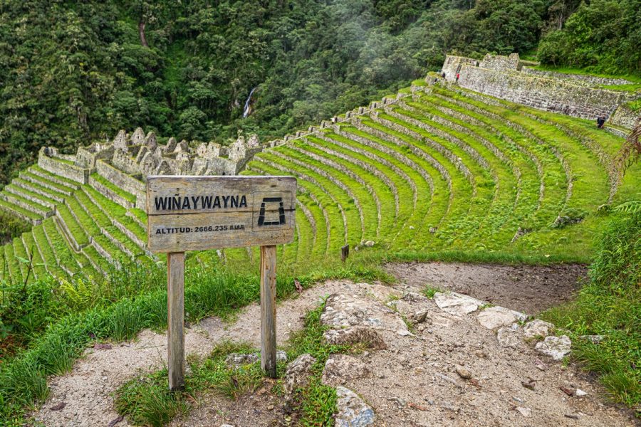
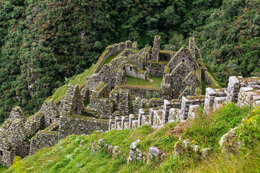
Most likely, this was a temple (based on the precise stonework, which Vicente referred to as “Imperial style”) ->
What was life like here during the Incan Empire? Hard to say. But the views they left behind? Incredible.
Our little tent village – now with a slightly clearer landscape in the background:
If only the weather had been better – imagine the views from here… But never mind! We’ll see them next time!…
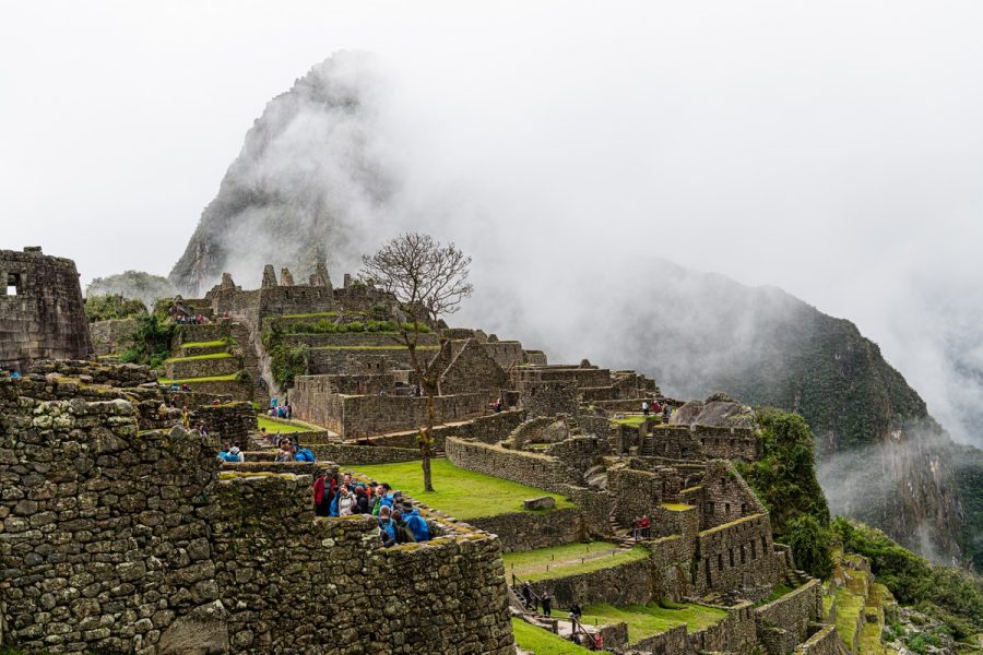
Day four: Machu Picchu, at last!
The next day – the fourth and final day of our trek up to Machu Picchu – started insanely early, at 3.30am. Why such an early start? Because the porters had a special train to catch at 5am, and they had to make it on time…
By 4am, the entire camp was already awake, with flashlights shining everywhere. Then, in the darkness, we set off down the trail, heading toward a special checkpoint gate – the official entry point to Machu Picchu.
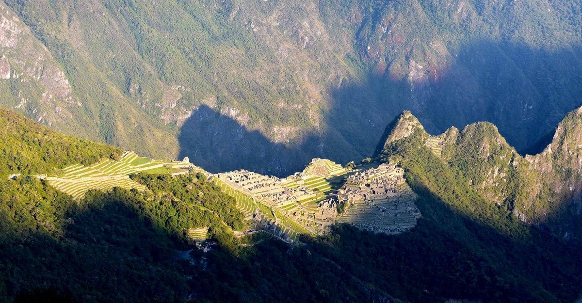
These gates opened at 5am, after which the path continues with a small ascent. After five kilometers we were to reach Inti Punku (the “Sun Gate”) – the pass where, after a long journey, ancient travelers would get their first panoramic view of Machu Picchu – like this:
But today? Not quite:
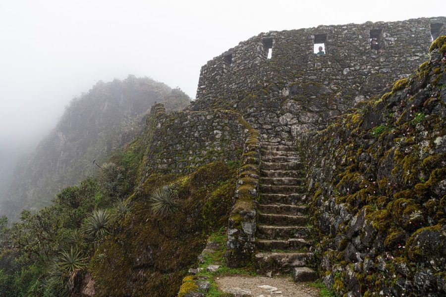
The path to the Sun Gate was easy and familiar (nothing surprising at this point) – except for one notoriously steep set of steps, known as “The Monkey Steps”. Locals have another name for it: “Gringo Killer”!
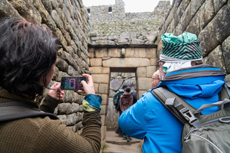
At Sun Gate, a crowd of eager tourists had gathered hoping to catch even the faintest glimpse of Machu Picchu. But the crowd had another distraction: for the first time in three days, there was cell-phone signal! So of course everyone simultaneously started checking emails, messaging, and uploading TikToks and Instagram posts. Then the crowds set off in the direction of Machu Picchu. I, however, stuck around a little longer – and was rewarded with at least a partial view! ->
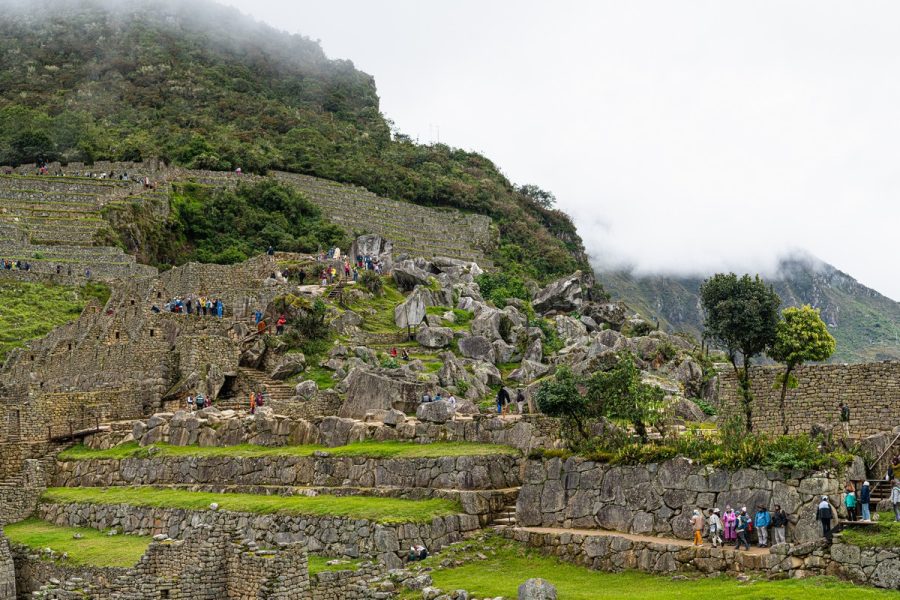
At around 8am, we finally cross the (ancient) city limits. The clouds started to clear, revealing a better view:
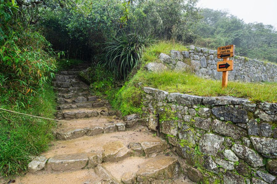
Here’s a turn toward an intriguing spot – the Inca Bridge. Alas, it was cordoned off. Too bad – it’s a spectacular sight. This is what it looks like: a path carved into a sheer cliff + a wooden bridge. Just looking at it is terrifying. Beyond the bridge, the trail continues along the rock face, but it’s completely overgrown and obviously impassable ->
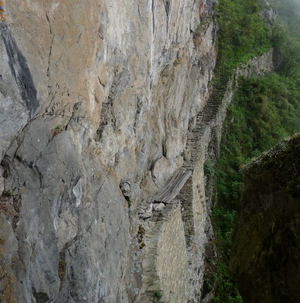
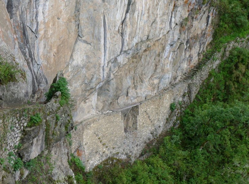
(These photos are from my 2011 trip)
Machu Picchu is a remarkable place. Rather than adding my own commentary, I’ll just pull some quotes from online sources (selectively edited for clarity):
Machu Picchu is often called “The City in Ruins”, “The City in the Clouds”, or “The Lost City of the Incas”.
For over 400 years the city was forgotten, abandoned. It was discovered by an American explorer on July 24, 1911, after pilots spotted it from the air. When the explorer arrived, accompanied by a government-assigned security team and a local boy as a guide, he found peasants were still living there.
The Spanish conquistadors never found Machu Picchu. It was never destroyed.
Its exact construction date, purpose, population size, and even original name remain unknown.
According to Vicente, when the Incas realized that their fight against the Spanish was lost, and that their empire was doomed, they chose to abandon the city. But they didn’t just leave – they destroyed the paths and bridges leading to it, and those who knew its secrets were killed. Over time, the jungle reclaimed the city, concealing it beneath a dense green canopy.
That’s the story. From a tourist’s perspective, however – this place is breathtaking! High in the mountains, surrounded by a stunning natural landscape, it’s nothing short of wow! Even with a misty, cloudy backdrop.
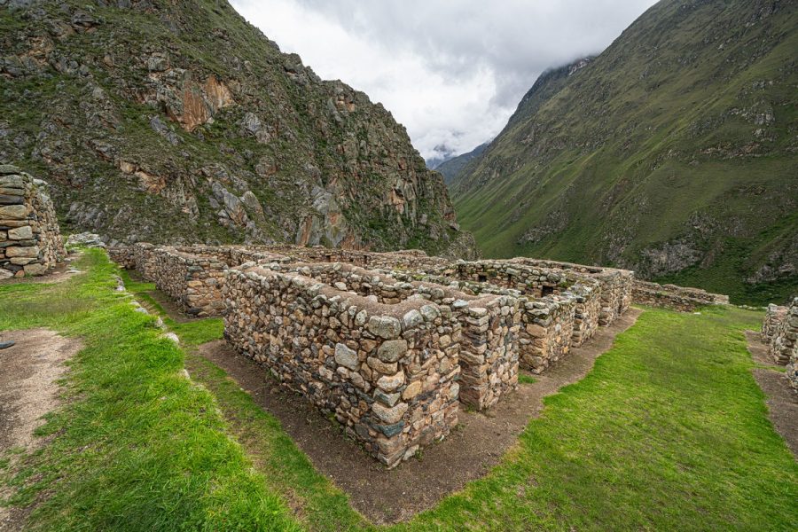
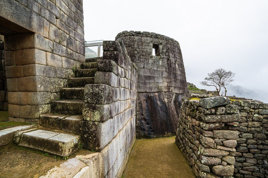
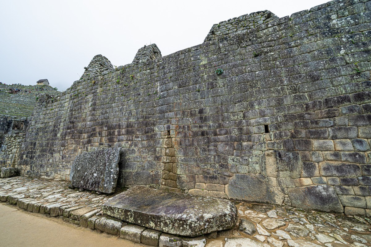
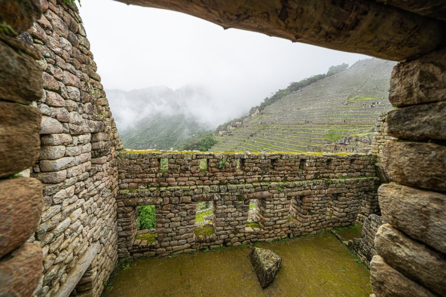
And again, rather than adding my own excessive commentary, I’ll mostly just share a photo tour of Machu Picchu, with minimal explanations. For example – these are probably residential buildings or warehouses, based on the rudimentary stone construction:
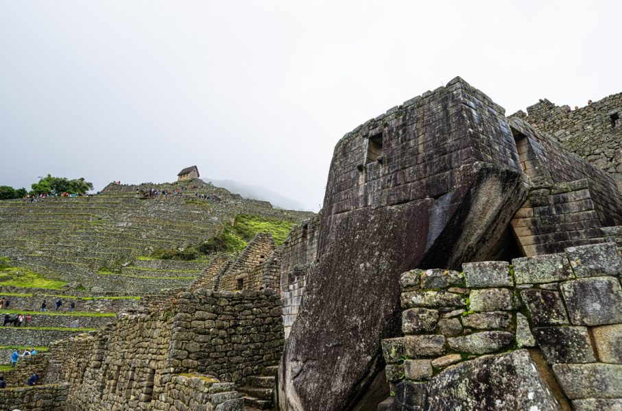
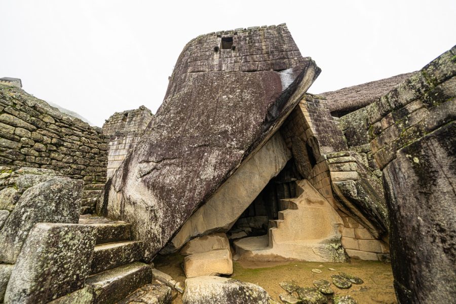
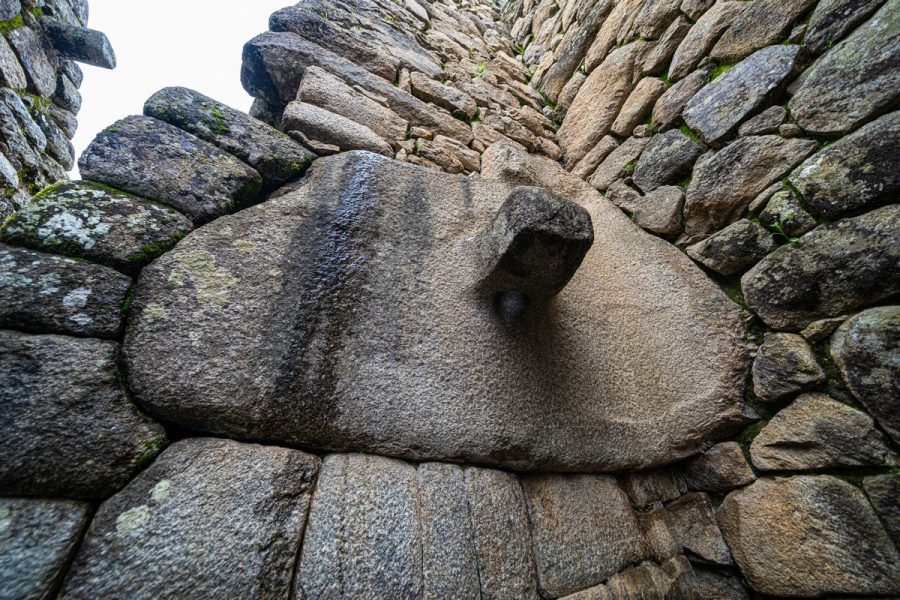
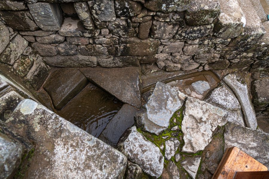
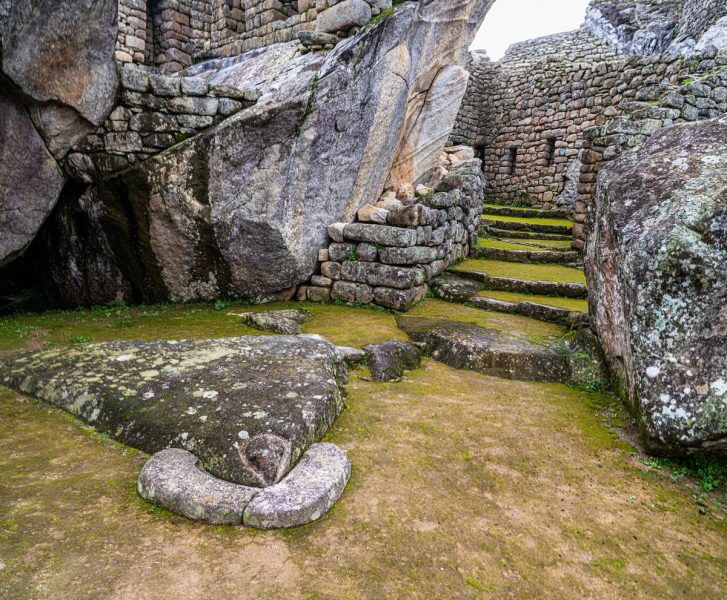
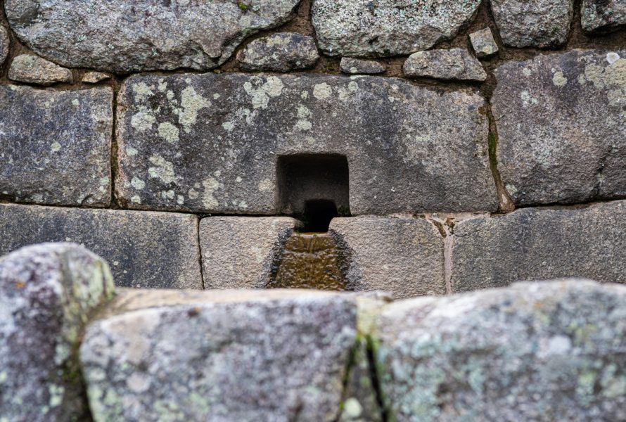
This granite boulder was being transported somewhere – but they never finished moving it to its intended location (possibly a temple). To its right, you can see remnants of the city’s water supply and drainage system:
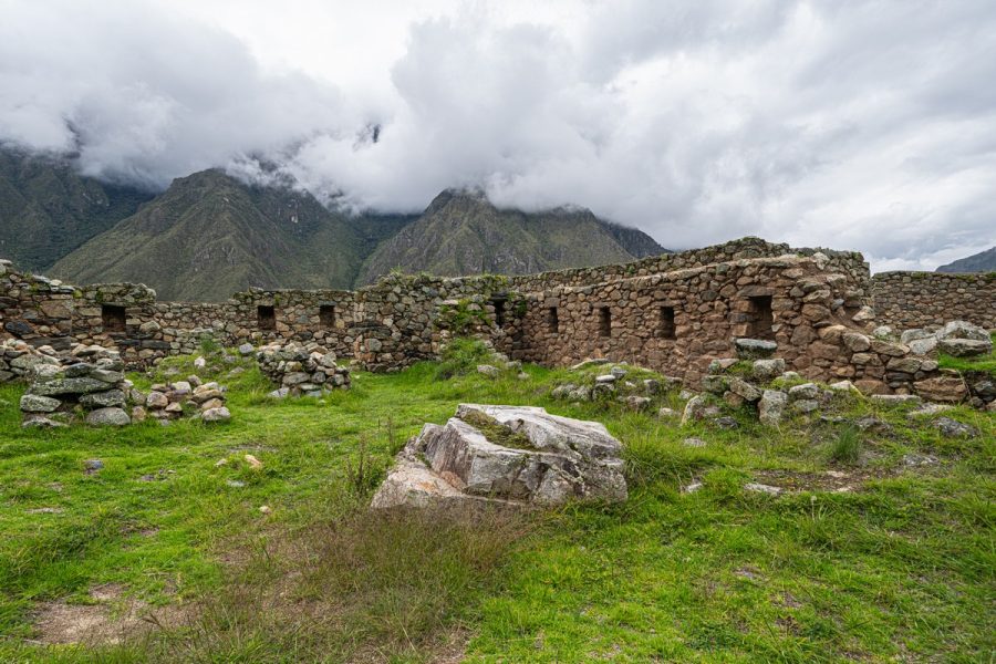
Judging by the precise “imperial” stonework, this was likely a temple. And look how it’s seamlessly integrated into the rock! ->
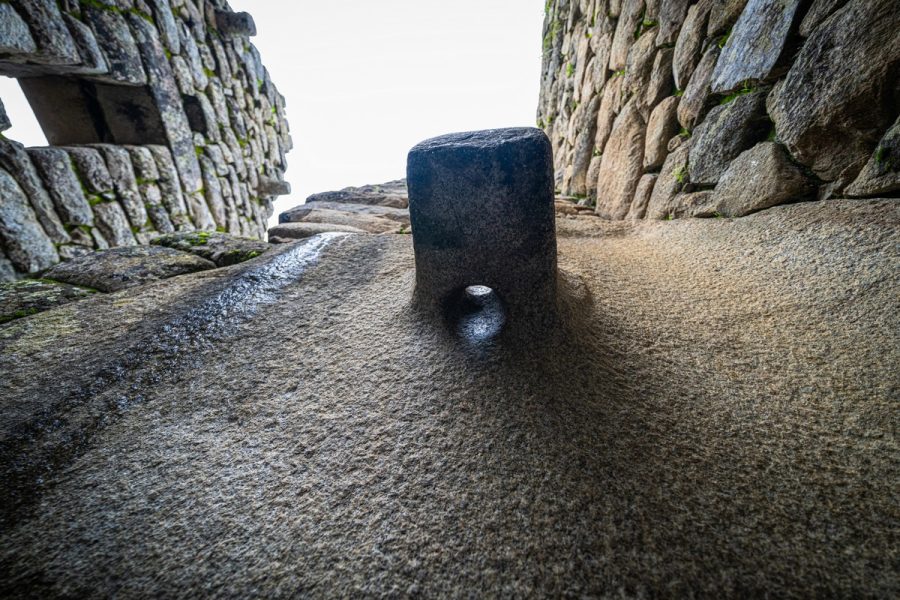
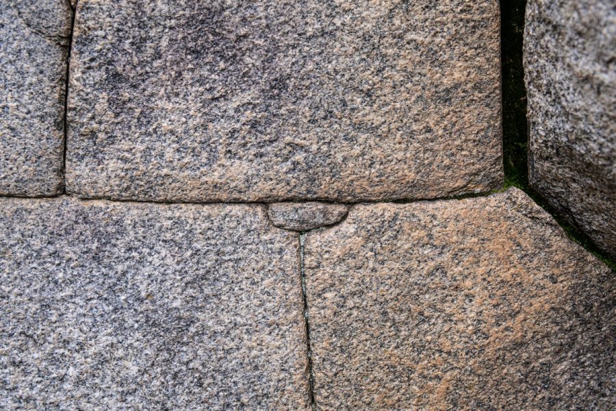
What exactly this place was, how it was used, and why certain features were built this way – all of it remains a mystery. For instance – what’s the purpose of this ledge with the hole in the rock? It must have taken a lot of effort to carve it into solid granite without metal tools. And yes, this was all hand-carved ->
Here, in what is believed to be the residence of the Supreme Inca, my favorite stone corner can be seen to the far right. Look at this beauty! Just imagine the skill and motivation required to sculpt something like this out of solid stone:
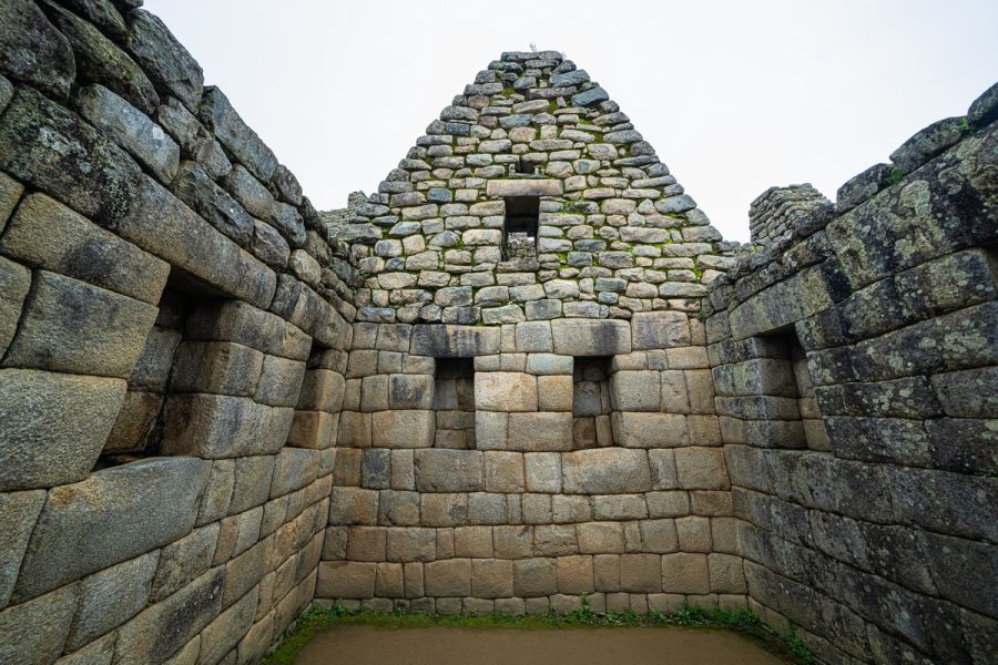
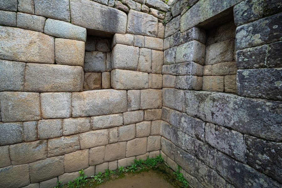
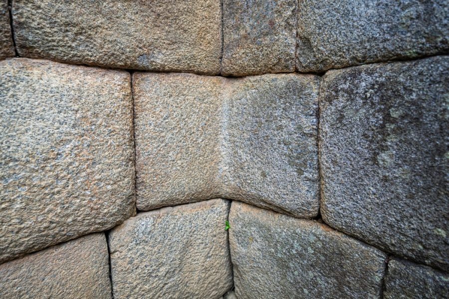
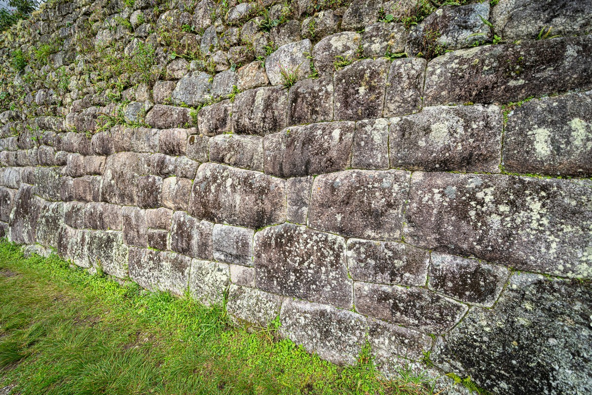
The scale of construction and the precision of the stone-fitting are simply astonishing:
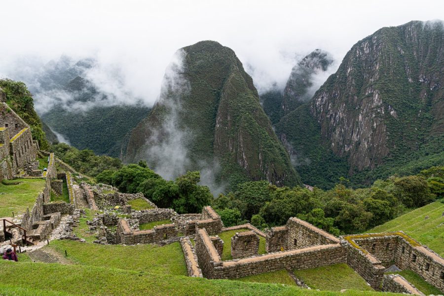
Assorted views from our exploration of Machu Picchu:
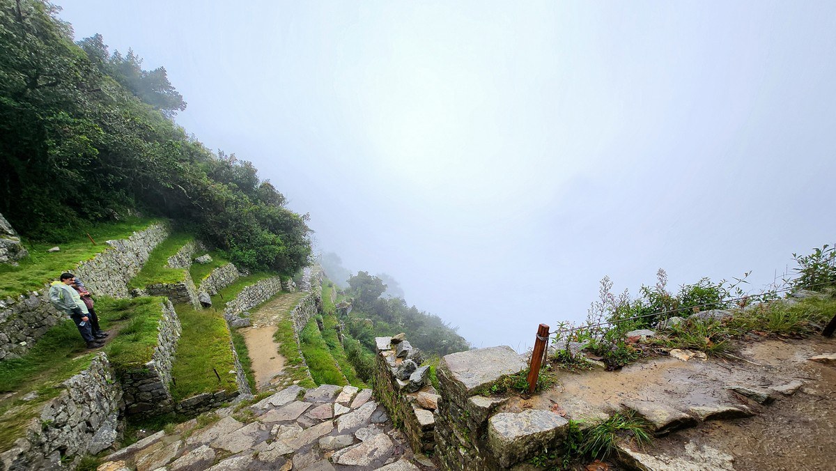
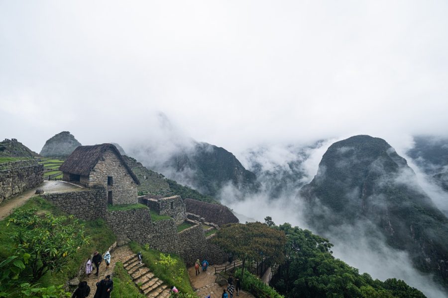
Back in 2011, it was possible to walk freely around Machu Picchu, which we took full advantage of. However, today, they’ve introduced new rules – there are now several designated routes, all with one-way traffic. Apparently, a sudden surge in tourist numbers forced them to implement these restrictions. Some paths are open; others are off-limits! ->
And local watchmen, formerly peasants from nearby villages, keep a close eye on things:
To be honest, though, I didn’t find these restrictions too bothersome. The only real disappointment was that I couldn’t revisit the Inca Bridge…
Yes, there were tons of tourists. Here’s the line for the bus down to Aguas Calientes, where the train station awaited us for the journey back:
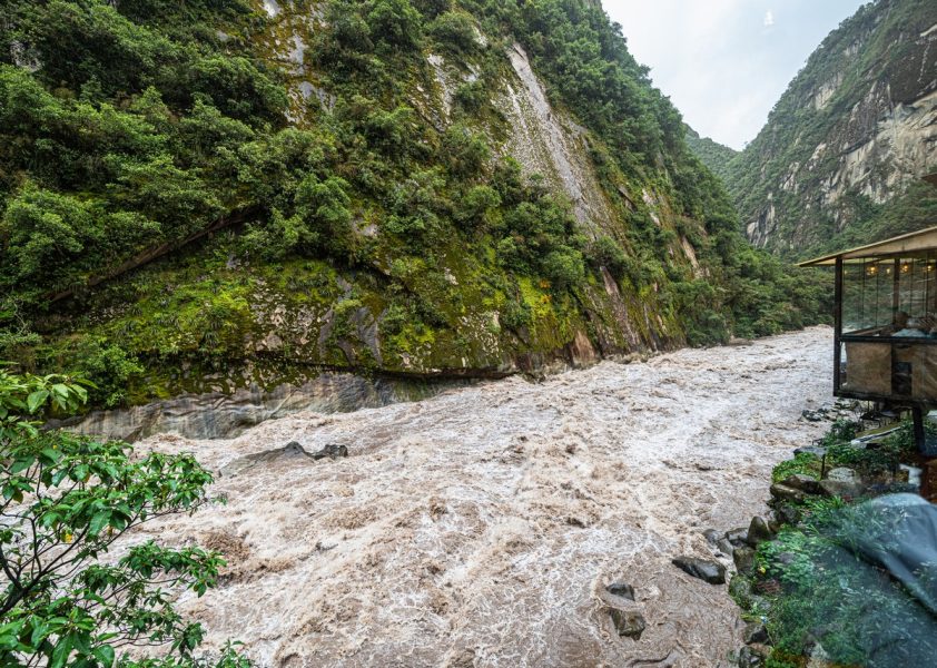
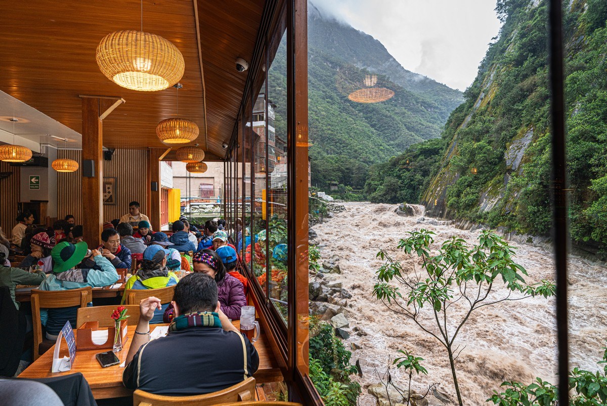
The Urubamba River. At this time of year, it’s completely unsuited for rafting! Terrifying, mesmerizing…
But watching it from a cozy restaurant with some local craft beer – just the ticket! ->
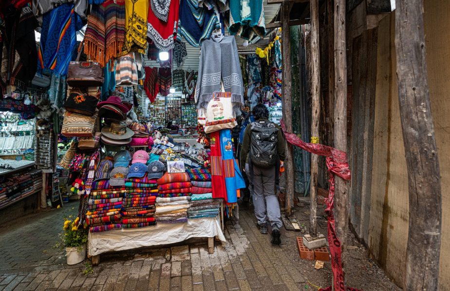
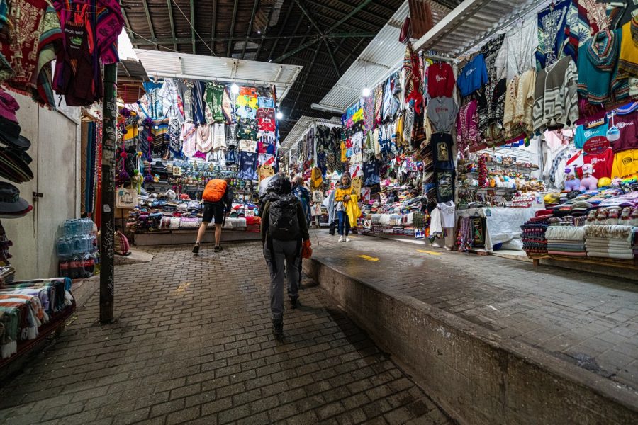
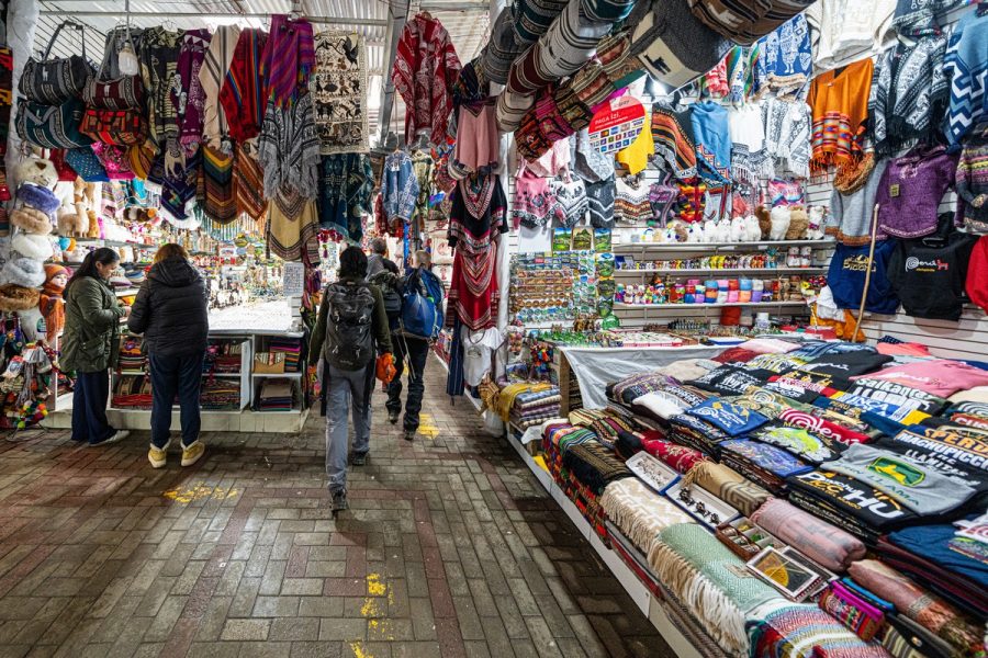
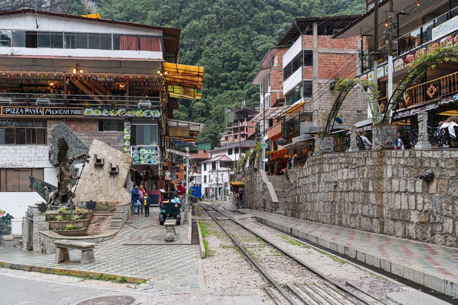
Restaurants and shops lining the railroad tracks:
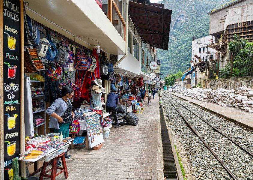
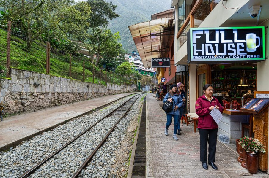
The train station felt more like a market – with non-stop shopping opportunities. It was easy to get distracted and almost miss the train!
Here’s the train we needed to catch:
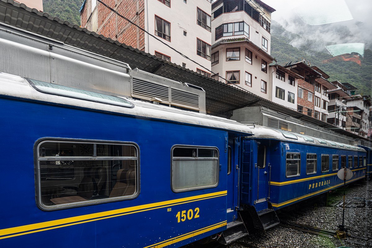
Or, if you prefer, there’s this alternative option:
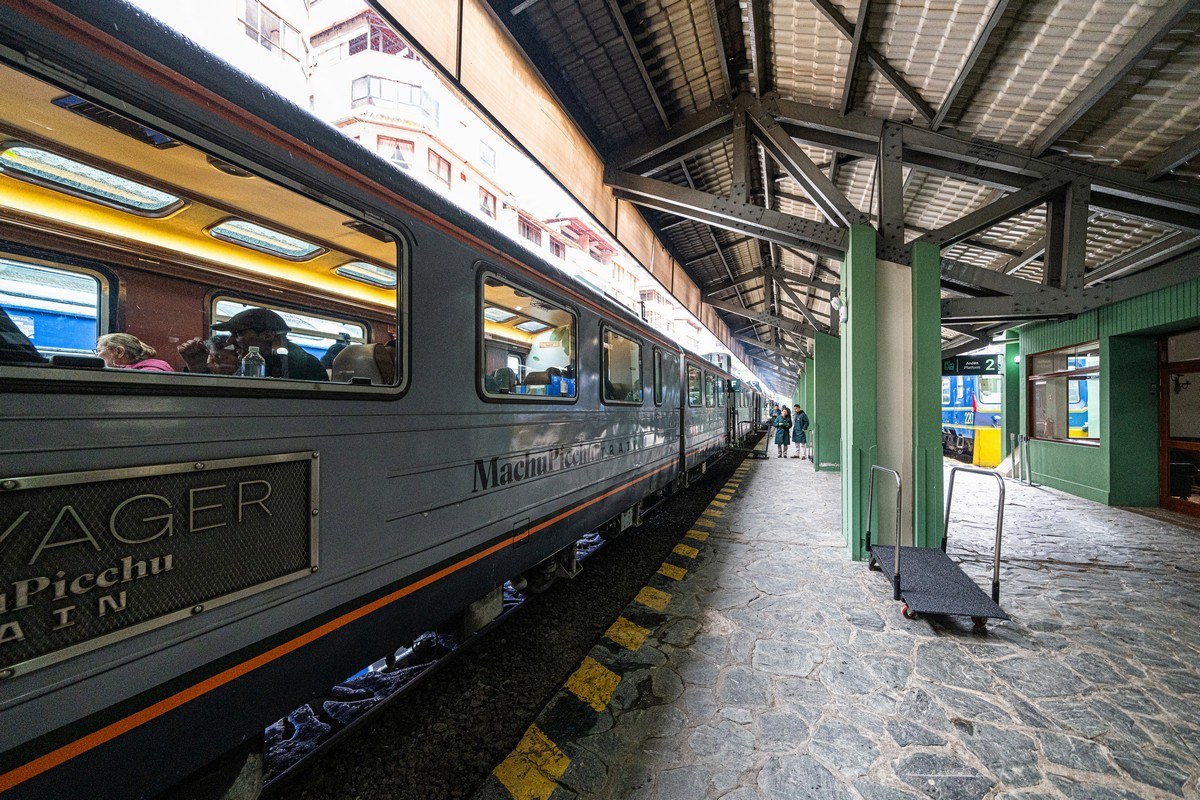
We made it! All aboard, and off we go!…
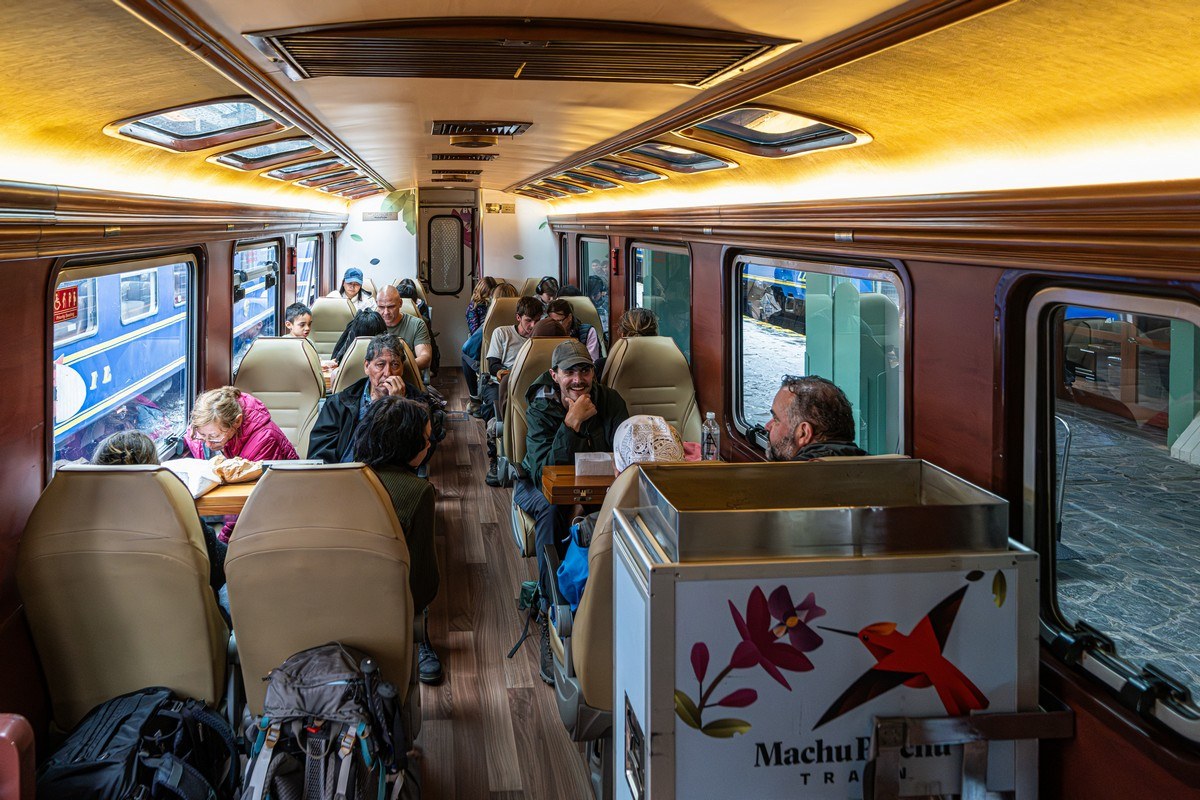
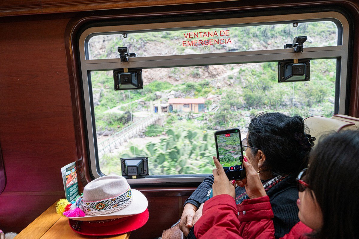
Pro tip: sit on the right side of the train – the views are much better. For example, here’s the bridge where the Inca Trail begins – we walked across it four days ago:
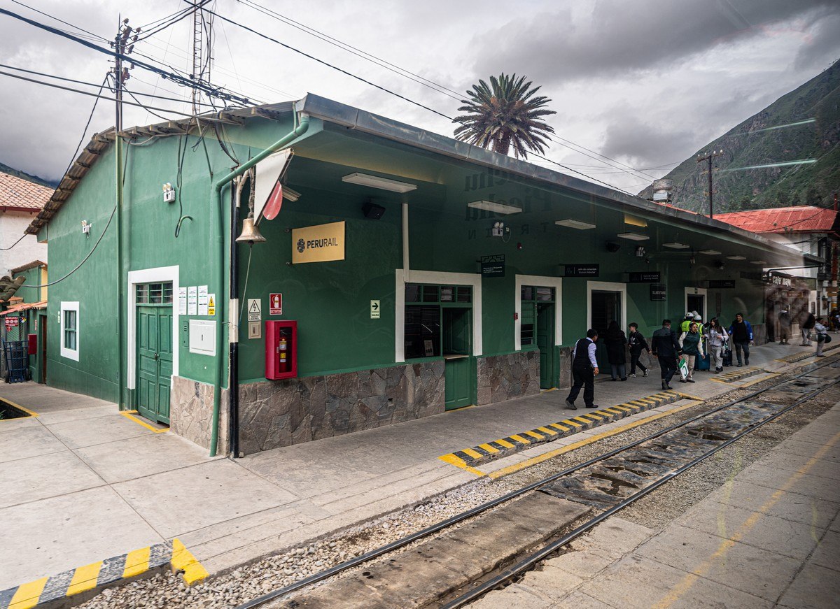
And just like that, we were back where we started – Ollantaytambo. From here, we hopped on a bus for the two-hour ride back to Cusco.
In finishing – a few extra photos from DZ:
We never got round to finding out about the Incan system of knotted writing – quipu! Just another reason to return :)
And that’s it for the Inca Trail and Machu Picchu. Next we were heading south – toward Bolivia!…
The best photos from our LatAm-2025 trip are here.

