October 7, 2024
A lot more than a big, long ice cube: the infamously dangerous Indigirka Tube!
Intro
Luck was on our side when heading back south on our Yakutsk-Tiksi-Yakutsk expedition: we’d narrowly missed being stranded for several days in Tiksi, and were way ahead of schedule. And it was this latter spot of luck that permitted us to spend plenty of time examining and enjoying a very special feature of the North – which I’ll be writing a lot about and showing a great many photos of in this here mega-long post. And as the title to the post indicates – the special feature is… the Indigirka Tube ->
So, what is the Indigirka Tube?…
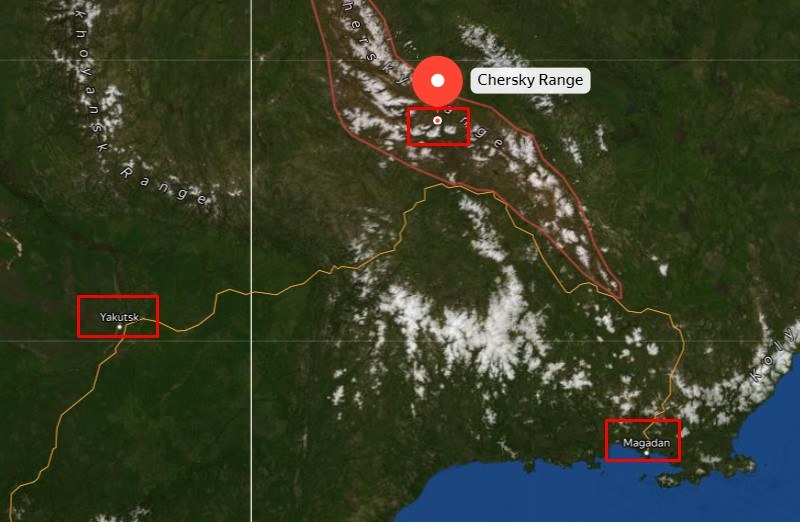
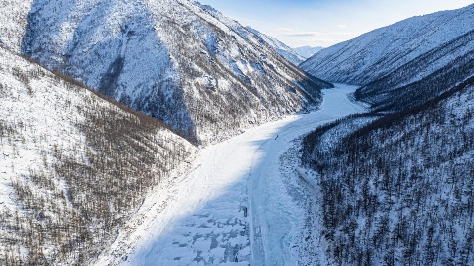
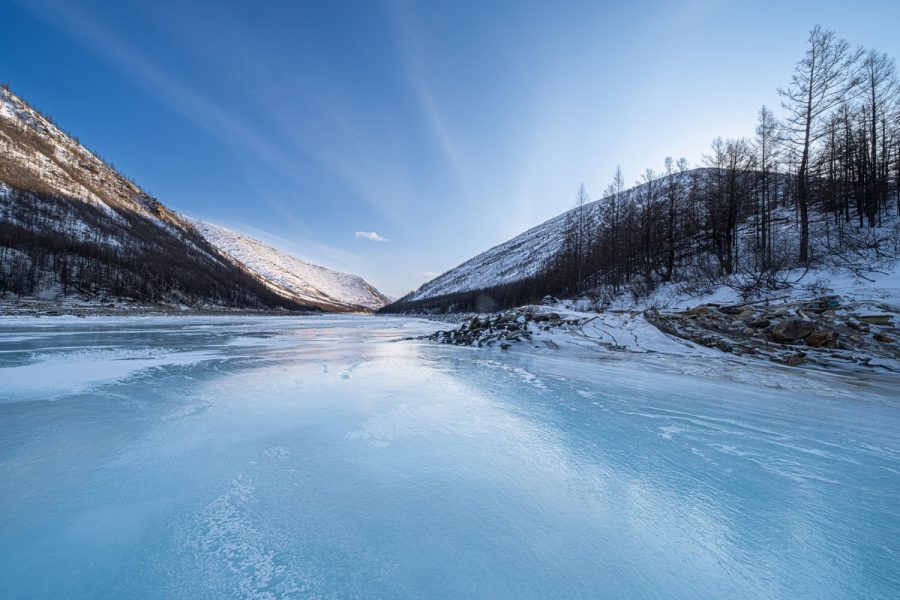
It’s a section of the Indigirka river more than 20 kilometers in length, which cuts across (in an almost directly north-south direction) the Chersky Mountain Range, situated some 500km to the north of a line drawn on a map between the cities of Yakutsk and Magadan:
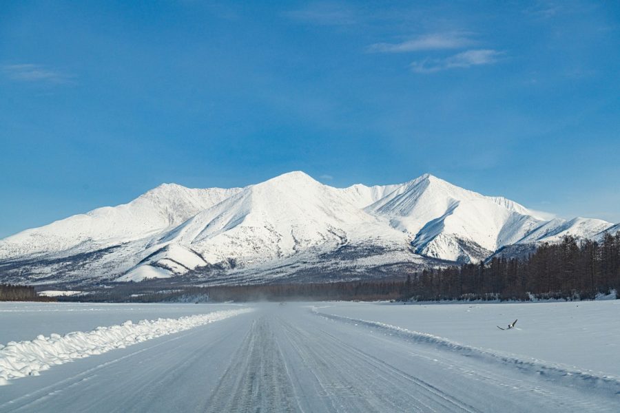
It’s a section of the Indigirka that is water-abundant and full-flowing, with the feet of mountains right next to its banks, and in a region where the climate is stubbornly continental–Arctic and with a particularly windy sub-climate. All these factors together add up to natural miracles taking place here – in the winter…
I’ve no idea about what goes on here in the summer – besides the fact that some cold-loving tourists like to raft down the Tube. Apart from that though it seems nothing goes on – one reason being that there’s no infrastructure, civilization or anything really. Oh – and nothing goes on here during ~spring or ~fall either when the river’s freezing over and thawing out, respectively…
Which leaves us with winter. And indeed it’s in winter when the Tube gets ultra-interesting…
The Indigirka freezes completely in the winter – right down to the river bed. This makes the perfect (well – not quite (see the rest of this post!)) winter/ice-road for convoys of long-distance trucks supplying remote northern villages with all they need to survive the spring, summer and fall until the following winter/ice-road “appears”.
But I’m not too taken by these economico-logistico aspects of the Indigirka – even though they are rather unique. What I am taken by are the totally unusual, deep-frozen, and devilishly harsh realities you encounter here – all of which happen to be simply extraordinarily fascinating (and all of which I’ll get to eventually)…
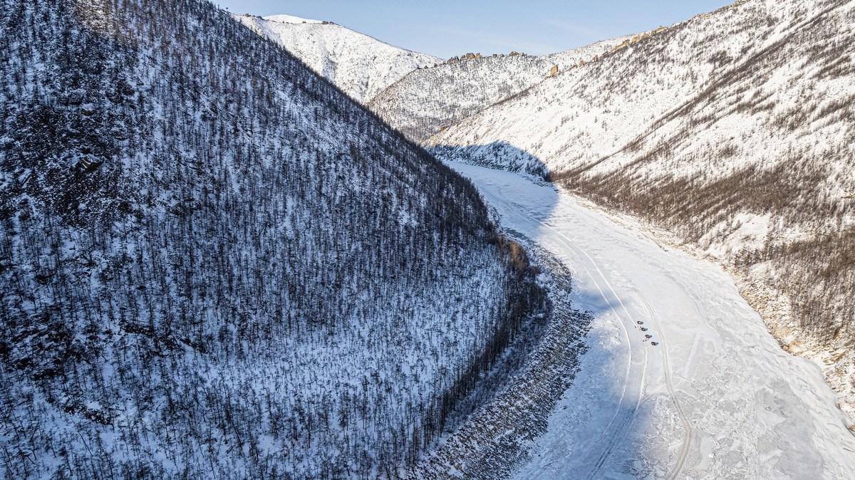
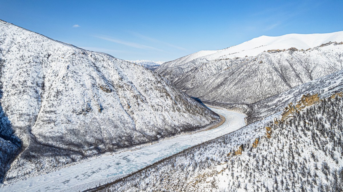
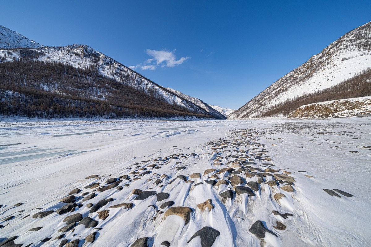
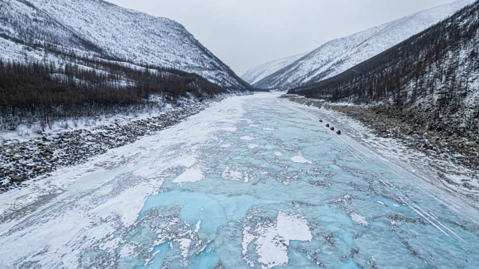
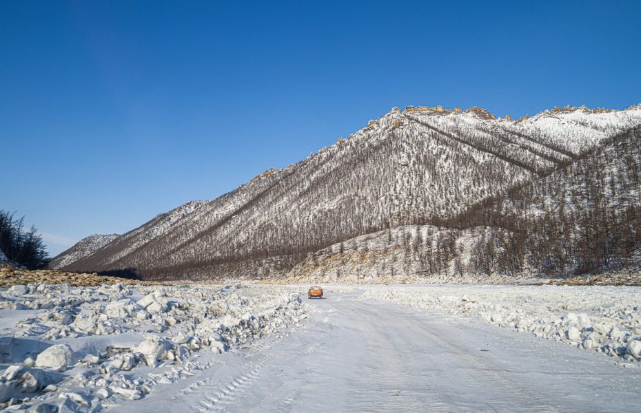
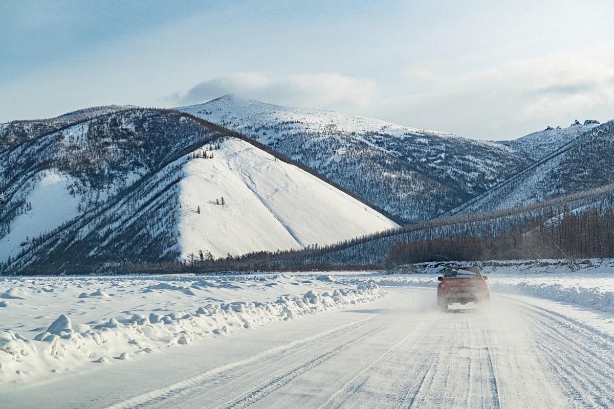
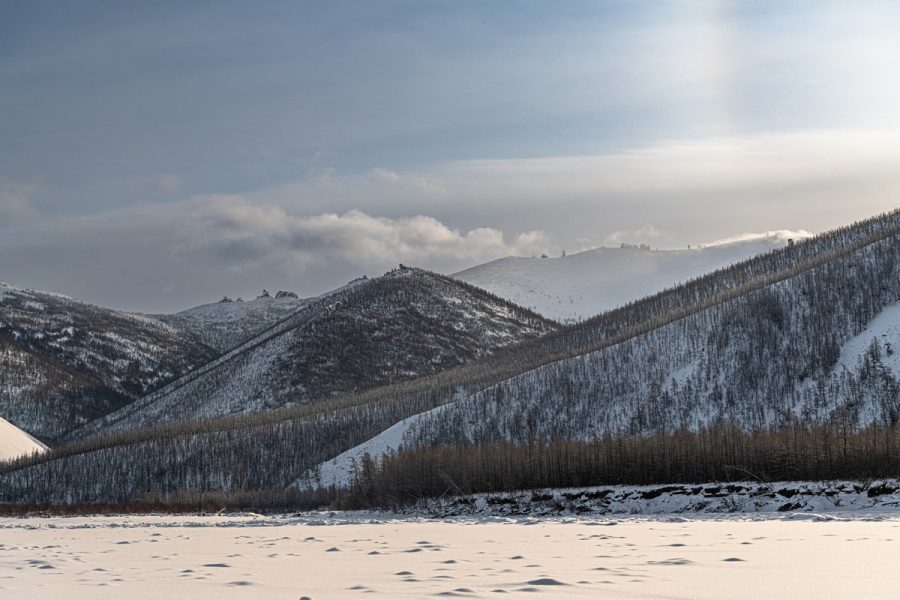
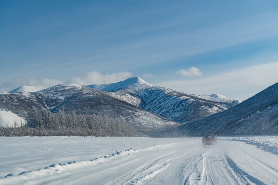
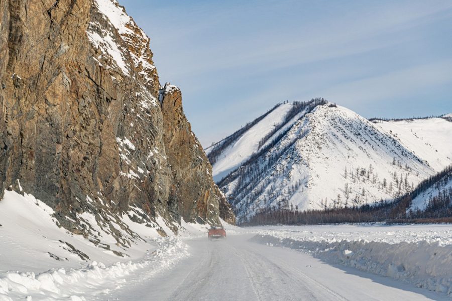
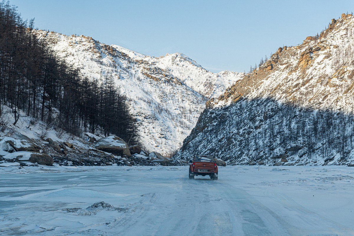
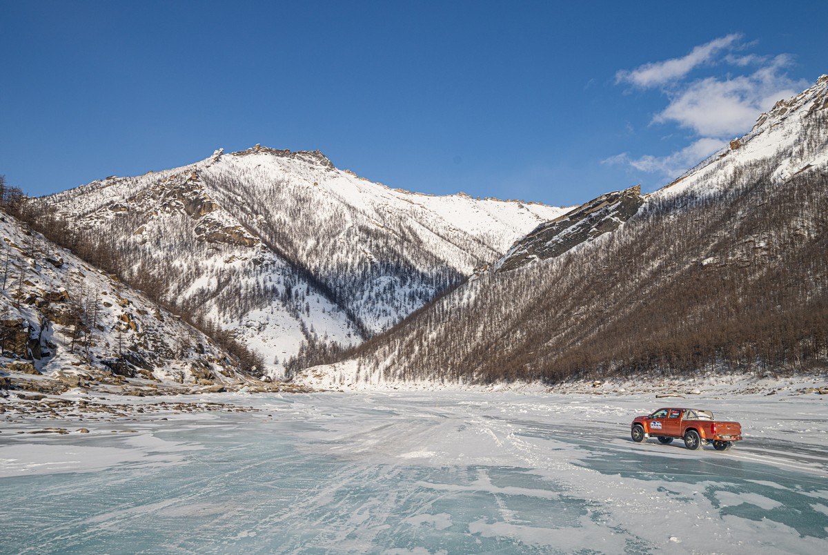
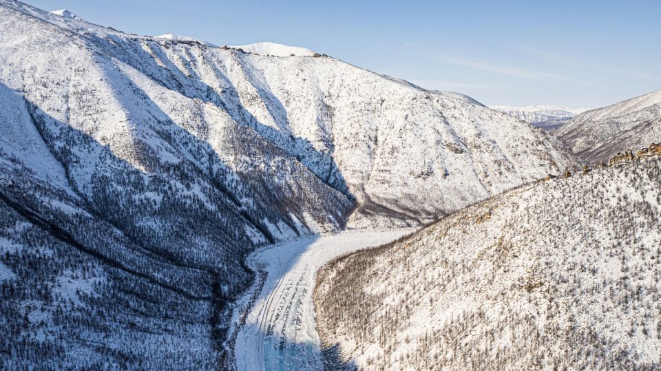
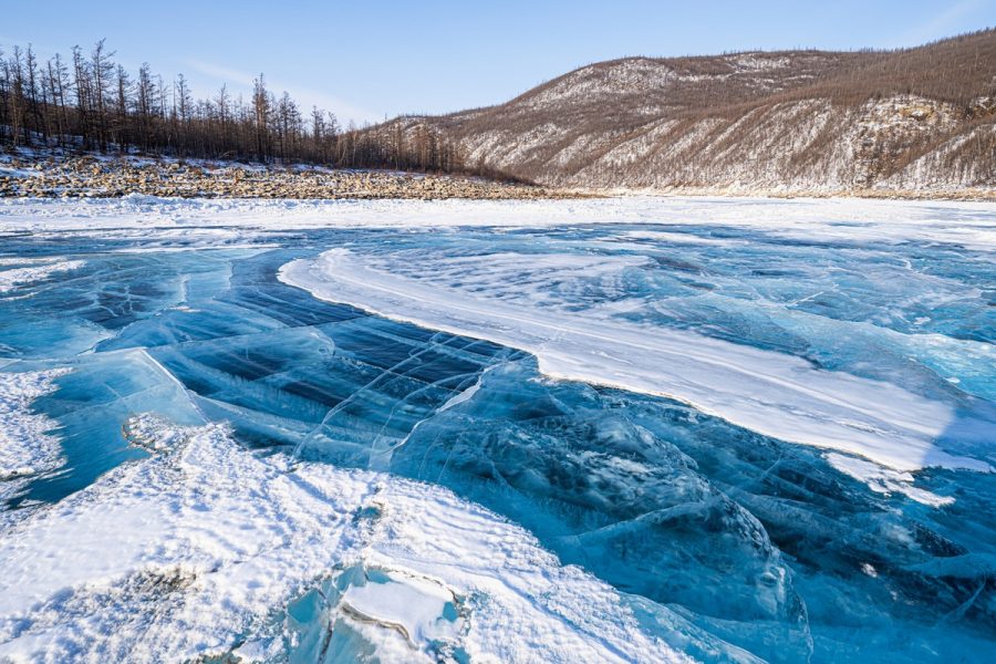
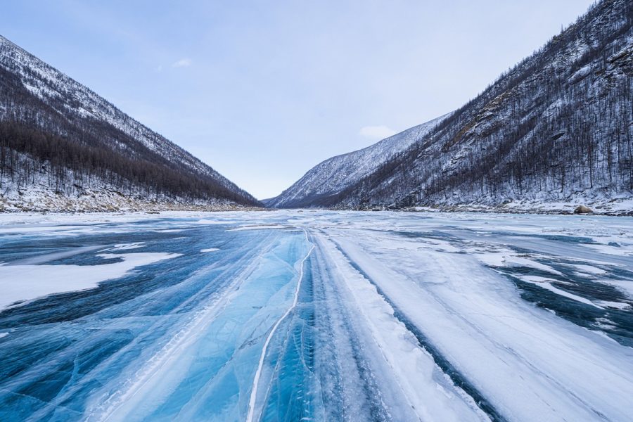
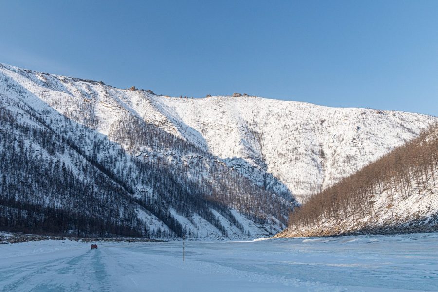
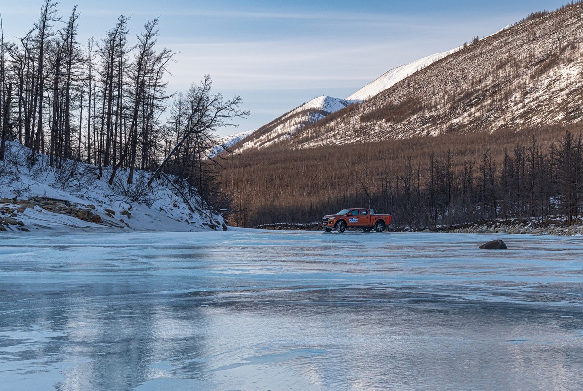
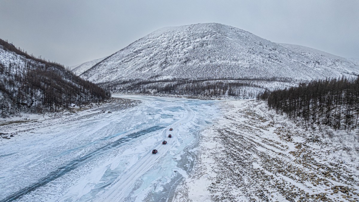
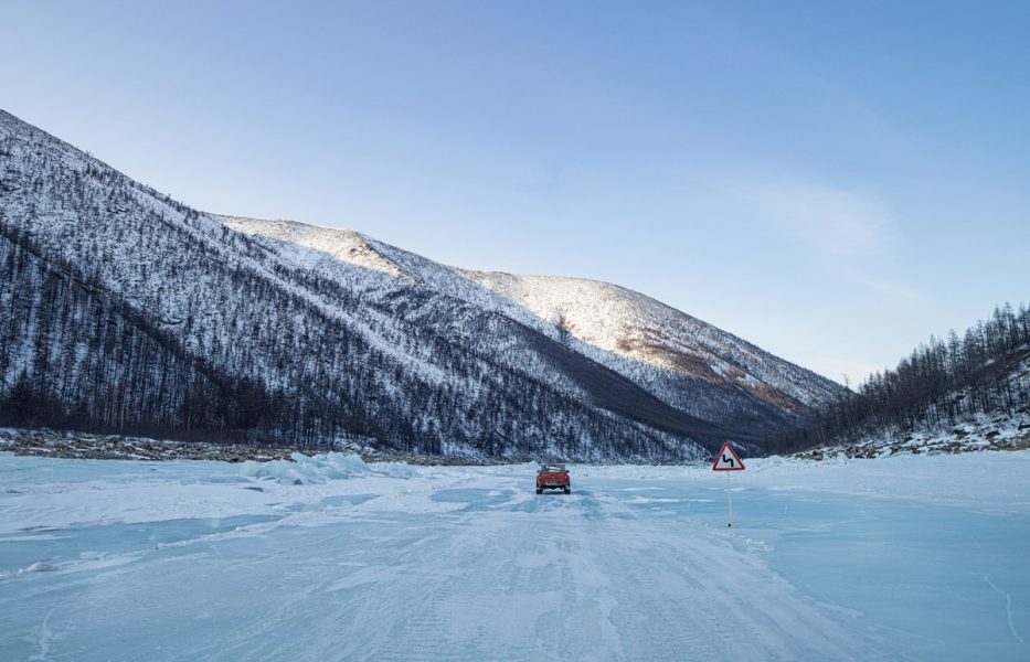
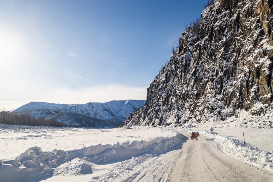
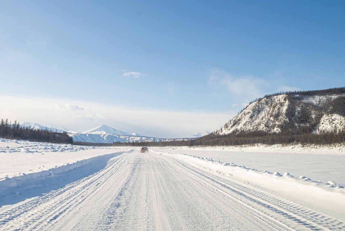
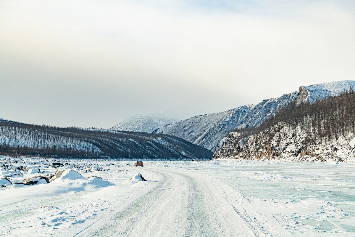
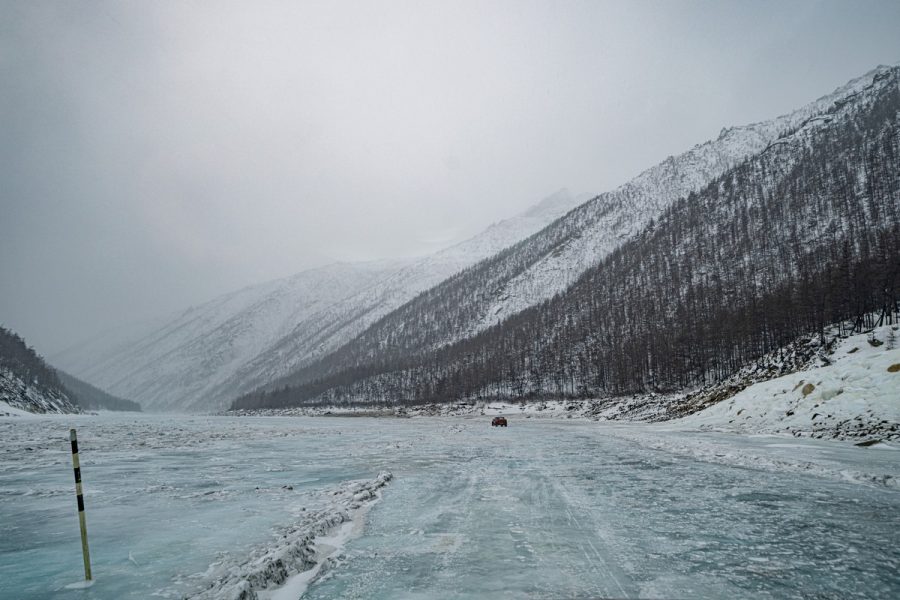
There are a great many marvels to be seen here. There are boulders suspended in the iced-over river. There’s pressure from the water that breaks up the ice and flows over the whole of the Tube. There are the hoar-covered mountain tops. There are the sticky situations long-distance trucks find themselves in. Oh, where do I begin? Ah – I know: I’ll start with stating that the Indigirka Tube isn’t quite a canyon, it’s a narrow ravine – one where the snow is blown clean off the iced river’s surface ->
Here’s why the ravine called a tube:
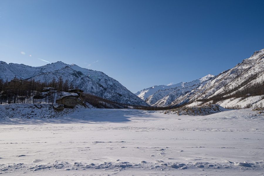
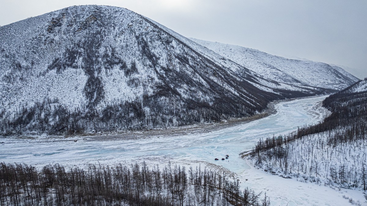
The Indigirka flows through rather wide valleys both above and below the Tube:
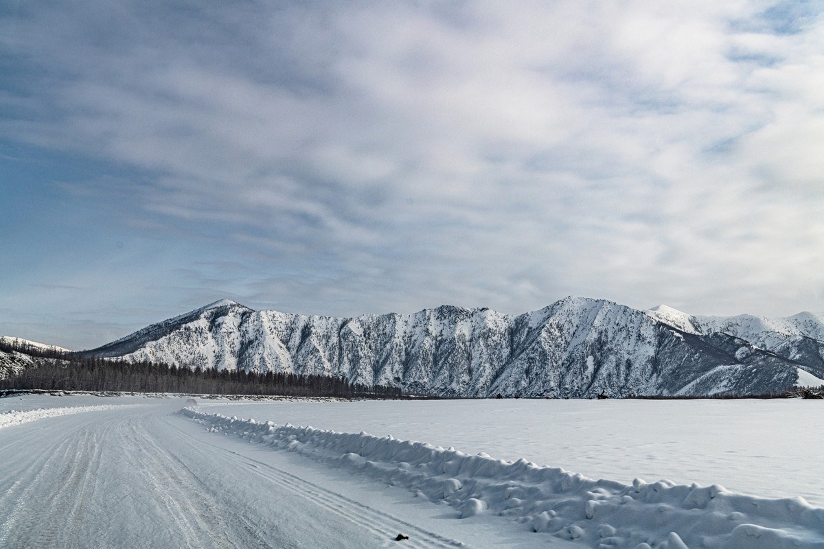
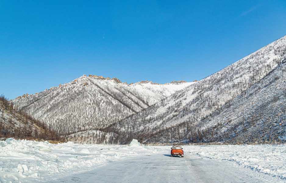
What makes the Tube the Tube is the narrowness of the valley: the feet of the mountains literally hug the riverbank:
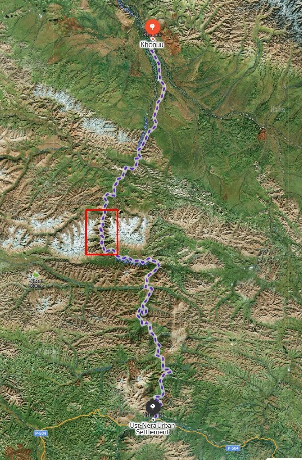
Here’s the Tube on the map:
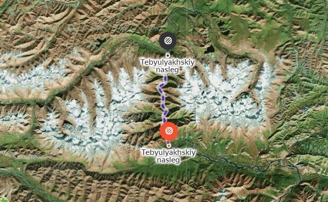
…Between the villages Khonuu to the north, and Ust-Nera to the south:
// Yandex Maps doesn’t show the “winter road” upon the Indigirka just now – which is just as well since the ice has all melted. But it does show the route you’d take between the two mentioned villages if you were going by foot – the purple dotted line on the above map – which surely is the same route as the winter road takes (you’d probably walk along the riverbank (but I don’t think anyone walks the Tube:)).
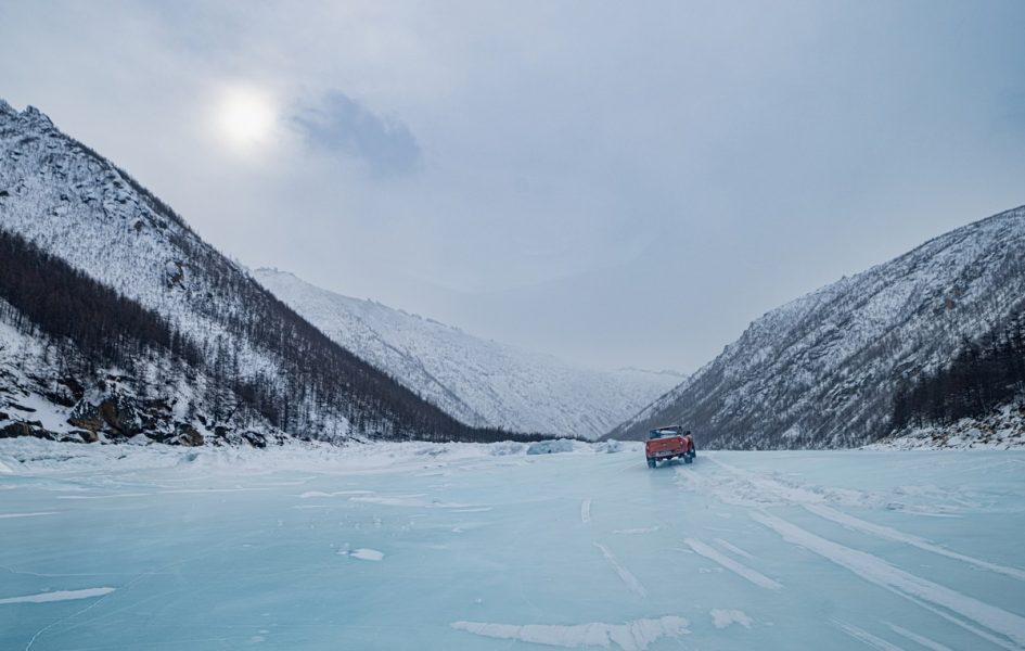
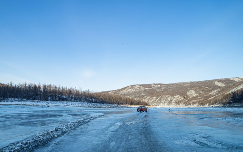
In winter the Tube is simply awesome (but very cold, very windy, and rather risky)…
Here’s how ice is broken up on the Tube:
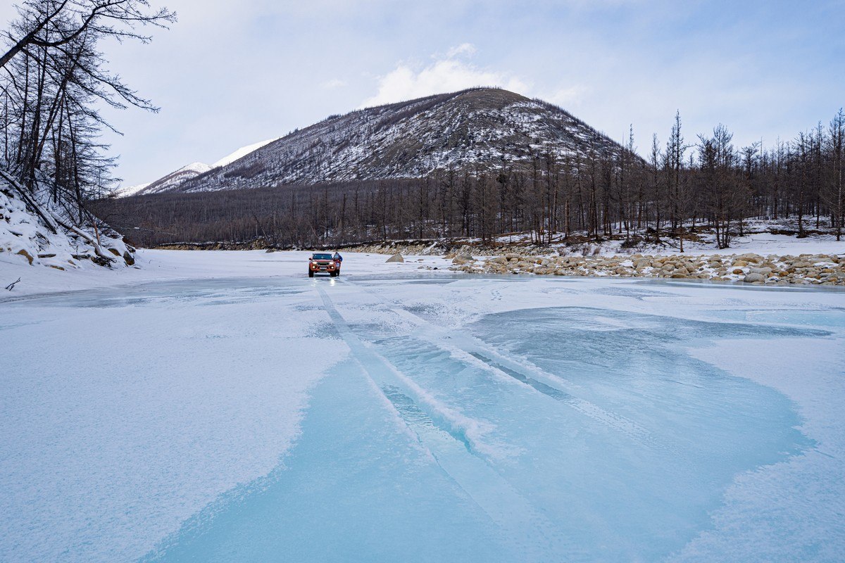
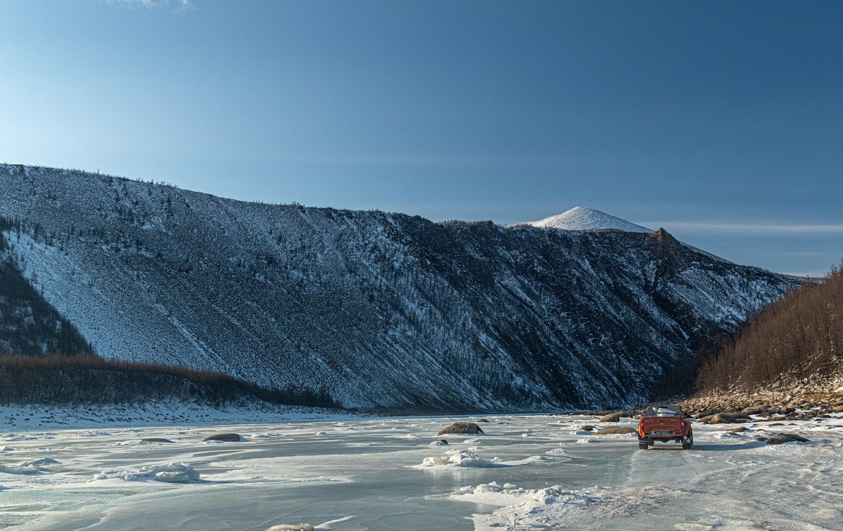
Where the Tube starts out from the south:
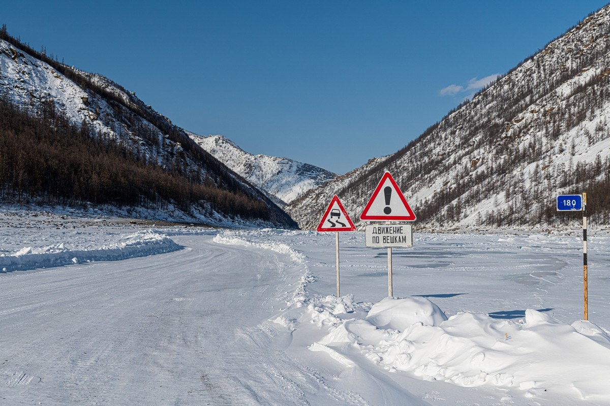
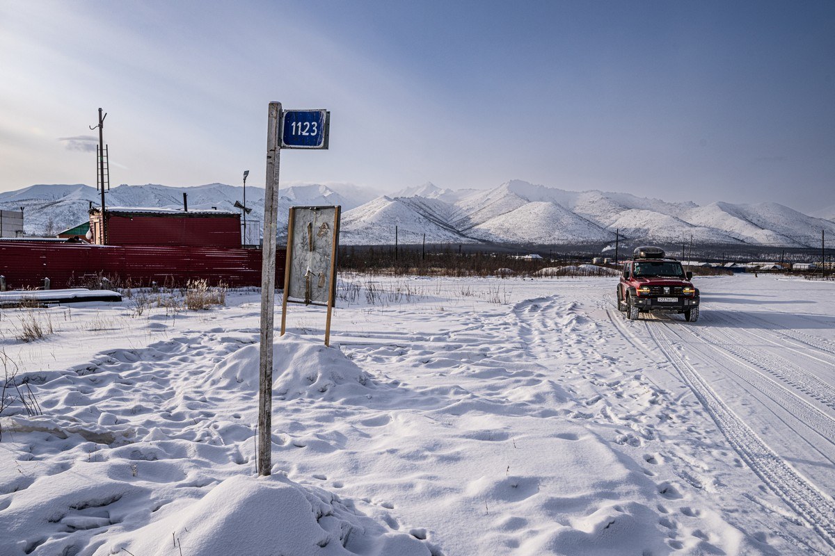
The 180 stands for the 180 kilometers from Ust-Nera. When we were here in the winter there was a temporary warming point here. I guess that this year they’d already removed it given the warm March weather.
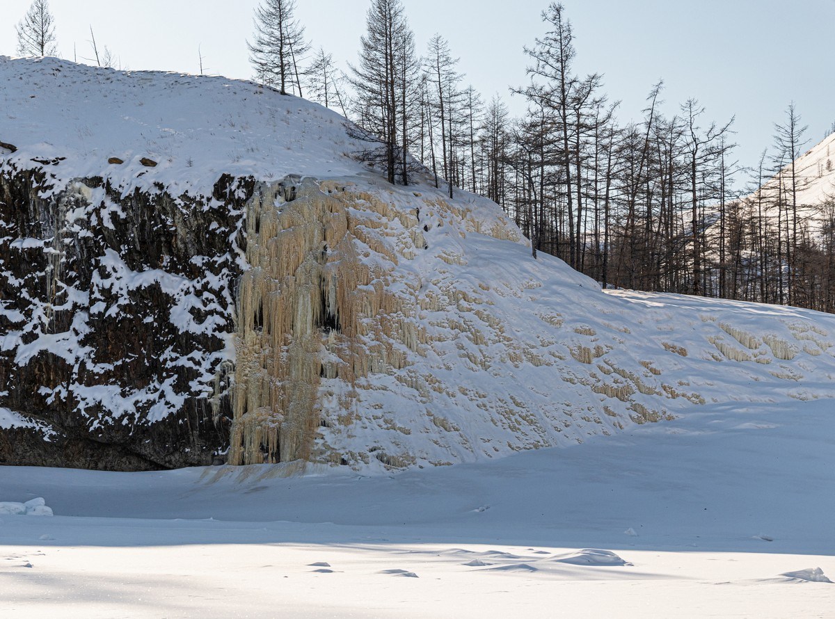
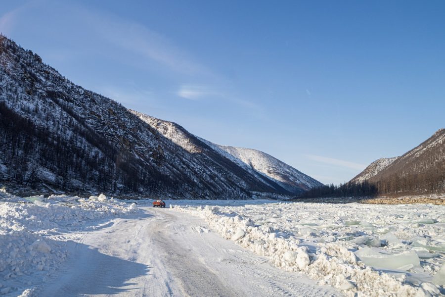
Snow blown off the rocks on the river bed/banks:
Naleds also cleared of snow by the wind ->
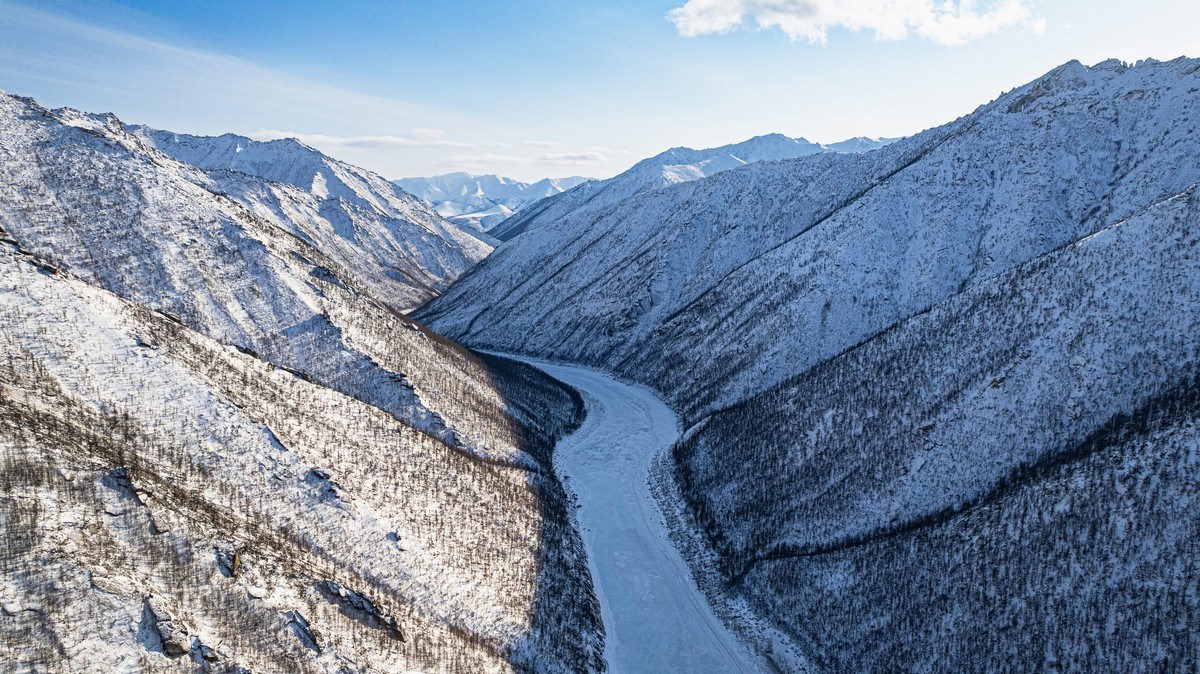
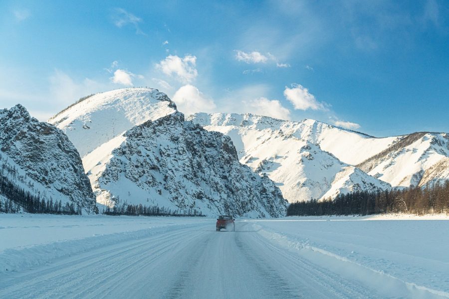
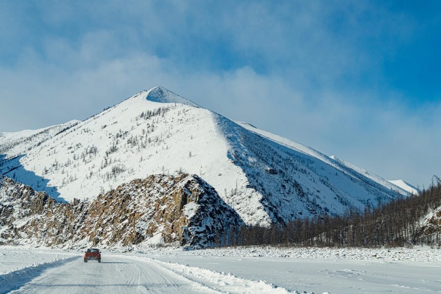
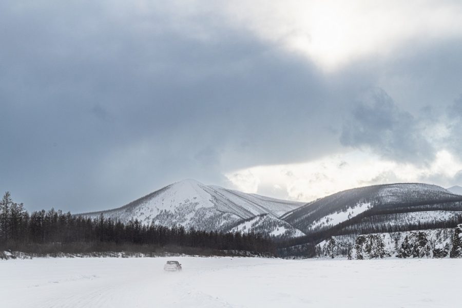
Brutal landscapes:
The view from the drone:
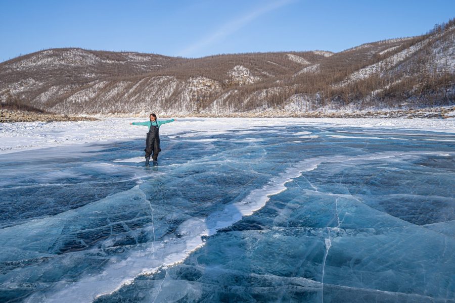
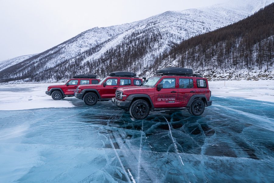
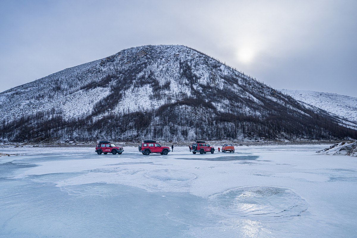
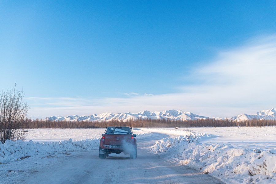
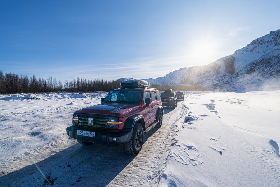
And assorted other intro-pics…
All righty. Intro done. Now for some detail…
Heading north, still toward Tiksi, we had to forego taking the Tube-route due to dangerous conditions there. On the way back down south though – given that we were way ahead of schedule: bingo – let’s do the Tube, which was already more water-less and solid than… the Pyramids, and had already been cleared by the winter-road workers…
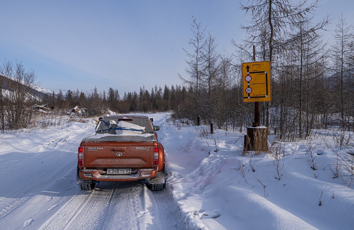
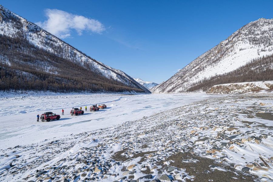
So, on the return leg of our Yakutsk-Tiksi-Yakutsk expedition, we found ourselves heading toward the Tube – counterintuitively in a northerly direction: we set off from Ust-Nera in the morning, drove along a stretch of the Kolyma Highway, and then turned off it and onto the Indigirka…
The beginning (0 kilometers) of the winter road ->
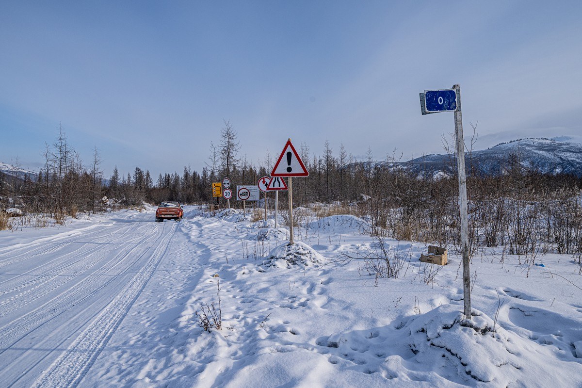
Overall, the Indigirka winter road is 1123 kilometers long! It’s mostly on the iced-over Indigirka, but occasionally takes to land to wake-and-shake us all up with its terra-firma unevenness (see this post for more on that). The endpoint of the winter road is in the village of Chokurdakh, btw – as in the next photo (just in case any of you, dear readers, may one day fancy having a pop at cruising the full length of the winter road yourselves:) ->
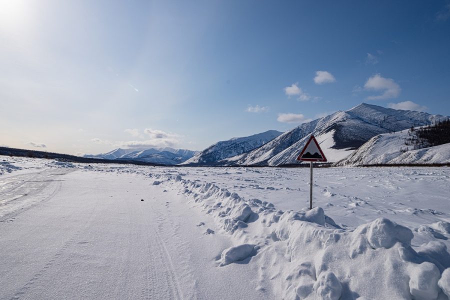
A warning sign just by the (two-sided) 0-&-1123km marker post pointing out the dangers of the Tube, and advising taking a long detour; duly ignored – off we set )…
…And anyway – we’d done that long way round two weeks earlier.
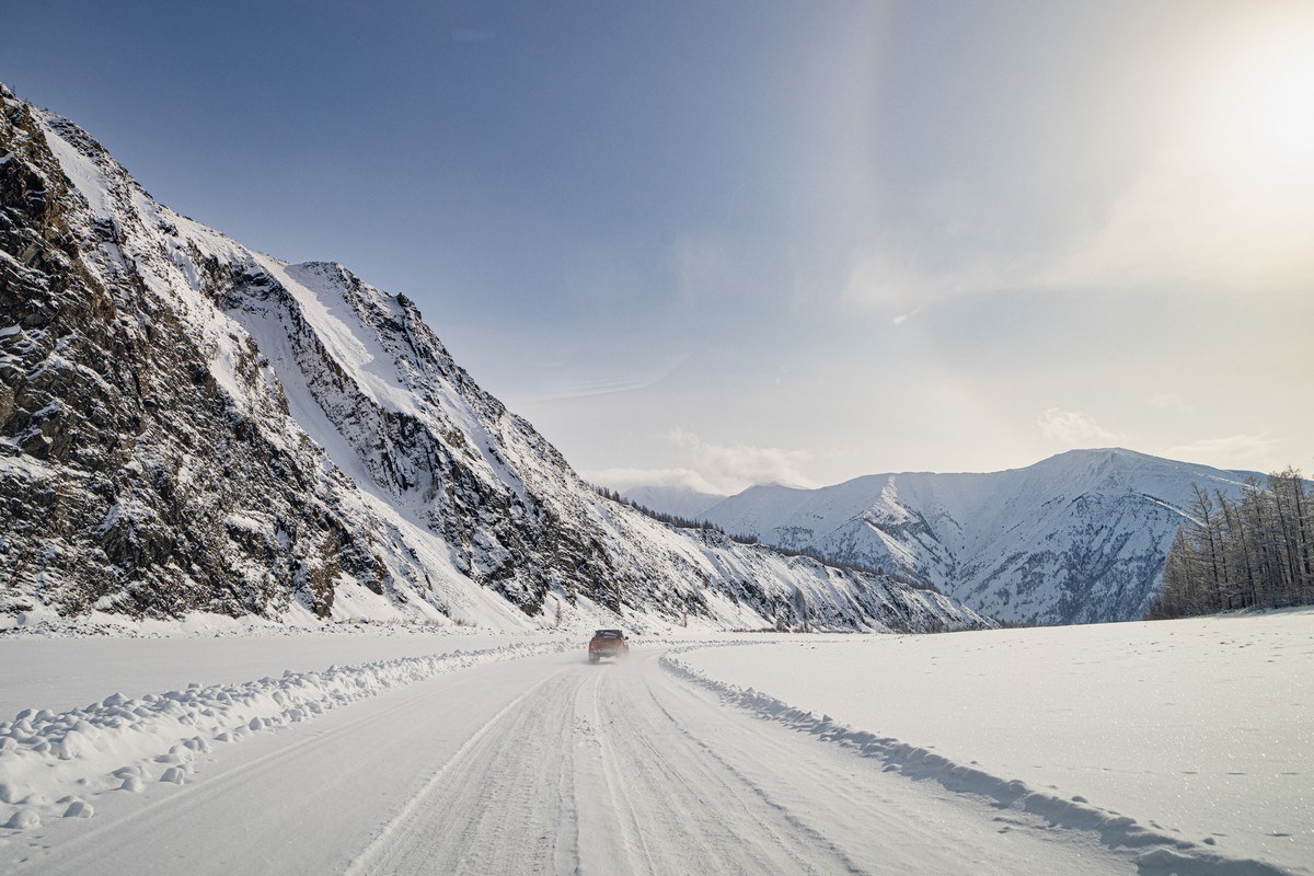
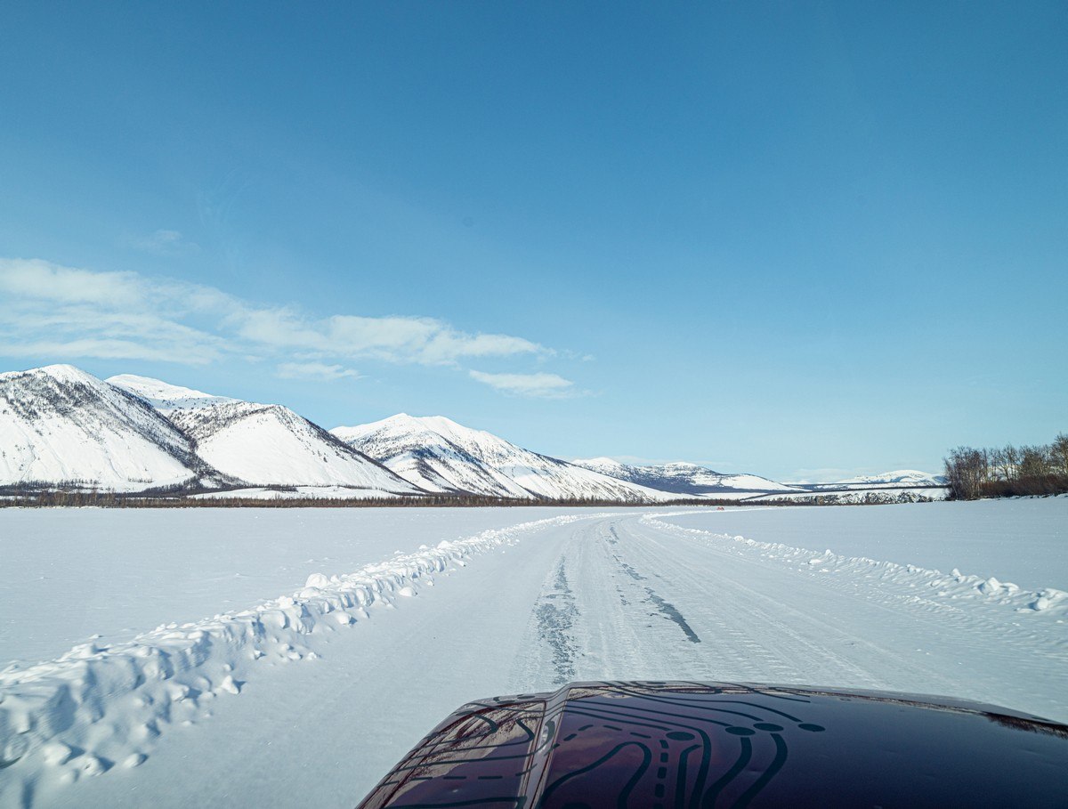
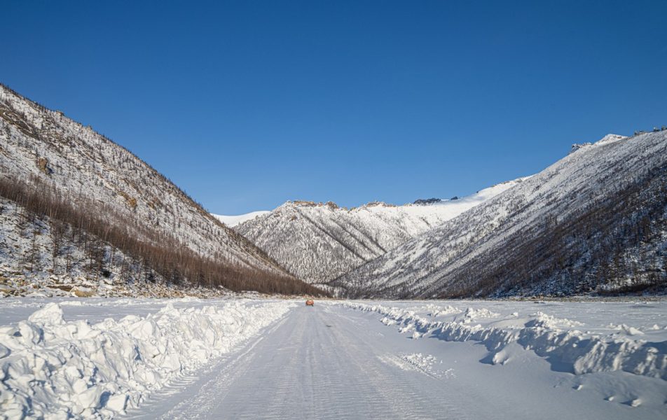
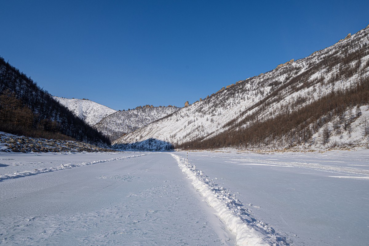
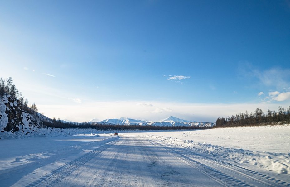
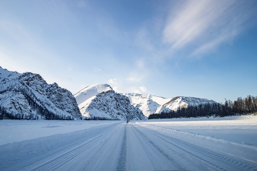
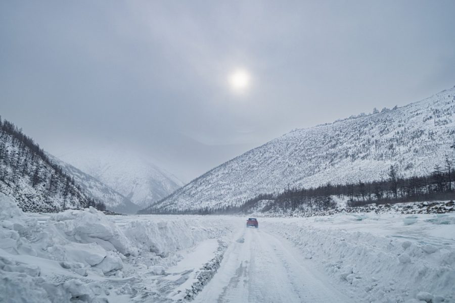
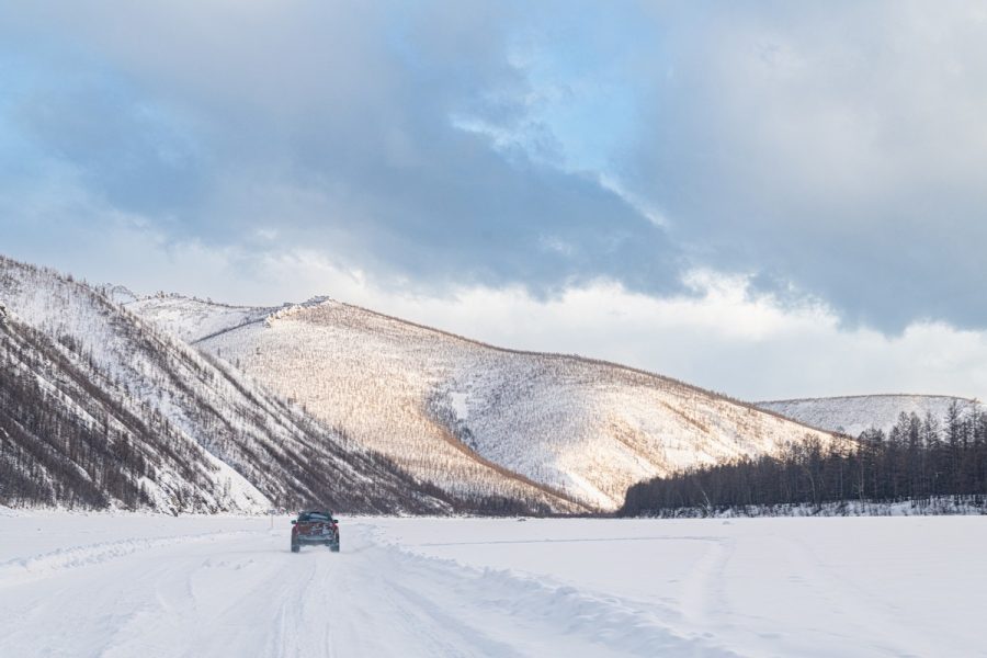
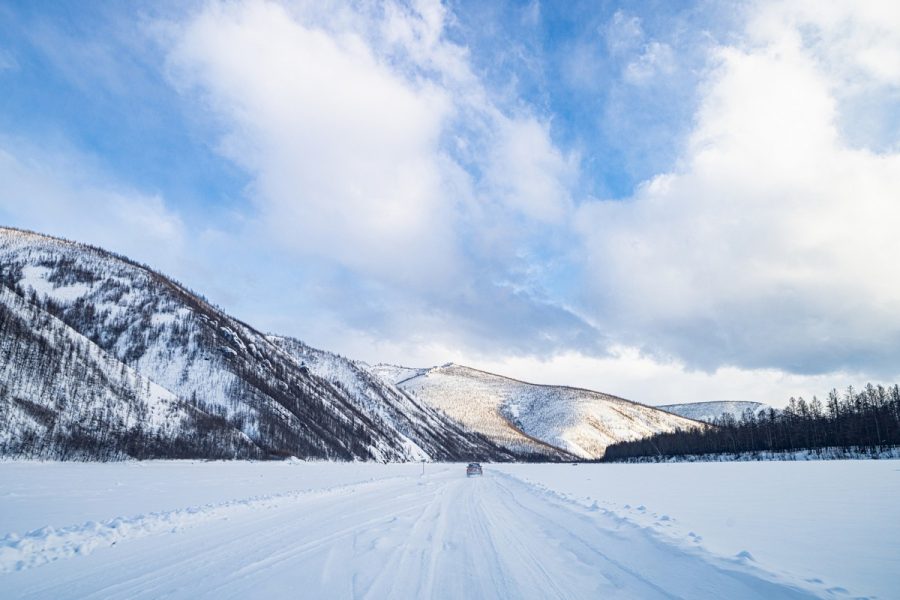
The winter road was mostly smooth – all the better for taking in the oh-my-gorgeous views all around ->
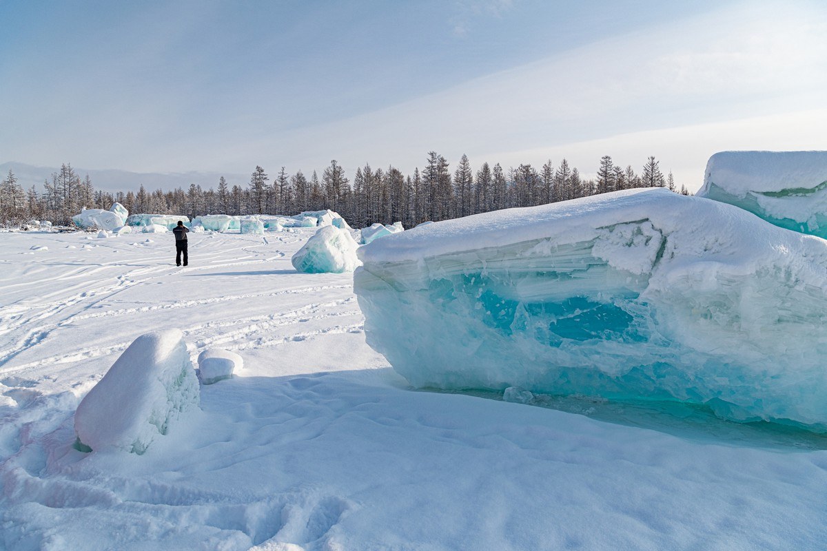
After just 20km on the winter road – we came across a rare natural phenomenon: the leftovers from an eruption of ice caused by a build-up of pressure in the water below (more details – here) ->
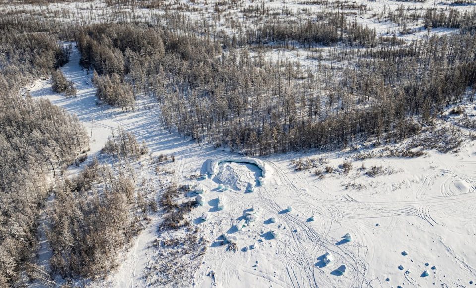
These blocks of ice that had been jettisoned out of the frozen river water were the biggest our experienced Arctic-expeditioner guide and team-leader, Alexander Yelikov, had ever seen! ->
What an eruption explosion that must have been. If only there’d been a time-lapse camera installed nearby…
What’s this? A block of ice with… acne? Actually – those are coins: pressed into the ice by passing auto-expeditioner-tourists (the equivalent onf tossing coins into fountains, etc. – for luck or when making a wish:) ->
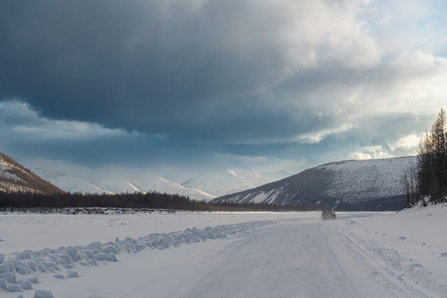
Wishes duly made, onward we cruised toward the Tube – the going: oh my great!:
“Emptiness”! ->
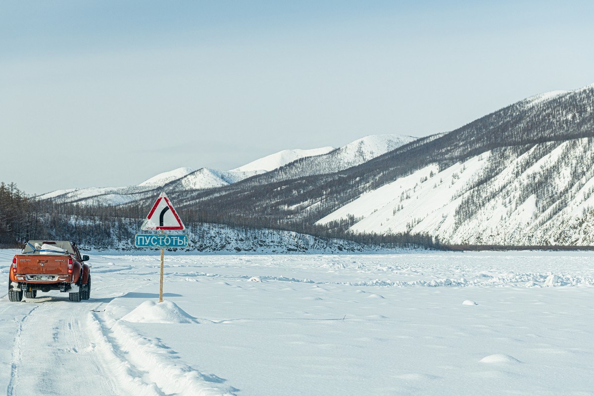
Emptinesses are air pockets in the iced river. They’re super hazardous as they’re invisible – so heavily-loaded trucks are kinda always taking a chance in areas marked with “Emptiness”: if they drive over one they could fairly catastrophically sink deeply into it. What’s curiously bizarre about the emptinesses though is that it’s not the first heavily-laden truck that can be swallowed up by one. It could be the third, fourth, fifth, or whatever-number truck – and it can end up like this ->
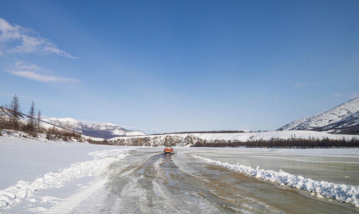
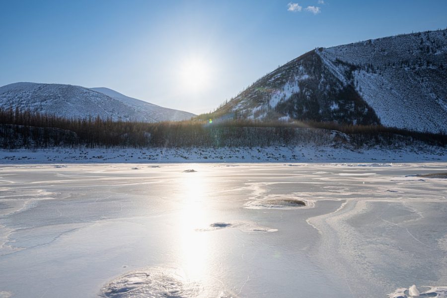
Then there are the previously-described naleds that are also treacherously hazardous, which lead to there being water all across the surface of the frozen river despite the temperatures being way below the freezing point of water (0°C for those who may have forgotten:) ->
Steady as she goes! ->
A burst ice bubbles:
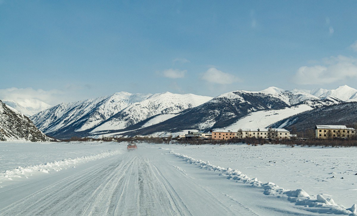
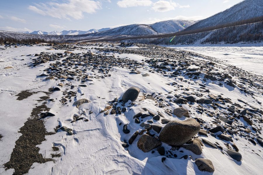
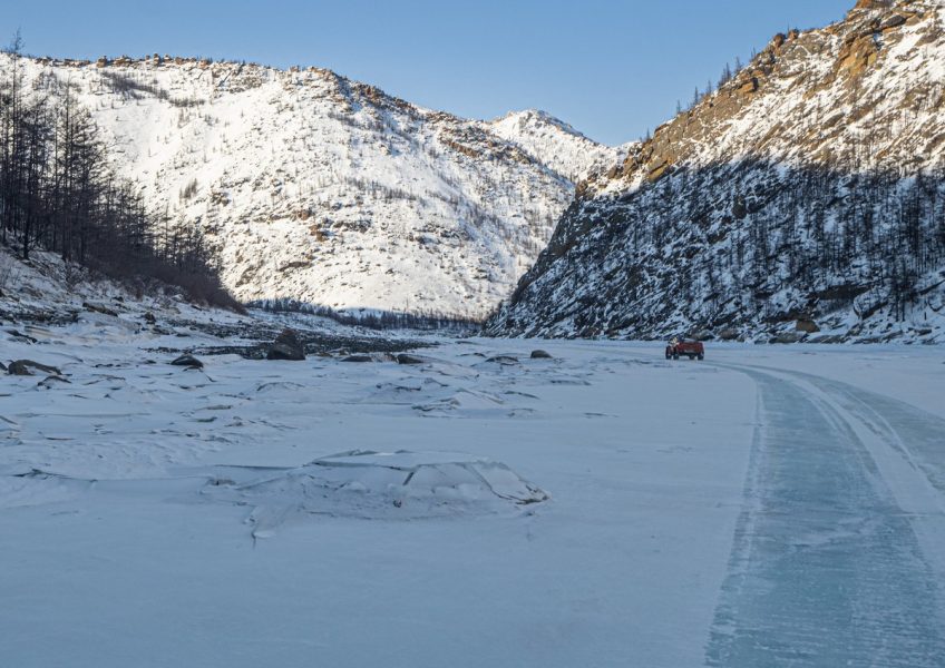
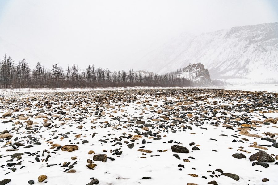
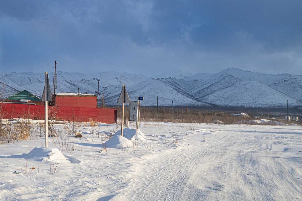
Along the way – abandoned villages where gold was once mined. For example, Predporozhny, here, which seems to still be inhabited by scores of folks even though it’s ceased officially being a village (does that mean there are no utilities, etc.? Not sure)…
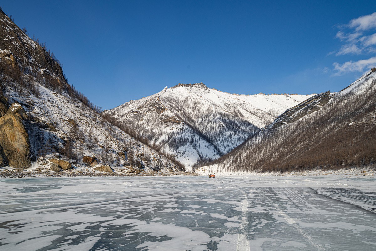
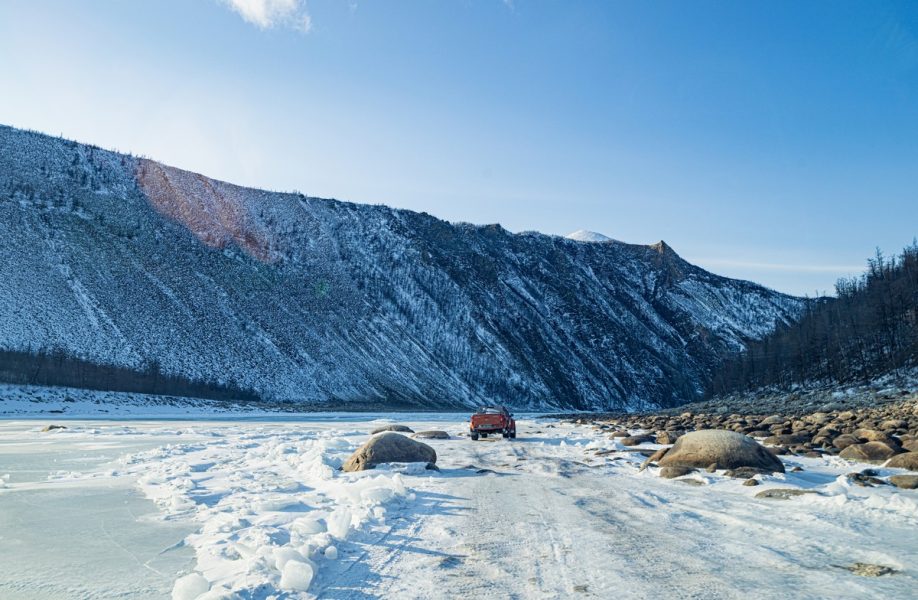
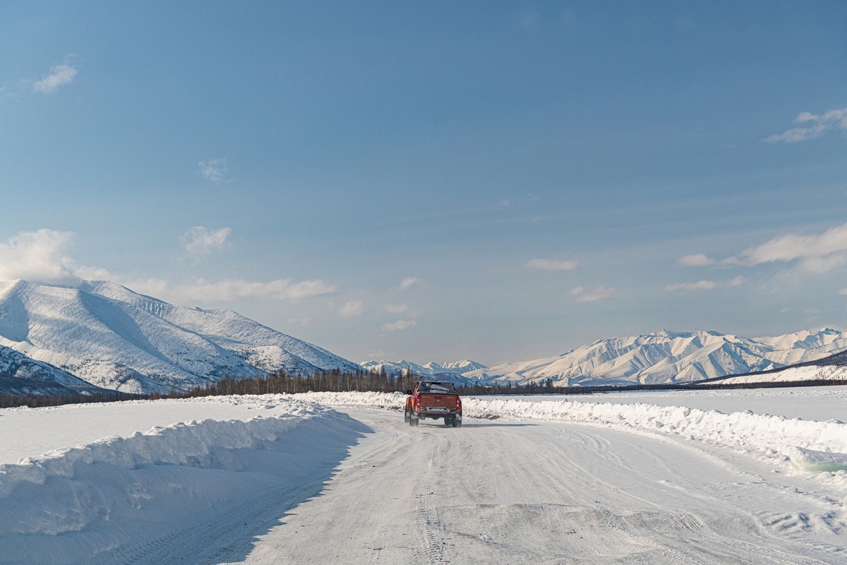
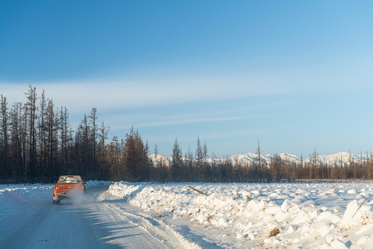
Onward! The views continue to astound ->
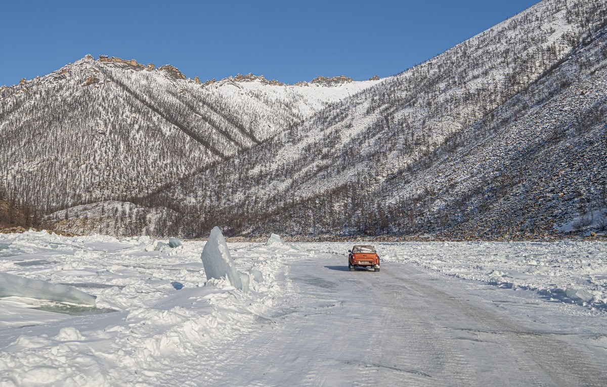
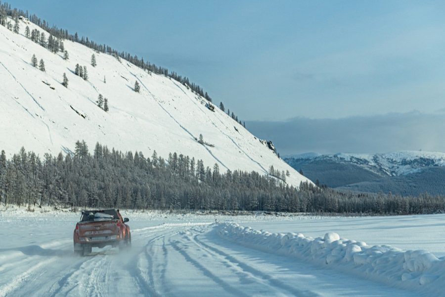
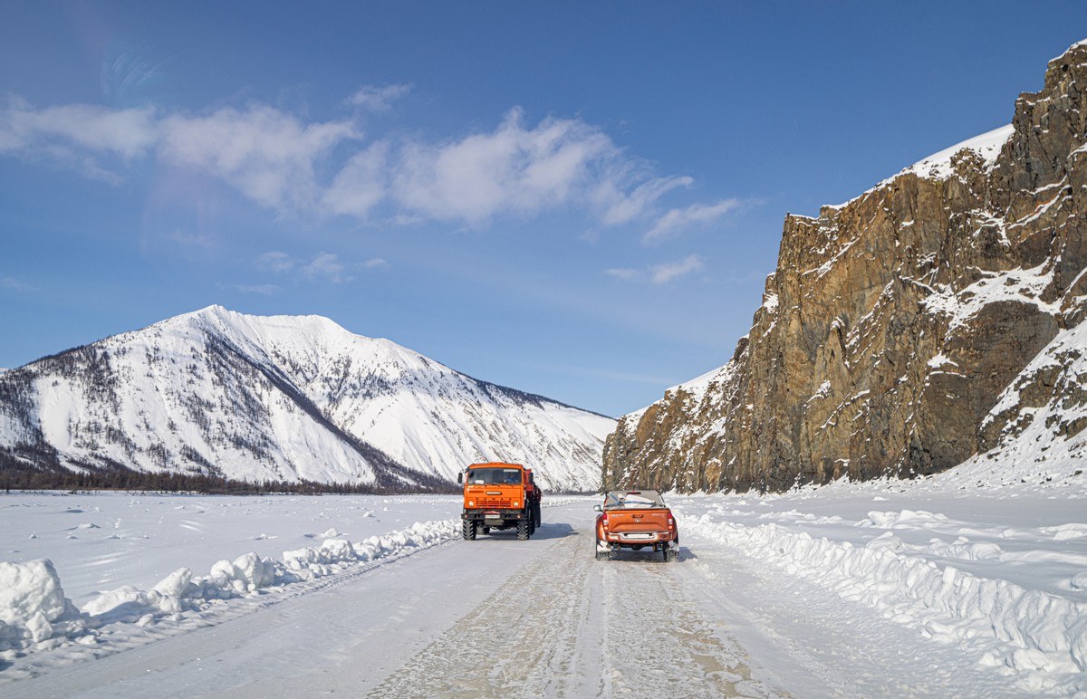
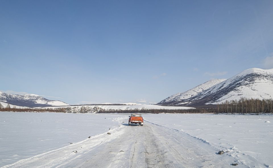
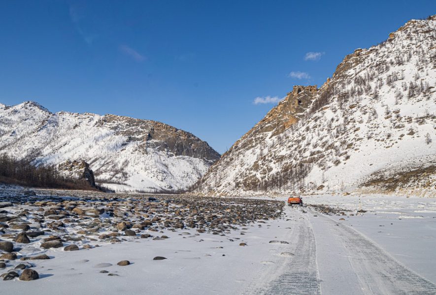
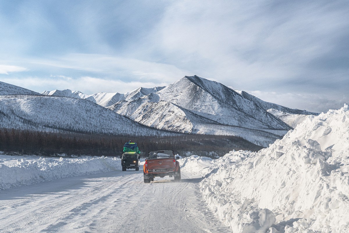
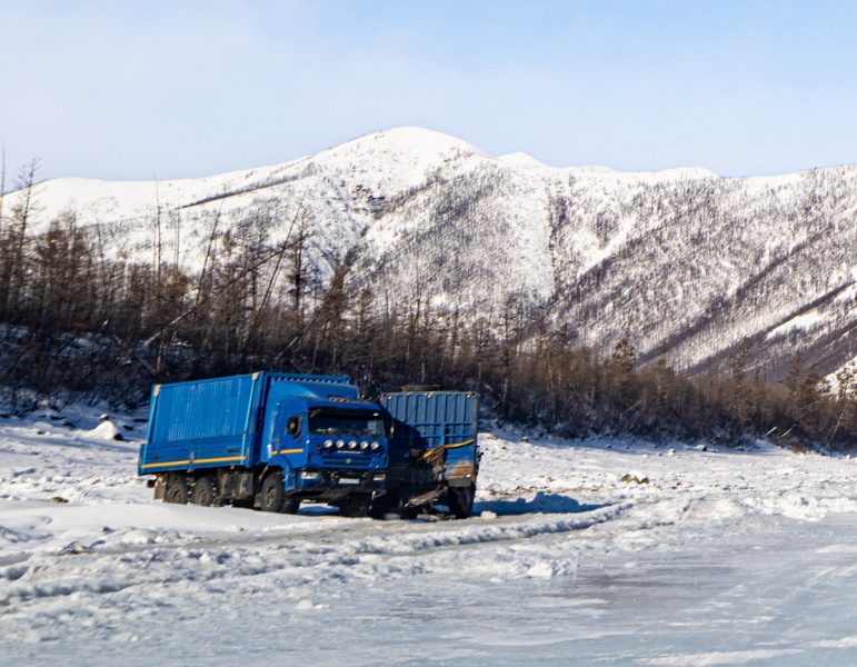
Only very occasionally do we pass an oncoming – handily brightly-painted – truck ->
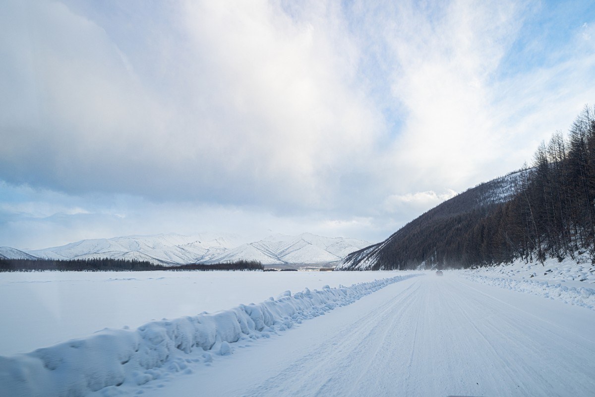
The winter road was mostly smooth today, so the going was generally fast…
Only occasionally – bumpiness:
Emptinesses sometimes turn into trampolines ->
I wonder what caused this? ->
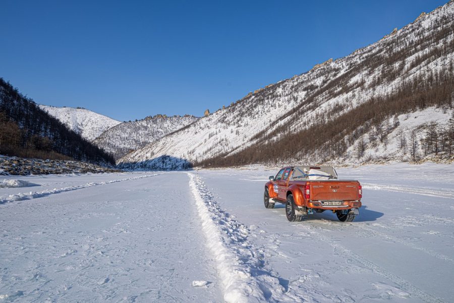
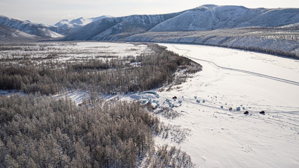
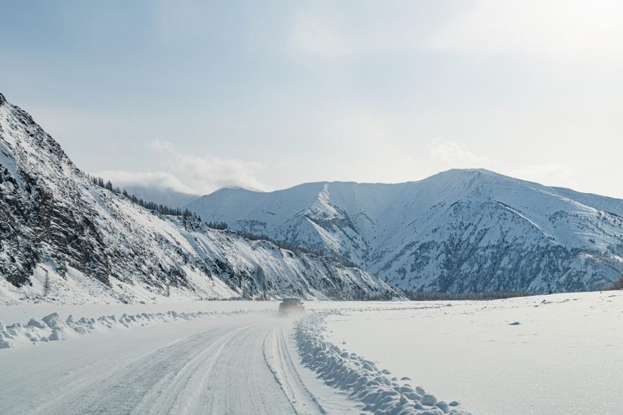
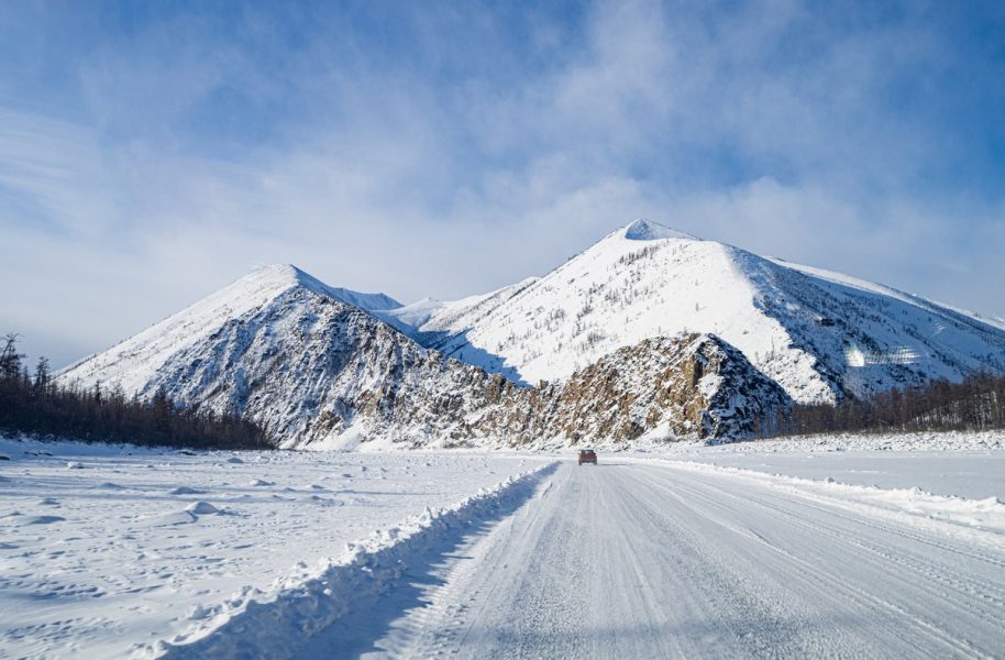
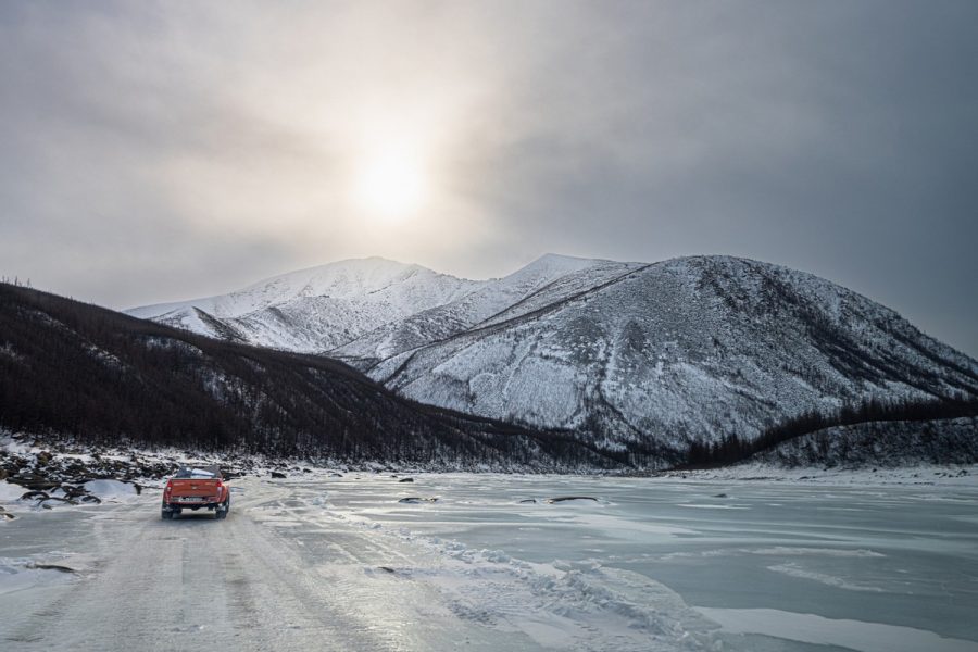
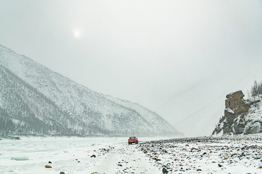
Finally, after 180km on the Indigirka, we make it to one end of the Tube ->
The naleds that prevented us from driving along the Tube on our way north two weeks ago had clearly all frozen over:
More burst surface-bubbles caused by water pressure – since frozen too:
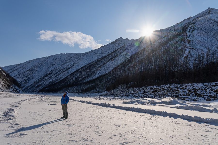
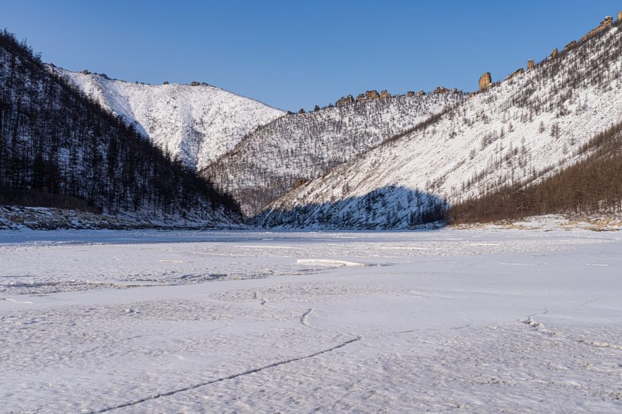
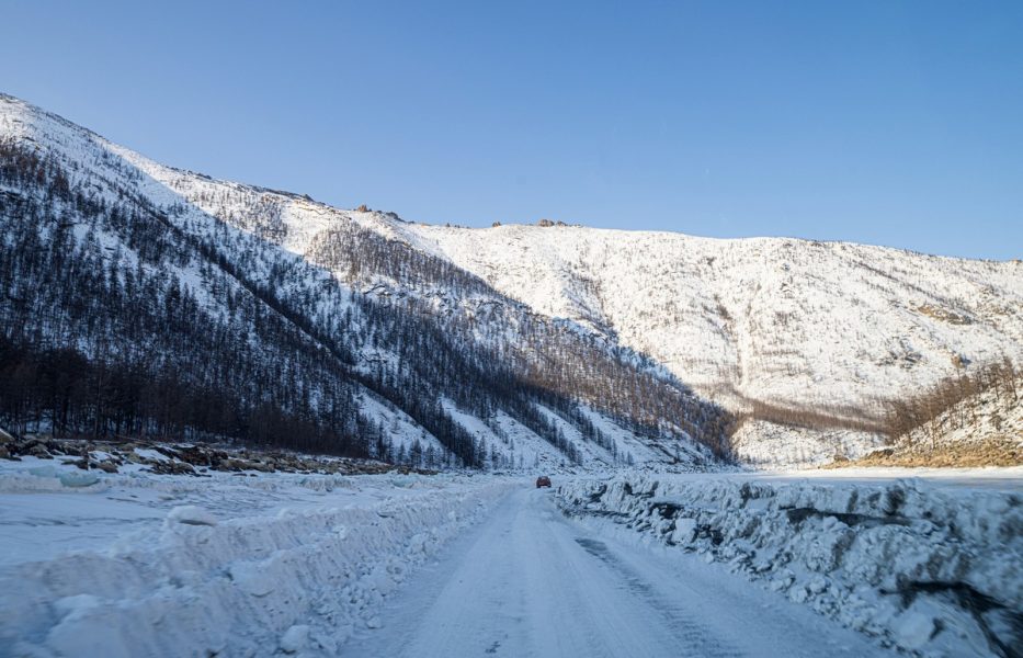
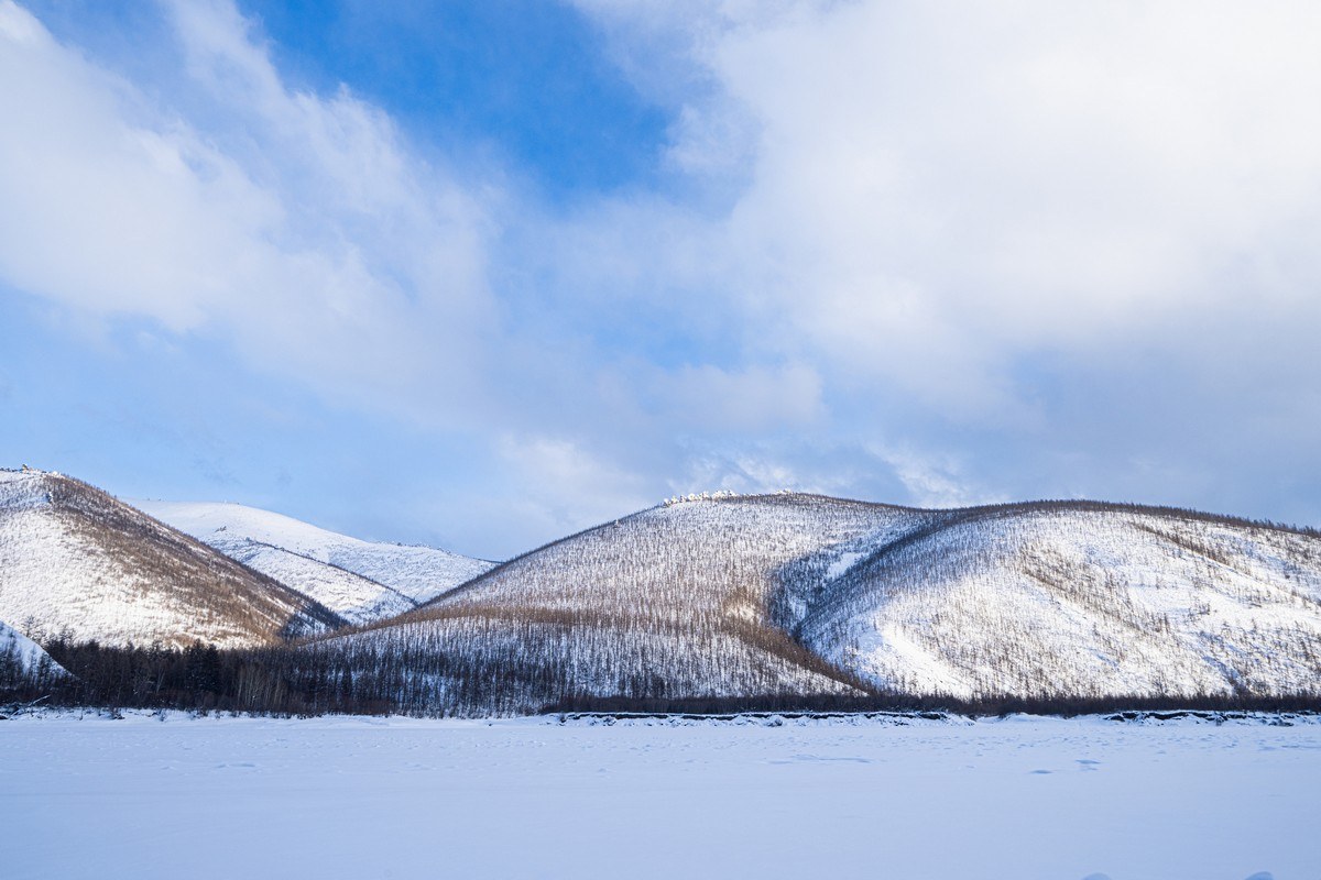
Most of the views along the Tube are brutal – especially in the shade:
The “Grandfather of the Indigirka” – © my fellow expedition companions:
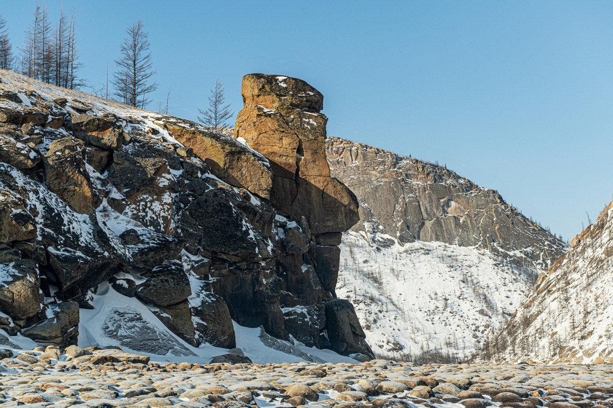
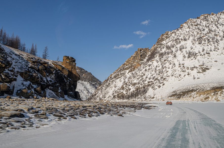
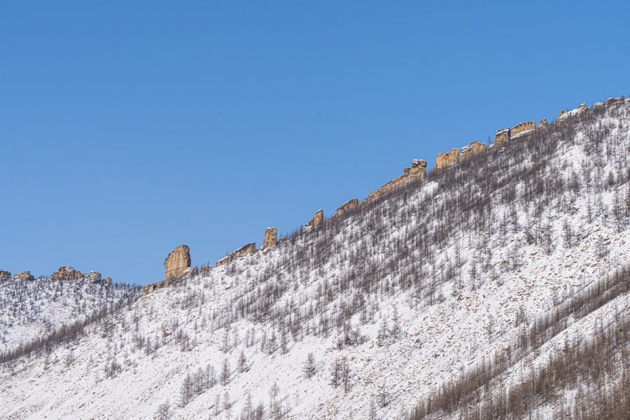
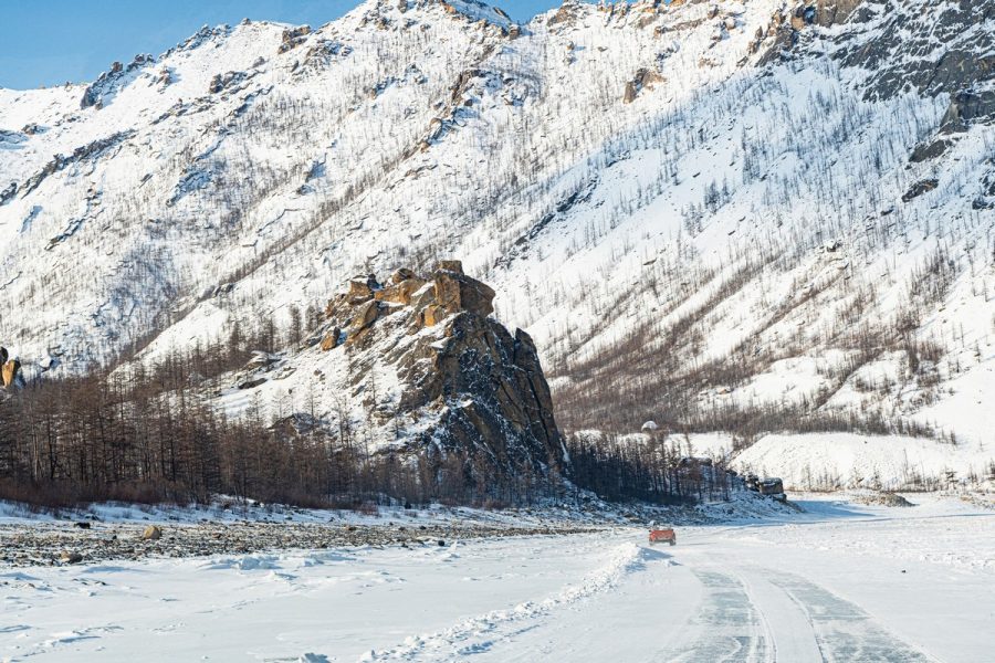
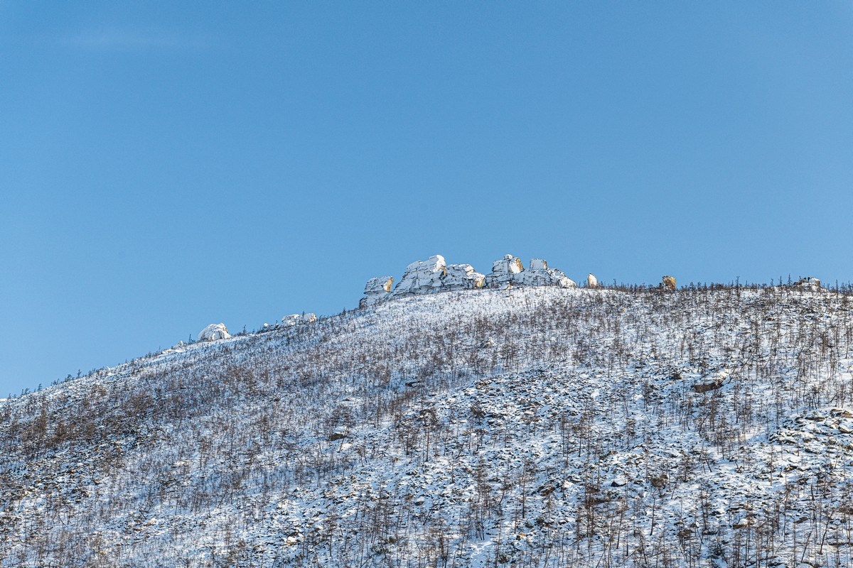
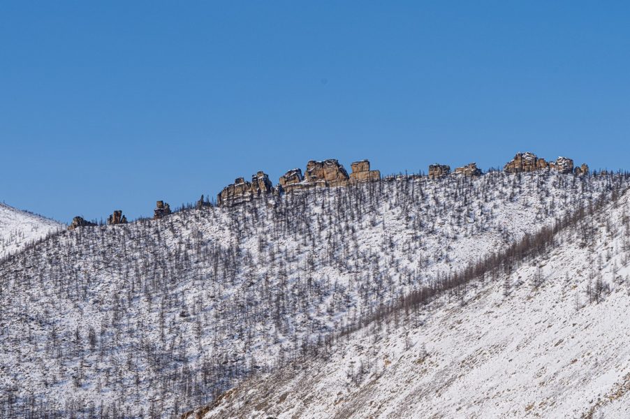
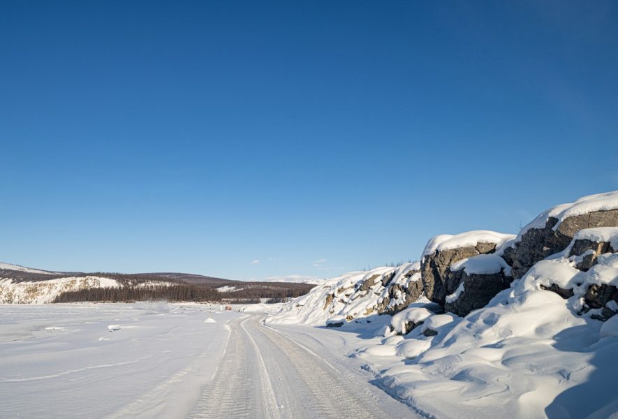
Occasional random rocky outcrops ->
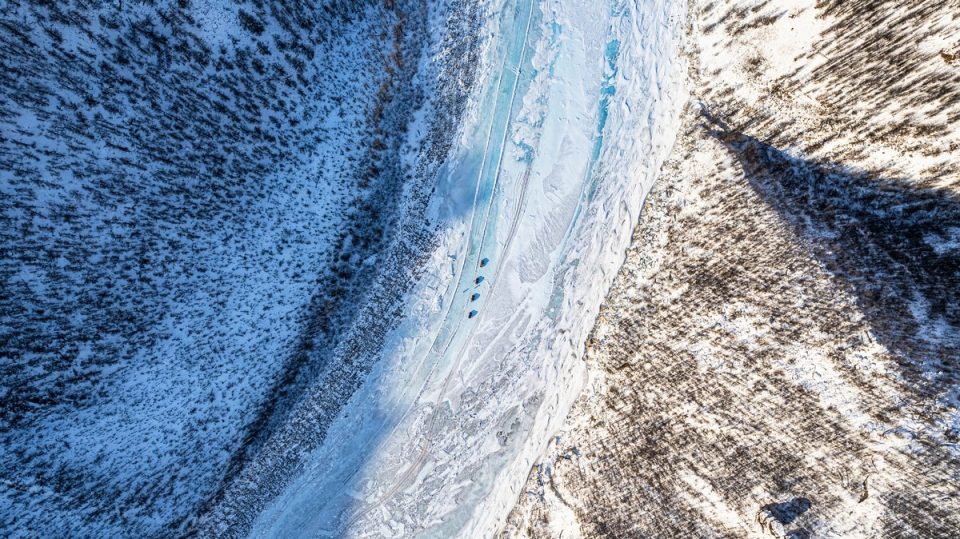
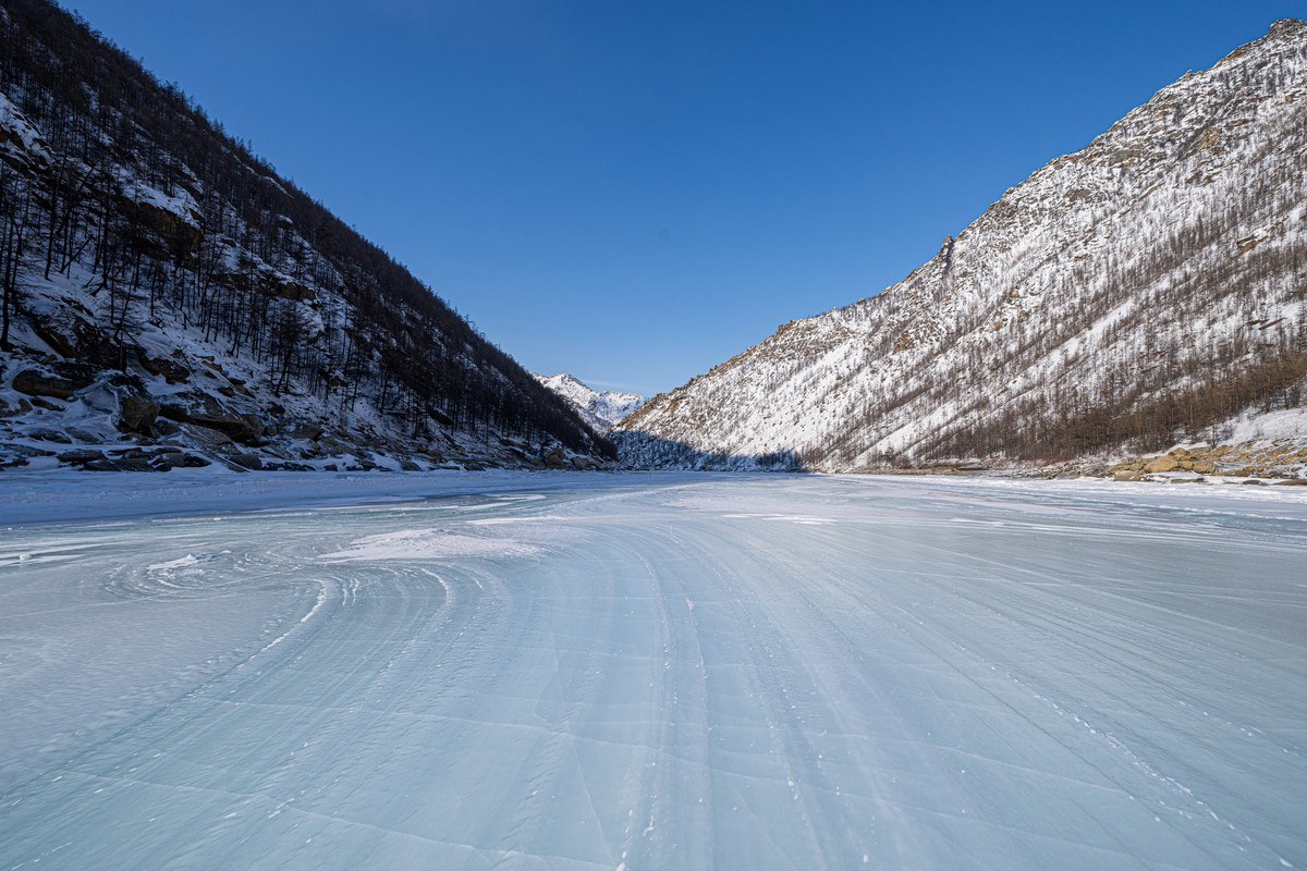
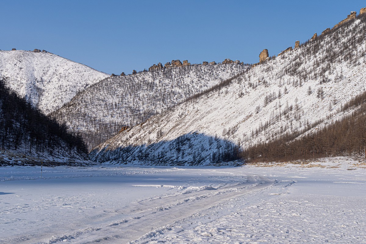
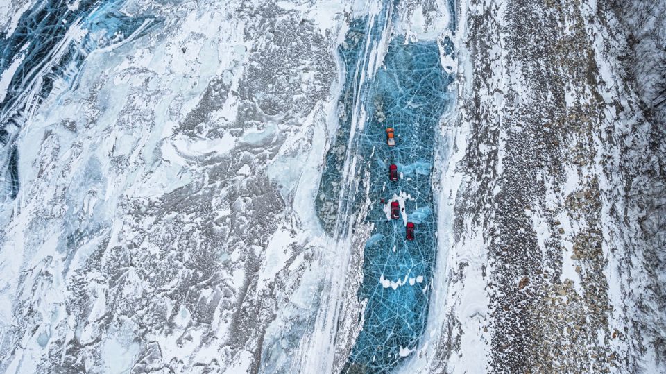
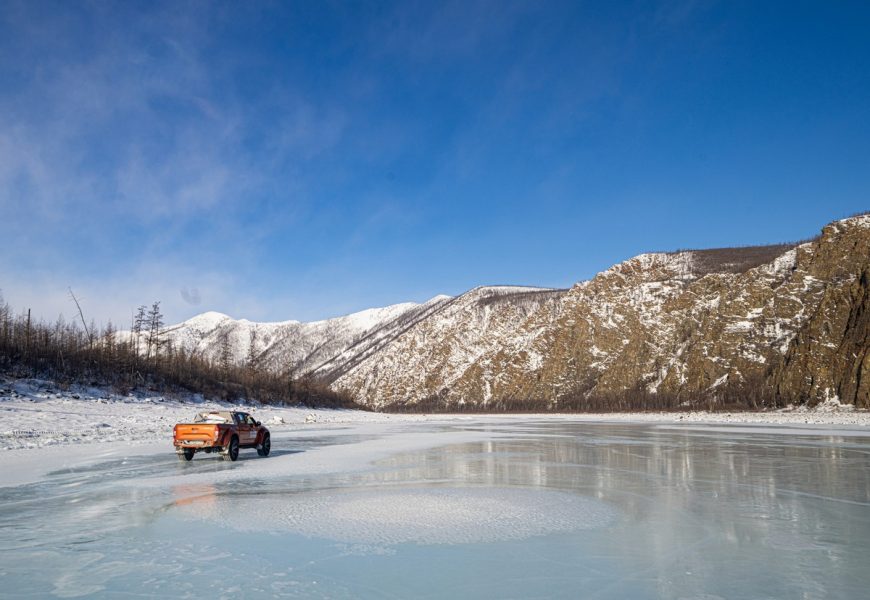
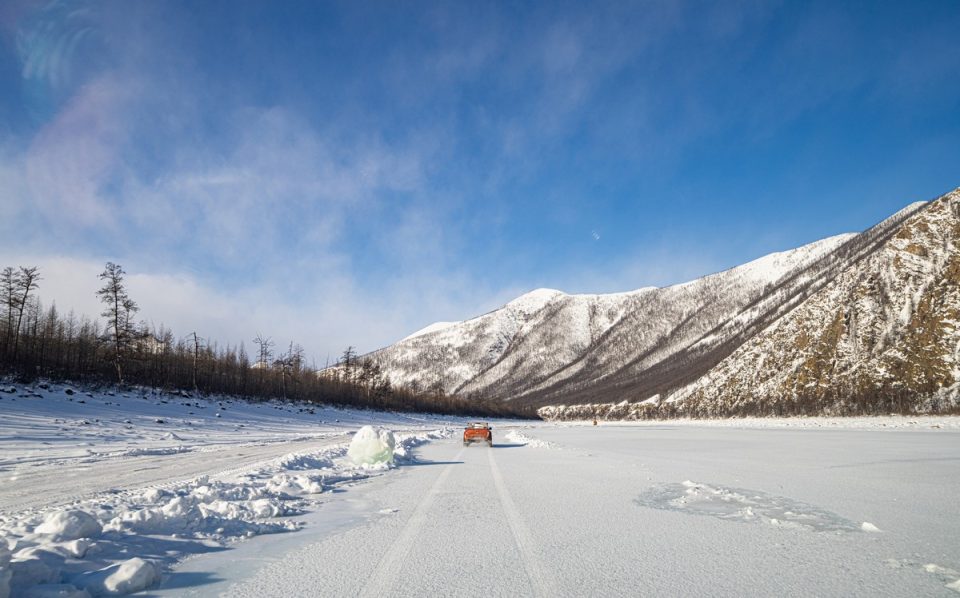
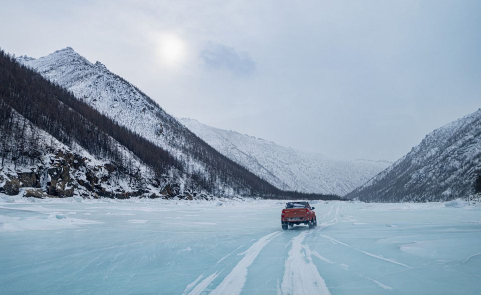
There’s a cleared “road” upon the ice – mostly smooth; but if you want smoother – you can go off-piste onto the clear ice:
Rocky outcrops atop the hills to each side are clearly a theme:
The rocks up top have sides either covered in snow blown ~horizontal by the wind…
…Or completely bare (the sheltered side) ->
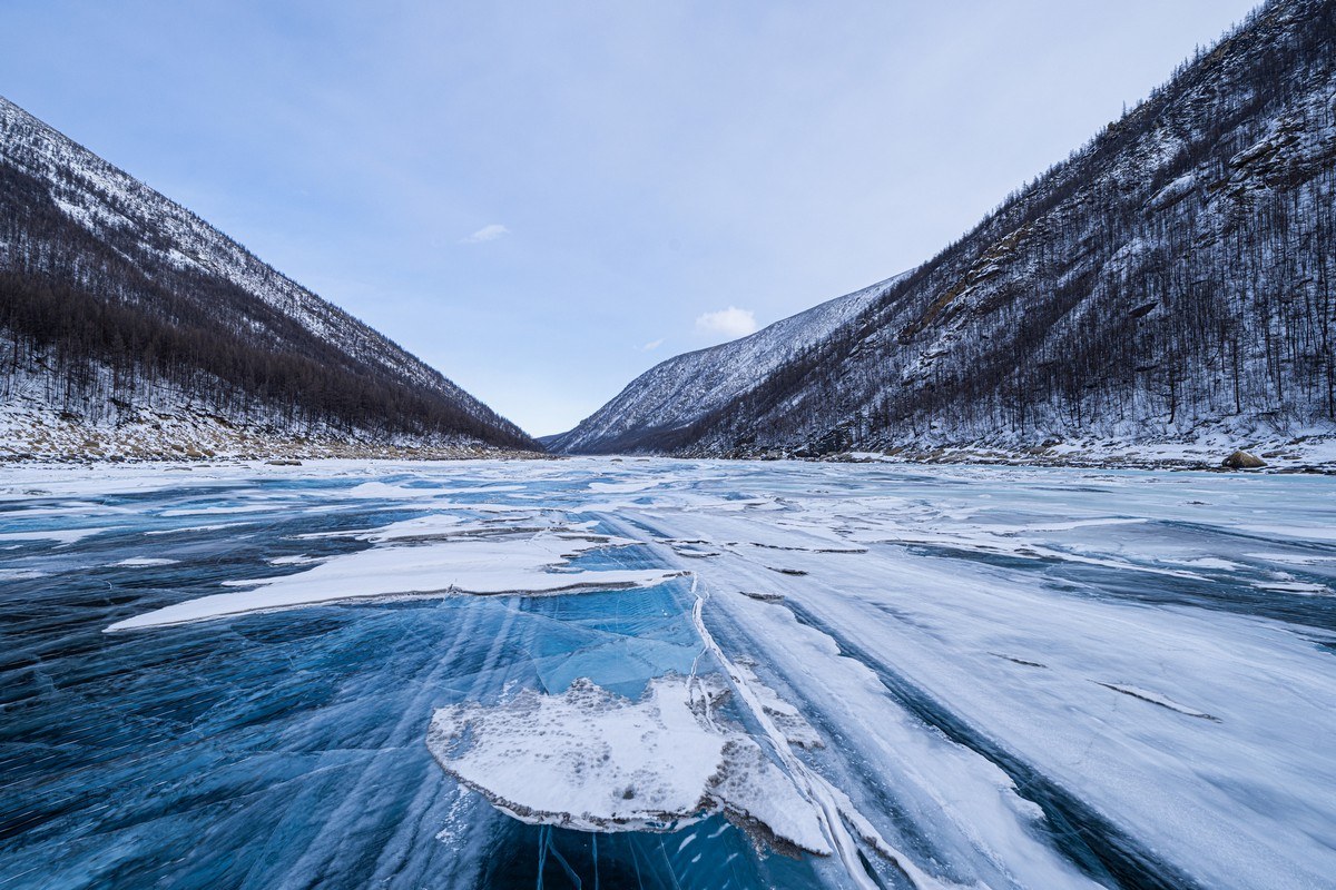
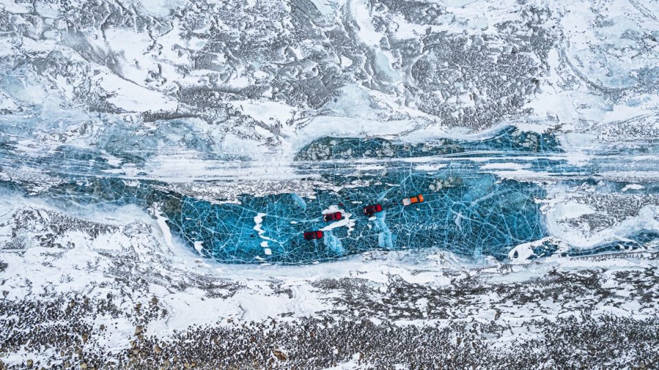
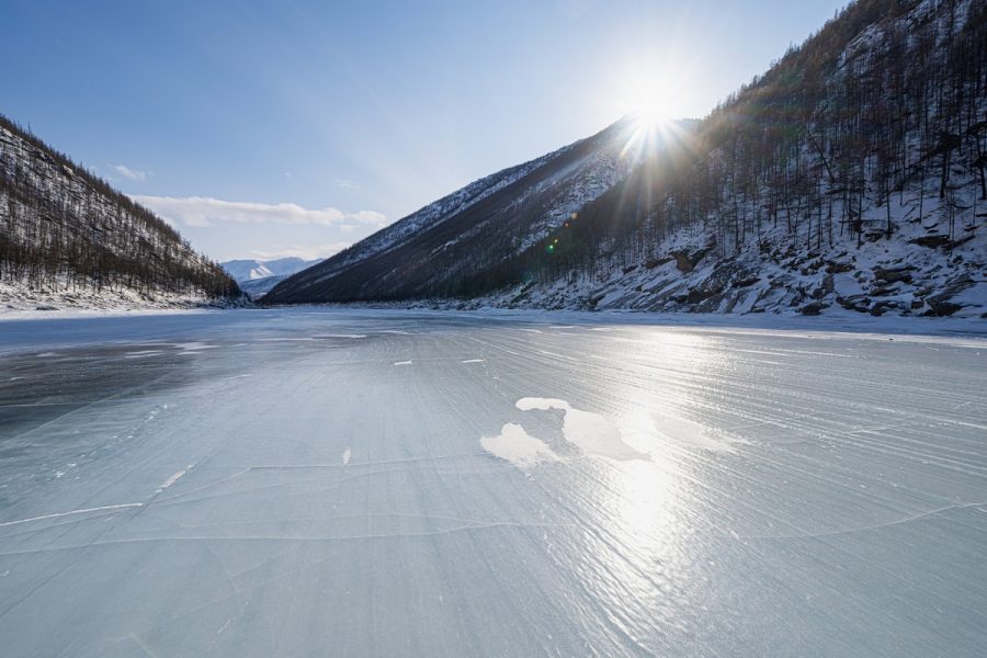
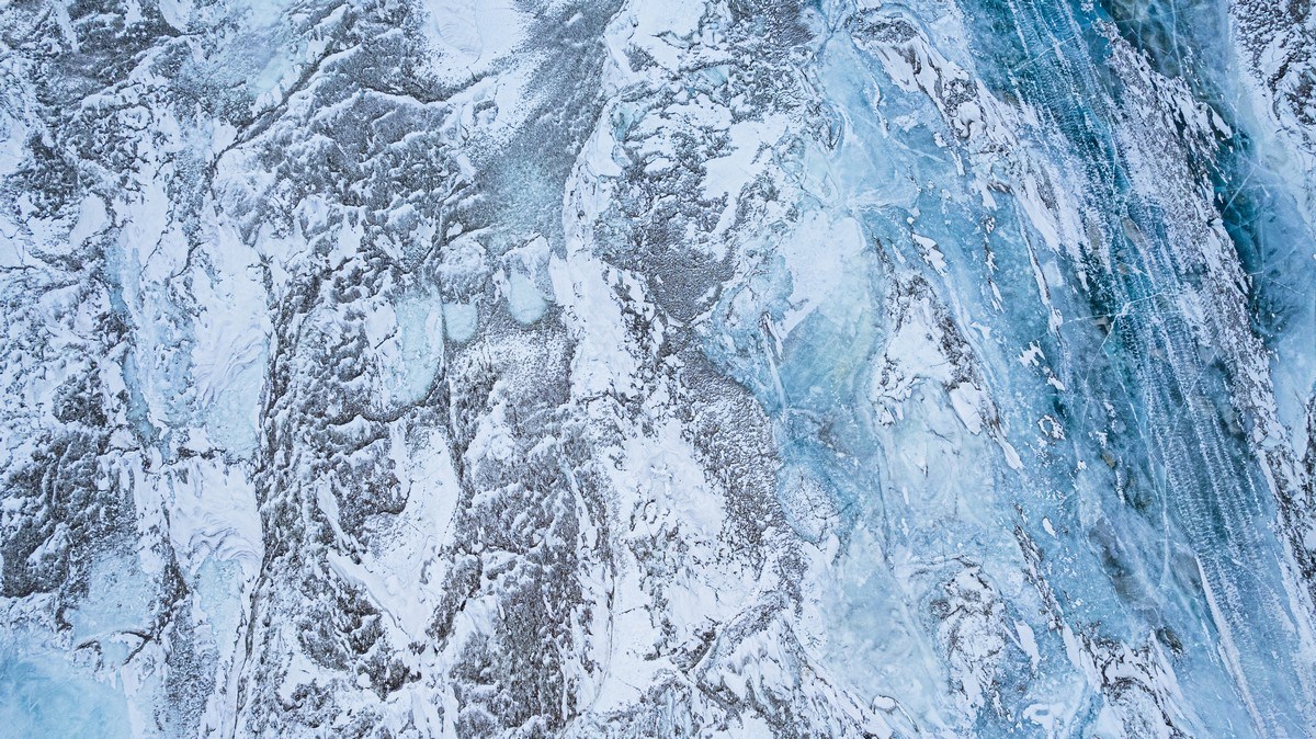
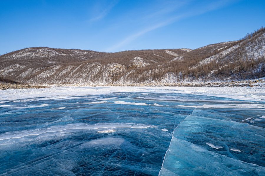
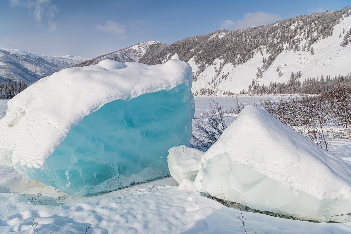
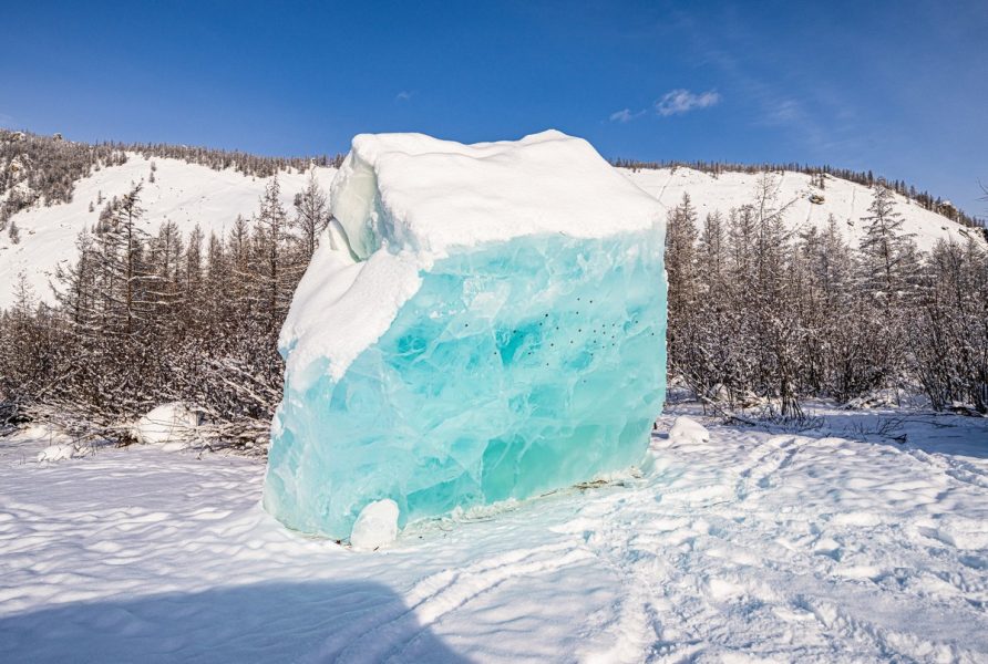
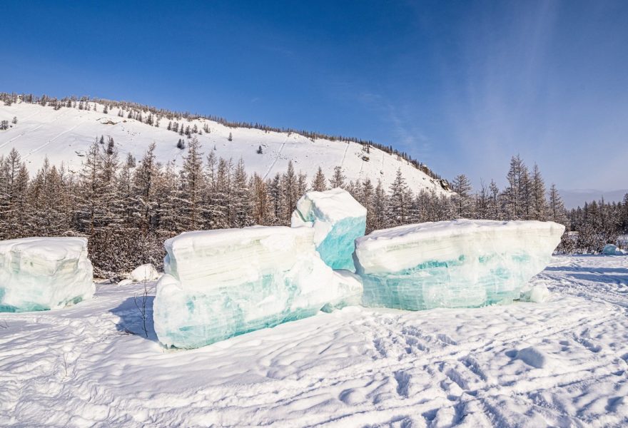
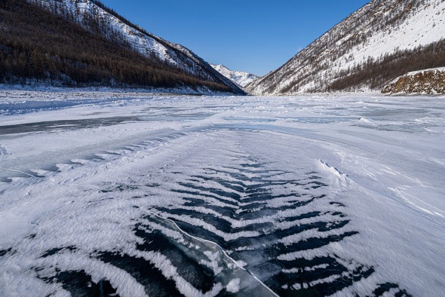
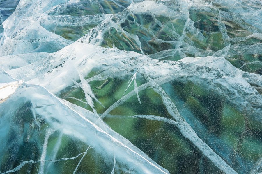
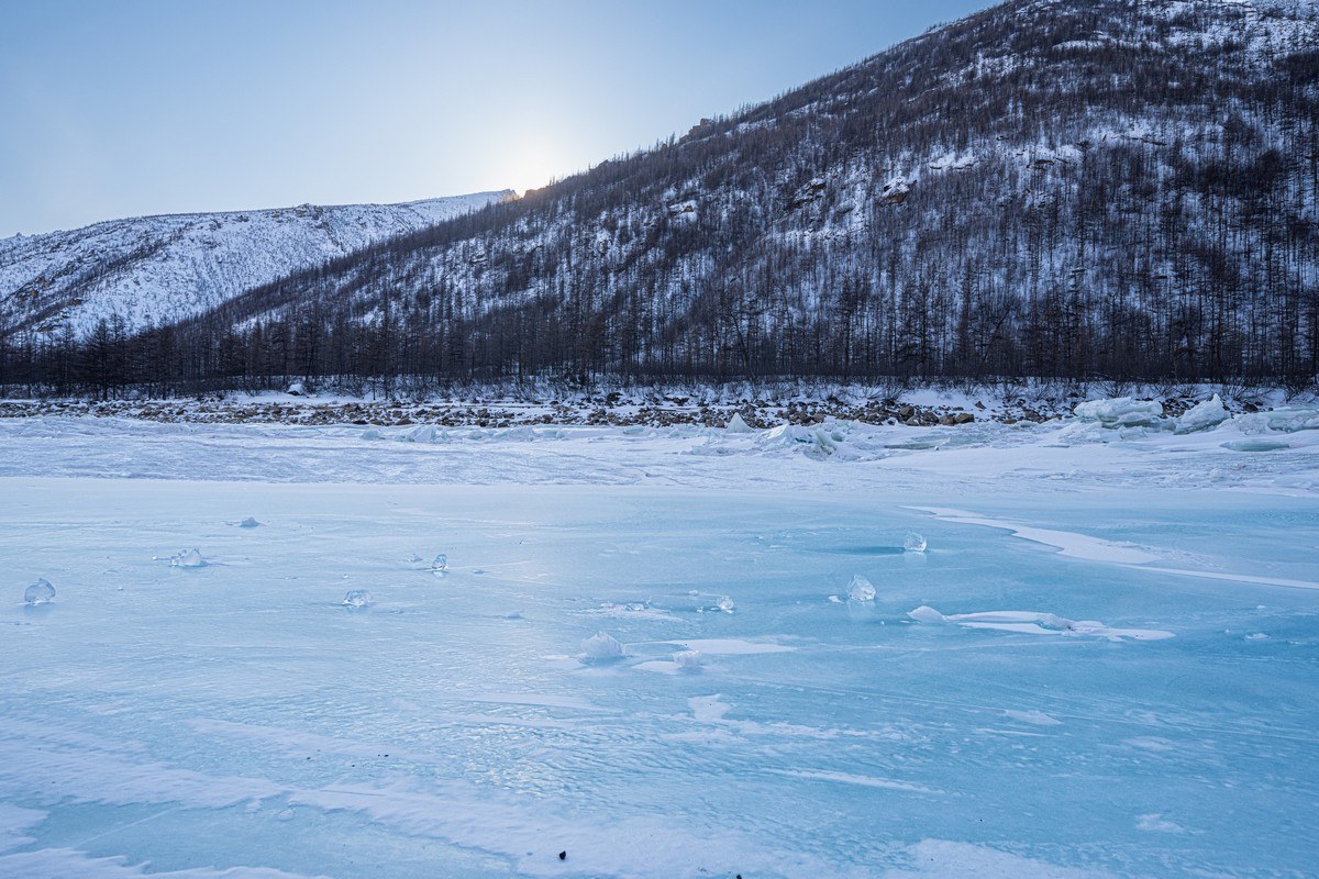
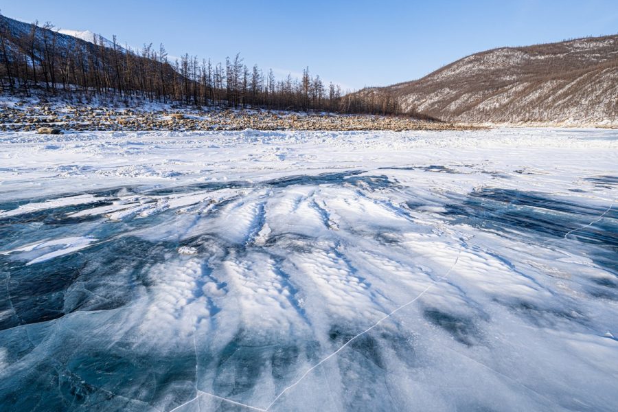
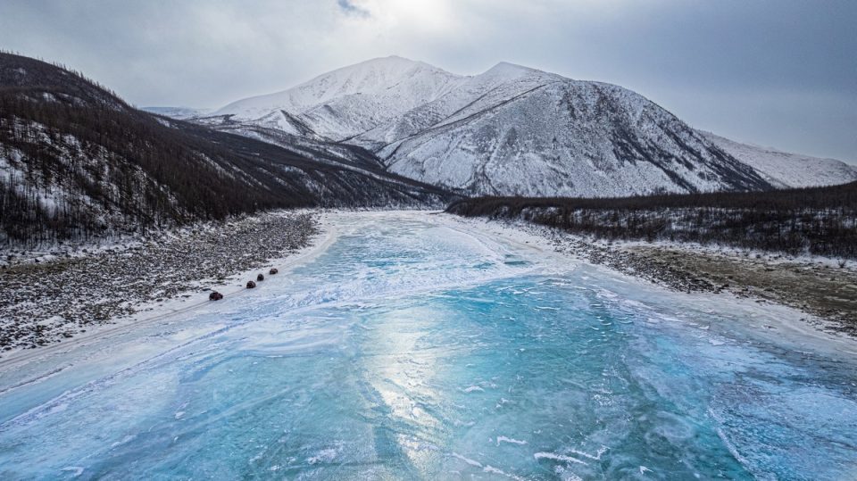
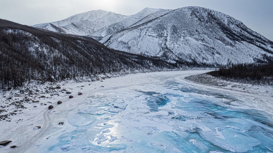
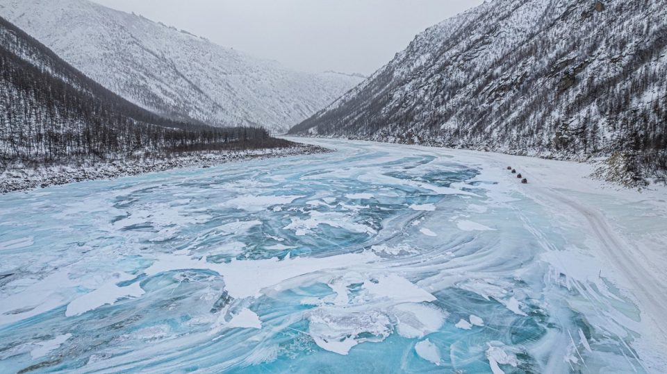
Black ice. Turquoise ice, more like ->
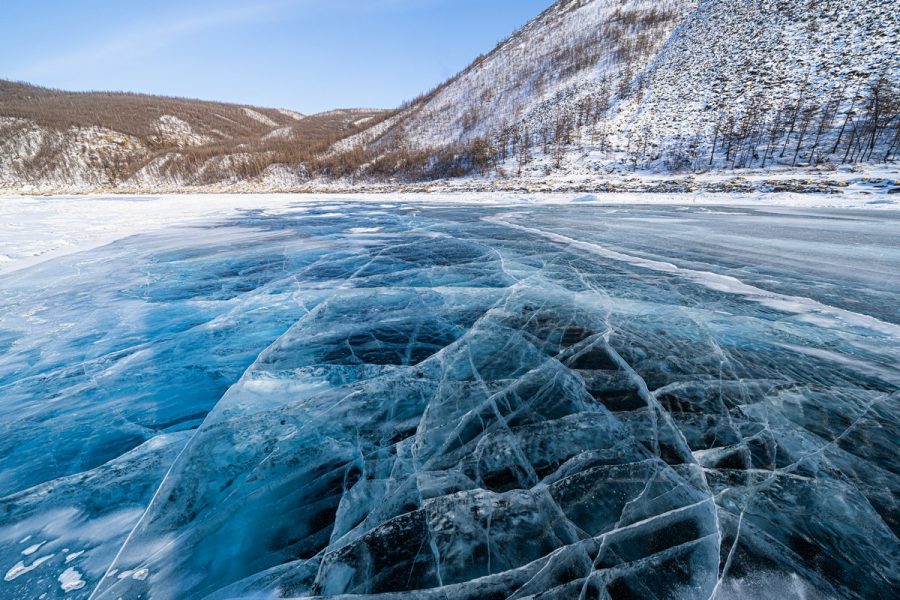
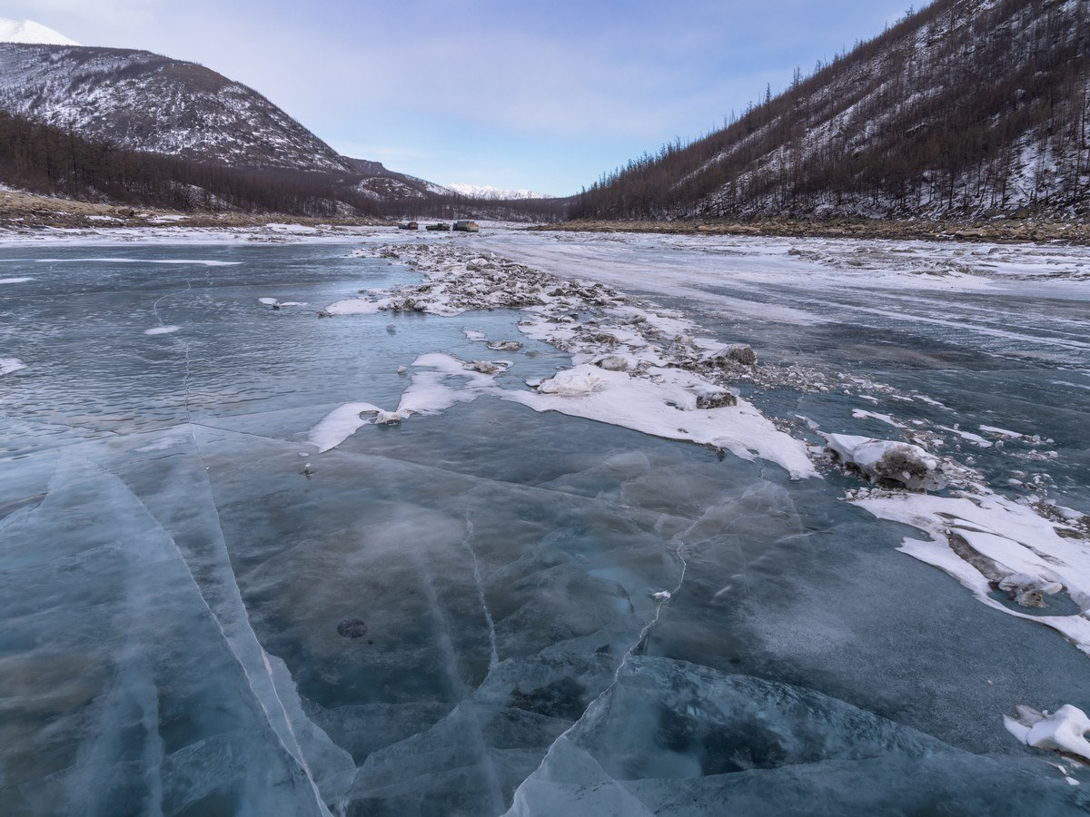
The cracks, btw, are also the result of internal water pressure, just like the naleds. The coloring and the cracking remind of Lake Baikal in March – just on a smaller scale:
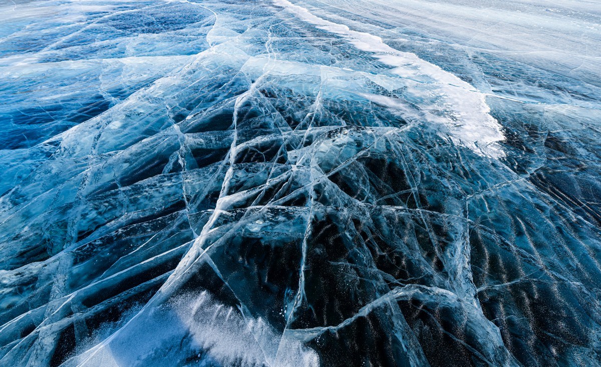
The ice is so transparent you can see the rocks on the riverbed! ->
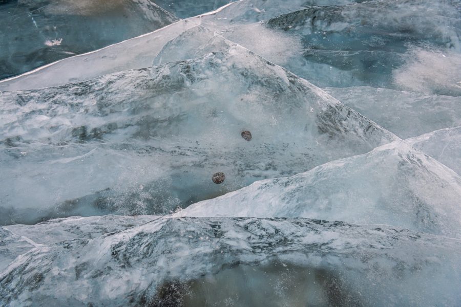
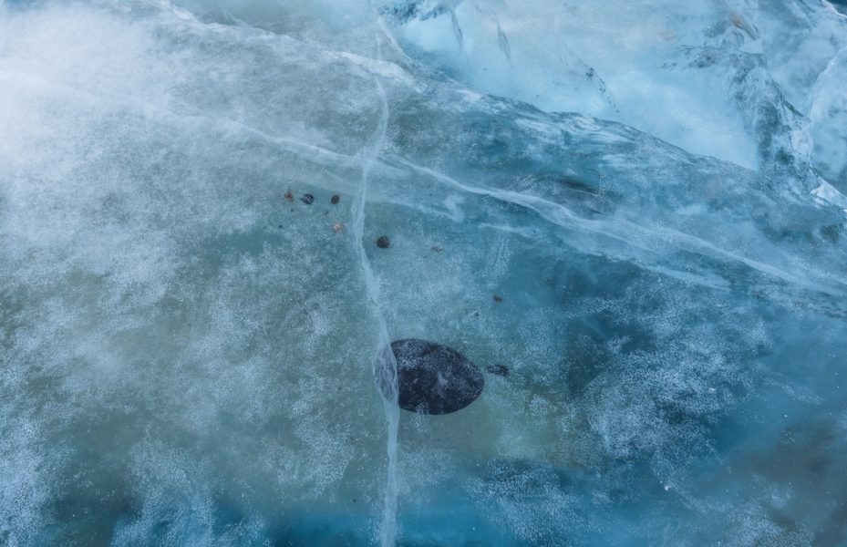
A cloudy spot of ice…
…Nothing special, right? ->
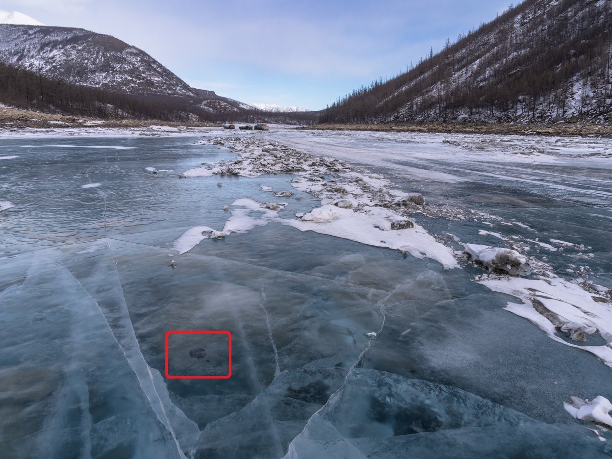
…But it turns out that there’s a rock there – outlined in red – suspended in the ice! What?! How is that possible?
And the more you look around here – the more you find ->
So incomprehensible – they make a decent April Fools’ Day prank.
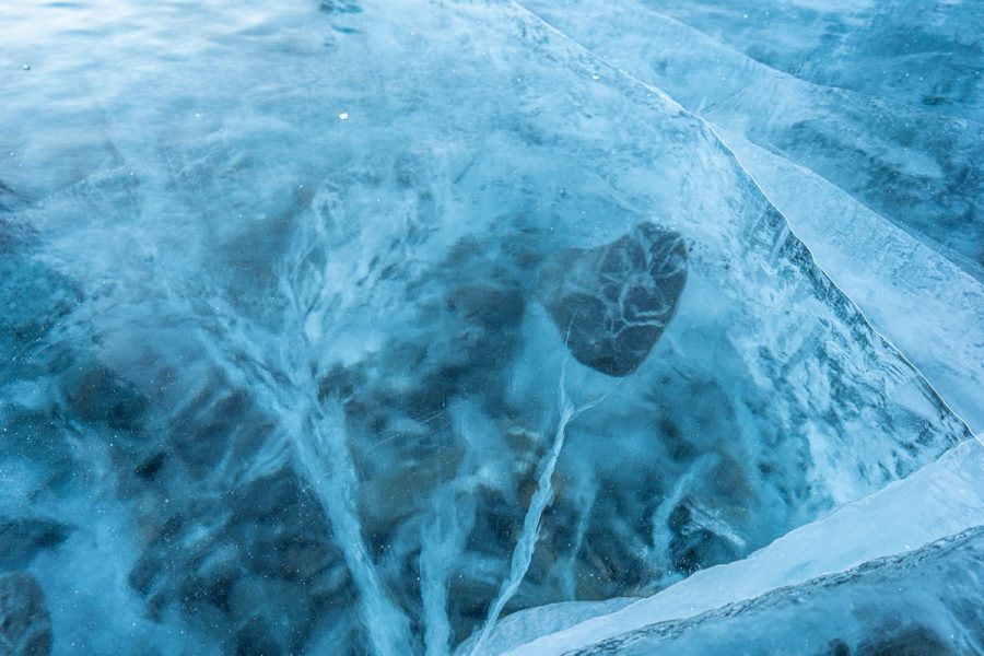
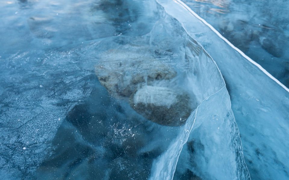
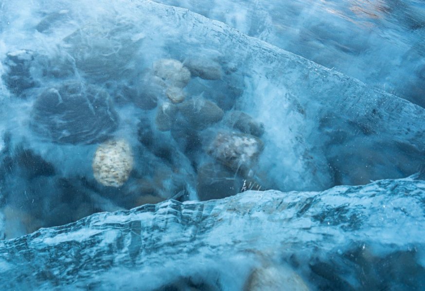
So – how are these suspended rocks physically possible? It turns out that the only working explanation of this phenomenon is based on naleds. Since it’s always very windy here, the river freezes very quickly – earlier than the upper currents. But upstream the river continues to flow, as do tributary streams, which regularly emit “new” water, which flows across the surface of the “old” water ice, carrying with it rocks from the shore. That water then also freezes – sometimes white, sometimes clear – and that’s how the rocks get to be suspended as they are. //Btw – why sometimes the water freezes white, and sometimes photogenic-clear – I don’t know.
Onward!…
To one side – ice hummocks…
…To the other – perfectly flat:
Here the road was cleared through an ice-hummock field:
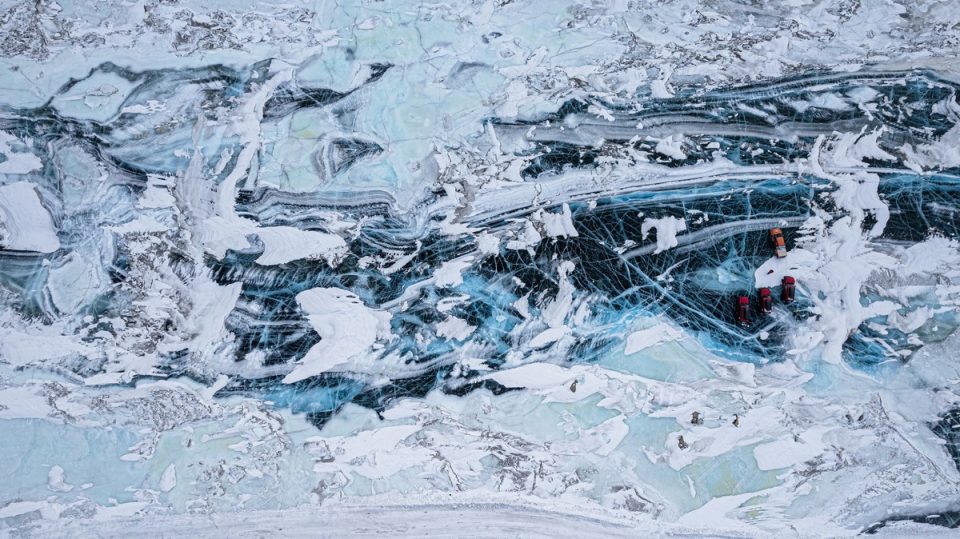
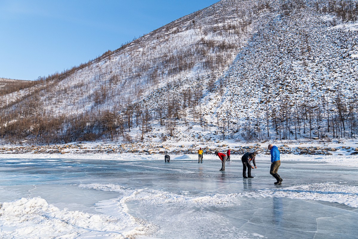
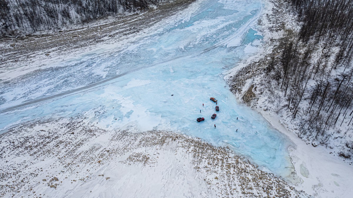
A “live” naled! ->
Where’s this? Here ->
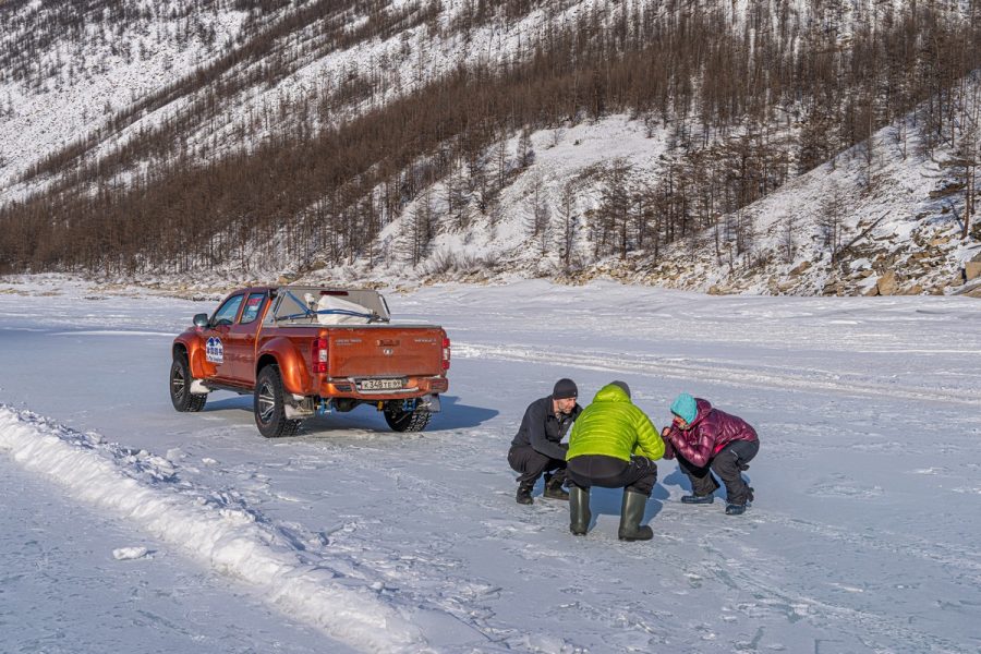
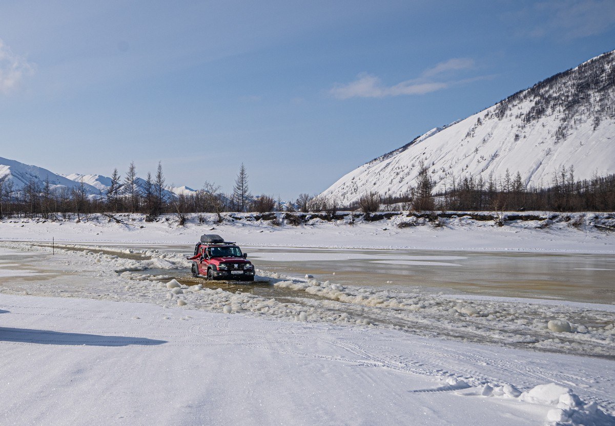
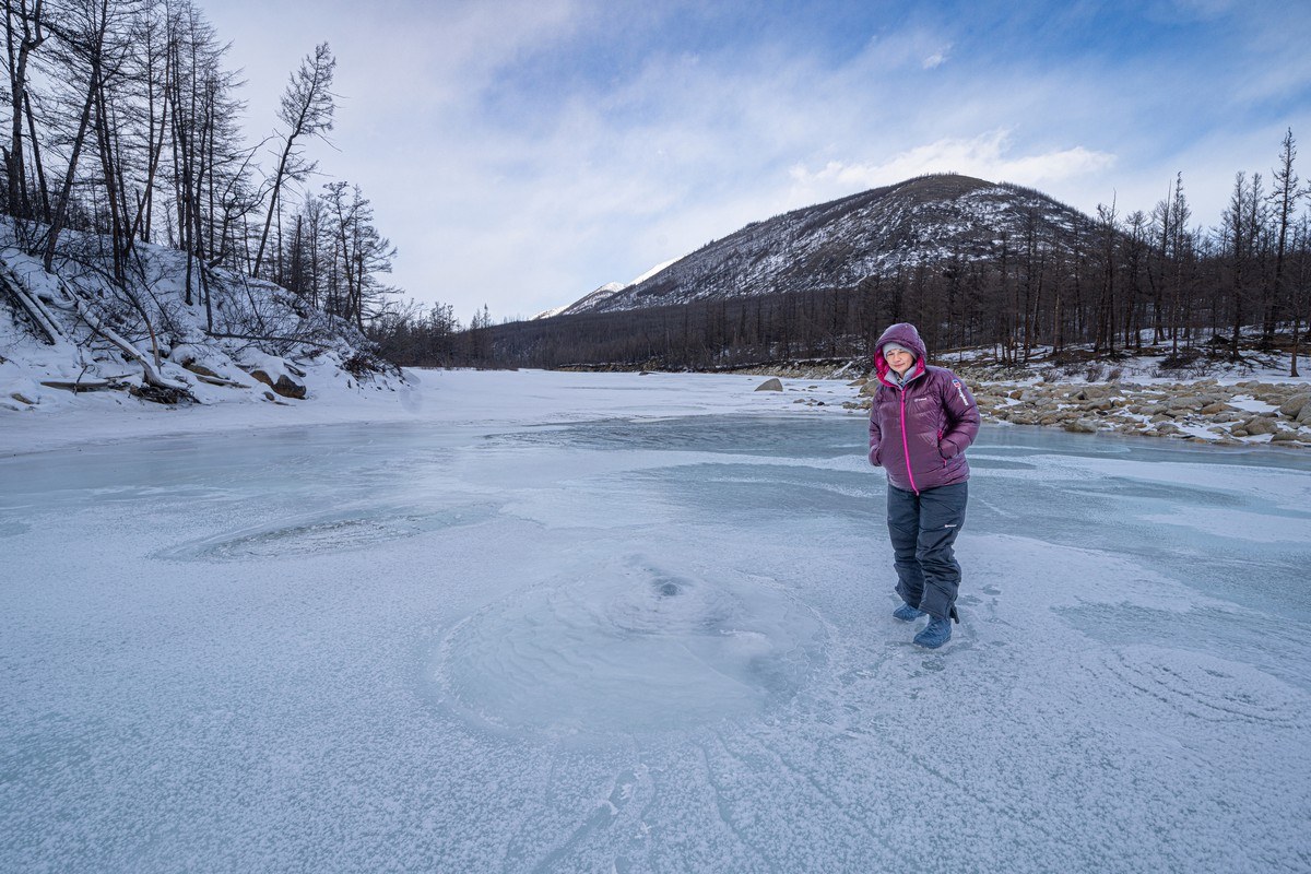
And there we are – standing upon the top thin layer of crunchy ice (fresh naleds), but we weren’t afraid: underneath, the “older” ice is solid right down to the riverbed ->
Driving over the fresh ice is fun – it makes a squishing-crunching sound as you pass over it. Even more fun is walking over it: firstly – because it’s perfectly smooth and slippery; secondly – it also crackles and crunches when you step on it. Here’s Olga finding this out ->
In a car it can be a little unnerving (might we get swallowed up à la victim-trucks?) ->
But we were safe: the naleds here were shallow. They can be of a depth of more than a meter however; that would have been hazardous, naturally…
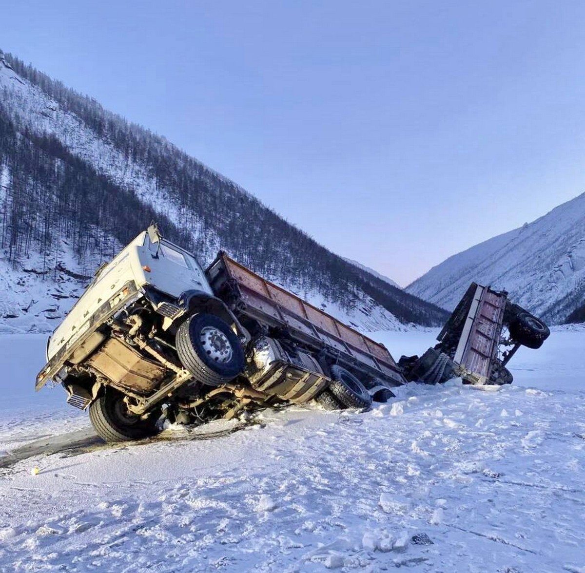
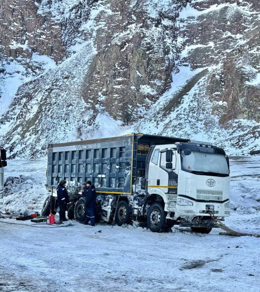
Fresh-naled fun over with – onward we cracked, soon coming across a naled incident: a truck heavily loaded with coal had sunk into one. It had already been carved out; now the damage done was being repaired ->
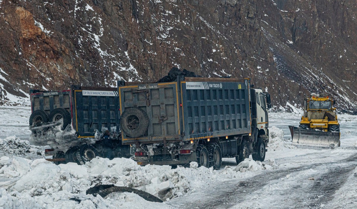
This one might have been the truck that was stranded here two weeks ago:
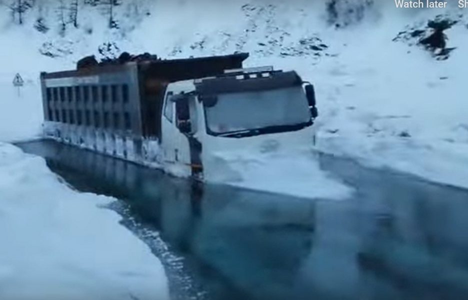
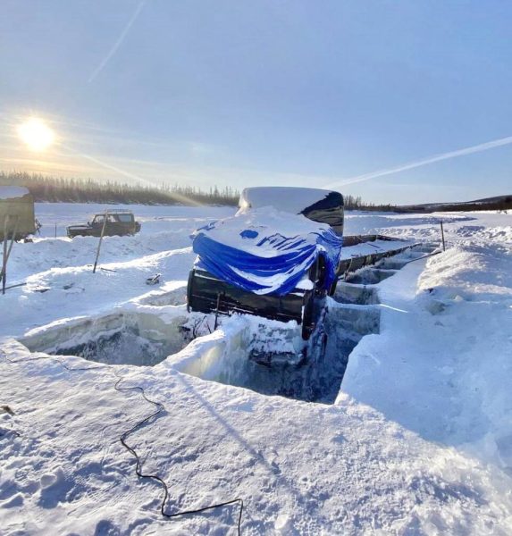
And a few assorted pics of this kind of thing from the internet. Here’s a truck that’s fallen into some “emptiness” ->

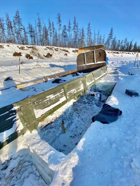
And here are two being cut out of naleds:
And a few videos taken from the net:
So now you understand why we didn’t risk doing the Tube when we were heading north and the naleds were too fresh? ).
So, why do these trucks risk doing the Tube? Why don’t they take the safer detour? Easy: the detour’s much farther to travel, and it also features naleds of its own anyway!
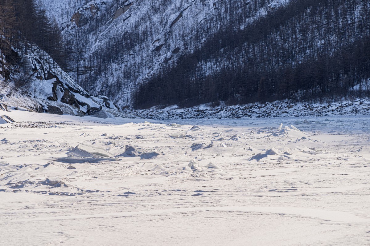
Nearing the end of the Tube, suddenly – globs of ice upon the river’s surface. Were they left over from another ice explosion? Not clear…
Road River sign ) ->
Ice, ice baby:
And that was that – we exited the Tube without incident. Phew…
We spent the night in Khonuu – our second stay there on this expedition.
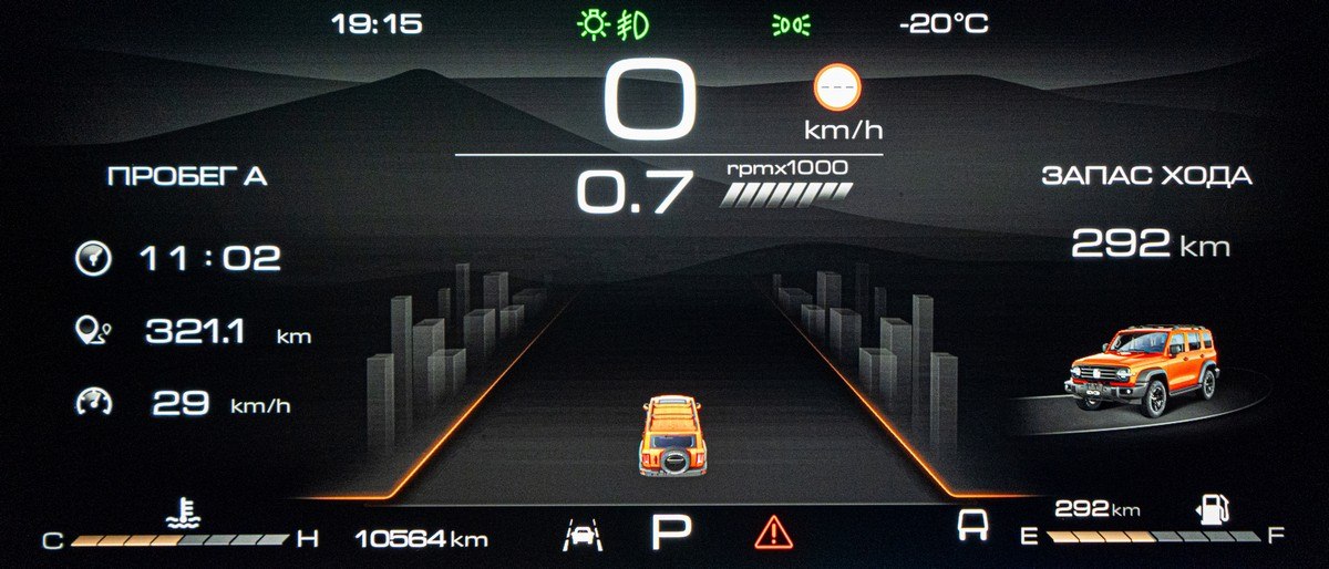
The day’s journey stats:
So what next? Of course – back to Ust-Nera down the Tube! After all (paraphrasing the Japanese saying), who hasn’t done Mount Fuji the Tube is a fool; who’s done it twice is twice the fool!…
Thus, we were up early in Khonuu, had a quick breakfast, and off we popped in the direction of the Tube…
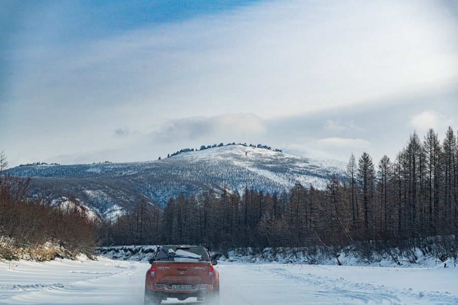
First up – 60km of on-land winter-road ->
…Then came an on-river stretch ->
Over there – the Chersky Range and the Tube ->
It was cold in the morning and the spring water was steaming ->
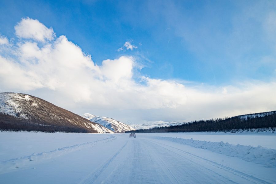
A beautiful day for a beautiful winter-road drive ->
Occasionally we see trucks at the winter-roadside awaiting or being repaired ->
Up ahead – is that snow falling in the distance? ->
Looks like it…
Naleds covering the whole of the surface of the river ->
Almost there…
And here she is (again!) ->
The weather worsened somewhat…
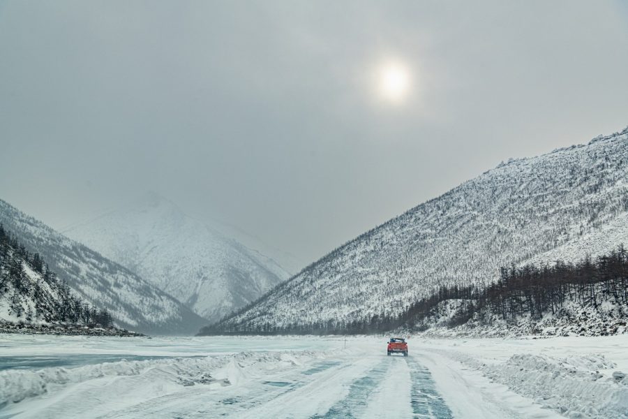
The weather worsened categorically…
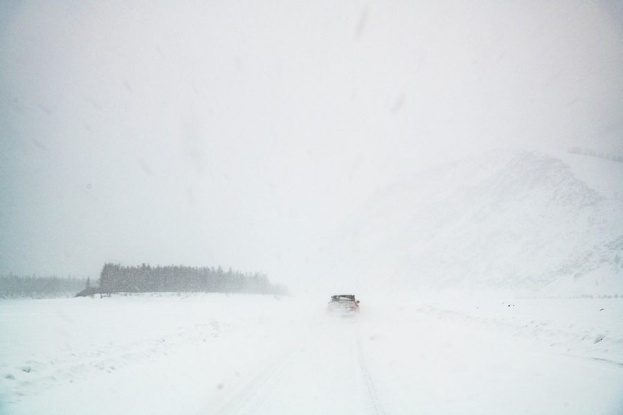
Mercifully – light sunshine at the end of the tunnel snowstorm ->
The rocky outcrops atop the hills all covered in snow:
Almost there…
We make it! Back in Ust-Nera again – for the third time on this expedition! ->
And that was that: the Indigirka Tube – done. Twice ).
…But that still left us with quite a way yet to go until Yakutsk. Which means these here tales from the sub-zero Siberian side aren’t over: more coming soon!…
The rest of the photos from our Yakutsk-Tiksi-Yakutsk expedition are here.

