March 29, 2023
Tokyo–Singapore: out the window – curious aerial views galore.
Today, aviation theme…
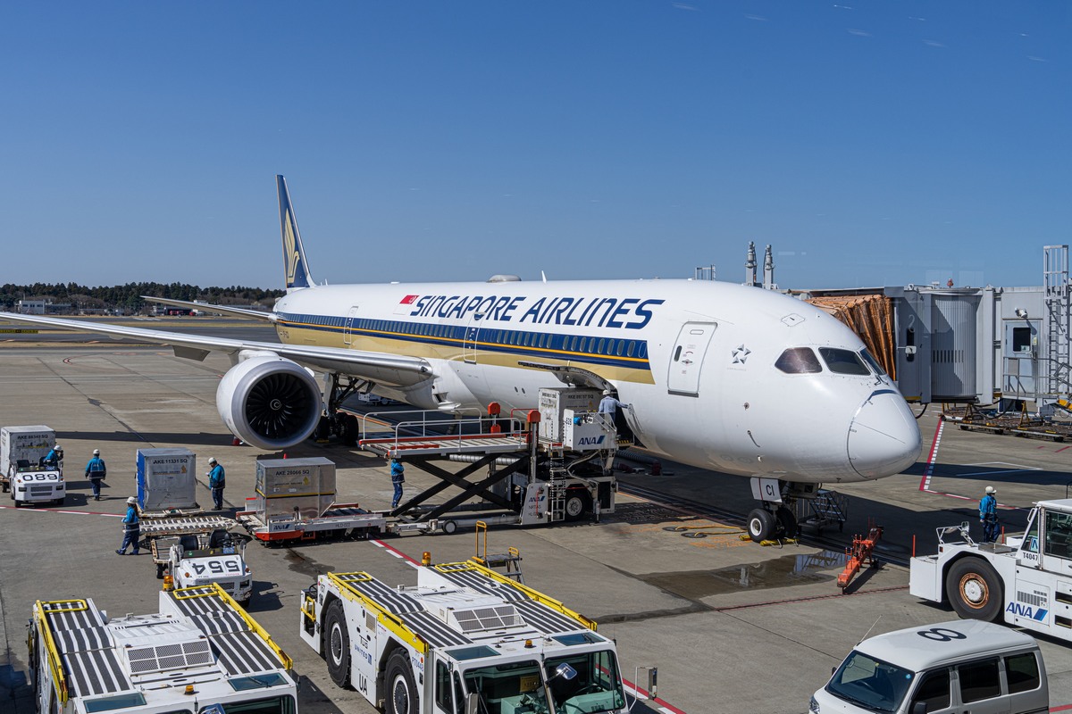
Window-seat air travel can be strange. There you are, ensconced, with plenty of thoughts whirling around in your head, but your brain doesn’t pay any attention to them – it just keeps looking out the window. Then, something aerial-awesome comes into view. Thoughts? What thoughts?! And then the hands reach for the camera almost automatically, and it’s “here we go again!” At least, that’s how things played out recently when flying on the short flight from Tokyo to Singapore, in this here mid-size airliner:
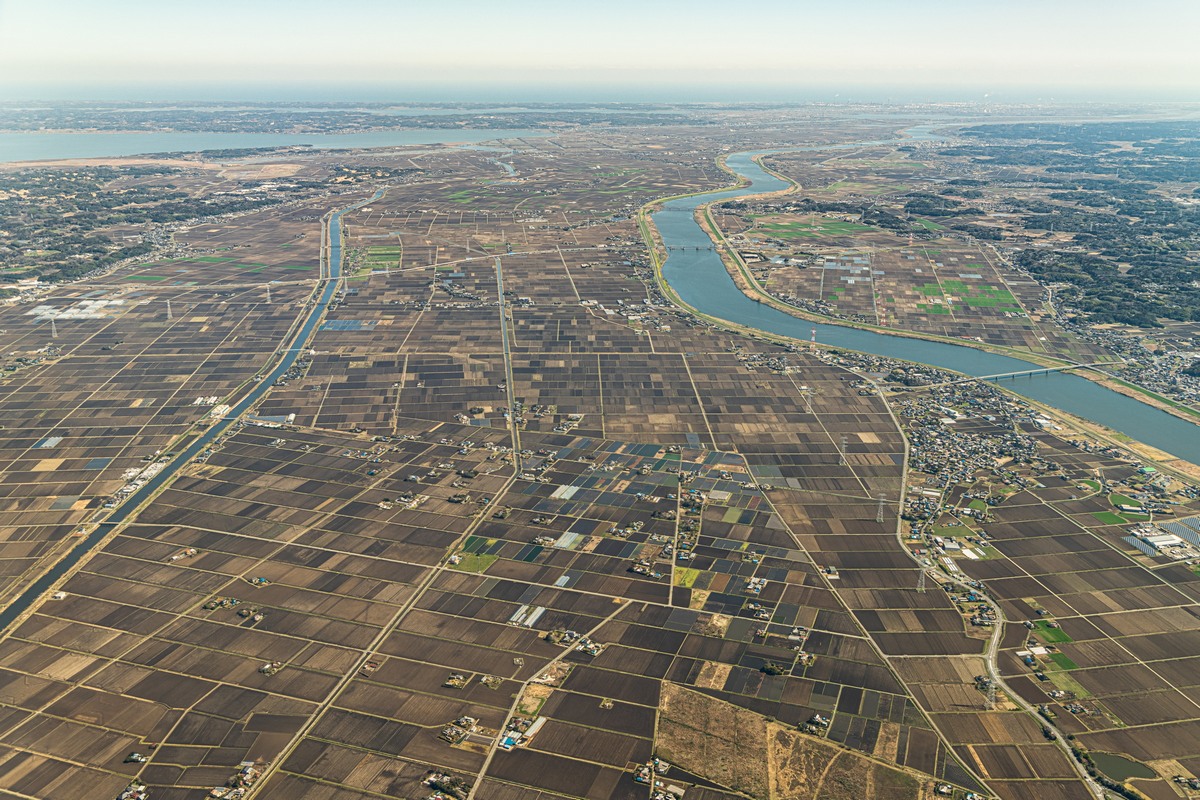
Right from the get-go after take-off the views out the window were fantastic. First up – the Japanese strong work-ethic, preciseness, and space-economy were in full view as far as the eye could see ->
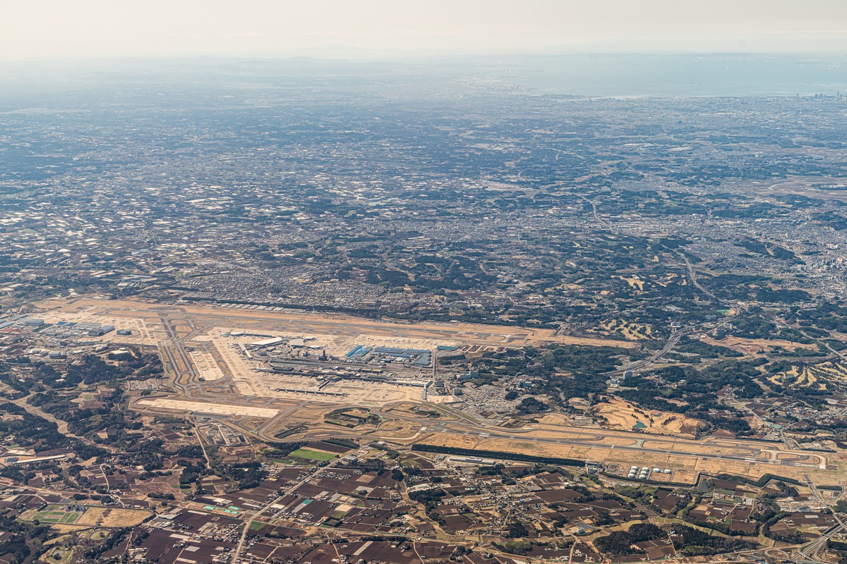
We bank to the right – and there in the distance (top-right in the following pic) is Narita Airport from where we’d just taken off. How did they manage to squeeze it into such a densely-populated area?! ->
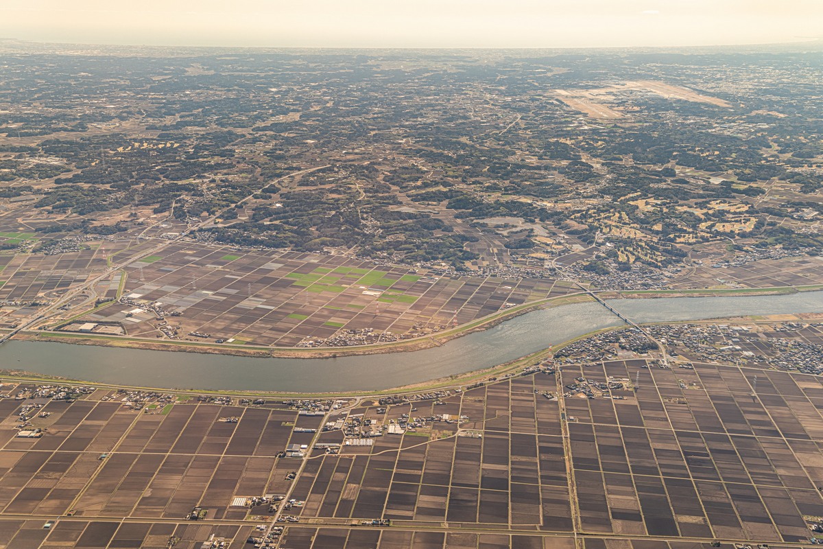
We come full circle – back past Narita, and see how it really is literally squeezed into a developed suburban/agricultural area, which is clearly much older than the airport (built in 1978). They must have cleared plenty of buildings for its construction:
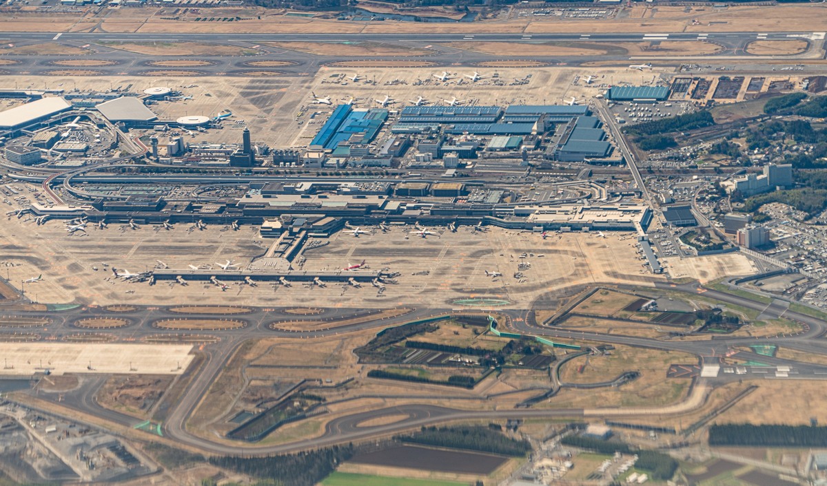
Zoomed in, we can see that there are some private land plots with what look to be farms thereupon within the territory of the airport! And the lanes the planes use for taxiing from runway to apron and back appear to encircle said farms! Apparently the owners refused to sell their land to the airport authority when they were constructing it, so the airport was simply built up around it. I think I can see sound barriers between the properties and the main runways too. But how many of a zillion decibels could they possibly attenuate? And what about all the kerosene fumes all day and night? The mind boggles.
I found this all most curious, so looked up these properties on the airport grounds on Google/Yandex Maps. One of them – just a house it seems (not a farm) – is squeezed in between taxiing-lanes (and they built access lanes to it using tunnels!!) ->
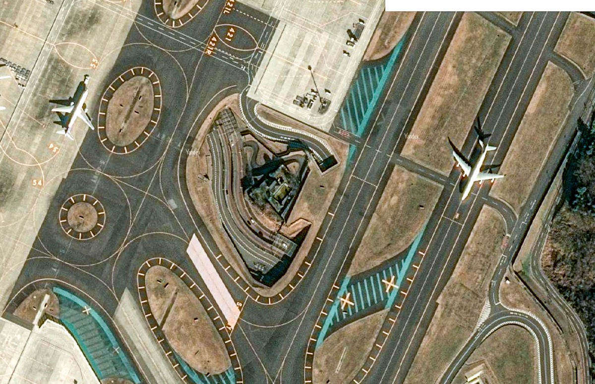
So, there’s farmland with farmhouses, and also just houses (it seems). There’s also a shrine that looks like it was built around!
// The overall aerial view of the airport from much higher up is also worth checking out.
And here’s another nano-plot of land with something non-aviational on it – also with an underground access lane:
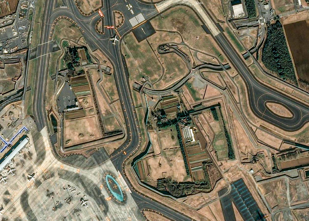
Up to several years ago I remember seeing protest signs hung up on the barriers that surround these in-airport non-airport buildings and plots of land. Yes – nearly 40 years after its construction! But I didn’t see any this time. They’ve finally given up the fight?…
Meanwhile, more extraordinary airport-farmland… “harmony”:


// More on the colorful history of Narita – its construction, protests (and even violence) – can be checked out, for example, on Wikipedia. Curiously there’s nothing there on the private properties that the airport was built up around…
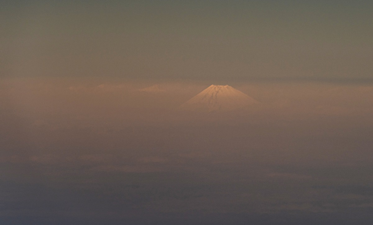
Meanwhile, we’re flying onward – with Mount Fuji (only just) coming into view again as we did ->
Japanese islands! ->
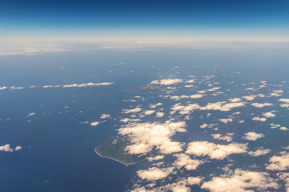
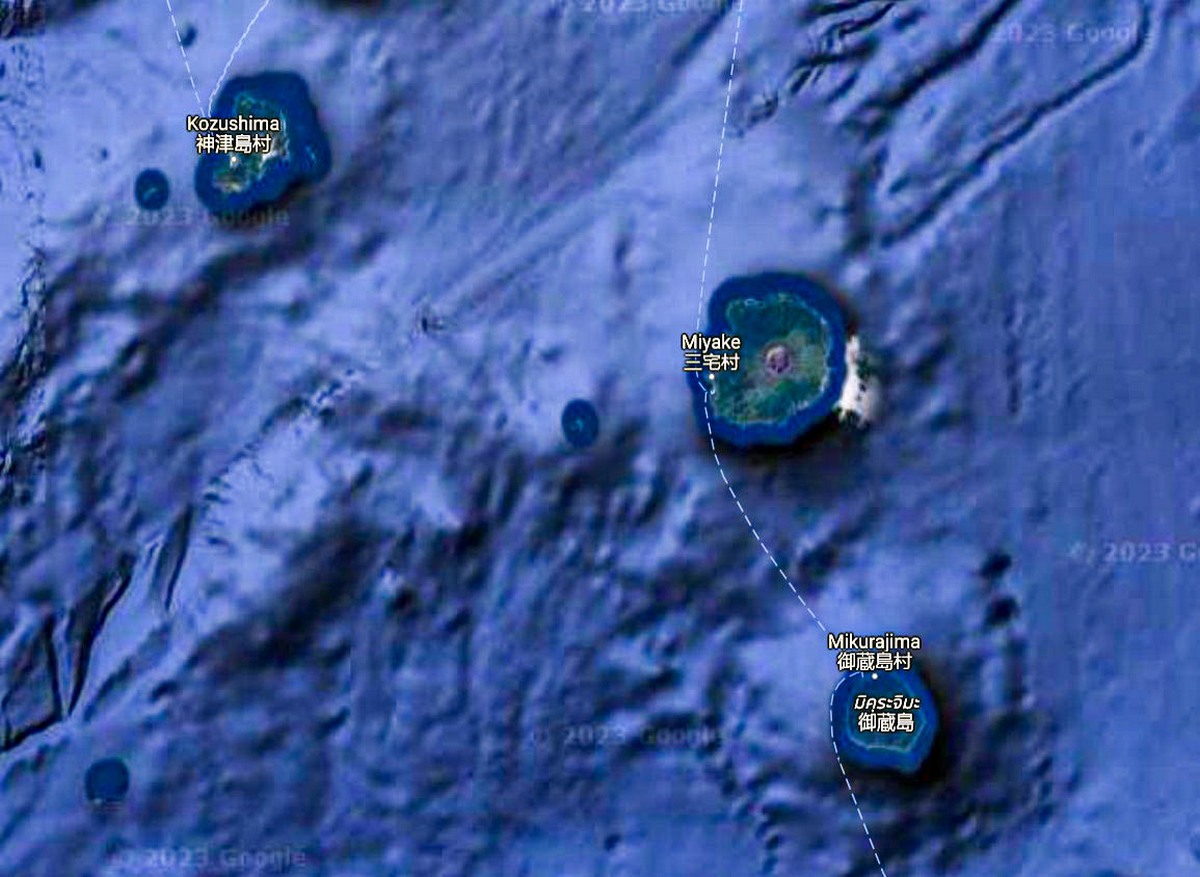
I wonder if the wonderful Aogashima (which I visited in 2015) is in there among them? Turns out – no. Those are two islands name Miyake and Mikura – here:
Aogashima is some 150km further south.
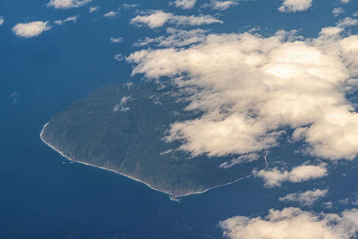
Another island comes into view, but it, too, isn’t Aogashima – it’s Kōzu(-shima) [the shima suffix means island].


Alas, these pics show the last of the clear skies for this journey. It was cloudy and murky the rest of the way to Singapore. But not to worry: once again it was a good opportunity to catch up with emails…
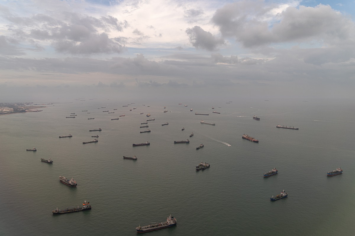
Approaching Singapore! ->