January 20, 2026
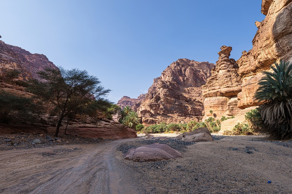
An oasis in the sandy Saudi desert.
Continuing my winter globetrotting tales, today we’re back in Saudi Arabia; specifically – in the mountainous Wadi Al Disah nature reserve…
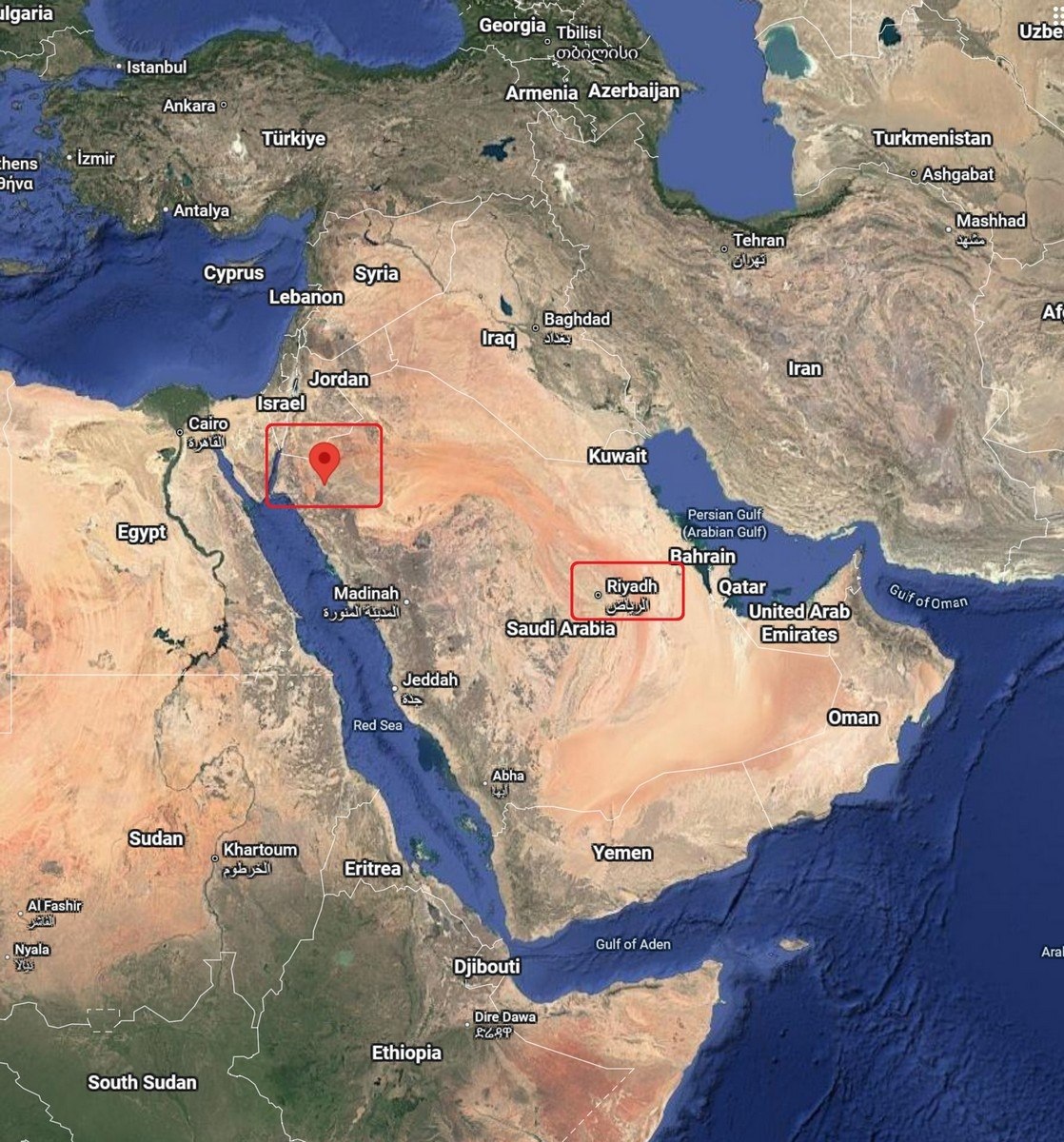
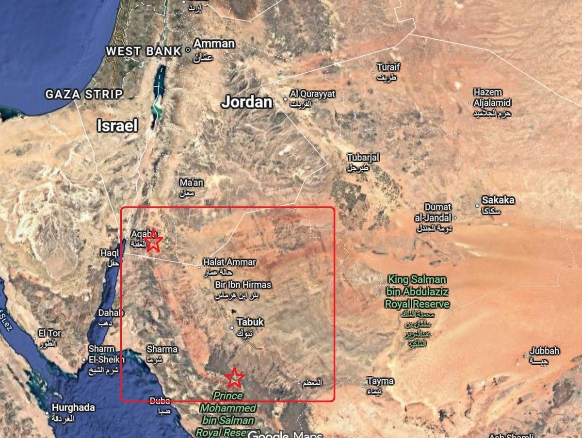
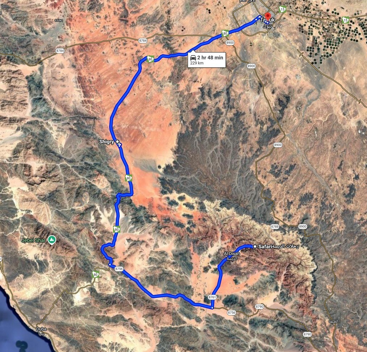
It’s located in the northwest of the country, not far from both the Red Sea and the border with Jordan – here, and here (with Riyadh also marked in red) ->
On the other side of the border in Jordan lies the Wadi Rum desert, which I visited and then wrote about back in November 2022. Since both places are in the same geographical area, the views of Wadi Al Disah are somewhat similar to those of Wadi Rum. // Btw: a wadi (from the Arabic) is a particular type of valley – one that contains water only after heavy rains.
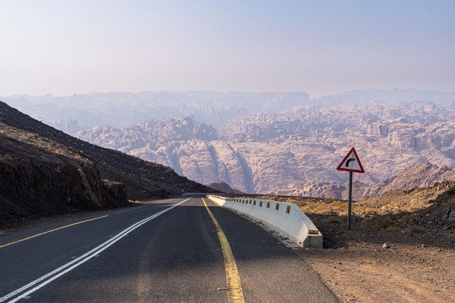
To get here, first you fly to the city of Tabuk from Riyadh (there are quite a few scheduled flights), spend the night there (there are some pretty decent hotels), and then spend the whole day enjoying the wadi scenery. We drove to the northeastern part of the valley:
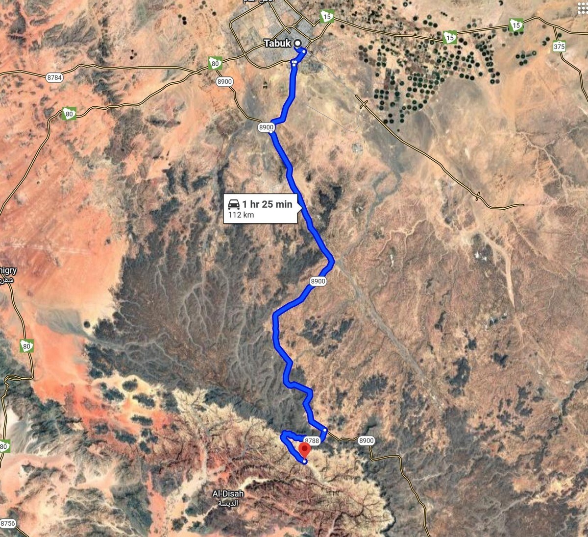
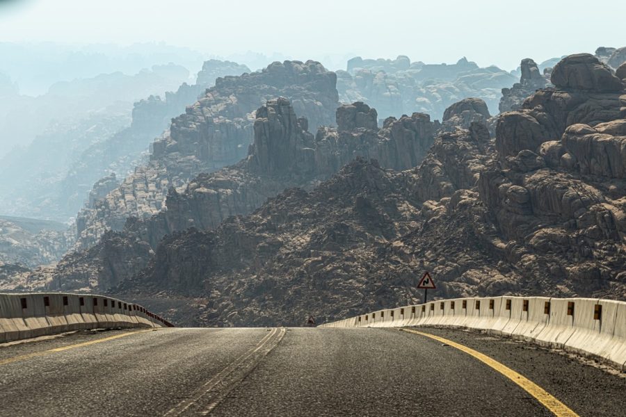
In the evening we returned to Tabuk taking a different road:
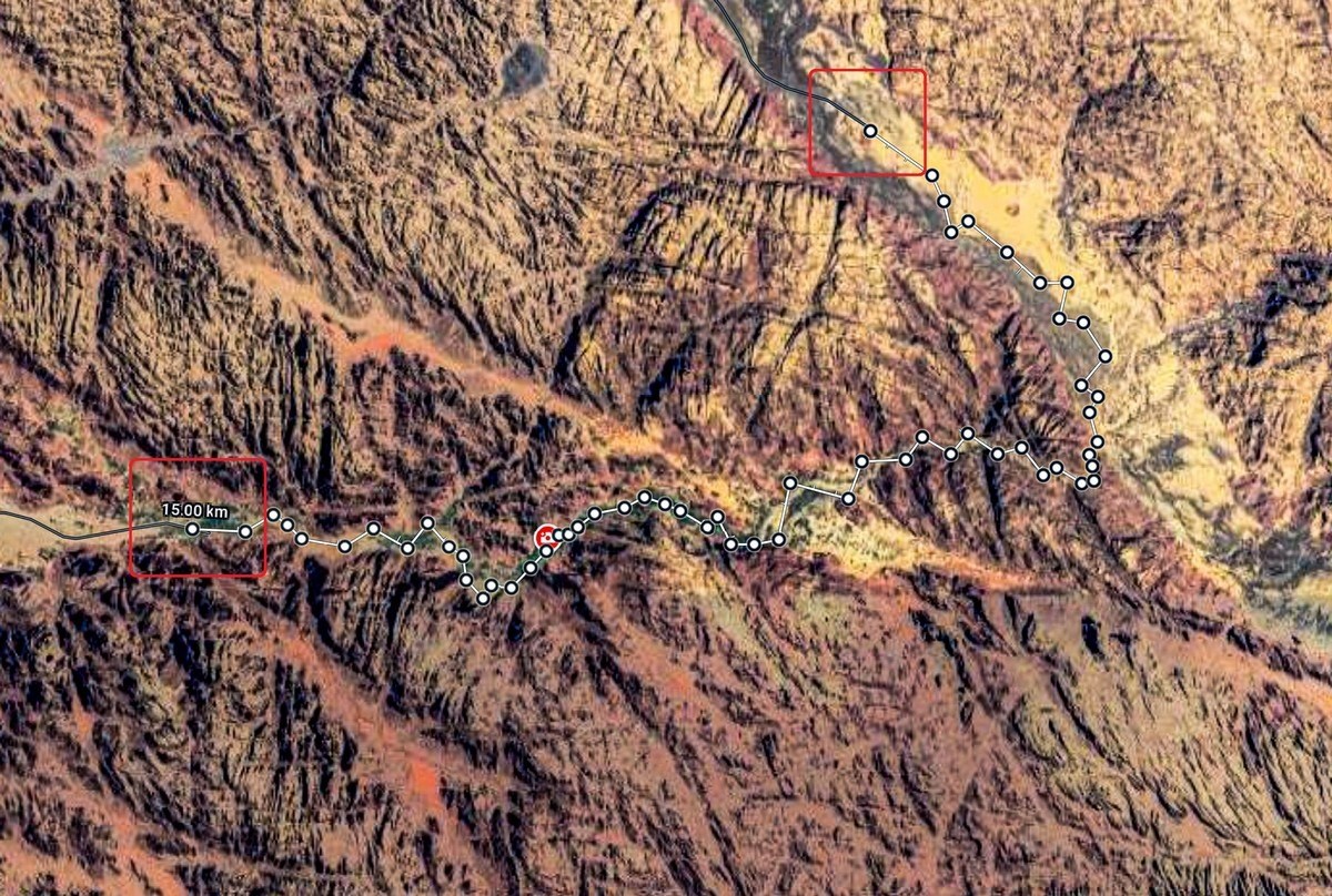
It took us two hours to get there with stops for photo shoots (there’s plenty to photograph), three hours to get back, and we walked (with a one-hour lunch break) for a full six hours, during which we covered a full 15 kilometers.
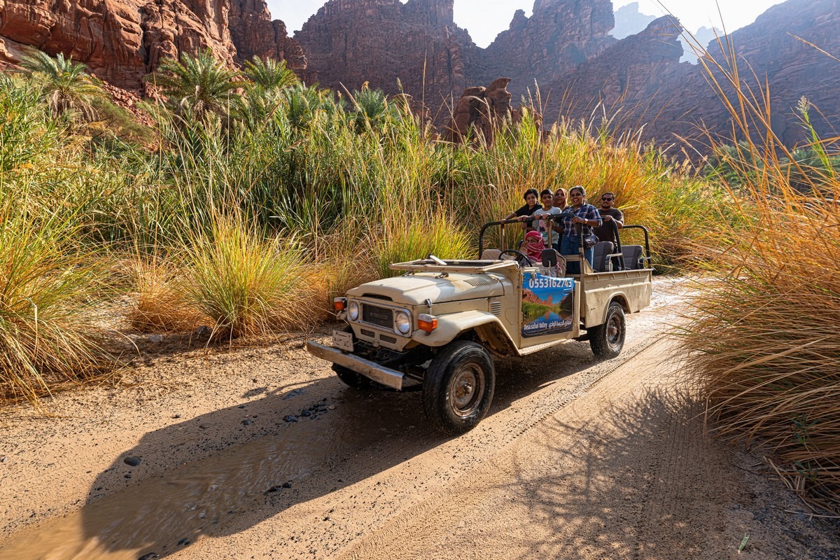
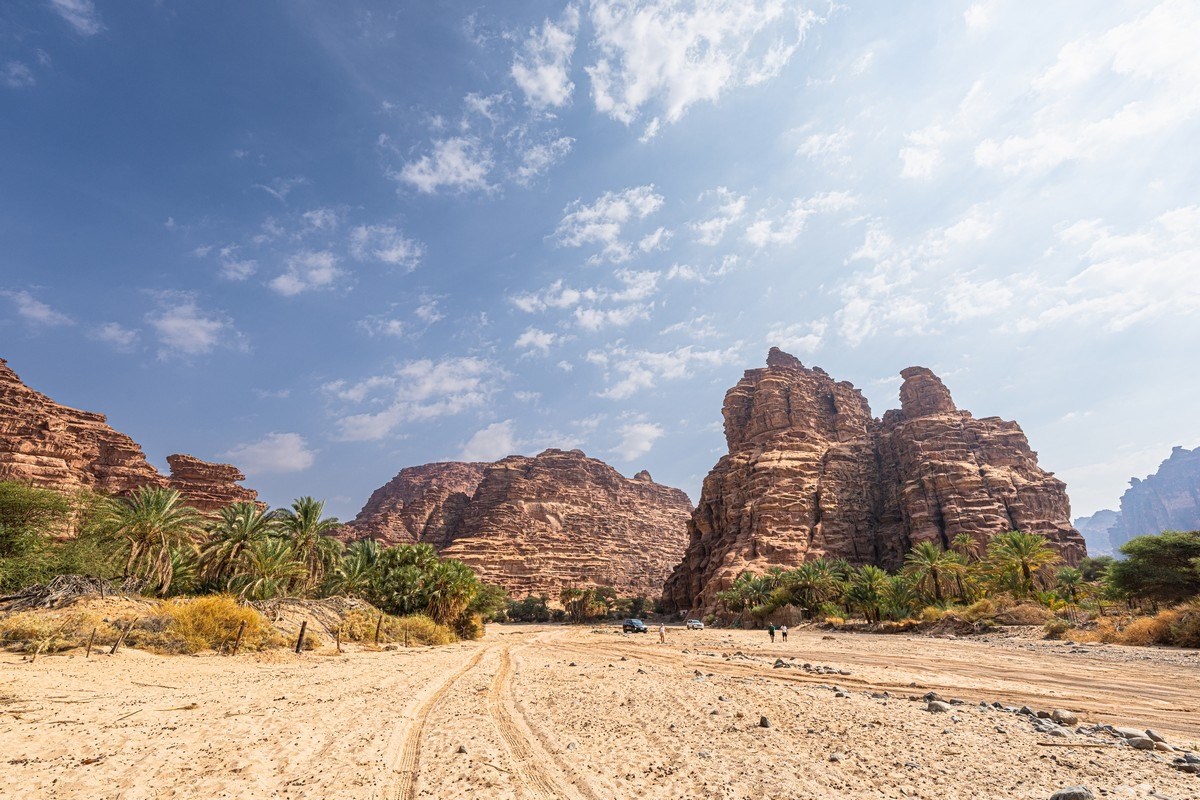
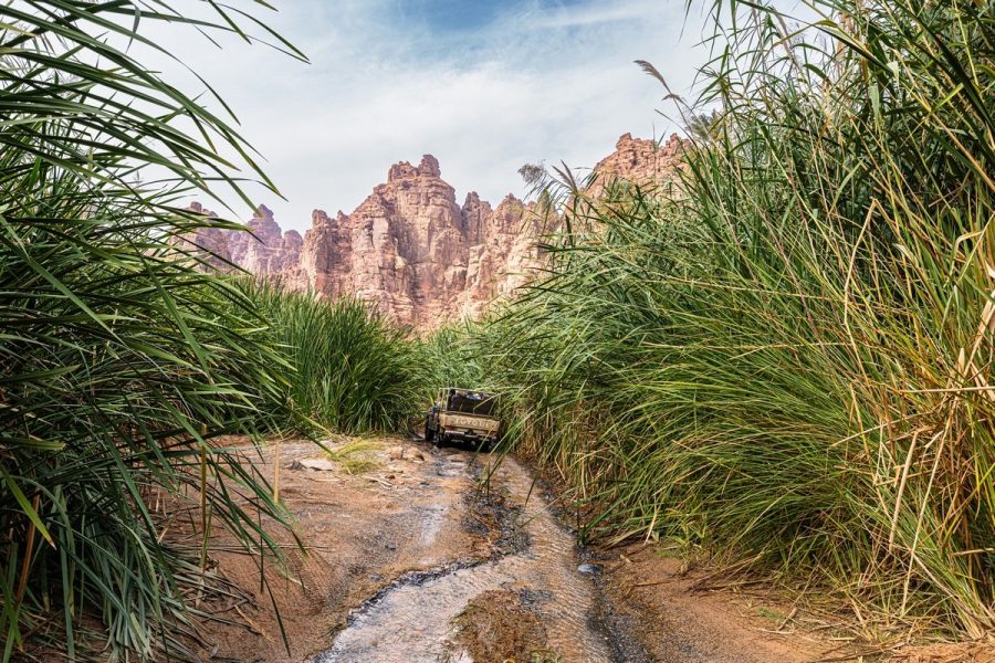
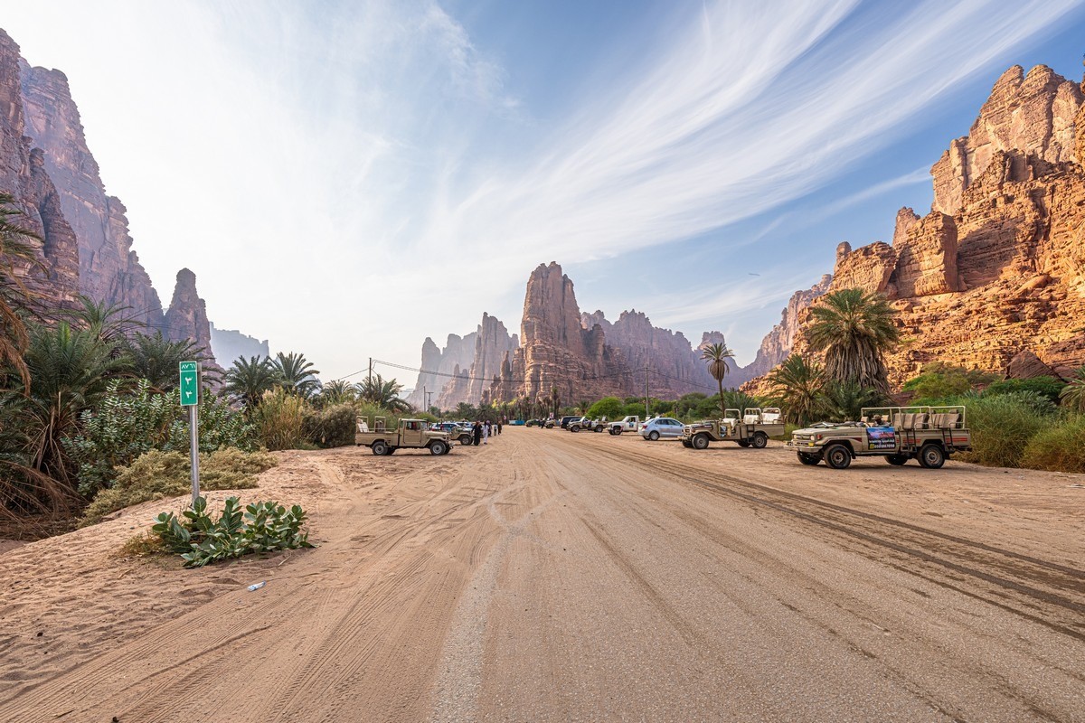
If you’re too lazy to walk the entire route, you can also drive it. You can probably even use your own car (though you’ll need a 4×4 – it’s not smooth everywhere, and the sand gets deep), but if you don’t have one, tourists are taken around in jeeps:
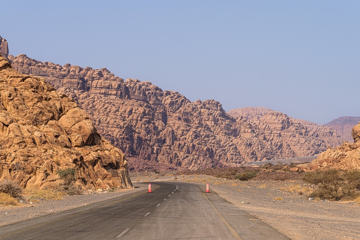
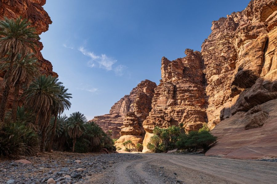
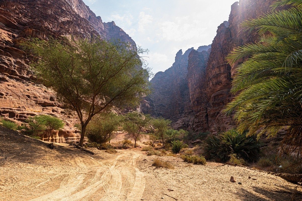
So off we pop to Wadi Al Disah. And the closer you get to it, the more interesting the views from the car become:
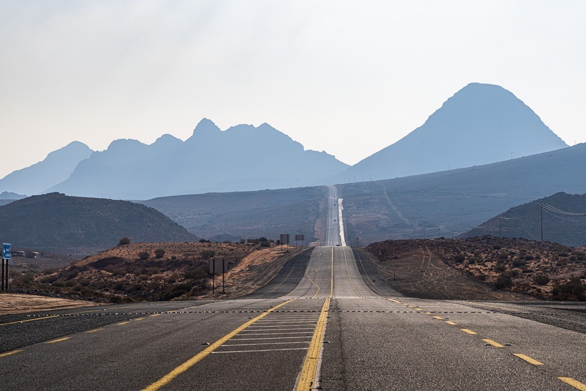
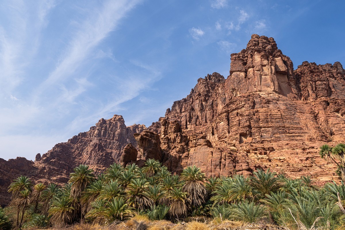
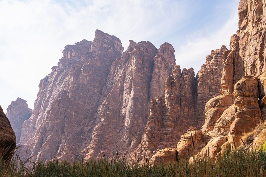
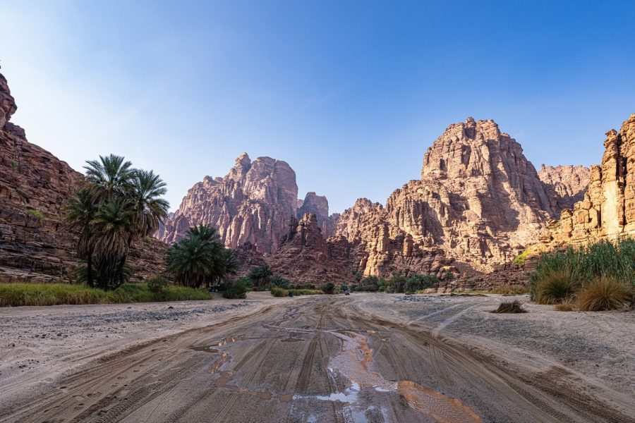
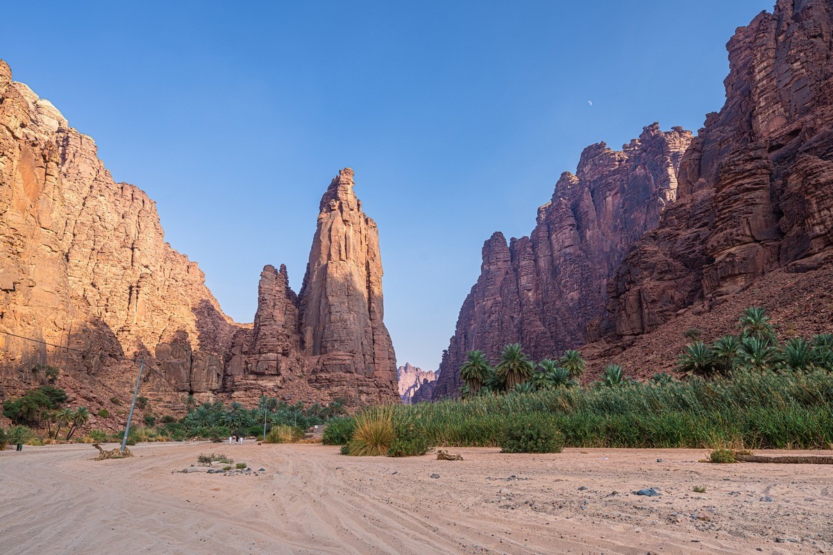
And here’s the mountain massif itself; that’s where we’re heading:
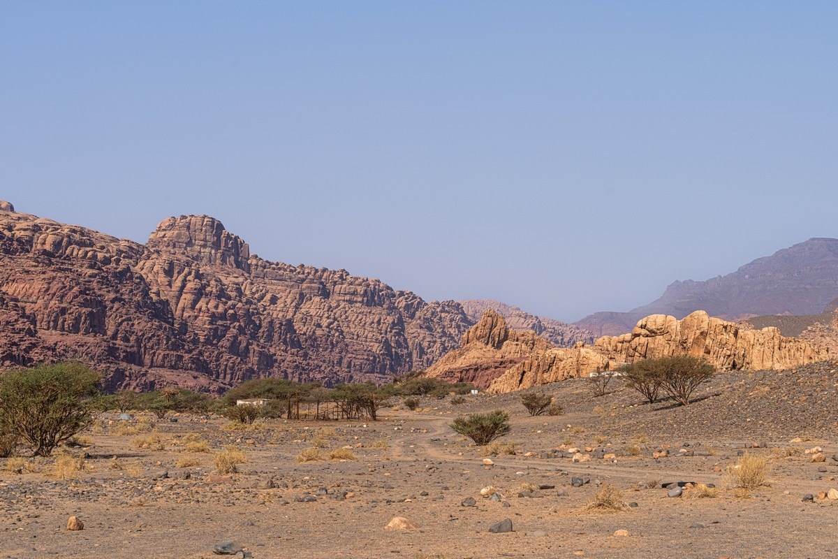
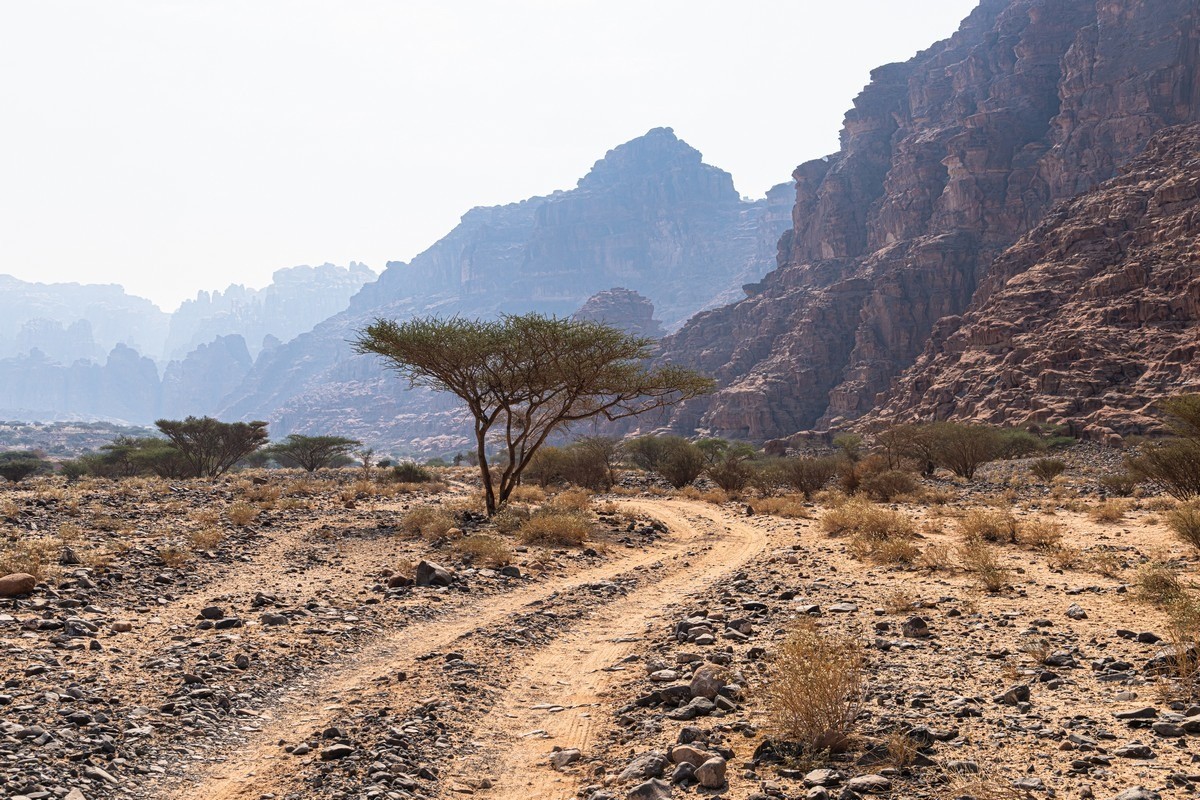
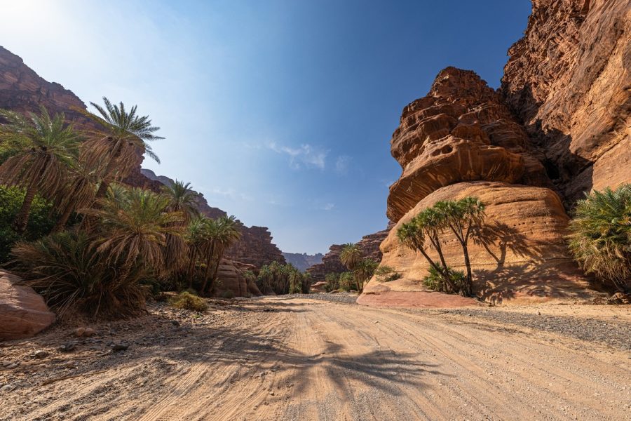
Around here the asphalt ends, and we continued on foot:
The first ~three–four kilometers are a warm-up. The views around aren’t bad, but not the most stunning…
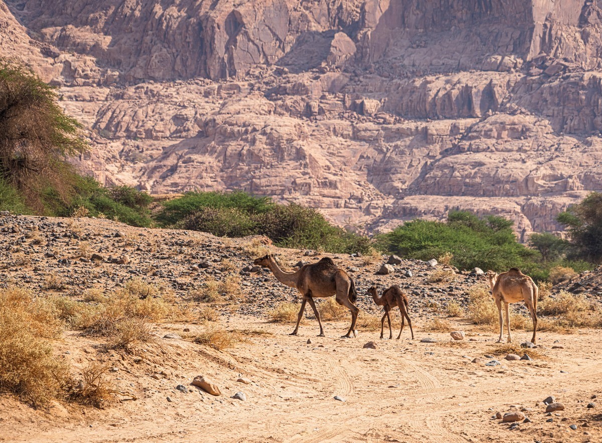
The camels were out for a stroll too:
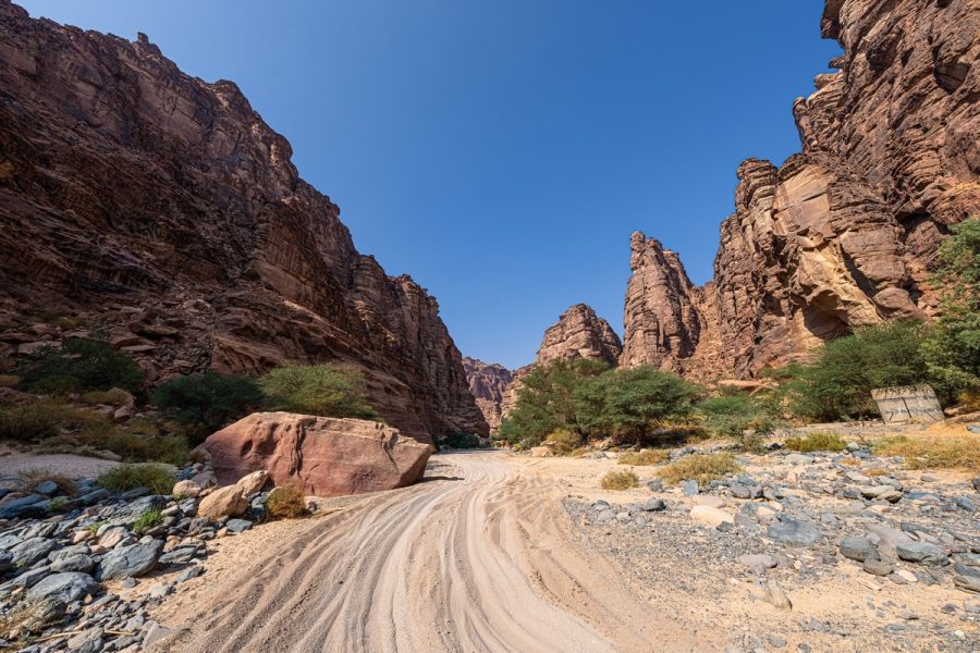
The road’s sandy in places, sometimes stony; the latter’s easier ->
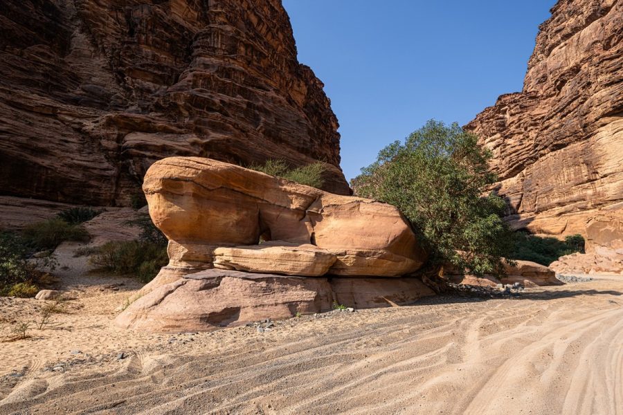
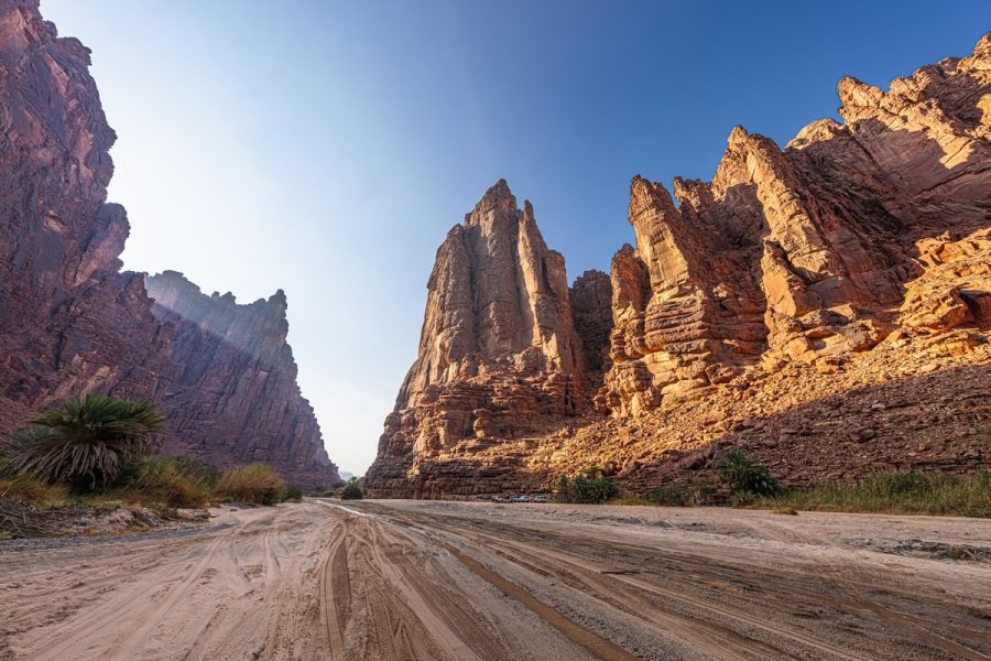
After these rocks we take a right…
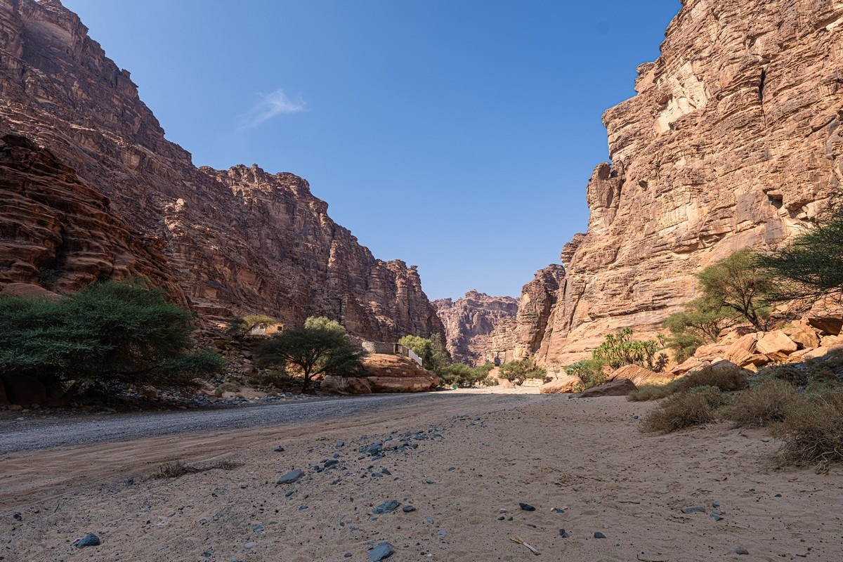
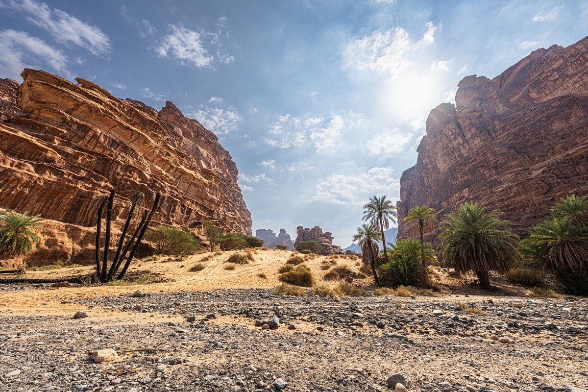
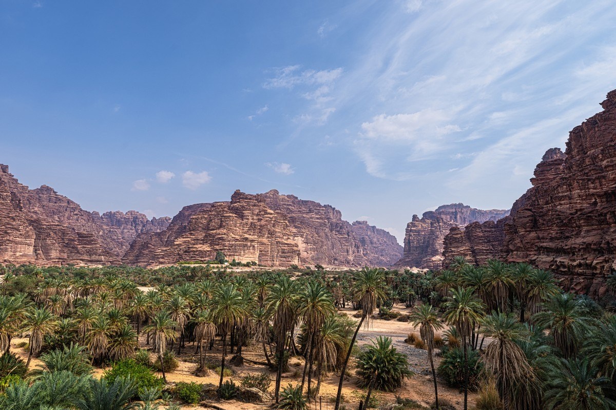
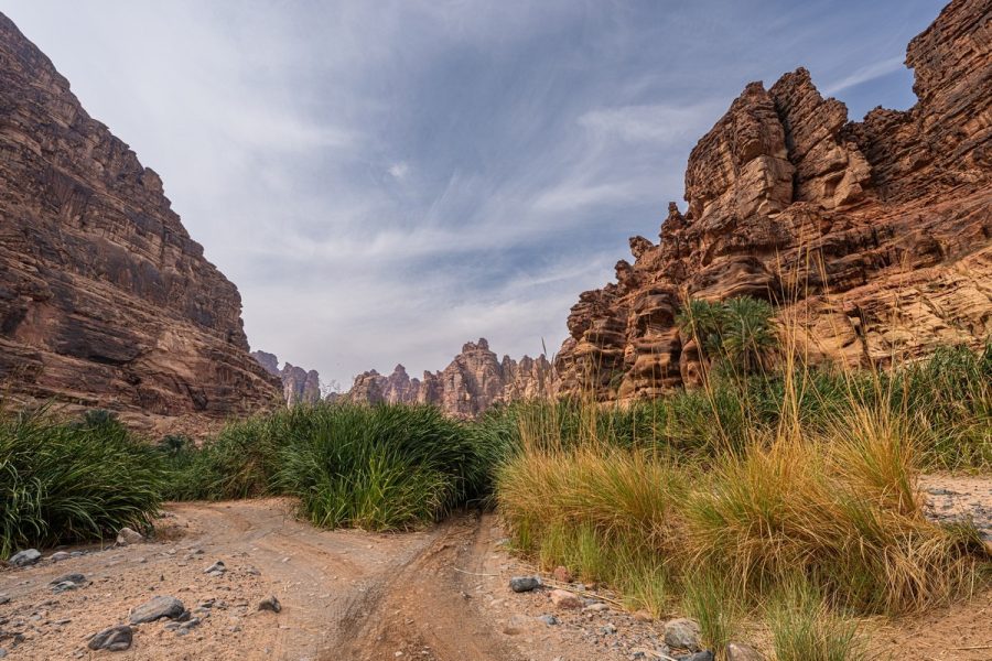
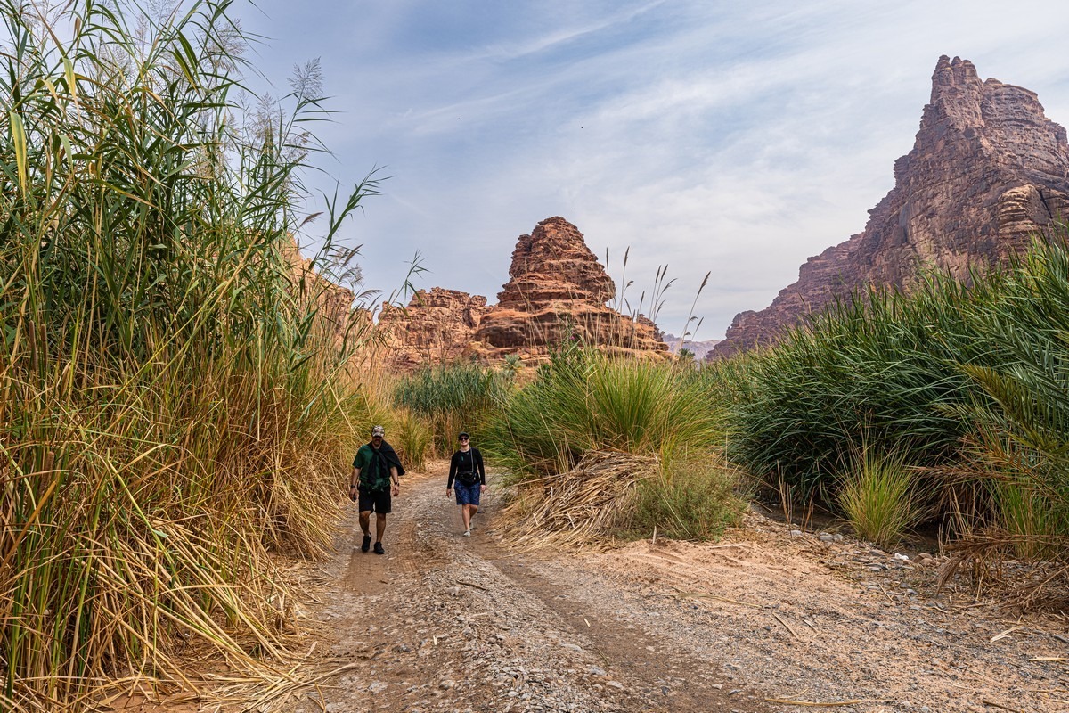
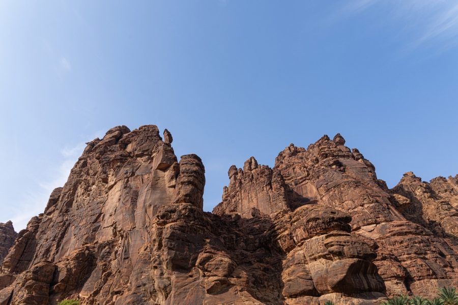
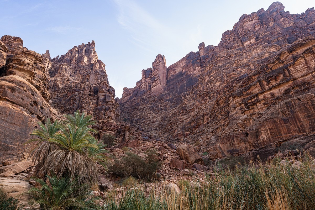
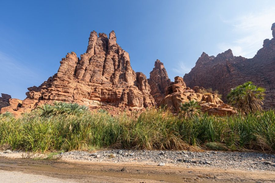
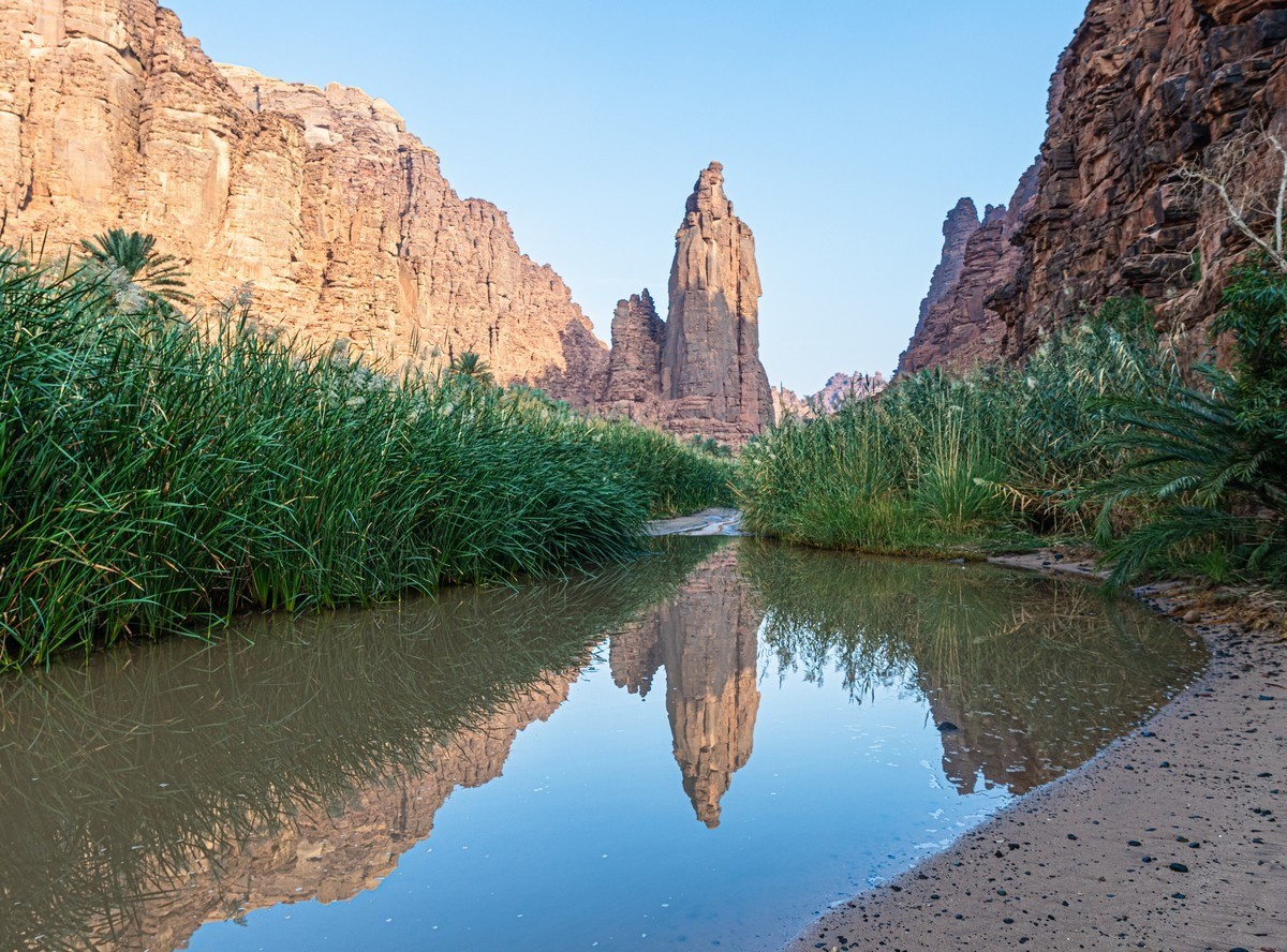
…and there’s the “main course”: a full 12 kilometers or so packed with spectacular views. The only problem – walking on sand isn’t very comfortable: you sink into it. It’s a bit like walking on loose snow…
Actually – it’s not the only problem; there’s also the climate. It’s sharply continental here, with big temperature swings: scorching heat in summer (up 44°C!), and bitterly cold in winter (down to -7°C!). The weather’s comfortable for hiking only in November and early December and in March and early April.
From here on – just photos. Lots of photos. Comments superfluous…

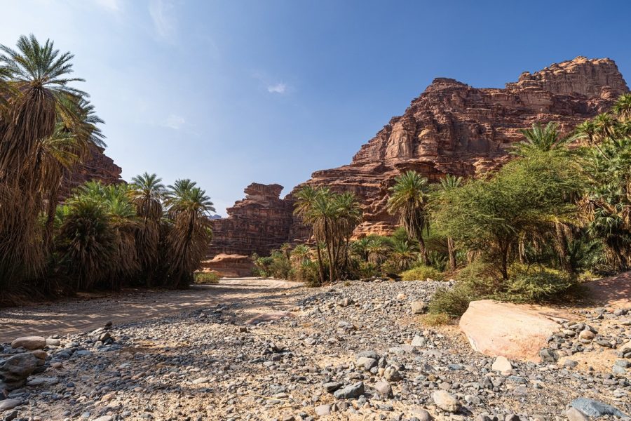
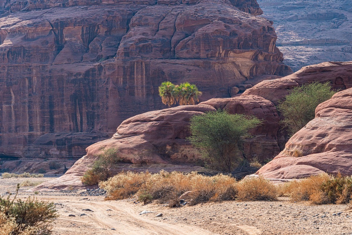
And this beauty goes on for almost 12 kilometers. But you have to walk them… which we did since we’re contemplative tourists. And such beauty has to be contemplated unhurriedly.
A side canyon. Down we popped… But it was a dead end. And with traces of barbecues, which are forbidden here :0)
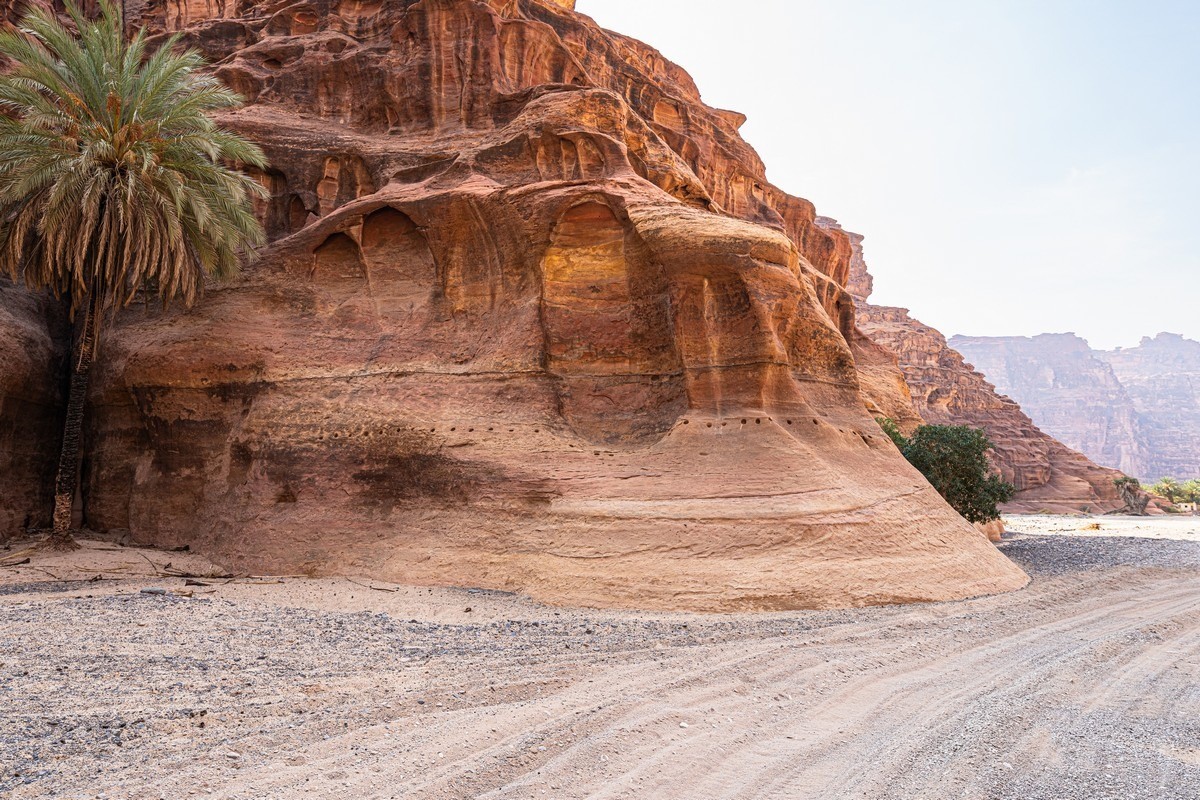
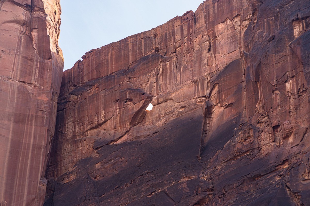
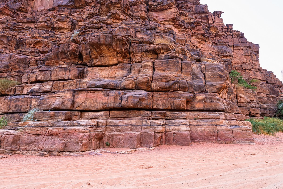
Notice how the lower part of the rock, up to a few meters from the ground, looks as if it’s been sanded down and polished, while above that the rock is rough. This means that water flows of that depth and strength pass through here. Impressive. When? The rainy season here is apparently December–January.
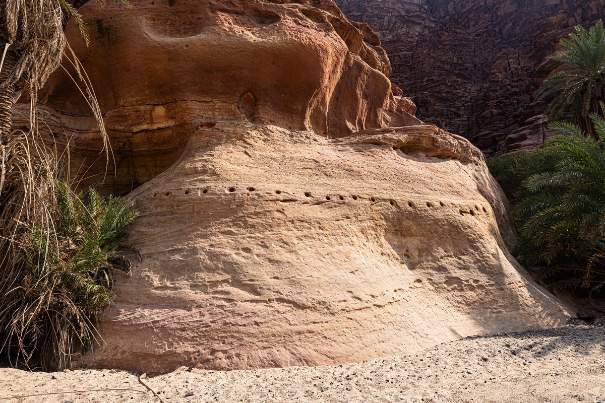
The mysterious holes more or less at the same level as the waterline apparently were made by Saudi Aramco. But what’s oil got to do with this place? Unclear and mysterious…
Another side-valley opened up… but unfortunately we had no time. And you can’t even launch a drone – they’re totally banned here.
So we just kept walking and enjoying the scenery:
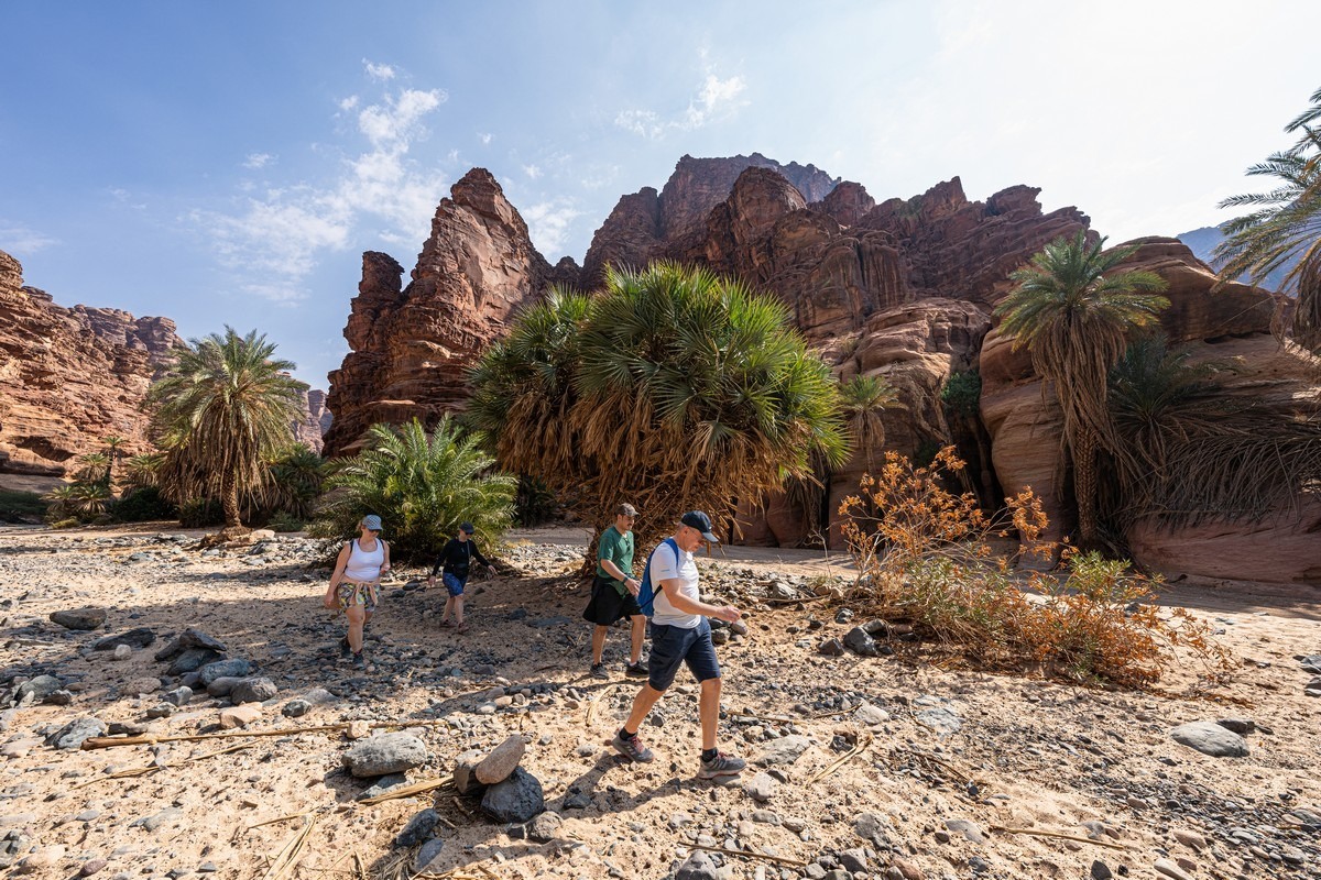
What was interesting is that we were almost completely alone. Now and then some locals drive by, occasionally a cart with tourists – and that’s it. No one else, despite it being a day-off (Friday’s the weekend here).
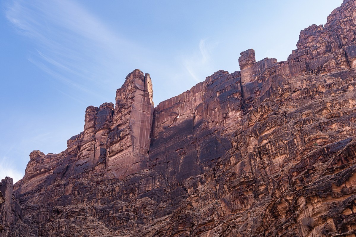
You can climb up onto a rock – and the view’s fantastic:
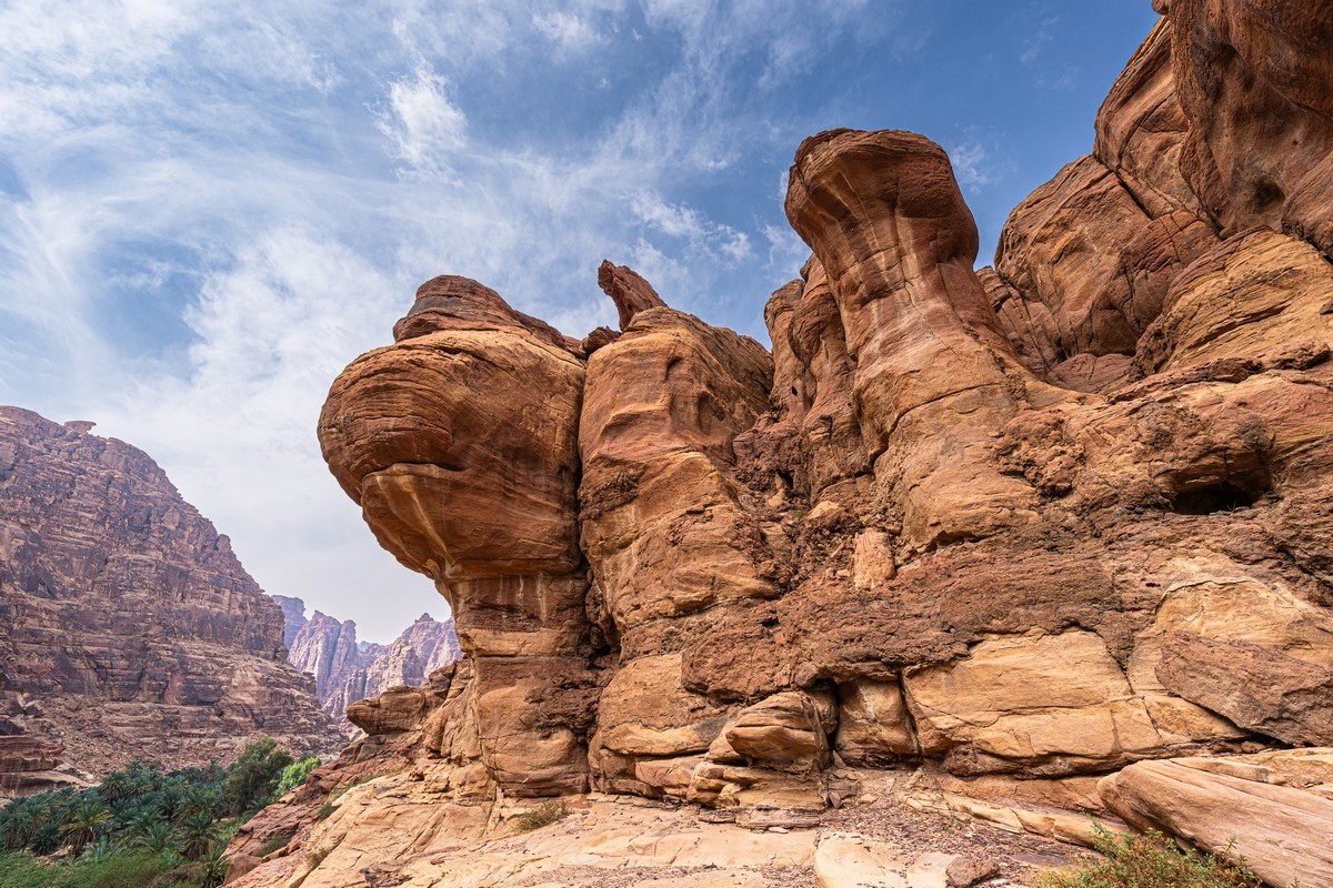
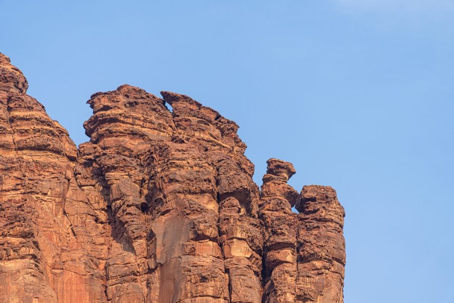
These stone formations look like some kind of aliens…
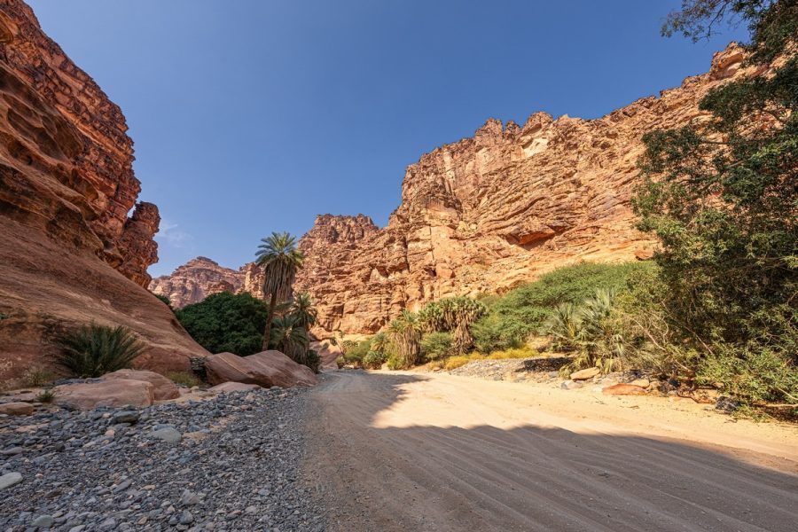
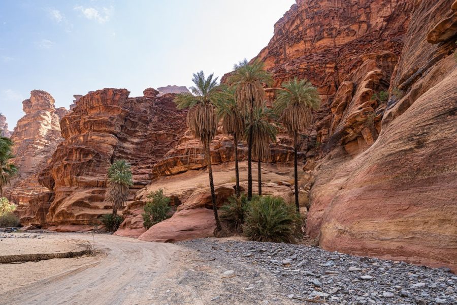
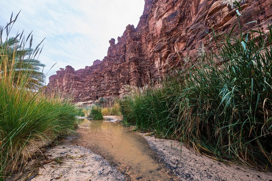
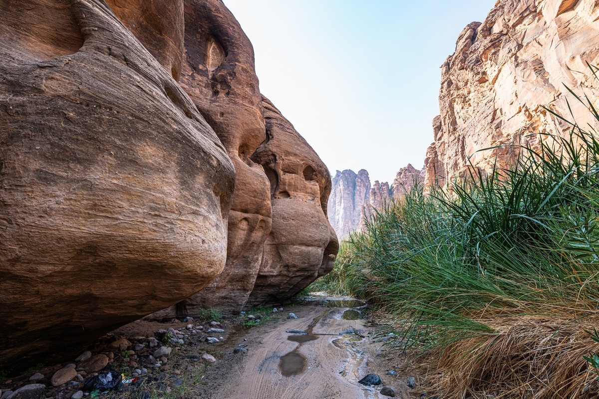
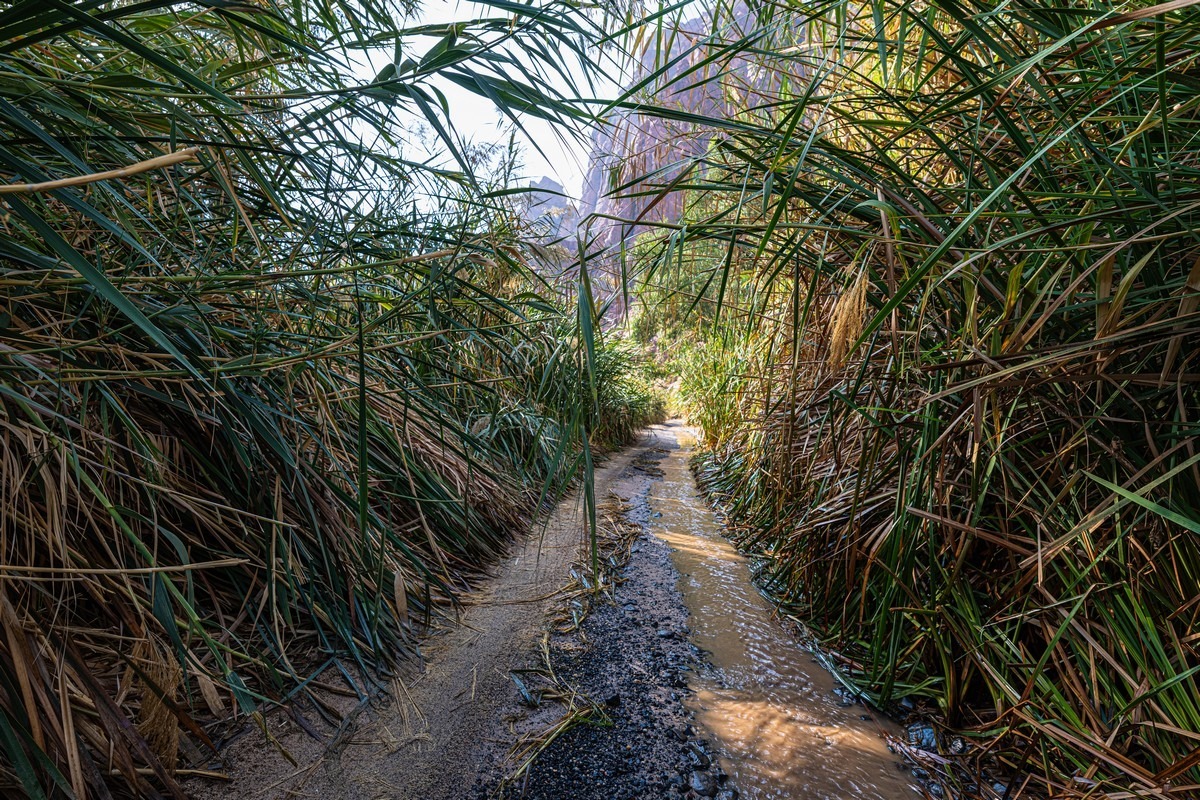
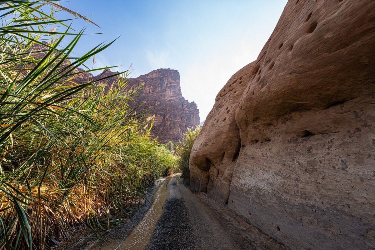
Suddenly – reeds. How’s that?..
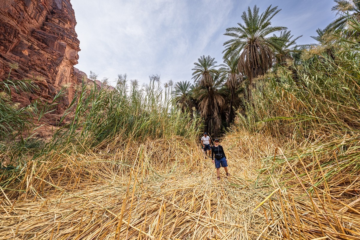
Very simple. Roughly in the middle of the hiking route, water starts seeping up through the sand – and from this point onward the road, which hugs the banks of a stream, is very damp.

The road sometimes cuts through thickets like this:
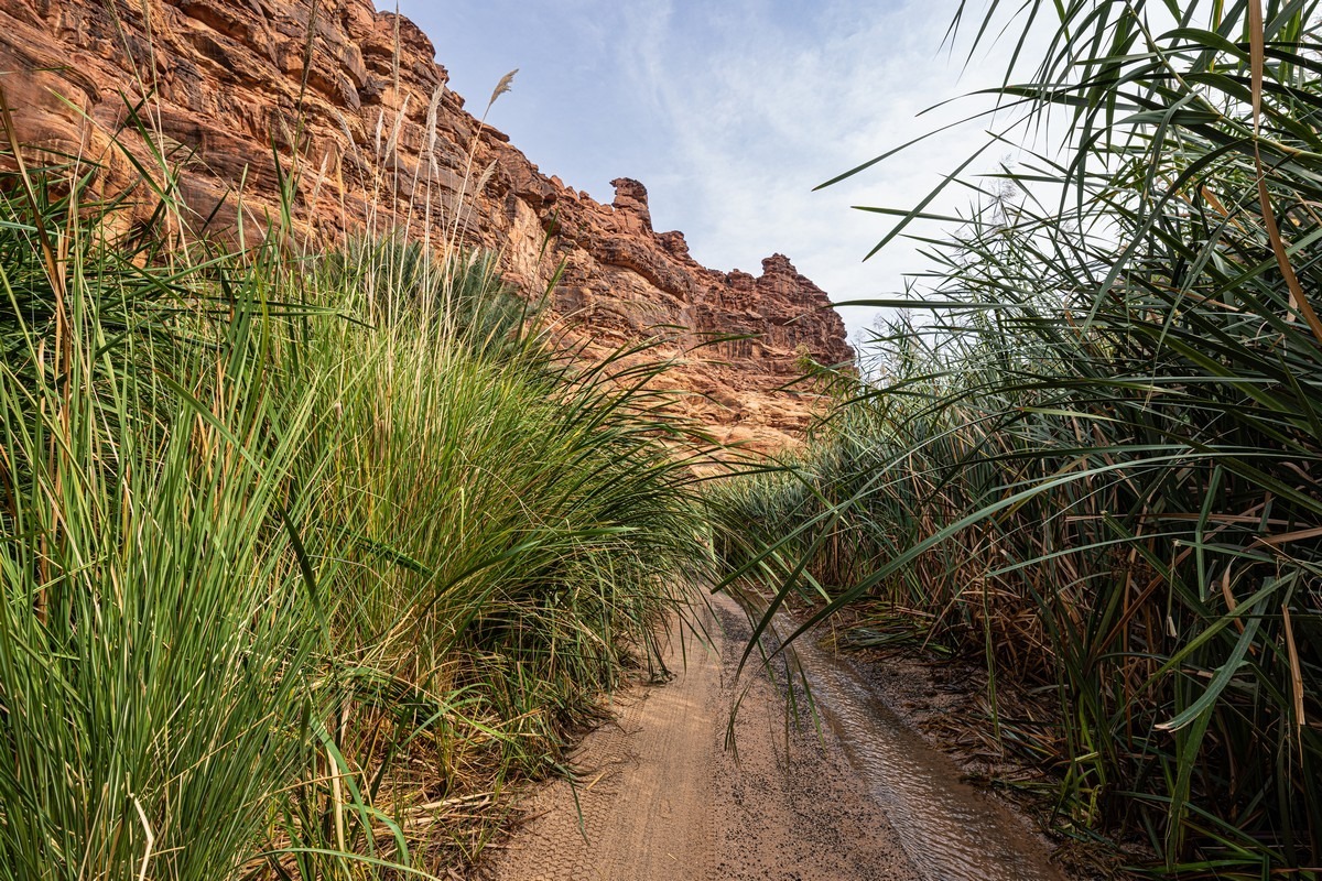
Straight or left? If you go straight, you can have trouble passing oncoming cars (if any appear):
Did we see any other hikers? No. Not one. Everyone else was traveling by car.
But we’d been walking for a long time already – it was time for lunch. And here, suddenly, a grand banquet-picnic appeared out of the bushes! ->
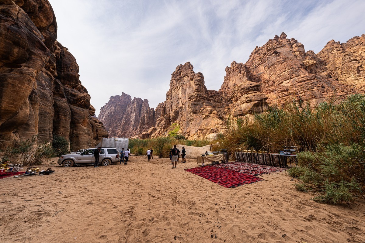
Yes, our hosts made a real special effort; there wasn’t just one chef, but apparently two – and then there were sous-chefs! All in all, the picnic was a roaring gastronomic delight. Delicious. Oh my gorgeous gorging – in a gorge :) ->
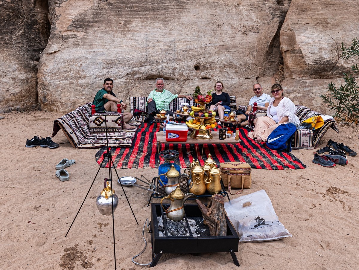
And the views from the lunch table weren’t bad either:
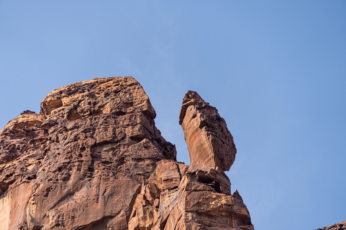
A seemingly teetering rock – it’ll probably stay there until the next strong earthquake:
But it was time to move on:
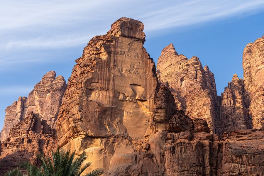
You can look at these rock formations forever – they’re all different.
But for some reason we didn’t find a single arch – while in neighboring Wadi Rum there are quite a few of them…
Although if you look closely, you can spot a hole in the rock:
And on we go through the Saudi “jungle”:
Once again, note how the rock walls are polished – obviously by water flows. That tells you what kind of flash floods sometimes occur here.
And various other views:
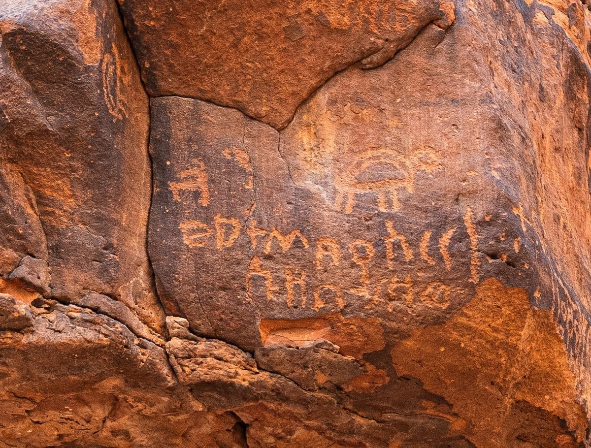
On this rock wall there are petroglyphs:
Depictions of camels scratched into the rock. I wonder how old they are…
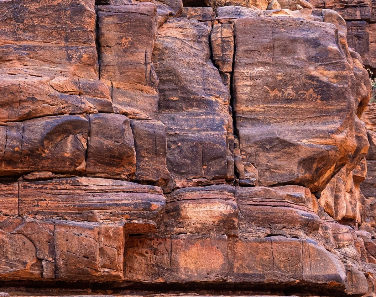
Tortoises? Greek?! ->
Suddenly the stream disappeared somewhere into the sand, and once again we were trudging across dry, sticky sand…
But luckily we didn’t have to slog like that for long – after about a kilometer the water reappeared on the surface.
We’re almost at the finish line now:

And that’s it! Parking lot. The 15km trek is behind us: the Wadi Al Disah walk: done!
And I highly recommend it to all of you!…
The best, hi-res photos from Wadi Al Disah are here.

