April 1, 2025
Down Bolivia’s Death Road on bikes – in a word: yikes!
Next up on our LatAm-2025 trip, not far from Bolivia’s de facto capital, La Paz, there’s the unique tourist attraction known as Death Road. It’s around a 30-kilometer stretch of the “Old Death Road” (I’ll explain why it’s called that later) that runs through extremely dangerous yet breathtakingly beautiful mountains. And we were going to experience it on bicycles. And I reckon it’s worth flying to La Paz just for this bike ride alone…
Briefly – an overview…
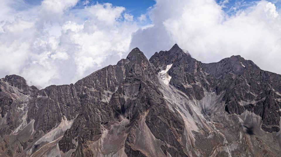
First, I repeat, it’s breathtakingly beautiful:
Second, just looking at these cliffs is pretty terrifying in places. And riding bikes here… pure adrenaline! So much better than being in a car :)…
Third, it’s all about the bikes! ->
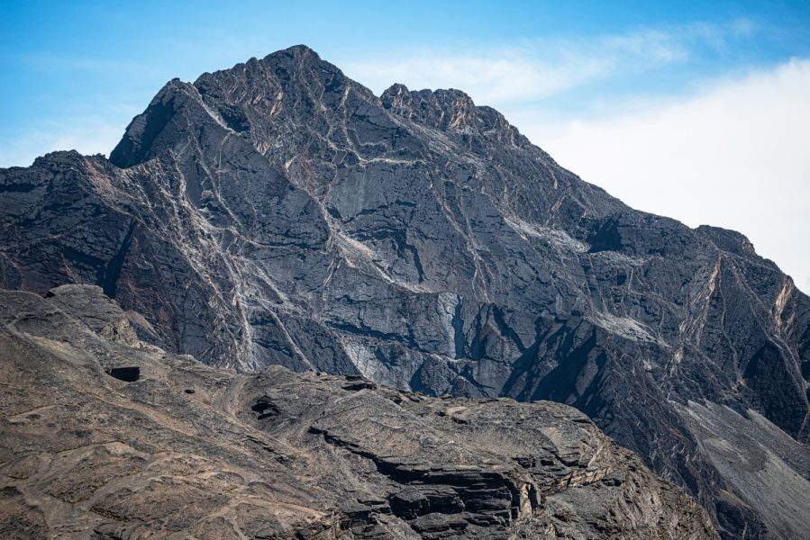
Fourth, some spots here are just incredibly unusual:
Fifth, practically the entire road (except for a couple of short sections) is exclusively downhill (in one direction – the one we were going in:) ->
It’s tricky and hairy in places, but even hairy (green) bears can manage it! ->
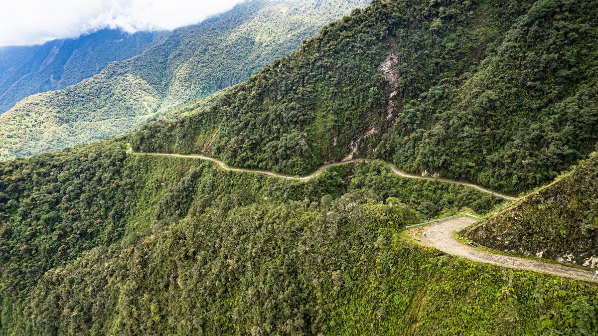
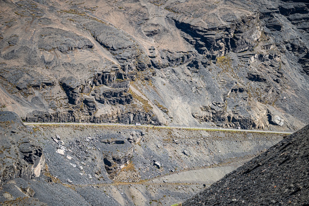
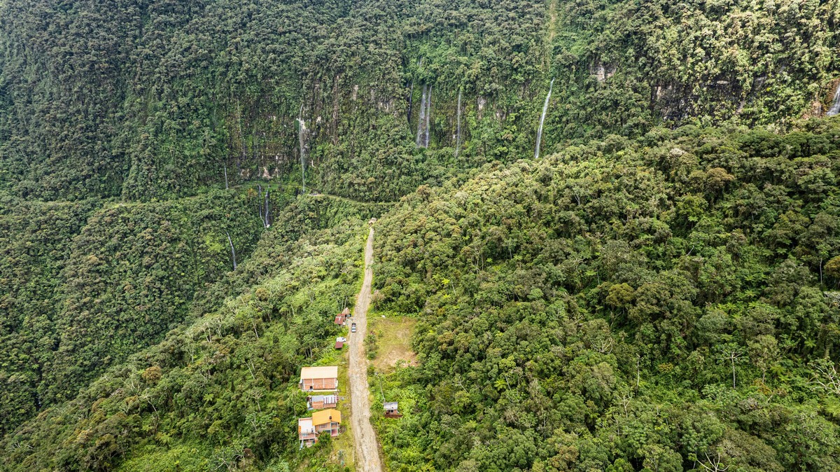
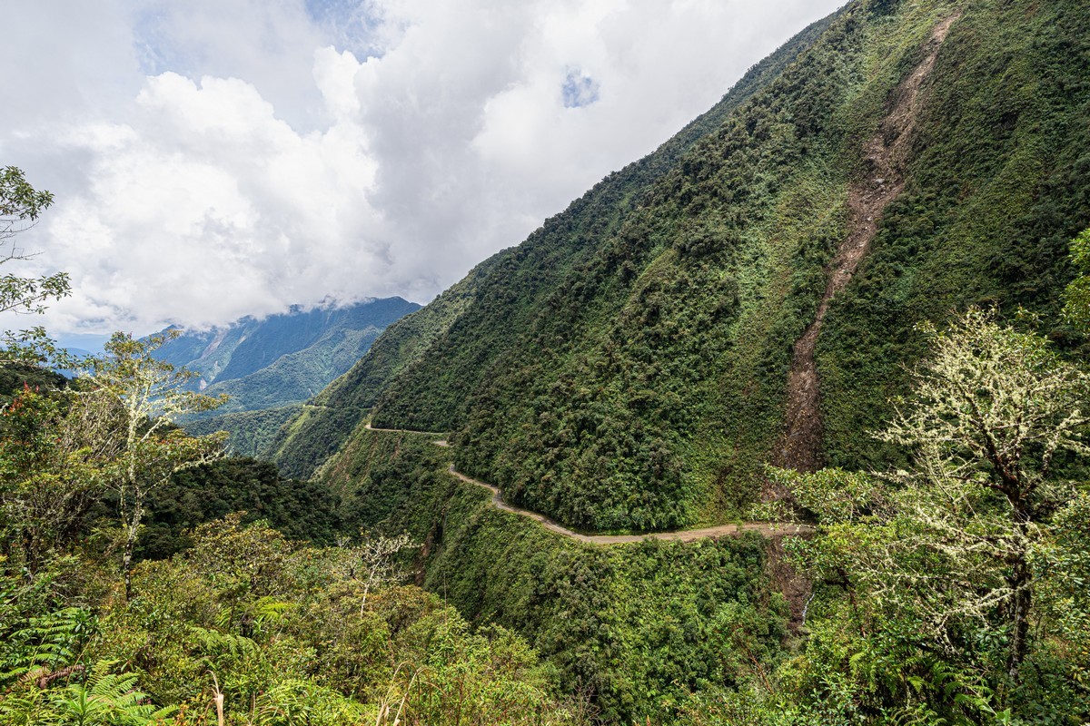
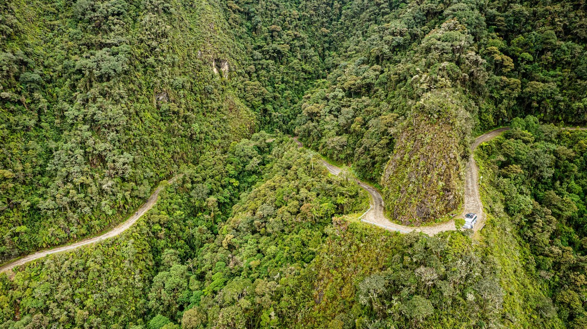
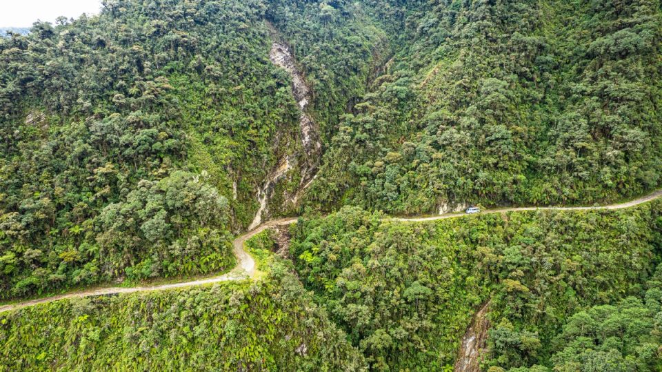
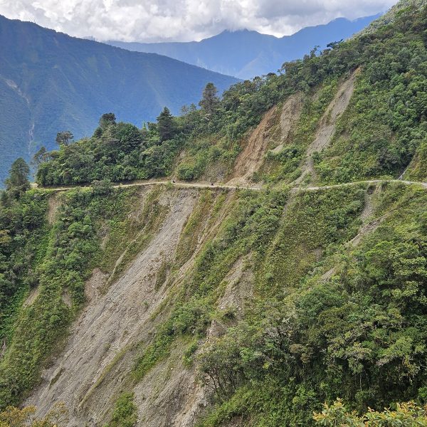
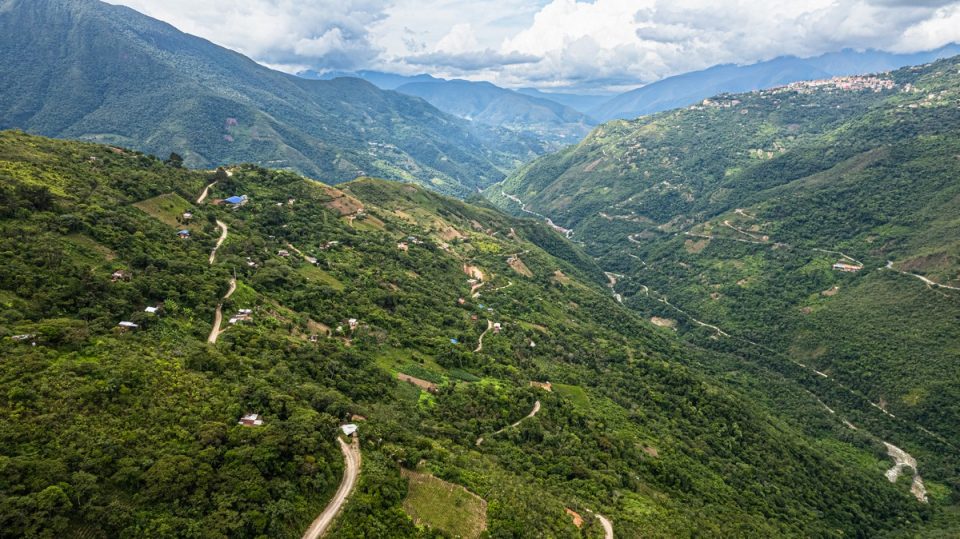
This is where we were to be riding. By the way, on the far slope of the mountain, you can see a stripe across it – that’s the continuation of the road! ->
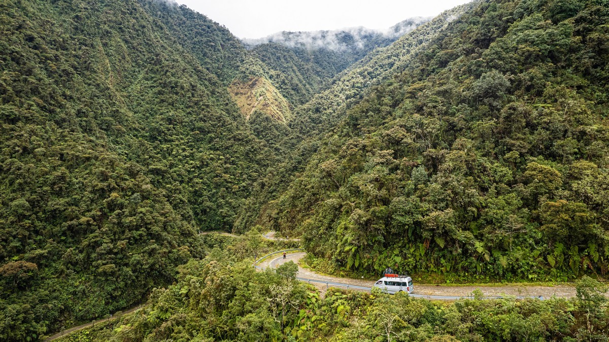
If someone gets tired or feels too scared to ride further on their own, a support bus follows the group ->
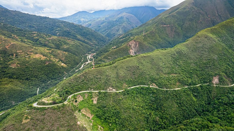
So, you just grab a bike and go! The road’s relatively short – about 30km, as shown here on the map:
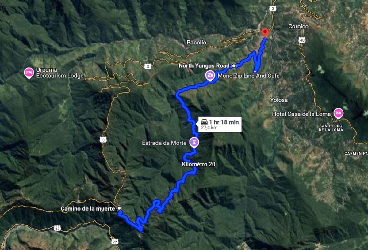
// For some reason, Google Maps doesn’t recognize the last section of the road and reports just 27 km.
Now for some detail…
Death Road is the unofficial name – no one intended for so many people to die here! The official name is Camino a Los Yungas, or Yungus Road. Built nearly a hundred years ago, it connected La Paz and the surrounding highlands with the jungles of Bolivia’s eastern regions. It was the only direct road between these areas, so it was heavily used for transporting both folks and goods back and forth. It earned the nickname Death Road because about half of its length (15 km) is extremely hazardous: some sections are carved into vertical cliffs! The internet claims that dozens of vehicles crash here annually – with something like 200-300 fatalities… per year :0)!
Here are a couple of old photos from the web. How would these guys maneuver around one another? The truck going uphill has the right of way:

Here’s another photo from Wikipedia:
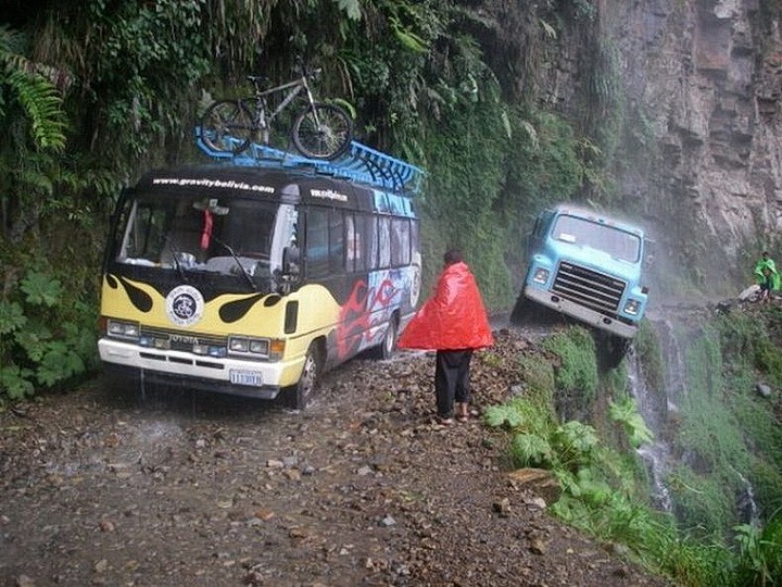
Initially, the entire 60-kilometer stretch from La Paz to the lowland town of Coroico was called Death Road, but by 2006, the road had been modernized, bypasses were built (making the road about ten kilometers longer), and the old 30km section was closed to traffic. Eventually, it was re-opened but only for bicycle tours. Technically, you can still drive a regular car there (we saw one tourist doing it), but I suspect you need a special permit for that (and your sanity checking, surely?:).
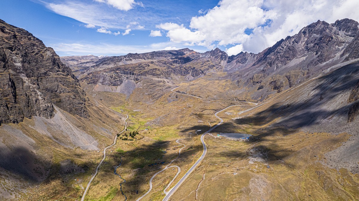
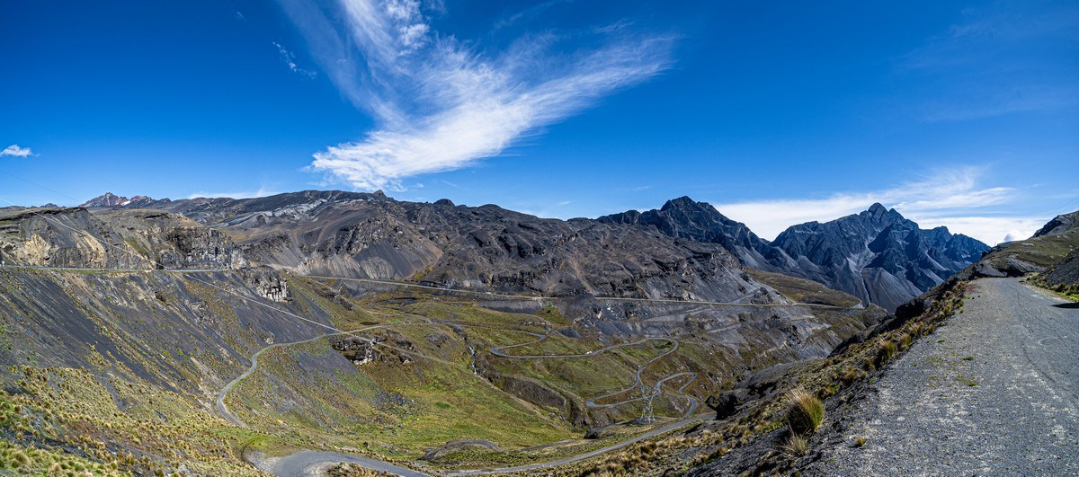
The bike ride itself is divided into two parts. First, the cycling tourists are taken to the very top of Old Death Road at an altitude of 4650 meters. From there they’re “warmed up” on a relatively flat, fully asphalted two-lane highway for 22 kilometers – all downhill, using only the brakes, while enjoying the incredibly magnificent views around them. That section looks like this:
Then, everyone gets on a bus and is driven to the start of the “real” Death Road, where there’s no asphalt at all – just dirt. Here, you start descending from about 3500 meters, finishing at ~1500. In other words, you drop an astonishing two (!) kilometers in elevation! From a chilly mountain climate, you descend into a hot and humid jungle. Quite the transition!
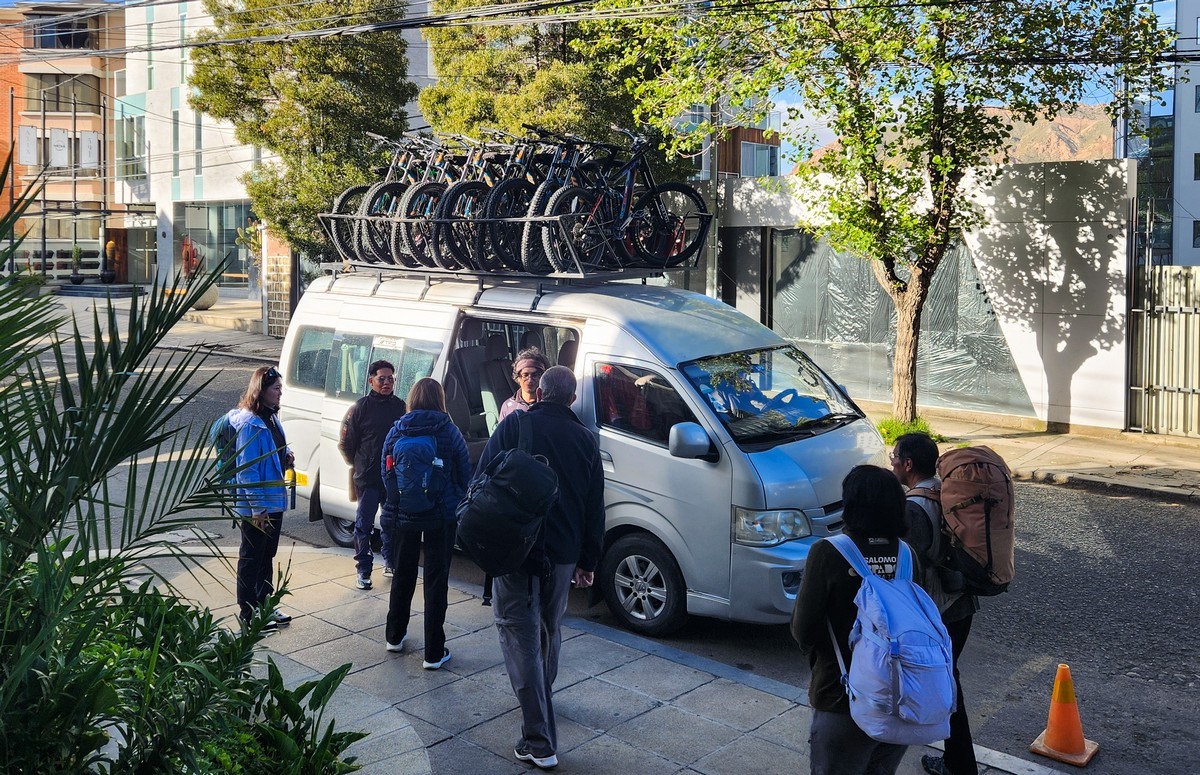
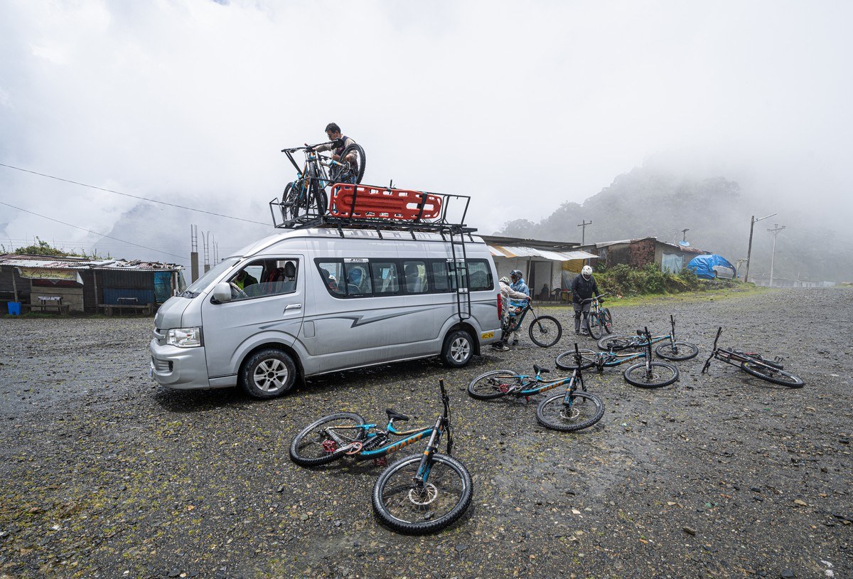
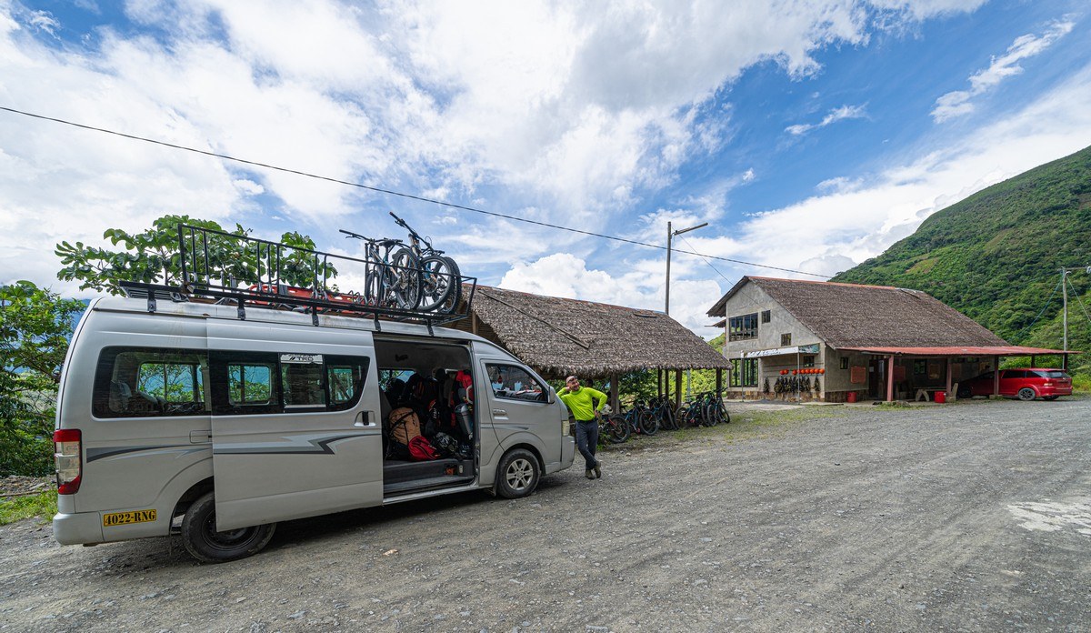
Early in the morning, the tour company picked us up, loaded us into a minibus with bikes strapped to the roof, and after about an hour-and-a-half, we left La Paz’s city limits and approached the mountain pass:
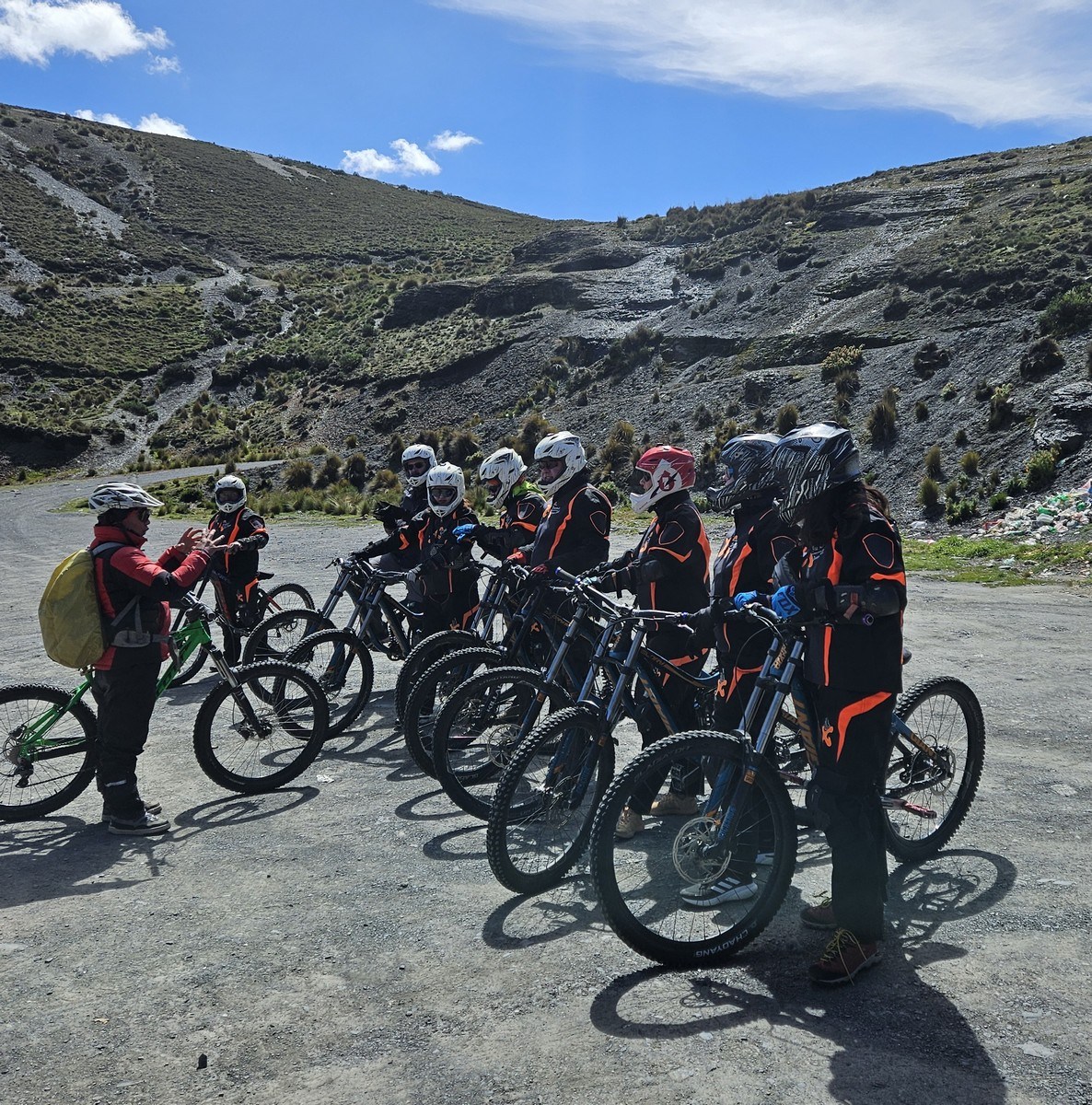
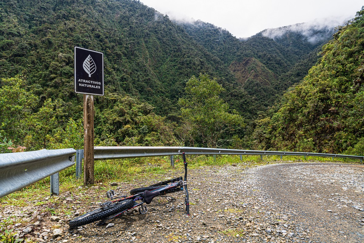
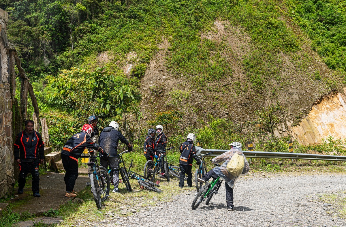
We arrive! Altitude: 4650 meters – yep: pretty high! Apparently, the local guides are used to tourists feeling a bit dazed at this altitude. Accordingly, they do almost everything for you! And the bikes are ready! ->
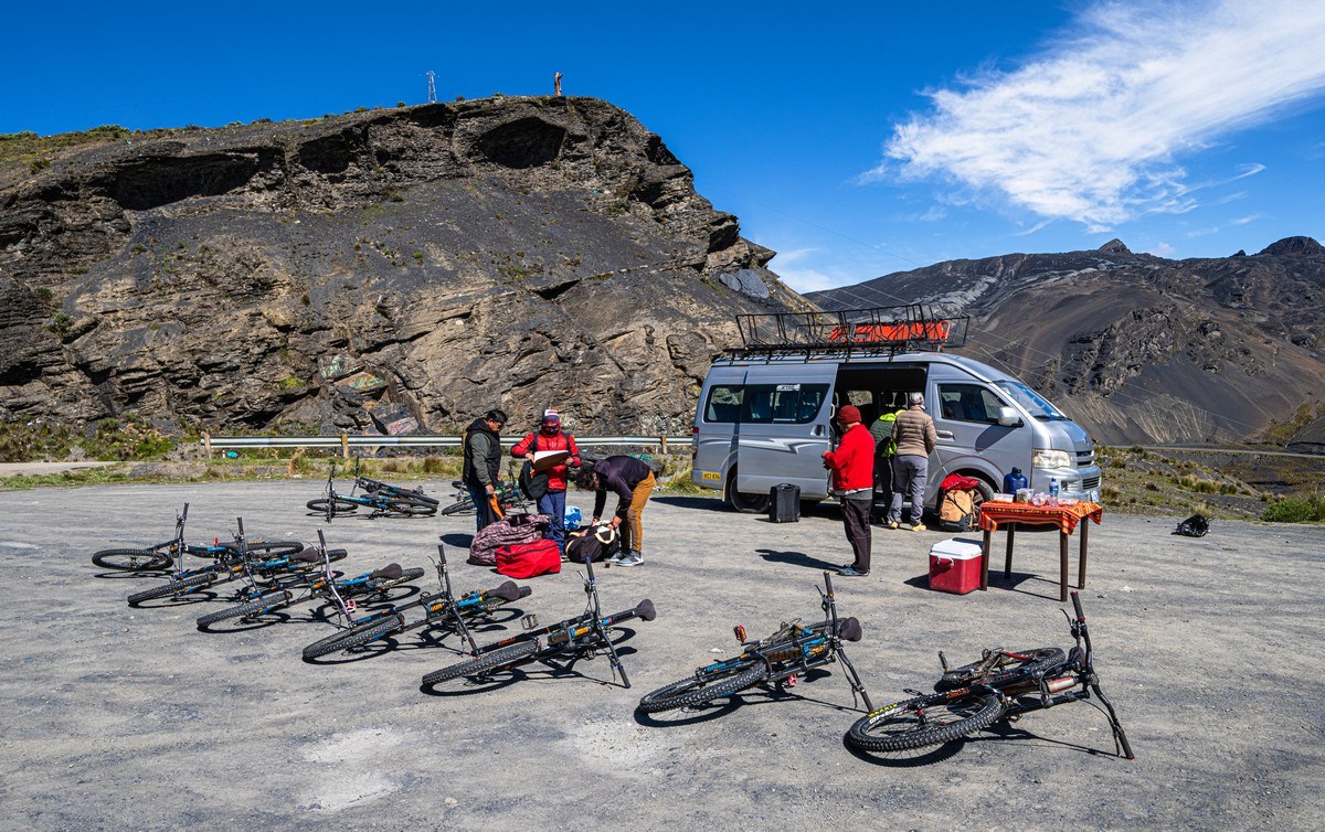
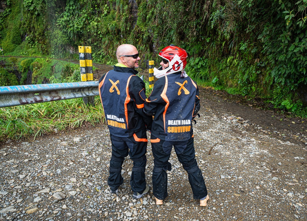
Mandatory gear-up in protective clothing. This is necessary because it’s going to get not only wet but also muddy in places…
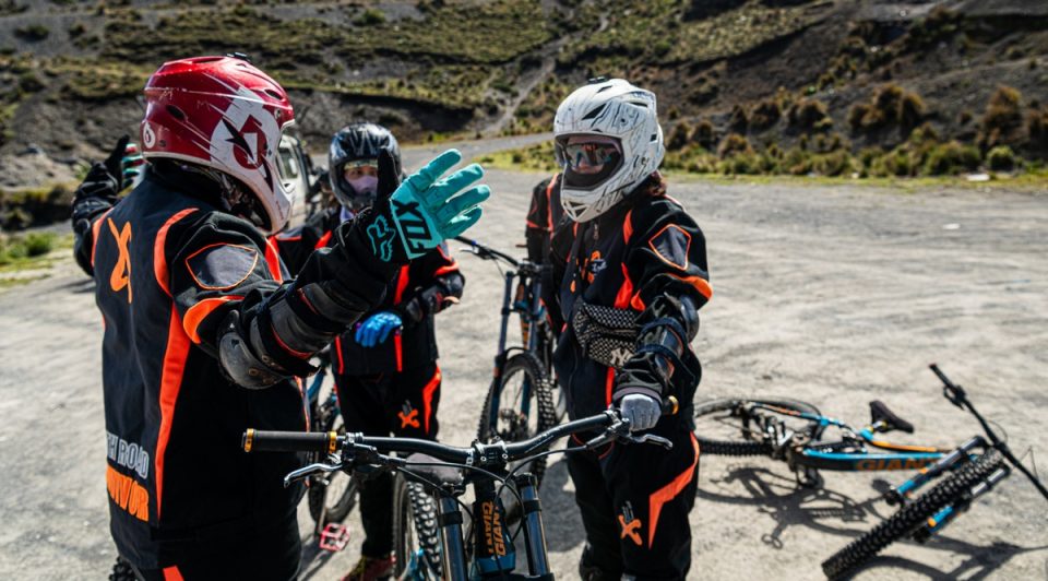
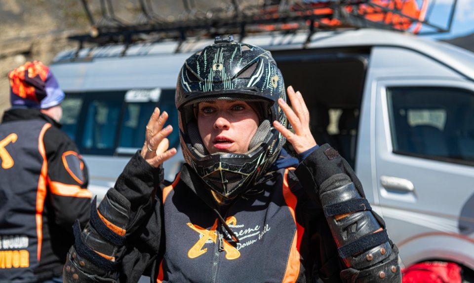
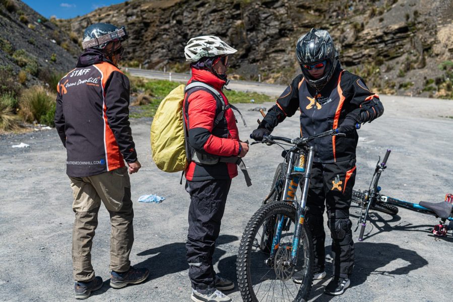
Ready? Safety briefing -> Let’s go!…
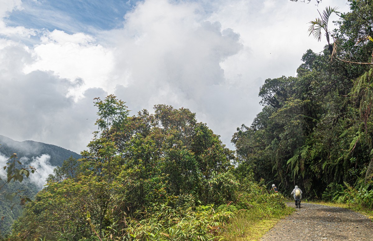
For some reason, I thought we’d start right away on a dirt road (by the way, this could have still been part of Old Death Road) ->
But no, we first ride 22km on a decent asphalt road:
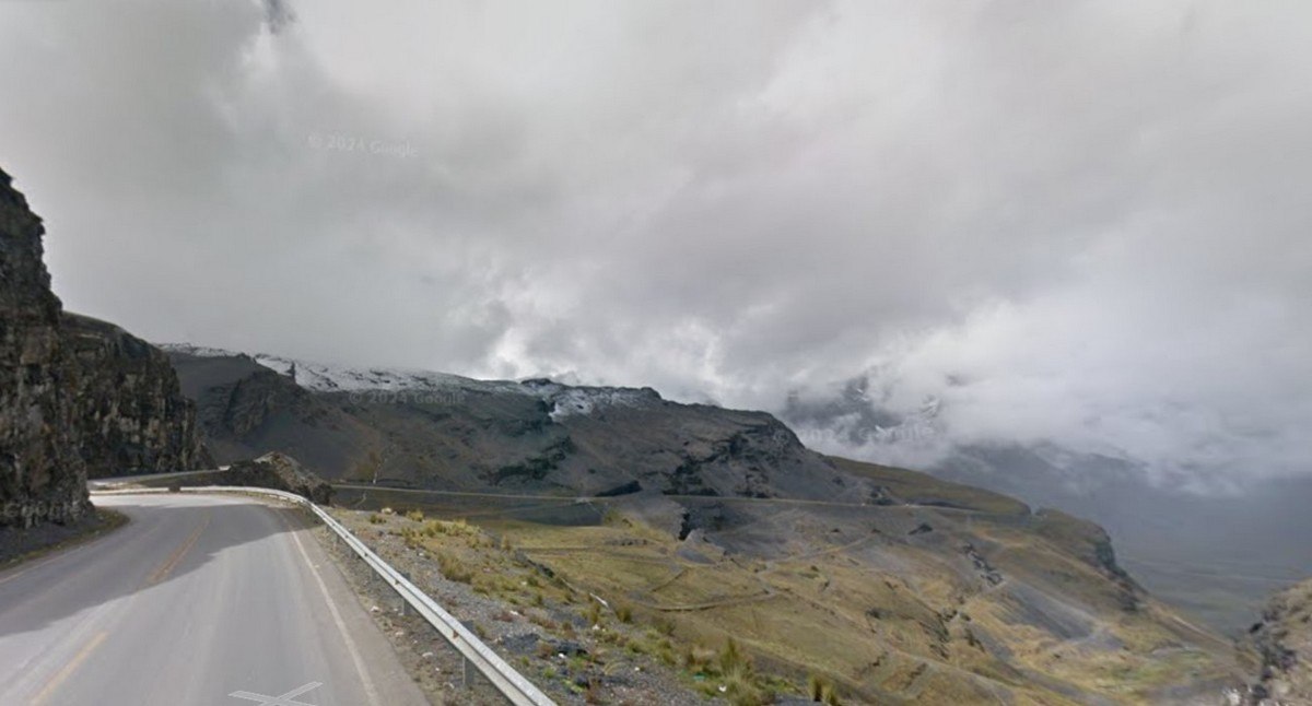
Since we didn’t think to bring an action camera with a helmet mount (we need to come back and fix that), and taking photos by hand while biking was nearly impossible, plus stopping on a road with moderate traffic wasn’t ideal, there are no pictures of the road itself! I had to grab some from Google Maps…
But the surrounding landscapes turned out great (taken on smartphones by brave female cyclists:) ->
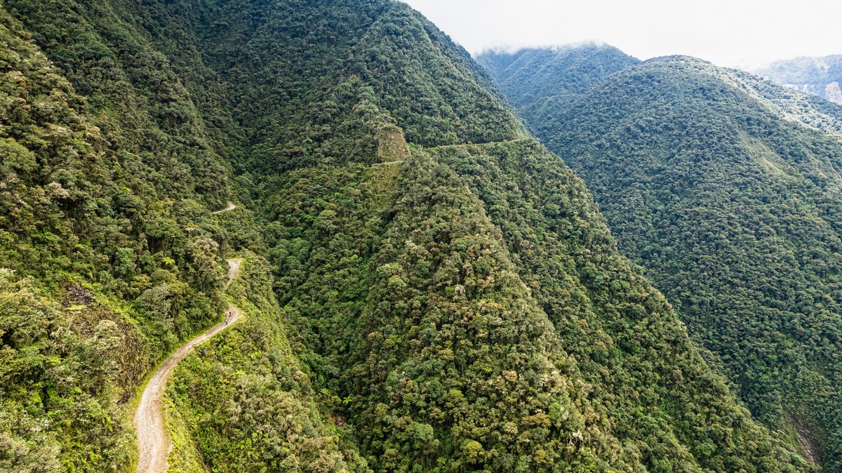
And aerial shots from the drone ->
An incredible 22km on a bike – all downhill! – with no pedaling whatsoever, just braking…
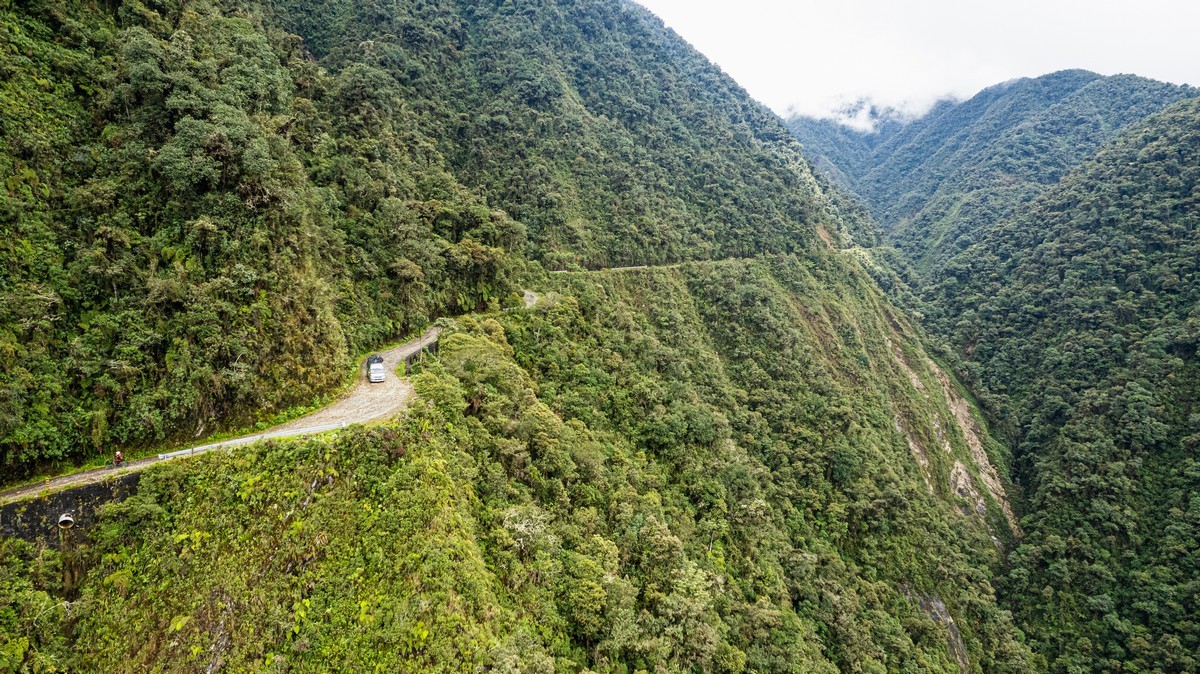
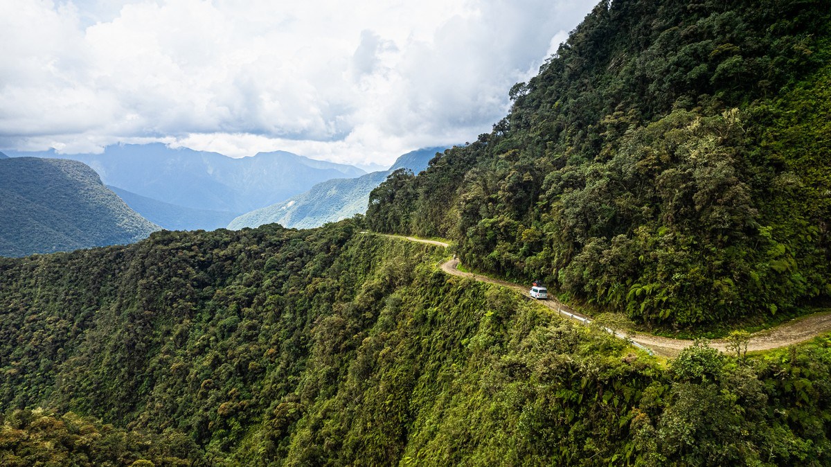
Then back on the bus, a short transfer, and onto Old Death Road. Here you realize that if you fall off your bike, you’ll probably get caught up in the bushes. But a larger vehicle would plummet all the way down ->
But cyclists also regularly perish here due to reckless riding or overconfidence. Maybe even altitude sickness? Some speed up too much and fly off corners, others try to be heroes, and some don’t maintain proper distance in the most dangerous spots. Apparently, since organized tours started, 18 cyclists have fallen to their deaths, with the latest incident occurring just six months ago. And I can I believe it. But it’s still so cool and beautiful! And I want to do it again!…
We arrive at the starting point of the second segment and offload the bikes:
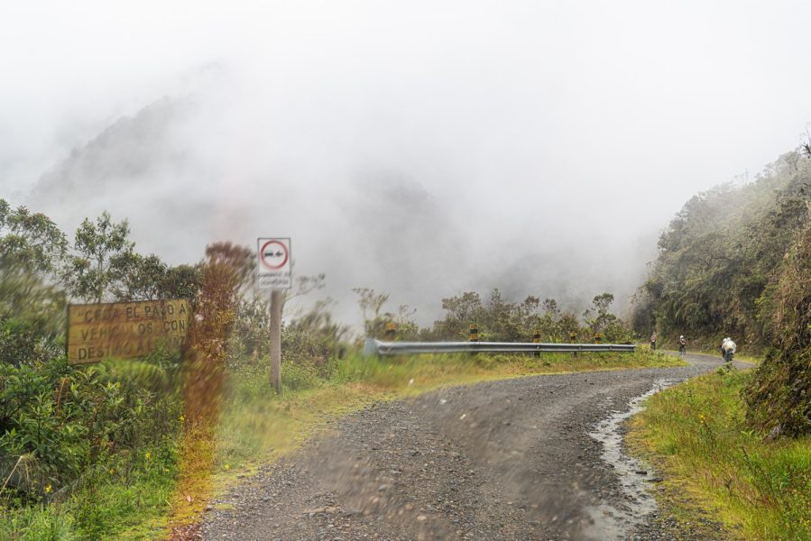
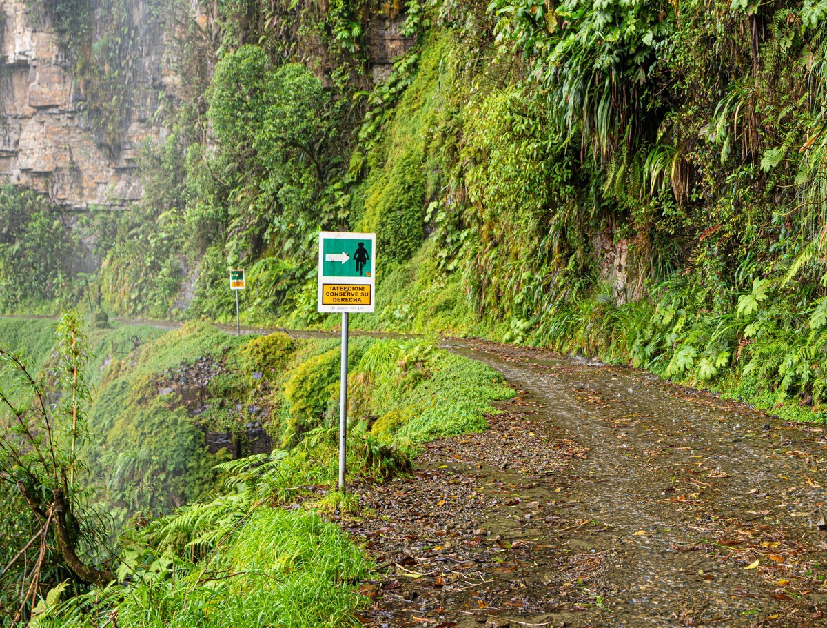
From here, we continue on a dirt track. Too bad the signs didn’t turn out well in the photo. They say to keep to the left (even though Bolivia drives on the right!). This makes sense here. With a left-hand drive vehicle, the driver can better see how close they are to the edge of the cliff – or to the sheer rock wall. It makes passing easier.
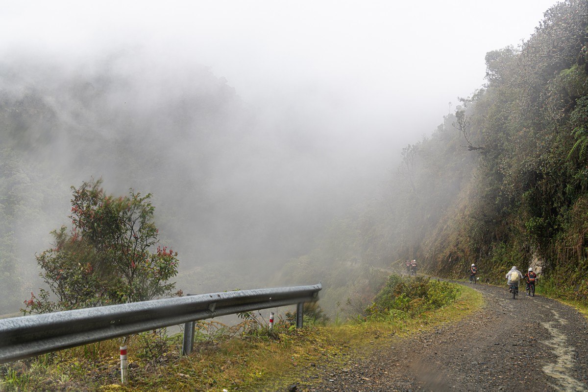
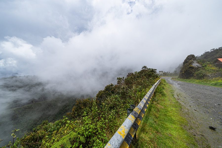
The weather was disappointing at first – a light rain started (but ended quickly), clouds covered everything, and there were no good views. But soon enough we emerged out of the clouds, and life instantly got better!…
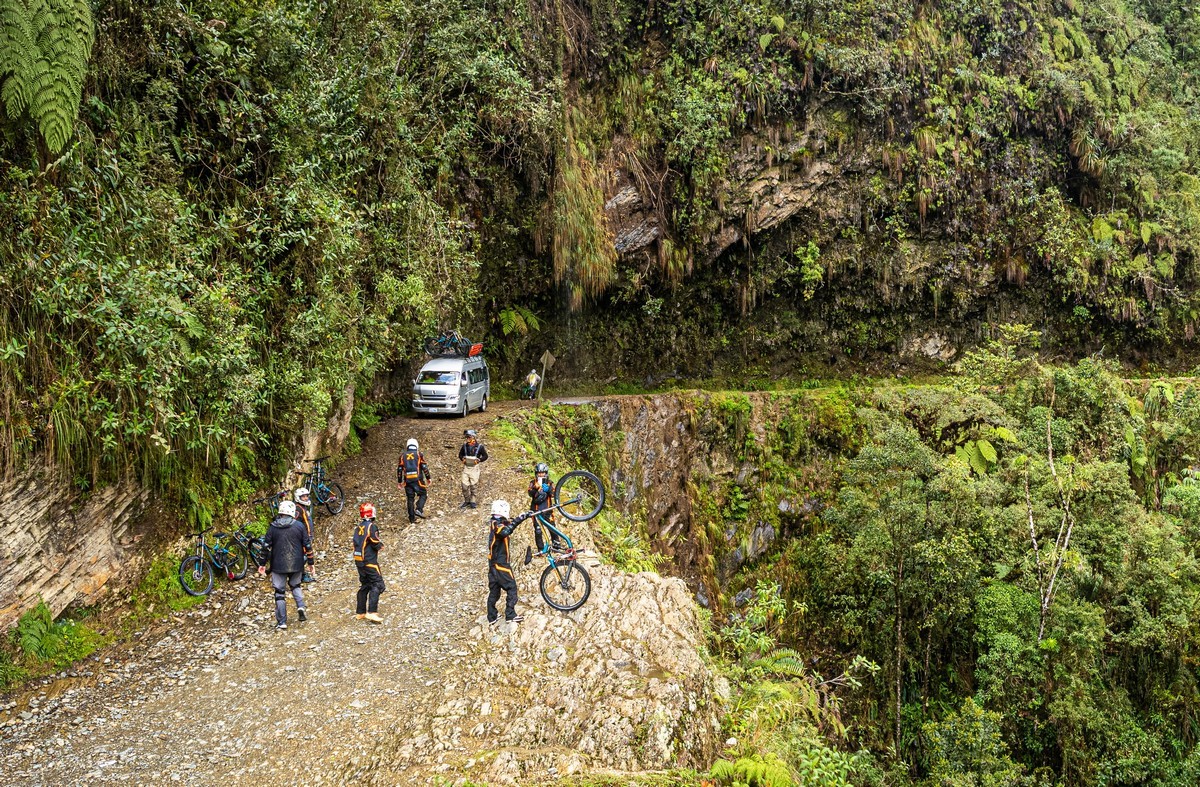
First stop: sightseeing and photography. We were advised not to leave our bikes at the edge of the cliff – just in case – otherwise we might need to carry on on foot take the bus onward…
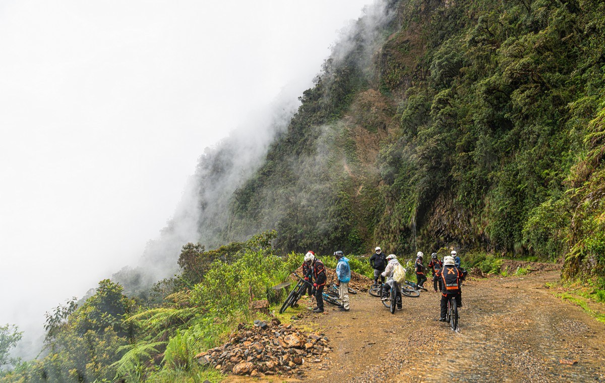
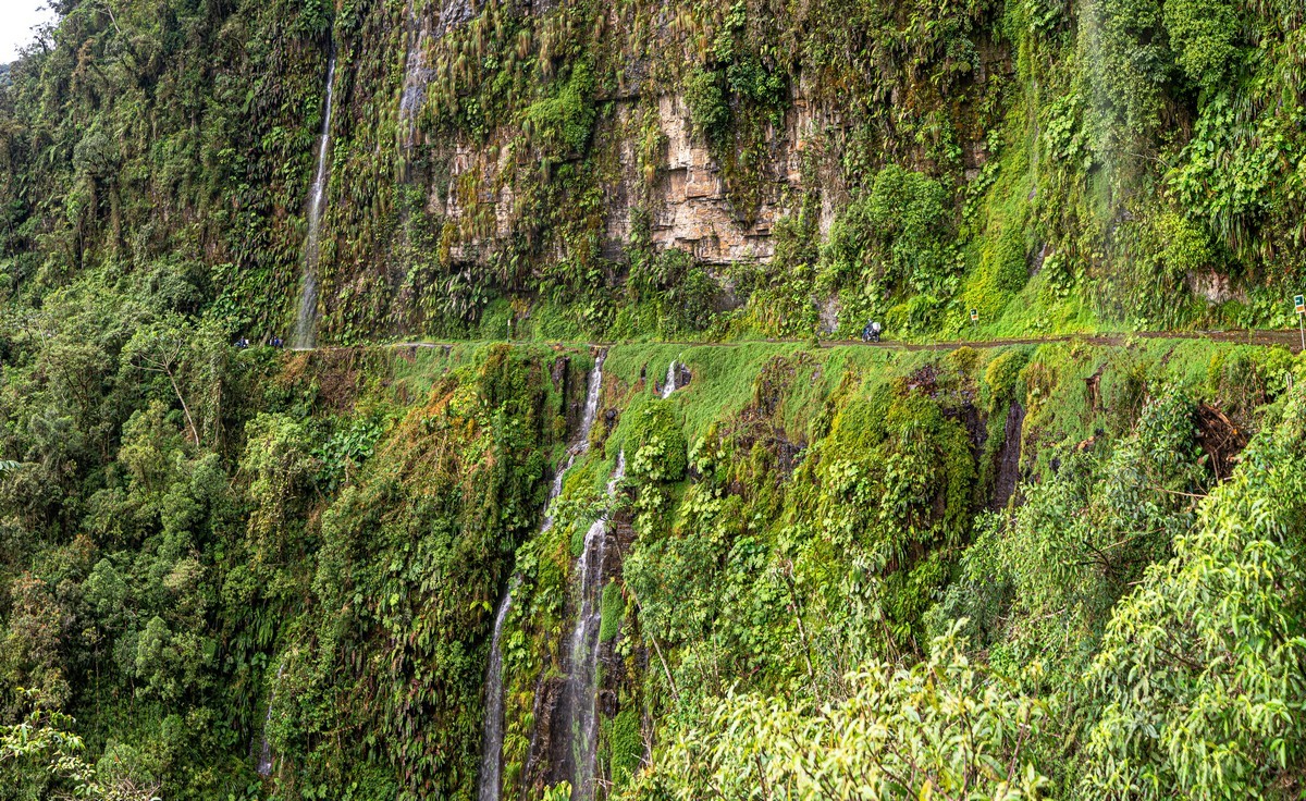
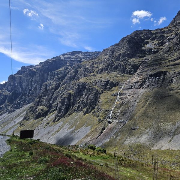
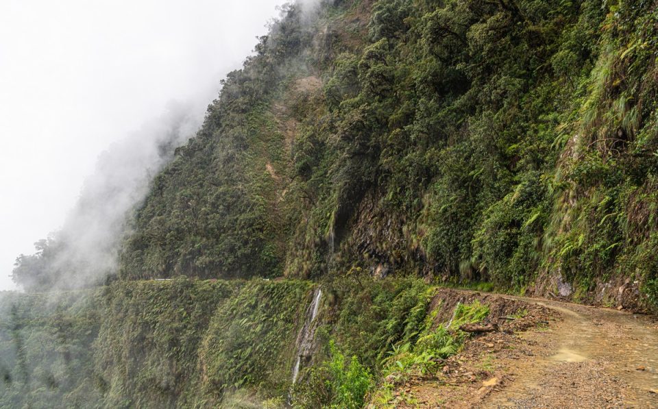
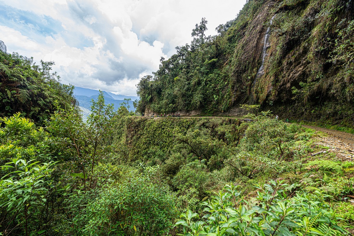
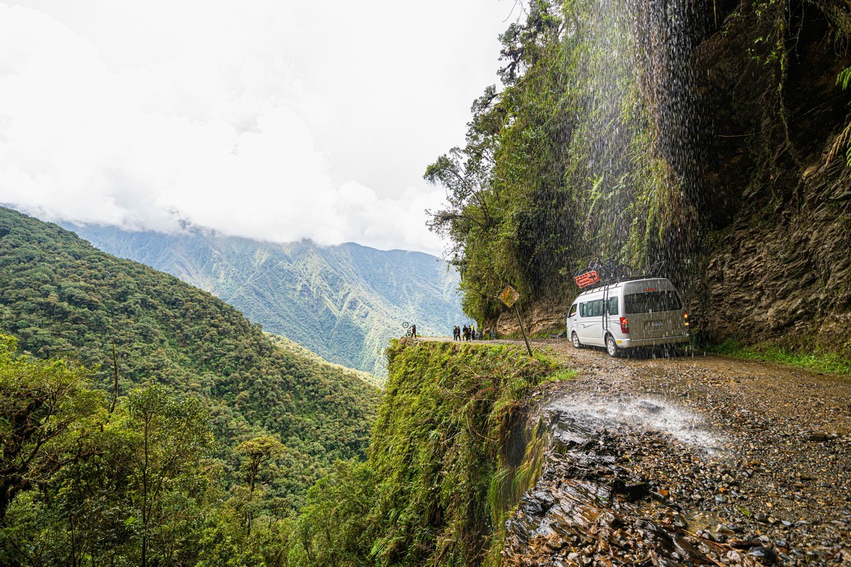
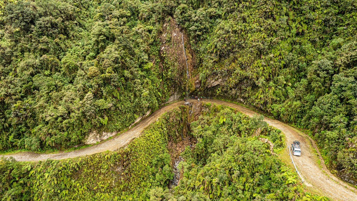
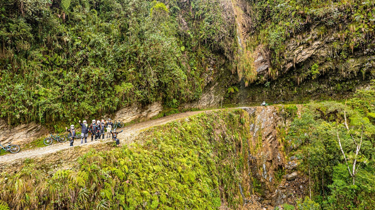
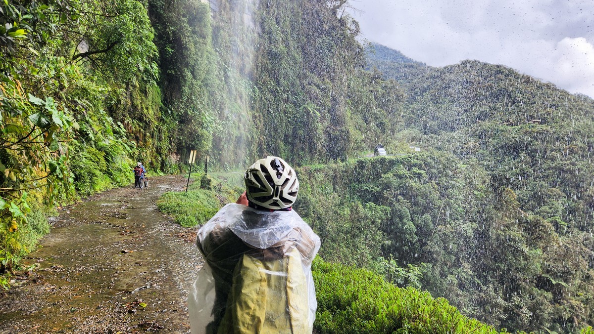
Here we encountered our first rather scary section and also our first waterfall. How did buses and trucks even manage to pass through here?
That’s us up there; looking down was kind of terrifying ->
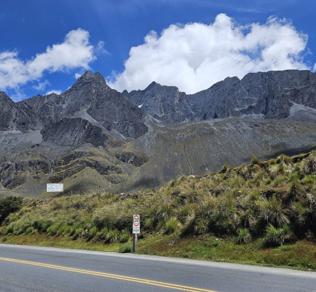
We took another glance at the cloudy distances and moved on. However, this section of the road wasn’t as scary – no cliff on the left or rock wall on the right. But speeding up isn’t a good idea – sharp turns appear unexpectedly.
The entire route is divided into two parts: the first, with steep cliffs and breathtaking views (about half of the whole road); and the second, which is less steep and less scenic. The second half is covered almost without stops, while in the first half we regularly stopped to admire the views.
Here comes the next stop:
The view of the road is amazing!
We take a look around – and then back on the bikes…
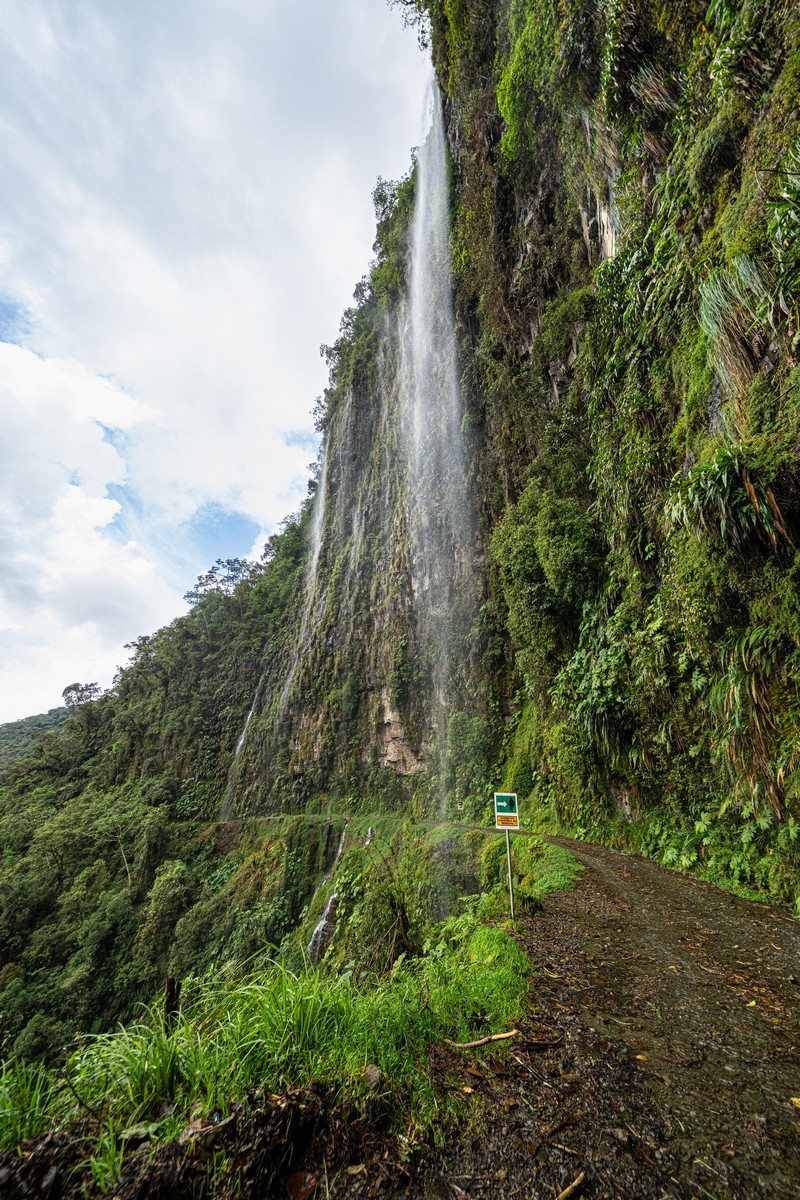
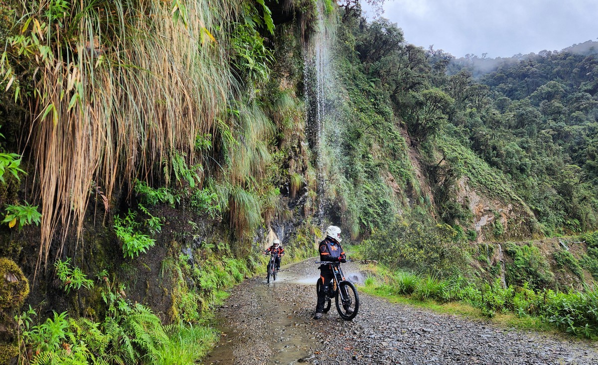
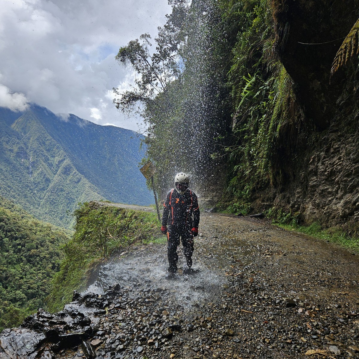
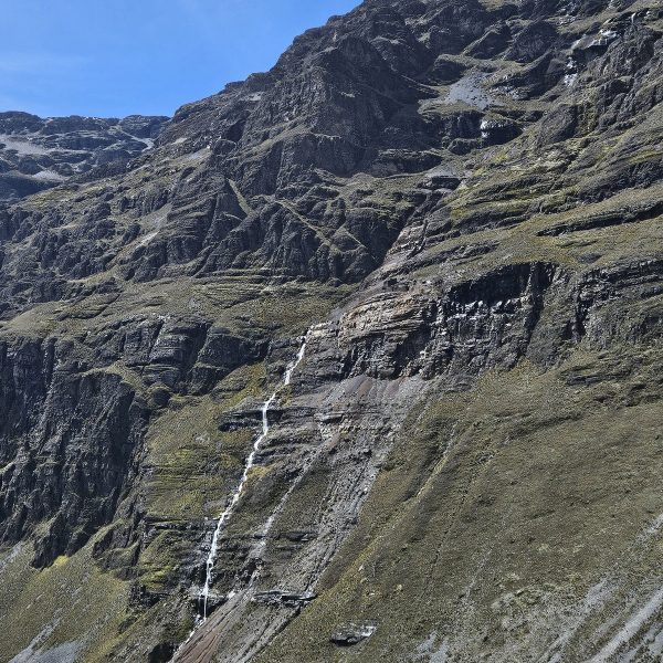
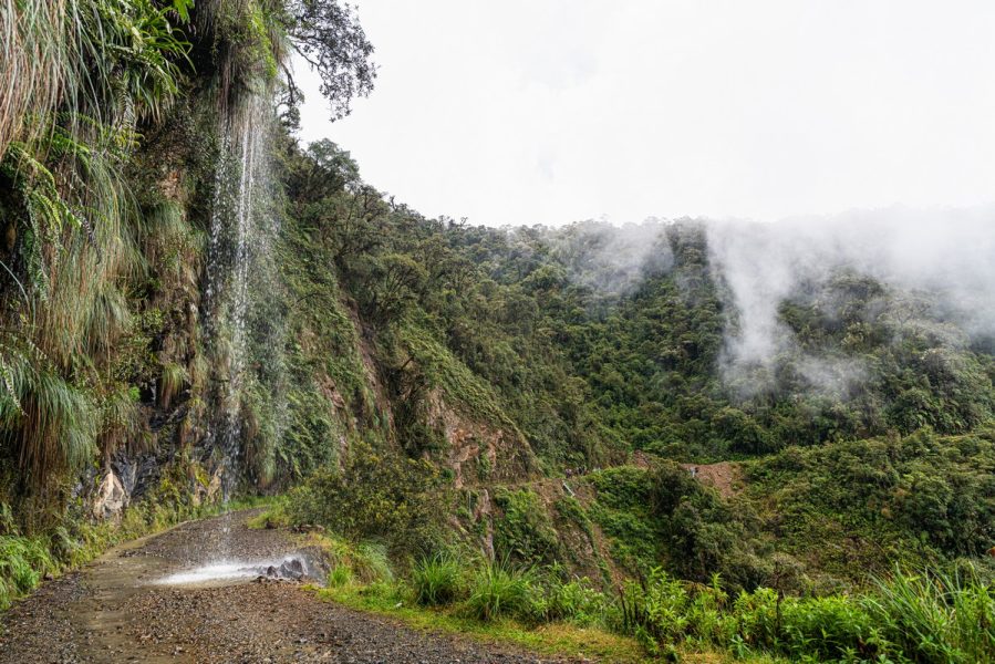
Descending lower and lower, the clouds were left behind somewhere up above, and the scenery became sharper and brighter. Next waterfall:
This is what the road conditions are like here. Beautiful! As long as you don’t look down over the edge. :)
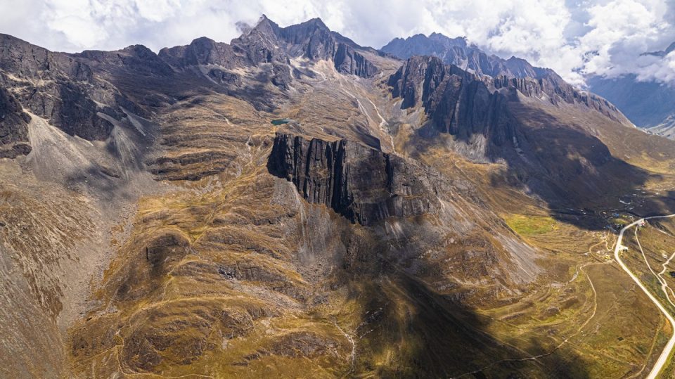
Drone shot:
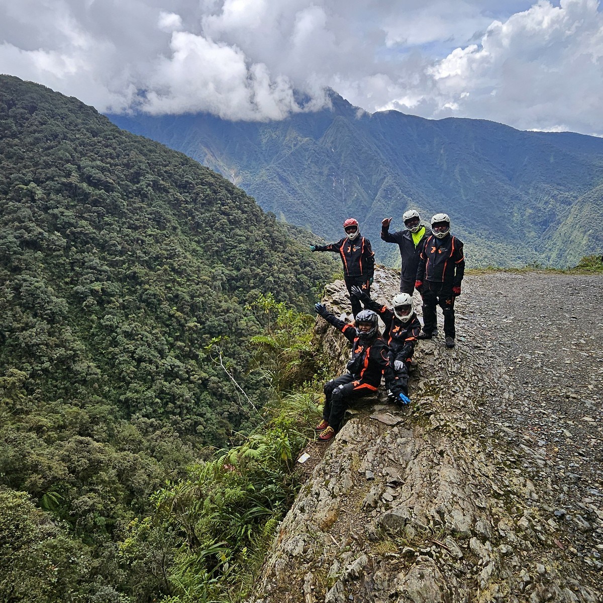
And there we are, looking good:
A photo of balancing a bike on its rear wheel is a tradition here and a must-take:
Another must-take photo for travelers passing through – then onward…
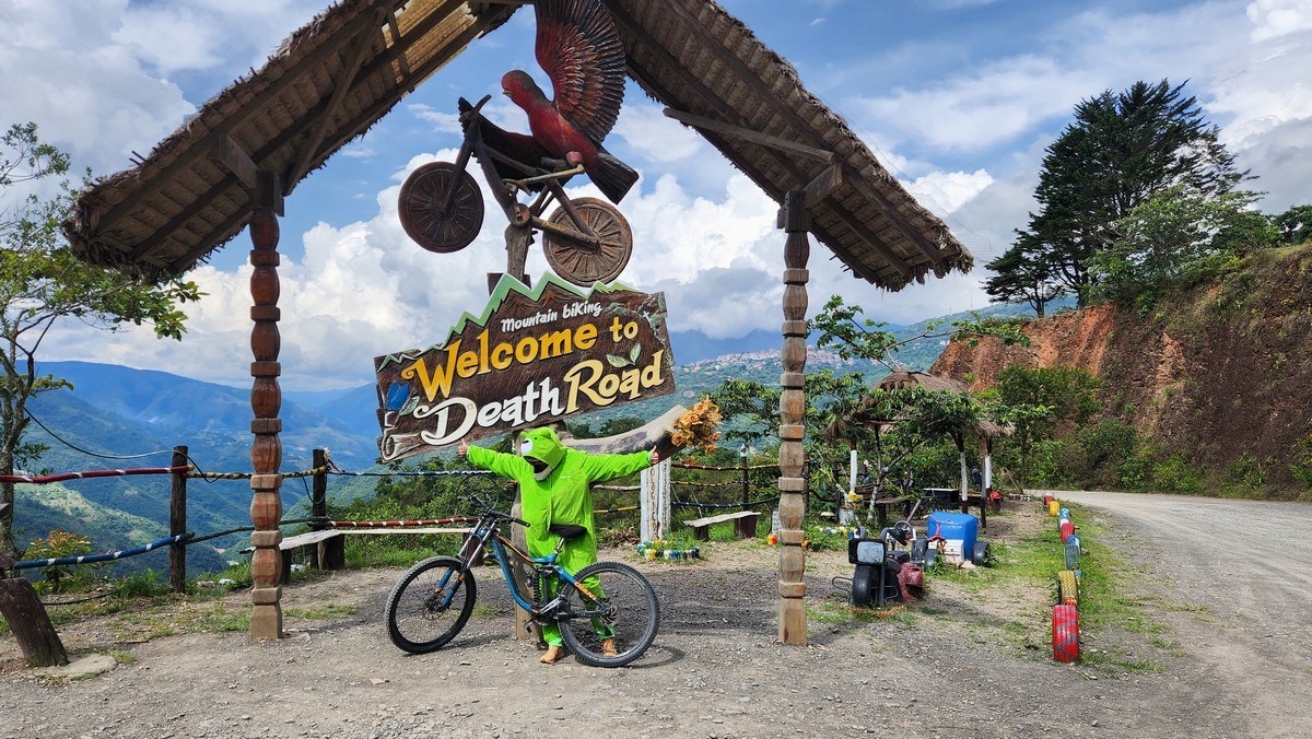
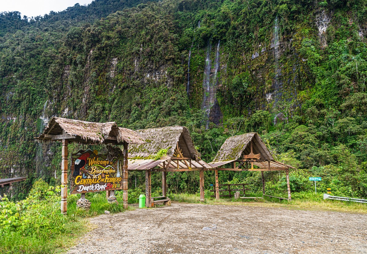
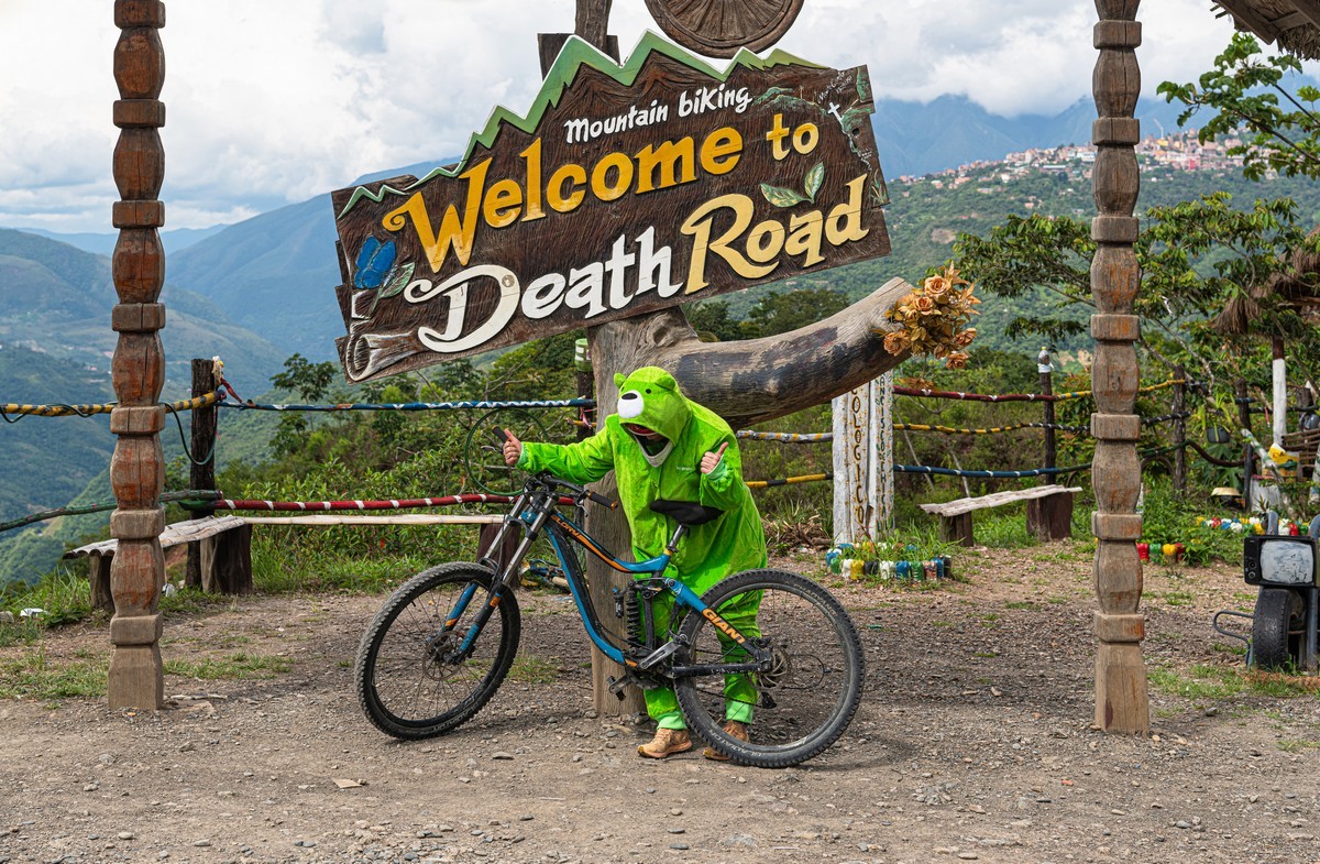
We finally reach the official Death Road welcome sign ->
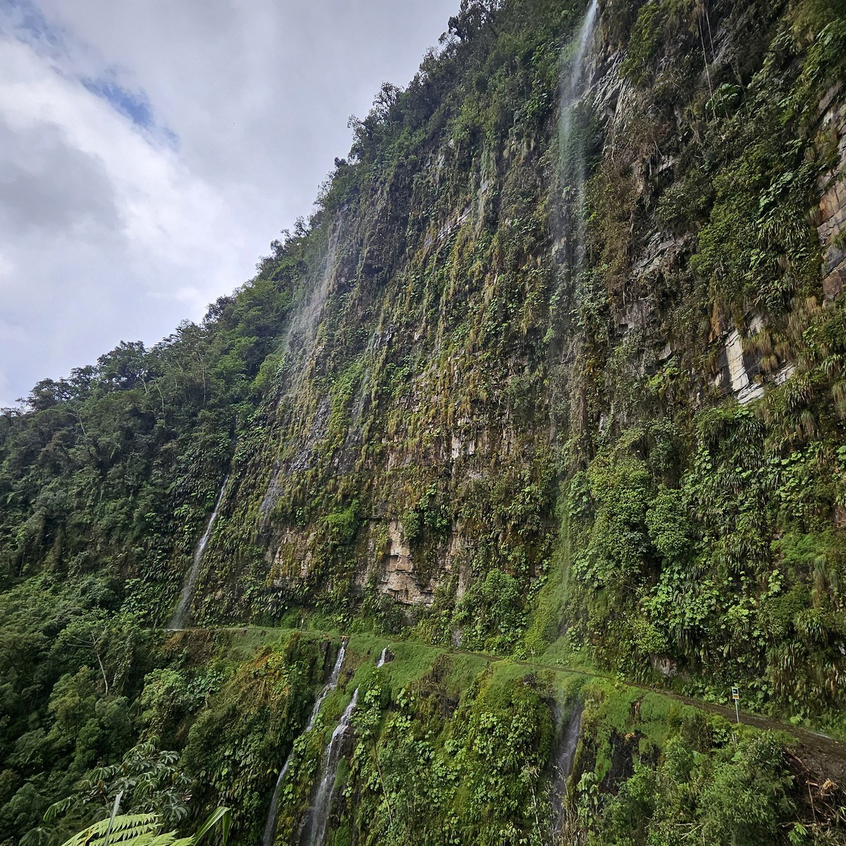
And another waterfall… or rather, a cascade of waterfalls. Stunning! ->
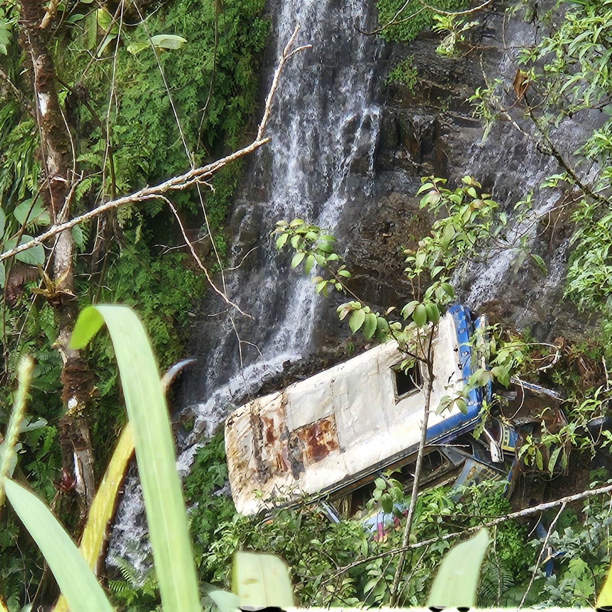
…As long as you don’t look down. What’s that lying down there? Something fresh… People are still crashing here :( ->
The warning signs state the obvious:
But some preferred to walk rather than ride their bikes:
By the way, which one of these two was on a bike, and which took the bus? :) ->
Amazing section! I want to do it again! // Just for reference: this is 11km from the start of the road.
Almost halfway:
Looking back – pure horror:
Looking forward – it’s getting flatter and less exciting:
From time to time, it’s good to stretch your legs, since they hardly do any work on the descent:
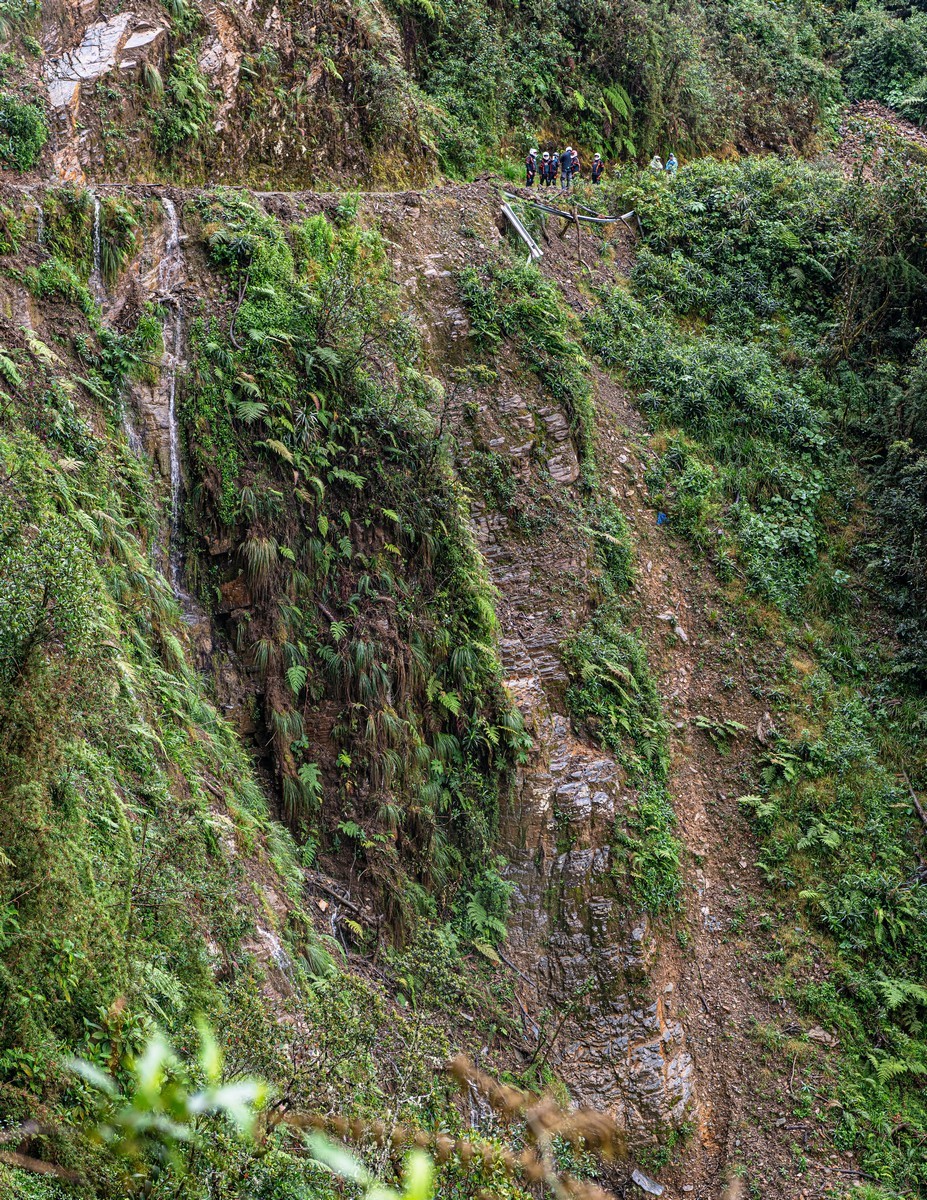
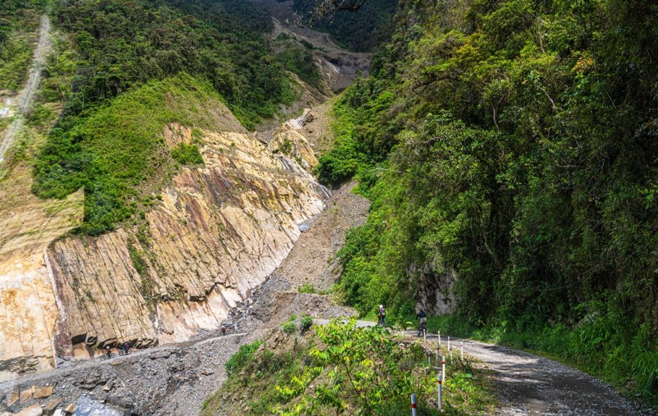
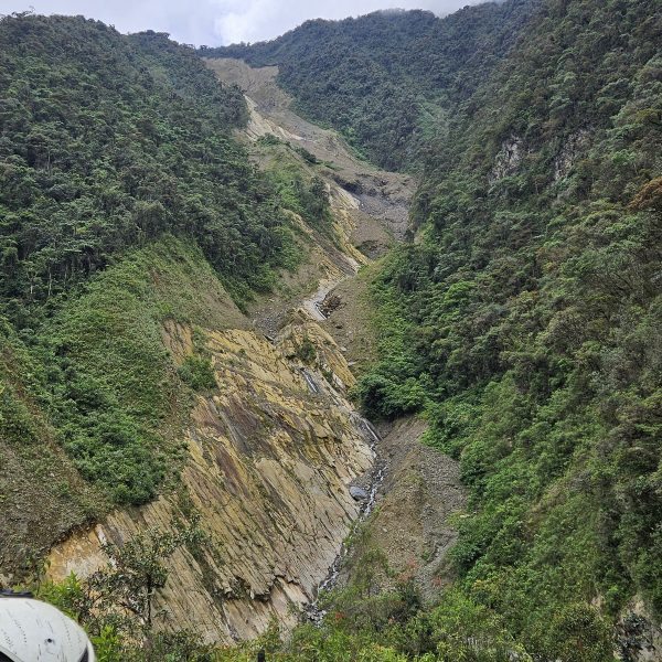
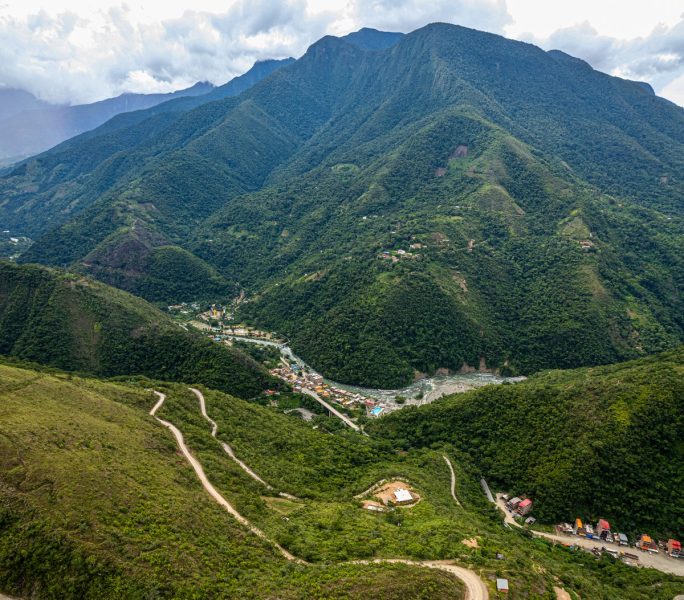
This is about 15km from the start – exactly halfway. A few years ago, a landslide blocked the road here. They say that back then the cycling route ended here, and everyone had to be taken back by bus – imagine the terror of driving back up those slopes! But they cleared the debris, and now you can ride all the way to the end, even though the rest of the route isn’t as thrilling. It seems landslides are a regular occurrence here:
And that’s it – the most exciting section is over. Time for lunch! 10km to the final stop…
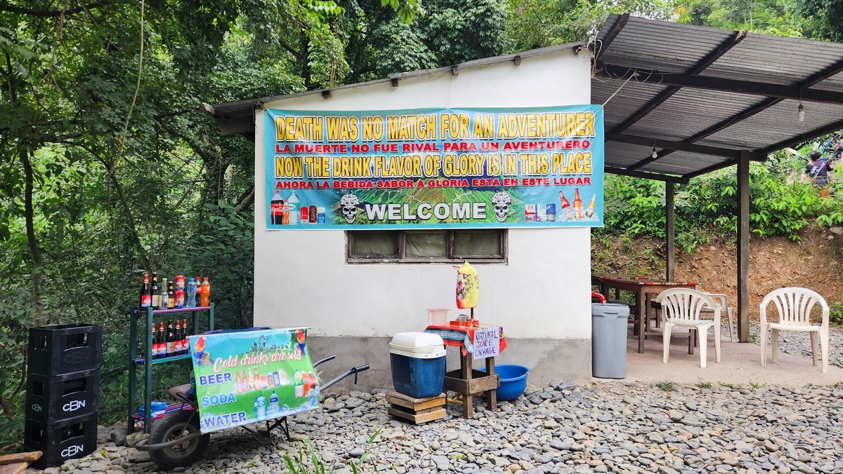
Those last 10km we rode non-stop except for one break – stopping by another welcome sign. Recommended by Midori Kuma! ->
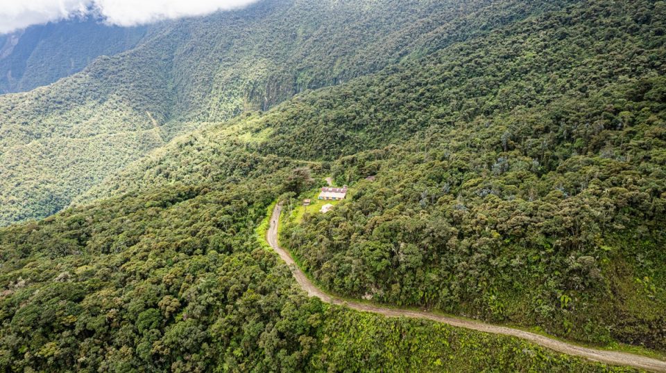
Drone shot of this stretch of the road:
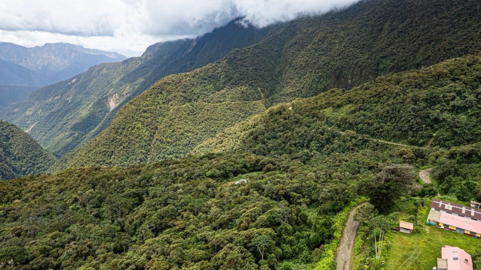
And there’s the gorge with the river:
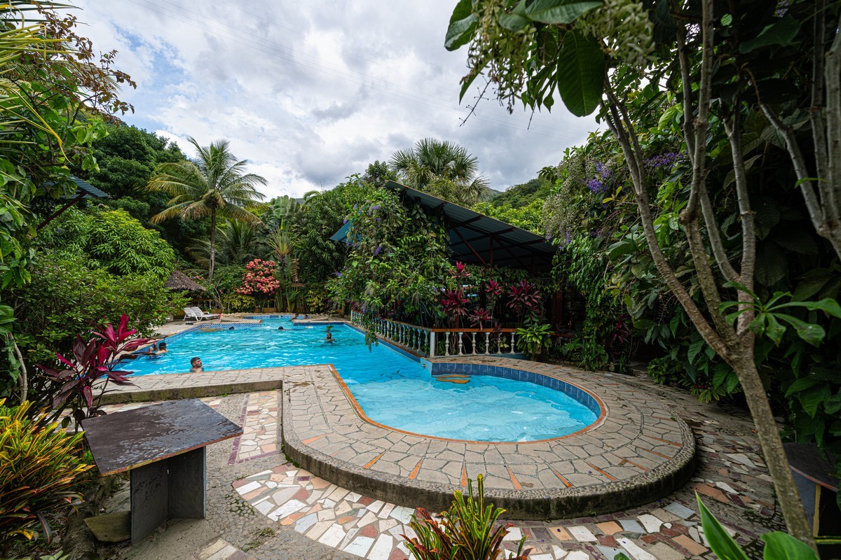
That’s it – finish line and celebratory cerveza! :)
In total: 30km downhill, about 3.5 hours on the road, a 2km descent in altitude (from 3500m to 1500m), and at the end – lunch, a shower, and a pool! ->
In short, highly recommended! I’ll say it again: this bike ride alone is worth coming to La Paz for – from anywhere!
The best photos from our LatAm-2025 trip are here.

