February 26, 2025
The Nazca Lines – finally!
Peru. So, what’s generally known about this South American country by the average general-knowledge pub-quiz buff? I’d say: the mysteriously extinct Inca civilization/empire, the ancient cities of Cusco and Machu Picchu, the high-altitude Lake Titicaca, and, of course, the mysterious Nazca Lines (also known as the geoglyphs of the Nazca Plateau).
As to the latter, seeing these drawings in the flesh has been a childhood dream of mine ever since I enthusiastically studied the geography of this world through books filled with maps, pictures, and photos of different regions of the planet. Naturally, when planning my trip to Peru, visiting the plateau – flying over it in some kind of aircraft – was one of my top priorities. And now, decades half-a-century (!) later, I’ve finally made it happen! The lines, geometric figures, and depictions of funny-looking folks and animals on the Nazca Plateau – checked off the list!…
Online encyclopedias state that there are over 140 drawings here, plus a hundred spirals, several hundred other geometric shapes, and about 13,000 (!) simple lines and stripes on the ground. The size of the drawings ranges from several dozen to 200 meters long, while the straight lines stretch for entire kilometers across the plateau. The age of these geoglyphs is estimated at 1500 to 2500 years, and they’ve been preserved thanks to the dry desert climate. Why the ancient inhabitants of this region “drew” on the desert surface remains a mystery. More precisely, they didn’t draw – they dug: the images consist of shallow trenches.
Such a cultural and historical phenomenon – truly unique in nature…
By the way, the spiral image from the Nazca Plateau has become the official tourism symbol of Peru:

Now for the bad news…
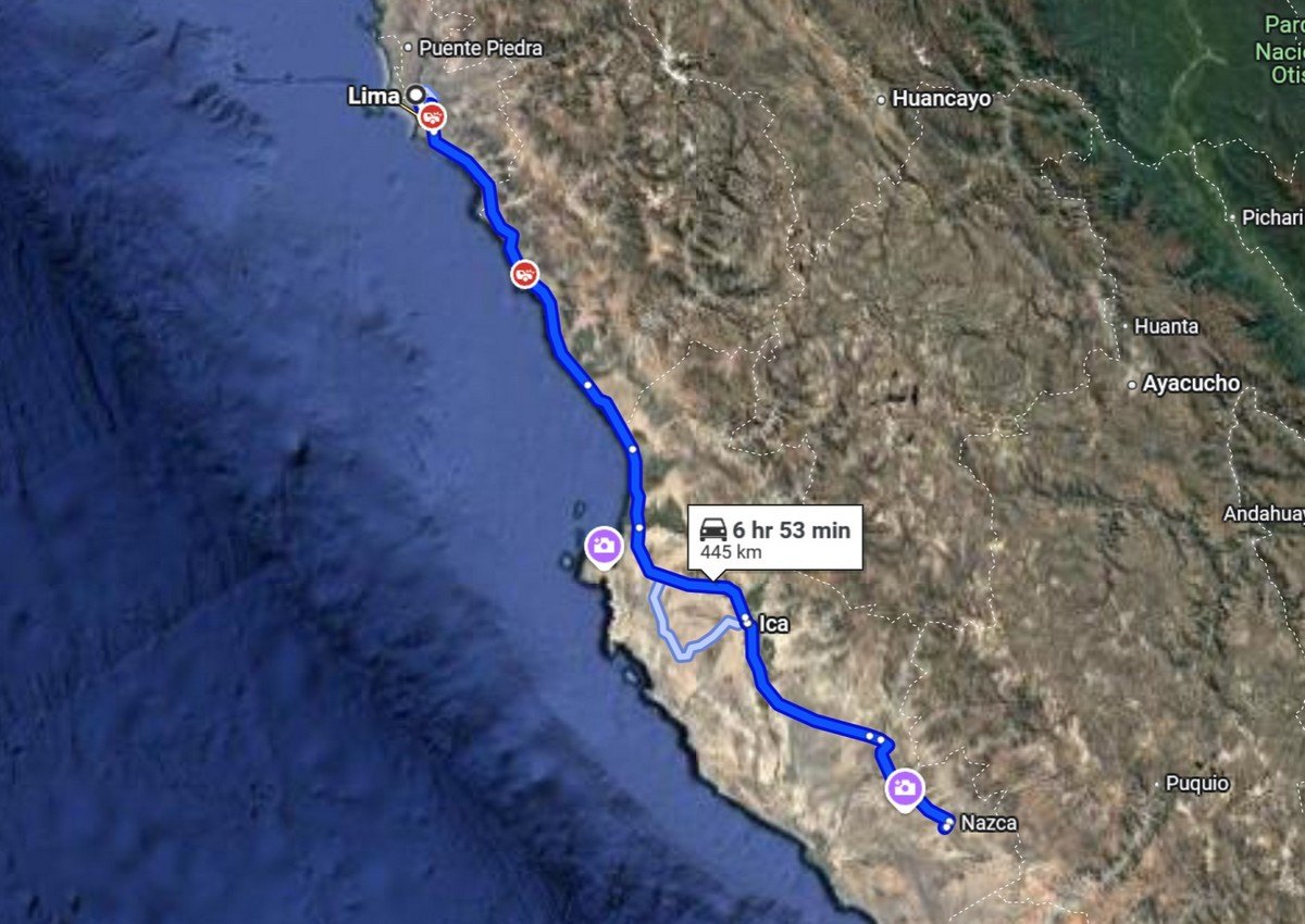
Tourists are flown over the Nazca Plateau in small airplanes operated by local airlines, which are based at a couple of ~nearby airports: one – 20km away, the other – 160km, and most flights now operate from the latter. The thing is, driving from Lima to this latter airport takes about seven to eight hours, which is frankly inhumane. The trip turns into a very long day, starting deep in the night and ending around midnight…
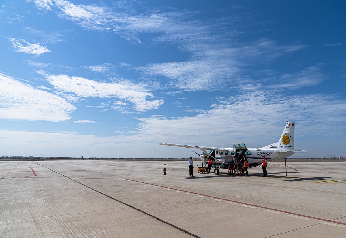
Additionally, we were advised to fly over the plateau around noon at the latest – that’s when the views are at their best. After some thought, we decided to rent a local plane and fly there from Lima and back. This one:

I’d hoped to fly straight from Nazca to Cusco, but unfortunately, that’s not possible: such small planes cannot operate at high altitudes (Cusco is at ~3400 meters), and larger private jets don’t fit the runway sizes of Nazca’s small airports.
So we were invited to take this little bird to the Nazca area, refuel there, fly over the drawings and lines, and then return to Lima. A reasonable plan. We boarded and took off! Flying towards the Nazca Lines, hooray!…


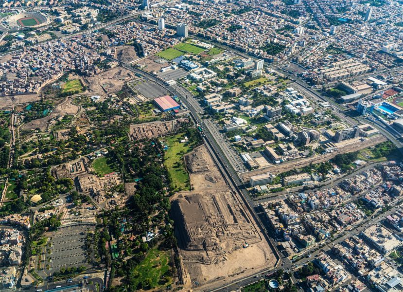
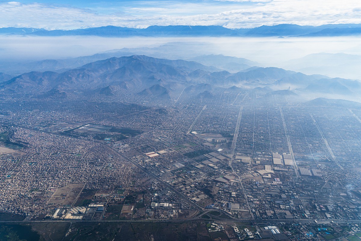
Views of early-morning Lima. Ooh! Some ancient ruins below… but not this time.
The Andes on the horizon:
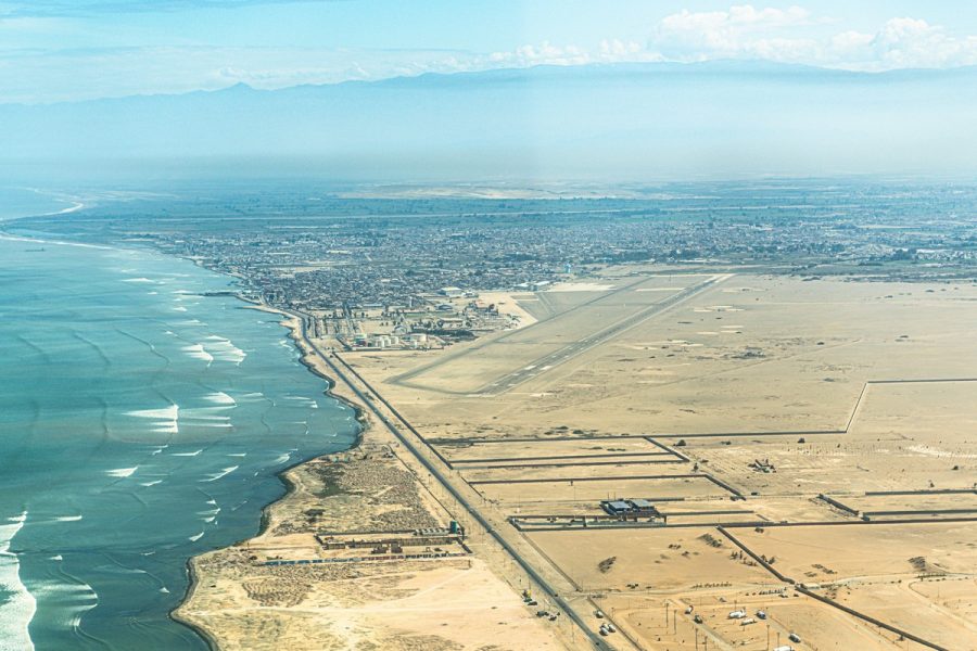
Around 40 minutes later we are approaching the airport of the town of Pisco. The airport’s brand new – completely fresh, but there were no passengers whatsoever; well – except for us:

The plane was refueled, we boarded, and headed to the Nazca drawings!…
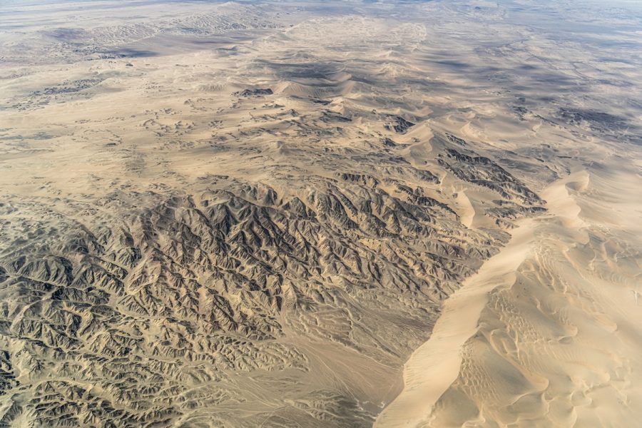
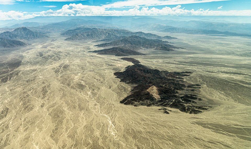
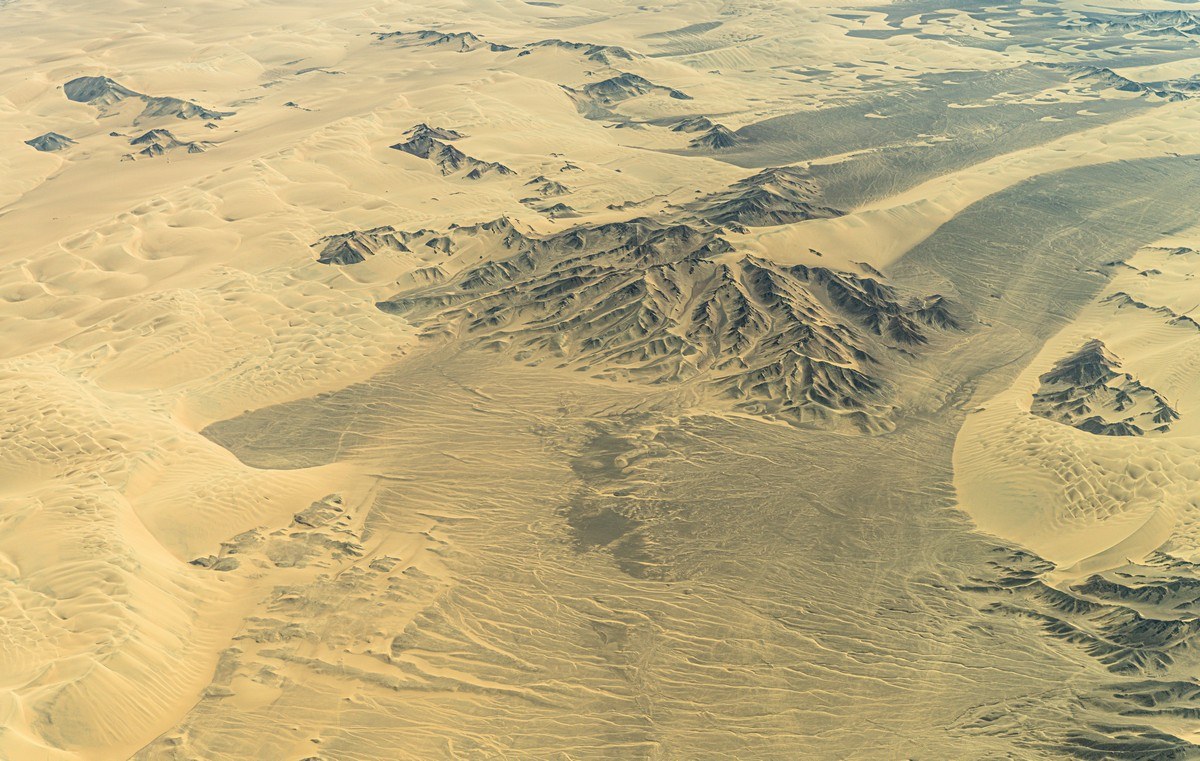
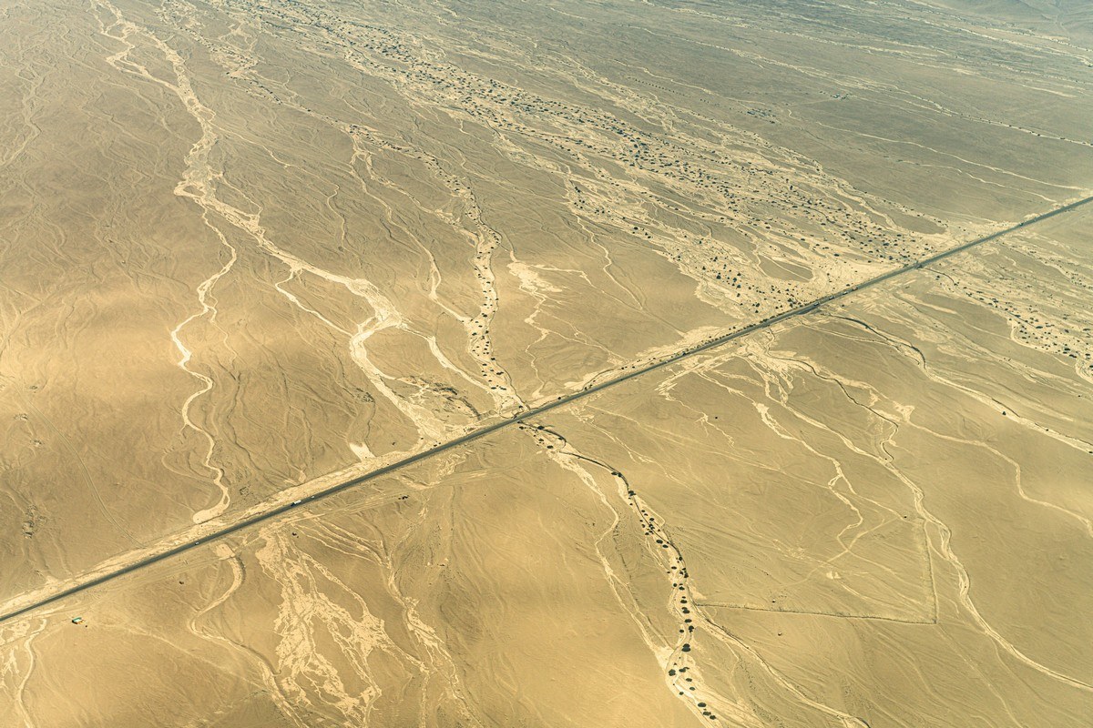
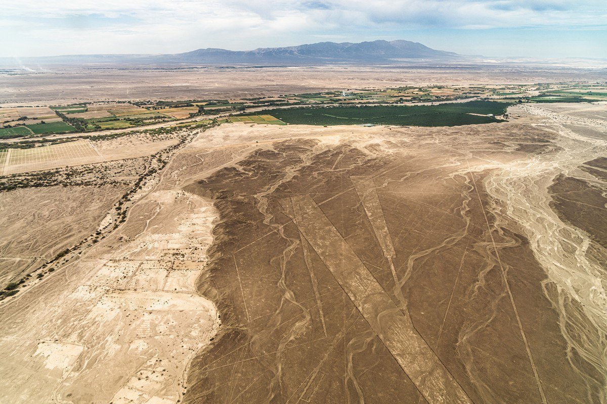
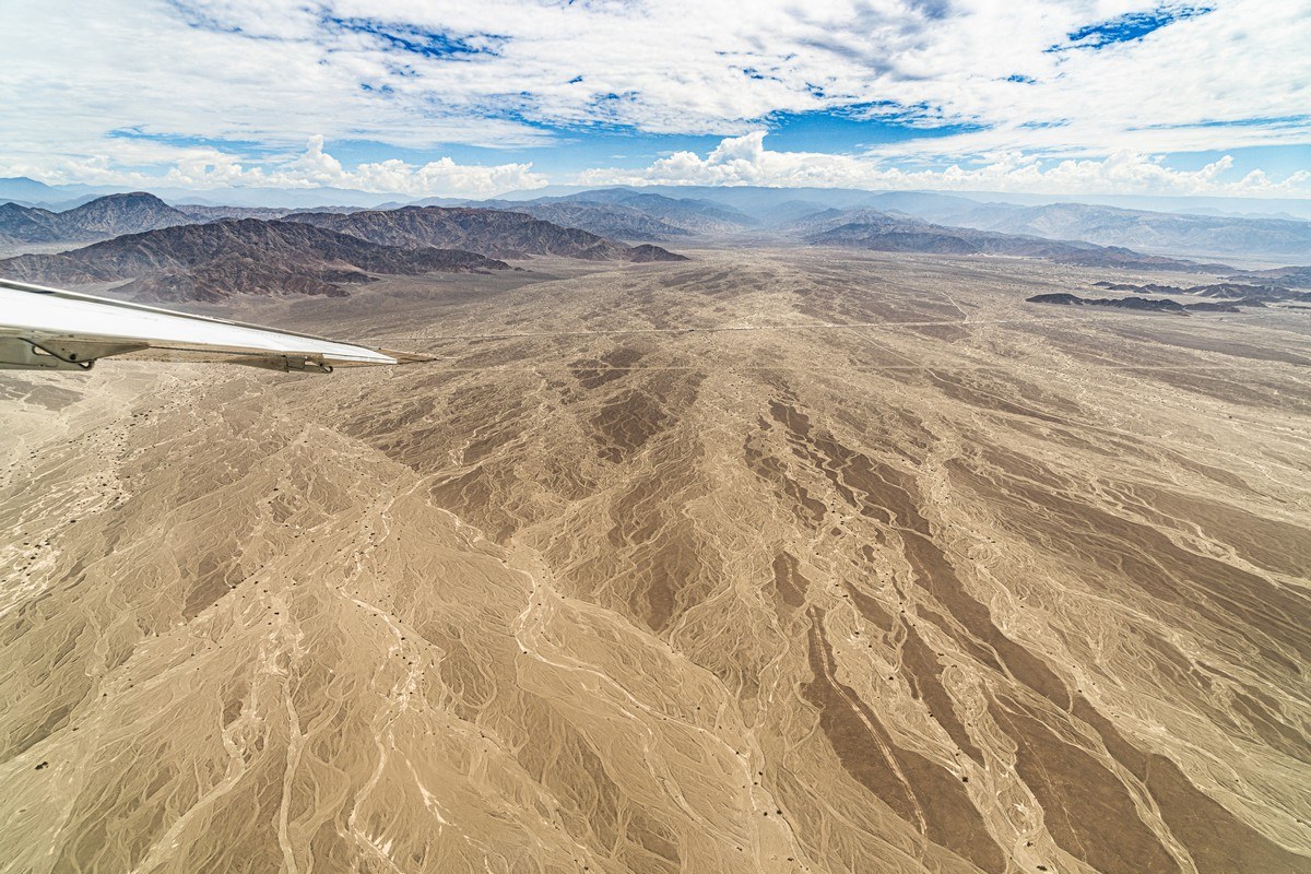
It takes about 30 minutes to fly from Pisco Airport to the main attraction, and along the way there are some incredible views! A vast desert – sand, dunes, rocky landscapes, all that. Impressive! The visible road ahead leads us straight to the Nazca Lines!
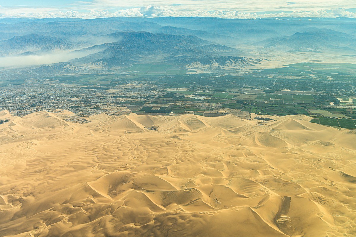
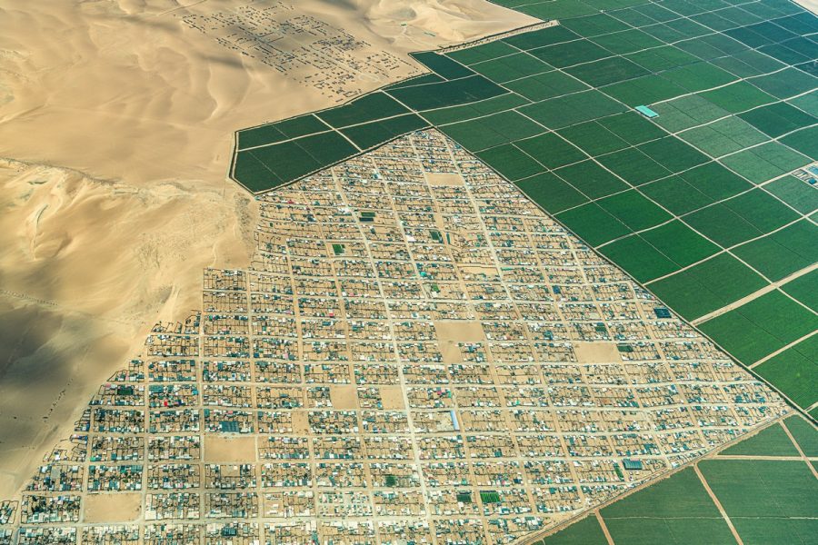
A desert is a desert, but – surprise! – there’s greenery here and there! ->
Flying further – serene desert landscapes floating past:
And suddenly! Sand dunes and… greenery! Again and again! How? Why? It’s a desert, bone-dry – yet here, it’s practically paradise!…
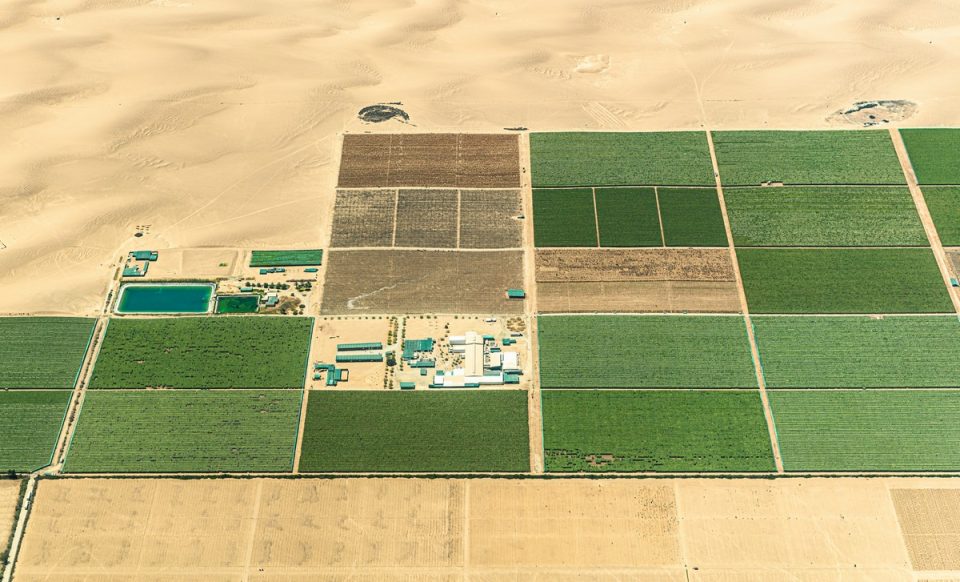
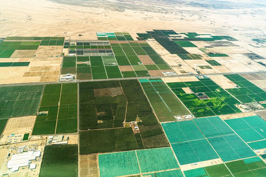
I’ll answer honestly and simply: I don’t know how it’s possible. But apparently, from the Andes mountain range (where various air masses accumulate), huge amounts of “water formations” are periodically dumped onto these areas… What did I just say? Kinda like dihydrogen monoxide?! In other words, these areas now and again get heavily drenched with mountain water – hence the endless green patches. And here are the dry streams that bring all this water:
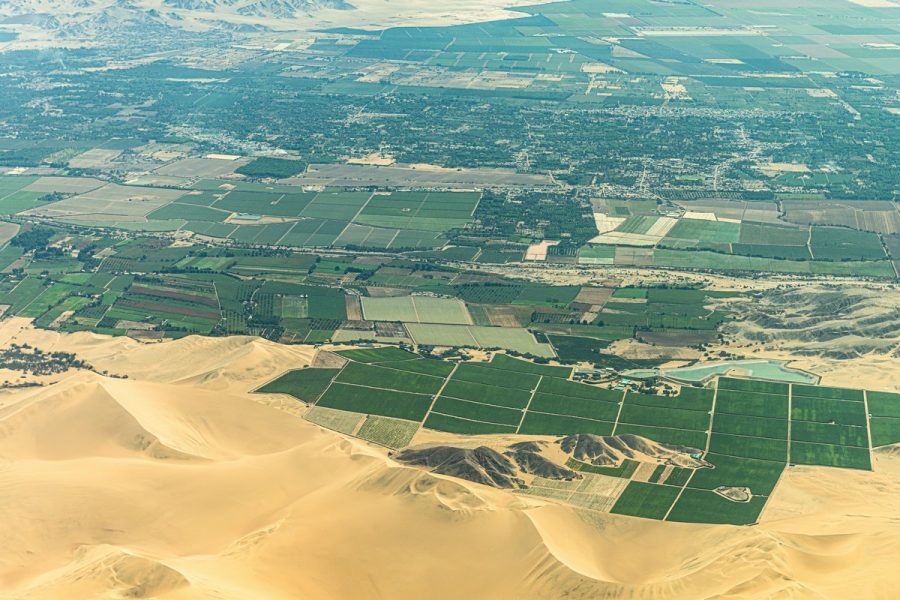
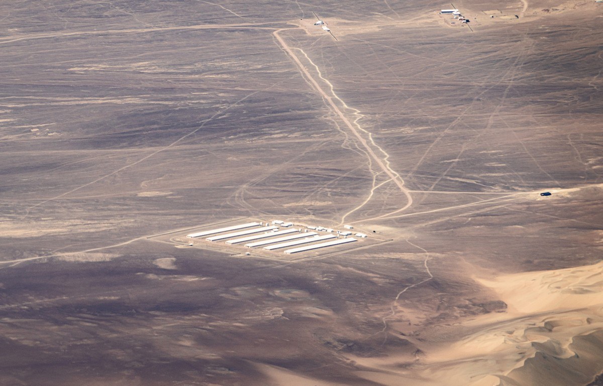
In these desert spaces, mysterious technological structures sometimes appear. Like these:
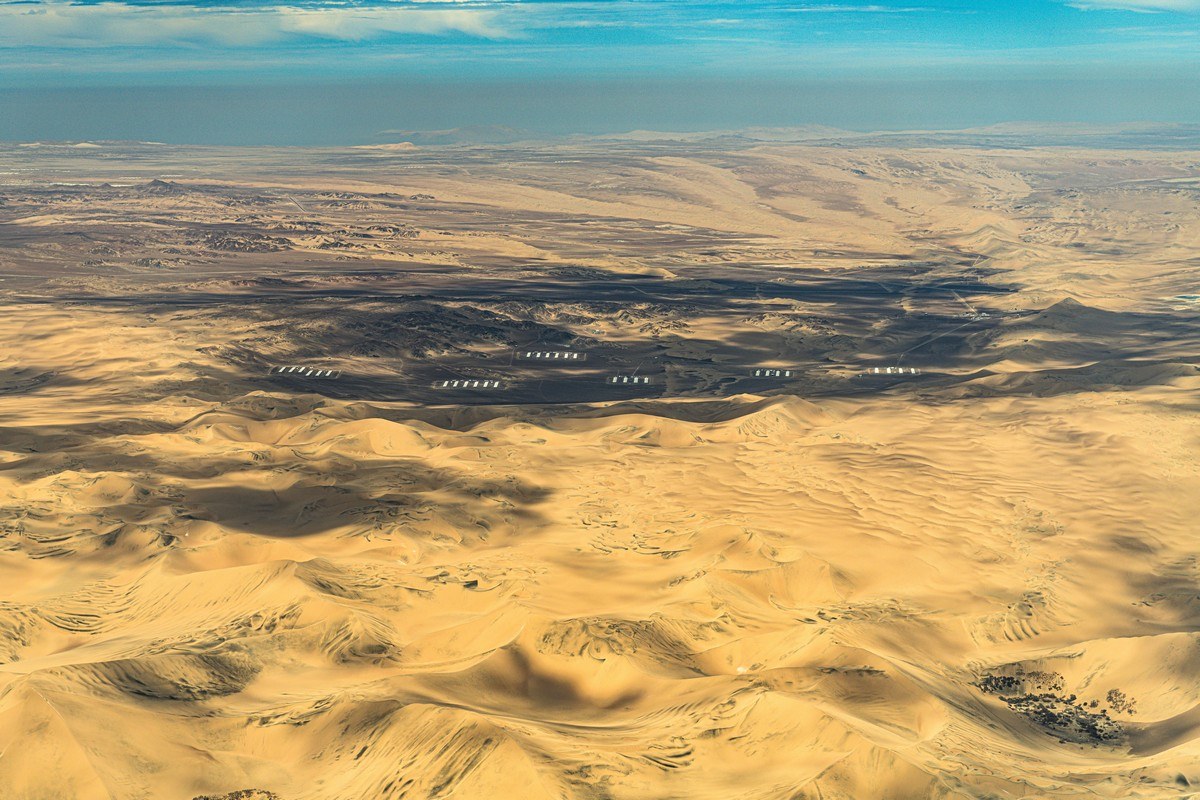
I got very curious – what exactly is being built in these deserts? Turns out, it’s something as mundane as… poultry farms! They raise chickens for eggs, legs, and wings! And the green plantations in the photos above? Just vineyards. Boring; no intrigue at all :)
We’re approaching! Do you see the drawings on the slopes? Look closely, they’re there ->
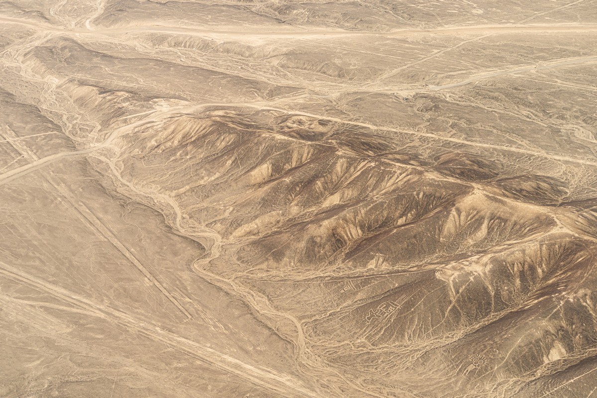
These were the first figures shown to us. They’re not on the plateau but on the surrounding hills:
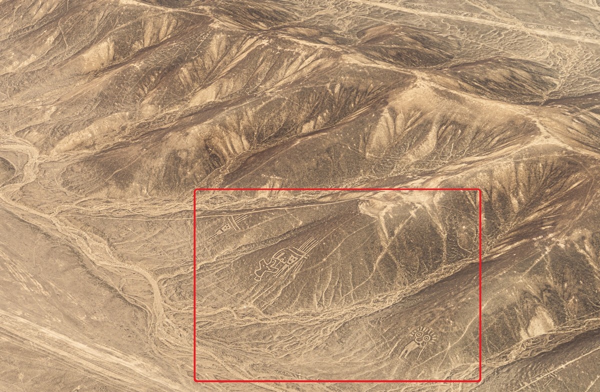
Some of the figures look primitive. Very simple, just like random graffiti like “Syd & Nancy were here”. Look at these heads, for example:
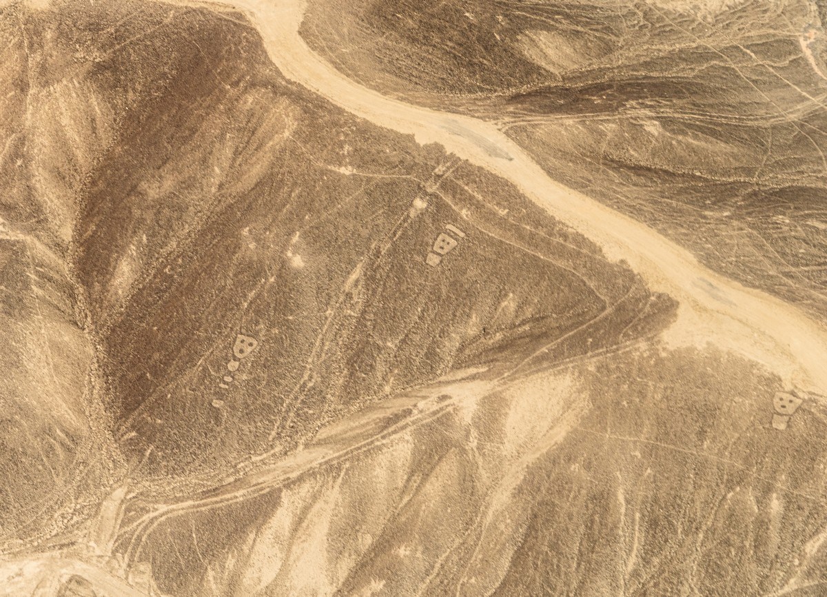
Apparently (and the internet confirms this), these geoglyphs were created over a long period. They evolved, improved, and their original meanings faded over time. And now, they’re completely indecipherable. Still fascinating! But only a time machine could answer the question: who made them and why?…
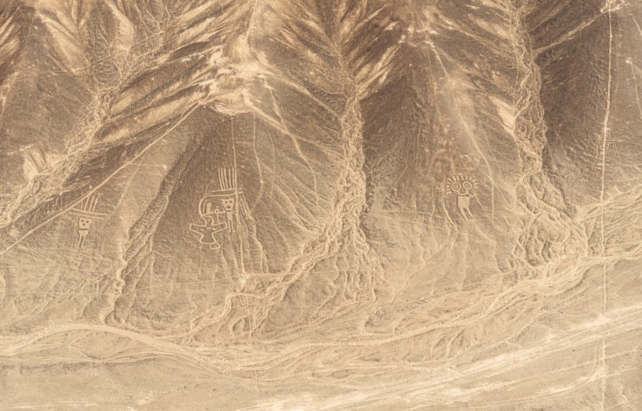
And these intricate yet childlike drawings created on the slopes of remote, arid areas – why?… Do you think the images are waving at you? No, it’s an illusion. Just another drawing on a desert hillside:

These are the drawings that unknown Homo sapiens dug into the surface of the Nazca desert around 2000 (± 500) years ago. Plus, before or after that, they decorated them with long straight lines and twists. A mystery, indeed! What an incredibly strong motivation they must have had to create these figures!
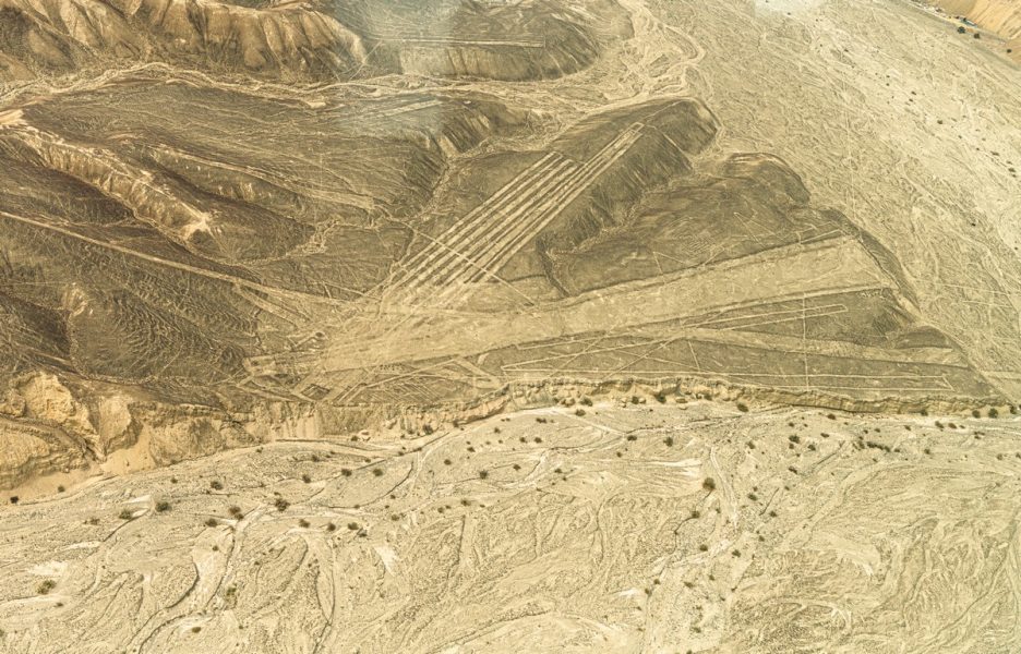
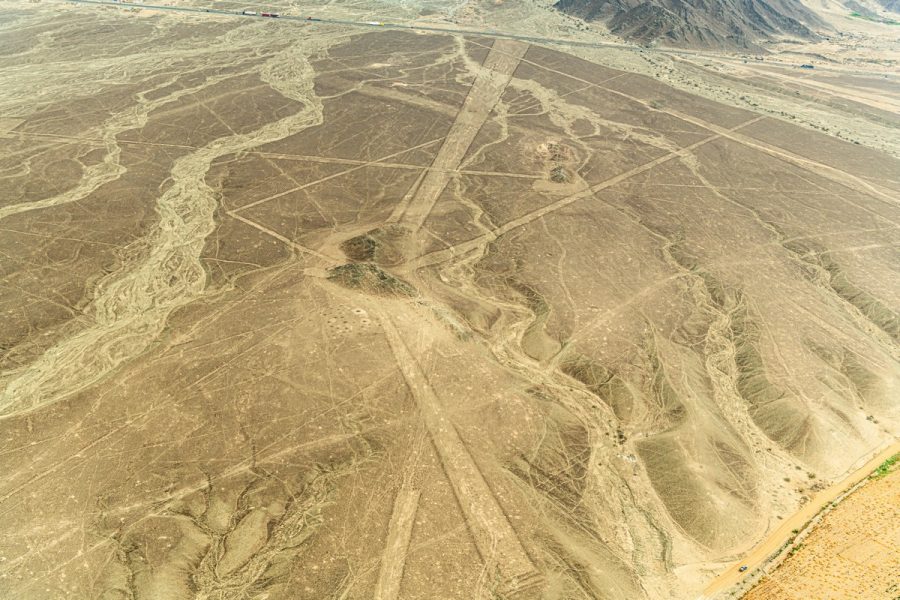
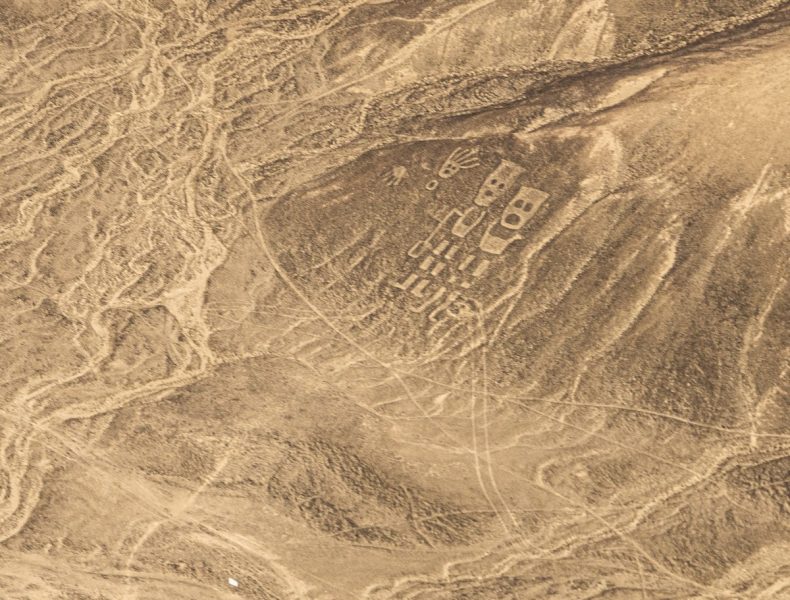
From a pragmatic point of view – why go to all the trouble? Unclear. But it all exists. In large quantities and on a massive scale:
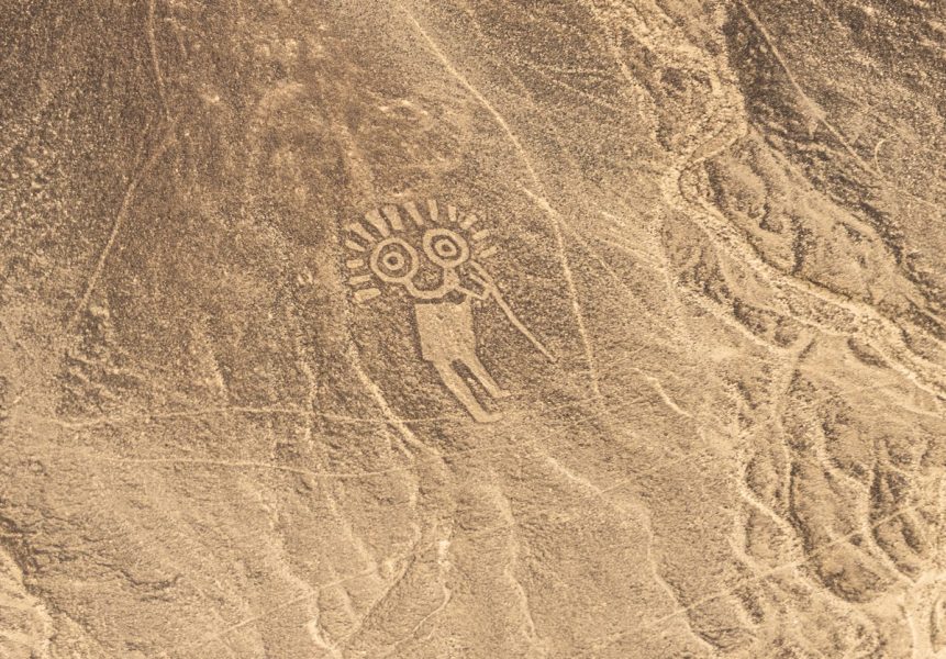
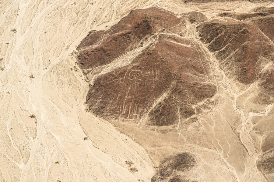
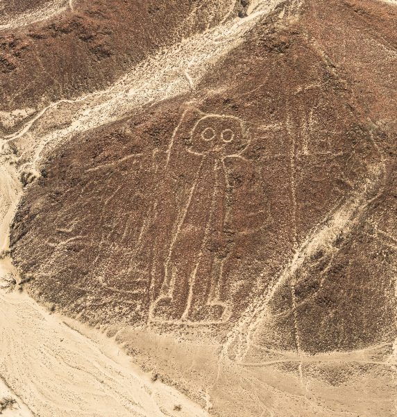
And now, appearing outside the plane’s window are the most famous figures! This is the Astronaut! If you look closely, the drawing is quite primitive. Yet someone carved it into these rocks ~2000 years ago?
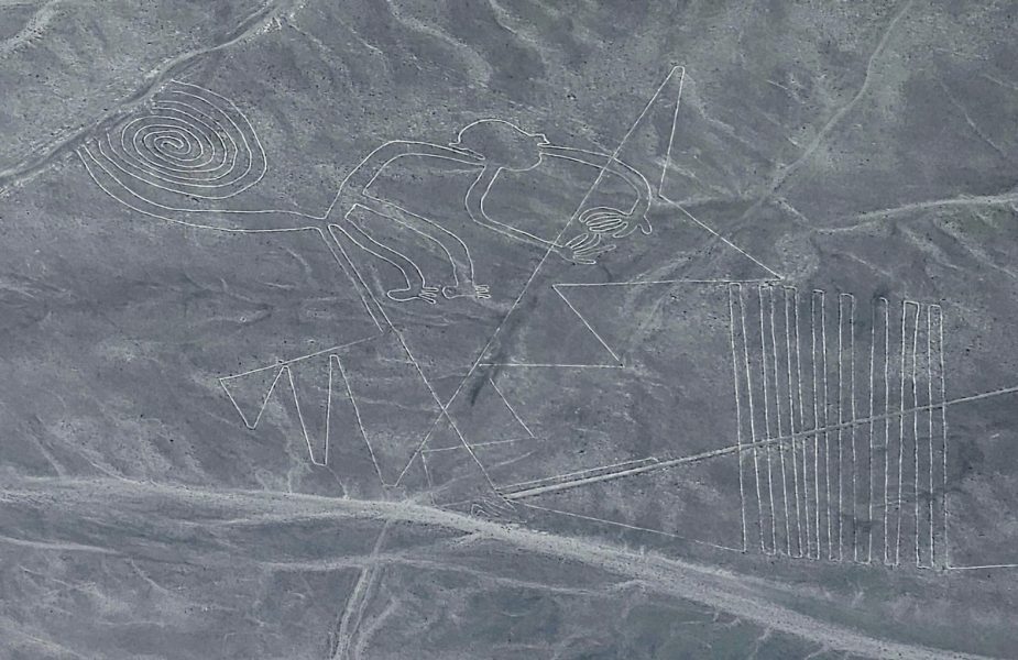
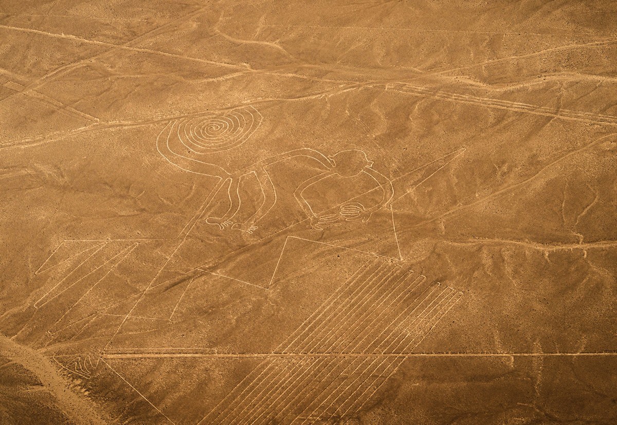
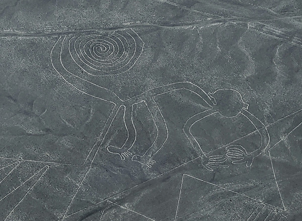
The Monkey:
Photos came out with slightly different colors depending on the camera (thanks, modern technology…) – pick the ones you like best…
Meanwhile, the plane turns to give both sides the best viewing angles. The turns are so sharp that some passengers’ well-being drops below their personal comfort level…
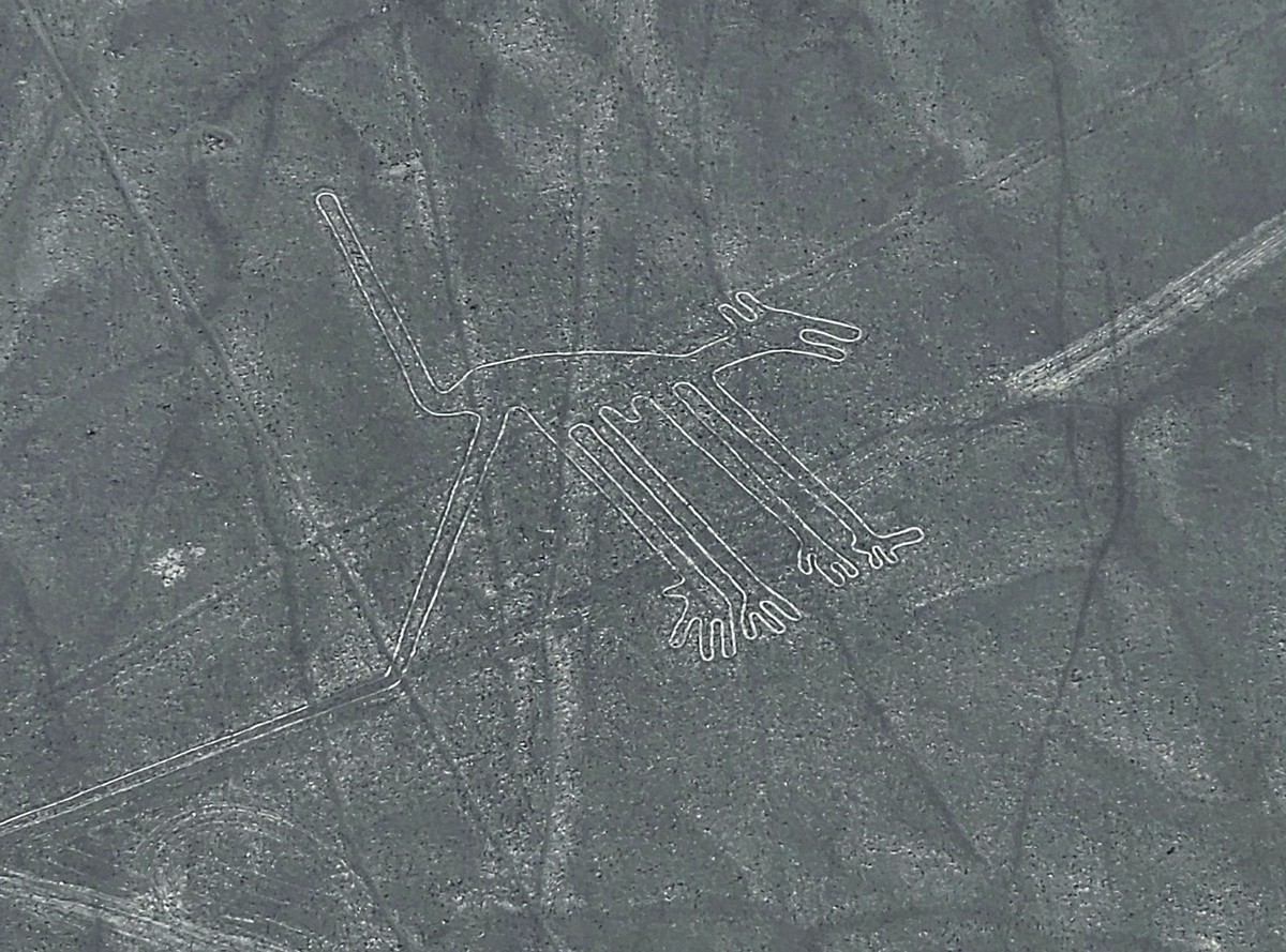
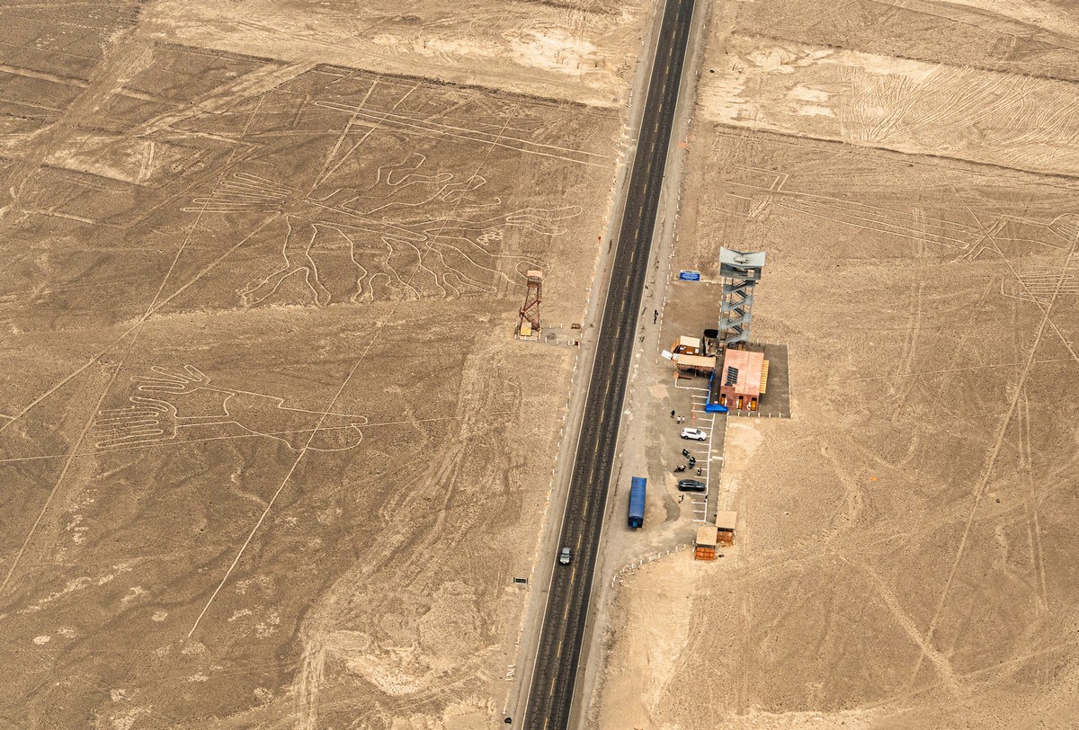
And here are more drawings! The Dog. Among the Nasca people (or even earlier tribes), dogs were part of life and even culture (maybe also food?!)…
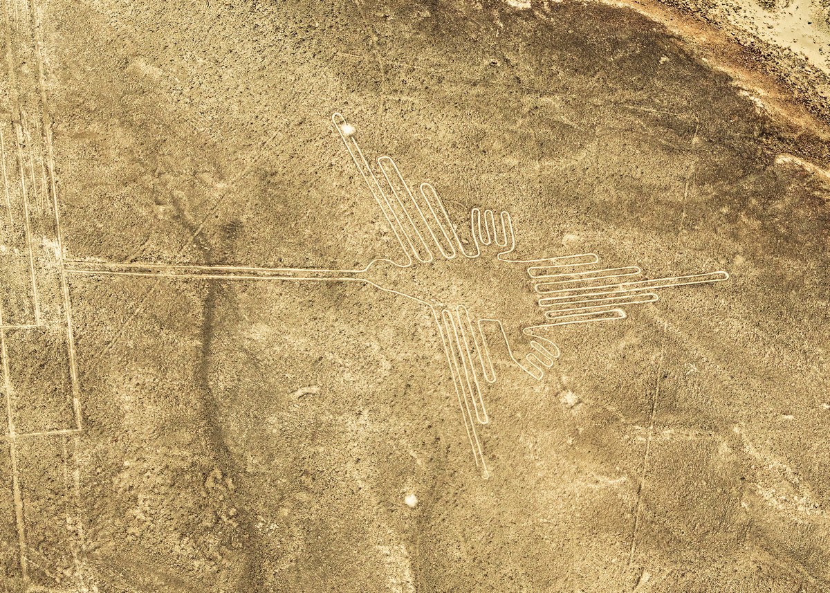
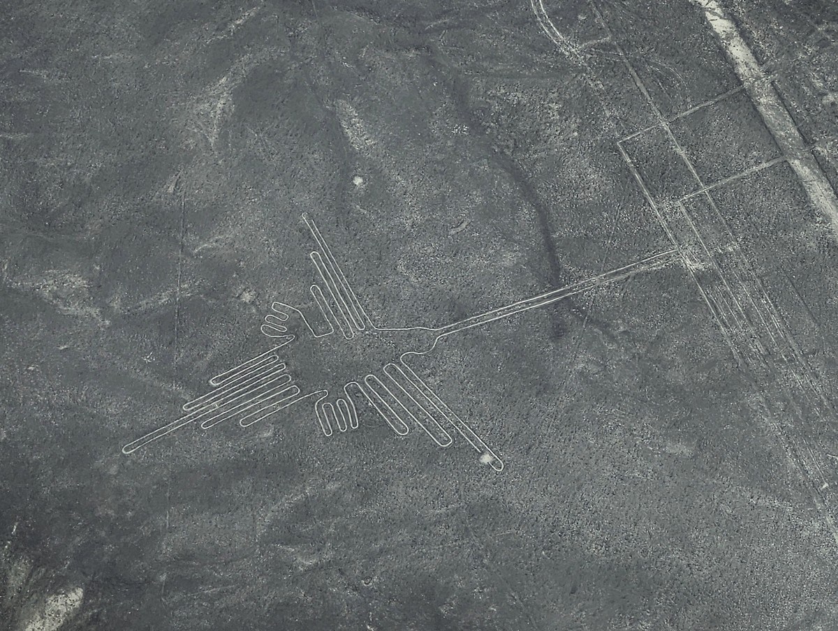
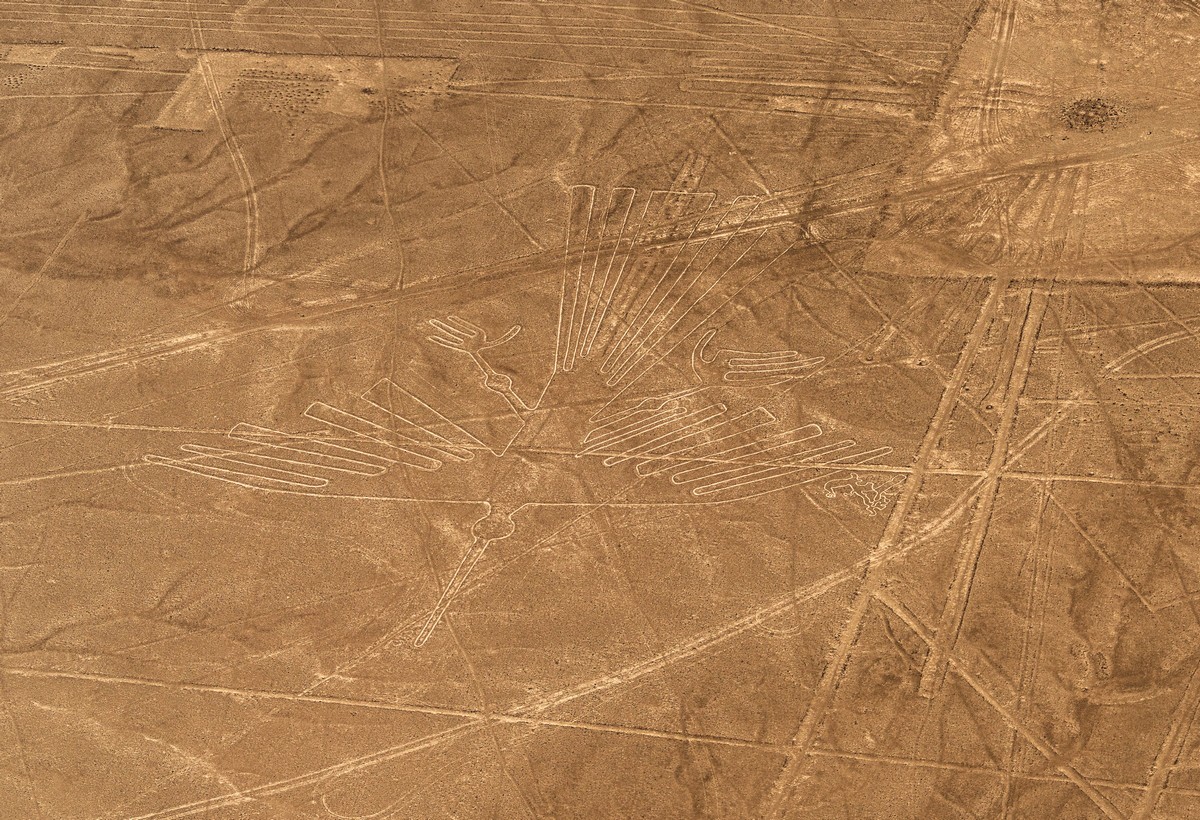
The Hummingbird – nearby are long strips of other lines.
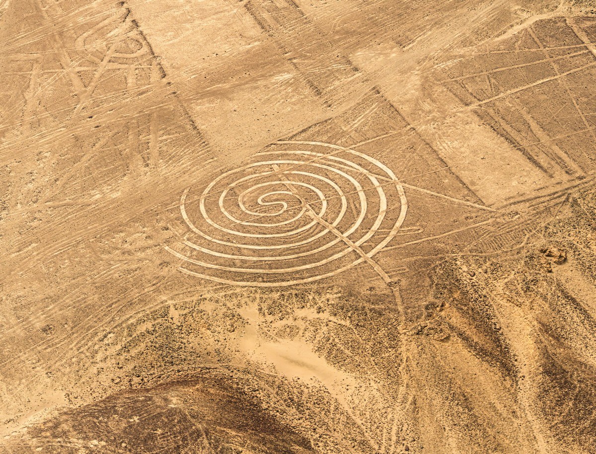
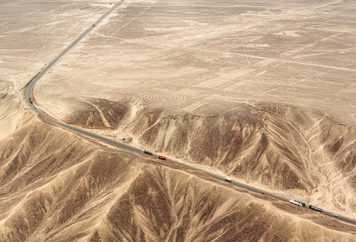
The Spiral – one of several, but this is the most famous:
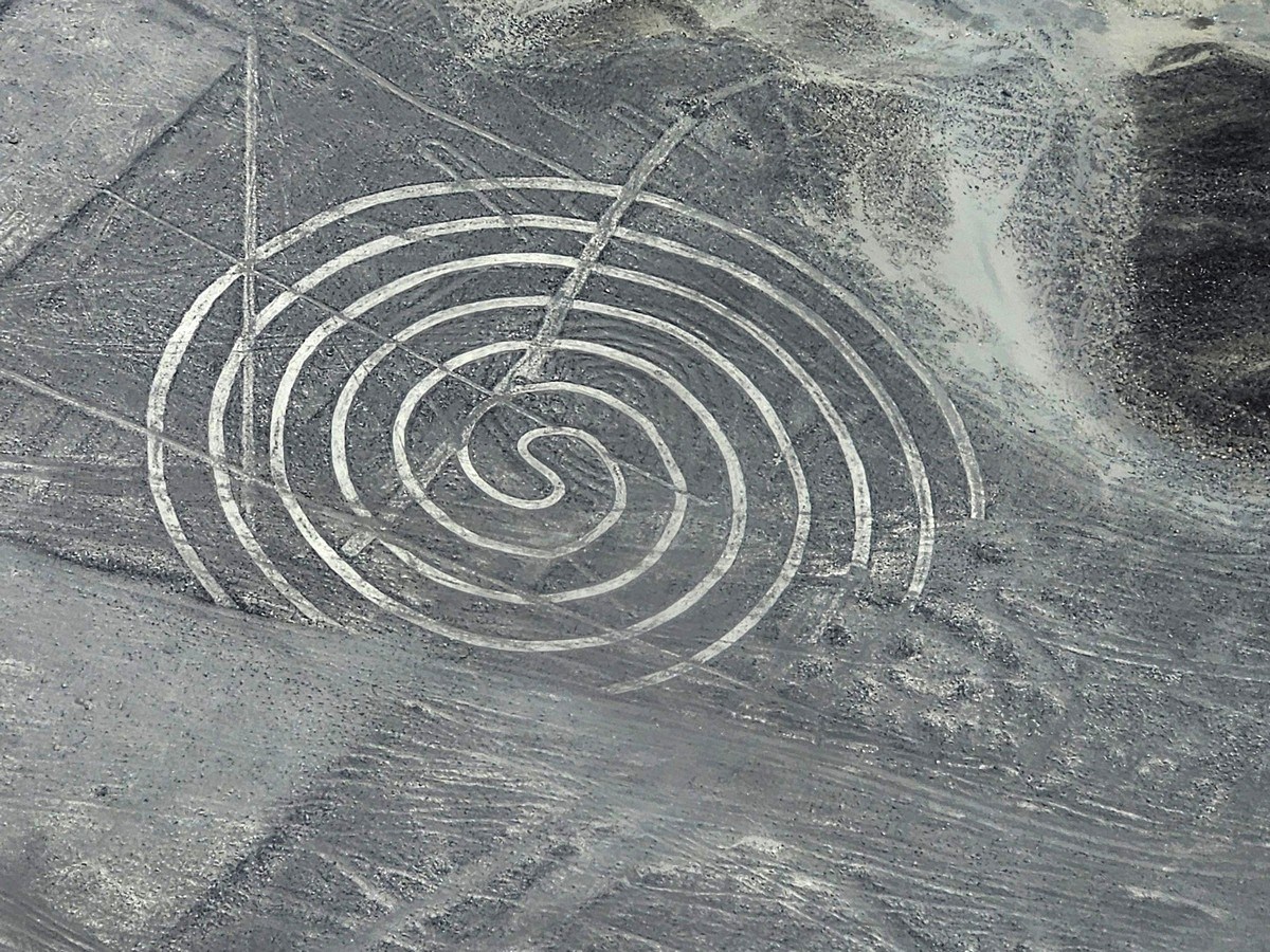
To grasp the geoglyph’s scale (and the time it took to create it), compare it to the trucks on the nearby road! ->
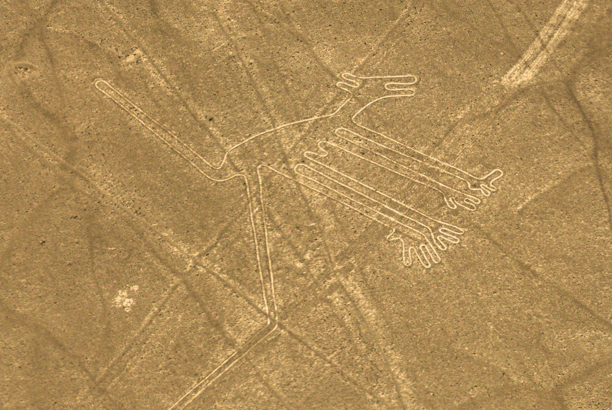
The Condor. Impressive:
I don’t remember what this is. The emotional intensity from seeing all these pictures had long since exceeded my capacity to process them. I just started feeling a bit overwhelmed without additional informational intake.
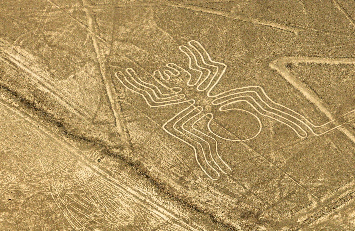
Aha, and this is the Spider! ->
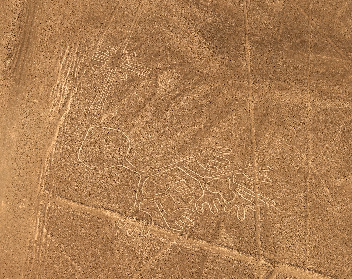
The Parrot:
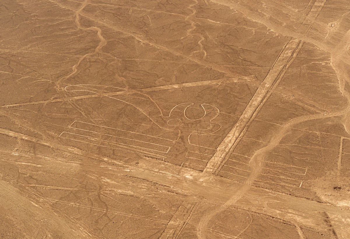
Not just the animal world, but flowers too! ->
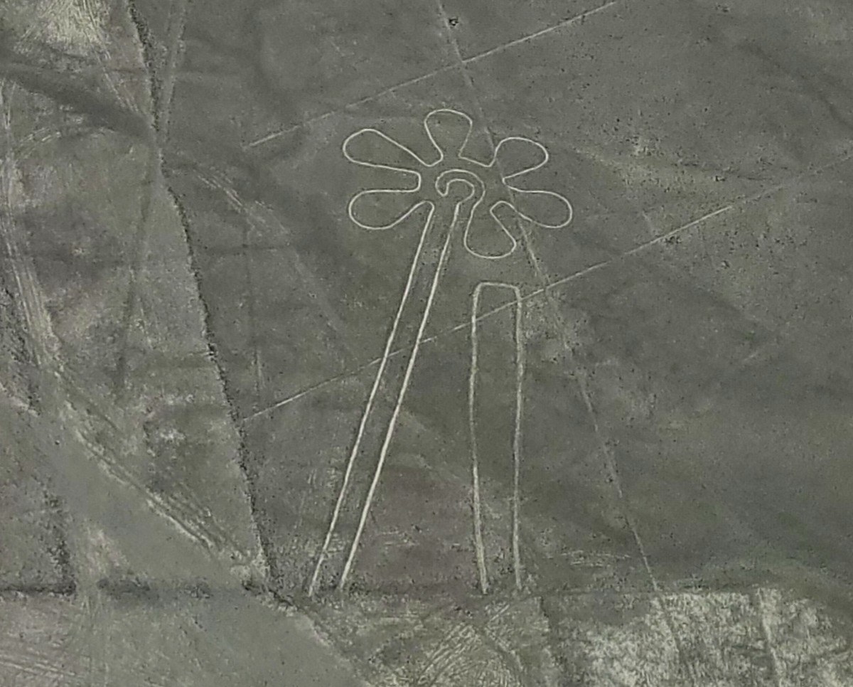
By the way, a highway runs right through this composition. Judging by its size, you can get an idea of the scale of these drawings:
Such are the wonders of the history of the ethnic groups that inhabited these lands about 2000 years ago. Many mysteries, many unknowns… but, without a doubt, I fulfilled a dream! I was there, I saw it, I photographed it. Shame they don’t sell t-shirts…

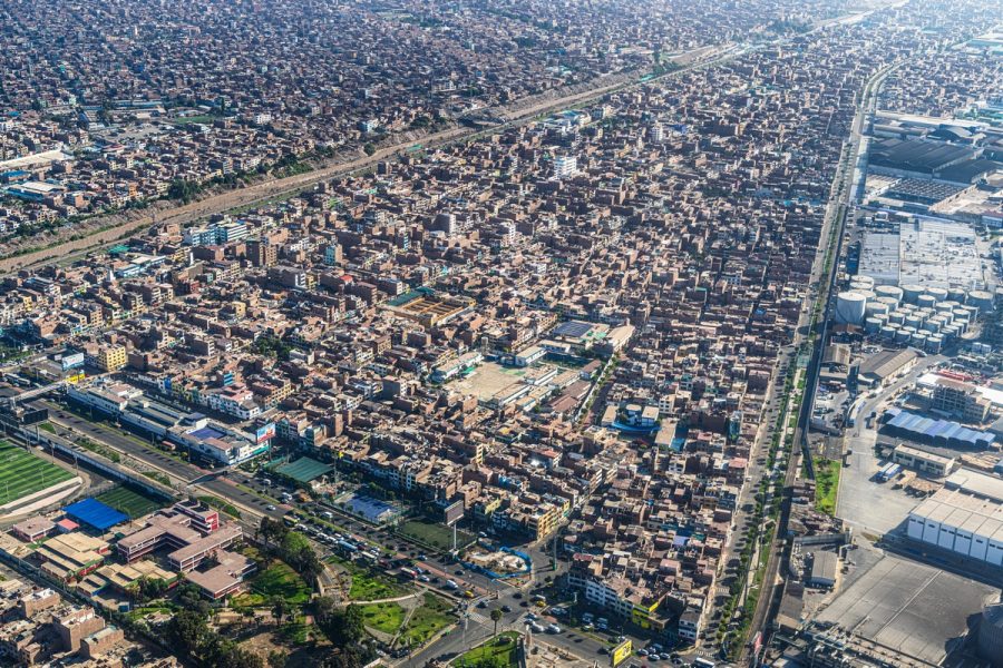
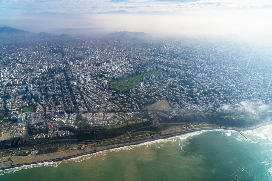
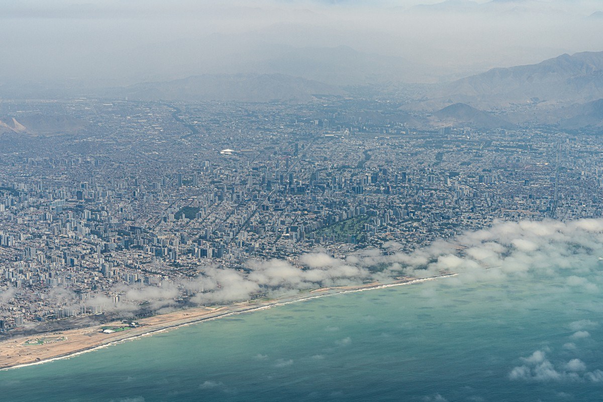
And that was that – we’re flying back! About half an hour later, Lima appeared…
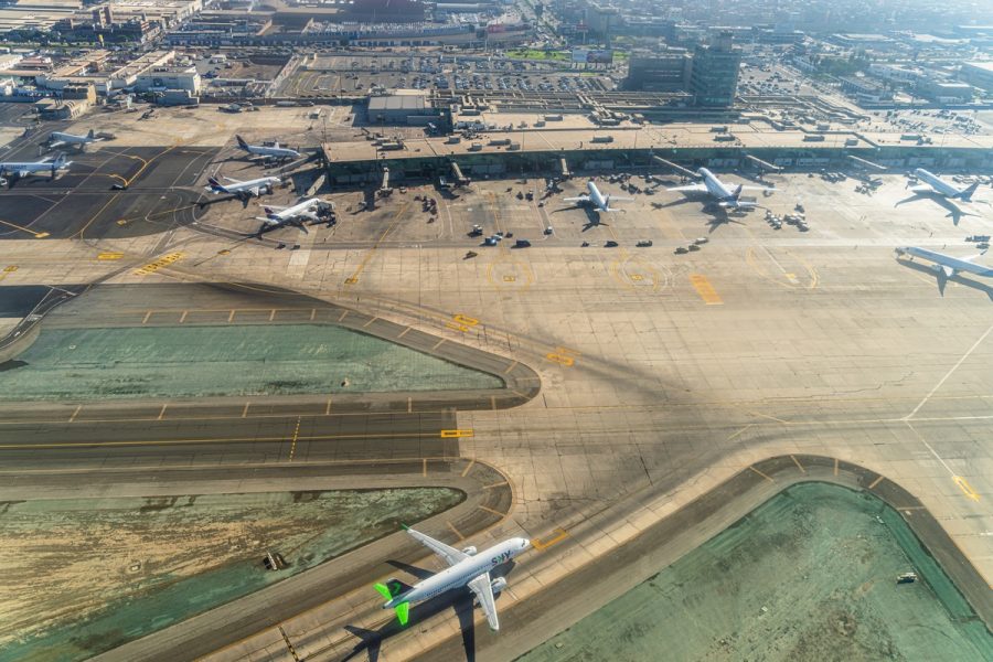
An impressive commercial fleet at anchor:

Next up – Cusco. About that in tomorrow’s post…
The best photos from our Latin-America-2025 trip are here.

