June 4, 2024
On quad-bikes around Mayon Mount: but up to its peak – on no account!
Next up on our short tour of paradisiacal Philippine islands – the Mount Mayon volcano.
Getting there from El Nido on a scheduled flight would have taken us ages, and since we didn’t have ages, we took a chopper again instead ->
From the get-go – oh my grandiose greenness! But yet again my photos were spoiled by the reflections on the windows of the helicopter. I wonder if there’s already some AI ML technology these days that can filter them out? I hope so: it’d really help on my summer holiday in Kamchatka this year…
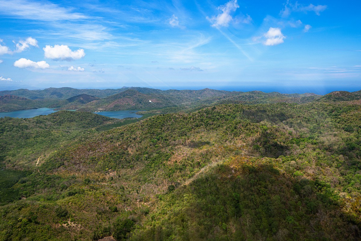
Jungle-covered larger islands first ->
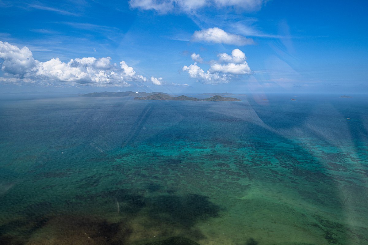
Then came smaller islands:

I keep using this adjective but, it’s the one that fits best: paradisiacal! ->

Ooh – I spoke too soon! ->

Curiously, those dug-out open mines are lower than the surrounding sea level in places! ->

Turns out they’re not mining raw materials here… Can you see the tiny rectangles that dot the landscape in the next pic? Those are trucks ferrying gravel to the shore where they dump it into the sea…

…So, is this how they increase the size of the island? But why? There are thousands of uninhabited islands that make up the country, yet they’re increasing the size of this one? Anyway, its name btw is Semirara, here.
UPD: it turns out what they’re doing down there is rehabilitating the landscape after years of exhaustive coal mining. All good (“a model for legacy mines”).

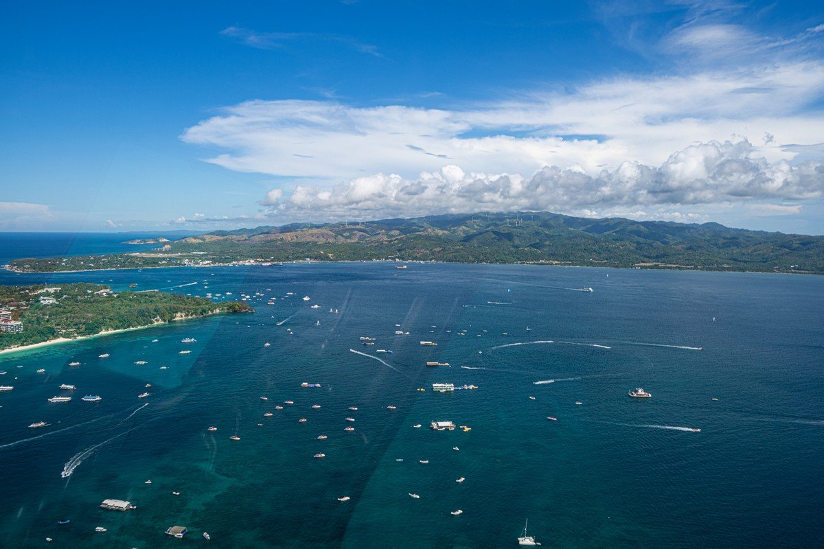
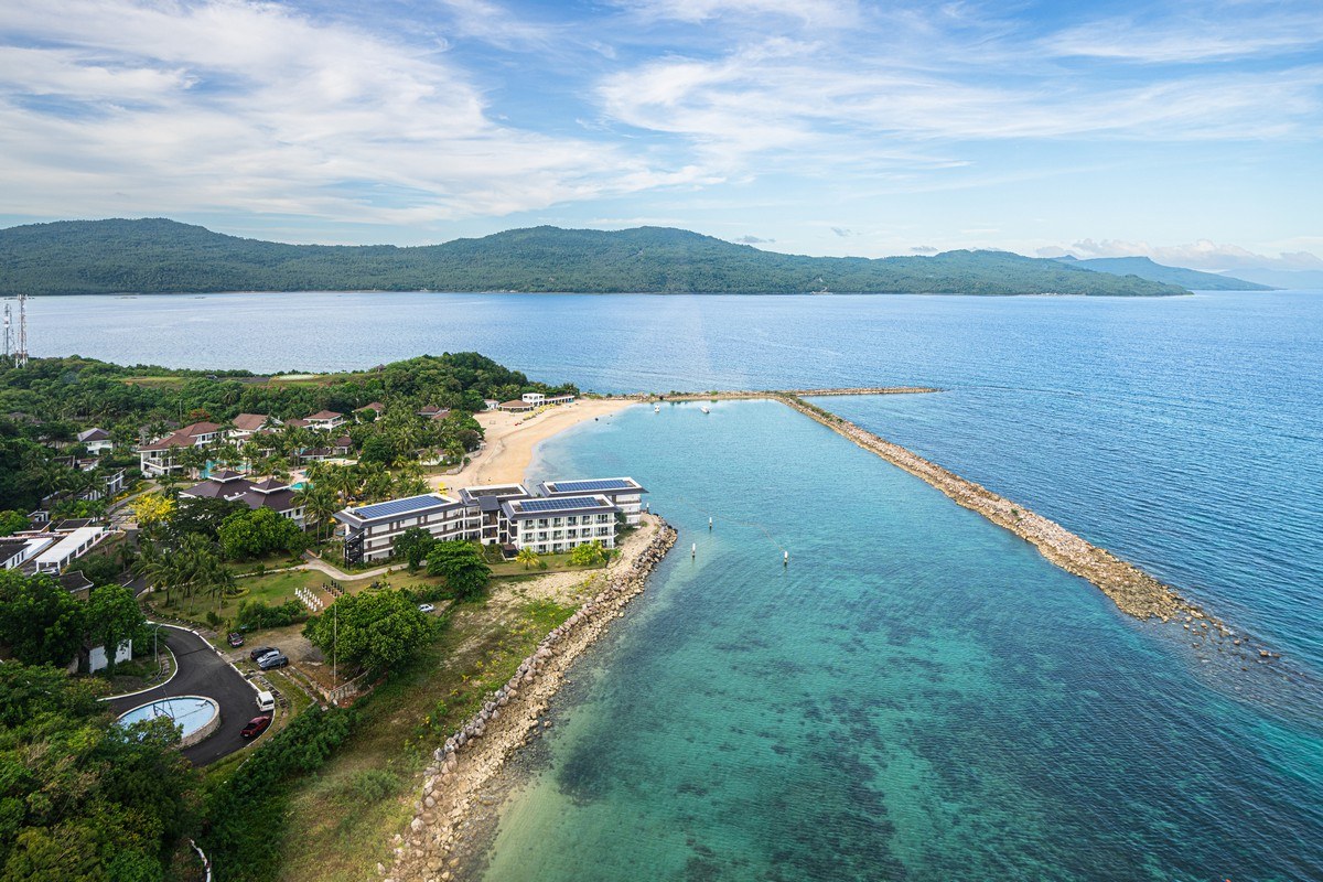
Next door is the resort island of Boracay. That it’s touristy-beachy-pinacolady is visible straight away ->
Onward we chopper. More oceanic agriculture going on – and on a large scale ->

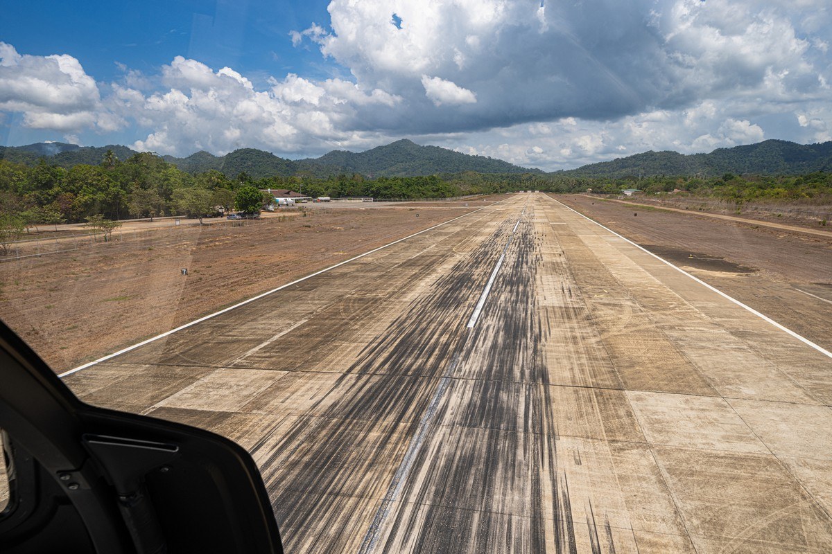
We need to land and refuel, since we’ve been up in the air quite a while:
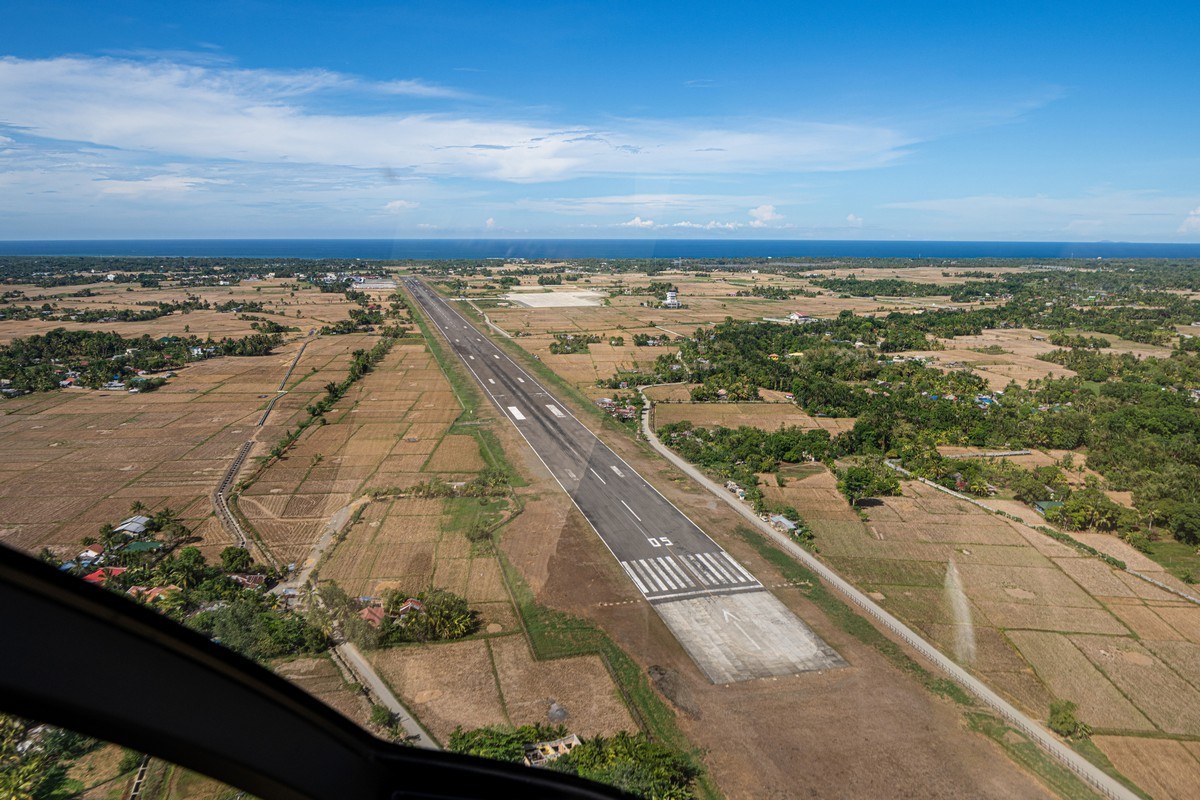
In half-an-hour we were done and up in the air again and heading for Mayon ->

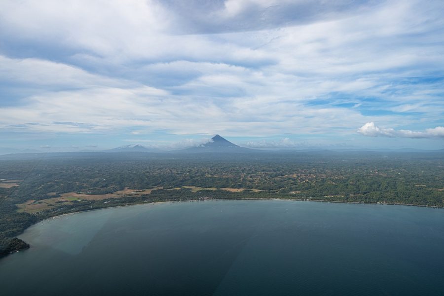
In the distance clearly some thunder doing its thing in a big way:

Finally we catch a glimpse of the cone of the volcano on the horizon:

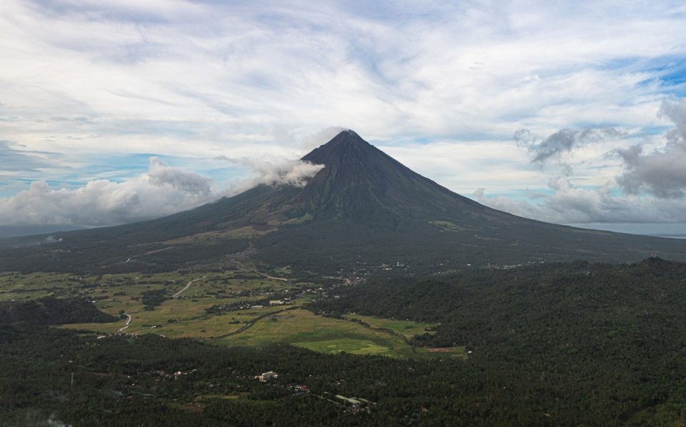
Ideal form; ideal pics:

We come in to land after flying over where we’d be staying ->
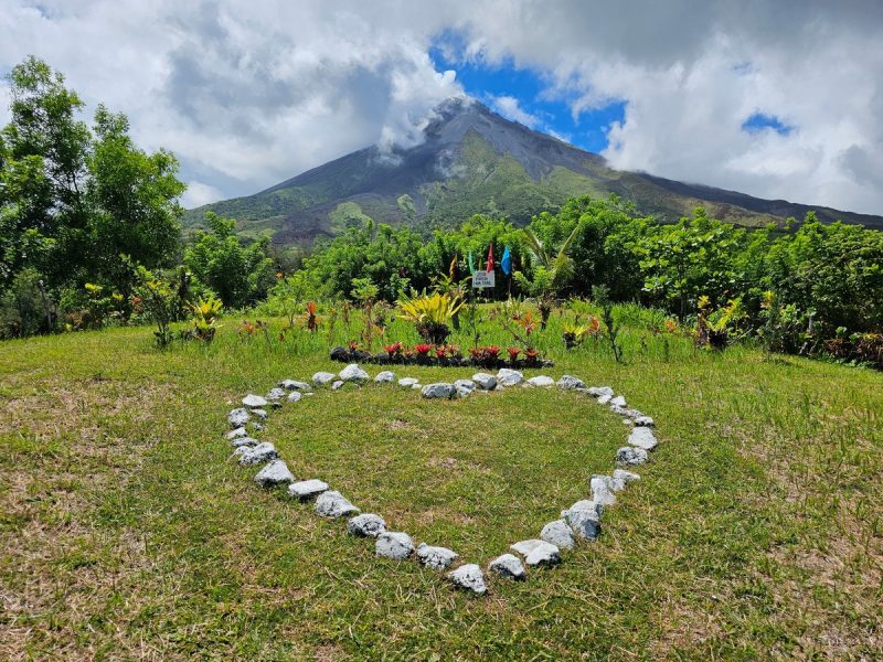
Next morning we were up and out and heading in the direction of this voluptuous volcano. Perfect cone, and still smoking away!…
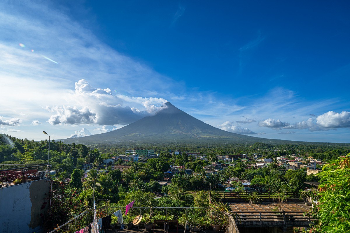
…And – from a different angle ->
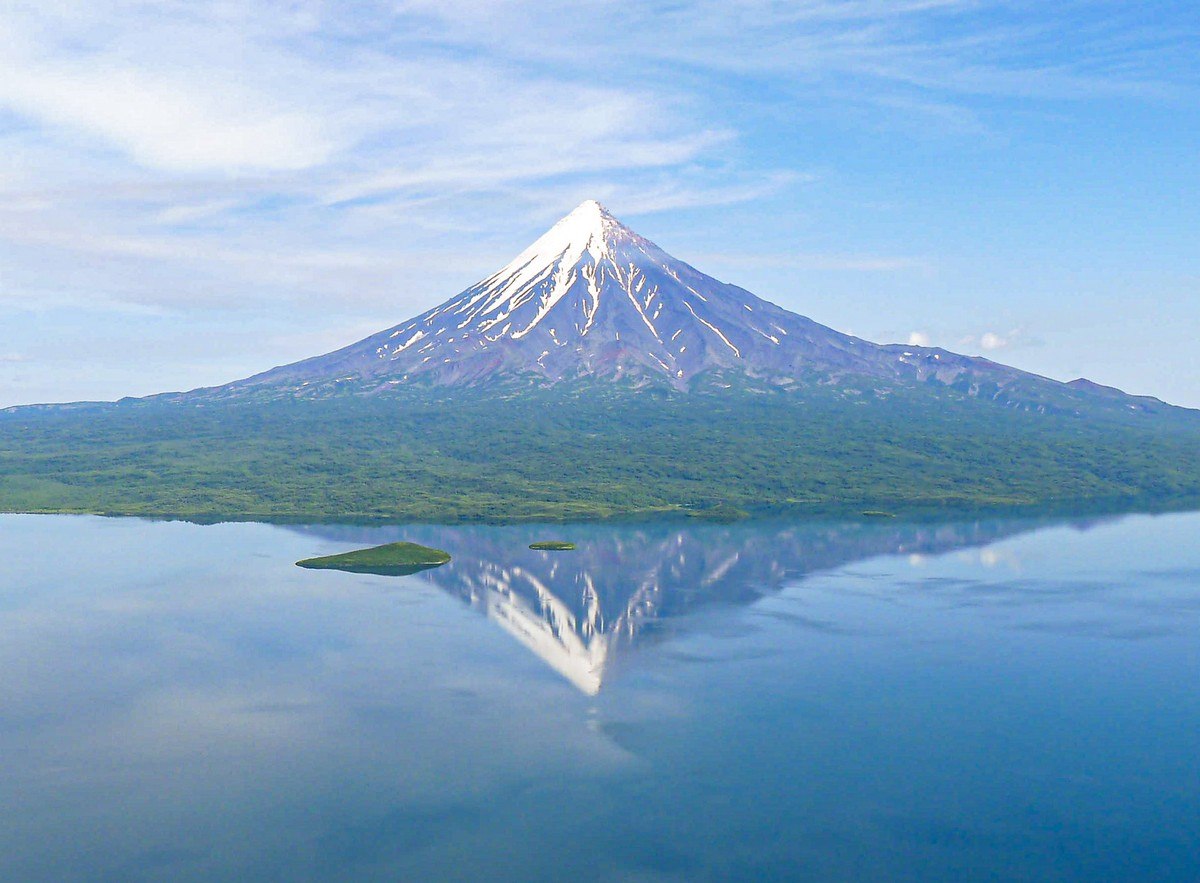
Fooled you! That’s not Mayon volcano – it’s Kronotsky volcano in Kamchatka!! Yes – they are very similar. Mayon is Kronotsky’s younger brother: (a kilometer) shorter, younger, and much more active, which is more and more noticeable the closer up you get:

When I was planning this long weekend in the Philippines, I’d intended to get up to the top of Mayon. After all, it’s not that tall (2462 meters above sea-level), there’s probably transportation on offer that takes you more than half-way up, and, given that this place is generally touristy, there are bound to be plenty of well-worn paths: kinda like on Mount Fuji (up which I’ve climbed twice).
However, the nearer we got, the more it became crystal there was no way we were going up anywhere even near the top. There aren’t any paths, everything’s coated in lava and peppered with assorted other volcanisms, and the last hundred meters (along the vertical) apparently are covered in thick brush cover; and if that’s not bad enough… – bonus: the fumaroles up there emit plenty of hot, sulfurous gasses!
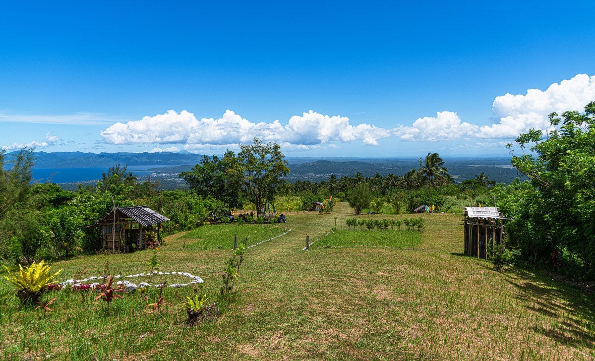
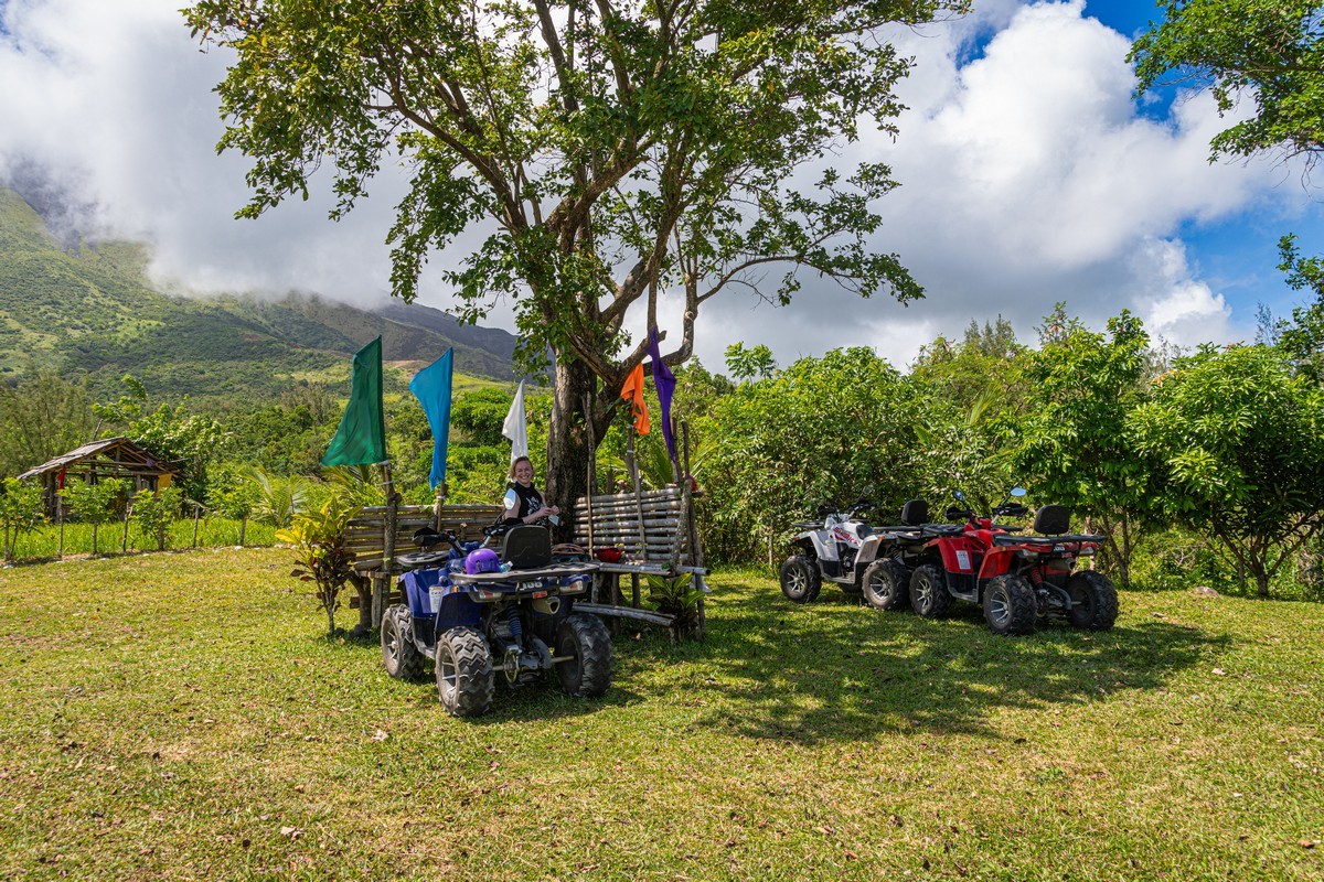
But things weren’t so bad: getting to the top isn’t the be-all-and-end-all around here. You can rent quadbikes and ride up to and around the volcanos’ lower slopes! So we did just that ->
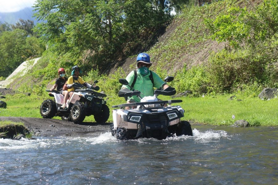

We arrive at the base of the volcano:

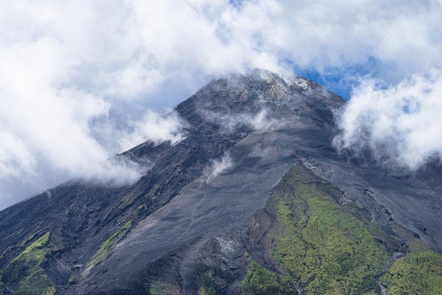
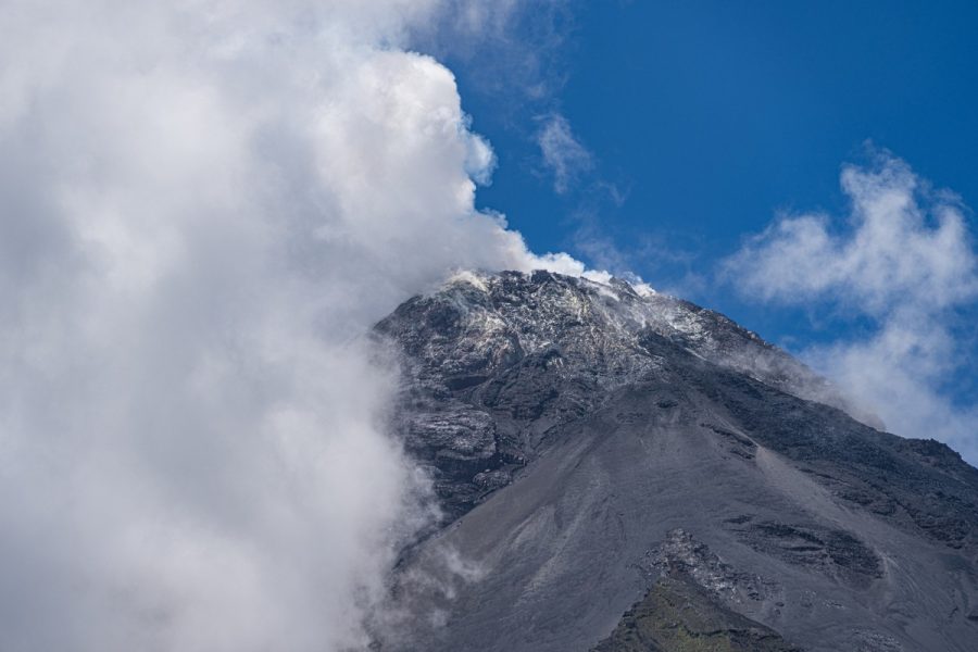
I pull out my zoomiest lens, and realize when I point it in the direction of the peak that even contemplating going up there for a second was a second too long! ->

…In the other direction – much safer, calmer, clearer, bluer, greener, prettier! ->
Boy was it hot. We even had to park up our quad bikes in the shade so their surfaces didn’t be become so scorchingly hot to the touch that we’d burn ourselves on them! ->
Meanwhile the peak of the volcano only showed itself intermittently through the clouds:

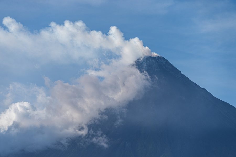
A brief, cloud-less moment – and I duly snap the peak in all its naked, brutal glory! ->

And what’s that stripe running down the side of the volcano? Footprints! So folks do get up there? Yikes. Rather them than me ->


And that was that: Mayon – sufficiently “done” ). A bit more quad-biking and then we headed back.
A few PS-pics of NK ->

Nearby there were a few more interesting places to visit. The first – the Cagsawa Ruins:
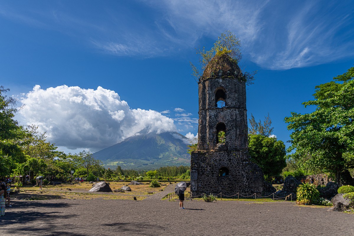
Originally built in the 16th century, it was burnt down 50 years later by Dutch pirates, then rebuilt 90 years after that, and a further 90 years later it was finally completely destroyed during a Mayon eruption.


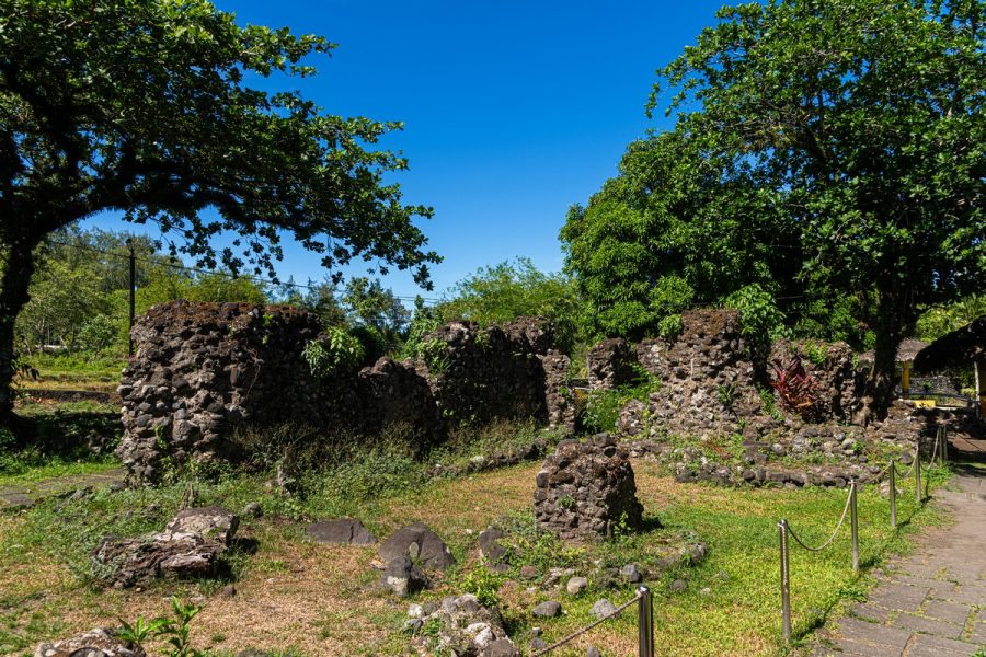
Inhabitants of the town here tried to shelter during the eruption behind the walls of the church; however everyone sadly perished from pyroclastic flows and mudflows.
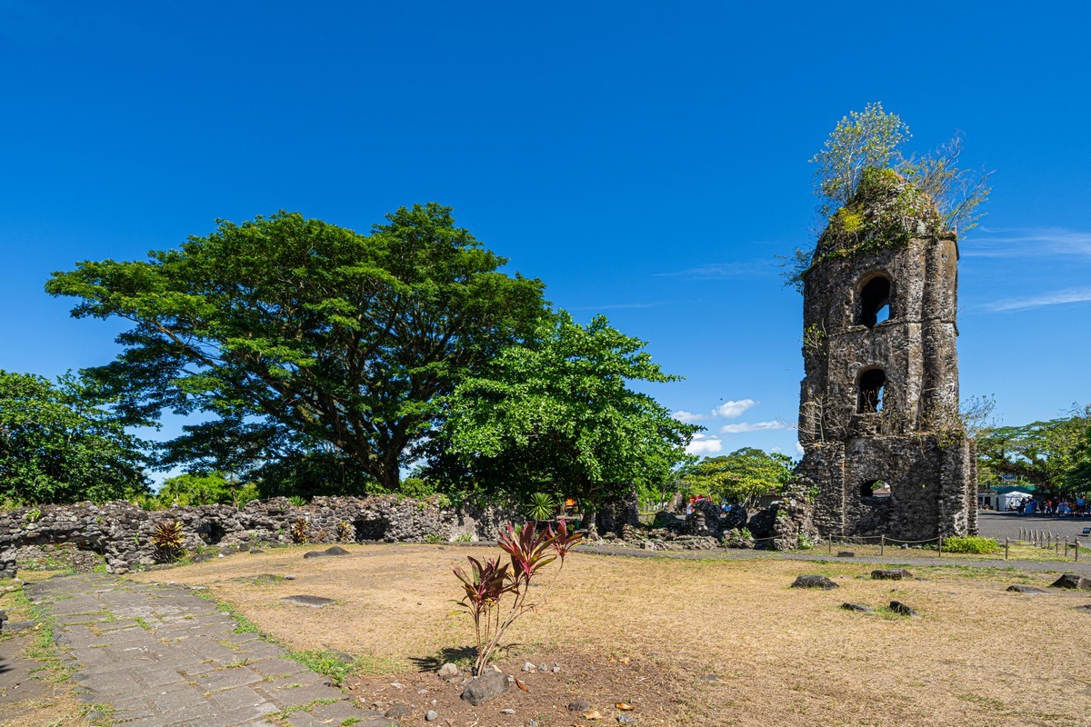
All very much like the story of Pompeii. Such are the risks of living in the shadow of an active volcano…
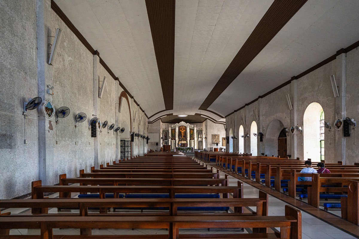
Some great views of the volcano can be seen from Daraga Church in the town of Legazpi:

Inside the church – very spartan, with fans along the wall for ventilation:
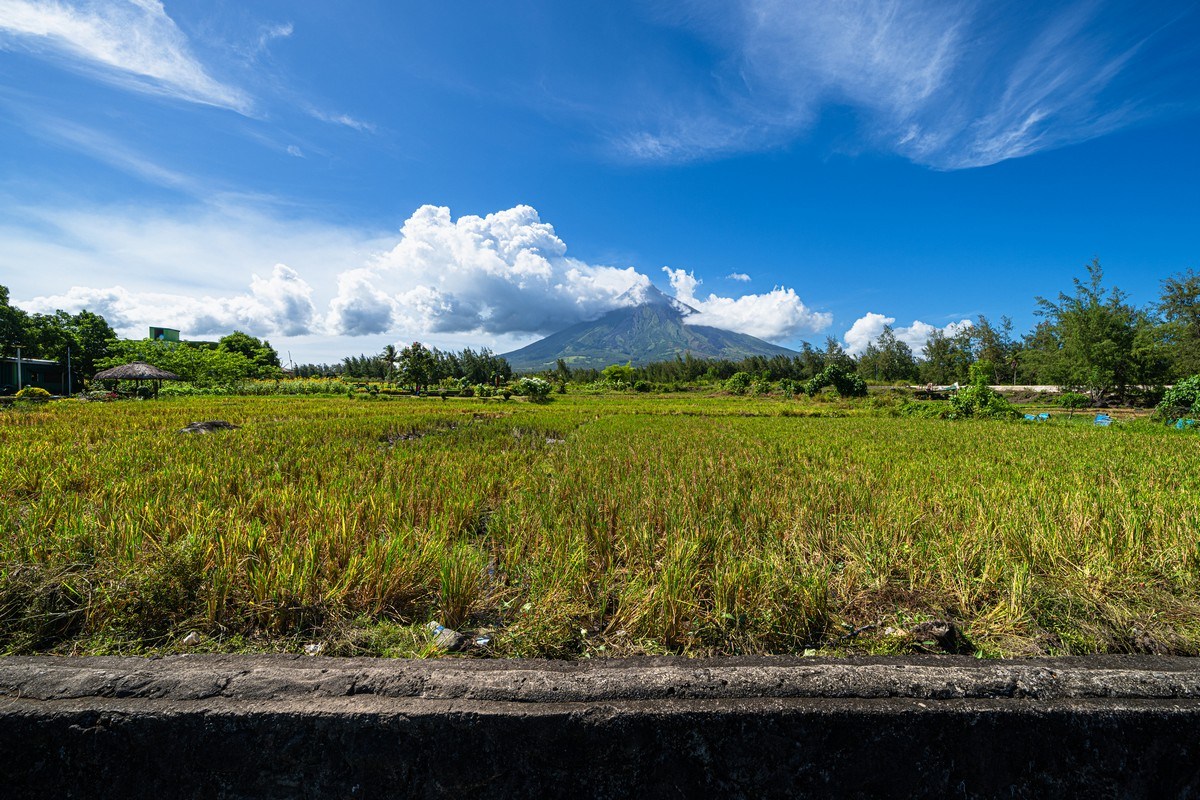
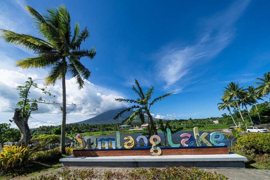
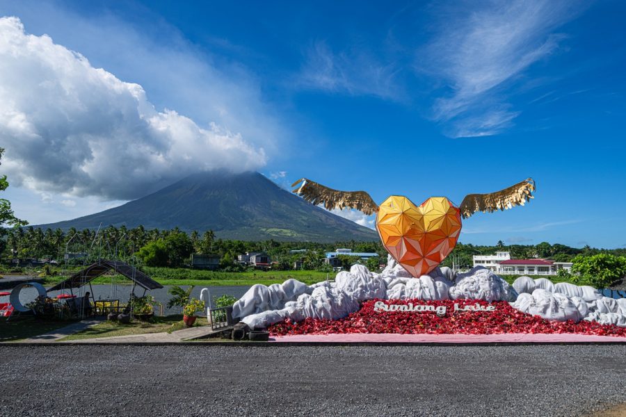
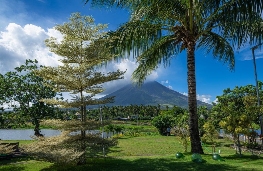
The second place that needed visiting was Sumlang Lake. The views of the volcano from there are simply splendid:

And from the veranda of a restaurant ->

Even when the peak’s shrouded in cloud – still looks great. Just a shame there was wind causing choppiness of the lake’s surface here. If it had been still – imagine the reflection? ->
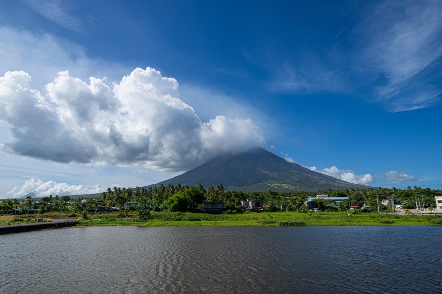

Assorted oddities in the foreground:

Apparently this whole restaurant-and-leisure-complex with the great views of the volcano was founded by a local businessman. He’d seen the view from here, was bowled over, and so decided to buy up the land and build the place ->

The rest of the photos from the Philippines are here.

